A Short Imprisonment on Norfolk Island

 Day 3 Saturday

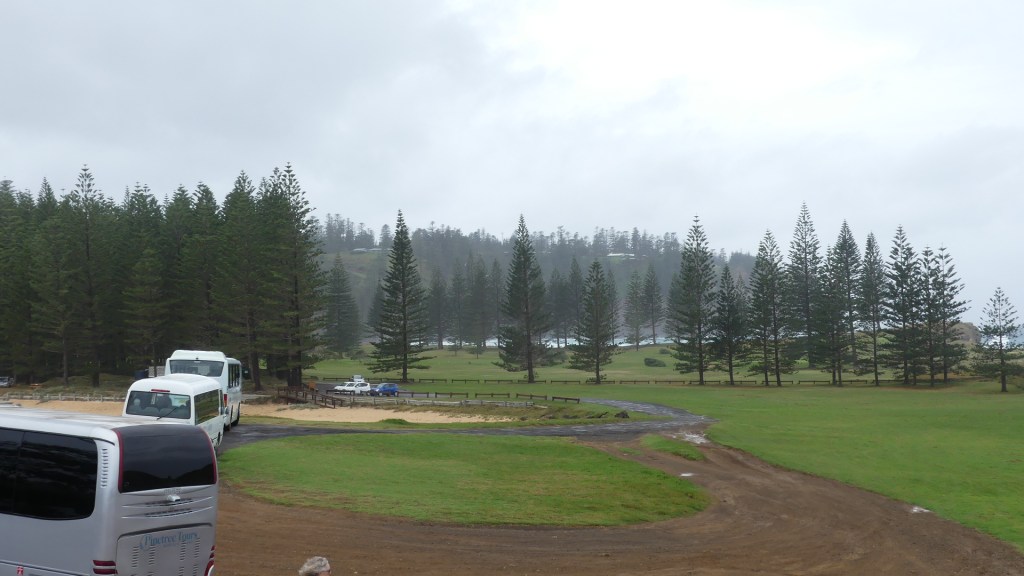
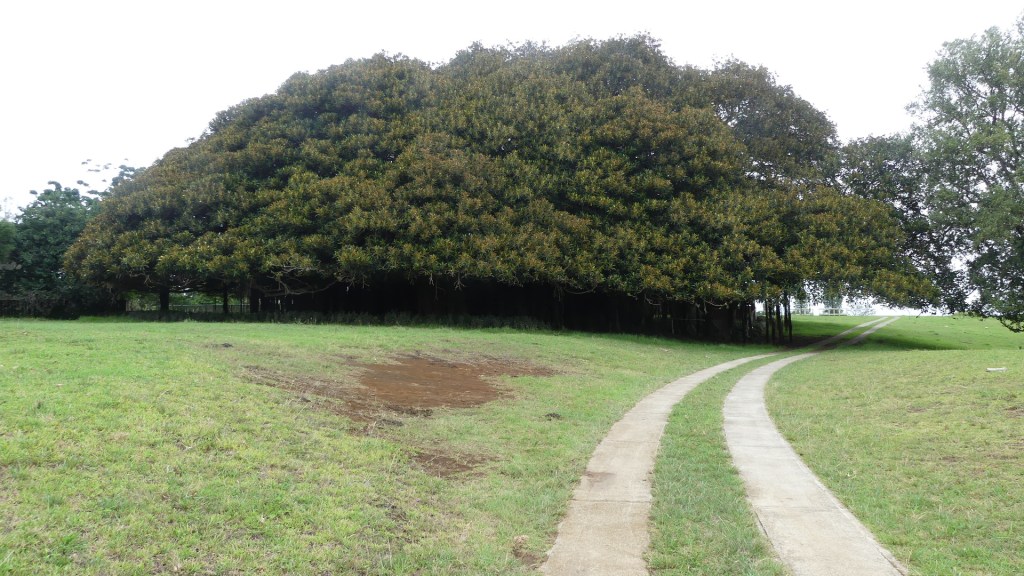
We were supposed to get up early and go to the farmers market as there is scant fruit and vegetables available at the supermarkets. Plenty of beef though. They graze in paddocks and on the road verges all over the island. The verges are considered “common” similar to the English system of common land and all over the island cattle graze there, give birth there and some are slaughtered there before being taken to the butcher’s shop. We were told that there was a vet in attendance to ensure the animal was killed efficiently humanely and compassionately but it is an event that school kids may witness going to school or to home. We did not witness this nor did we arise to get to the farmers markets but instead we revisited the Banyan tree and then the cemetery.

In 1824 the British government instructed the Governor of New South Wales, Thomas Brisbane, to occupy Norfolk Island as a place to send “the worst description of convicts”. The convicts detained have long been assumed to be hardcore recidivists, men transported to Australia who committed fresh colonial crimes for which they were sentenced to death but were spared the gallows on condition of life at Norfolk Island. However, a 2011 study of 6458 Norfolk Island convicts, has demonstrated that the reality was that more than half were detained at Norfolk Island without ever receiving a colonial conviction, and only 15% had been reprieved from a death sentence. The overwhelming majority of convicts sent to Norfolk Island had committed non-violent property offences, and the average length of detention there was three years. Norfolk Island went through periods of unrest with convicts staging a number of uprisings and mutinies between 1826 and 1846. The British Government began to wind down the second penal settlement after 1847, and the last convicts were removed to Tasmania in May 1855.

We returned to the Banyan tree in Rooty Hill Rd. The tree is a native of India and brought to this island by immigrants. An enormous tree it needs a paddock to spread through. It is located on private property, so we were wary about entering until the neighbour across the road assured us that it was ok to enter. After taking a few pictures which appear in this blog we went to the cemetery.

That Banyan Tree

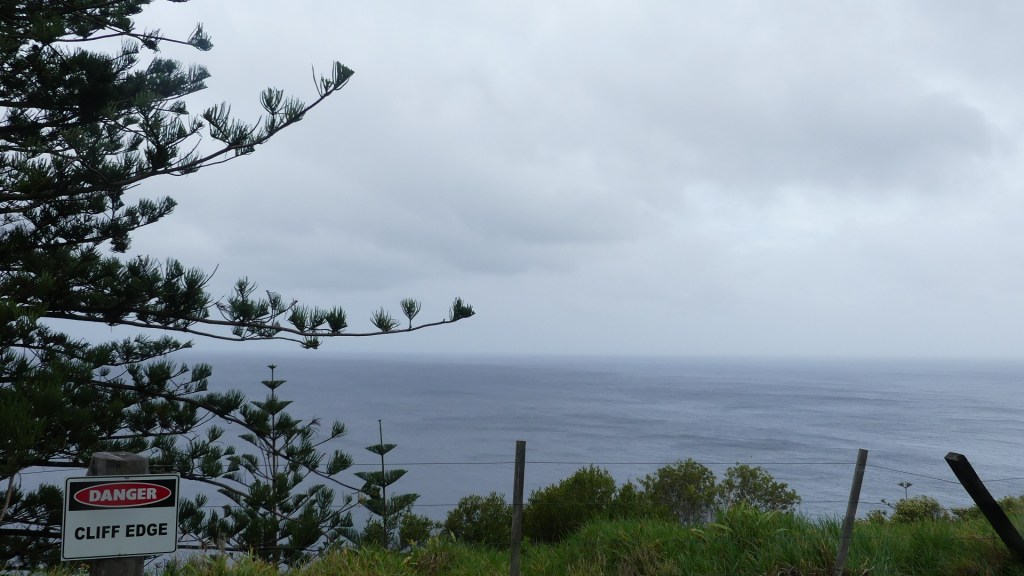
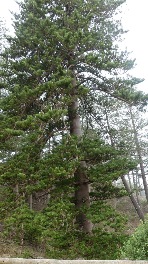
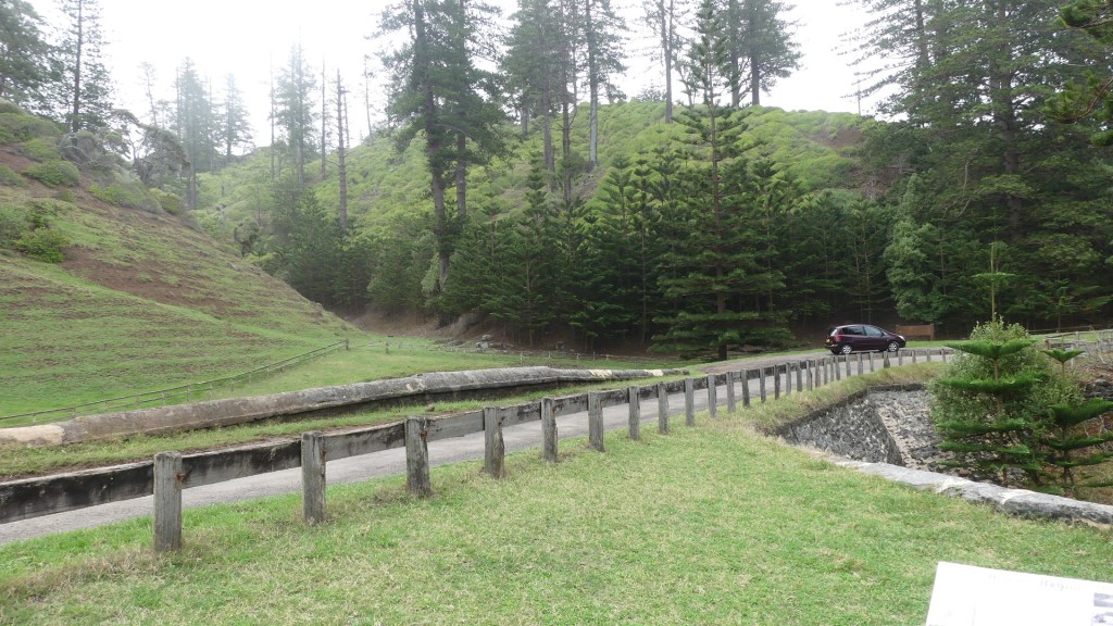
We started our visit to the cemetery with a stop at Bloody Bridge. On our tour we had seen a baby Red­tailed Tropic bird in the nest and at the foot of a Norfolk Pine, so we wanted to see if it was still there. The tropic bird is distinguished by it’s single long red tail feather. Yes, the chick was still there. Apart from feral cats and the rats brought to the islands by the Pacific Islanders, there are no predators on Norfolk.

Red Tail Tropic Bird chick and the tree above it

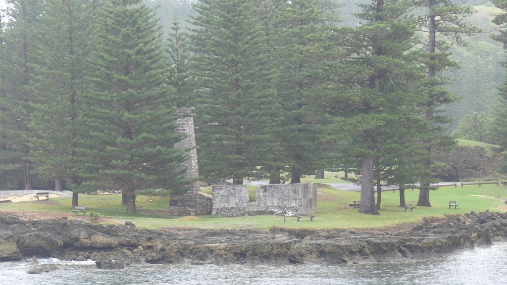
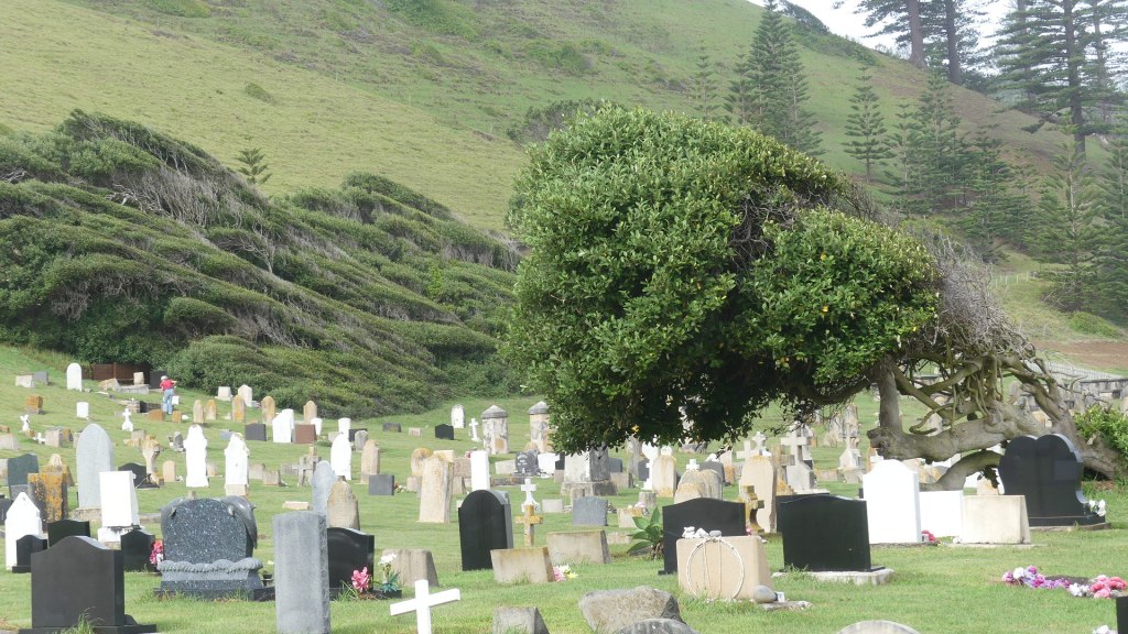
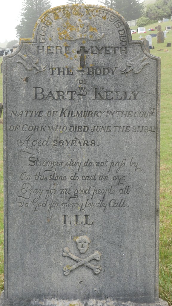
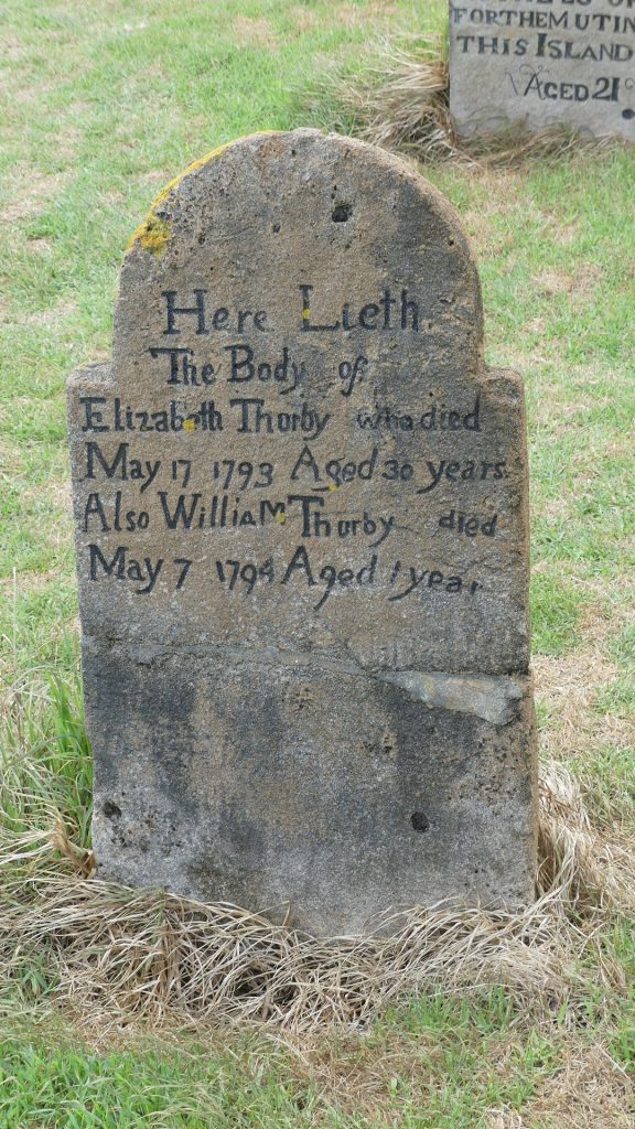
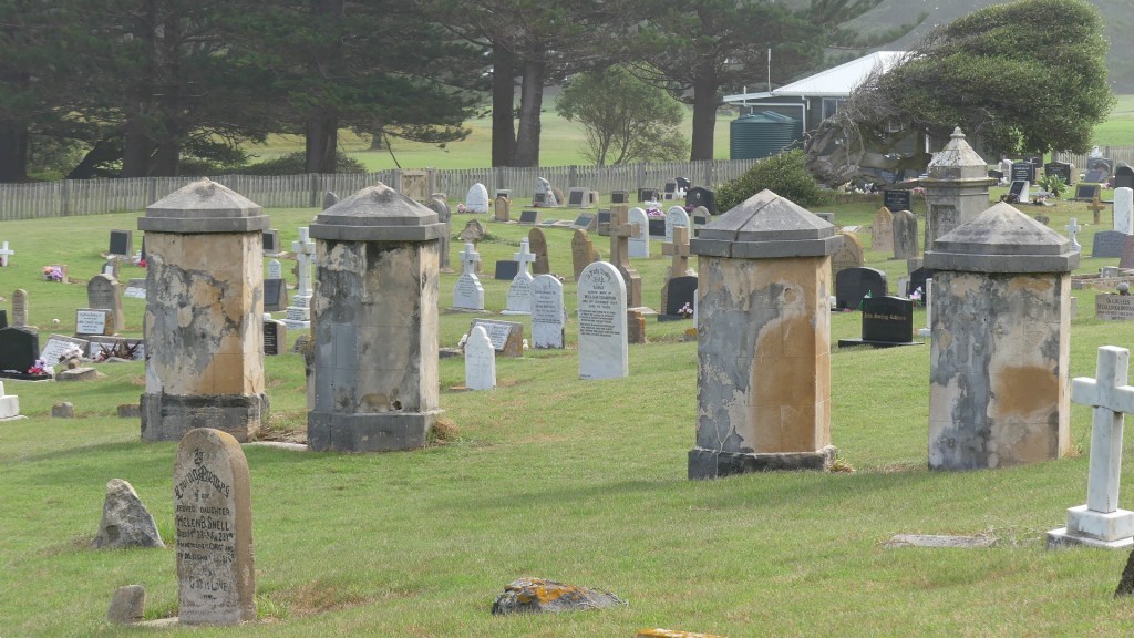
The cemetery contains headstones of military officers, convicts, Pitcairners and Norfolkers the unknown and the famous like Colleen McCullough. Battered by the south easterly winds to the sounds of the crashing of the waves, headstones from 1793 to the present can be found. Many are defaced by the wind so who knows the earliest date on the oldest headstone. I have uploaded my photos so that you can read the headstones for yourself. Here is the history of the island. Note the trees bowed to the wind or are they reading the headstones for themselves?

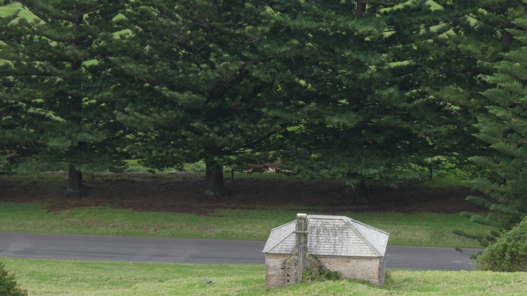
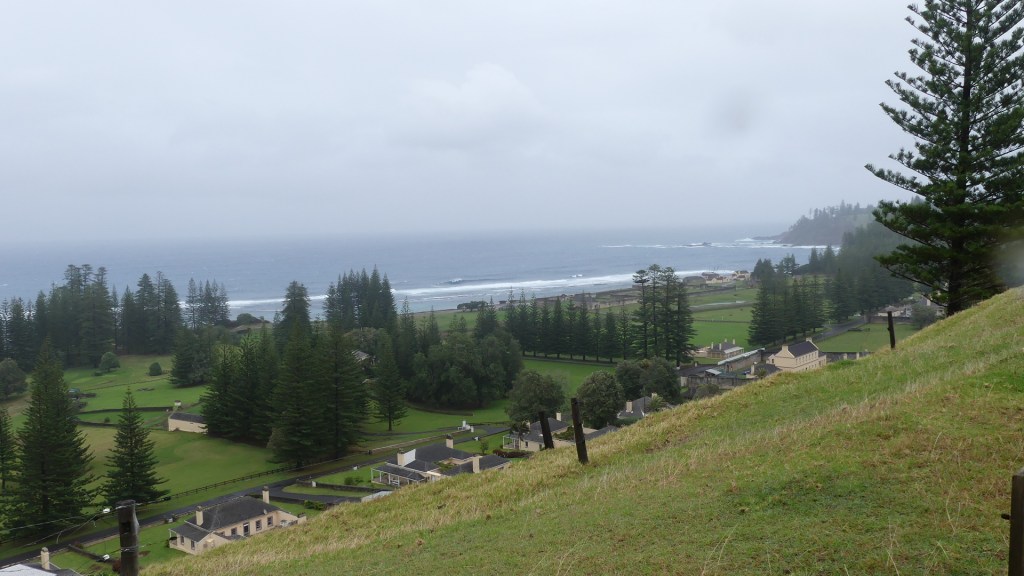
Bloody Bridge and the road to the Island cemetery and the headstones

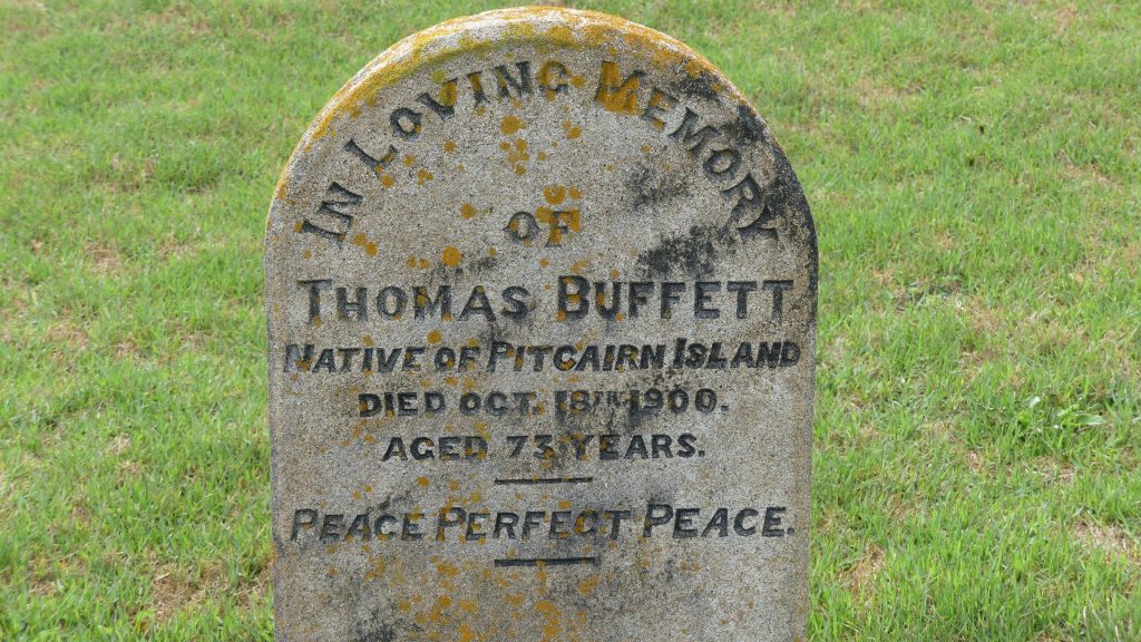
The civilian settlement of free settlers began on 8 June 1856, when the descendants of the Tahitians and the HMS Bounty mutineers, including those of Fletcher Christian, were resettled from the Pitcairn Islands, which had become too small for their growing population. On 3 May 1856, 193 people had left Pitcairn Islands aboard the HMS Morayshire. On 8 June, 194 people arrived, a baby having been born in transit. The Pitcairners occupied many of the buildings remaining from the penal settlements, and gradually established traditional farming and whaling industries on the island. Although some families decided to return to Pitcairn in 1858 and 1863, the island’s population continued to grow. They accepted additional settlers, who often arrived on whaling vessels.

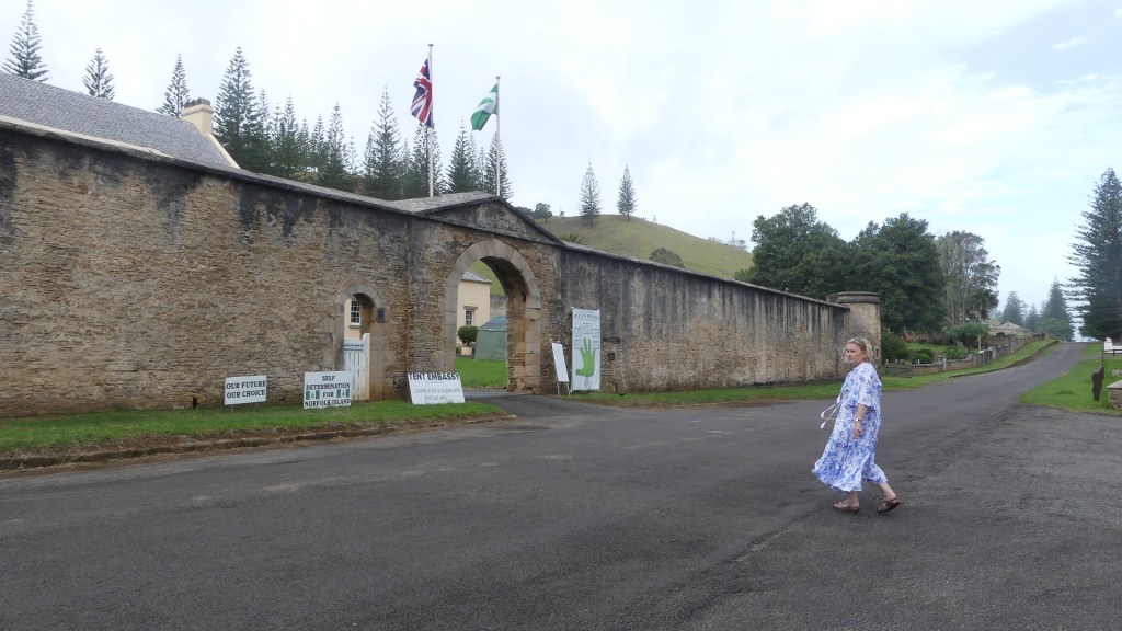
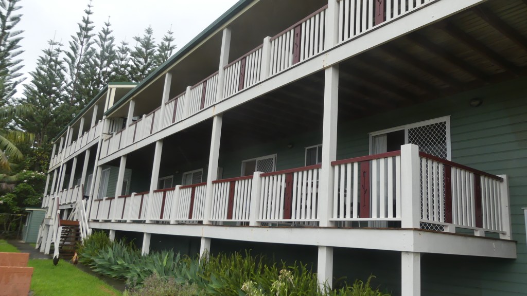
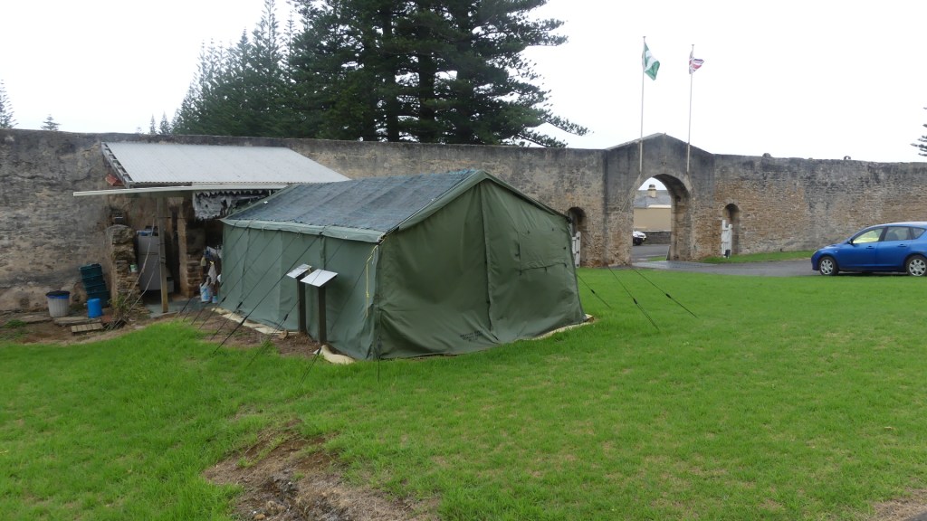
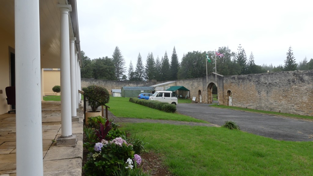
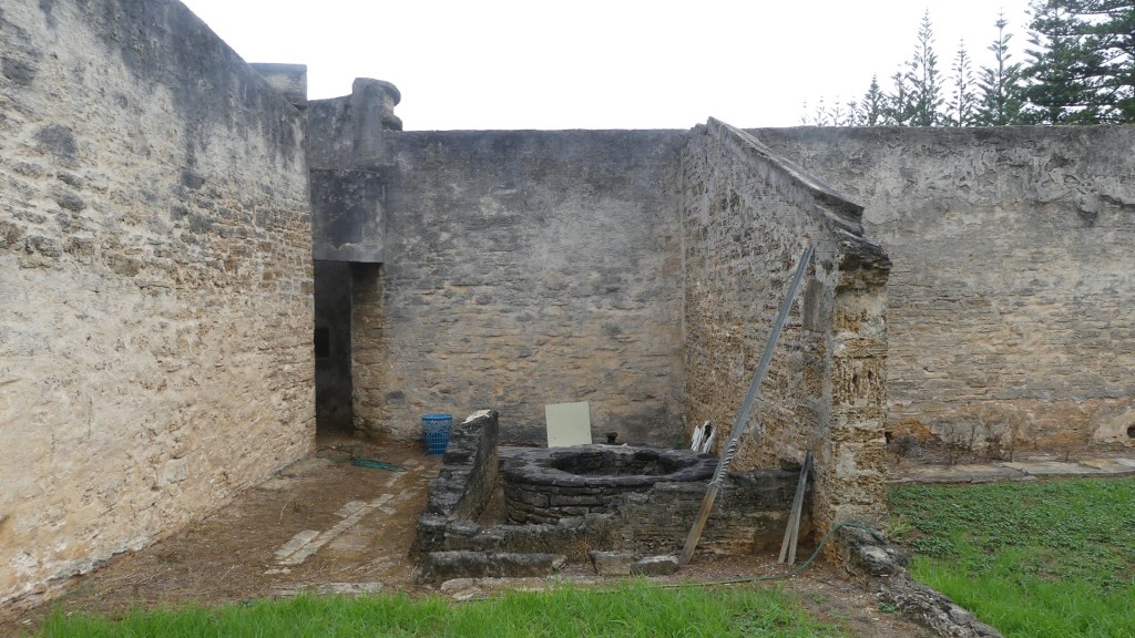
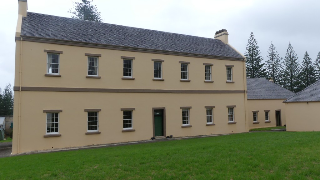
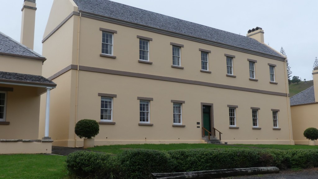
After visiting the cemetery, we drove along Quality Row to the first of the two garrison buildings. This building is now used for the Court and the elected Council. A controversy has arisen with Australia dismissing the Norfolk Island Council and appointing an Administrator.

Kerry entered the garrison and ran into Bindi a Norfolk Islander manning the tent embassy inside the garrison, protesting Australia’s interference and protesting for independence for Norfolk Island. Kerry and Bindi seemed to have an immediate connection and when Bindi mentioned coffee they adjourned to the tent for gossip and coffee. I was left to scout around the buildings which I did, and my photo record is uploaded below.

The garrison complex now containing the tent embassy the courts and the council plus the grounds of their revolution

Norfolk Island was the subject of several experiments in administration during the century. It began in the nineteenth century as part of the Colony of New South Wales. On 29 September 1844, Norfolk Island was transferred from the Colony of New South Wales to the Colony of Van Diemen’s Land. On 1 November 1856 Norfolk Island was separated from the Colony of Tasmania (formerly Van Diemen’s Land) and constituted as a “distinct and separate Settlement, the affairs of which should until further Order in that behalf by Her Majesty be administered by a Governor to be for that purpose appointed”. The Governor of New South Wales was constituted as the Governor of Norfolk Island.

On 19 March 1897 the office of the Governor of Norfolk Island was abolished and responsibility for the administration of Norfolk Island was vested in the Governor of the Colony of New South Wales. Yet, the island was not made a part of New South Wales and remained separate. The Colony of New South Wales ceased to exist upon the establishment of the Commonwealth of Australia on 1 January 1901, and from that date responsibility for the administration of Norfolk Island was vested in the Governor of the State of New South Wales.

The Parliament of the Commonwealth of Australia accepted the territory by the Norfolk Island Act 1913 (Cth), subject to British agreement; British agreement was expressed on 30 March 1914, in a UK Order in Council made pursuant to the Australian Waste Lands Act 1855 (Imp). A proclamation by the Governor-General of Australia on 17 June 1914 gave effect to the Act and the Order as from 1 July 1914. So, Norfolk Island became subject to administration by Australia.

During World War II, the island became a key airbase and refuelling depot between Australia and New Zealand, and New Zealand and the Solomon Islands. The airstrip was constructed by Australian, New Zealand and the United States servicemen during 1942. The island proved too remote to come under attack during the war and NZ Service personal left the island in February 1944.

In 1979, Norfolk Island was granted limited self-government by Australia, under which the island elected a government that ran most of the island’s affairs. Financial problems and a reduction in tourism led to Norfolk Island’s administration appealing to the Australian federal government for assistance in 2010. In return, the islanders were to pay income tax for the first time but would be eligible for greater welfare benefits. An agreement was finally signed in Canberra on 12 March 2015 to replace self-government with a local council and comprehensive reforms for Norfolk Island, the Norfolk Island Legislative Assembly was abolished, with the territory becoming run by an Administrator and an advisory council. The action was justified on the grounds it was necessary “to address issues of sustainability which have arisen from the model of self-government requiring Norfolk Island to deliver local, state and federal functions since 1979” From that date, most Australian Commonwealth laws were extended to Norfolk Island. This means that taxation, social security, immigration, customs and health arrangements apply on the same basis as in mainland Australia.

Elections for a new Regional Council were held on 28 May 2016, with the new council taking office on 1 July 2016. But a majority of Norfolk Islanders (68% of voters) objected to the Australian plan to make changes to Norfolk Island without first consulting them.

There is opposition to the reforms, led by Norfolk Island People for Democracy Inc., an association appealing to the United Nations to include the island on its list of “non-self-governing territories”. There has also been movement to join New Zealand since the autonomy reforms. Bindi is one of them. Note my photos show the UK flag flies over the gate of the garrison just above the protest sign for independence.

Our day ended with dinner at the Bowls Club in Taylors Rd. It is a busy place and there always seems to be a competition happening. Visiting bowls clubs seem to be drawn here. Simple pub type fare along with a cold drink – very satisfying. Kerry struck up a friendship with another elderly couple who joined us for dinner and who we then bumped into everywhere else on the island. Did I tell you it’s a small place.

A Short Imprisonment on Norfolk Island

Day 2 Friday

We are awoken by the local rooster crowing at the dawn and make our way to Pinetree tours office. The rooster is not domesticated. Like all of the open range chooks on Norfolk they are the current generation of the chooks released by Lieutenant Gidley King when he established the first English settlement in 1788. The first European known to have sighted and landed on the island was Captain James Cook, on 10 October 1774, on his second voyage to the South Pacific on HMS Resolution. He named it after Mary Howard, Duchess of Norfolk. After the outbreak of the American Revolutionary War in 1776 halted penal transportation to the Thirteen Colonies, British prisons started to overcrowd. In December 1785 Britain decided that it would send convicts to Australia. In 1786, it included Norfolk Island as an auxiliary settlement. Governor Arthur Phillip ordered Lieutenant Philip Gidley King to lead a party of 15 convicts and seven free men to take control of Norfolk Island, and prepare for its commercial development. They arrived on 6 March 1788. It was also called “Sydney” like its parent.

Lead rooster outside our Apartment and views from our deck

We are going to make this trip to Taylor’s Rd Burnt Pine many times as we have booked a few tours and if it is not Pinetree Tours, its Baunti (Bounty) Tours – the Pitcairn Islanders introduced this type of Pidgin English which is spoken by the “natives” today.

We join many of the other passengers from Brisbane and board our bus. Our driver is John Christian (of the Fletcher Christian line – I make him to be 10th generation) and he understandably has lots of knowledge about the island, its heritage and history. We drive out of the main street Taylor’s Rd and along to Queen Elisabeth Ave up to Rooty Hill Rd and south along that road until we see an Indian Banyan Tree. This thing covers approximately ½ an acre (one tree) with its extensive canopy and air rooting system. It’s on private land so the bus does not stop but we return for a closer look.

Further down the road is a lookout named after Queen Elizabeth (you would be surprised to learn she visited on a royal tour and left her name on a few things). Liz has her name on an Avenue, but poor old Phillip only gets his name “Prince Phillip Drive” on a dirt road to a dry waterfall at a place called “Cockpit” – does this reflect on Phillip?

Photos with the convict at Pine Tree tour office, from the Q Liz Outlook and that Banyan Tree

The first known settlers in Norfolk Island were East Polynesians but they had already departed when Great Britain settled the island as part of its 1788 settlement of Australia. Archaeological investigation suggests that, in the thirteenth or fourteenth century, the island was settled by East Polynesian seafarers, either from the Kermadec Islands north of New Zealand, or from the North Island of New Zealand. However, both Polynesian and Melanesian artefacts have been found, so it is possible that people from New Caledonia, relatively close to the north, also reached Norfolk Island. Human occupation must have ceased at least a few hundred years before Europeans arrived.

When they did arrive, it was to provide food for the settlement in New South Wales, so the settlement was called Sydney town. They brought with them domesticated animals that would become pests and cause environmental harm to the Islands. But the settlement did not last. As early as 1794, Lieutenant-Governor of New South Wales Francis Grose suggested its closure as it was too remote and difficult for shipping and too costly to maintain. All of the remaining inhabitants of the first settlement were removed in 1813. Everything that had been developed was destroyed in fear of another European power claiming and using the island.

From February 1814 until June 1825, the island was abandoned. The island served as a convict penal settlement from 6 March 1788 until 5 May 1855, except for an 11-year hiatus between 15 February 1814 and 6 June 1825, when it lay abandoned. On 8 June 1856, permanent civilian residence on the island began when descendants of the HMS Bounty mutineers were relocated from Pitcairn Island. In 1914 the UK handed Norfolk Island over to Australia to administer as an external territory, but as a distinct and separate settlement.

The buildings and development created by the 2nd settlement were centred around the settlement formerly known as Sydney town but renamed Kings Town (Kingston) by the 2nd settlement. Many of these buildings have survived and form the centre of the historic village. We can view these buildings and the cemetery from a top of Queen Elizabeth’s lookout. Our tour takes us down into the village and along Quality Row where there are garrison buildings which are now used as an Anglican Church (All Saints), the Council Chamber, the Supreme Court of Norfolk Island and the Magistrates Court and the Governor’s residence (now the Administrator’s residence). The officer’s houses are now private residences and one of the former military buildings is the Golf course clubhouse. Beyond the golf course and before reaching Bloody Bridge, is the cemetery. The cemetery was commenced with the first settlement and is still used today. Unlike other cemeteries around the world which do not accept criminals into the consecrated grounds, this cemetery welcomes all comers.

Former Governor’s residence now home to the Island Administrator and Kerry approaches the Supreme Court, Magistrates Court, and Island Council building (formerly a garrison building) in Quality Row

Our tour continued leaving the lookout and travelling down through Kingston around to Bloody Bridge. There exists a myth about how the bridge got its name, but recent research suggests that it was built by Irish Political prisoners who named it after a bridge Ireland.

We then travel north to Cascade where the international ships come in (they have been waiting 5 months for a ship such is the difficulty to unload to the Island and the irregularity of availability). This is the old whaling station. The island was a regular resort for whaling vessels in the age of sail. The first such ship was the Britannia in November 1793. The last on record was the Whaling Bark Andrew Hicks in August–September 1907. Andrew Hicks of Westport Virginia had died in 1897 but his empire continued with this vessel lost when it dragged anchor in Havana. They came for water, wood and provisions and sometimes they recruited islanders to serve as crewmen on their vessels.

Whaling ceased in the 1960’s because they thought they had over fished the whales. Later evidence showed that Russian whalers had severely over fished sperm whales pushing that species of whale almost to extinction. With the cessation of whaling stocks have rebuilt and the station dismantled such that only one of the boilers is all that remains bar a few cement pads.

The jetty is inadequate for modern shipping which is now containerised. The wharf requires the ship to anchor off the island while Norfolk tenders ferry cargo to and froe – I don’t think the Norfolk Islanders want that to change just as they don’t want too many tourists as they like their little paradise just as it is with time and the world forgetting it is there. Violent winds raging seas and shallow water mean that any passenger ships can only unload passengers with the use of the 3 Australian donated ferries which sit dry docked waiting for the next ship never to come.

Our trip continued through Kingston and we headed to St Barnabas Chapel. In 1867, the headquarters of the Melanesian Mission of the Church of England was established on the island. We then back tracked going east to St Barnabas Chapel Anglican Church founded by the Mission and Ona dar Cliffe (some more pidgin – It literally means “on the cliff” which is precisely right). More about the church later when we visit the church on Sunday. In 1920 the Mission was relocated from Norfolk Island to the Solomon Islands to be closer to the focus of population

Ona dar Cliffe (Norfolk for “On the Cliff”), is a retreat like an oversize scout camp which the tour company controls and uses as a morning tea stop in this tour. It was sprinkling all day, so we were thankful for shelter. The grounds do end at a cliff, but the adjoining property and its two cattle and calf caught my eye. I am told that the cattle are a Canadian breed, but I could not find out anymore.

Lone Pine, the back of the golf course and the cemetery beyond, the old lime burner pit and salt mill, those cattle and looking off the cliff

After morning tea, we went to the church and then south to “Lone Pine” on Hunter’s Point between Slaughter Bay and Emily Bay below our apartments the two most popular swimming spots – you don’t have to jump off a cliff to have a swim. There is a second settlement derelict salt mill on the Point and evidence of a smelter to obtain lime from a rocky reef and the evidence of the earliest settlement by Pacific Islanders which remains buried by sand for its protection. Native to the island, the evergreen Norfolk Island pine is a symbol of the island and is pictured on its flag.

The tour bus returned us to Taylor’s Road, and we returned to our apartment for a lazy afternoon. It continued to shower/rain and the wind was howling. After an afternoon nap it is off to the RSL for dinner. They are champions of the raffle. All night they were raffling something, and the same crowd seemed to be winning and it was not us. We left them as I was expecting they would start cockroach races shortly and I think they kept them in the kitchen.

Tomorrow we venture out on our own.

A Short Imprisonment on Norfolk Island

Day 1 Thursday

In these Covid times travel overseas is out of the question except for the overseas territories of Australia but even those can be subject to irrational shutdowns because of outbreaks of the contagion. In the case of Norfolk, it was the outbreak in Auckland that caused Air New Zealand to cancel our flights to Norfolk, but Qantas came to our rescue in the nick of time.

So, we departed Brisbane on 18th February 2021 for the short 1 hour 55-minute trip by air to Norfolk. I was interested to visit the former British penal colony and home of the Pitcairn Is families of mutiny on the HMS Bounty fame and one of Australia’s external territories.

Norfolk Island located in the Pacific Ocean between New Zealand and New Caledonia, 1,412 kilometres (877 mi) directly east of Brisbane and about 900 kilometres (560 mi) from Lord Howe Island. Together with the neighbouring Phillip Island and Nepean Island, the three islands collectively form the Territory of Norfolk Island. At the 2016 census, it had 1748 inhabitants living on a total area of about 35 km2 (14 sq mi). Phillip Island and Nepean Island are uninhabited. Its capital was Sydney but changed name to Kingston and since 1856 Burnt Pine is now the capital.

We landed at Norfolk Is/Burnt Pine international Airport. The airport was built by Australia and New Zealand during WWII as a base for the NZ “N” force but abandoned when they realised it was too far from the action. Fortuitous for Norfolk Island. After walking across the tarmac and collecting our luggage we boarded our ride to the apartment. It was at this time that we experienced the weather that would continue until the afternoon of Wednesday week – windy overcast and occasional drizzle. The Norfolkers were not unhappy as they have been through a dry spell.

Burnt Pine Airport

We travelled to Aloha Apartments 5 mins from the airport and dropped off the first six visitors leaving Kerry and me with Col and Gloria going to Panorama Oceanview Apartments another 5 minutes away but on the southern side of Norfolk Island. We drove south into the main street of Burnt Pine, Taylor’s Rd, and out again rather quickly onto Queen Elizabeth Avenue and down Middlegate Rd to the Apartments awkwardly placed on a bend in the road but with elevated views of Nepean and Phillip Islands, the old penal settlement of Kingston and the beaches.

the Apartments and the view

They have some great tourist innovations like delivering your hire car to your apartment in advance of your arrival with the keys in the ignition ready to go. You register at the apartments, put your luggage away and then you check in at the hire car office. So, we saw our mulberry coloured 7 seat corolla for the first time as we collected our room key.

Our Mulberry Toyota

The Apartments are very tired and musty smelling something you don’t expect or want but the views – wow! So, we settled in and then went to the Governor’s Residence (a resort between our apartment and the main street) to book in for the car. We decided to take the excess reducing insurance not aware that no one locks their cars and collisions are infrequent. Norfolk is 1 hour ahead of us in Brisbane and on daylight saving time so it’s now 4.00pm and apart from a light breakfast at 6.00am we have not had any lunch.

Hunger drives us to the Bowls Club in Taylor’s Rd – the kitchen opens at 5.30pm. Time for a drink. So we position ourselves for easy access to the kitchen/dining room and watch the world go by – at least the NI world. We meet Ray and Lorraine travellers like us and share a meal then wind our way back to the Apartments.

Very soon we are curled up in bed listening to the wind and rain hoping that tomorrow we are off to Pinetree tours for a half day sight-seeing of the Island.