

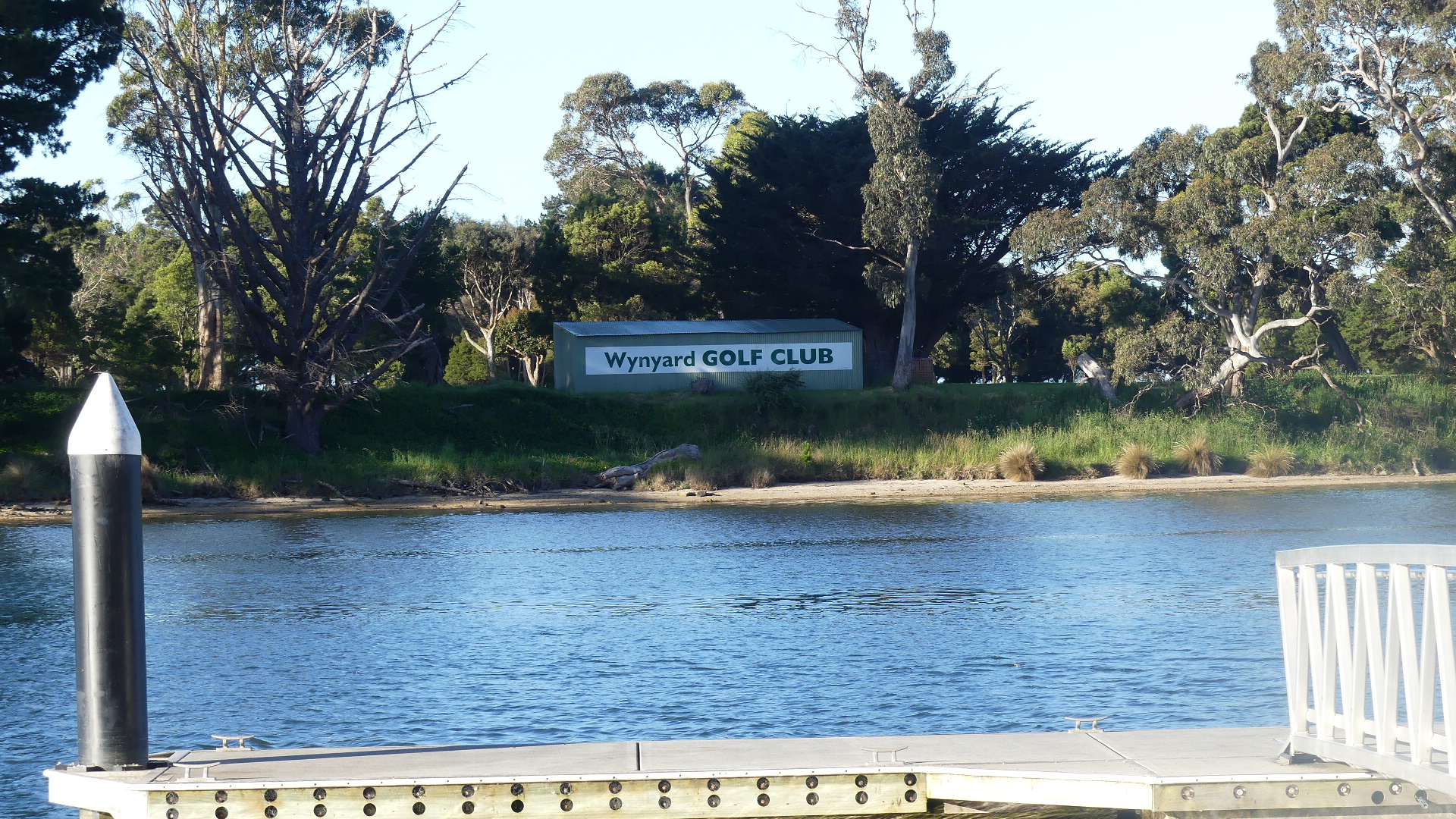
Its daylight saving in Tassie so when we arrived in Wynyard the Sun was still shining and the residents of Wynyard #wynyard were in the streets doing their shopping and what have you. Masks were the popular fashion accessory and remembering to put the damn thing on was still a chore. We found our accomodation. A bit tricky though. Its river front and yet just below the main street of the town. The motel extends to the carpark beside a wharf from which a municipal park follows the river as it curves back into the mountains. It was a pleasant surprise. Our accomdation was an old motel freshened up and given a modern appearance with the best view in town. From our room we could look over the river and with a craning of the neck see the mouth and river bar.
The motel area included two “shipping container houses” #shipping container house. I have included pictures below. I just loved the innovation but apart from being impressed I cannot tell you much more as they were locked up but clearly occupied.


After registering and moving our gear into our room we decided on a walk down the main street – Goldie Street. Now we were staying at 1 Goldie Street. To get to that address coming from the east you have to crossover Goldie St and duck down onto the lower part of Goldie St disconnected from Goldie St the centre of town. So see what I mean about tricky.
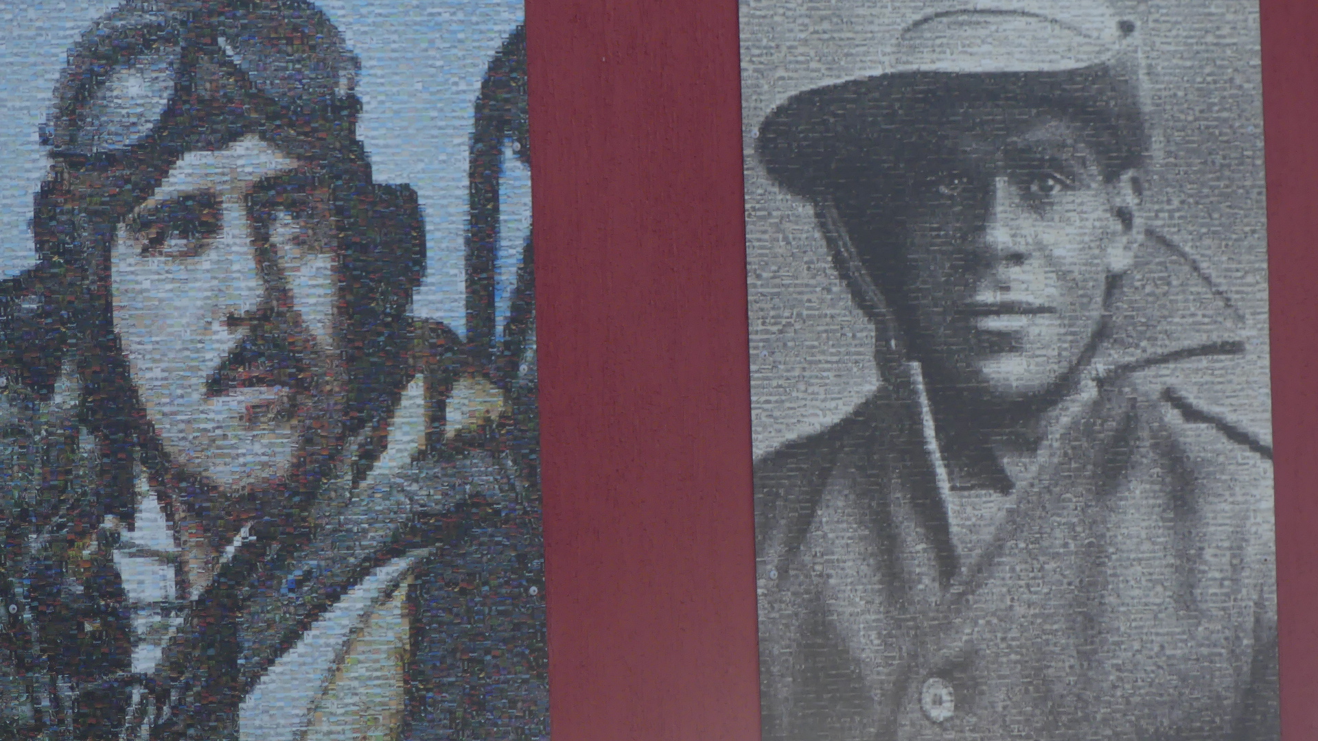
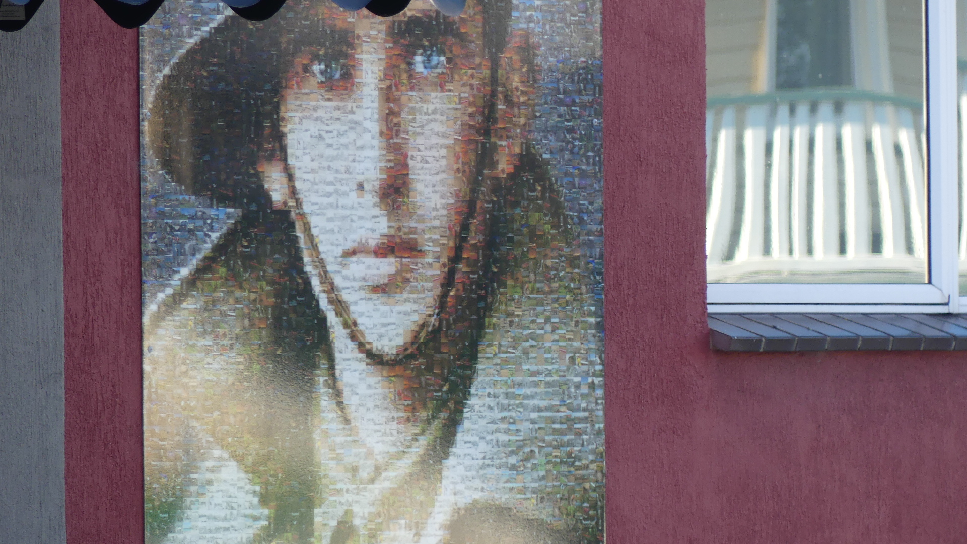
We very quickly encountered the RSL (Returned Servicemans Club for Wynyard) #RSL Wynyard and its moving display of images made up of smaller images of servicemen and women.

We found the Woolies and bought something for our evening meal. Although the trip was not overly long in distance we had spent all the daylight hours travelling and needed some sleep so with the sun going down around 8.30pm we decided we would take our rest also.
Next morning – Up bright eyed and bushy tailed the next morning we planned our day. First we would go to Table Cape Lighthouse.
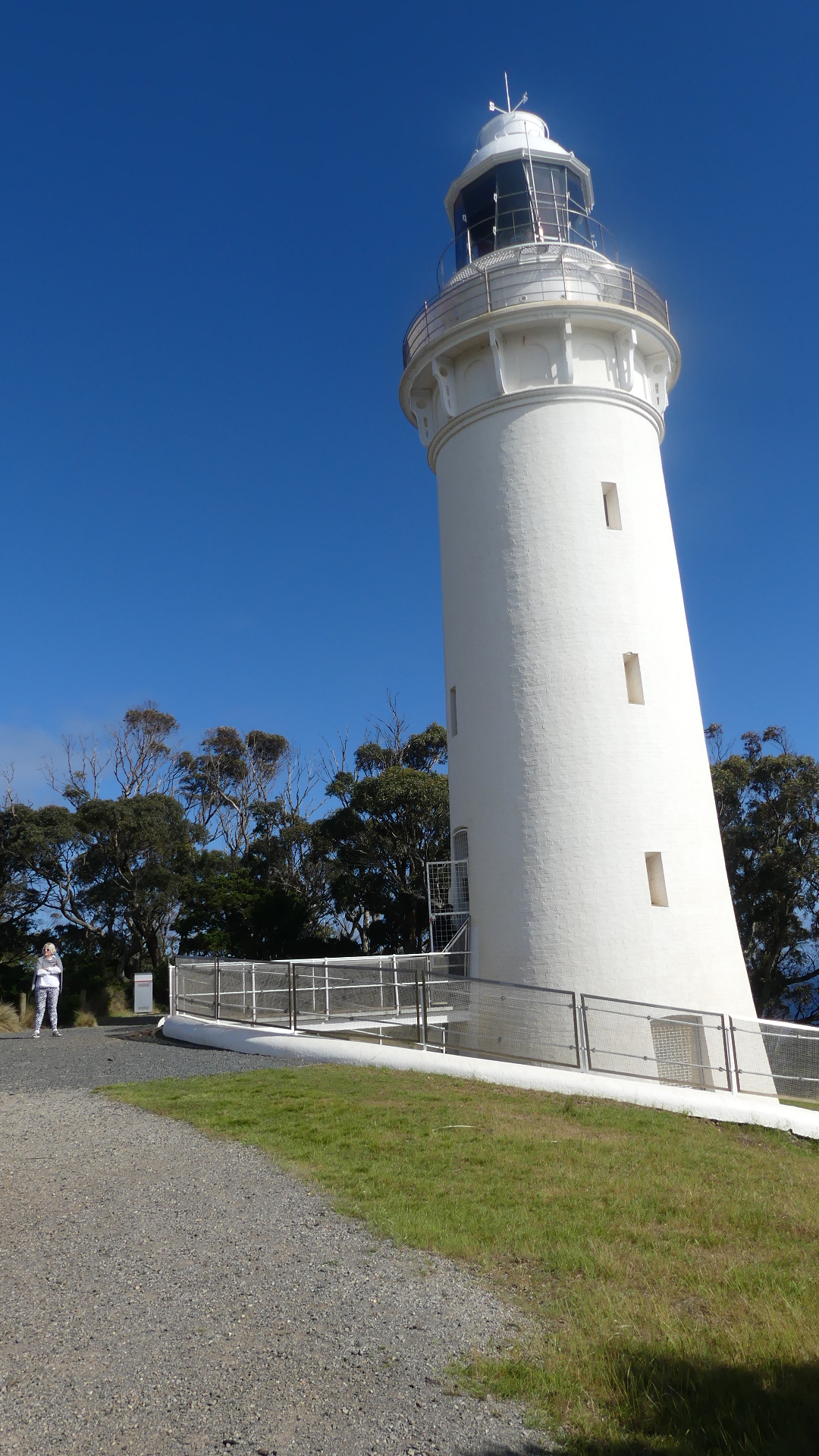
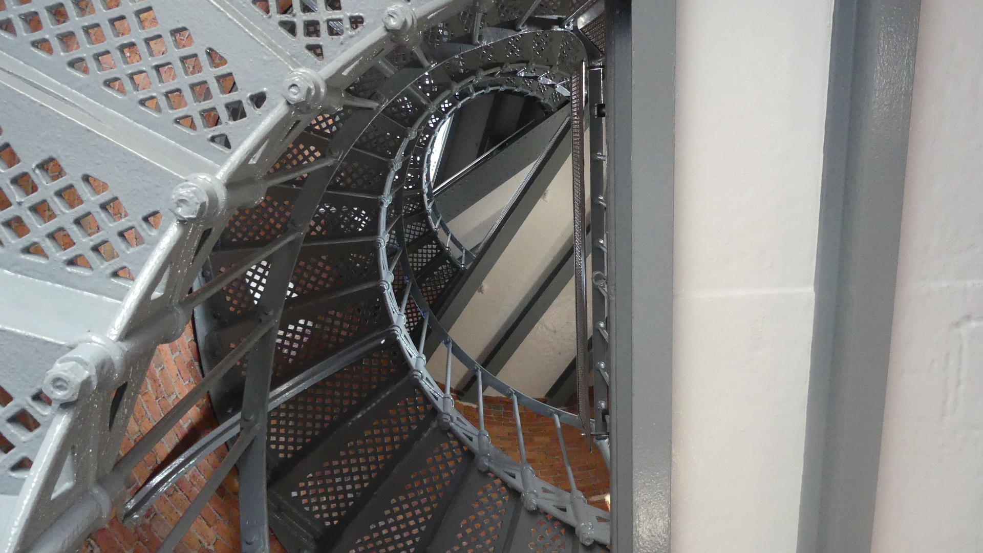
The magnificent plateau of Table Cape is by far Wynyard’s most remarkable natural wonder. Sitting at 180 metres high, ‘The Cape’ – as locals refer to it – dominates the Wynyard coastline and offers spectacular views of Tasmania’s coast and agricultural farmlands. As you drive to the top of the remains of a 12 million-year-old volcano you’ll reach a viewing platform where, on a clear day, you can see George Town’s Low Head and mountain ranges over 175 kilometres away. Take a short stroll along the cliff-top walking track to the Table Cape Lighthouse #Table Cape Lighthouse, the only operating lighthouse open (seasonally) for tours in mainland Tasmania.
Table Cape is also home to the Table Cape Tulip Farm where acres of patchwork fields explode with colour each spring. We must have missed this display by that much – there were no blooms to be seen.
As for seasonal openings of the lighthouse, we encountered the seasonal maintenance team. Being a friendly Tasweigen he invited us to step inside the thresshold and view the interior. Staring up to the light in the top of the lighthouse you wonder about the effort of carrying the lamp oil to the top before electric power replaced the lantern and the tough life for the lighthouse keeper and the family beofre civilisation surrounded it – the solitude and the harshness of life is brought home by the grave of a child just by the gate into the lighthouse keep.
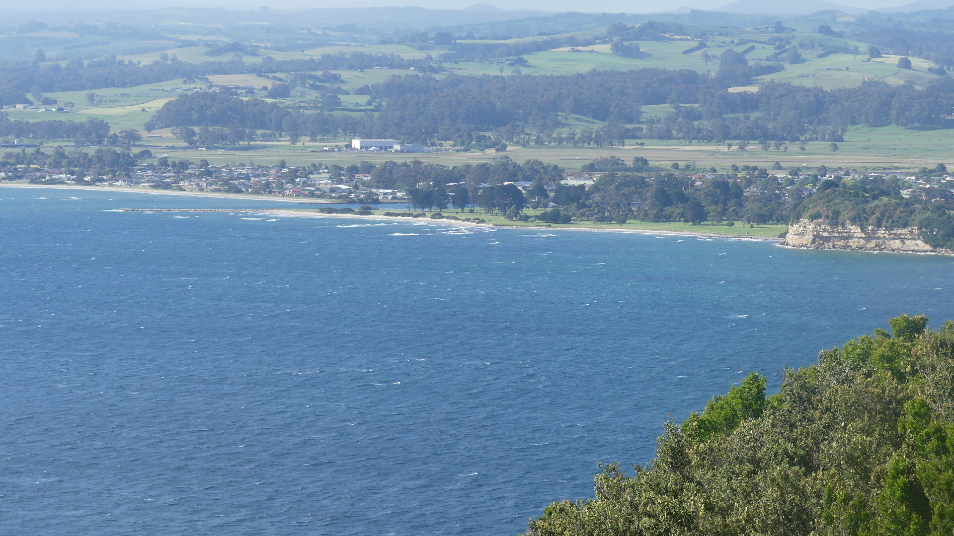
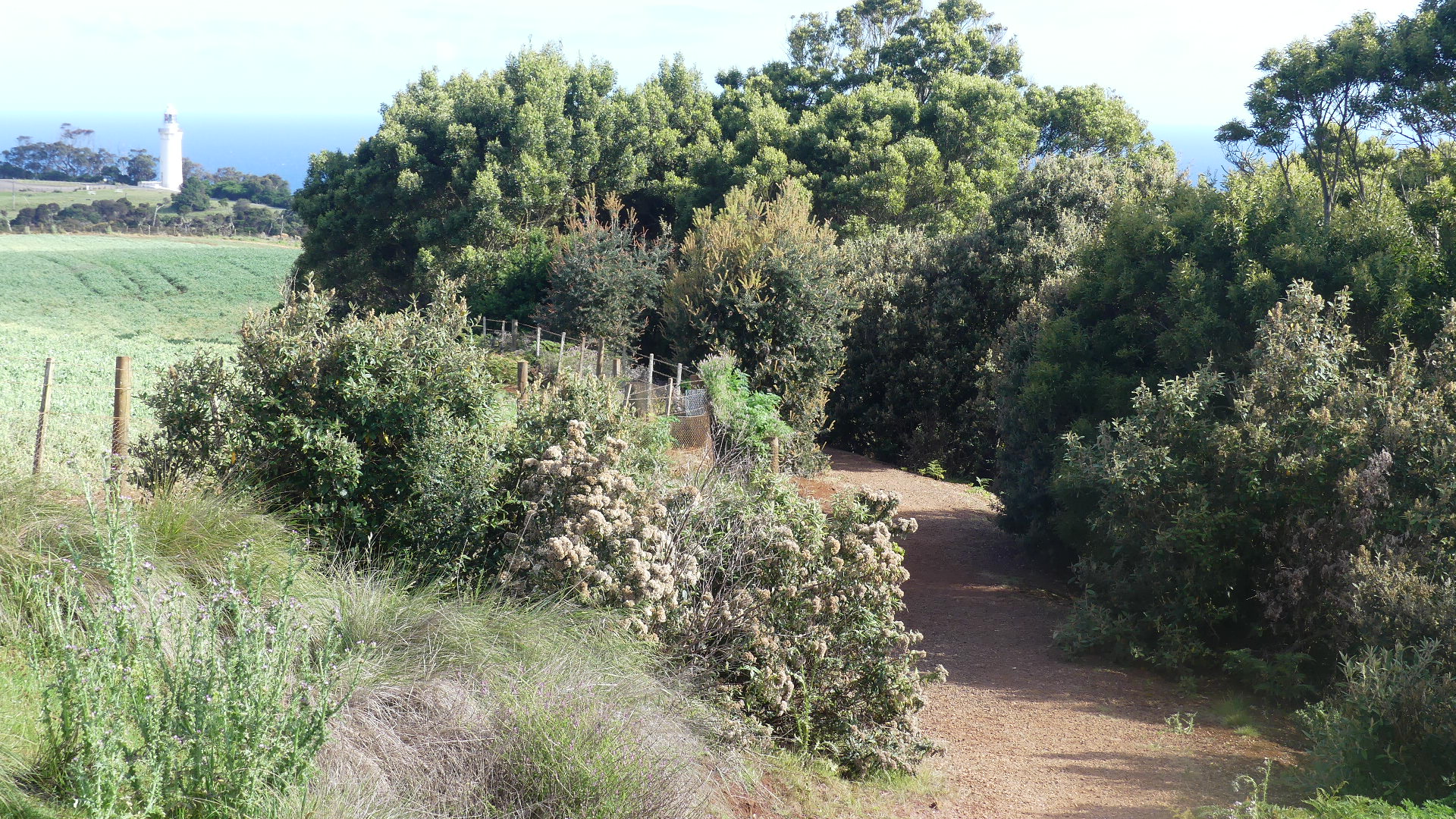
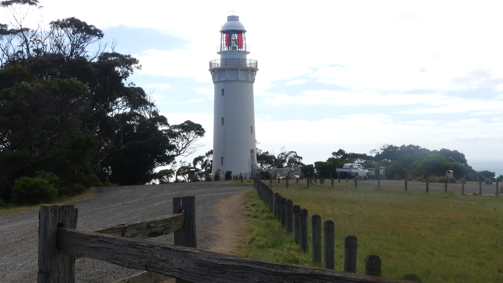

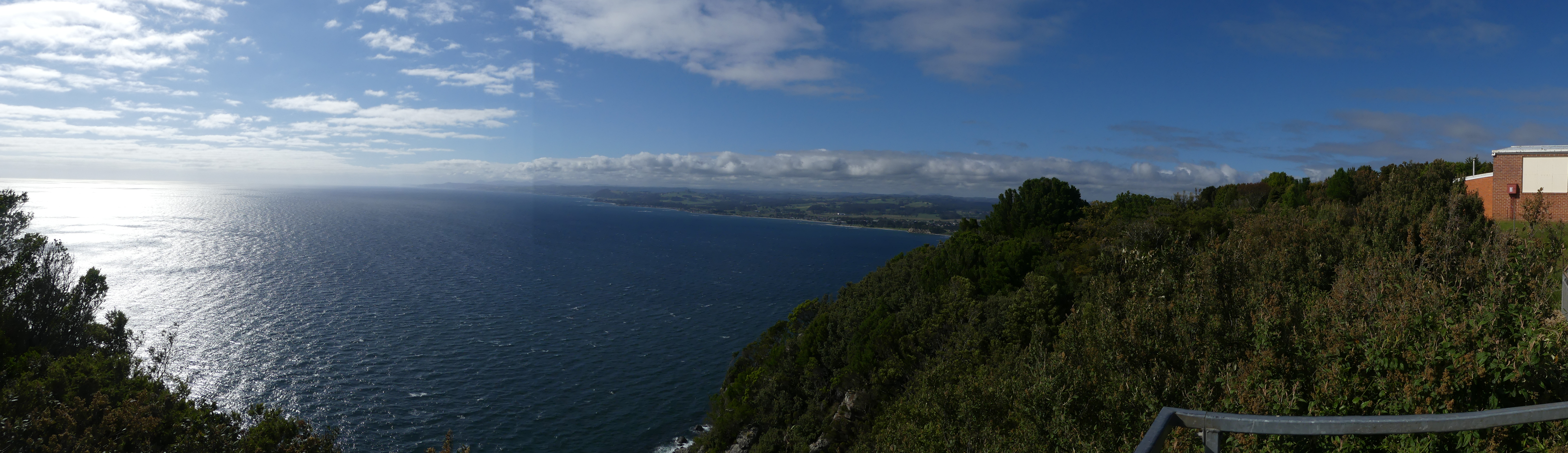
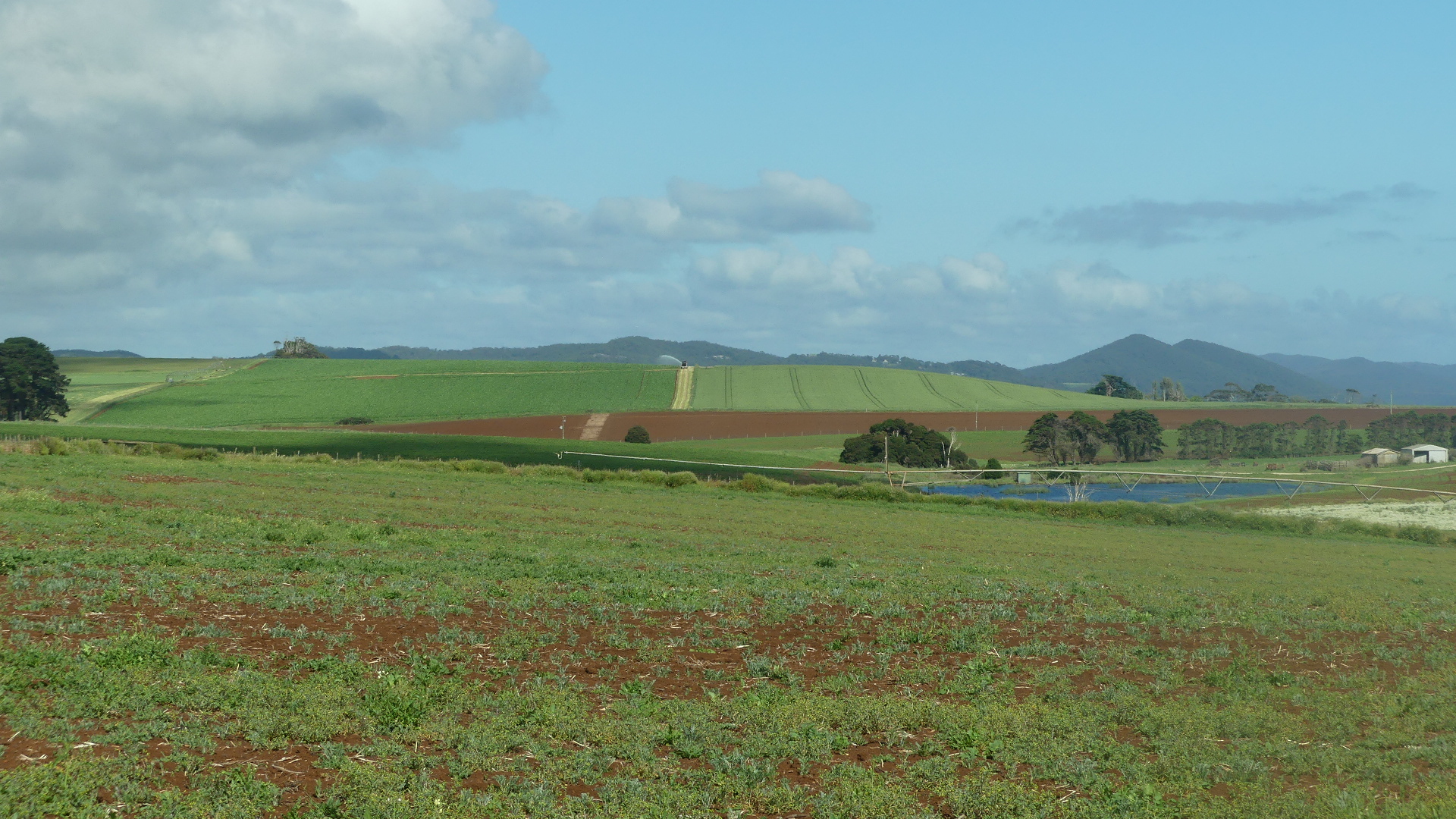
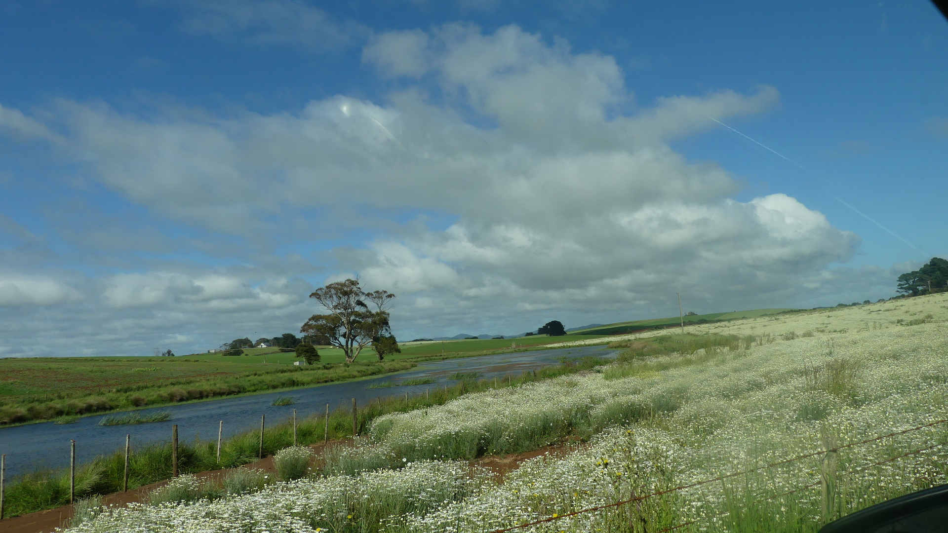
The drive to the lighthouse today is a pleasant cruise along bitumened road through fields which would normally be filled with tulips but even without the flowers this was extremely beautiful, traffic free and pastoral. Some of the vistas were remarkable.

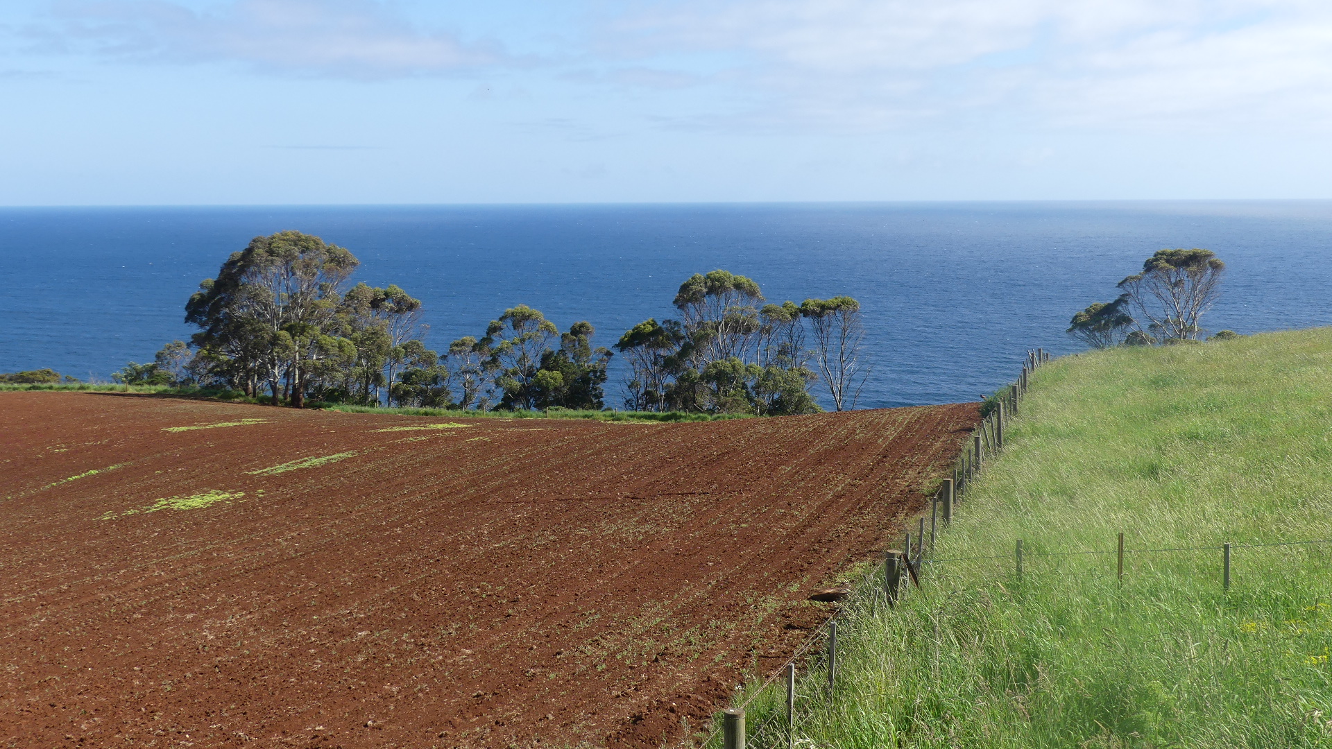


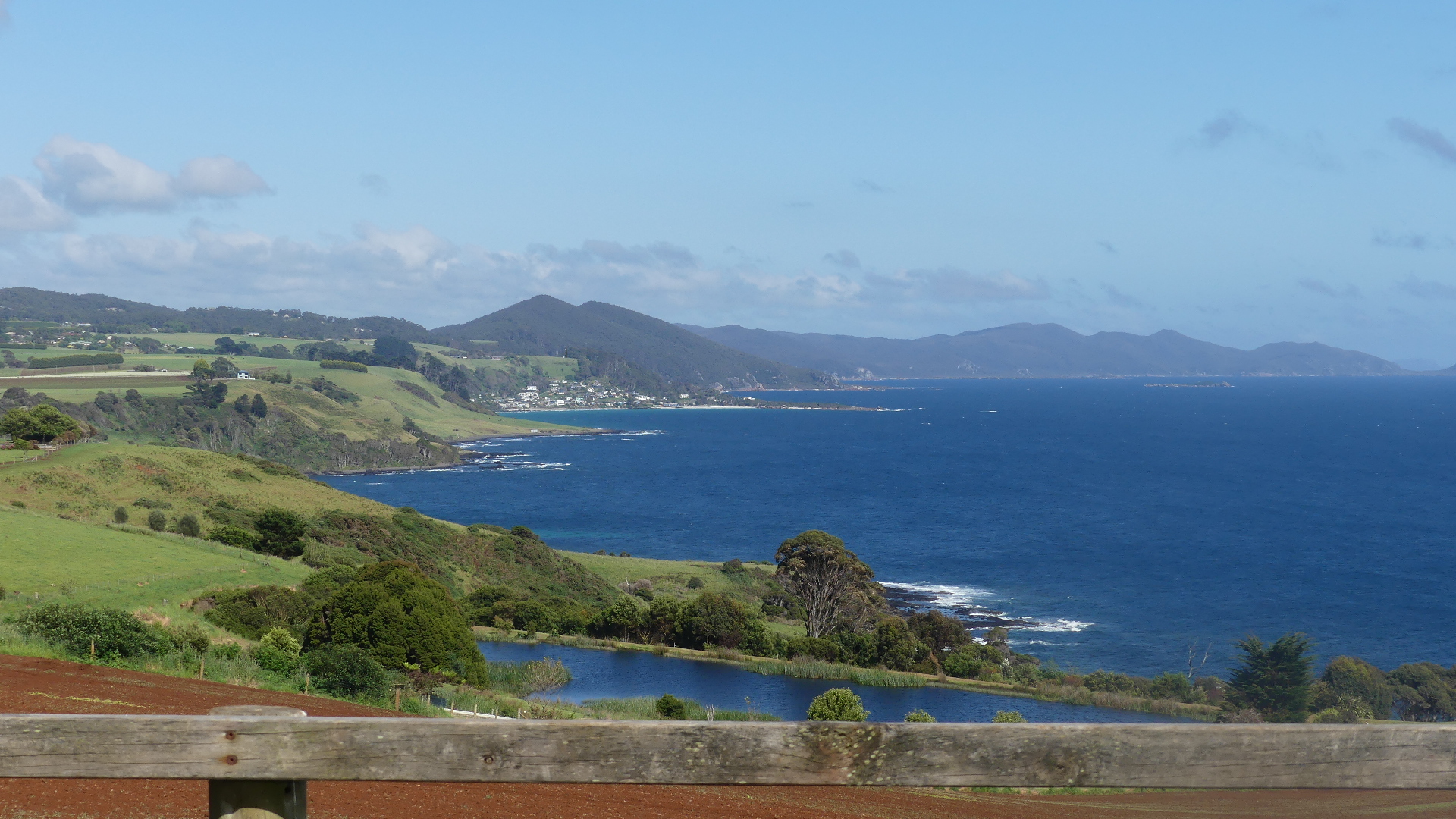
Views from the drive through the coastal road from the Cape to the freeway near Boat Harbour and Boat Harbour Beach.
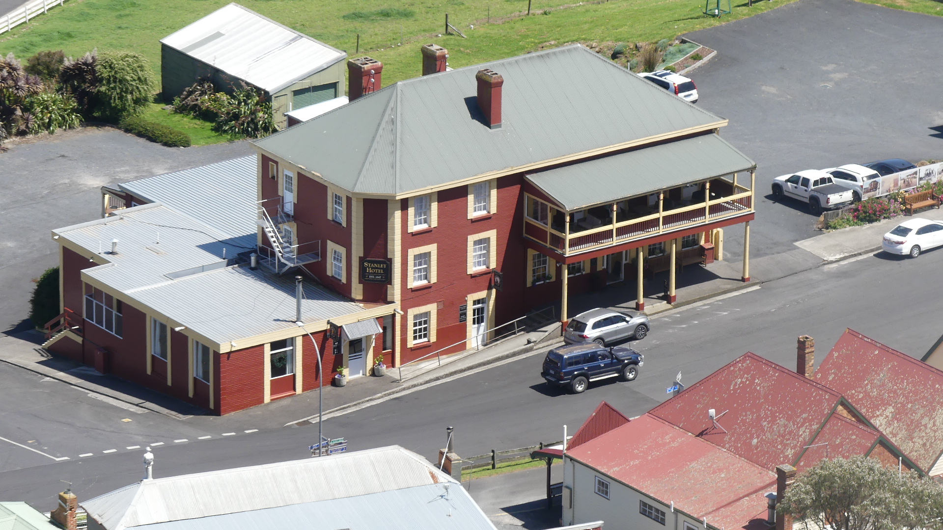
Our destination now was Stanley # Stanley and the “Nut” #the Nut.
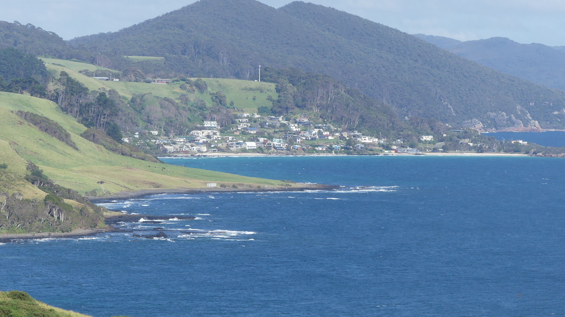
We decided to leave the highway at Boat Harbour and go to Sisters Beach just to have a look. This stop had been pointed out to us as a “must see”. After leaving the freeway and following the winding track along the coast we came to Sisters Beach #sisters beach both a locality and small town located in the Waratah-Wynyard municipality. This road is the old horse trail known as the Postman’s Track that once formed the only connection between Emu Bay now Burnie and the Van Diemens Land outpost of Stanley. According to local publicity it has a beach of white sand, approximately three kilometres in length. However the prevalence of the giant banksia (the only place in Tasmania where they occur) has darkend the water flowing from the creek onto the beach. Not exactly white sand. The community is widely spread with a cafe/ shop on the approach to the beach.
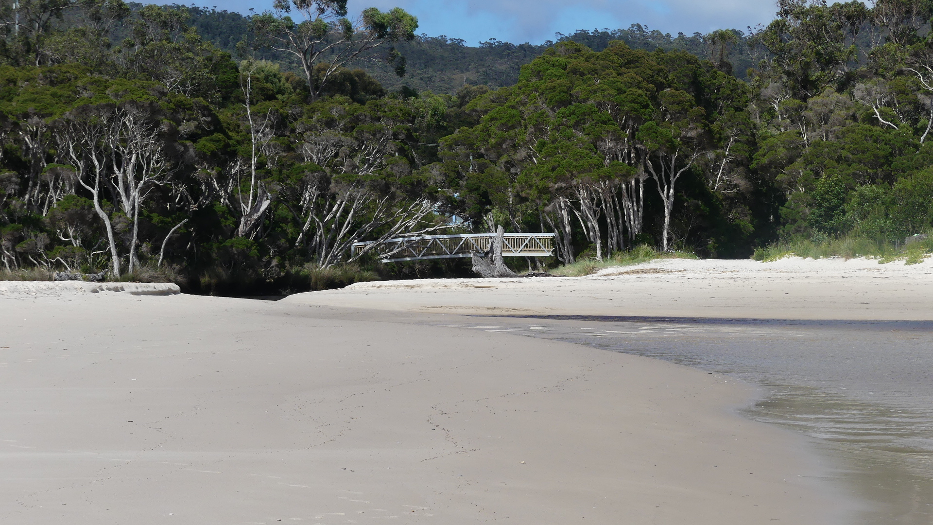
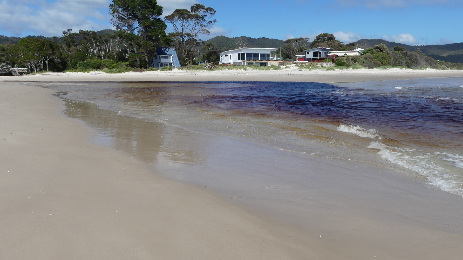

Inky coloured water running onto Sisters Beach.
We stopped for a morning coffee and despite the store looking as though it was running out of supplies we found a fenced off garden off the cafe which had a pleaseant outlook and seemed to be awaiting the arrival of all the expected visitors like us except there was only us. Sad.
After contributing to the local economy, we made our way to Stanley and its famous “Nut”.
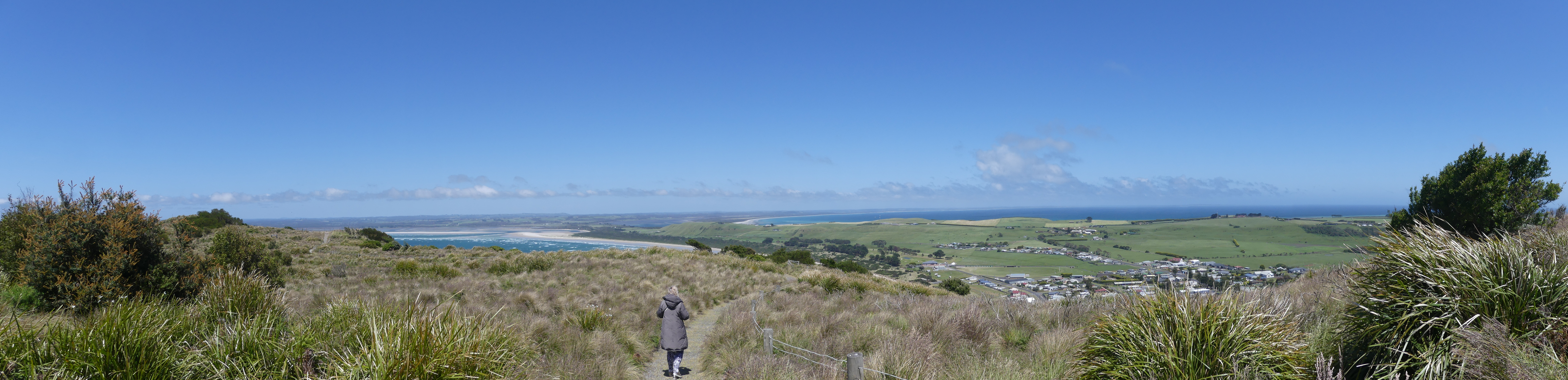
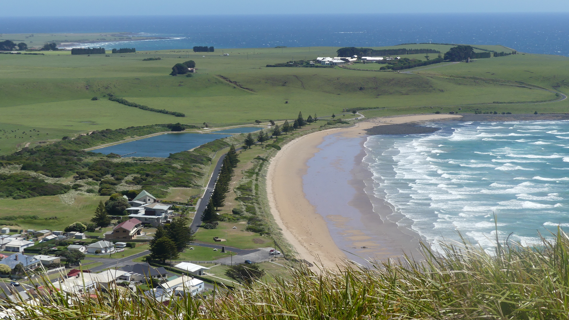
Stanley is located at the eastern end of a peninsula thrusting into Bass Strait and overlooking Sawyer bay to the east and Seven Mile beach to the west. The Nut is a name commonly given to a volcanic plug rising behind Stanley. It has an elevation of 143 metres (469 ft) above sea level. The Nut was first recorded as being observed by George Bass and Matthew Flinders when they circumnavigated Tasmania in the sloop Norfolk. It is made of fragments of basaltic volcanic rock from a volcano which was active approx 25-70 million years ago.
The origins of its name are speculated to be from the Tasmanian Aboriginal name, “munatrik” (moo-nut-re-ker), or because explosives were unable to dent it during the construction of a breakwater (a “hard nut to crack”). The areas around the Nut are culturally significant to the local Tarkine Aboriginal people because of stone formations, middens, quarries and artefact scattered near the area. Stanley itself is an unusual village/town in that there presently seems no reason for it being there.
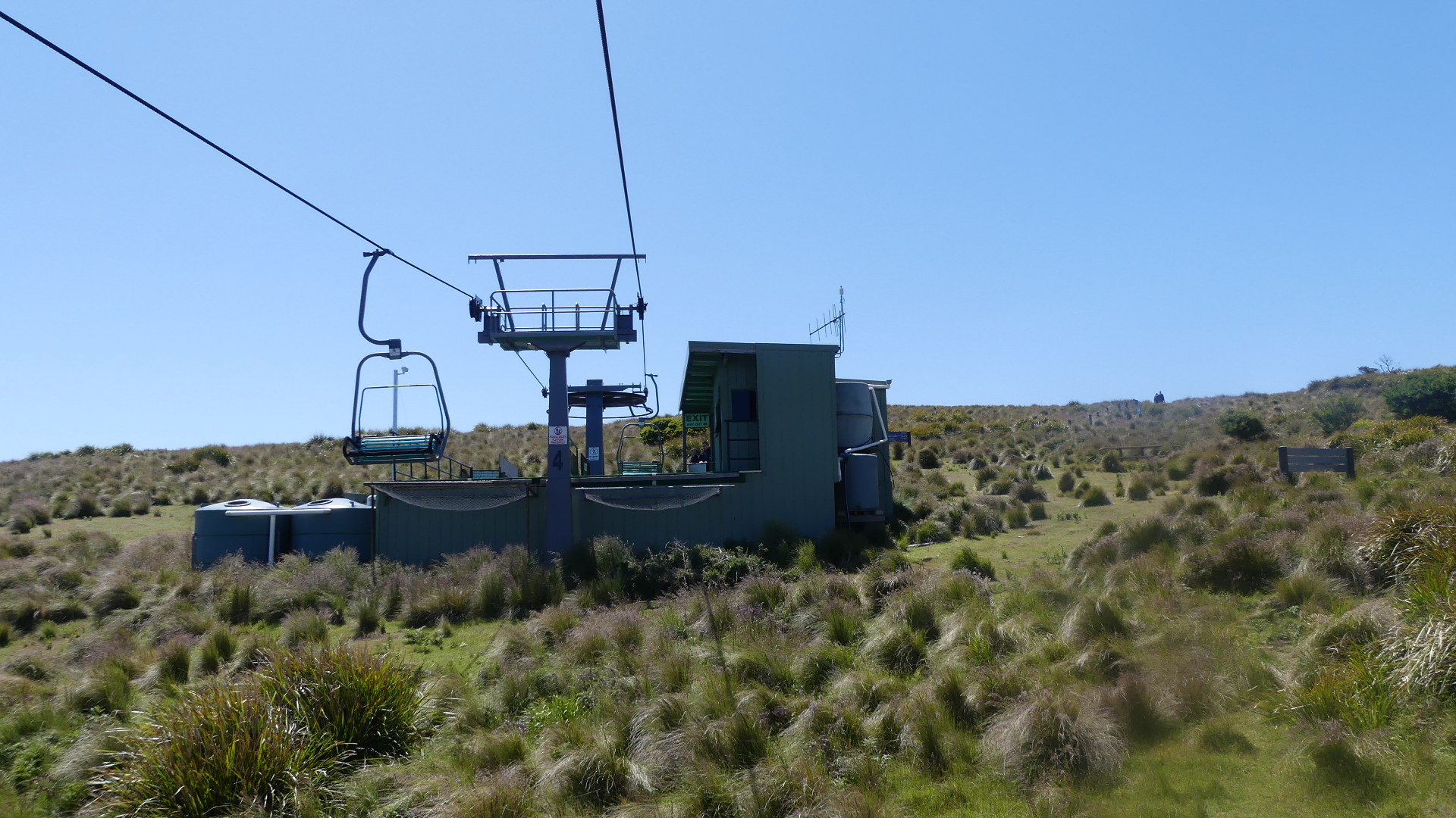
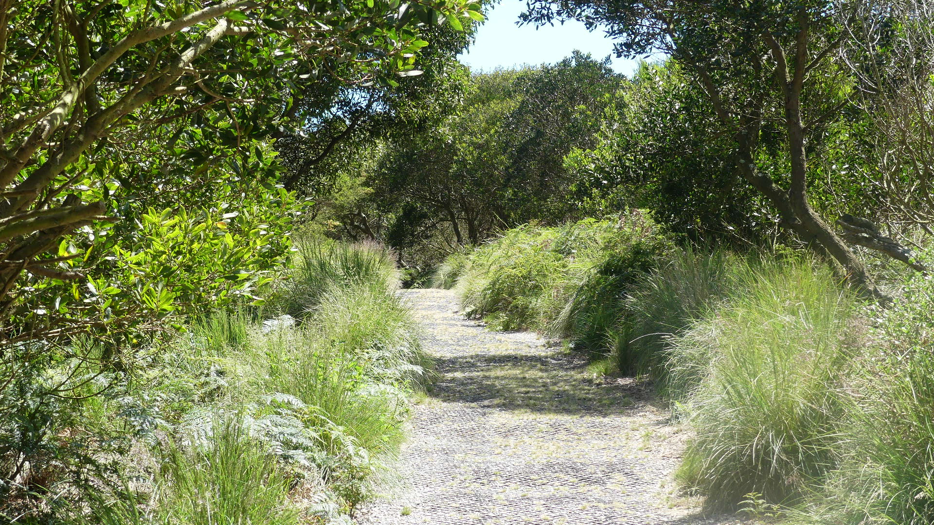
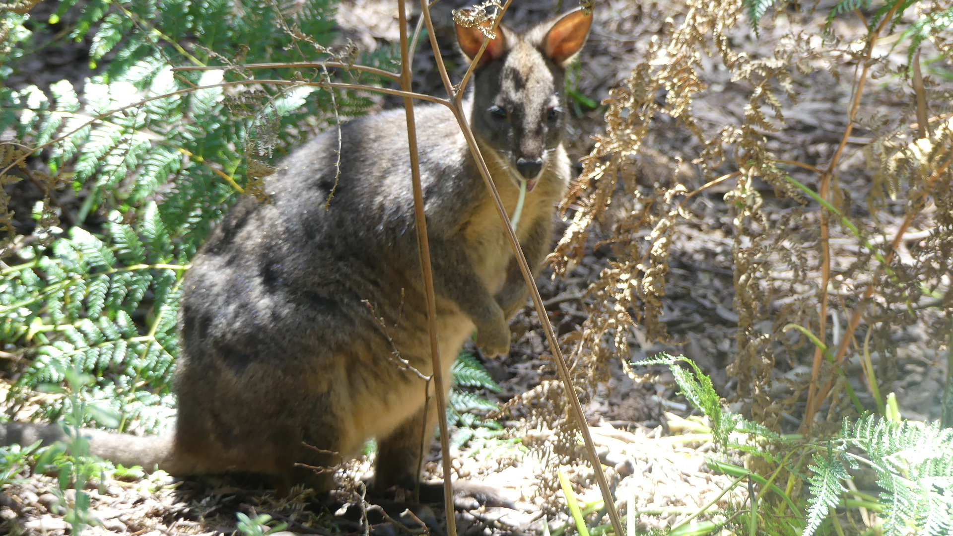
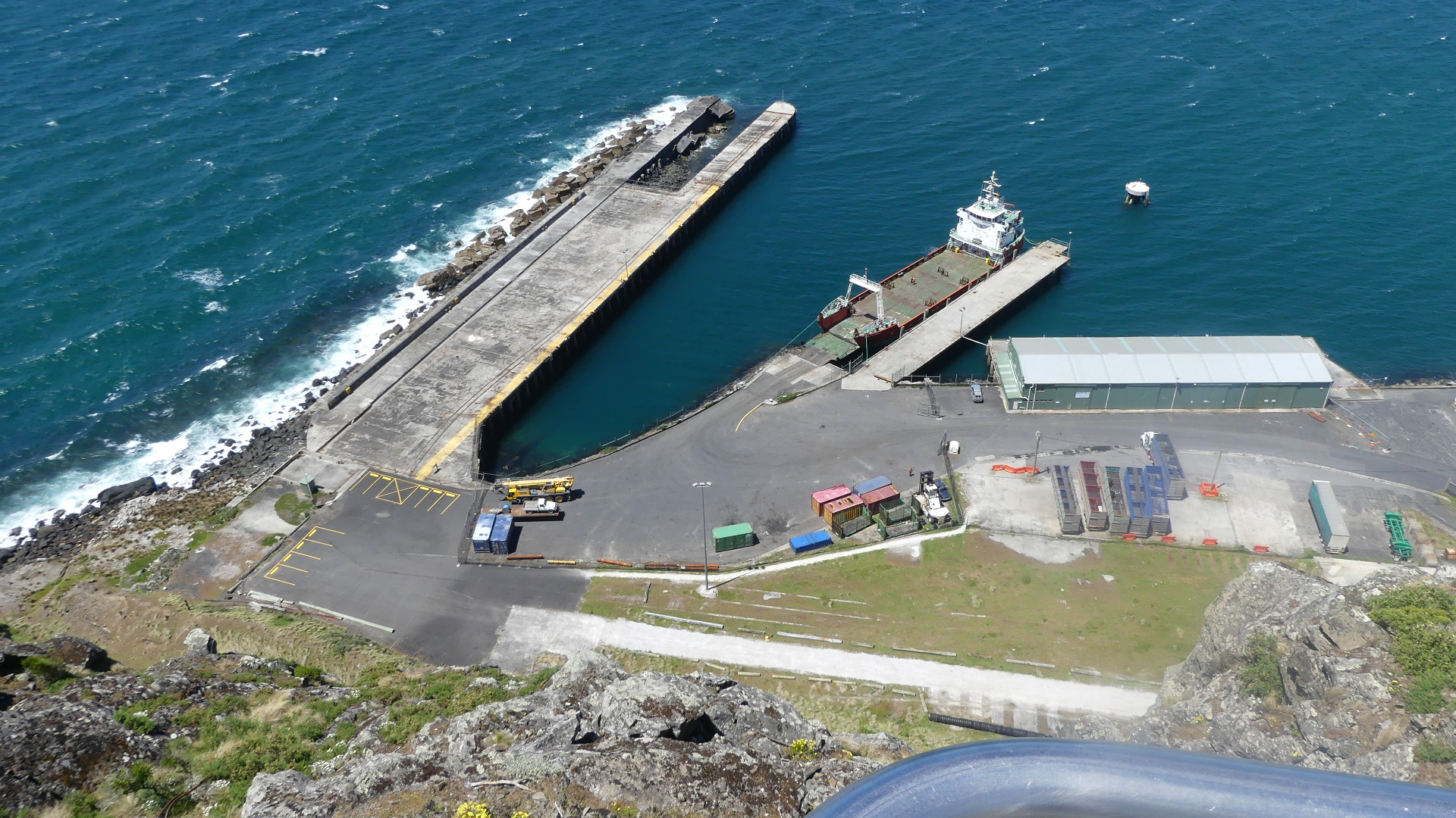
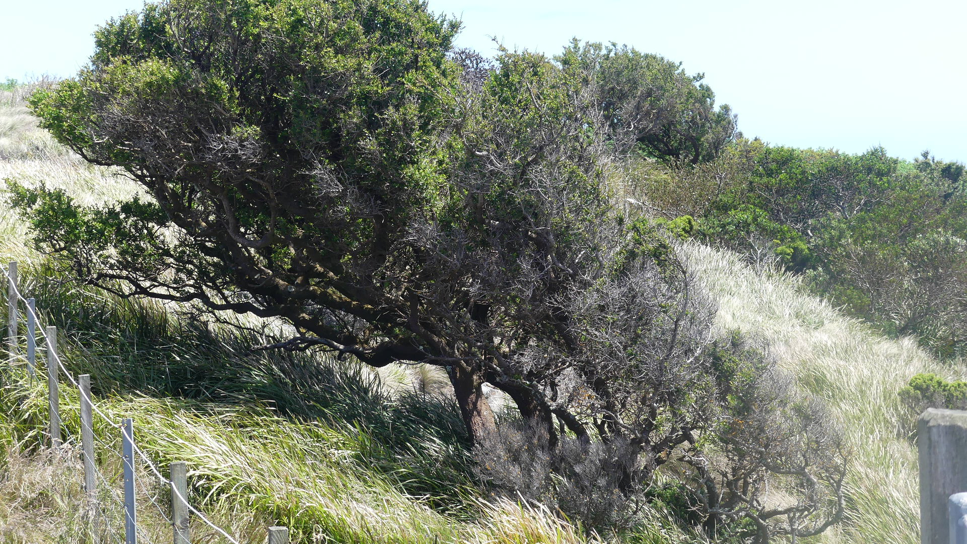
A port opened in 1827 and the first school opened in 1841. There was a short-lived bay whaling station in operation on the fore-shore in the 1830s. Stanley officially became a town in 1842 and by 1843 more than 8,000 acres had been sold or leased to almost 70 people. The Post Office opened on 1 July 1845 and was known as Circular Head post office until 1882. In 1880 the first coach service between Stanley and Burnie was established. In 1936 a submarine telephone cable from Apollo Bay to Stanley provided the first telephone to Tasmania from the mainland. Today Stanley is a tourist destination and the main fishing port on the north-west coast of Tasmania. We made the journey up the Nut and observed the port. The trip up can be undertaken on foot (rather arduous) or by chairlift (our preference). The walk around the Nut was at times very windy and quite cool and at other times shaded and seculded. We encountered a friendly wallaby #wallaby or maybe it was a paddymelon #paddymelon along the way


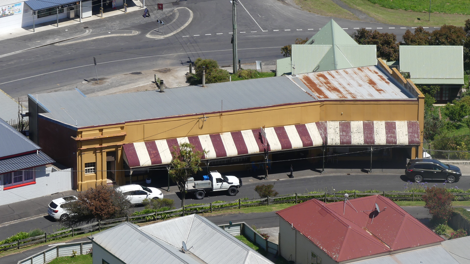


We have finished our walk across and around the Nut and can understand it attraction. One of the things that people go to Stanley for is its crayfish. Its lunchtime and after our walk we have the appetite for crayfish. Below the Nut is Hursey’s Seafoods #Hursey’s Seafood. We ordered the Crayfish for Kerry and unfortunately there was little more than a mouthful of crayfish. So ended the day trip to Stanley and we returned home to dream of what tomorrow will bring.

