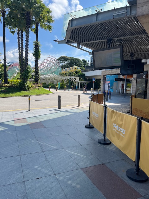
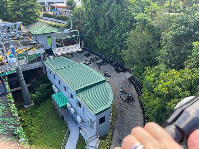
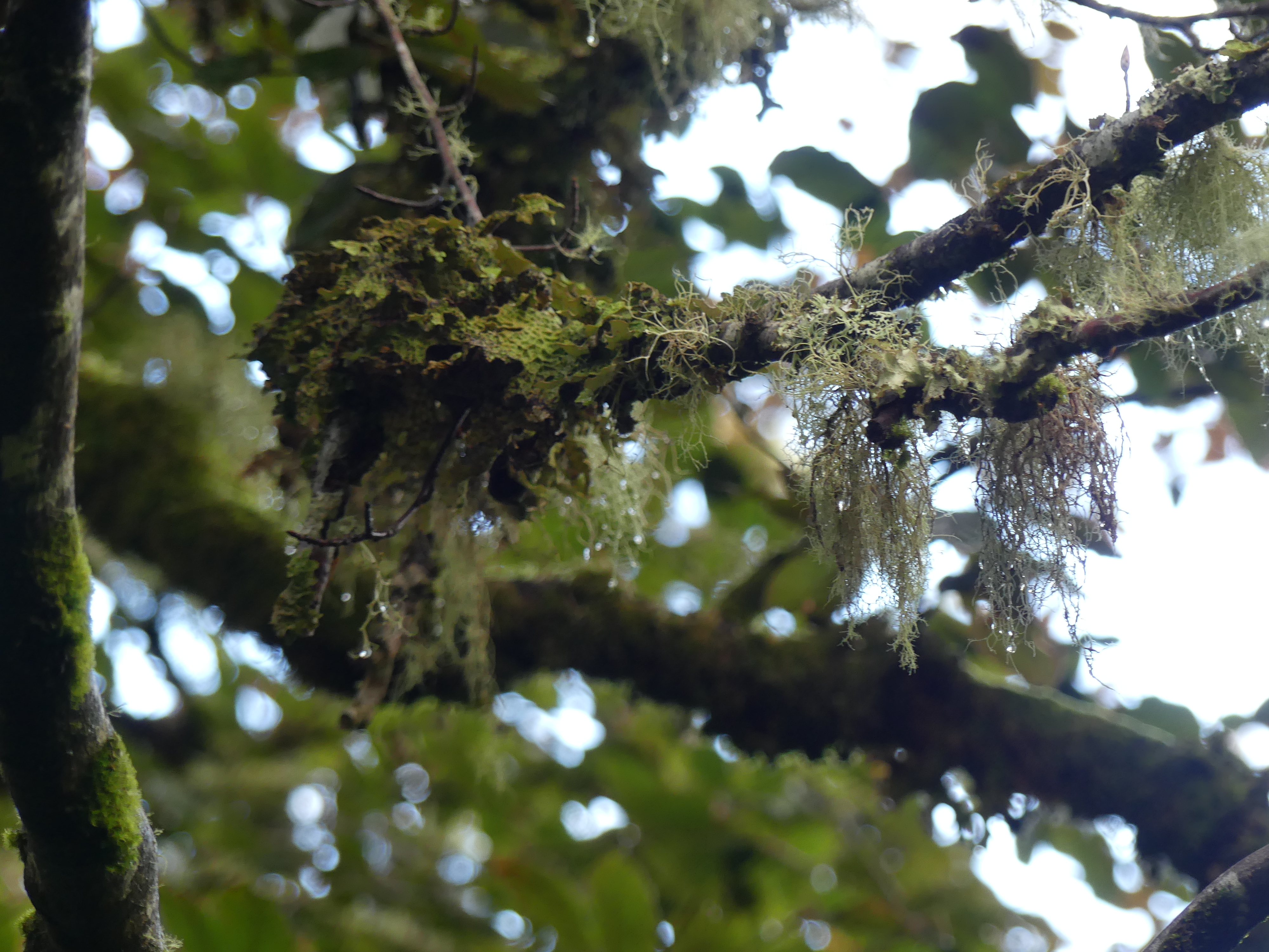
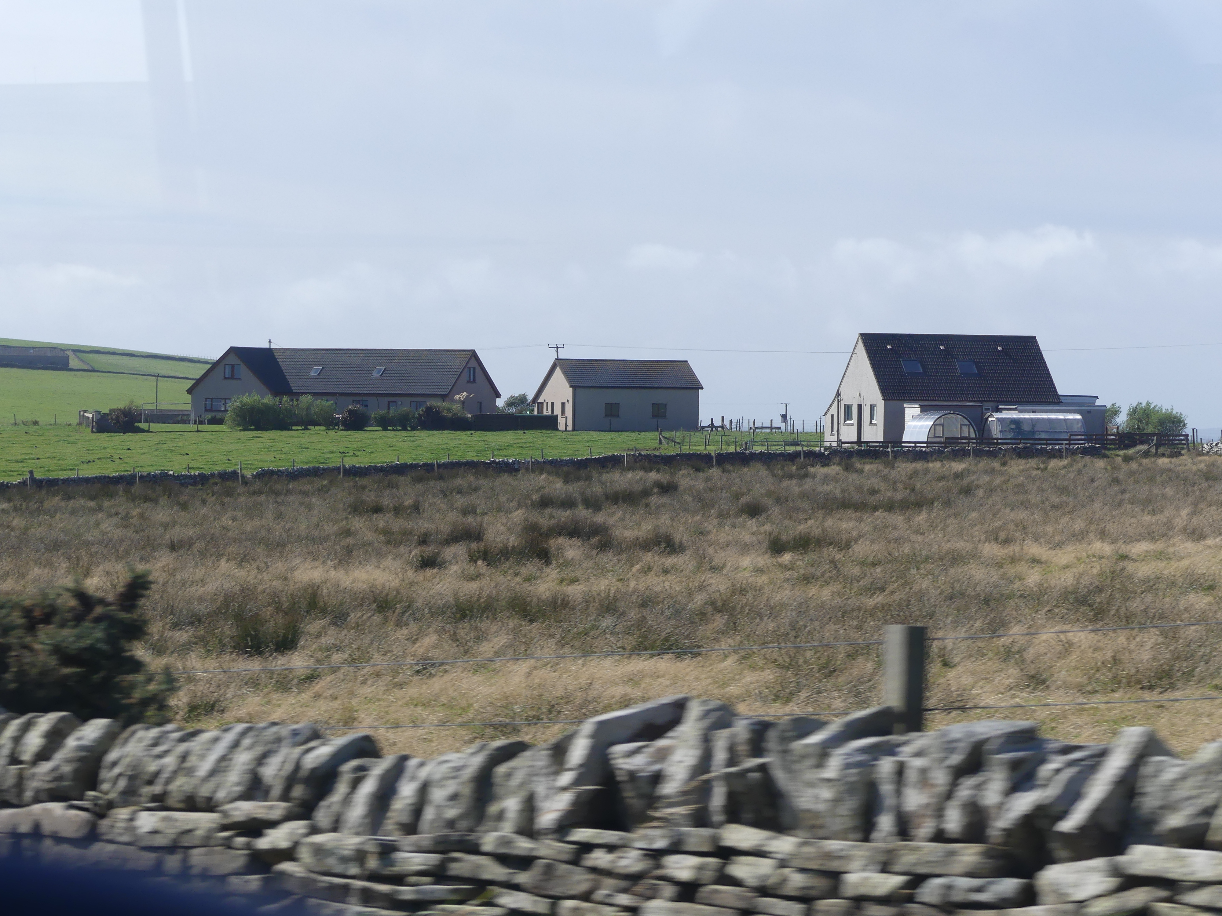
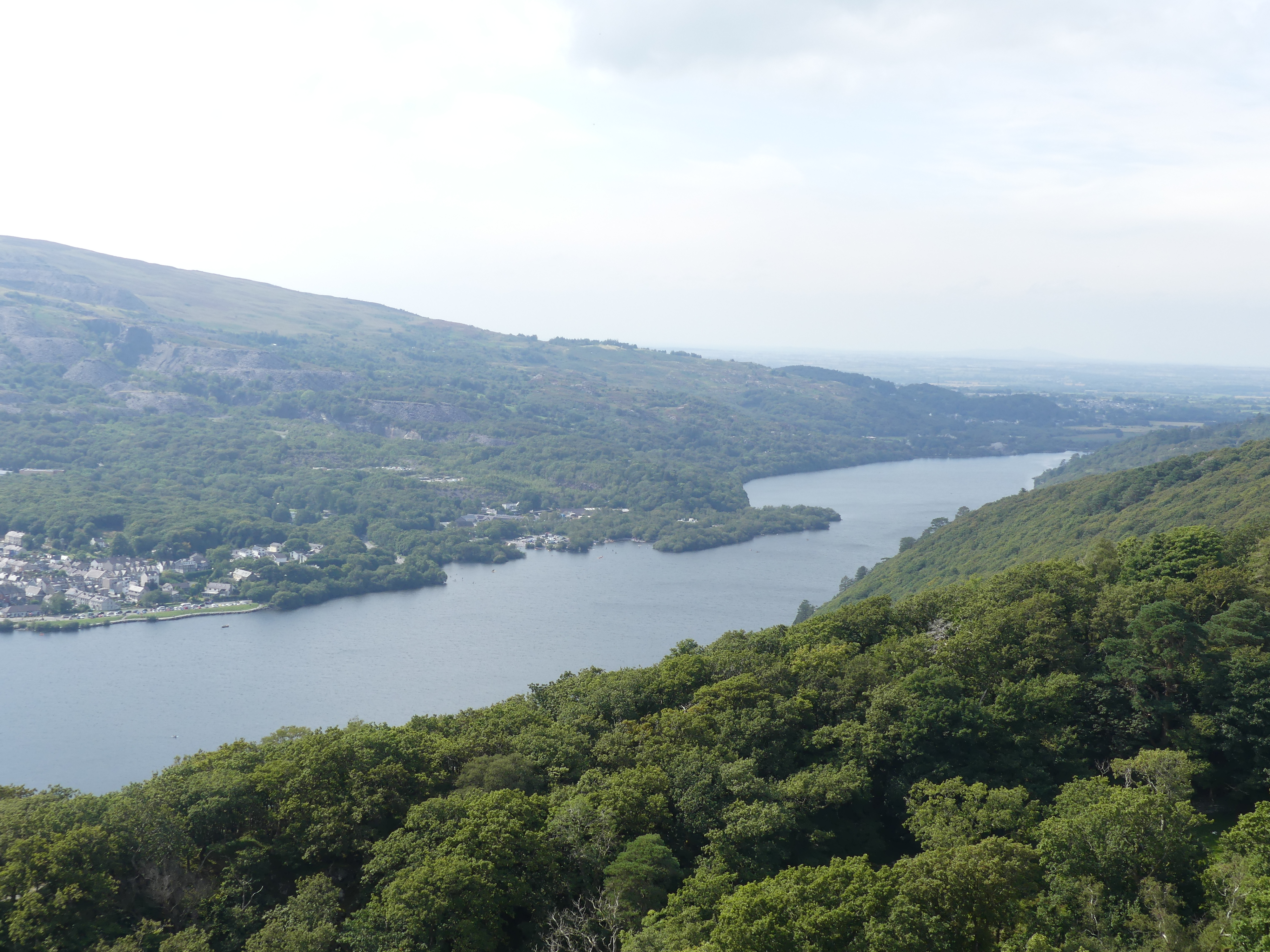
We awoke early this morning as we had decided to visit Sentosa Island with plans to ride the cable cars. Of course we had to work out the underground to travel to the island. Once we reach the Terminus for the train we were hopeful of catching the cable car across to the island. But the cable car was being serviced that week, so we travelled on the monorail.
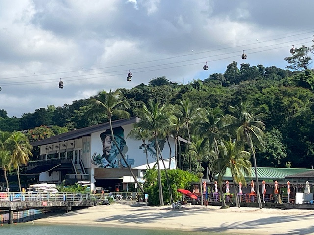
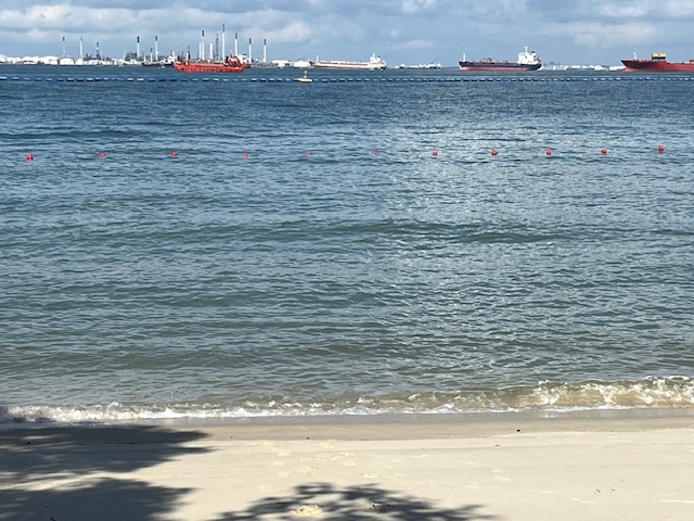
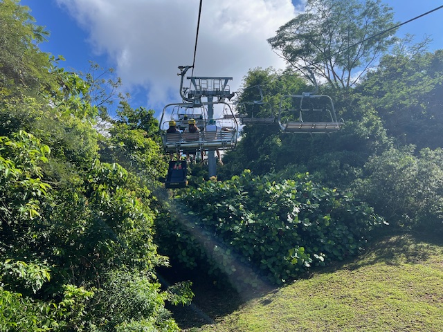
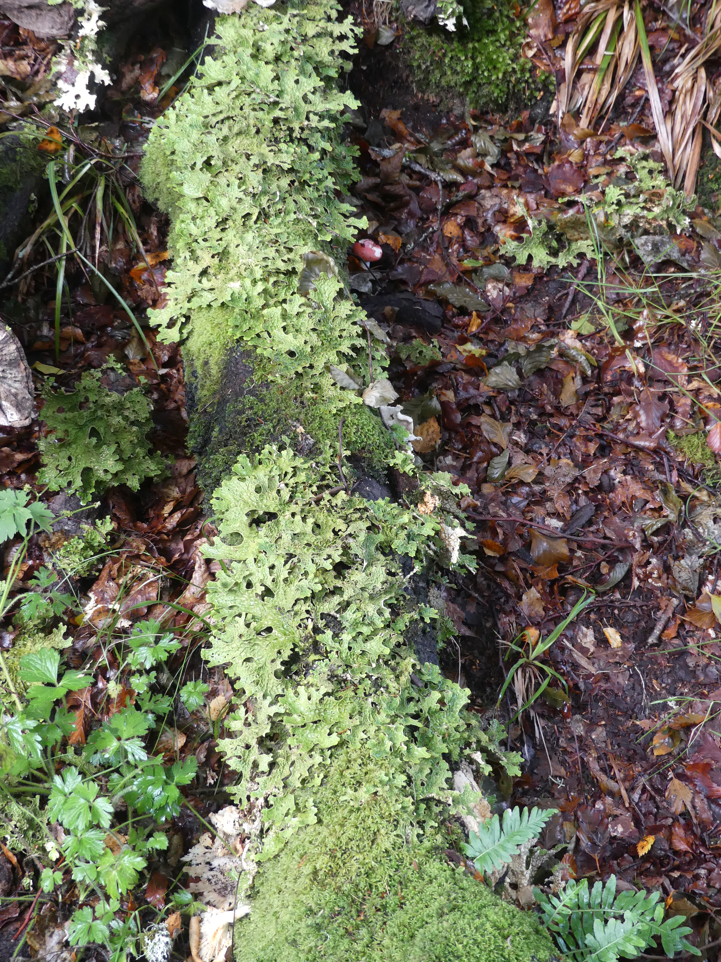
Interestingly the underground train and the monorail both reminded me of Beijing and Hong Kong – struggling against the tide of people trying to get into the rail car. Despite the throng when we arrived the place looked deserted. There were 5 to 6 stops on the monorail and maybe they all got off at earlier stations than the terminus. On arriving the directional signs took us to the beach where the only other people there was a family under a red umbrella. No waves to be found but the bay was cluttered with ships at anchor. Not much excitement there so we followed the signs to the ski lifts – yes we are on the equator and they are using ski lifts. The reason is that under the ski lift there is a raceway so you can hire the car to ride down the hill and you dragged your car up the hill by dragging it from your lift. I could not work out if the nets were to catch falling passengers or falling cars.
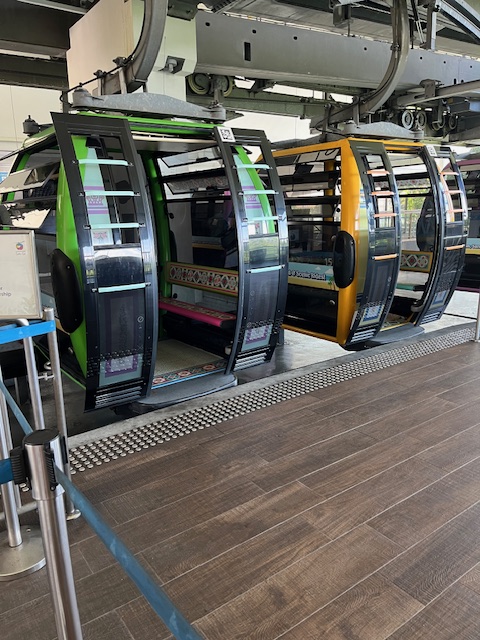
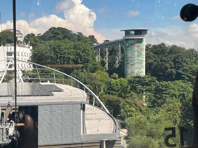
We weren’t ready for the race so we left the ski lift at the top station and walked around to the cable car which we thought was not operating. Yes it was operating but not the connections to the mainland. Still we thought we ought to catch the cable car to see more of the island. The cable car terminated at the treetop walk. Now the temperature was bloody warm, my disposition was cranky due to my various ailments and there was no lift to take us to the treetop climb. We stayed aboard and went back to the ski lift as we had spotted an air conditioned ice cream shop with tables and chairs.
We made our way back to the hotel to get ready to transfer across to Raffles the following day.
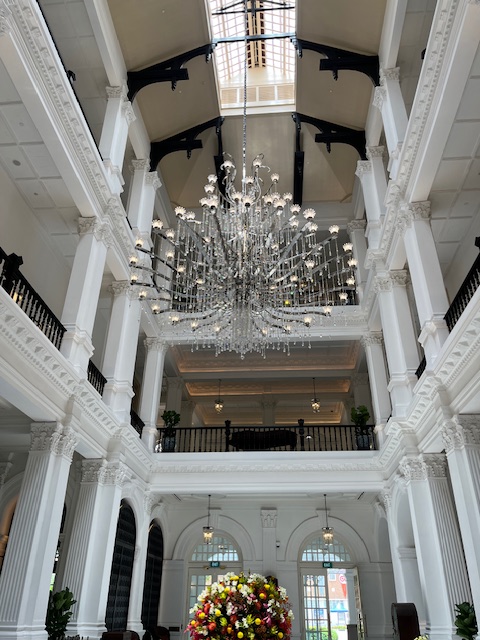
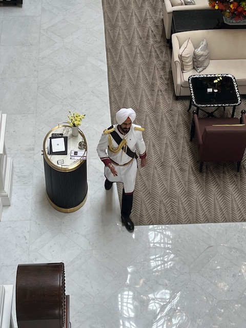
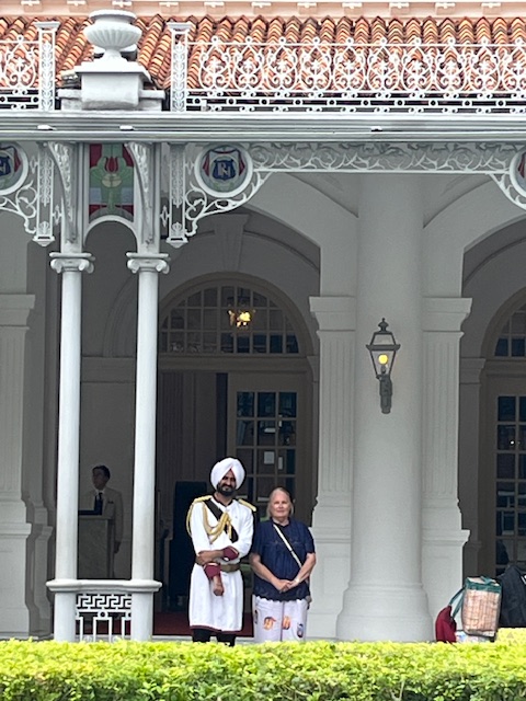
Day 4 and we start preparing to check out Park Royal Collection Hotel and make the move across to Raffles Singapore. We caught a cab even though the hotel was nearby. We did not feel like dragging our luggage in the heat of the day. Arriving at Raffles we were met by the traditional Sikh Doorman at the front door of the hotel and shown inside to the reception office. Our room was not ready so we decided to check out our home for the next 2 nights.
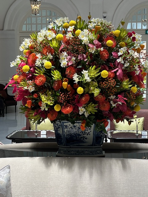
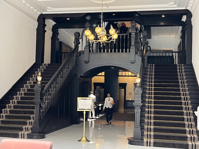
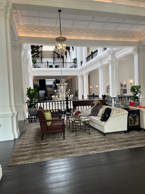
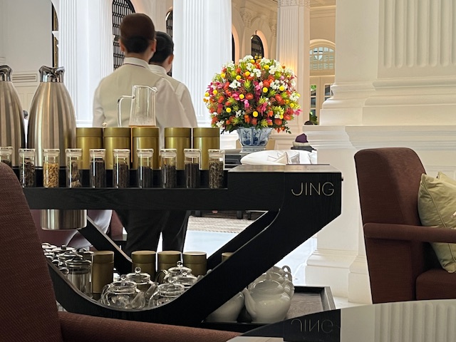
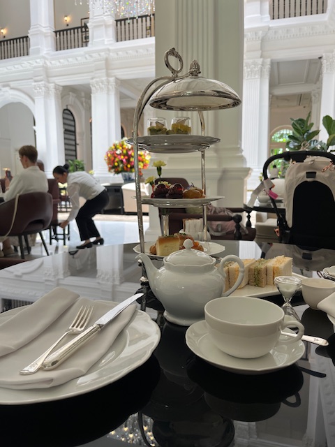
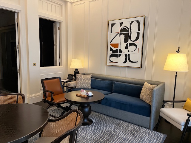
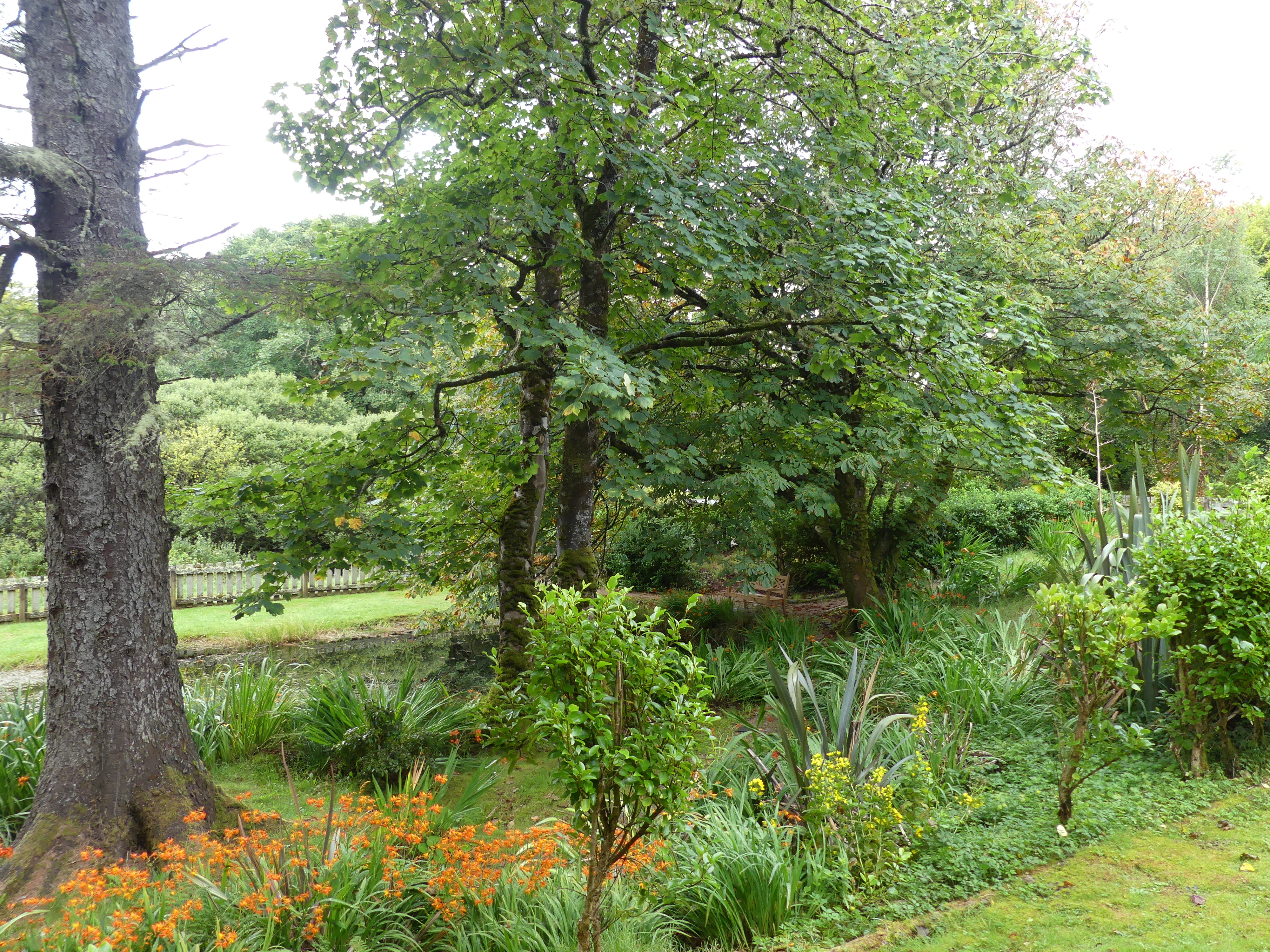
The entrance was grand with a huge chandelier and flower bouquet. Beyond the back staircase is the reception room – guests only no visitors allowed. Leading off the entrance foyer was a dining area and the “High Tea” service area. Kerry had this itch and desire for a high tea and as high teas go it was expensive but exquisite. After our high tea we moved to the relaxing lounges on the floor above .
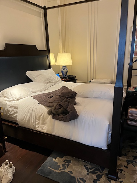
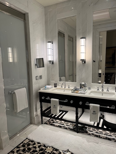
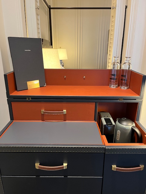
Finally our room was available and we were guided to the room (formerly part of the stables of the original hotel) where we met our butler who guided us through the use of the tablet to operate the room. I will mention an incident that happened on the 2nd day of our stay. Kerry was certain we had to catch our flight so rather than check we packed and got ready to go by limo to the airport. We said good bye to the hotel and I have included her picture with the Doorman. We drove to the airport only to be told our flight was the following day so we cabbed it back to the hotel and asked for our keys back for 1 more night. They assured us we were not the first to make that mistake.
So my next blog will deal with some of the facilities at the hotel and a visit we made to the Orchid Gardens which is part of the Botanic Gardens of Singapore. Get ready for “THE RETIREES GO AROUND THE WORLD – Singapore Day 5“
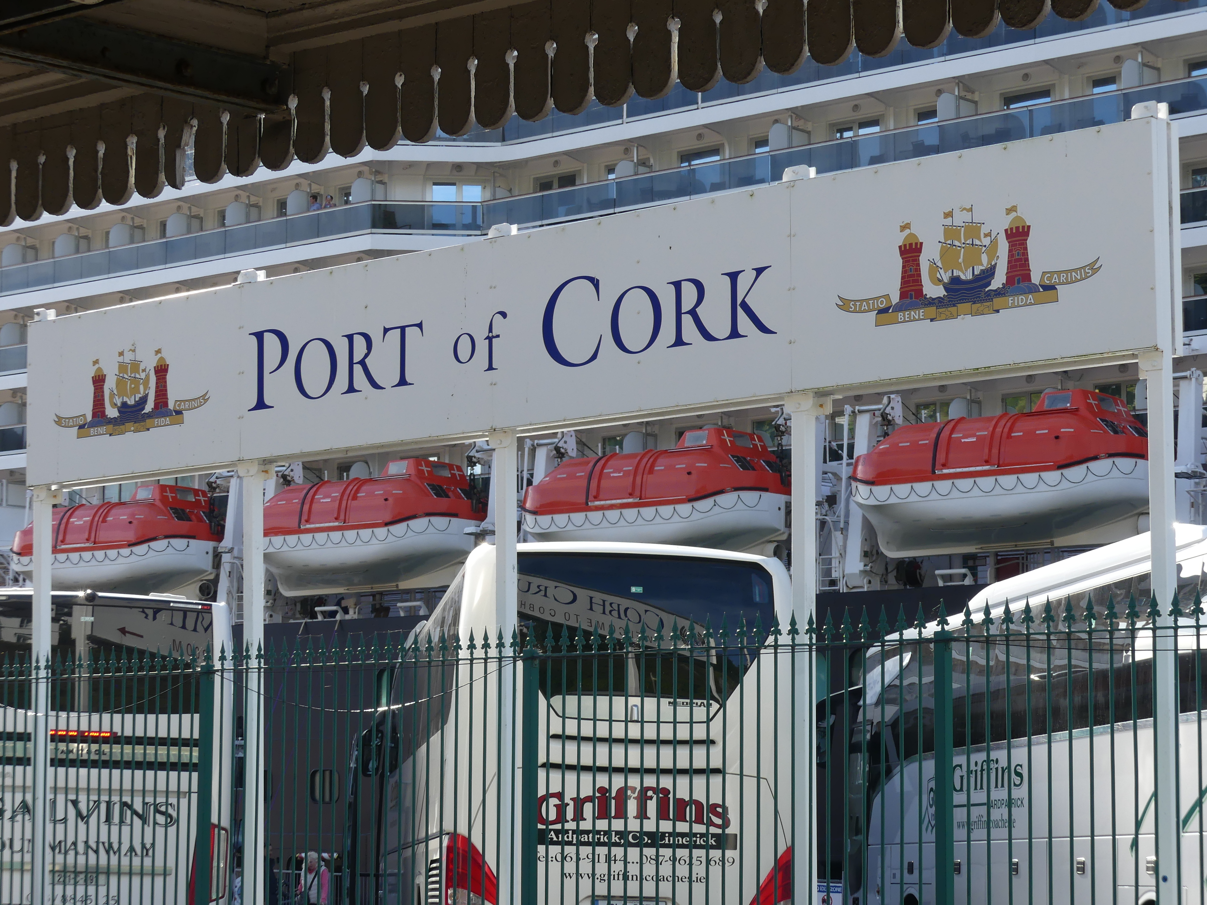
After sailing from the Isle of Man, we headed toward a former British dependancy – Eire and the city of Cork. We have been to Ireland previously but despite it being tiny compared to home, 4 weeks was not enough to get everywhere and Cork was one of those places. We have become quite adept at finding our own way. But it becomes tiring so we took the easy way with the hop on hop off bus. I have attached our map of Cork – things to see and do in Cork. We had been to Blarney castle and I had kissed the “Barney stone”. Its supposed to give the kisser the gift of elequence – some might consider that to be an overkill in my case. And thats why we did not go to Cork – we went to the castle only all those years ago.
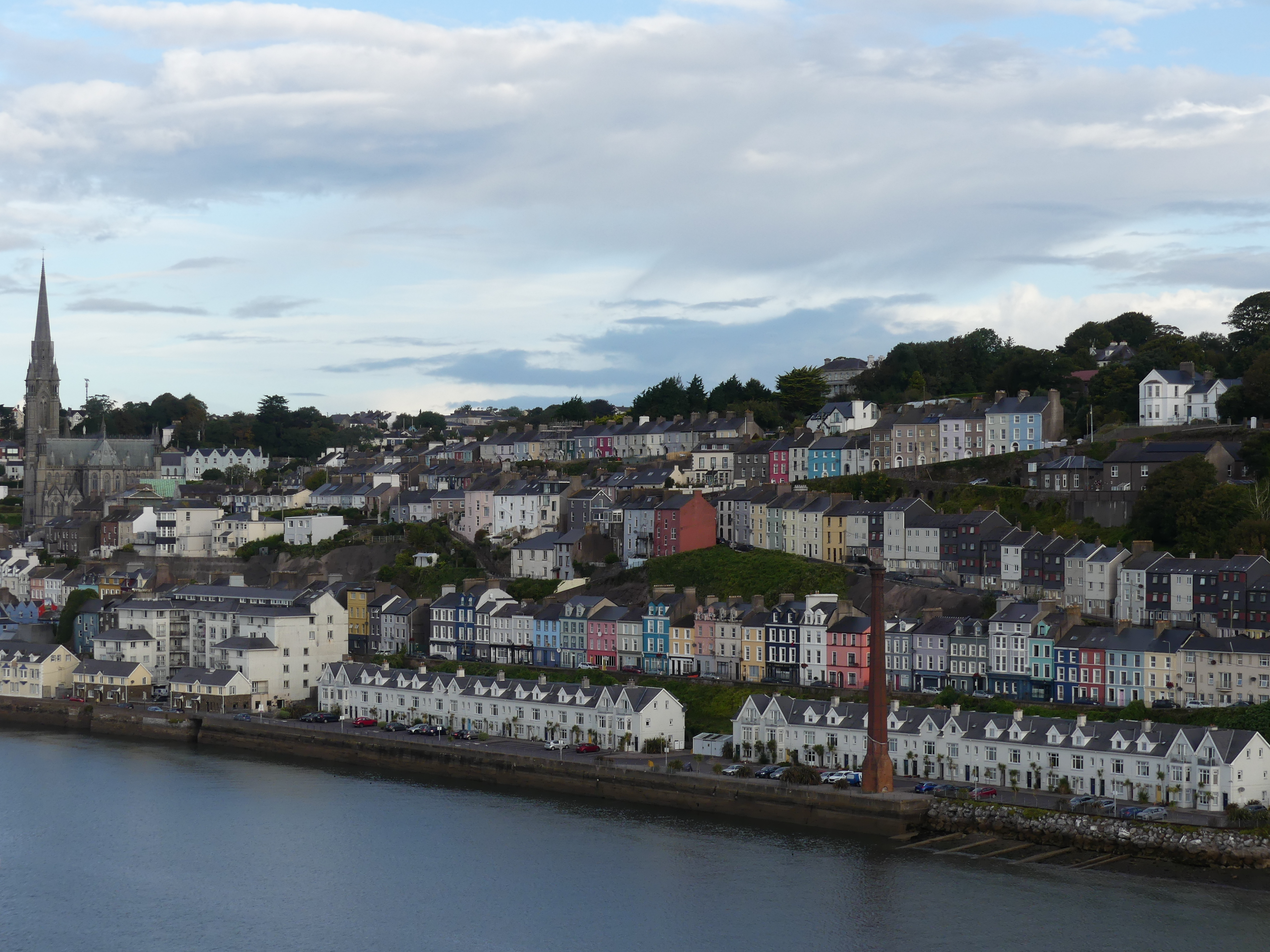
The port for Cork is actually a town called Cobh and a pretty town it is with a good connection to Cork by rail. So our day started with a train ride. The ship passed some of the pretty houses as it docked but once we docked and entered the Port of Cork we then had to pass through the Cobh Cruise Terminal – now that’s Irish. On arriving at Cork rail terminal we crossed the road to Station View Tavern (it looks at the station) and awaited the hop on hop off bus.
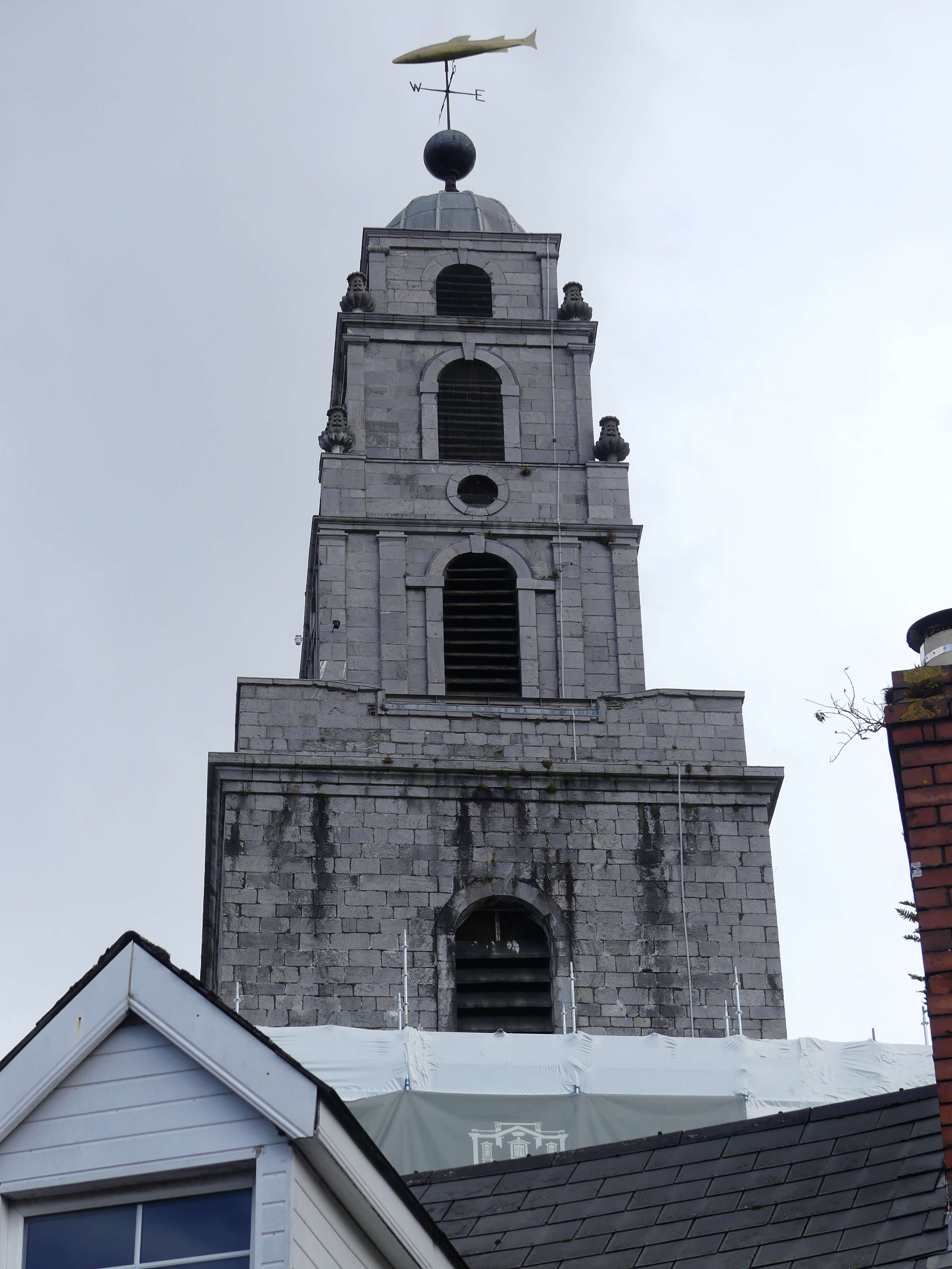
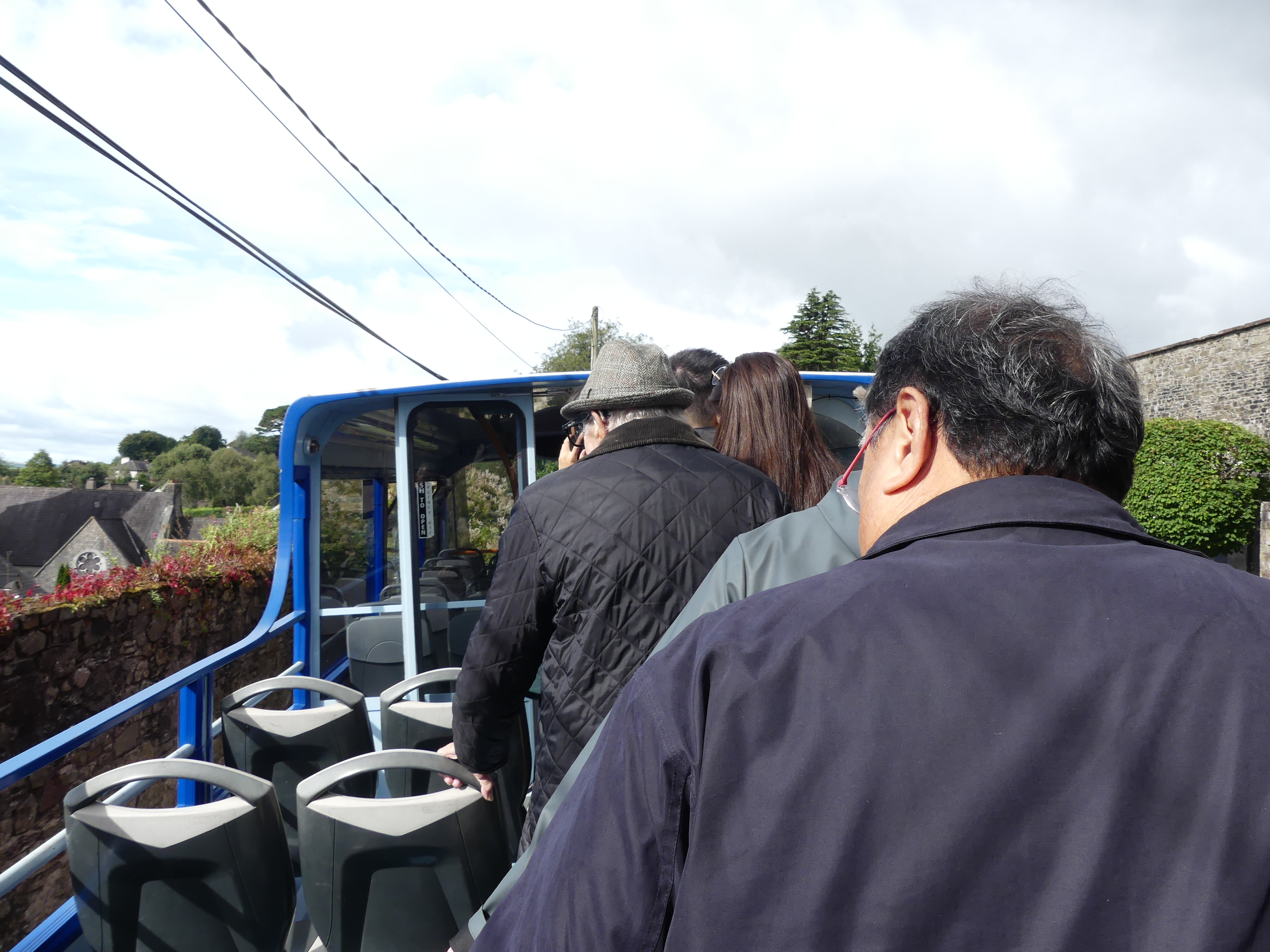
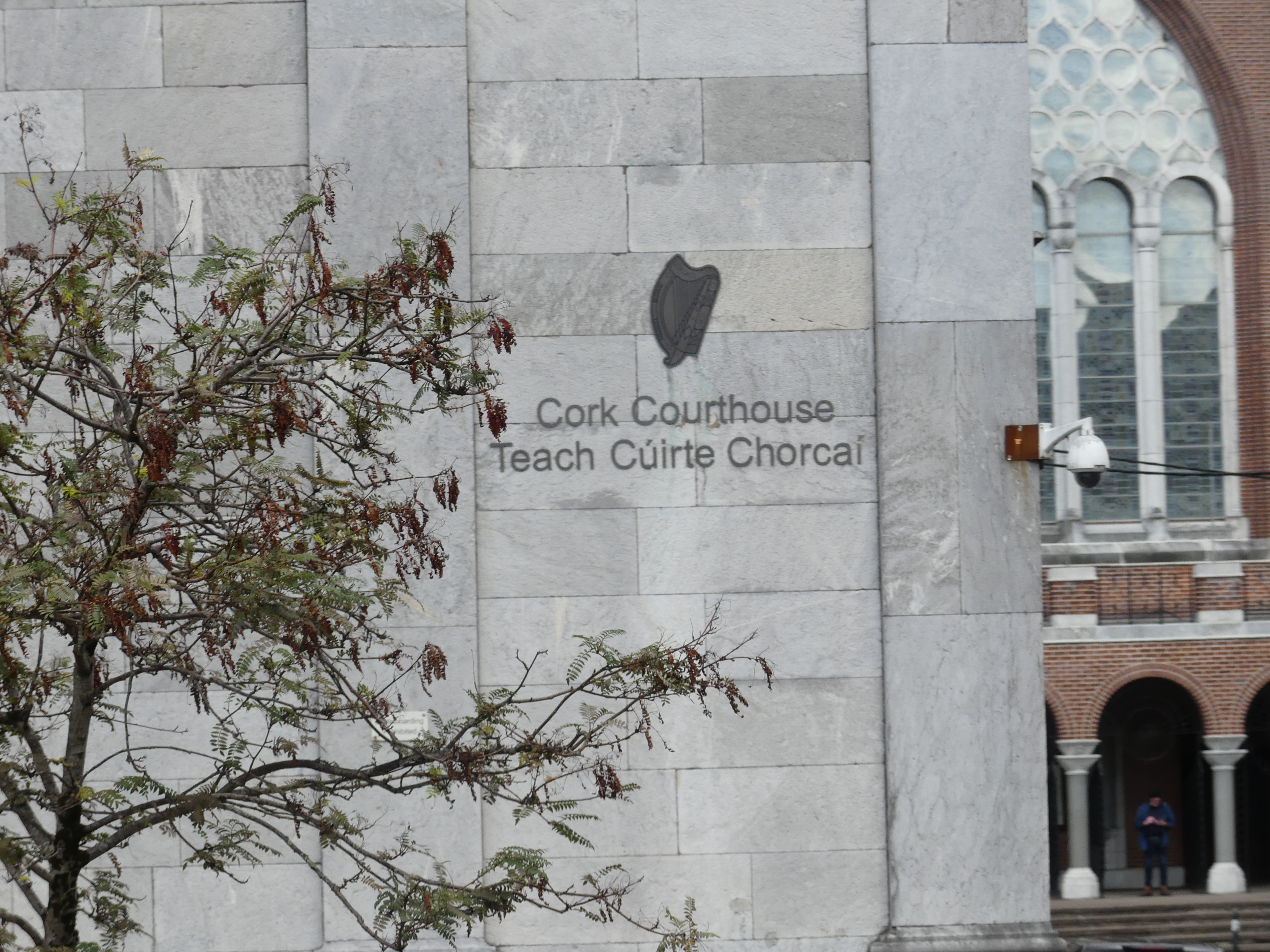
Having boarded the bus, we occupied seats on the open roof of the bus. The following photos follow the ride. Firstly we moved through the docks area to an old bridge which had street lighting where all the lights appeared to be arching over the road similating dockside cranes. There were church spires on the horizon some like the one photographed below adorned with a sign of the occupation of its parishoners – in this case a fish atop the weather vane. We had no particular things we wished to see so we were taking the full tour before deciding. We came to the entrance of the old gaol and the bus had an exagerated lean towards the footpath. After some passengers got off the bus the cry went out, “Stand up and move over on top”. Well that had me puzzled until I realised the bus had to be righted so that it could leave its parking place – you see all of us moving as instructed. The bus then carefully made its way to the Courthouse.
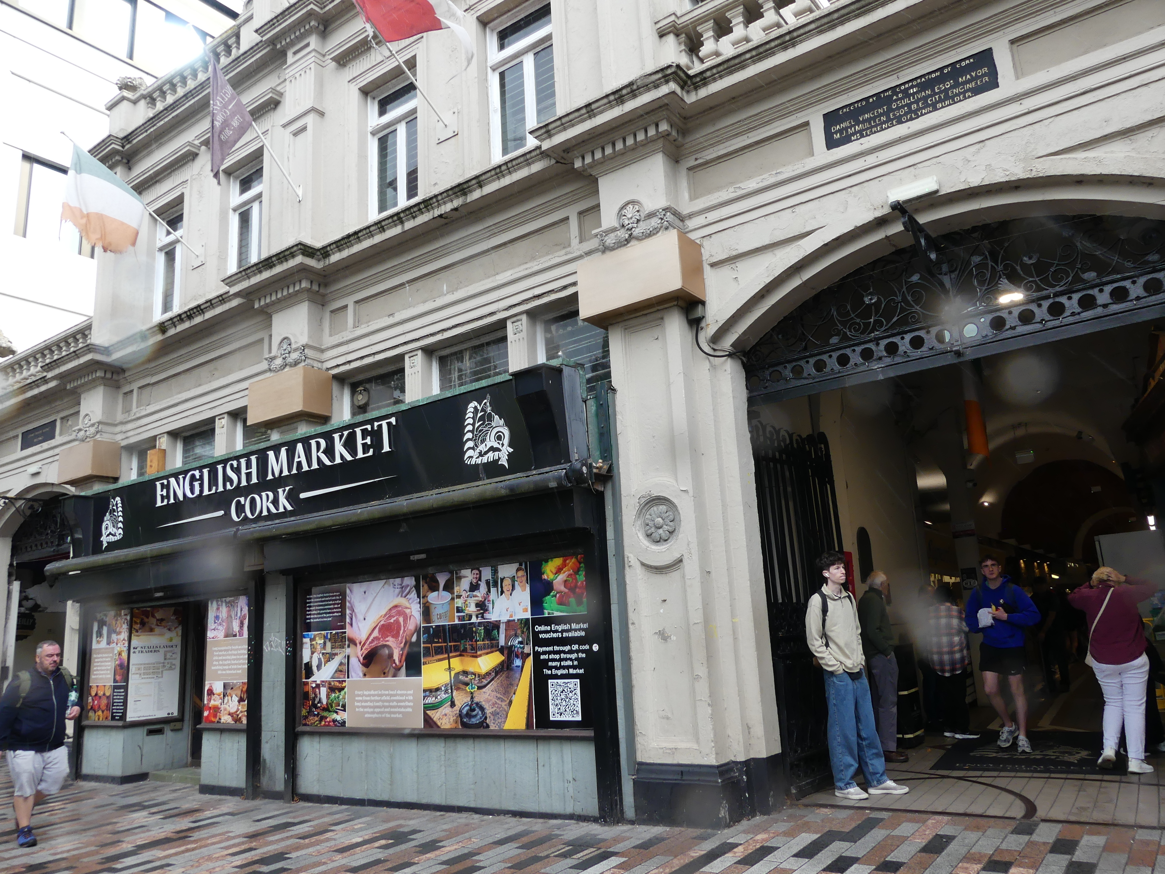
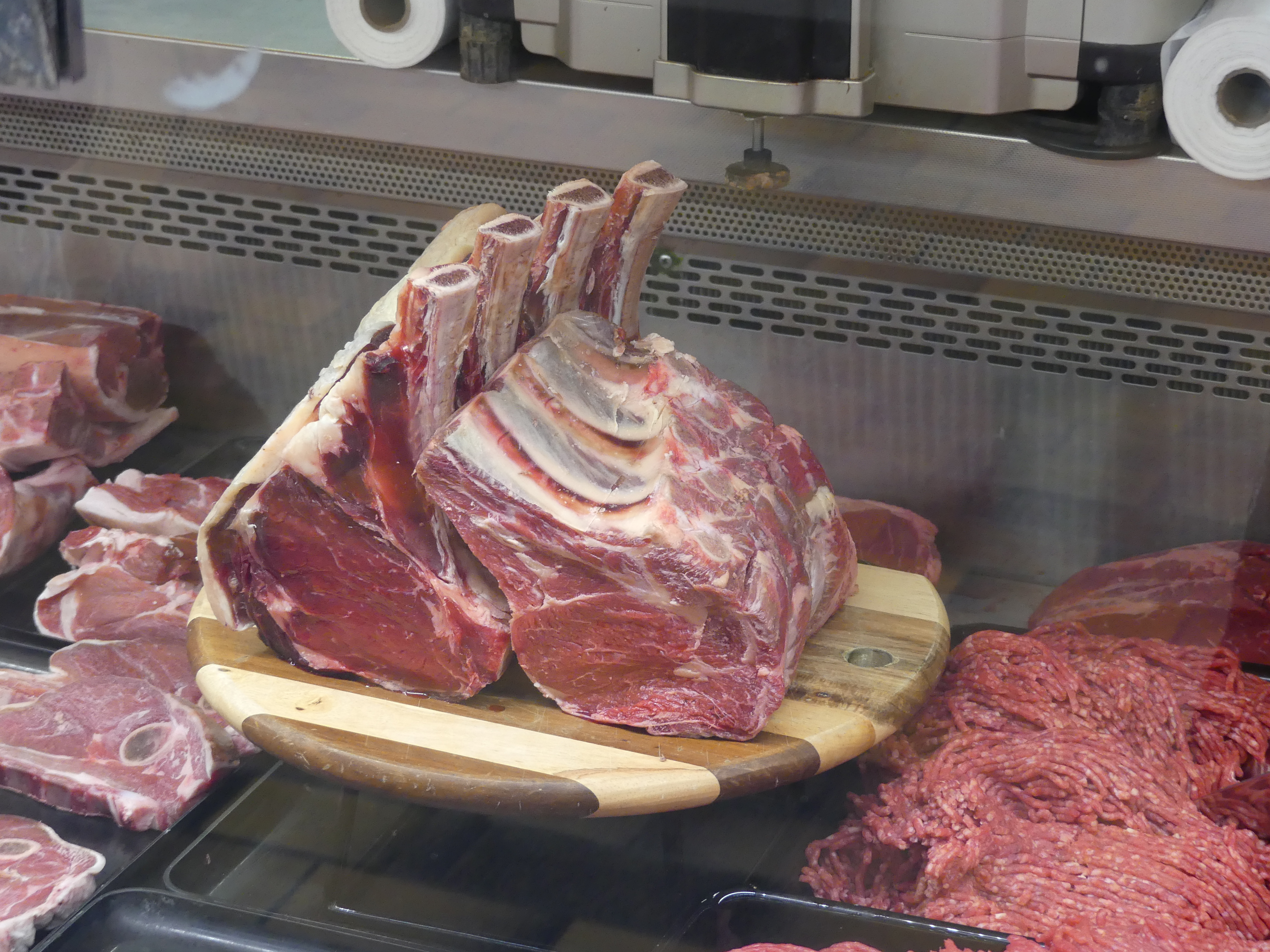
We planned to hop off the bus at the English Market. We passed some graffitti on the way – some in the street style and then a full size portrait but there was little else of interest before reaching the Market. I am not sure what we were hoping to find. As the name implies its a market and there was nothing that we could take back to the ship.
We left the market and waited in the square for our bus. Kerry stopped a local bike rider for some directions. We felt like fools (I was taking the picture).
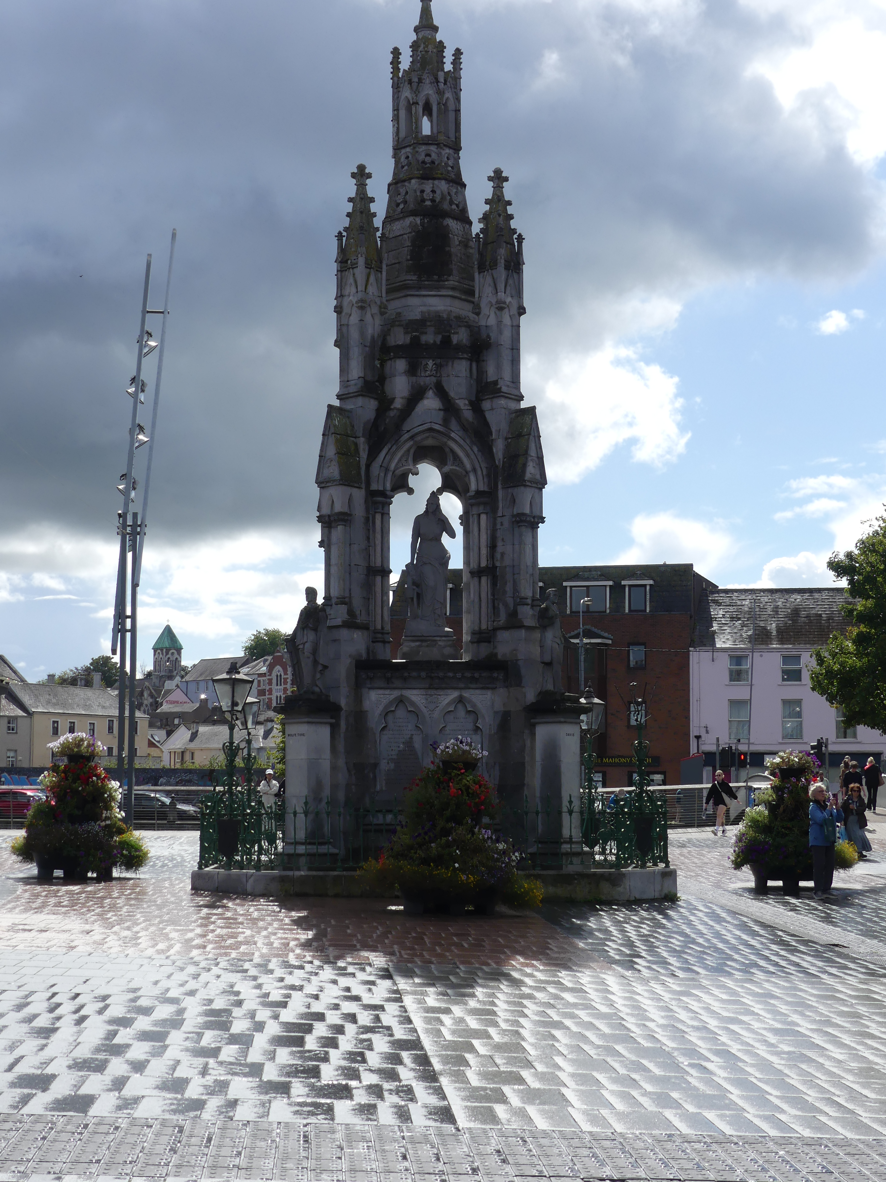
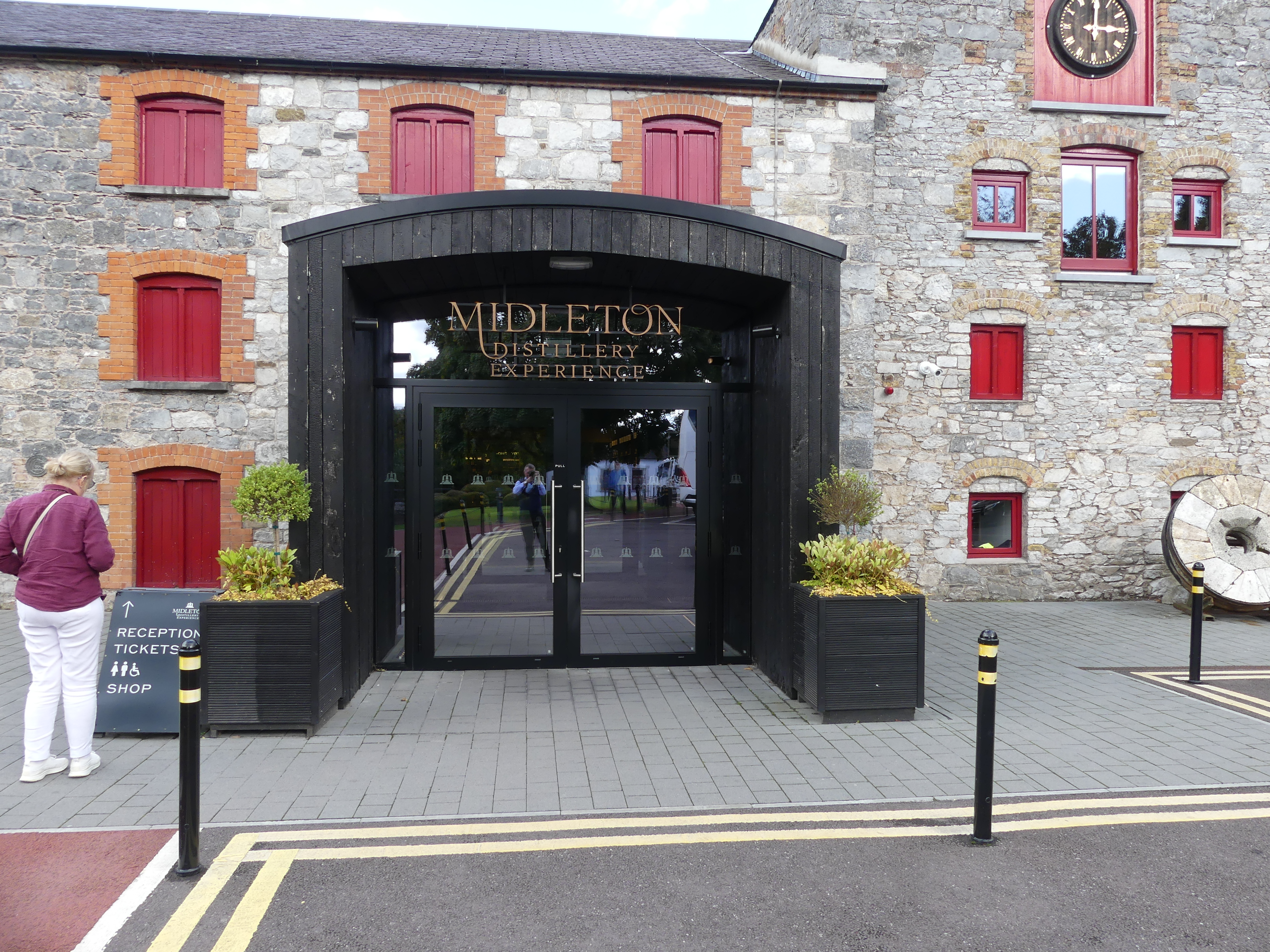
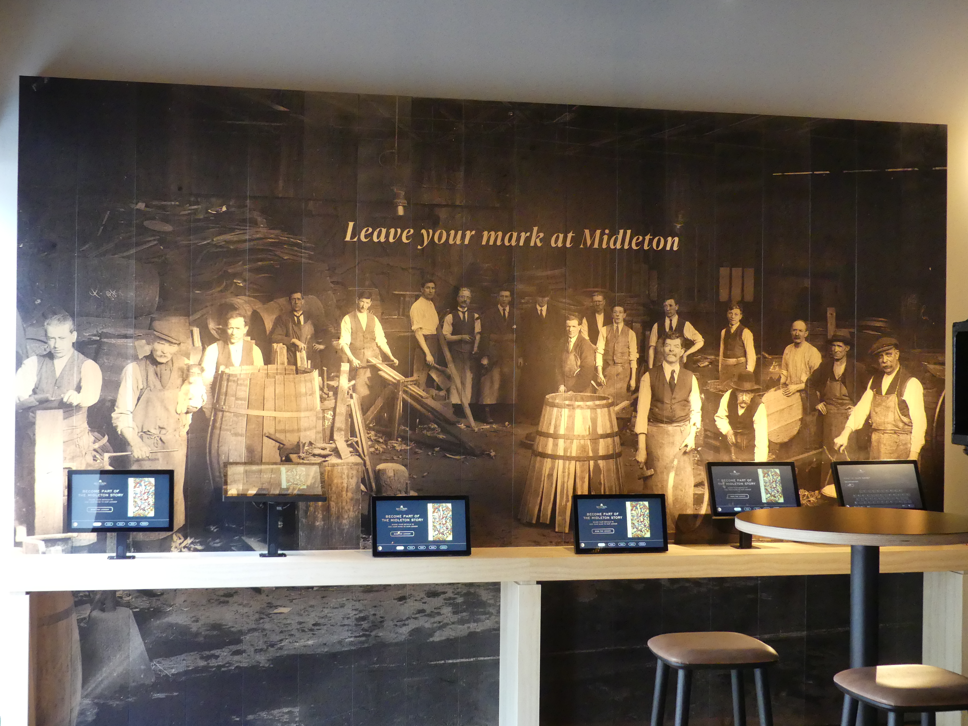
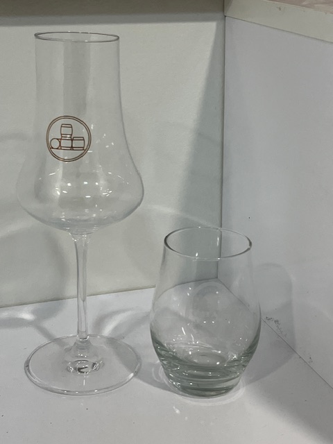
There was some time wasted waiting for the bus. I took some further photos of surrounding buildings and ultimately the bus arrived. Our tour was coming to an end. We got off at the Station View Tavern and then returned on the train to the port. Nothing much to do when Kerry noticed the cabs lined up offering tours and one was to the Jameson Distillery. That sounded promising. We climbed into the cab and shot off expecting this would be nearby. Well we were wrong. Firstly he stopped to show us a castle tower converted into a dwelling before turning into a place called Middletons which turns out to be the maker of Jamiesons Whiskey and some other labels. They offered tasting paddles at a price of course but I picked up a bottle of Redbreast single pot stilled 12 year old whiskey and saved paying for the paddle. I also obtained a whiskey taster. Many years ago, probably 10 years ago, Doug and Neirda travelled with us to Oban and Doug and I did the tour and obtained an “Oban” labeled taster. So I also obtained a Jamieson’s taster. I have shown both tasters below.
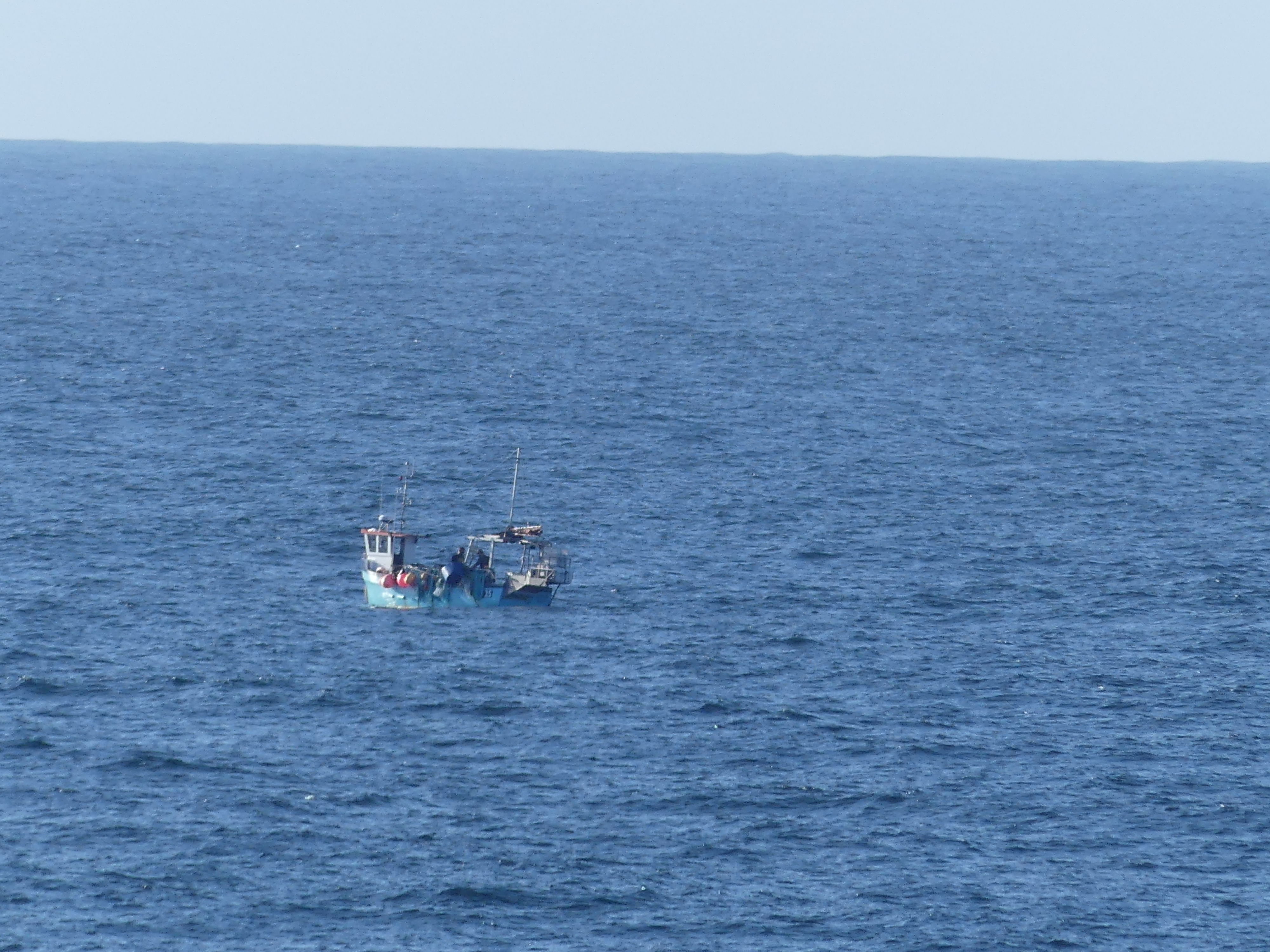
We were returned to the dock in Cobh and boarded the ship with our booty. Tomorrow would be at sea and our last day would result in our returning to Dover and disembarking. So this is what its like to be at sea. The only vessel we passed between Cobh and Dover.
We had planned to take a taxi to our hotel in Heathrow following which we would fly to Singapore for a short stay before travelling home. However, the ship was providing a bus to Heathrow which meant we could make a saving of over 100 pounds and a more reliable way to travel or so we thought. My next blog we return to Heathrow Airport then go to Singapore. Stay tuned for the trip home – “THE RETIREES GO AROUND THE WORLD – Heathrow overnight and arrive in Singapore“
Leaving Liverpool we sailed north again to visit Glasgow but as all you geographers know Glasgow is not on the coast and our ship was far too large to be sailing up the wee little river (River Clyde) on which the city is located. No other explanation was given as to why we docked in Greenock which is on the western coast. What ever the reason we landed in Greenock. So I did a bit of research and this is what I found:
“Greenock is a town in Inverclyde, Scotland, located in the west central Lowlands of Scotland. The town is the administrative centre of Inverclyde Council. It is a former burgh within the historic county of Renfrewshire, and forms part of a contiguous urban area with Gourock to the west and Port Glasgow to the east.” Wikipedia
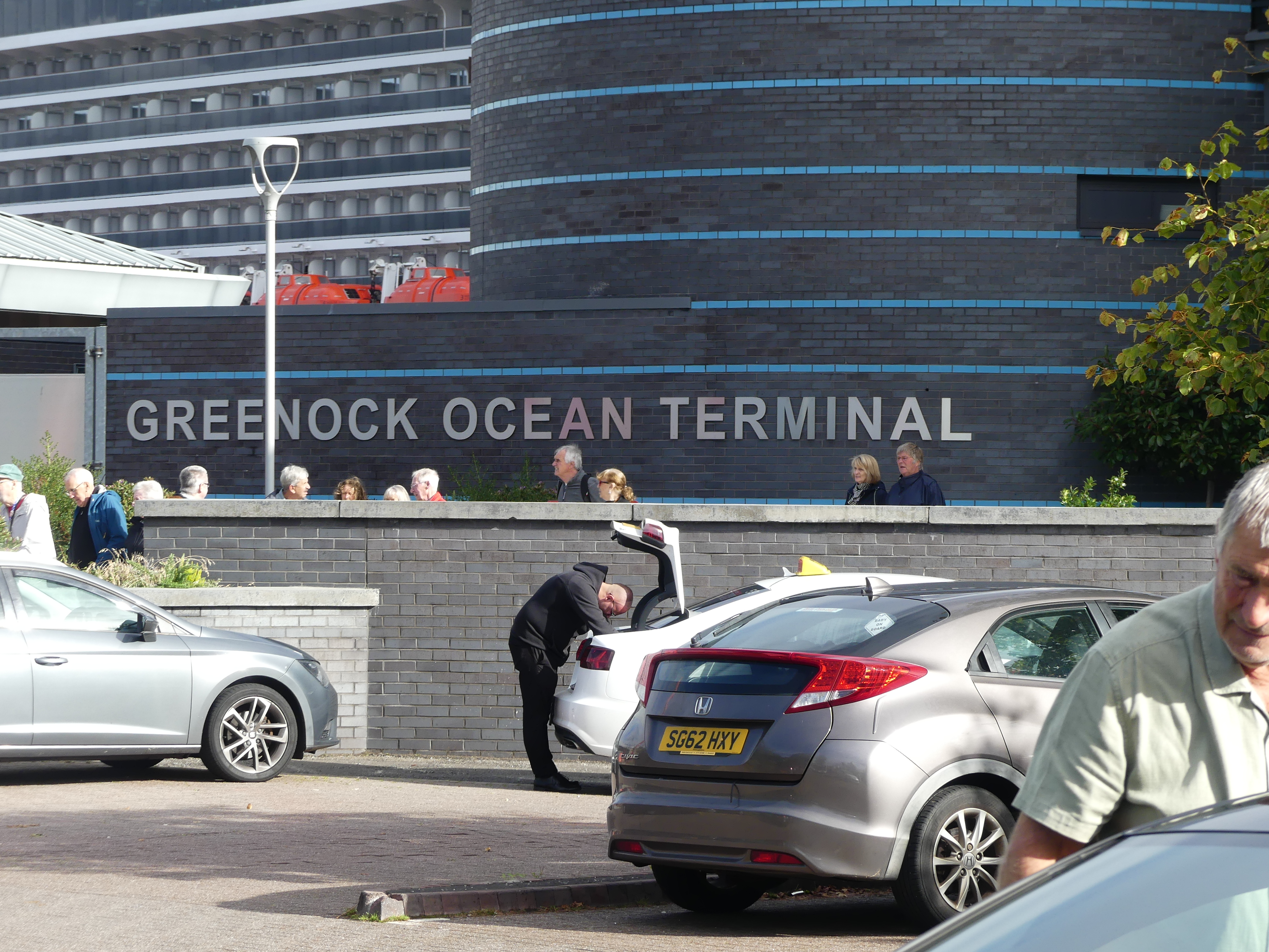
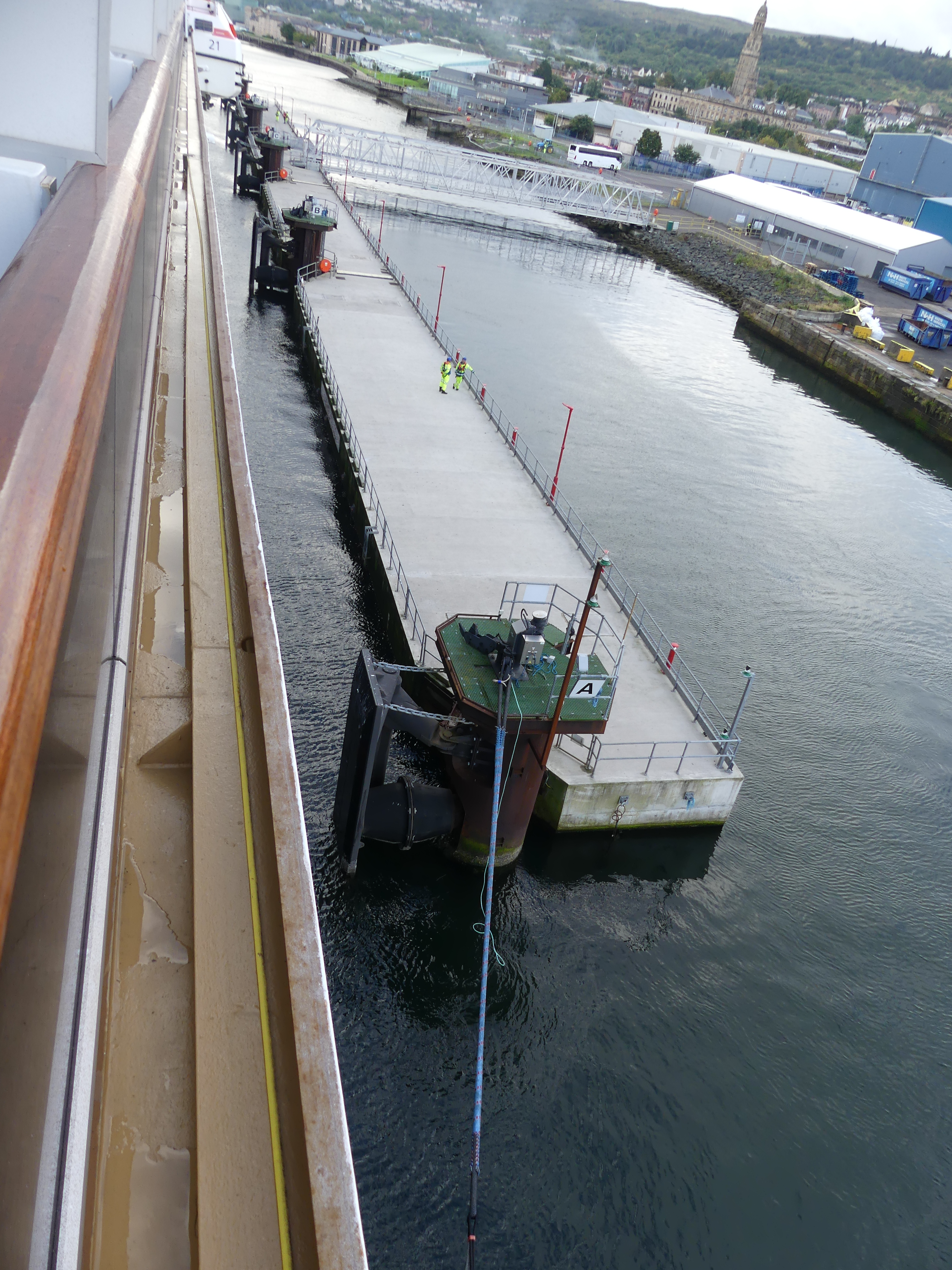
Still none the wiser we followed the crowd and disembarked. Later when we returned further research showed the reason why cruise ships docked at Greenock. “Strategically positioned along major maritime routes, it is a key stop for Northern European and British Isles cruise itineraries, offering travelers a perfect blend of cultural heritage and natural beauty.” Still didn’t help my understanding but we found a reason why all travellers should stop there. I’ll let you know shortly. The photos show the terminal which does nothing to help understand the attraction.
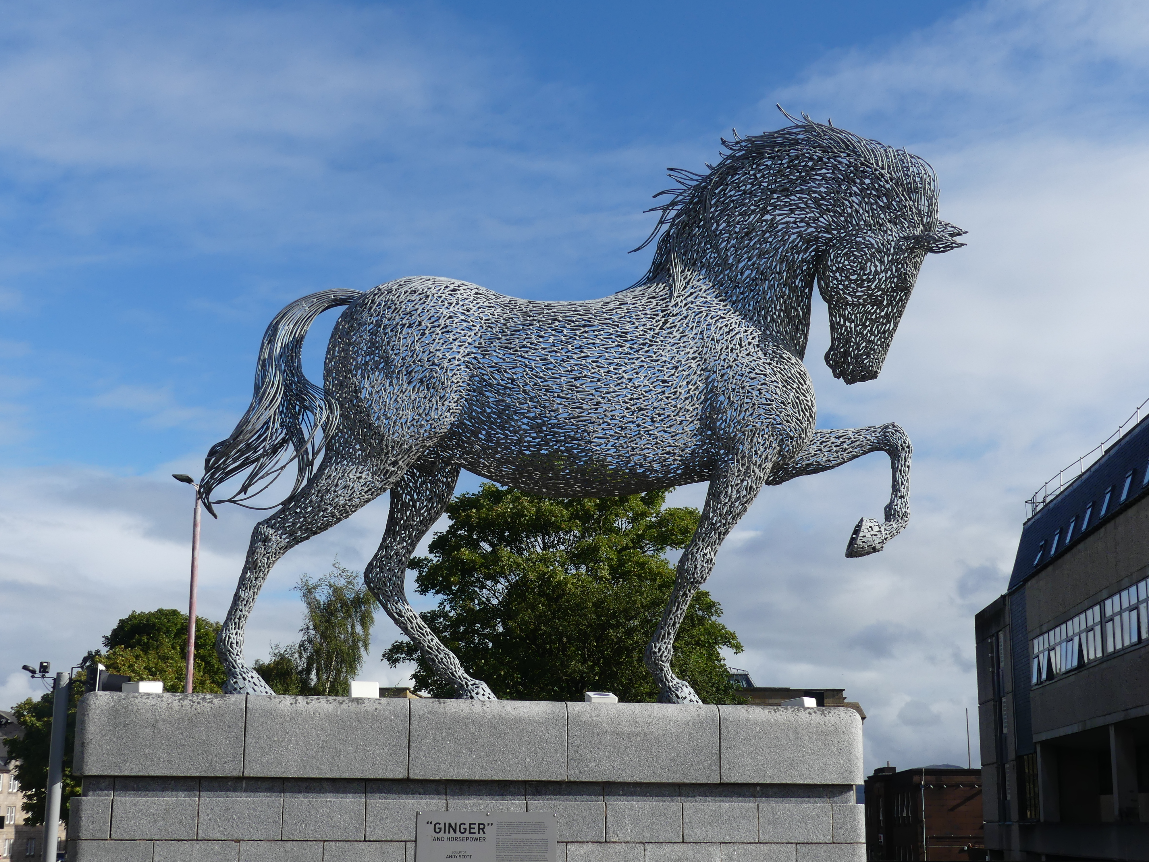
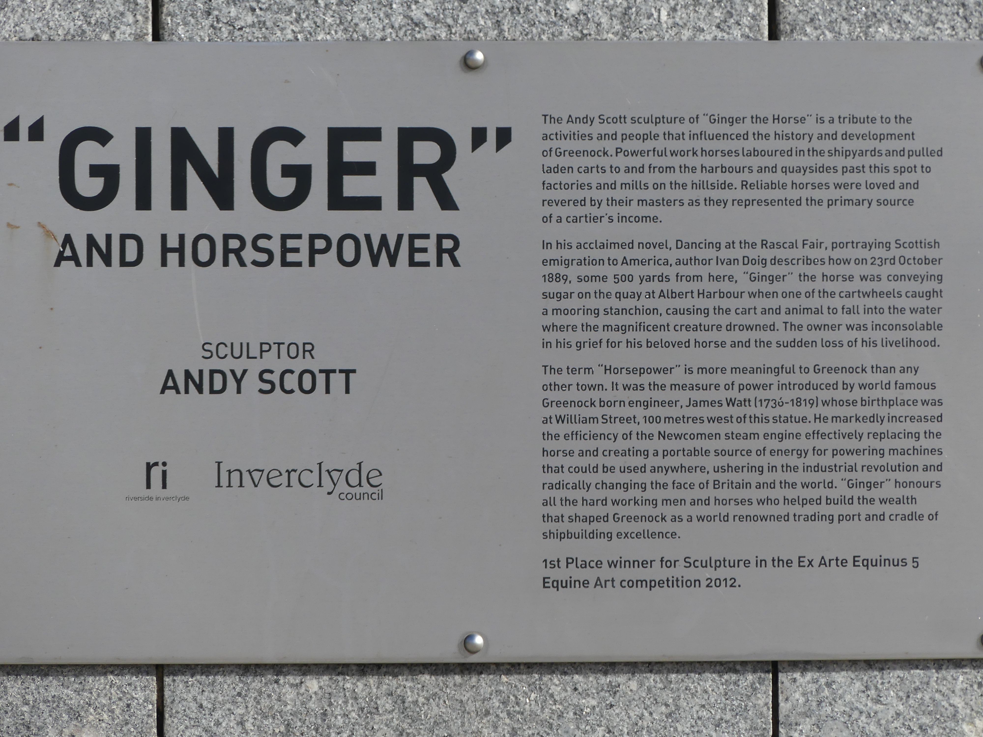
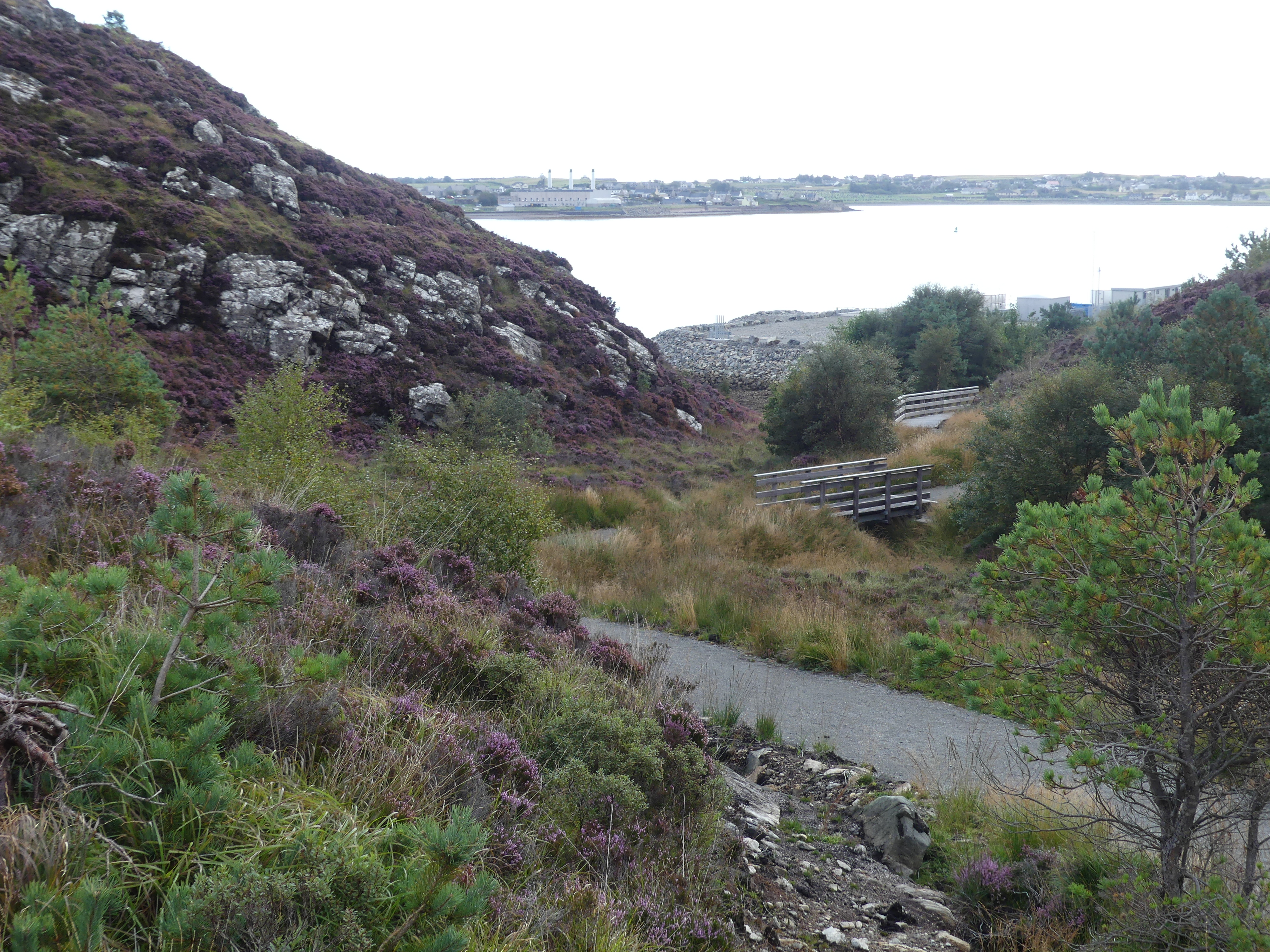
We walked from the ship toward the central business district. We passed a car missing its front wheel but didn’t know if it was well equipped thieves or someone without a spare tyre. After passing an Aldi supermarket we came to a major road crossing with an imposing statue on the other side of the road. It was “Ginger” a sculpture by Andy Scott designed to represent all the cart horses which pulled carts during the area’s great shipbuilding and maritime history. Inverclyde was once one of the most important shipbuilding ports in the world. When Greenock engineer James Watt wanted to describe the measure of power, he invented the term “horsepower” which is still used to this day. The name Ginger comes from an actual horse which drowned while transporting sugar on the quay at Albert Harbour in Greenock. A very emotive monument to the industry of Greenock.
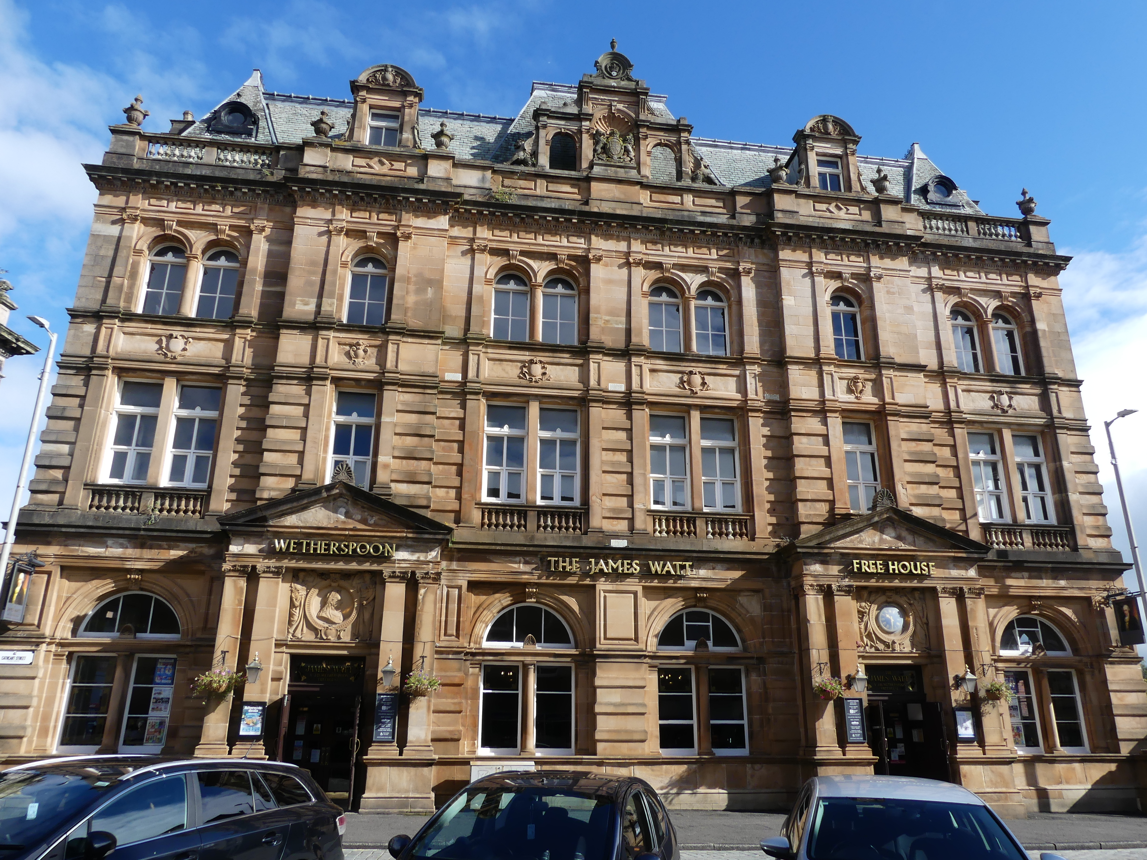
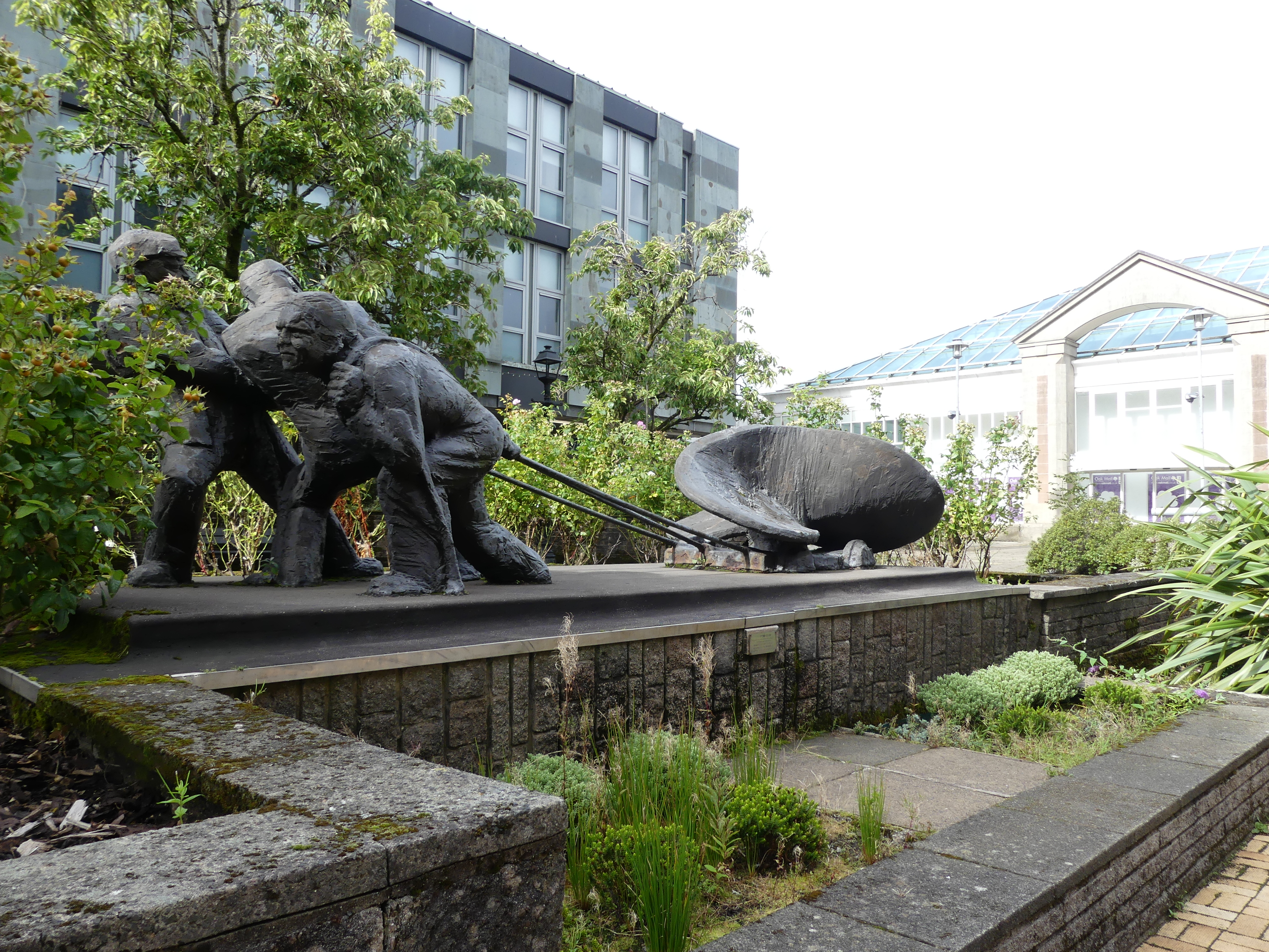
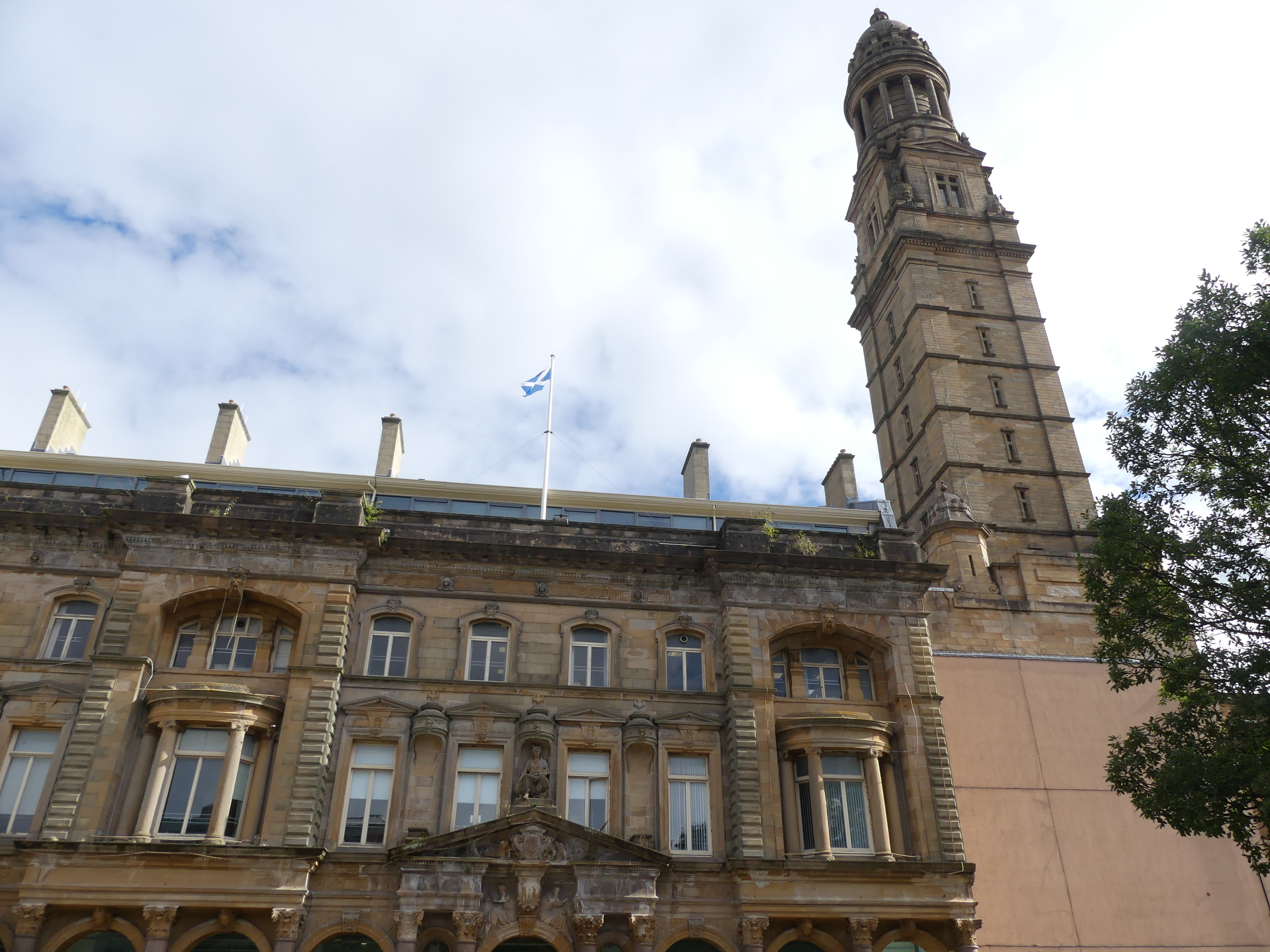
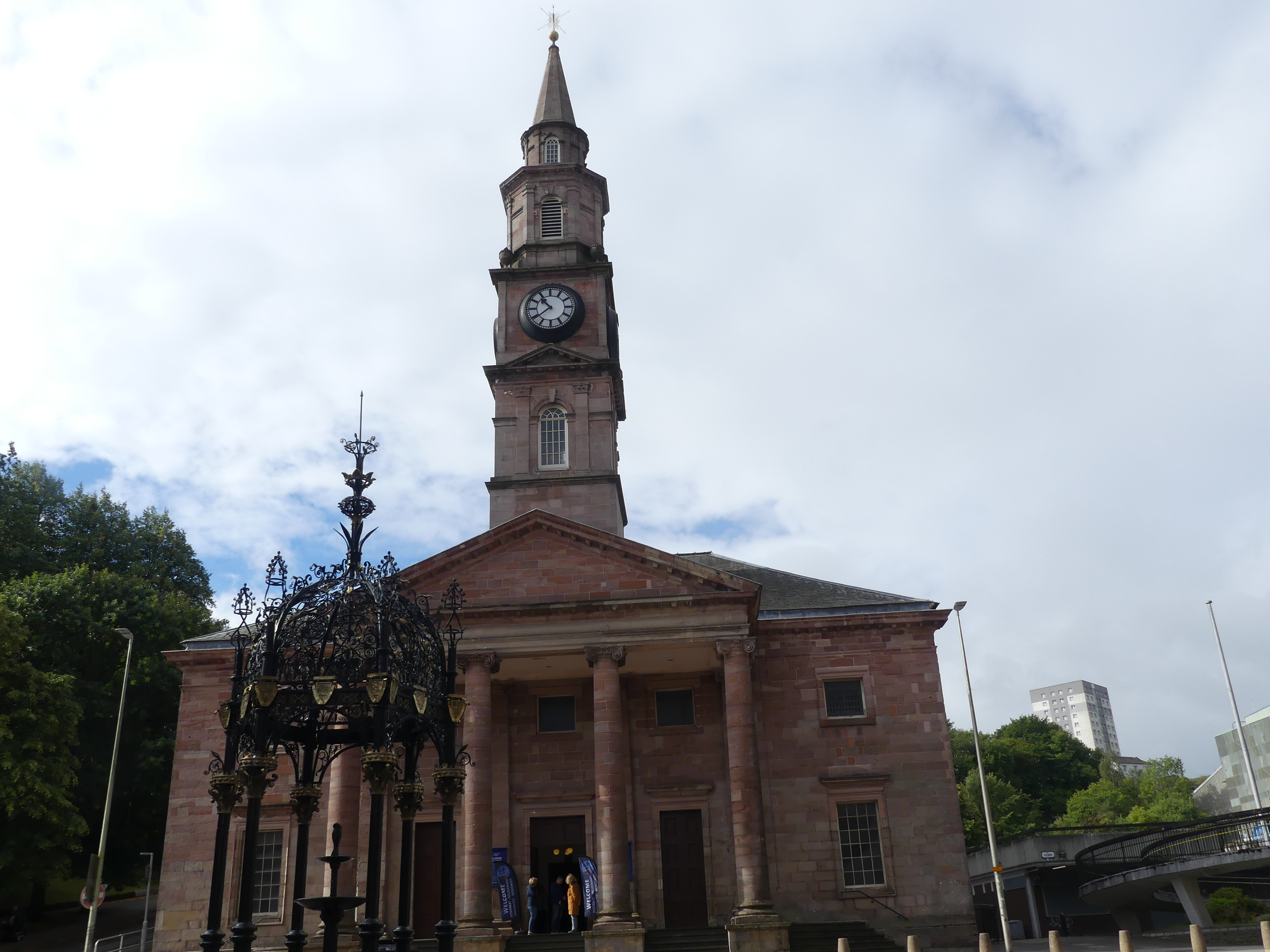
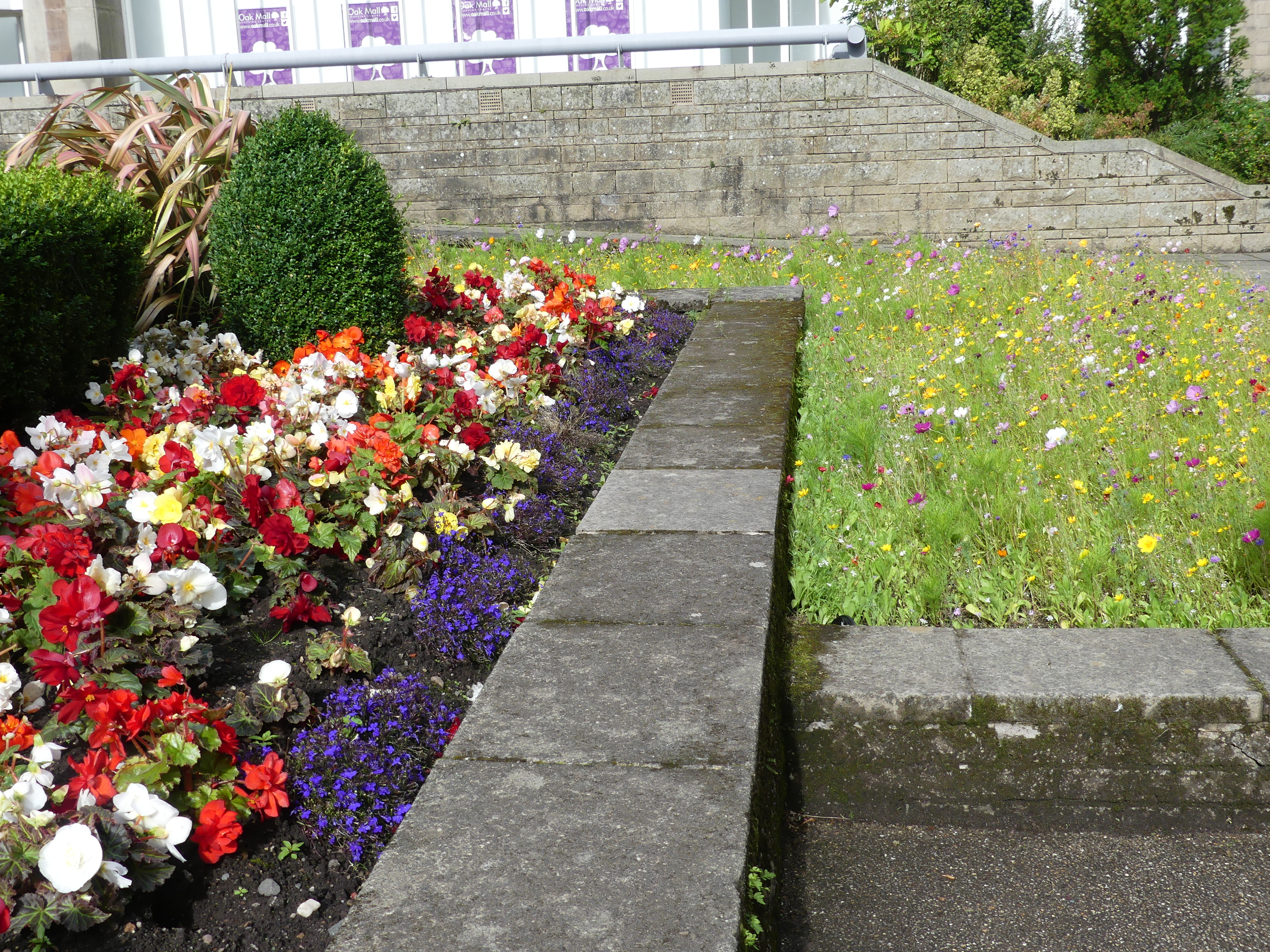
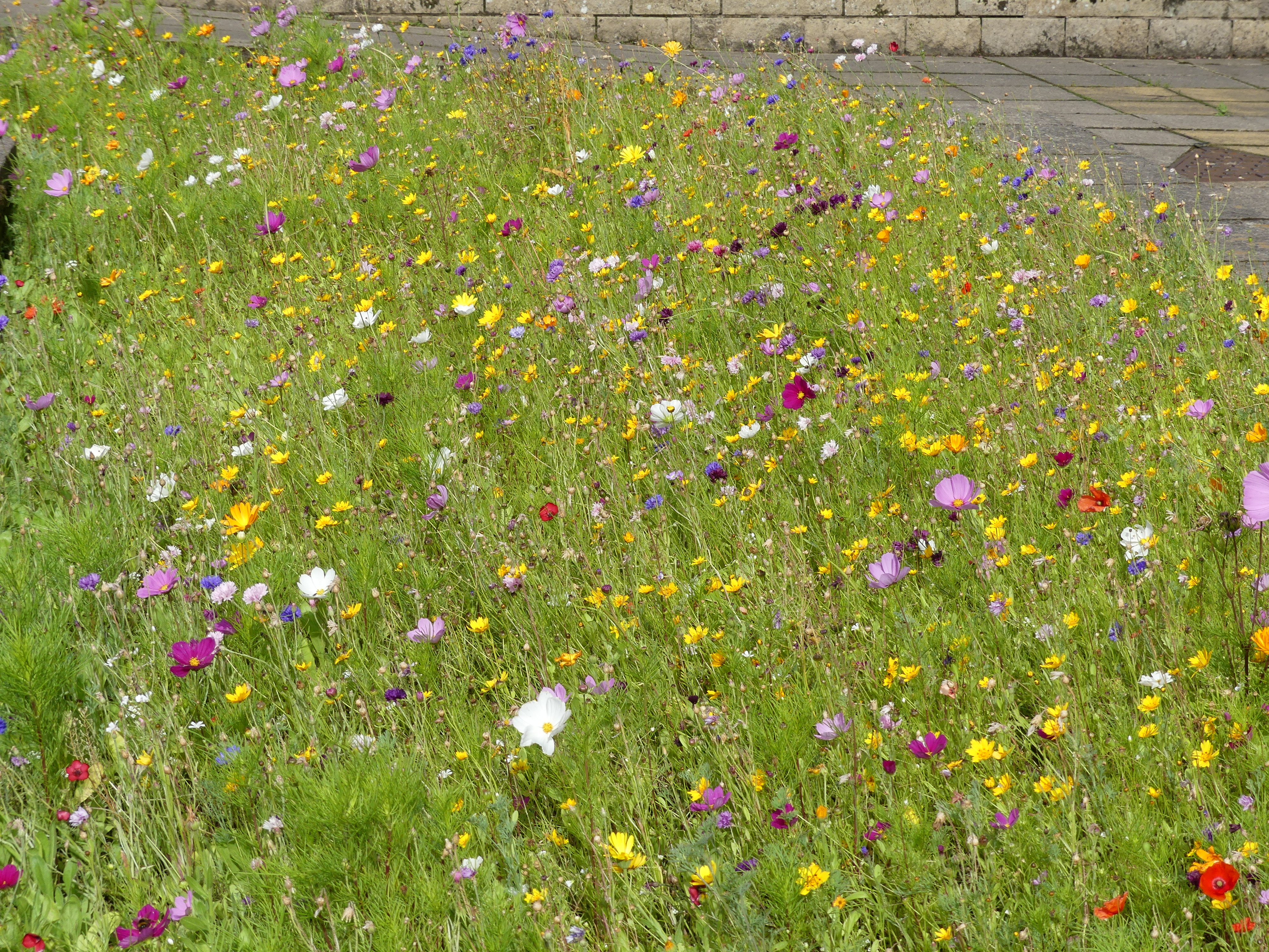
We continued our exploration following the road to the CBD passing some very impressive buildings of the nineteenth century including one converted to a Weatherspoons Pub named “the James Watt Building”, the Town Hall and the square in front of the hall. The sculpture of workmen dragging a newly forged propeller again references the industrial history of the town. The harshness of the stone and mortar is softened by the wild flowers and grasses in the garden.
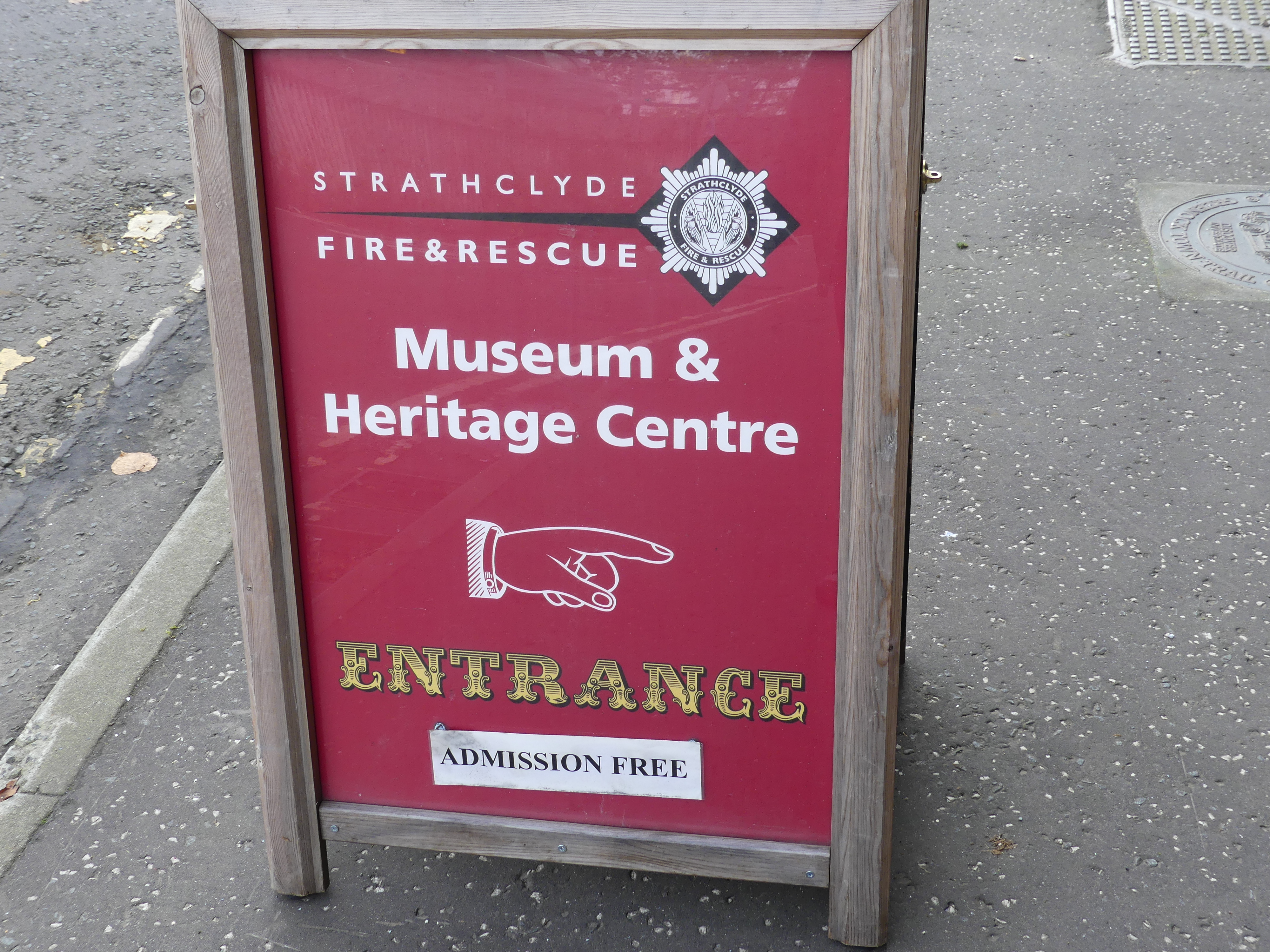
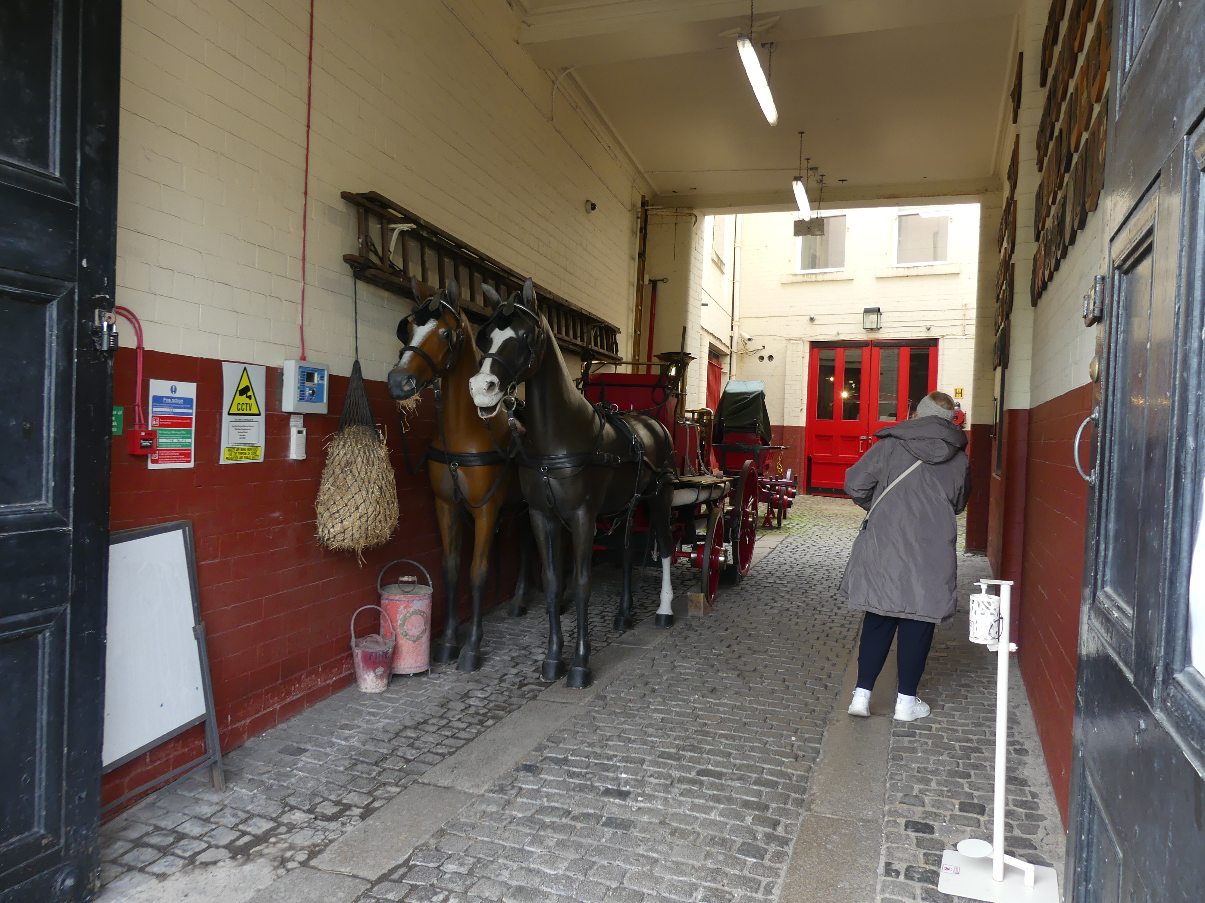
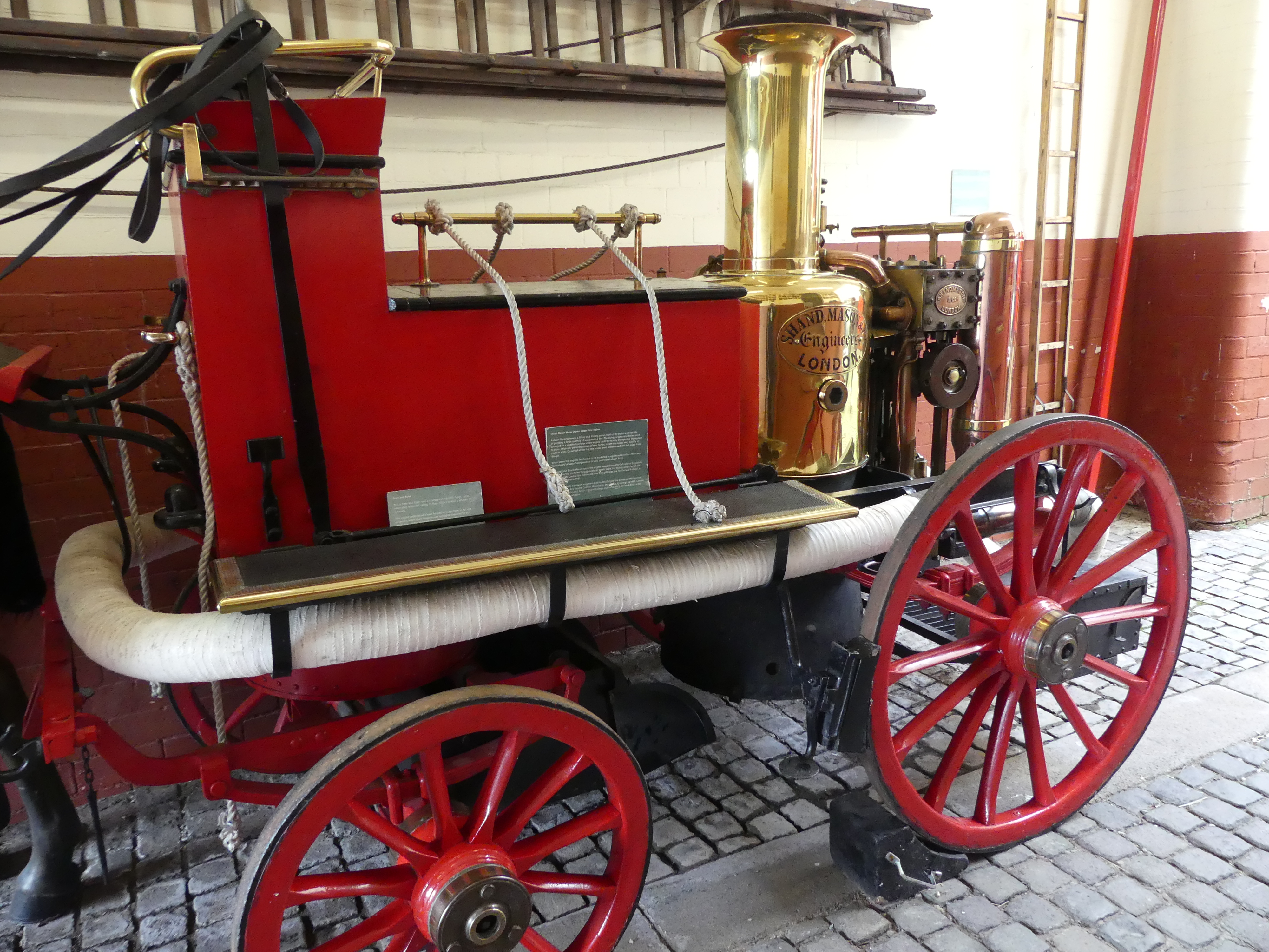
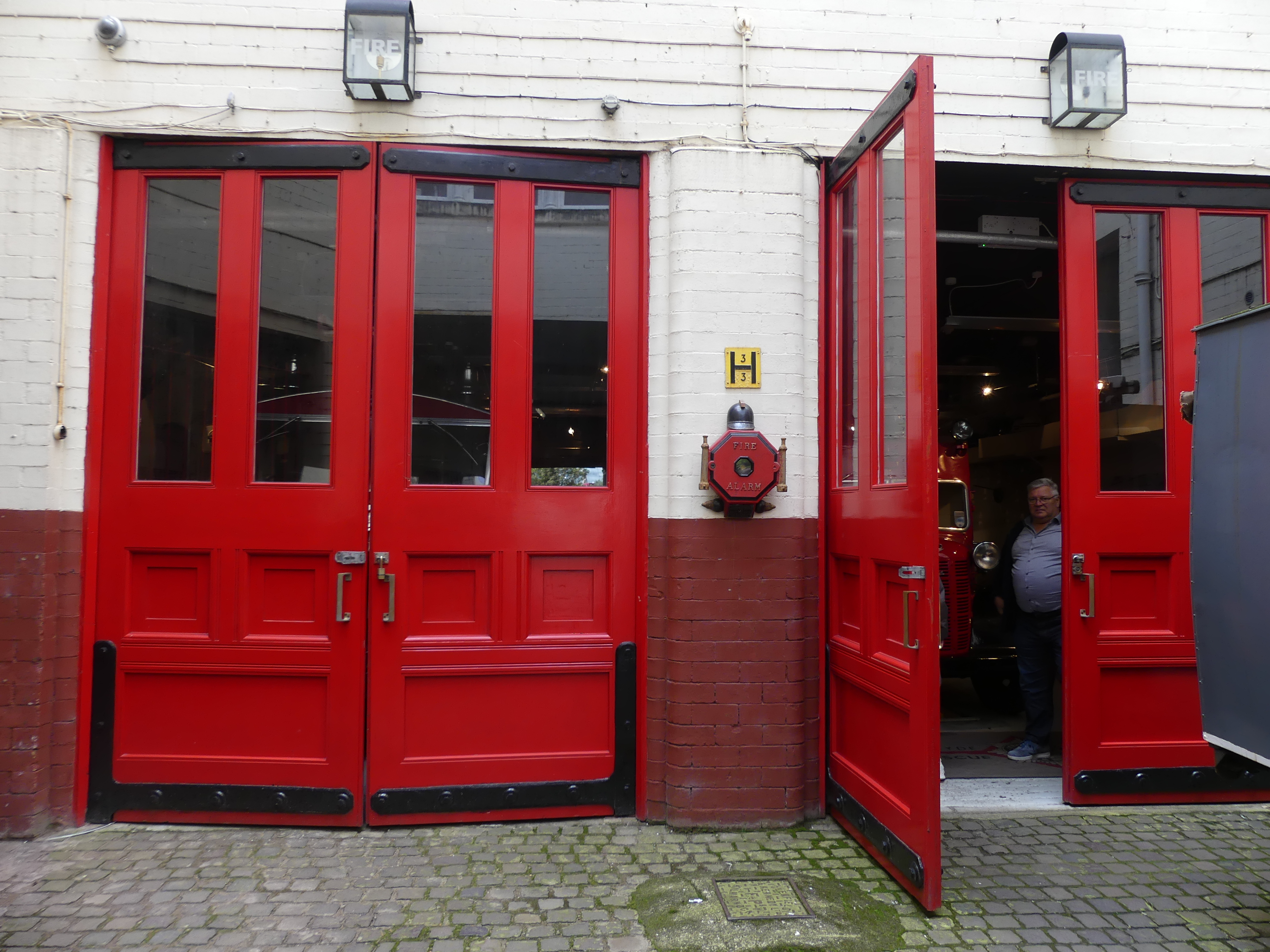
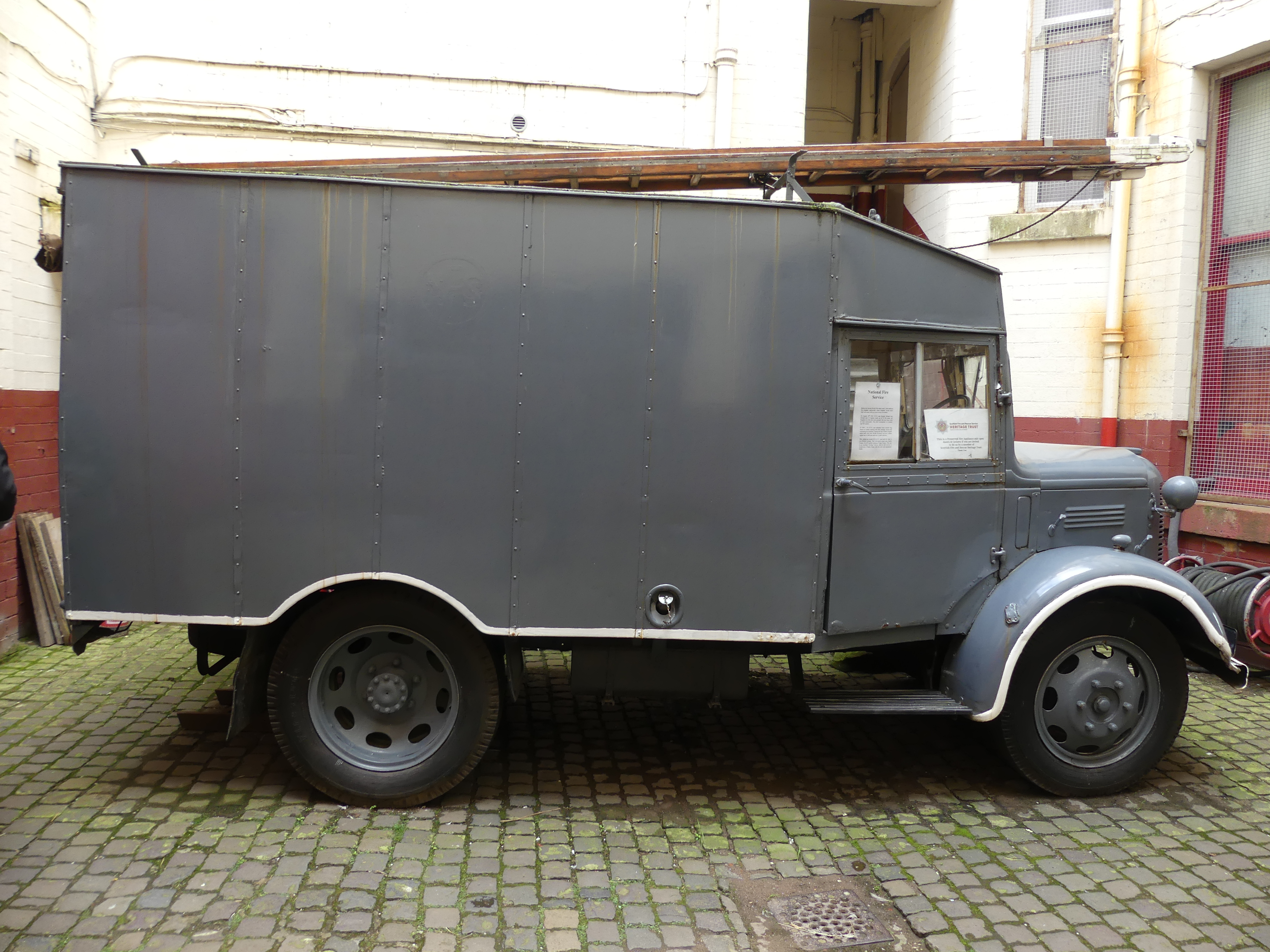
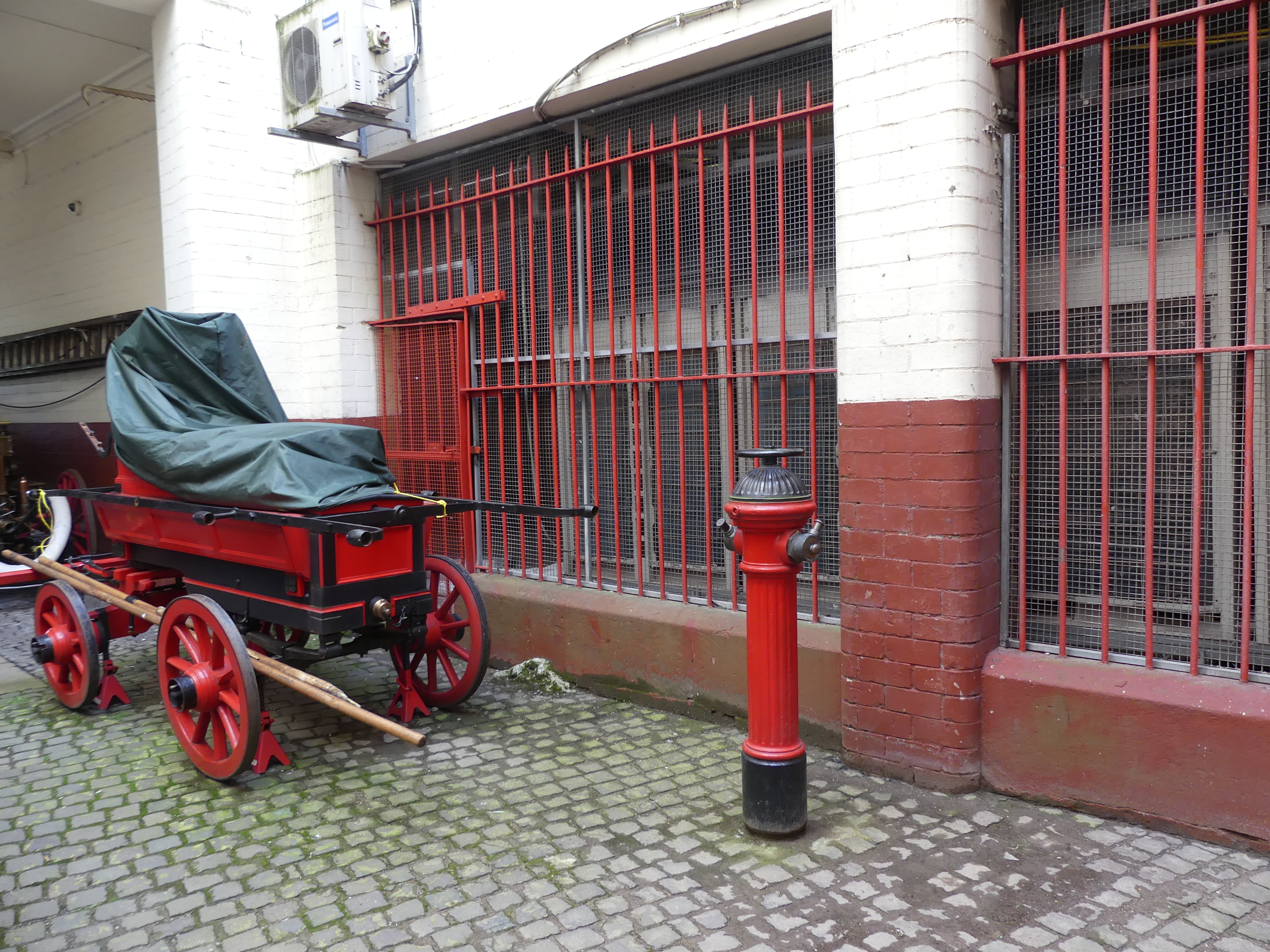
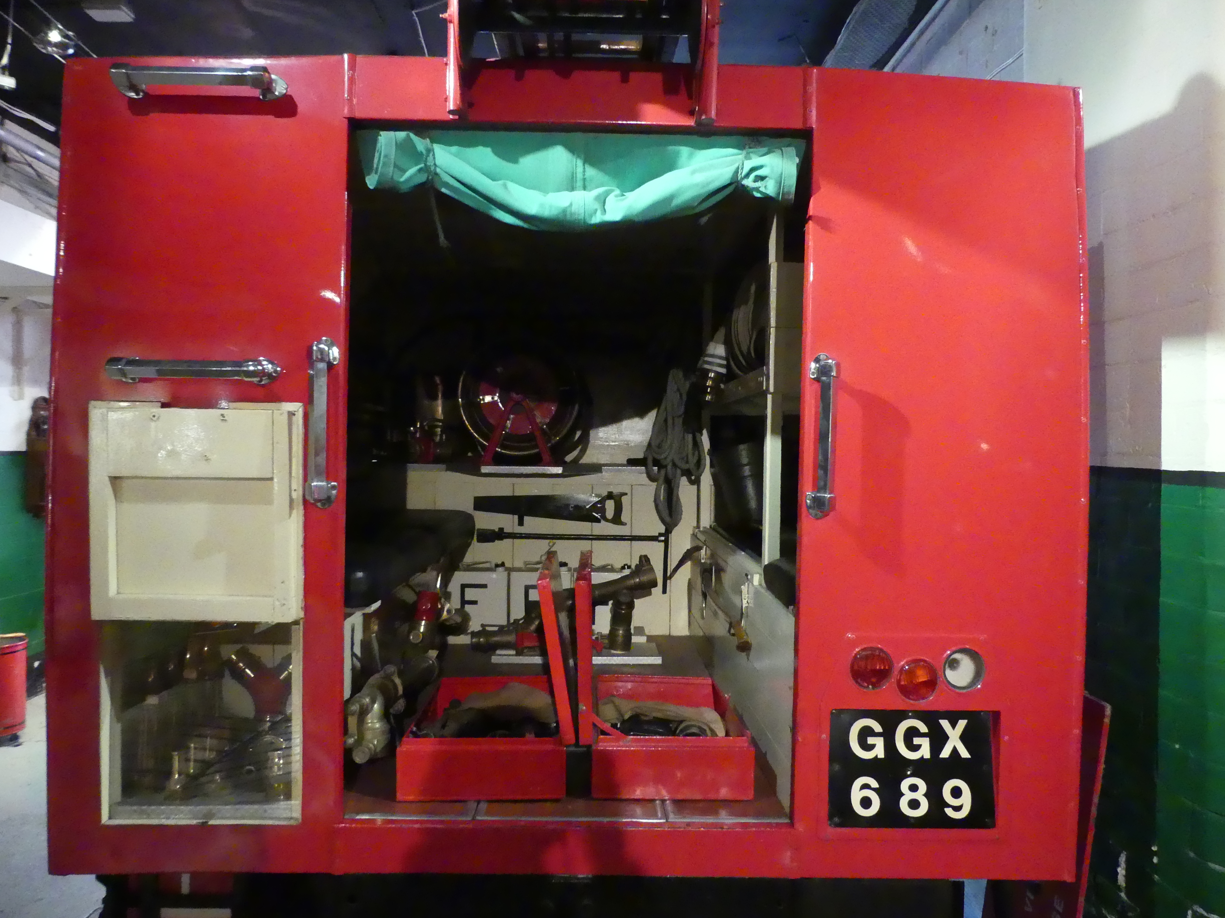
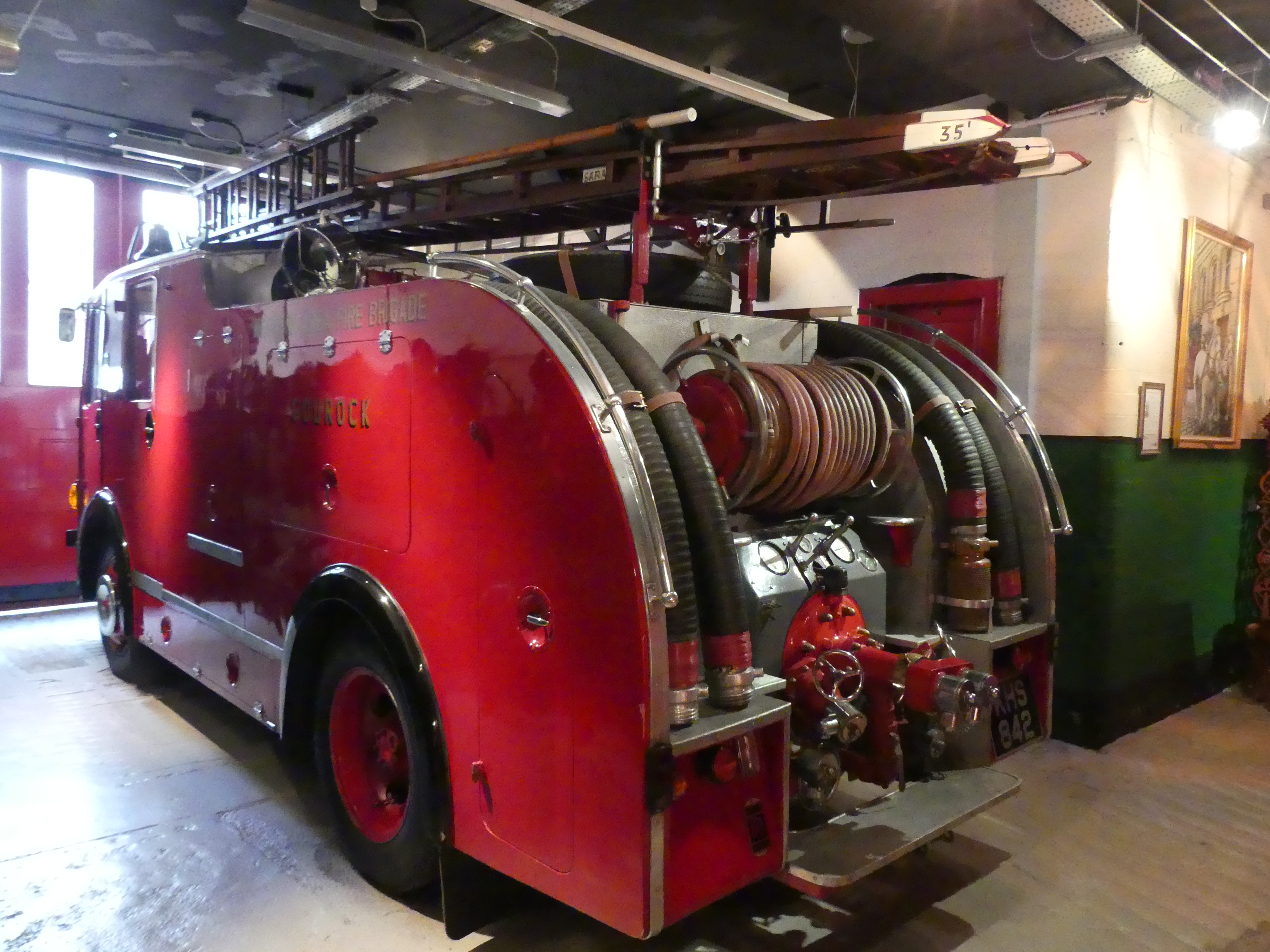
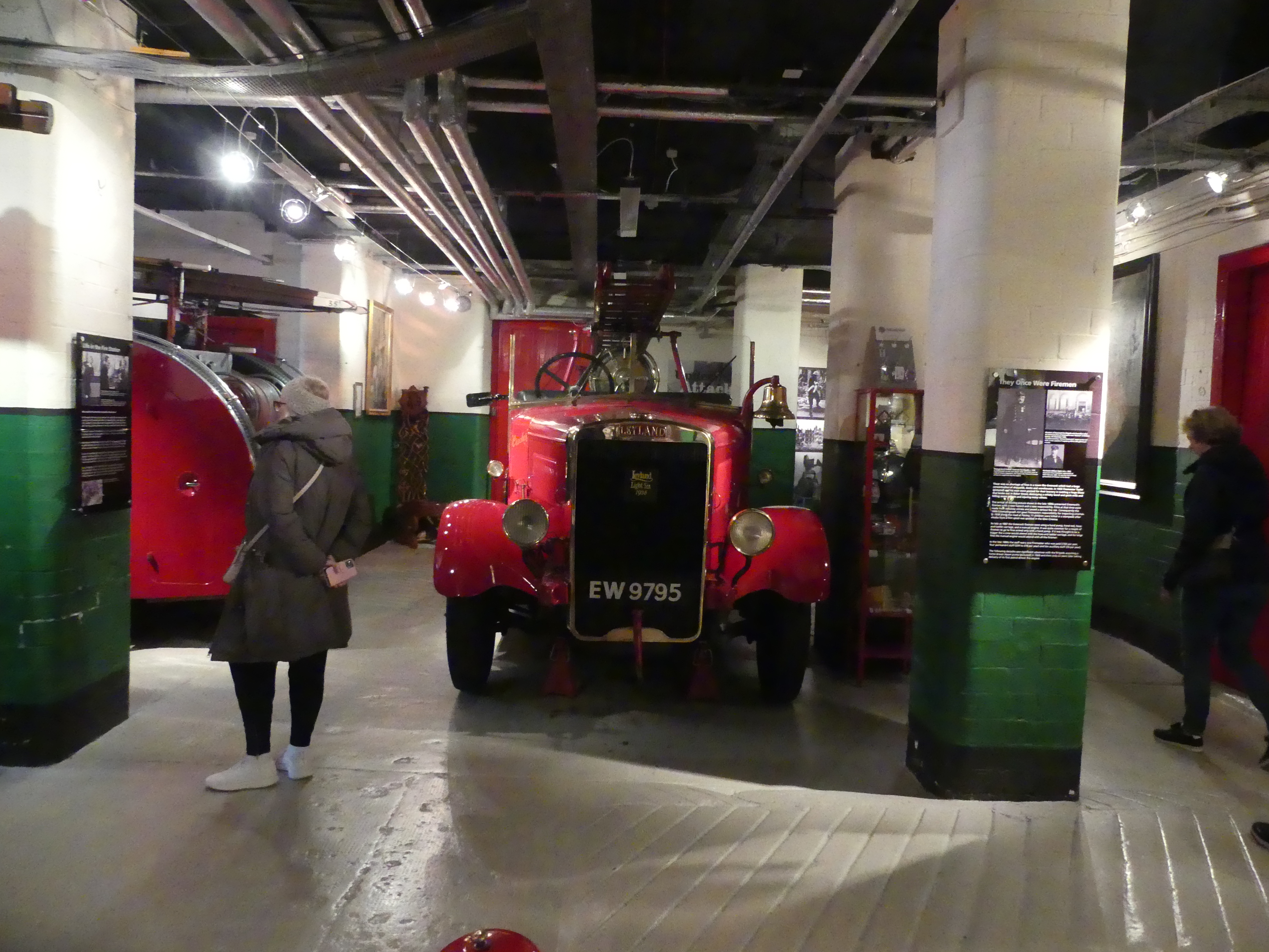
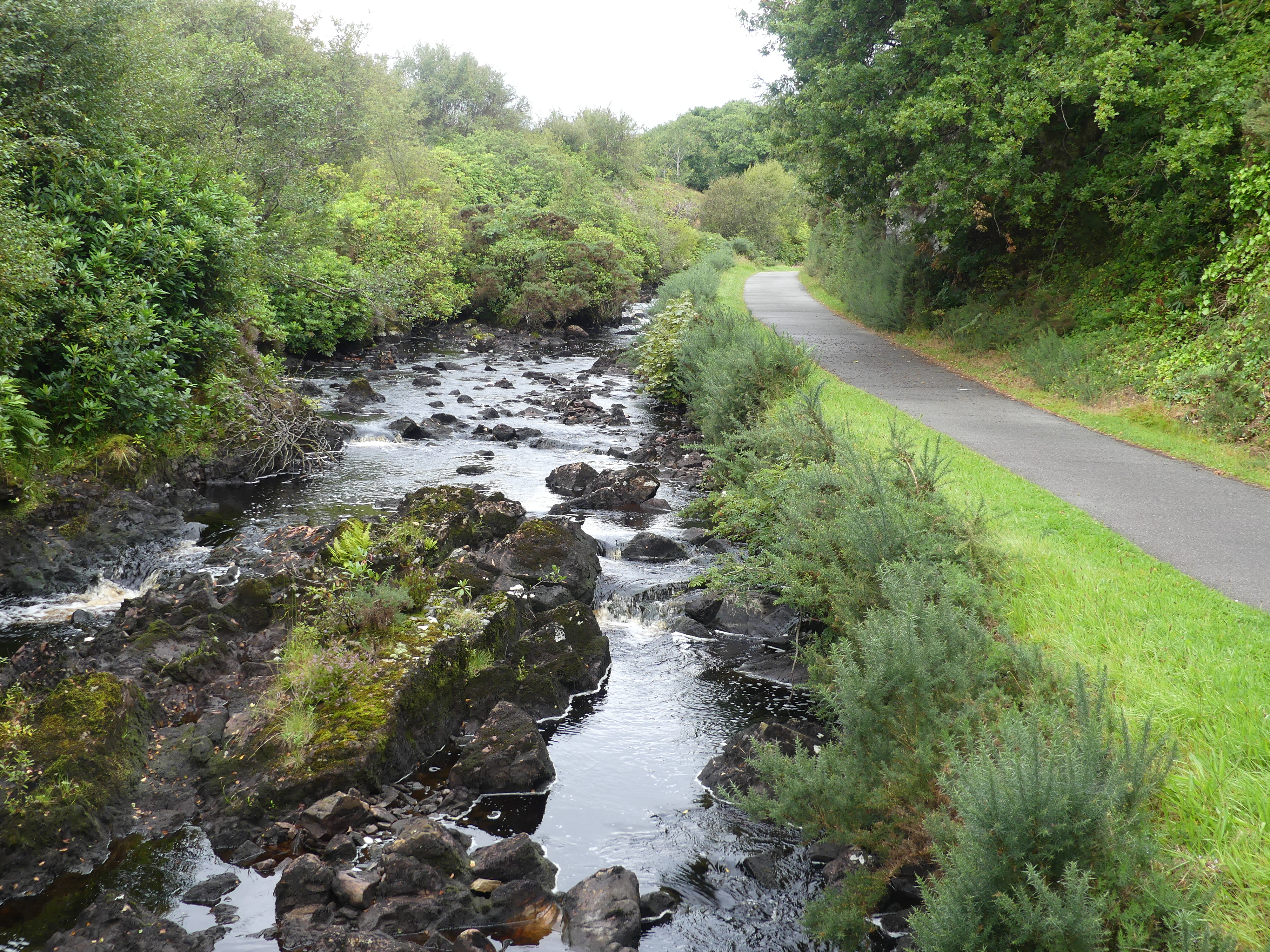
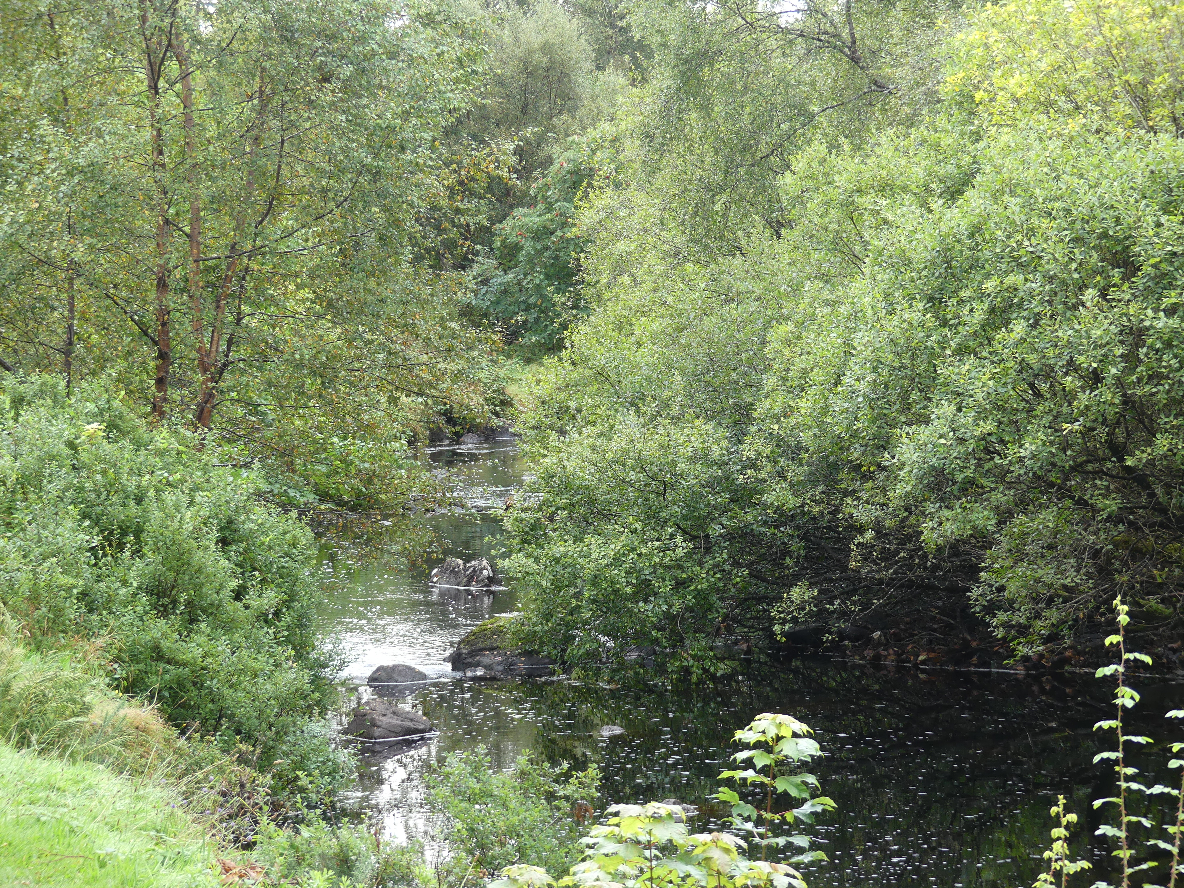
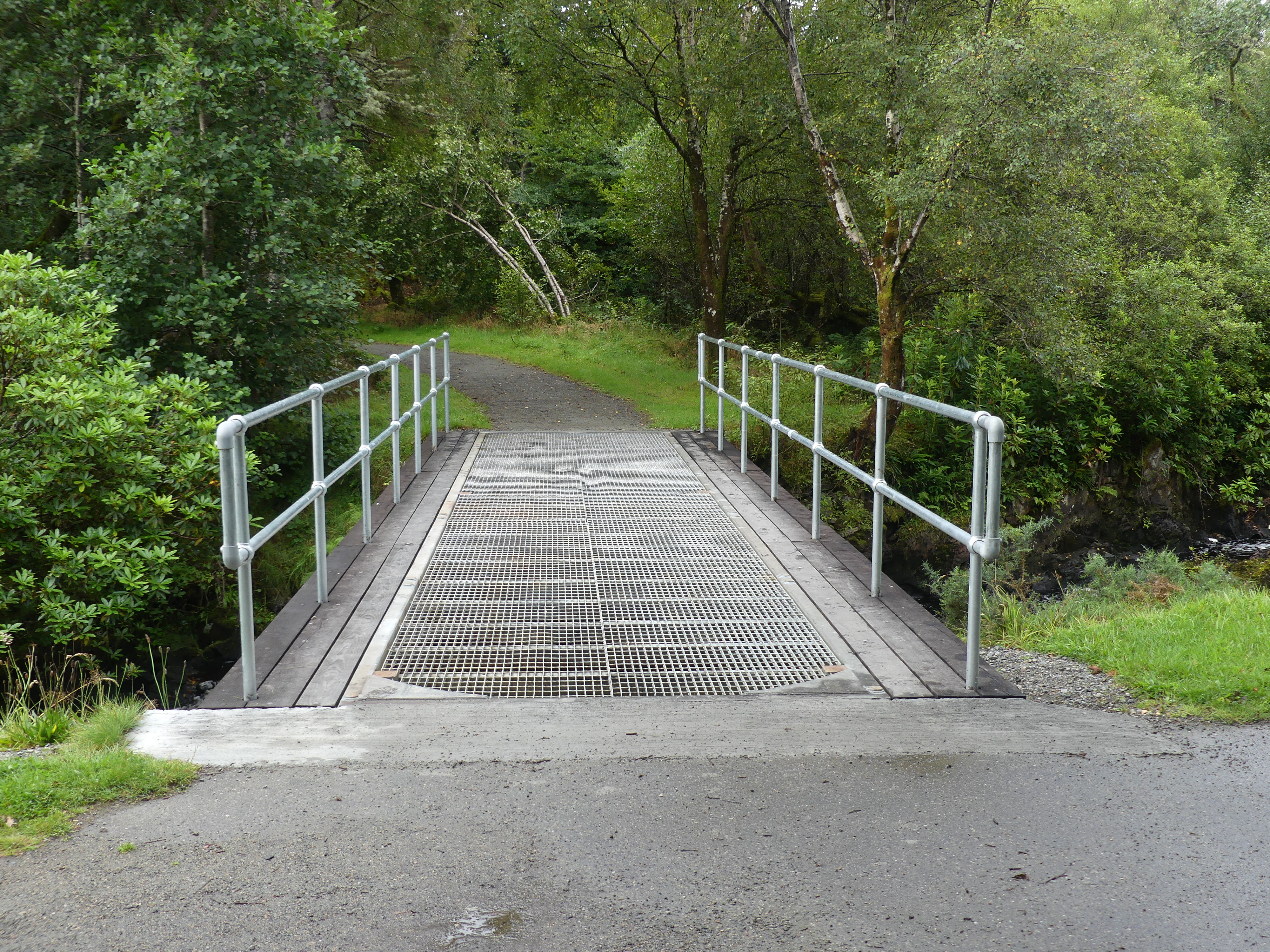
I cannot recall what drew us toward an A fold sign in Wallace Place but I’m glad it did. Here in the old Fire Station the Scottish Fire and Rescue Service Museum has been established by a Trust of the same name. It is a museum dedicated to the history of Scotland’s fire and rescue service. It houses a wide range of artefacts and stories from the service’s long history with displays on the history of firefighting, the development of fire safety in Scotland, and the history of the building. Many of the exhibits have been gathered from around Scotland as the station closed in 1960 before it was reopened as by the Strathclyde Fire & Rescue Museum 52 years later. The video story is fascinating and a must see should you visit it. My photos give you a snipet of what you will find.
I have also scanned the brochure on the museum and attached its 4 pages are here.
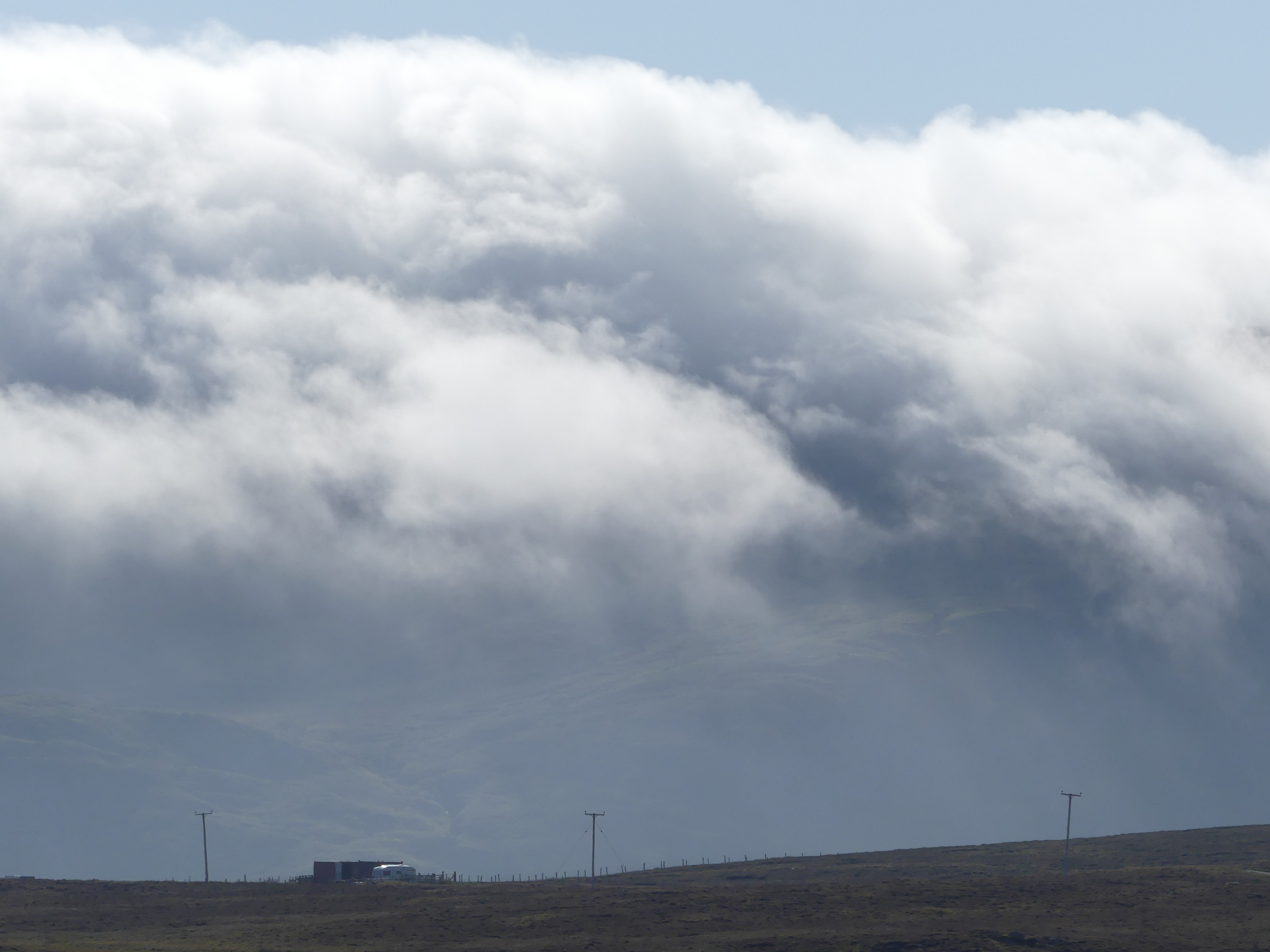
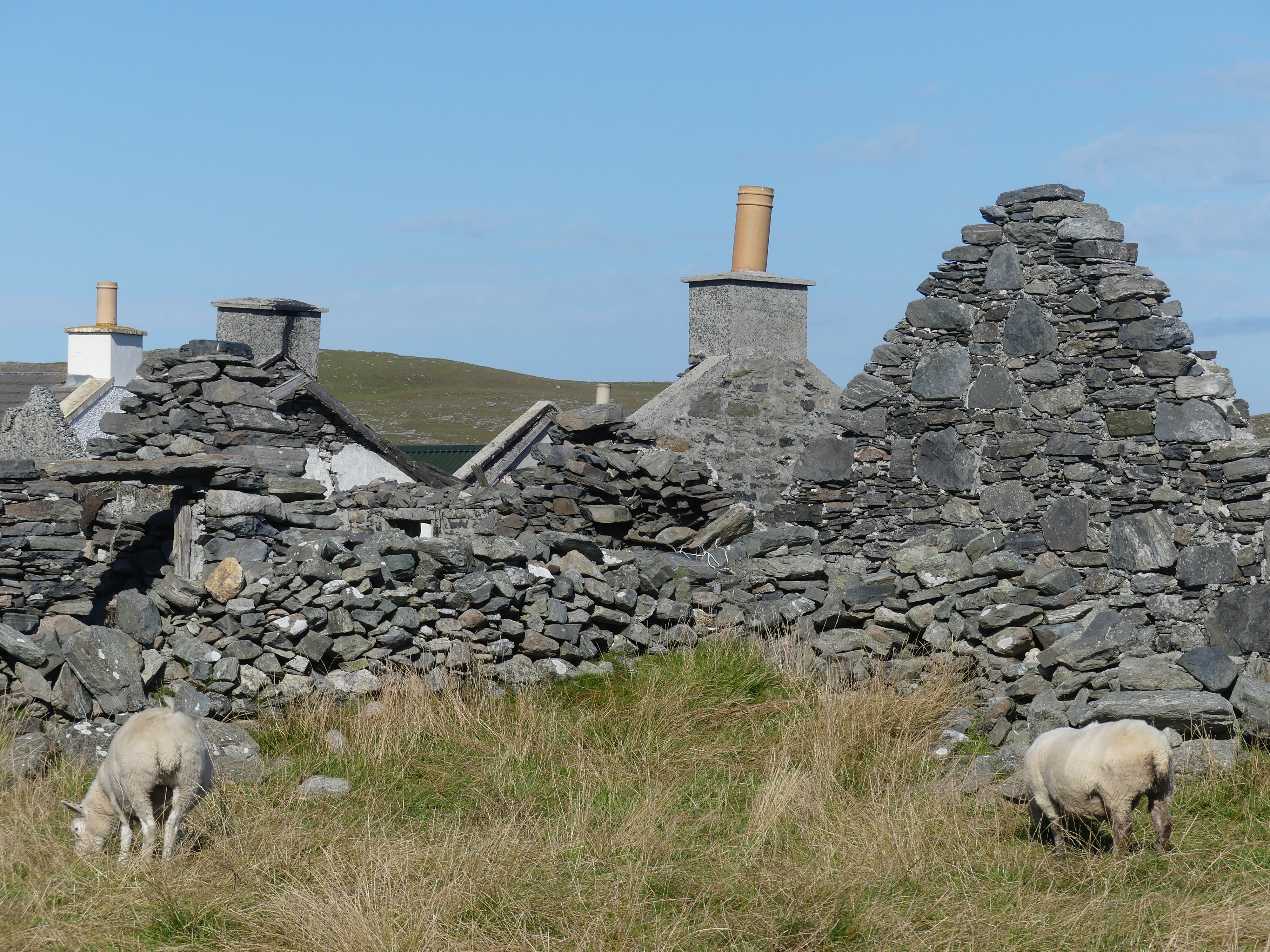
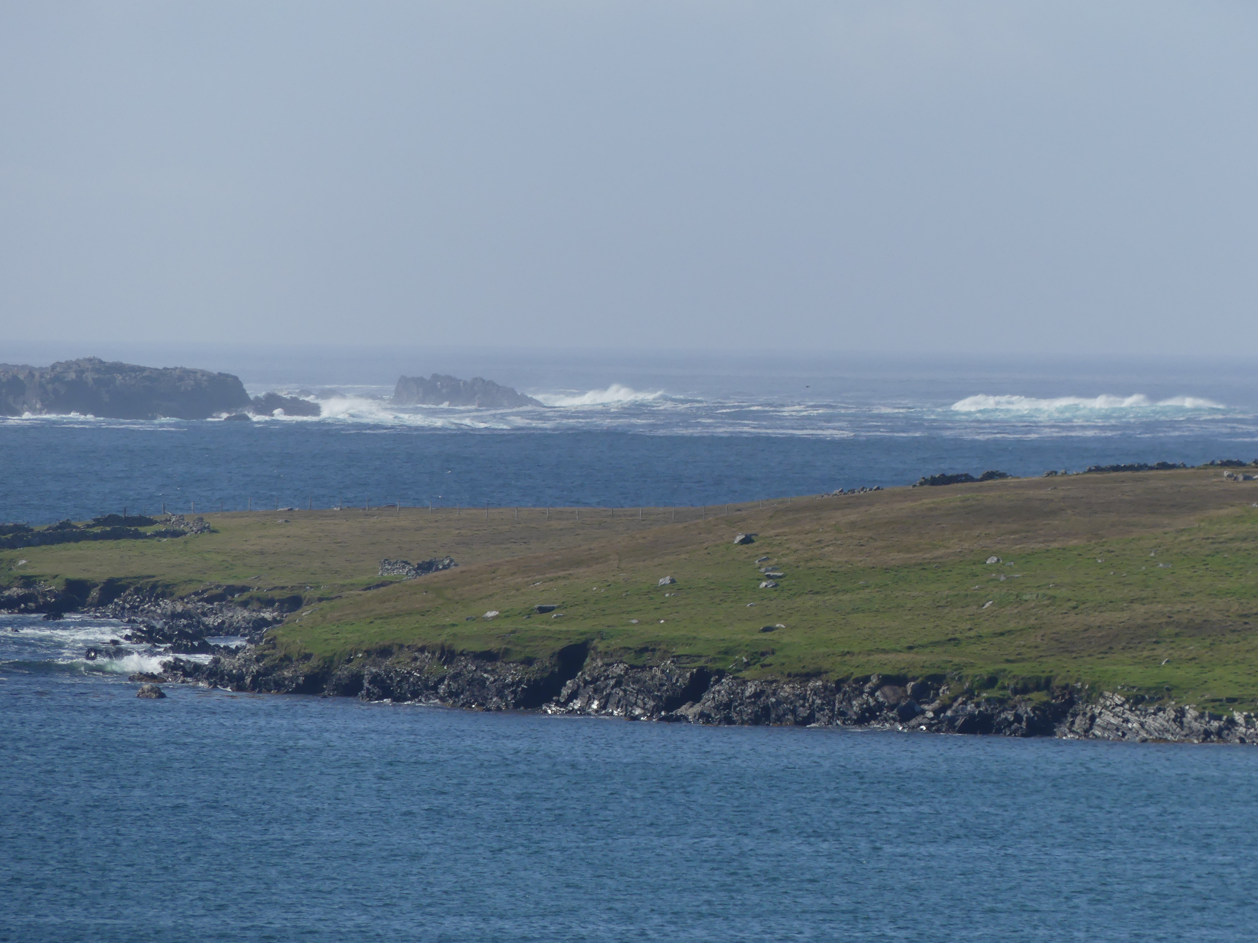
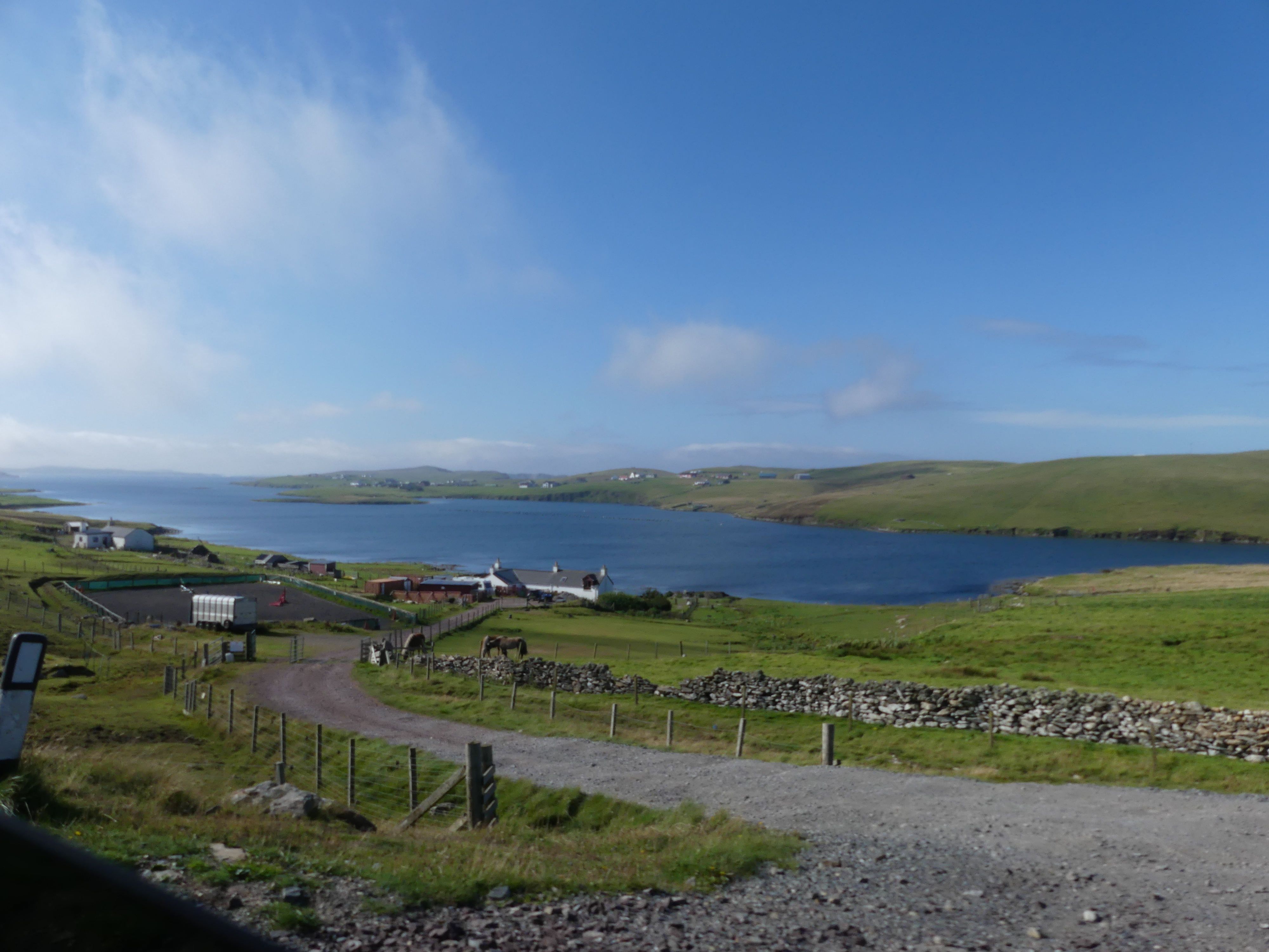
We spent most of our visit in this museum before returning to the ship. There must be a reason why such an interesting and important museum has been hidden away in Greenock and we only found it by accident. However that is the way I like it – something undiscovered brought to life in my blogs. Our travels then took us to the 4th Island “THE RETIREES GO AROUND THE WORLD – DAY 9 SS NIEUW STATENDAM – Isle of Mann “. A few interesting facts around this limb of the Empire so you will need to read on.
My research into the Outer Hebredies was rather limited. The known history of the archipeligo starts in the Mesolithic era leaving a diversity of important prehistoric sites. The Outer Hebrides, sometimes known as the Long Isle or Long Island (Scottish Gaelic: an t-Eilean Fada), is an island chain off the west coast of mainland Scotland. The islands form part of the archipelago of the Hebrides, separated from the Scottish mainland and from the Inner Hebrides by the waters of the Minch, the Little Minch, and the Sea of the Hebrides. The Outer Hebrides are considered to be the traditional heartland of the Gaelic language. Since 1998 the Council has used only the Gaelic form of its name, including in English language contexts. The council area is called Na h-Eileanan an Iar (‘the Western Isles’) and its council is Comhairle nan Eilean Siar (‘Council of the Western Isles’). There are 19 inhabited islands having an estimated population of 26,020 in 2024, and there are more than 50 substantial uninhabited islands.
The Romans appear to have had sporadic settlements on the islands but little other impact. The Western Isles became part of the Norse kingdom lasting for over 400 years. The ill-fated 1263 expedition of Haakon IV of Norway, resulted in the Outer Hebrides along with the Isle of Man, being yielded to the Kingdom of Scotland a result of the 1266 Treaty of Perth. The archaeological record of the Norse period is very limited with the best known find from this time being the Lewis chessmen, which date from the mid 12th century. With the Treaty of Union with England in 1707, the islands came under the control of Great Britain. Much of the land is now under local control, and commercial activity is based on tourism, crofting, fishing, and weaving.
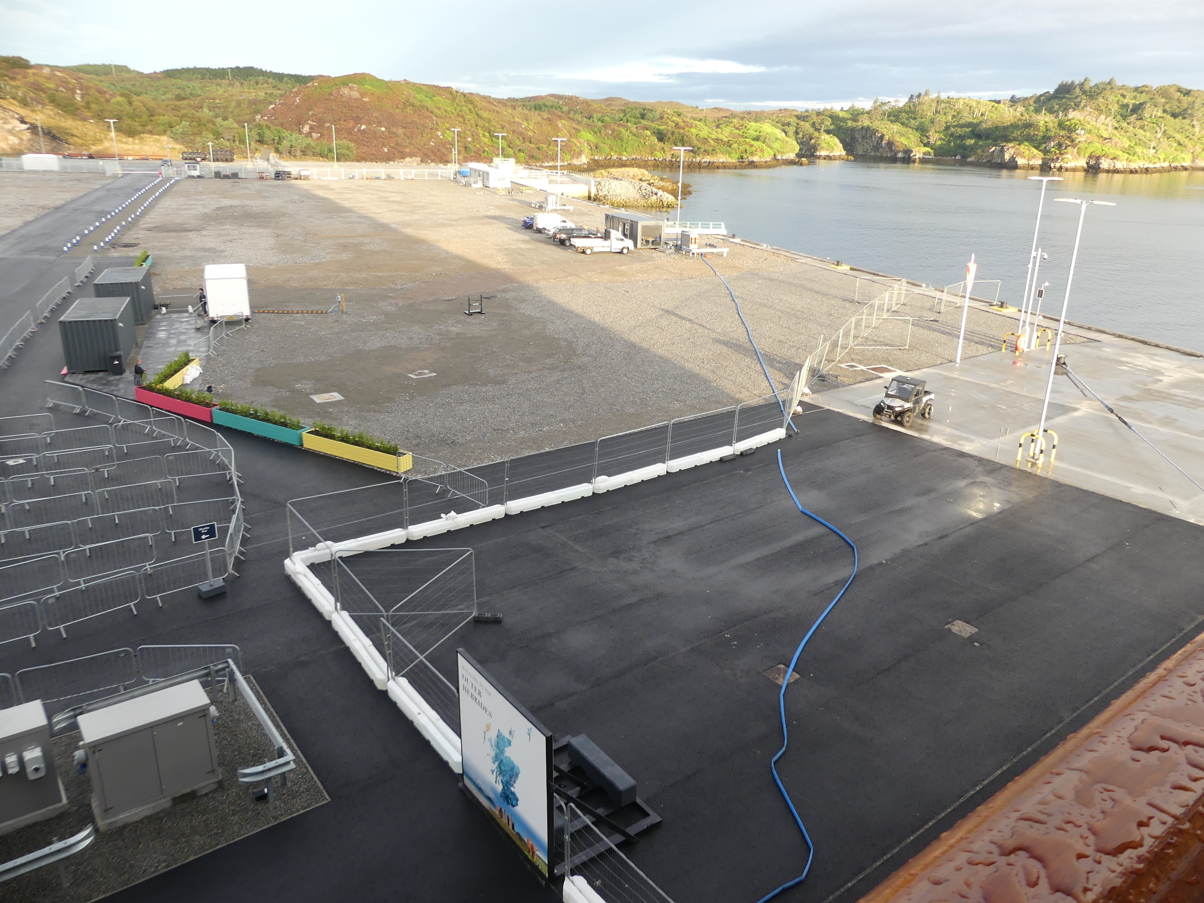
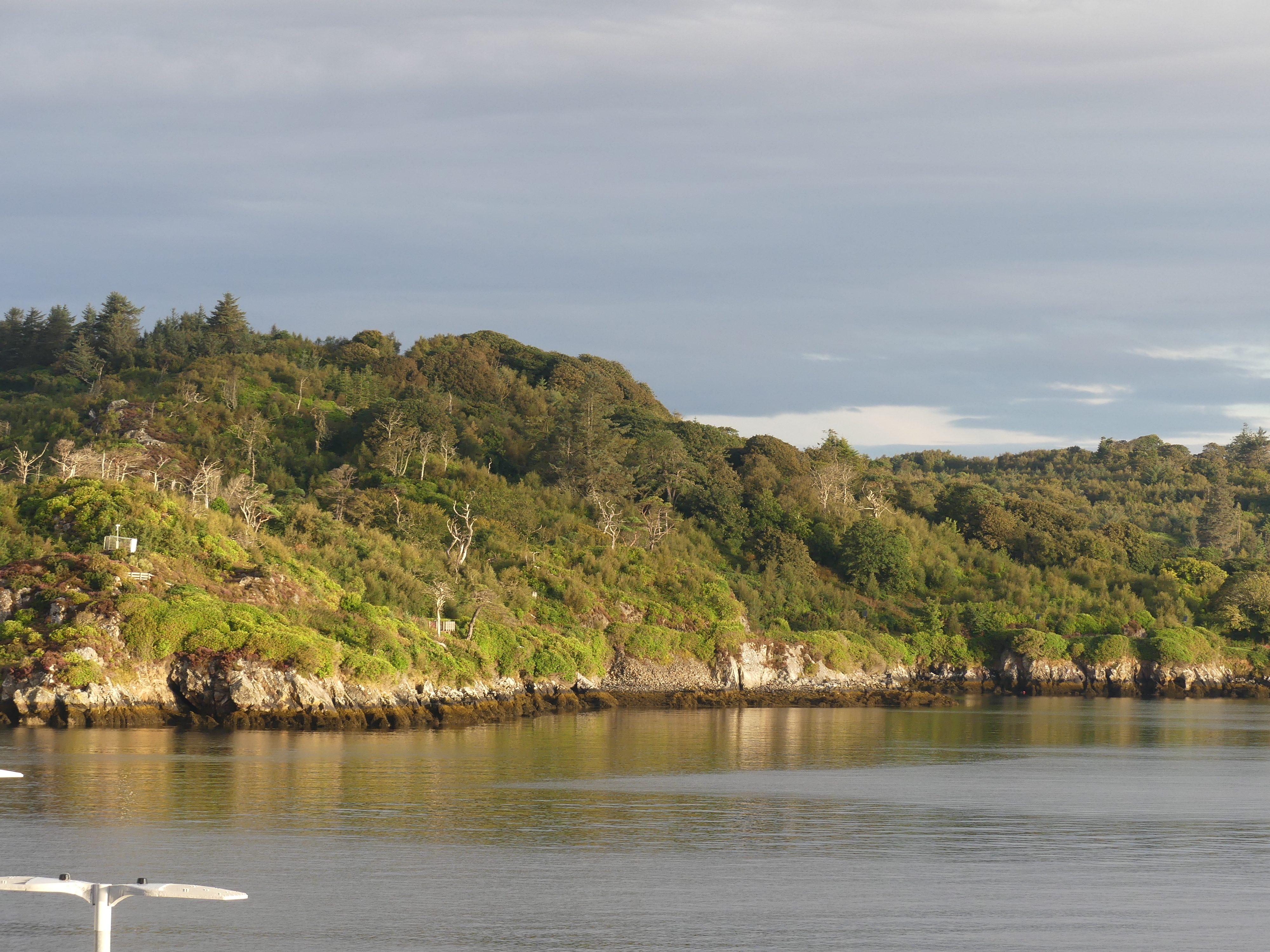
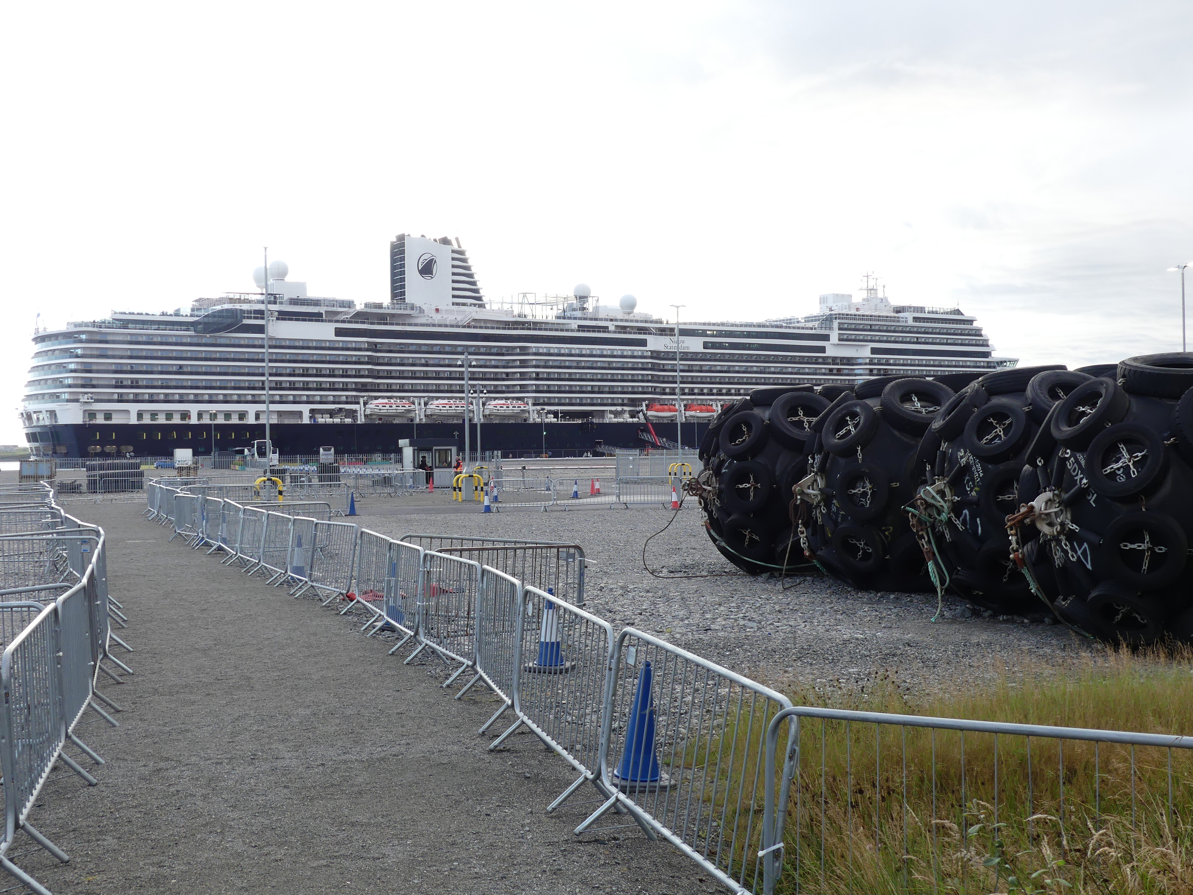
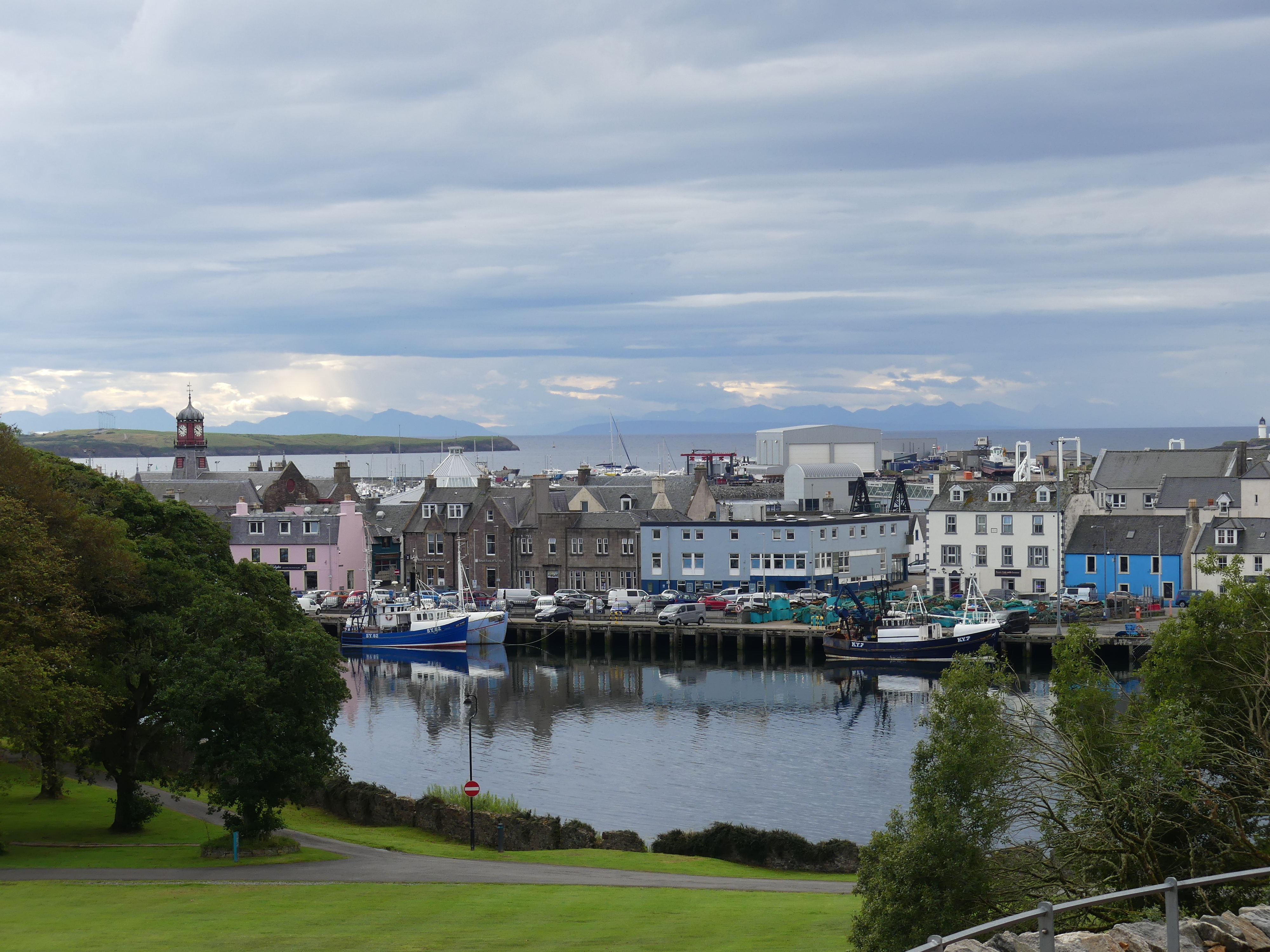
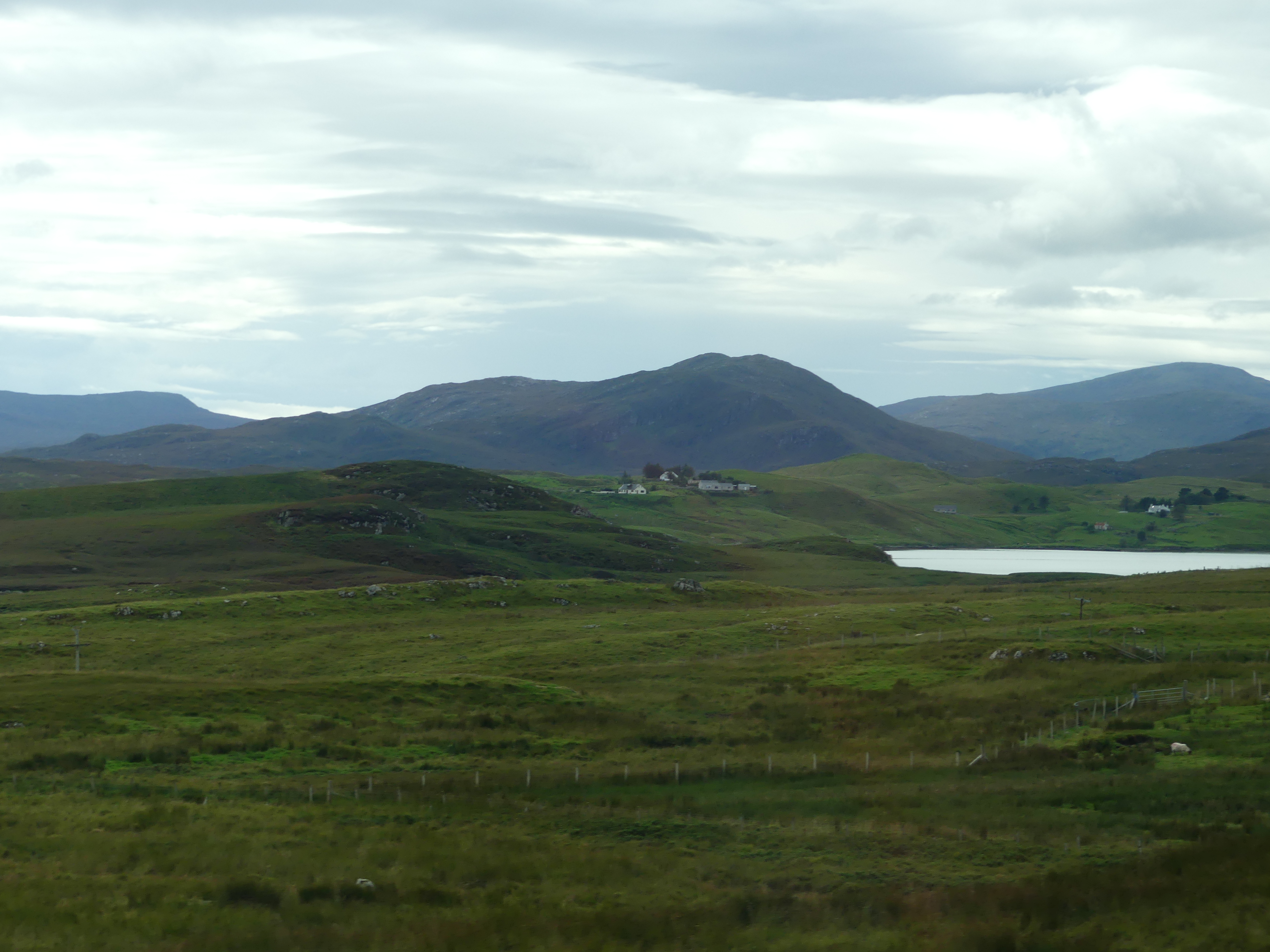
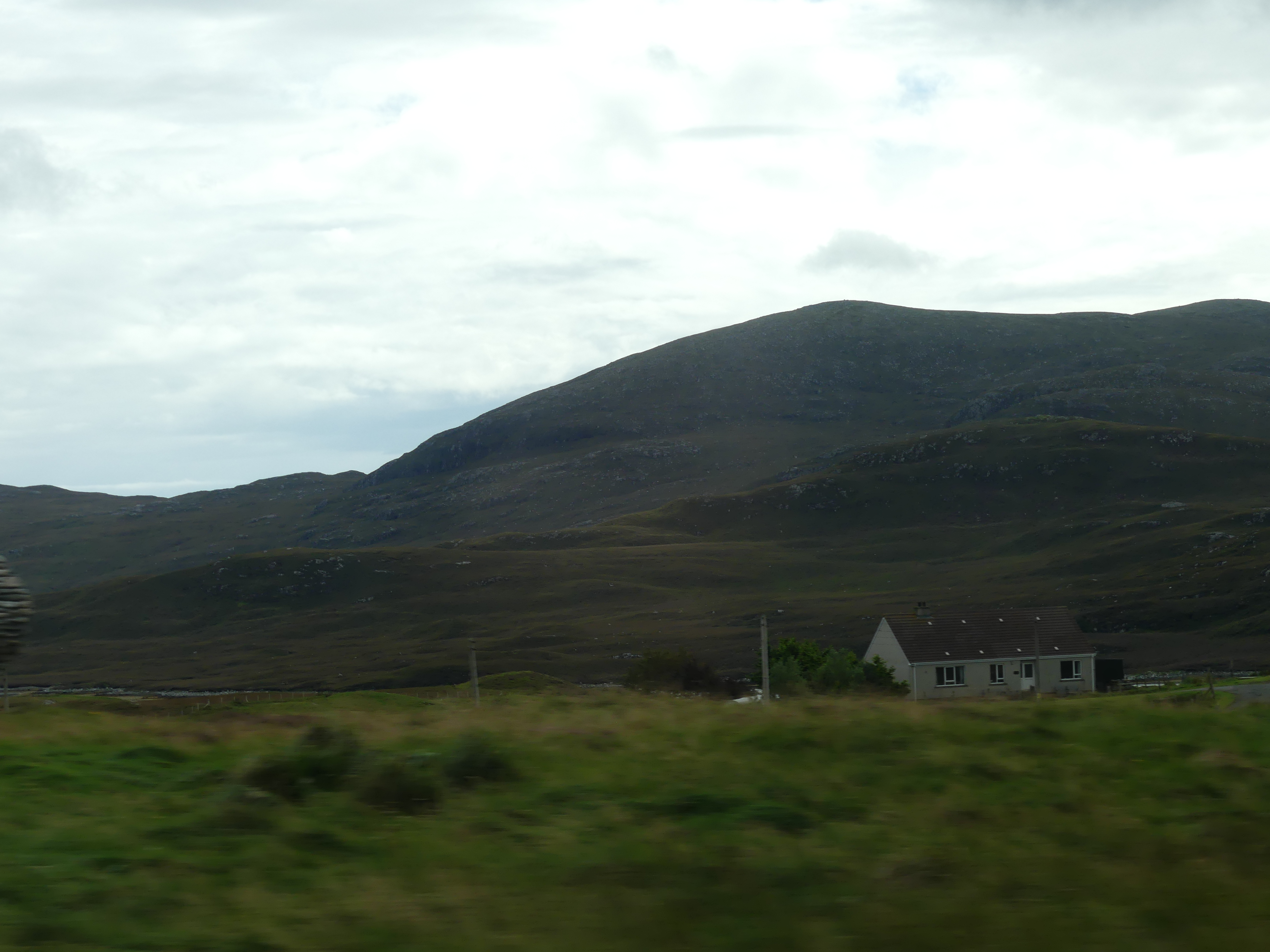
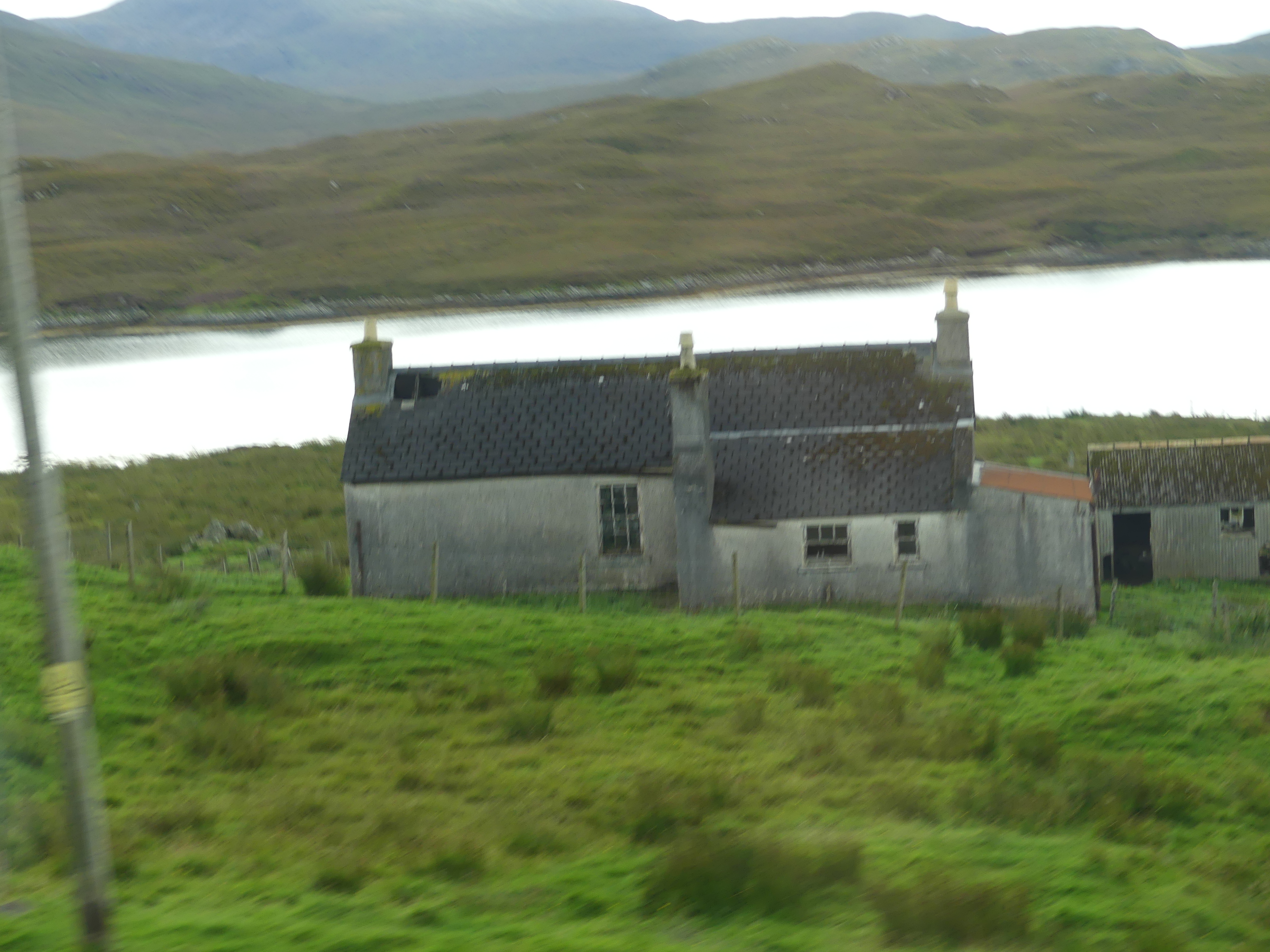
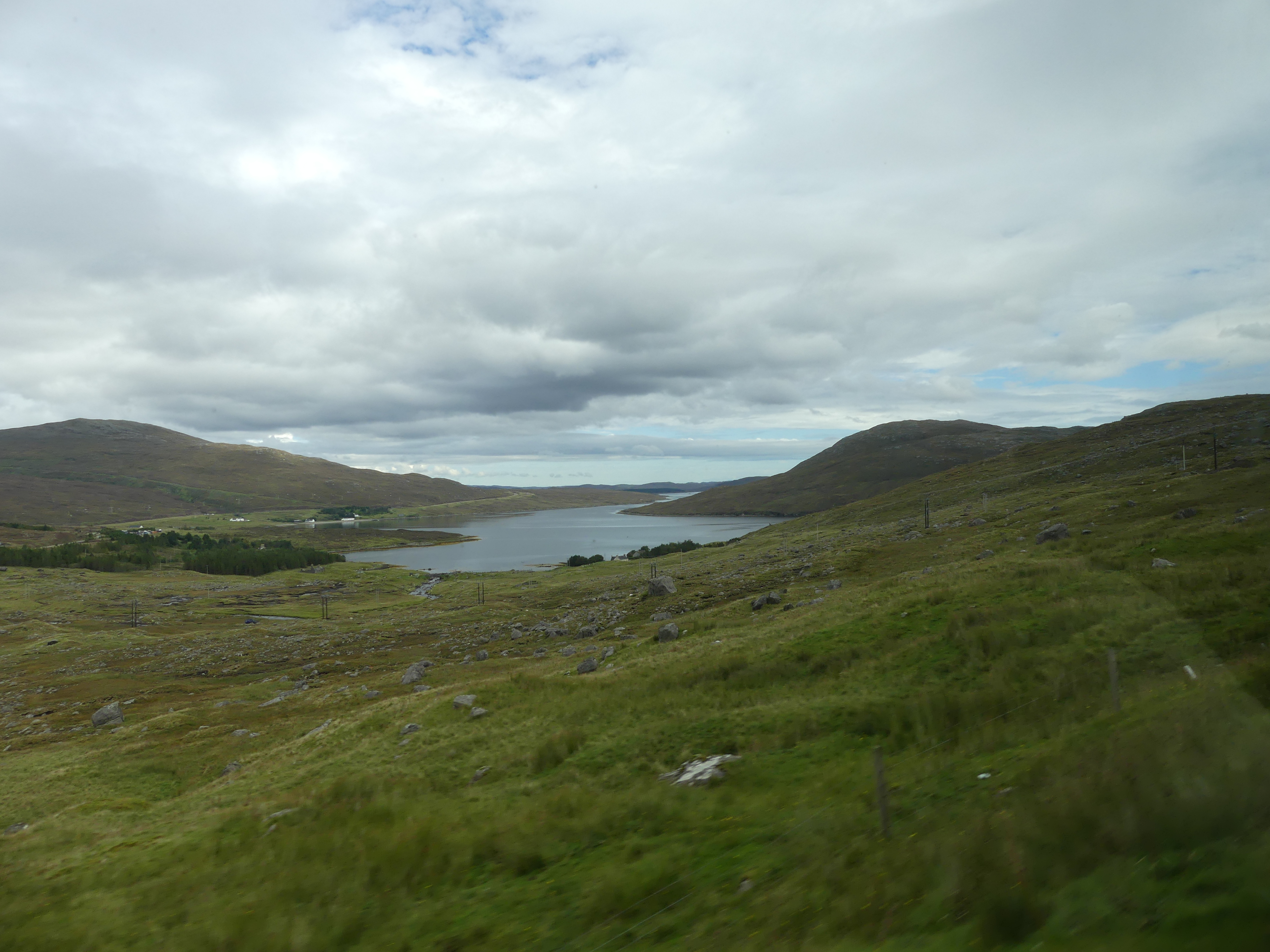
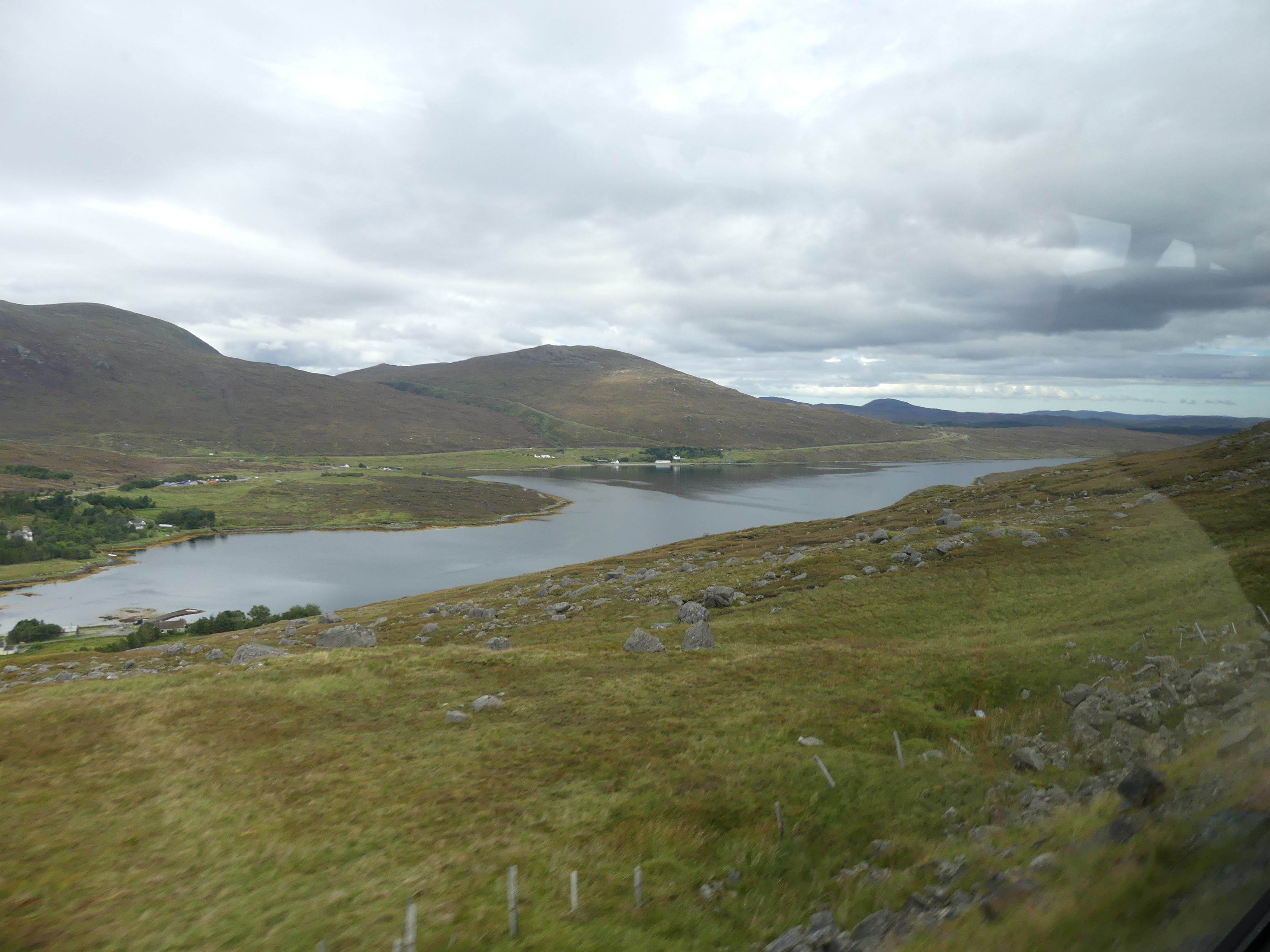
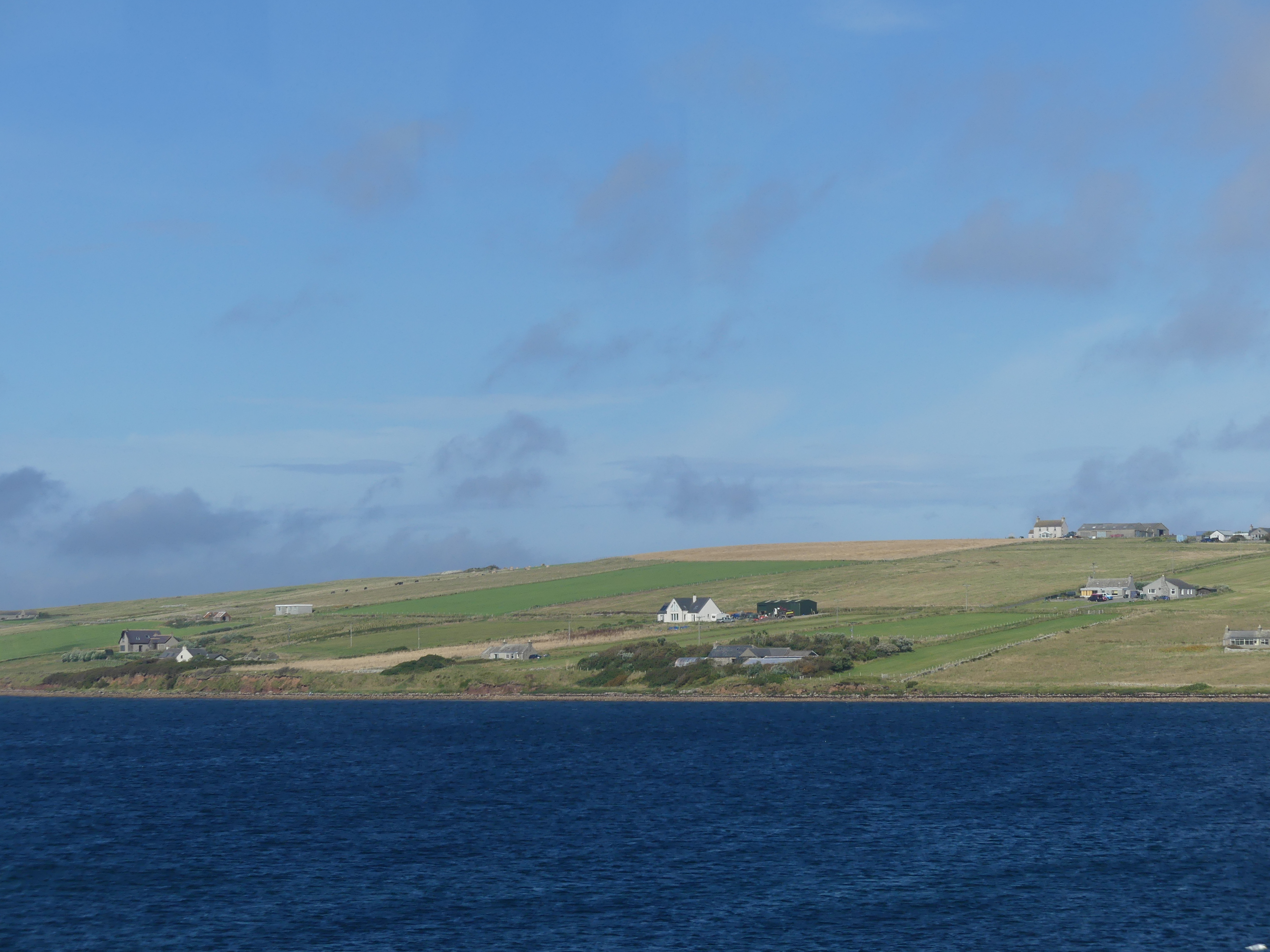
When we awoke we were met by an austere vision of what we might expect in Stornoway. I have added the tourists Map of Stornoway which will make sense of my tale of exploration. The first photo is the barren “Deepwater terminal”. The absense of residences and human activity had us puzzled.
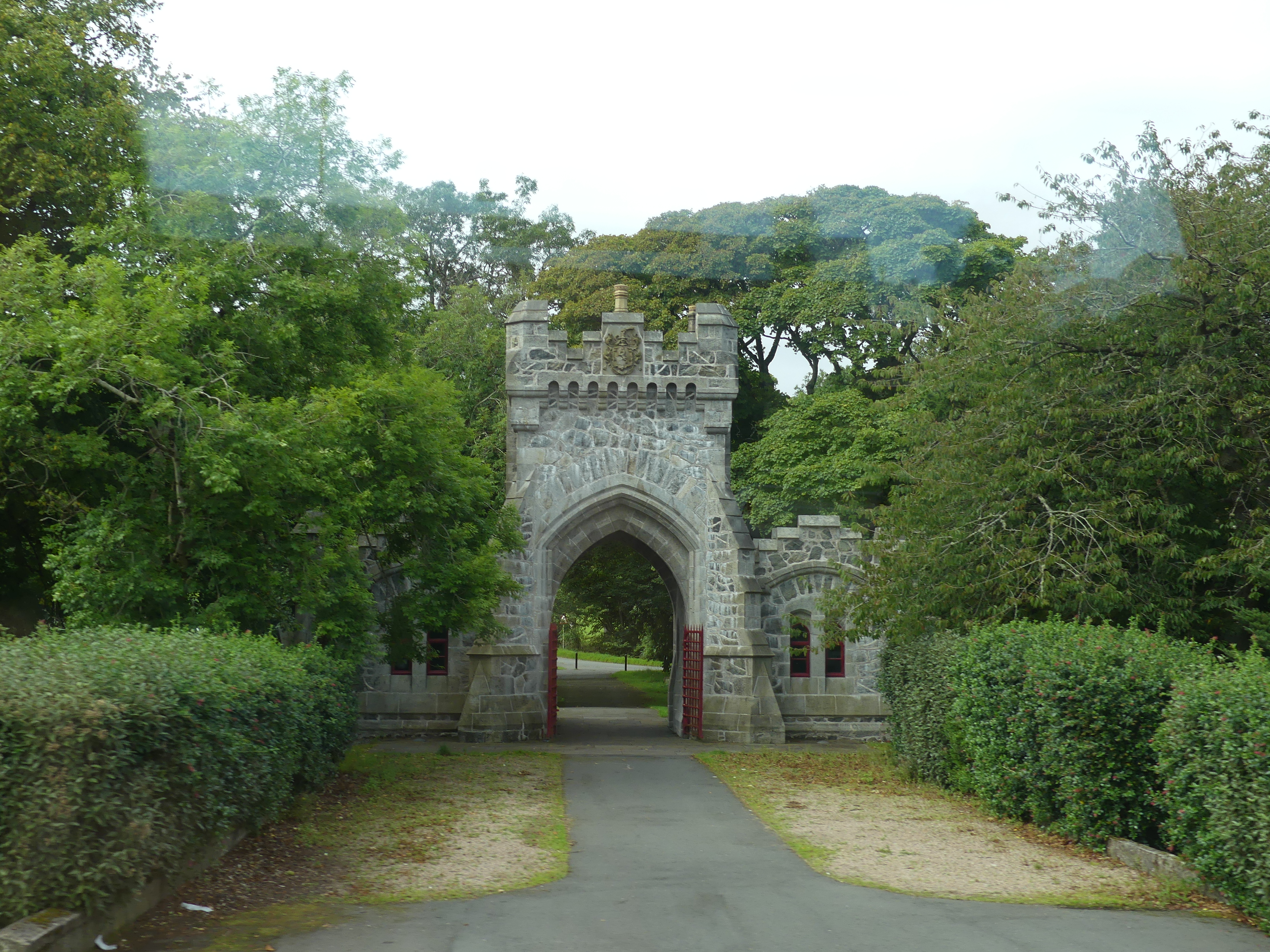
Map 1 shows the location of the terminal at which we had docked. At that time by means of gossip amongst the passengers, we learned that there was a path to follow through the woods to reach the town or there was the shuttle bus. We elected for the path. Map 2 shows you where the path ended. We walked through Castle Lews (which was closed for a private function) into the harbour of the town.
My photos of the walk through the woods to Castle Lews and then into Stornoway follow.
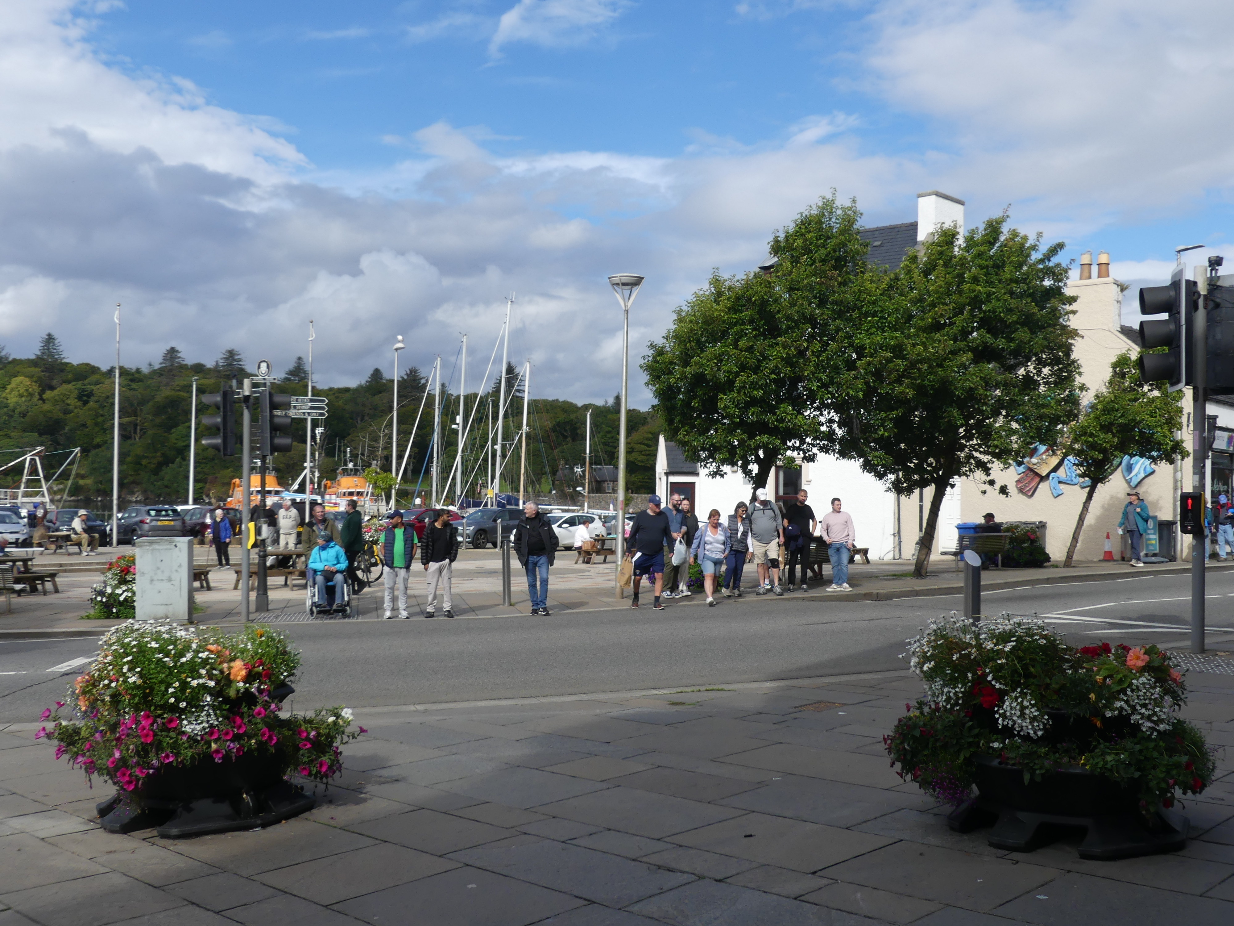
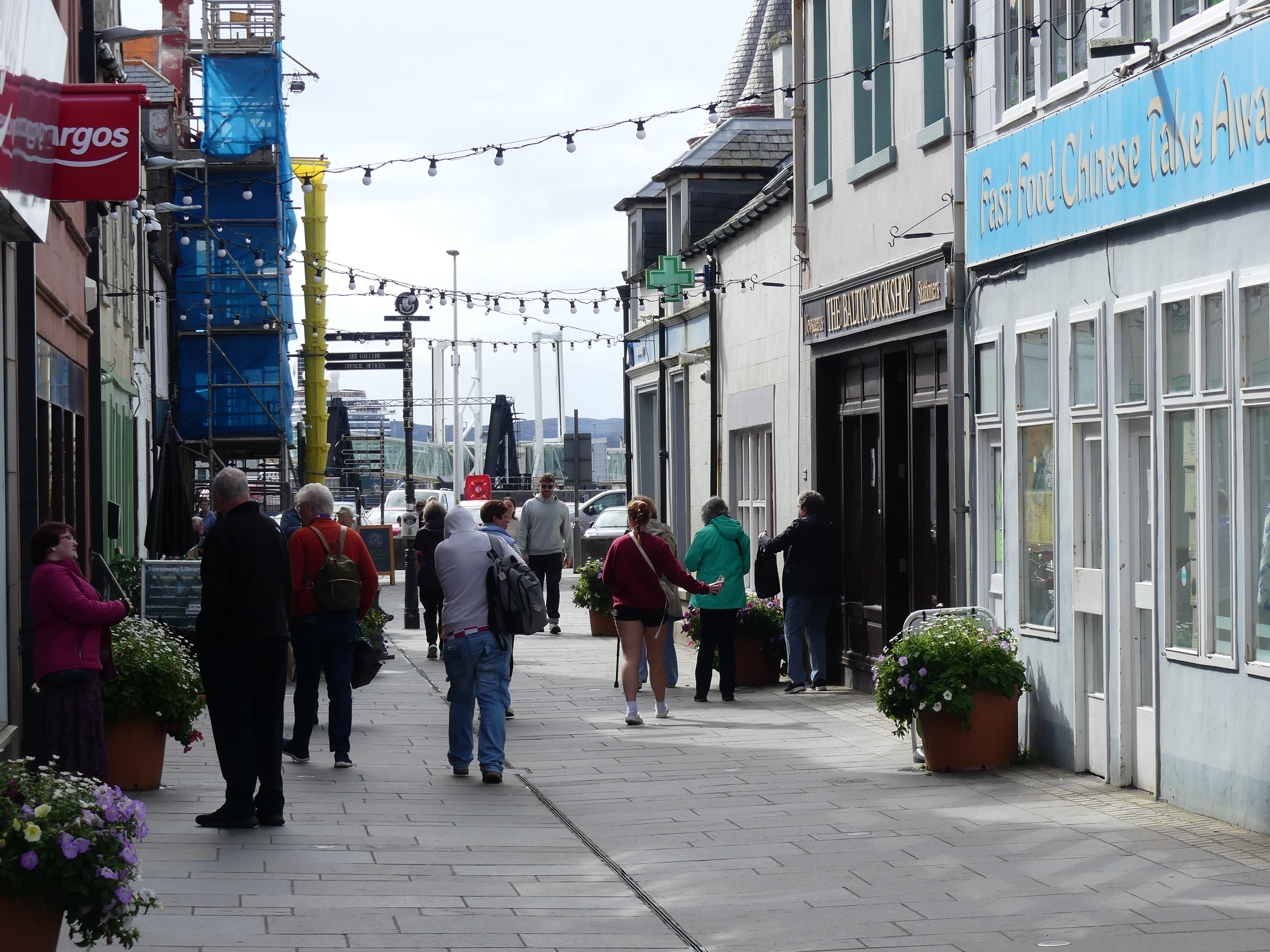
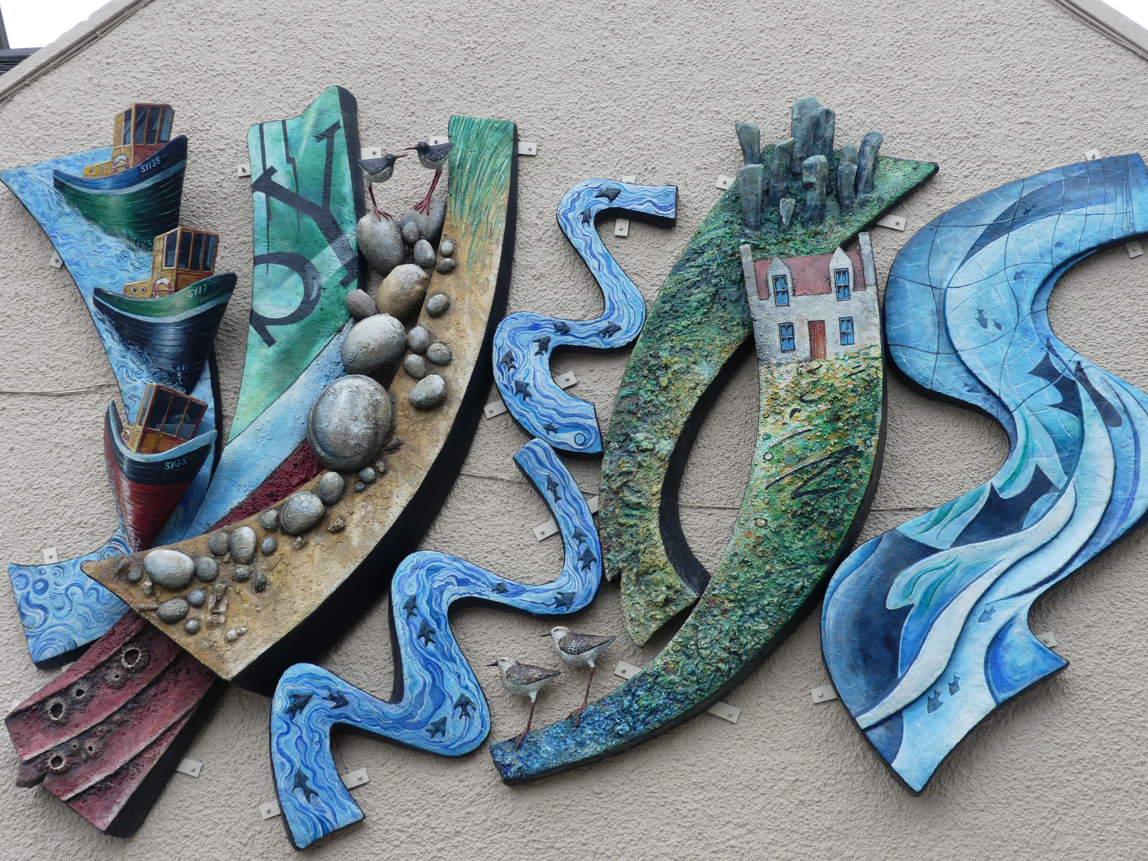
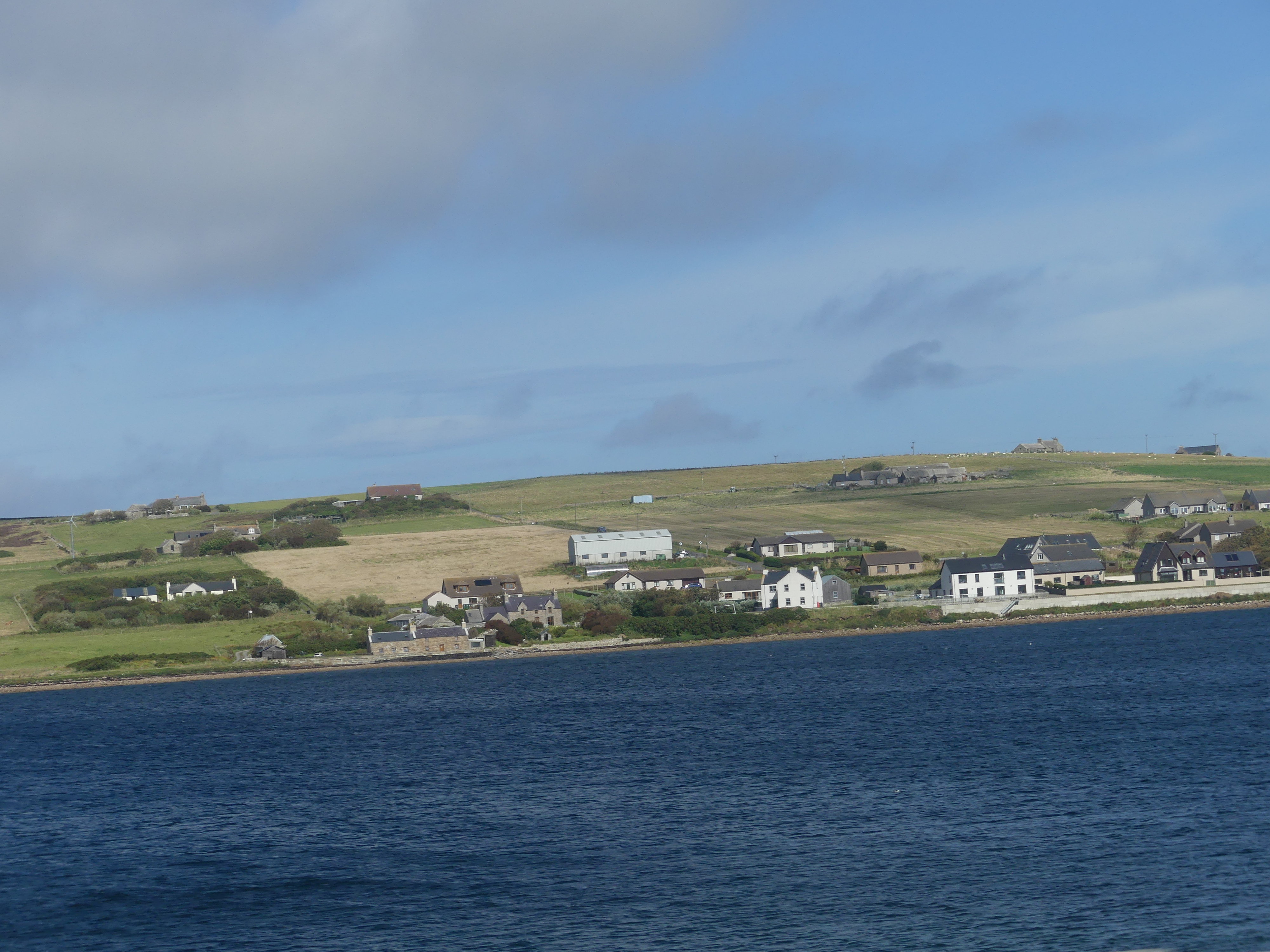
As we came to the end of the walk, we encountered people from the cruise boat visiting the castle and we became the bearers of the sad news that it was closed for a private function – glad we didn’t pay for that excursion. Crossing the bridge to enter the town we encountered a sculpture of a chessman one of the few Nordic reminders of the past. We strolled into town and found it to be a thriving village. With the back drop of the harbour and the Castle over the inlet it was romantic to walk the waterfront then head into the main street.
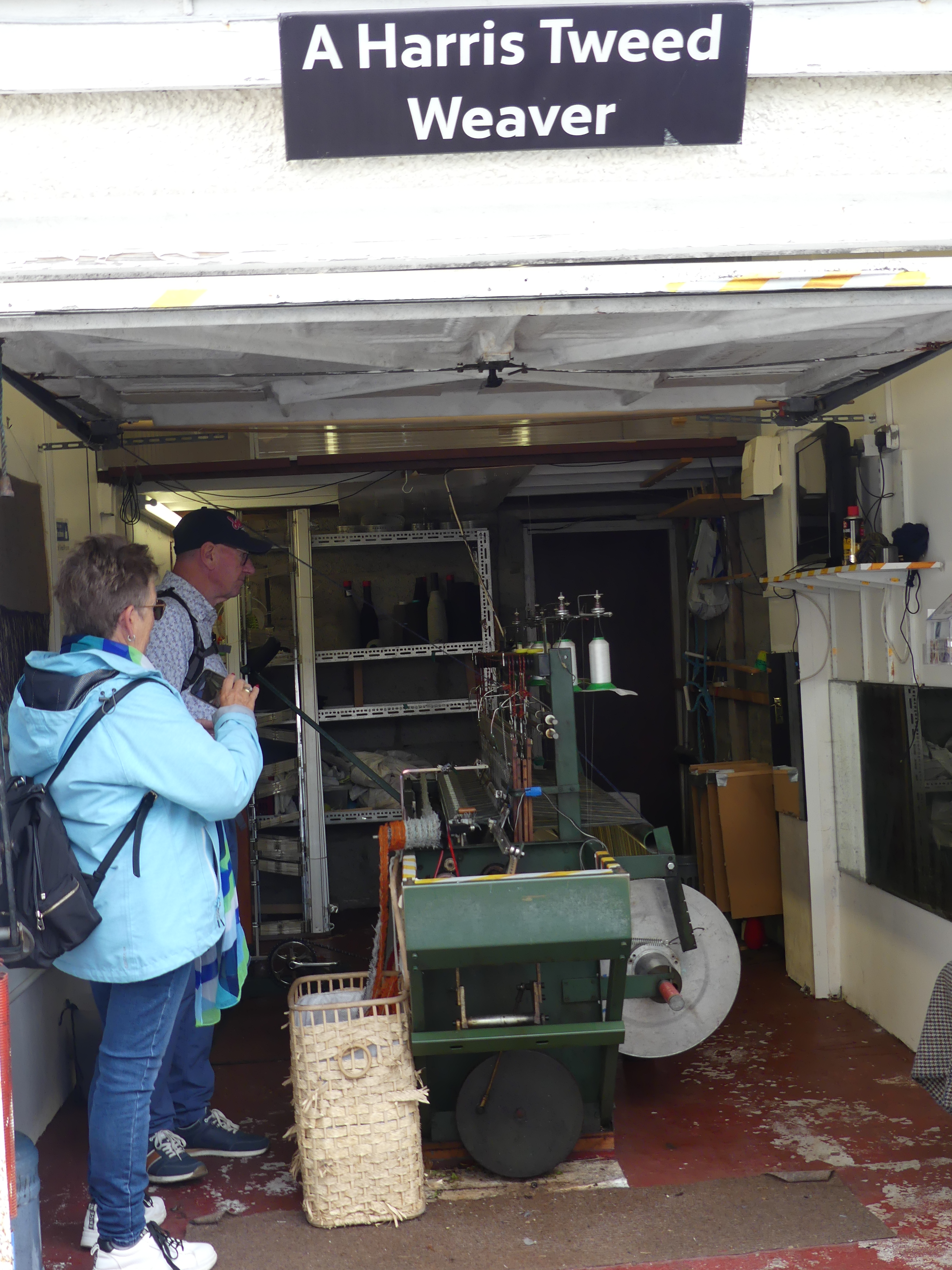
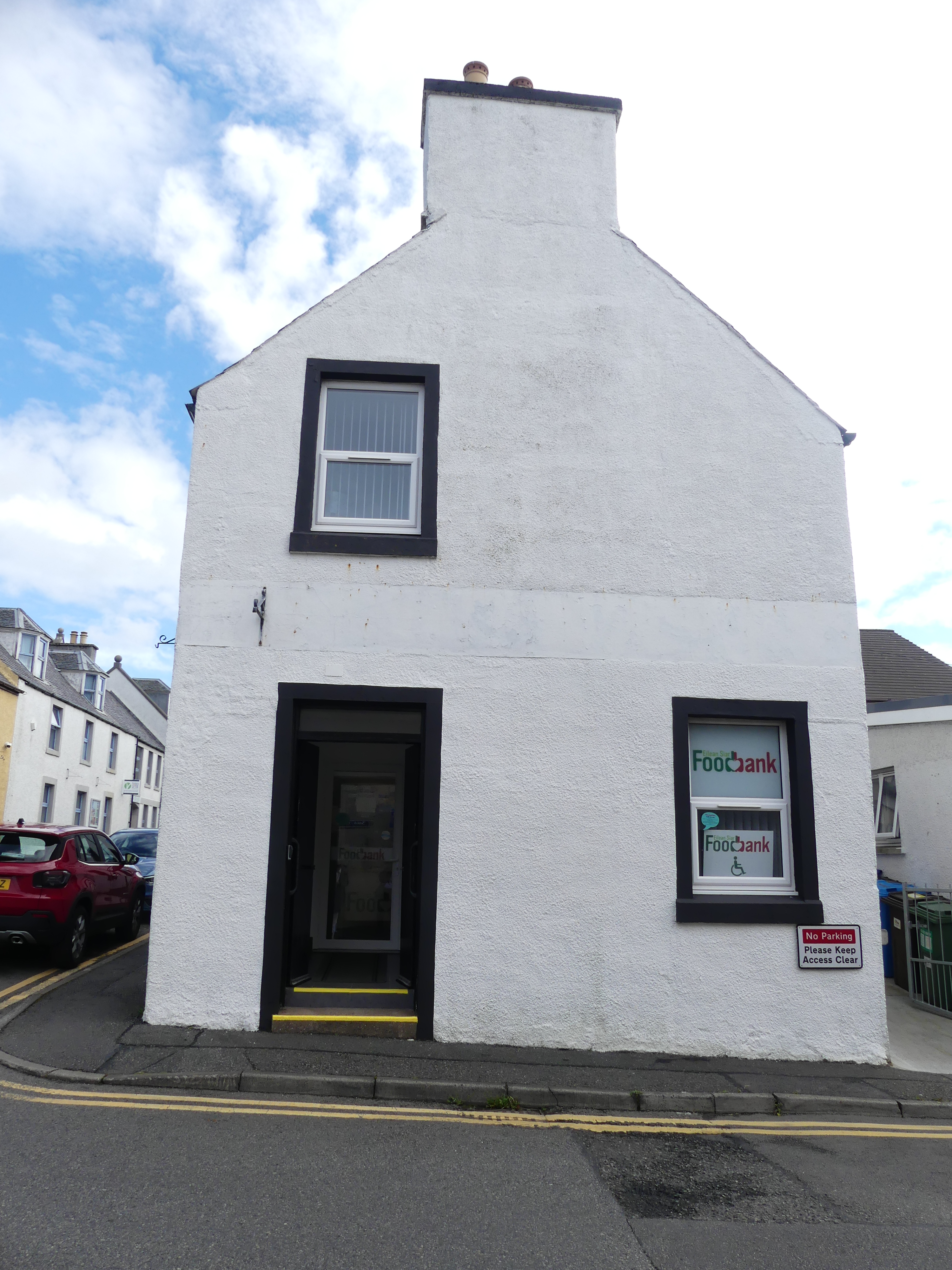
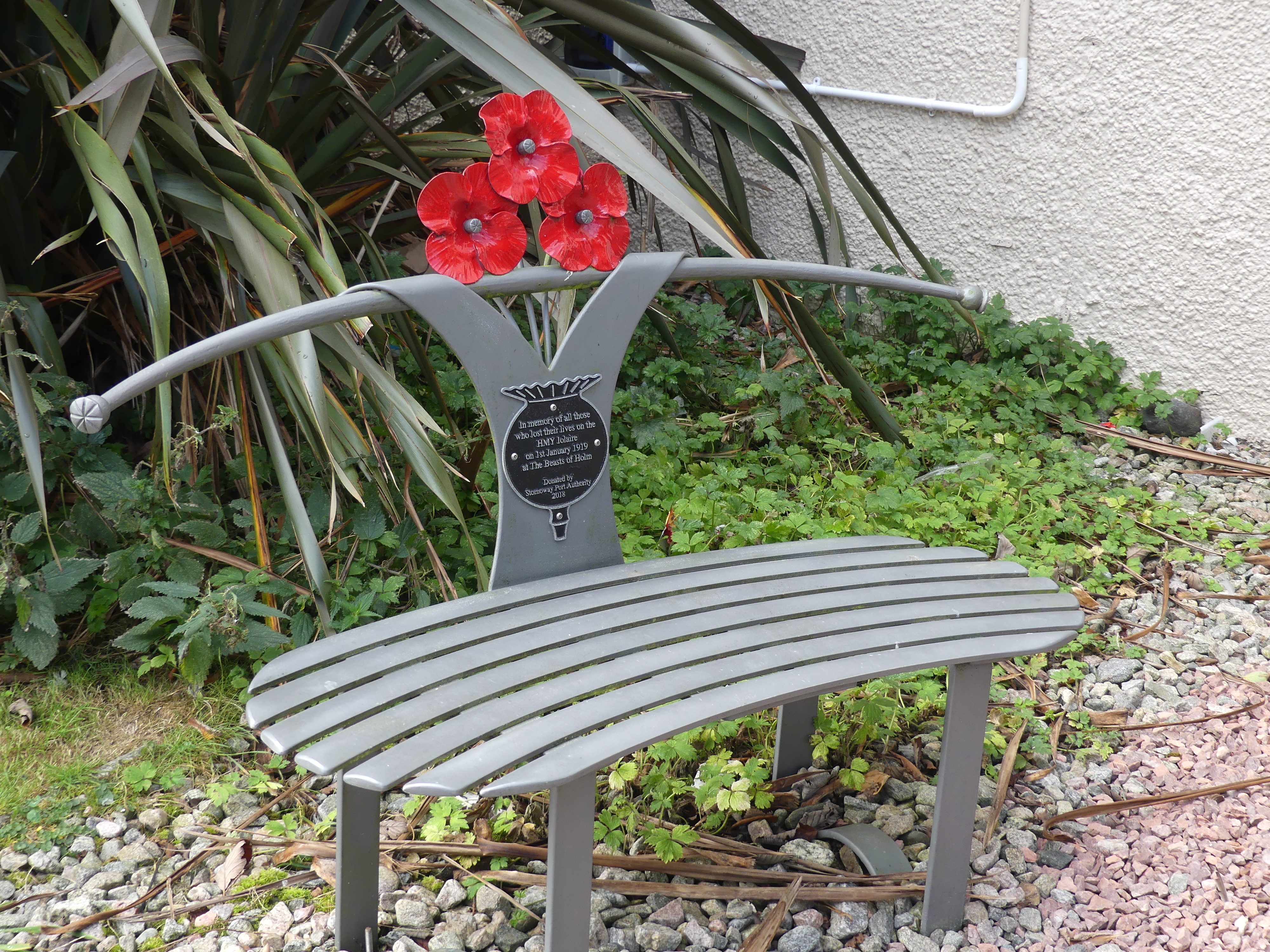
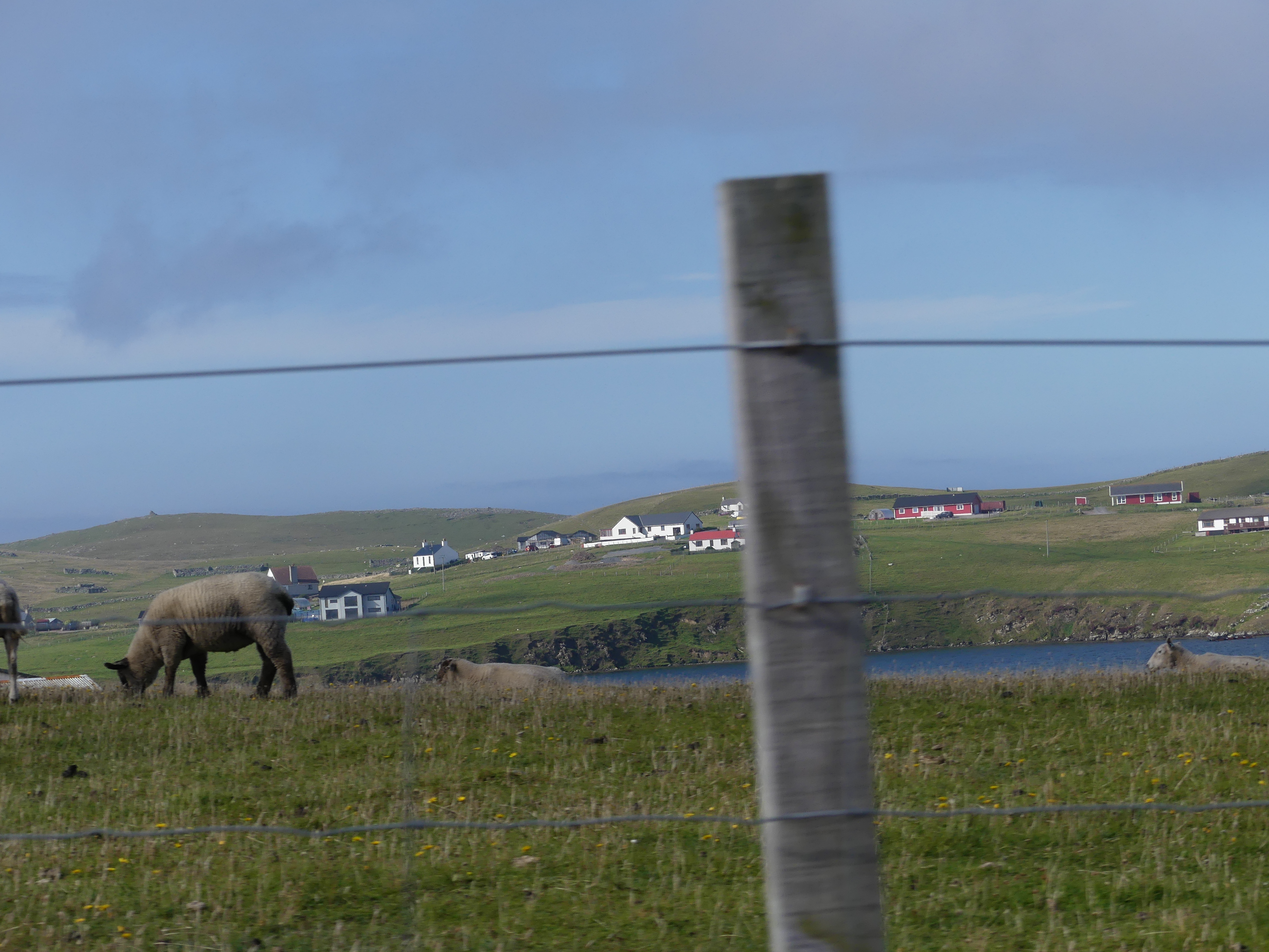
We moved into some of the semi-residential areas just on the edge of the town and discocered tha Harris Tweed weaver working in his shed (former garage attached to his house – not really a throw back to the shed outside the croft). And we found a reminder of home – the Foodbank office (Rotary obtains prepared meals for its Community Table in our Senior Citizens Hall kitchen with the meals being provided by FareShare at Morningside heated, packed and delivered by Rotary Brisbane South-East). We also found a memorial to soldiers lost in war and another stylish memorial chair as we saw in Kirkwell.
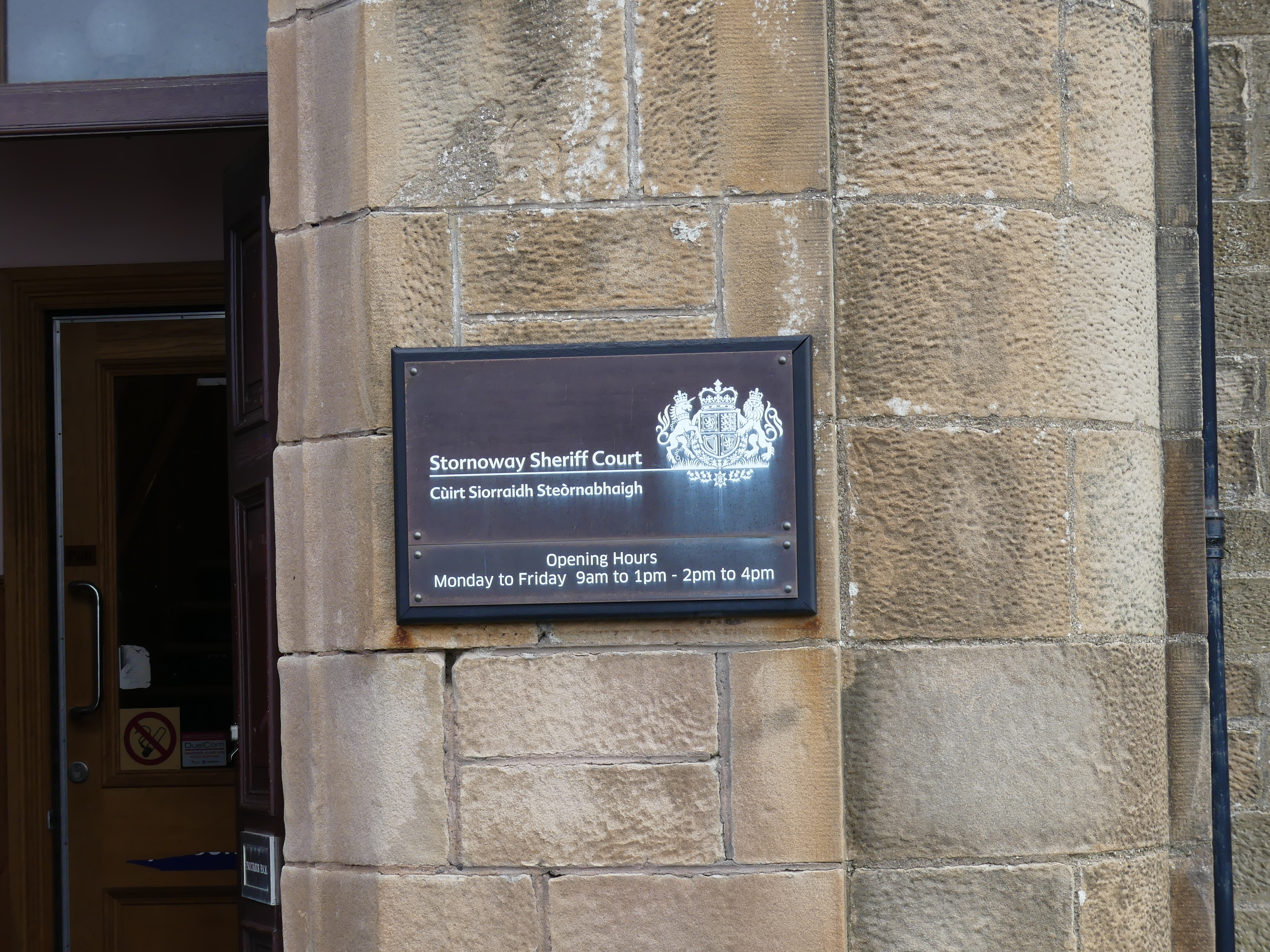
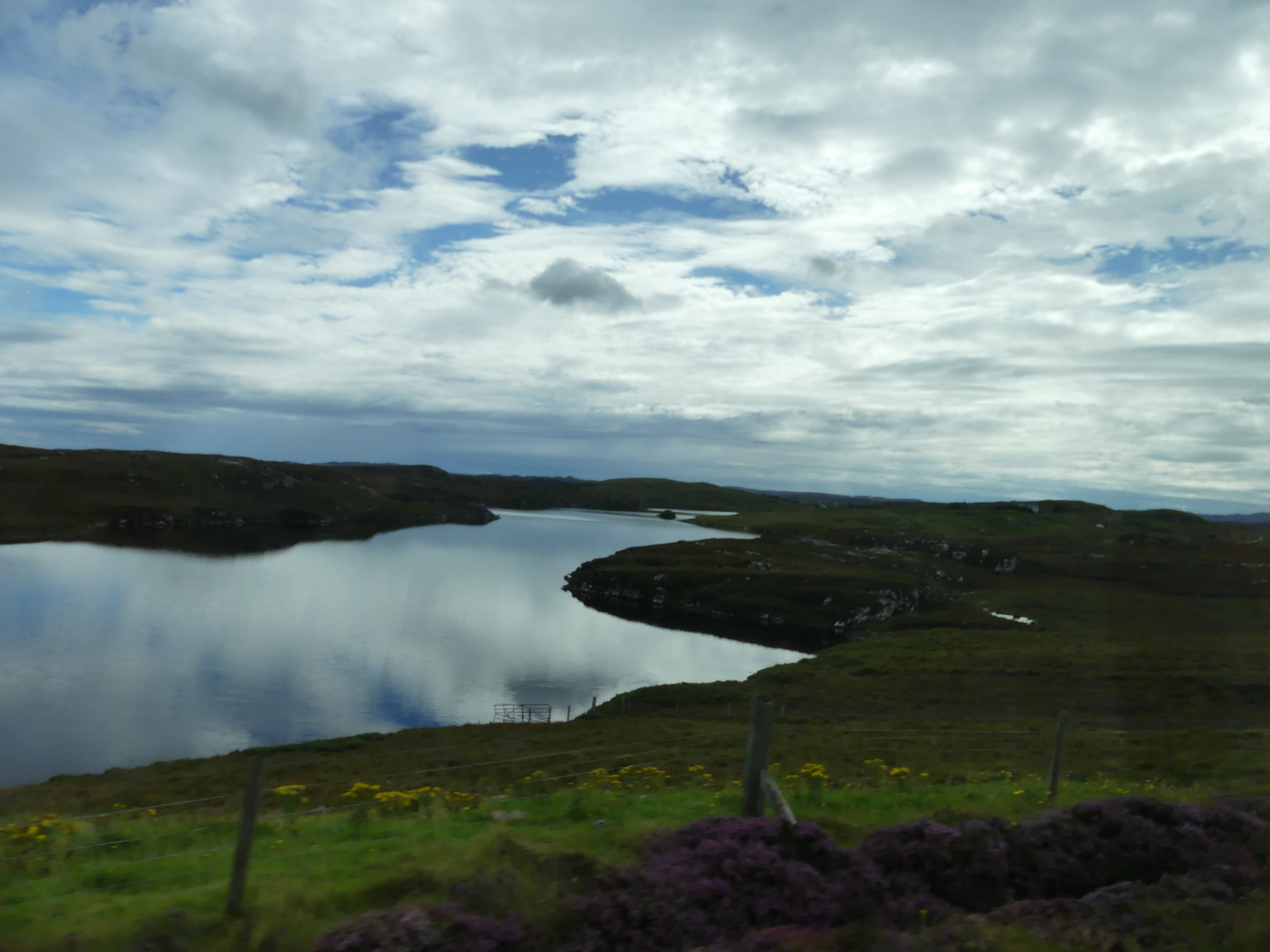
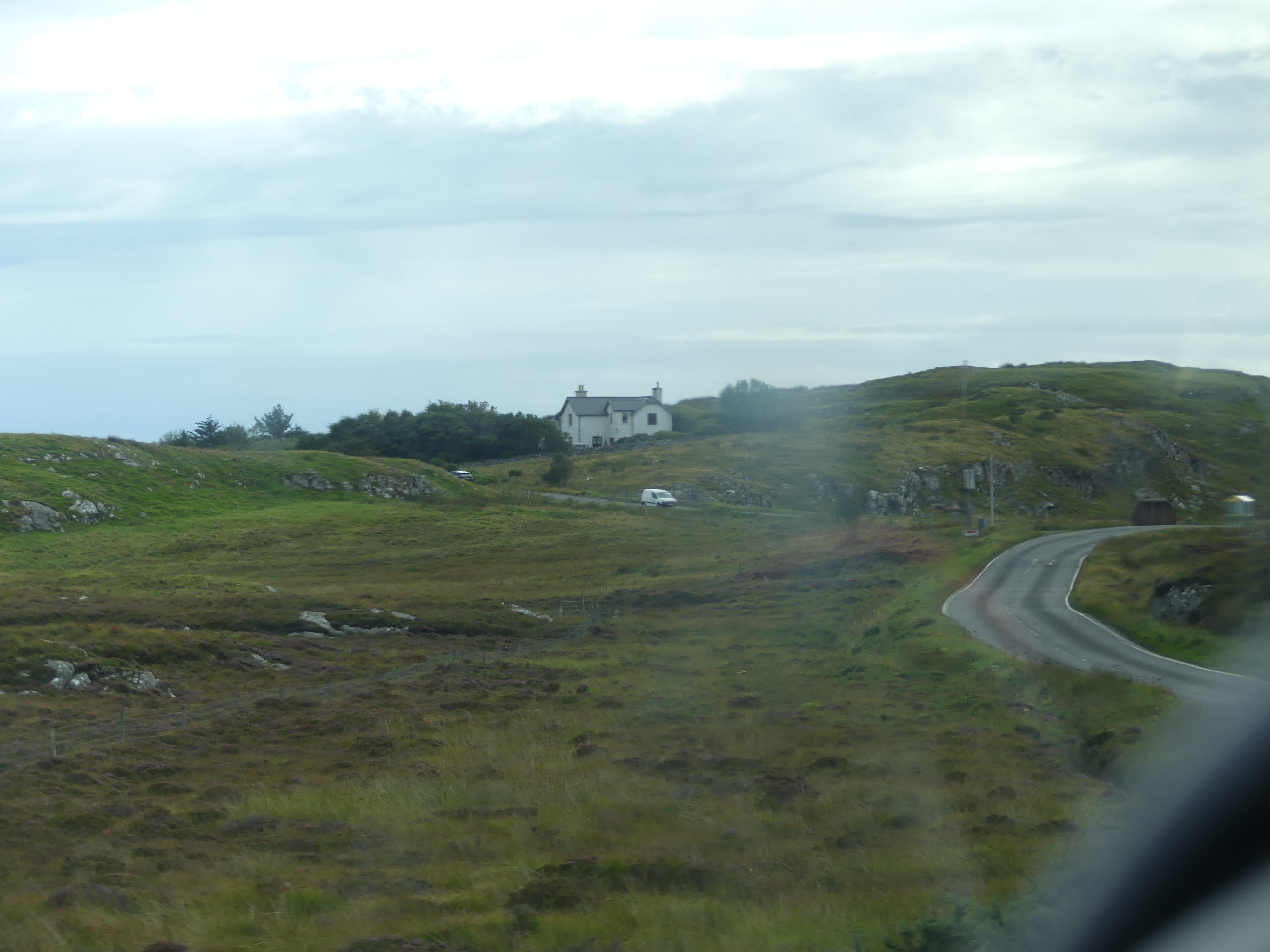
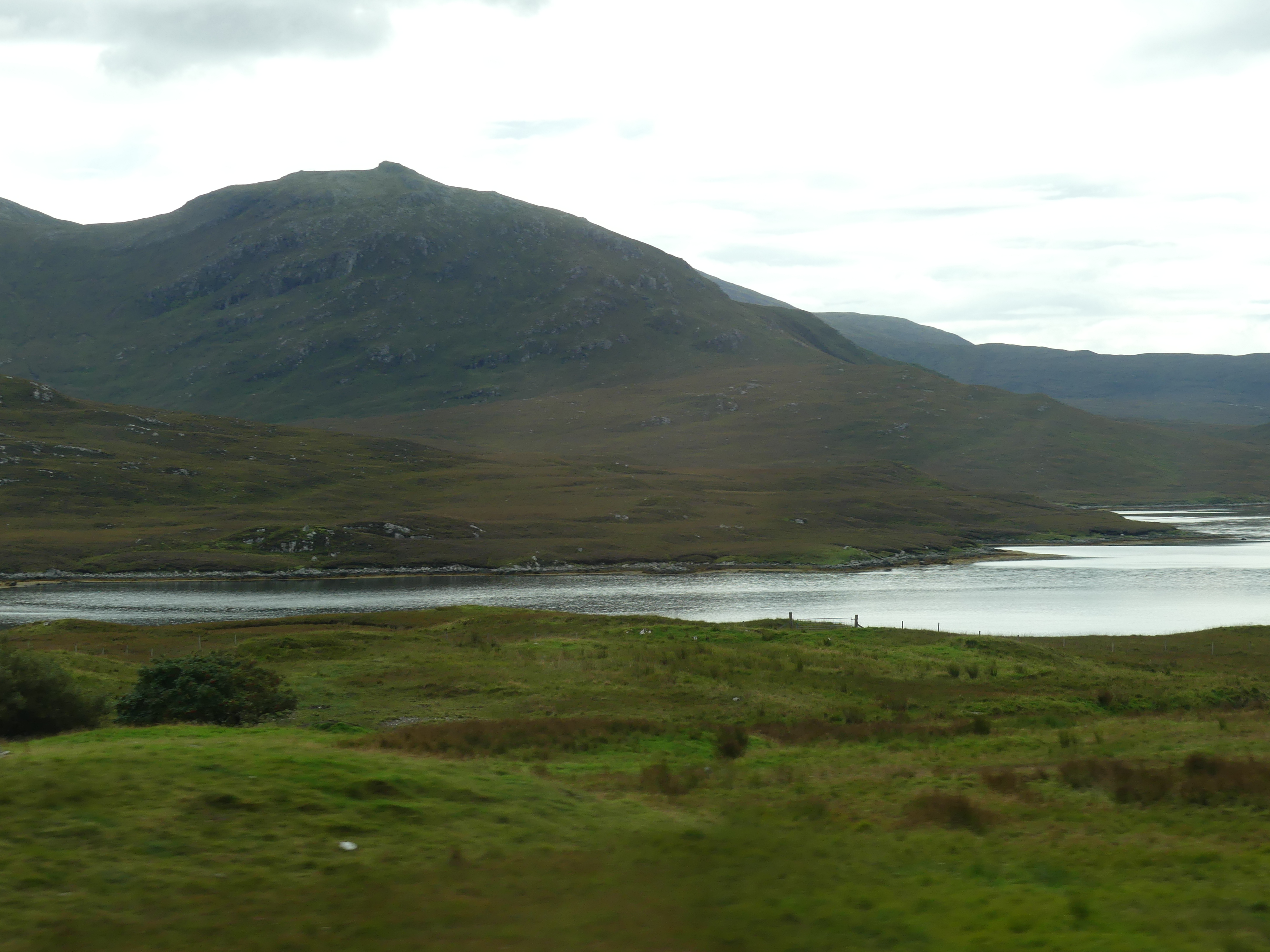
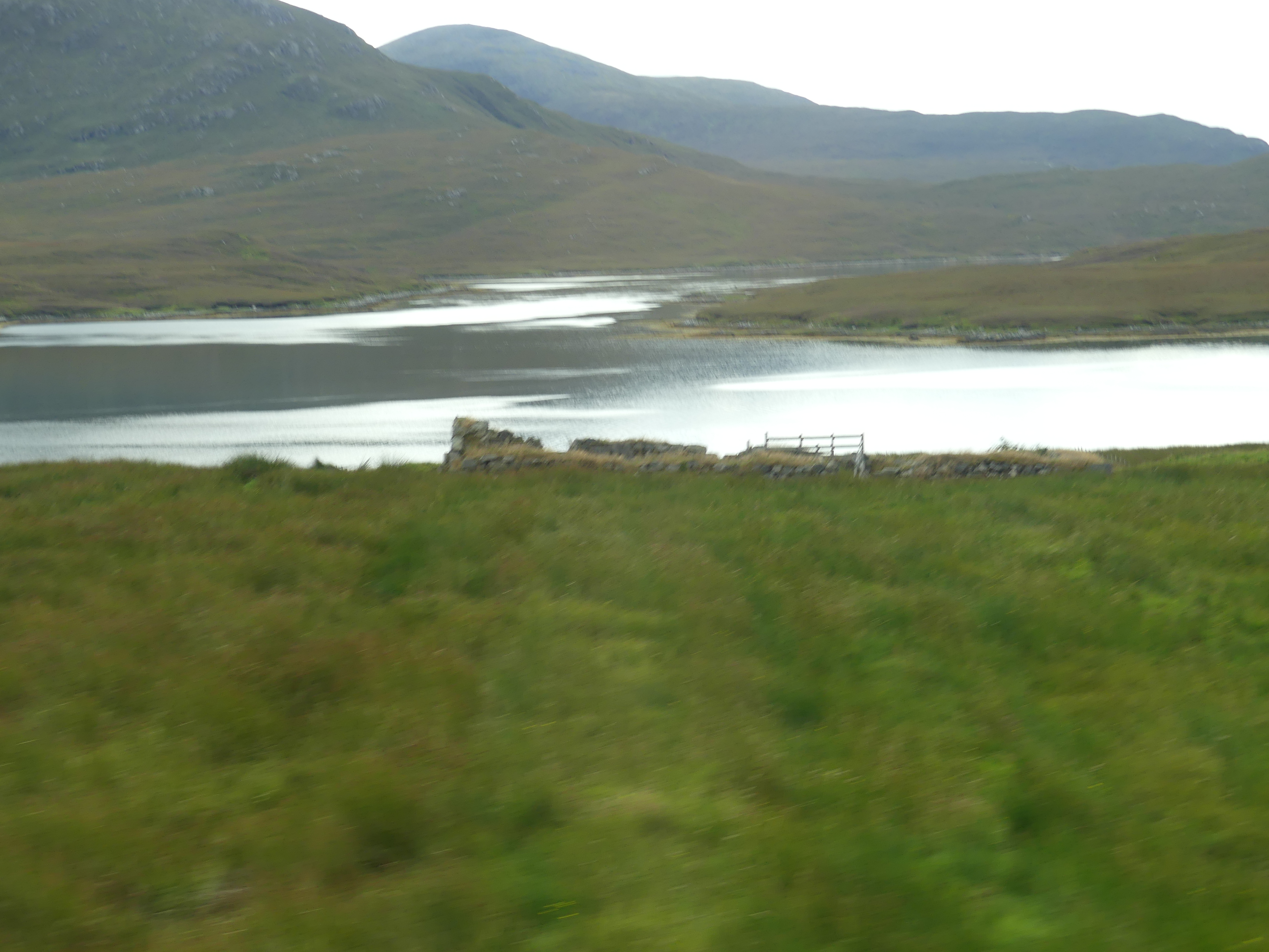
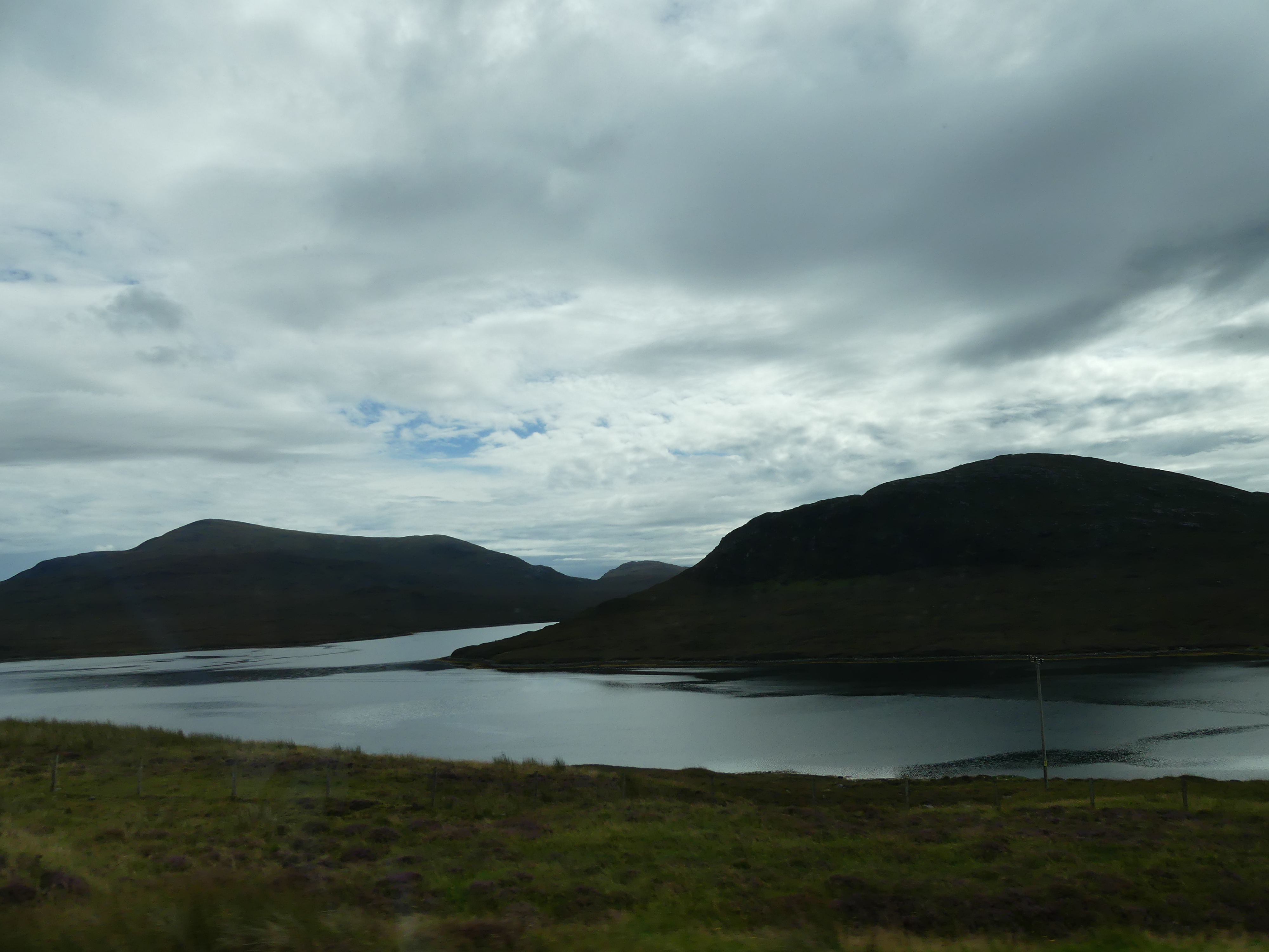
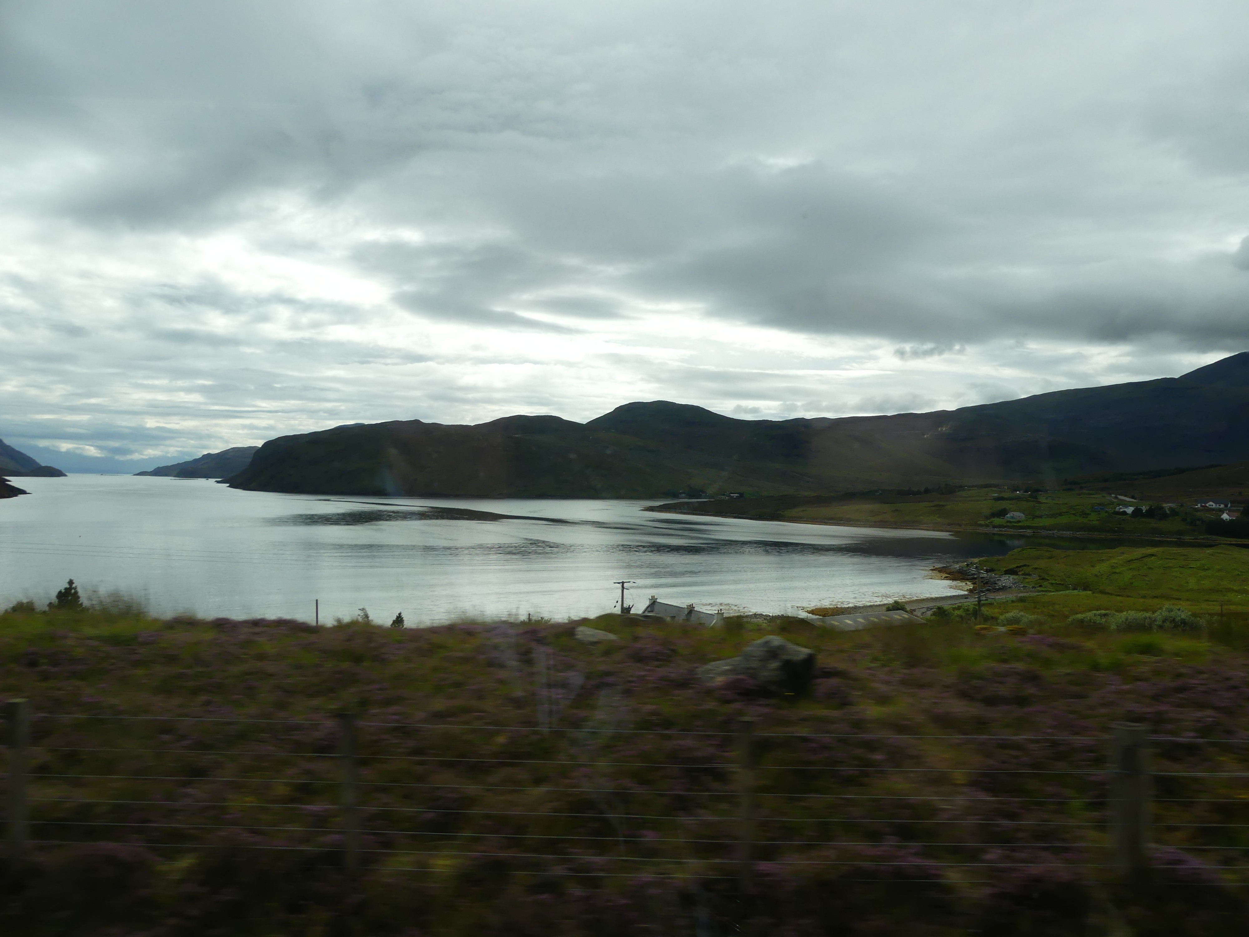
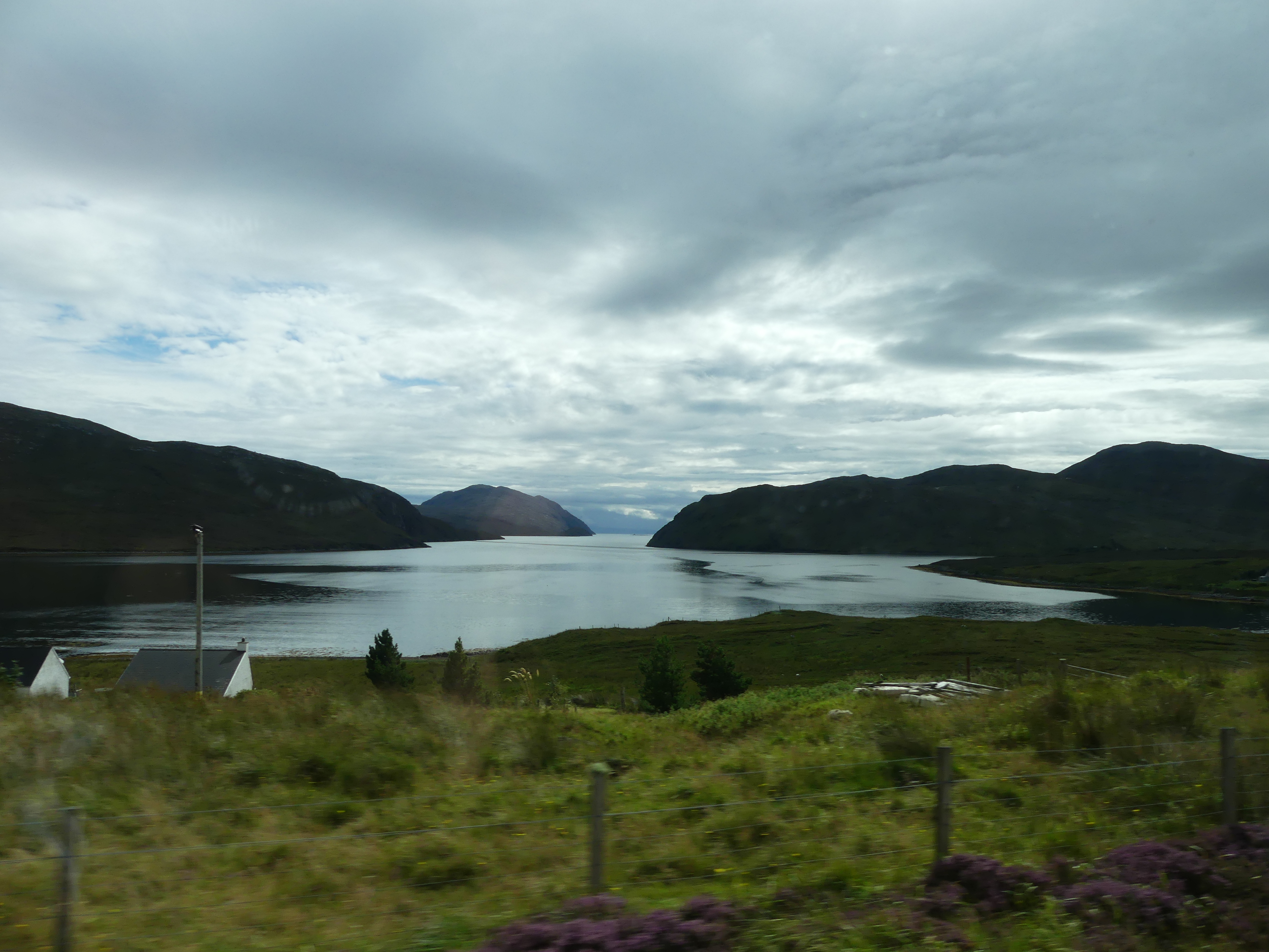
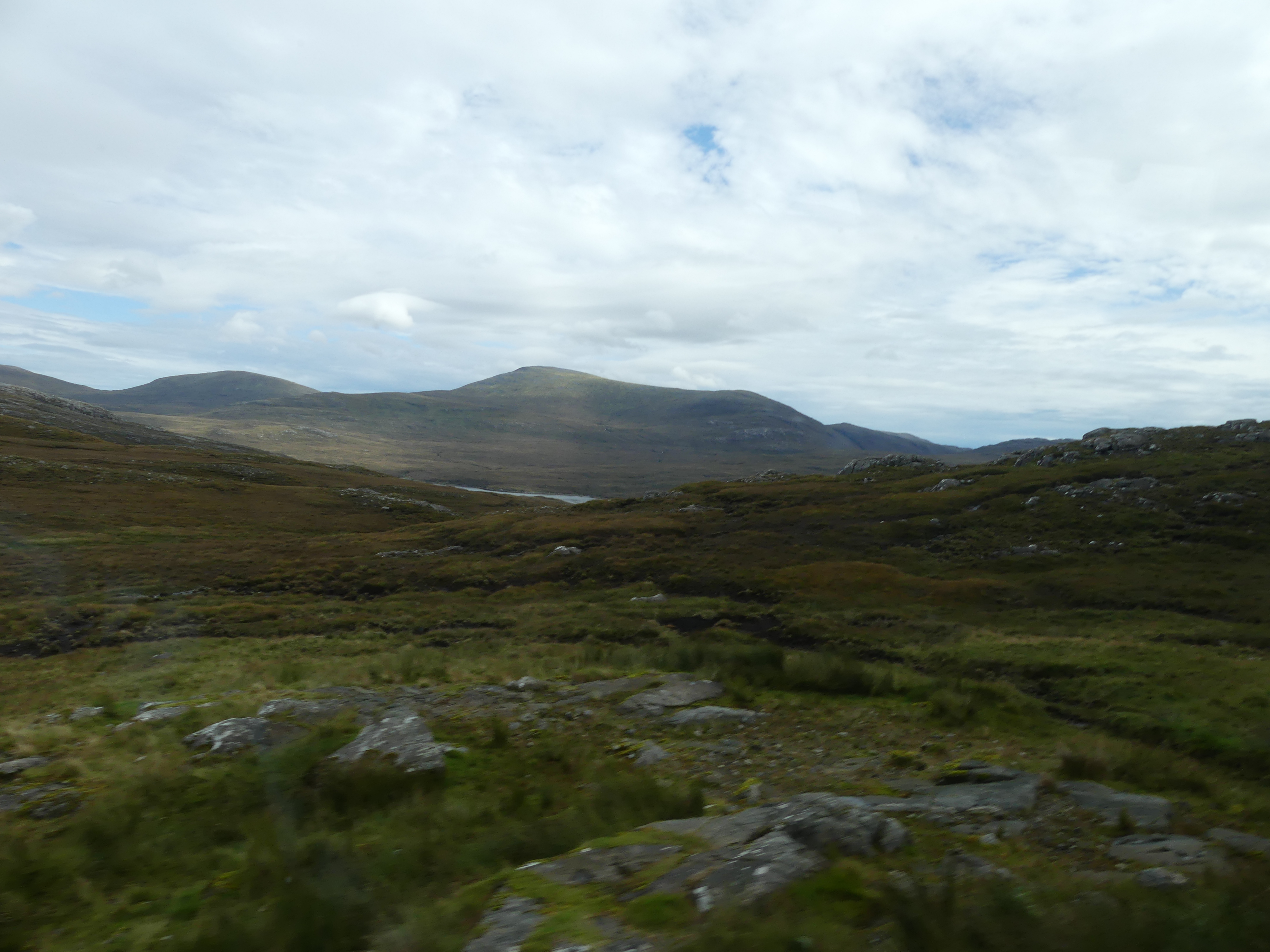
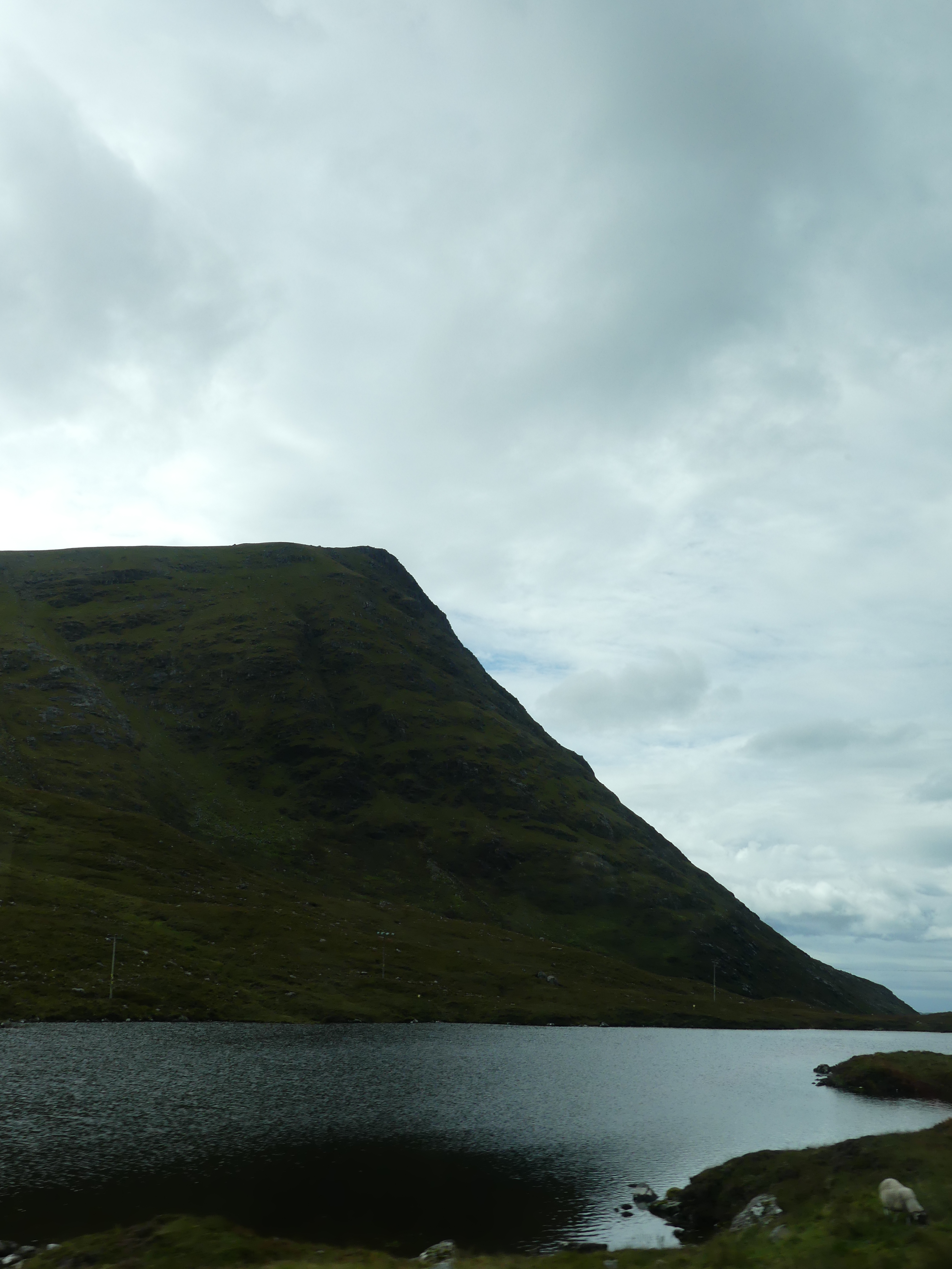
We also found the Sheriff Court and the bus station. We had decided that we would take the local bus over to the township of Harris. It was not difficult and they buses ran fairly regularly. Leaving Stornoway we passed the gate to the castle and soon we were into the countryside. Remote and wild, it took sometime to cross the island
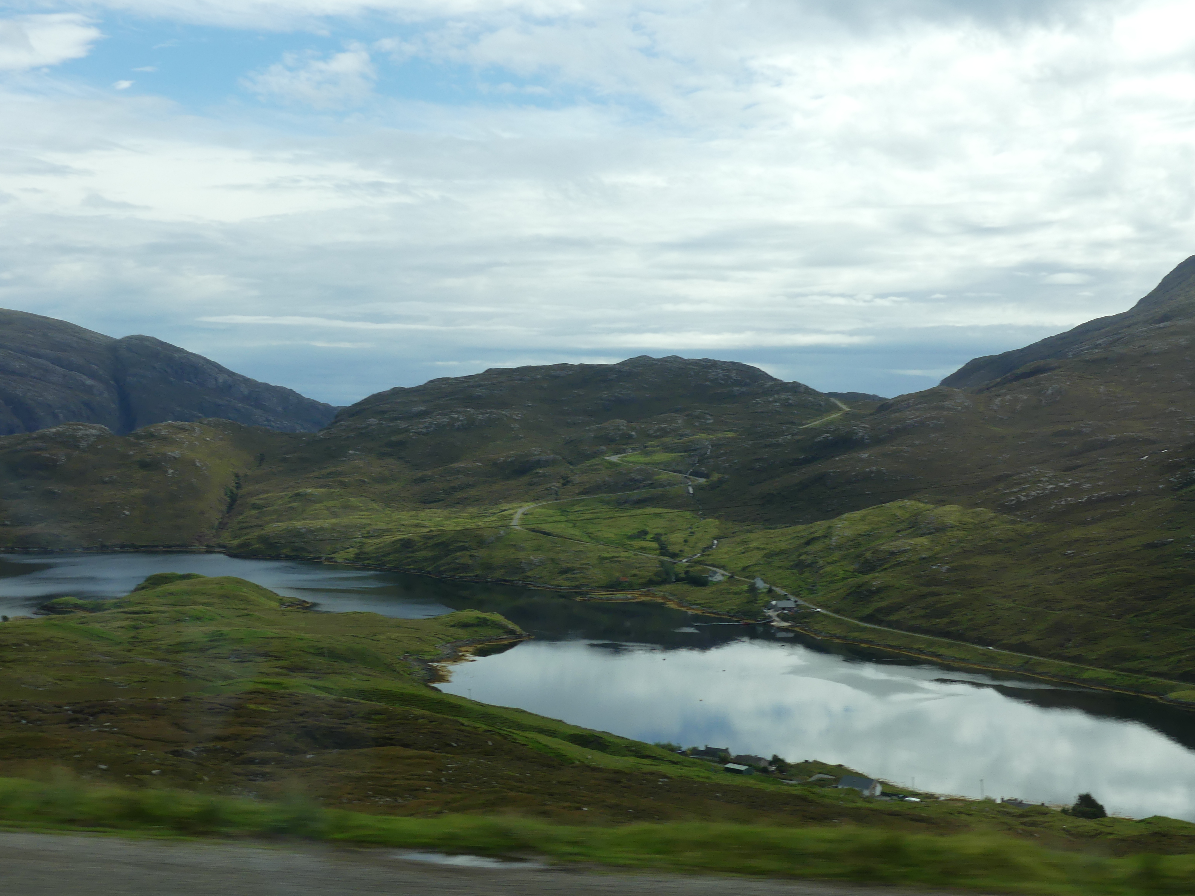
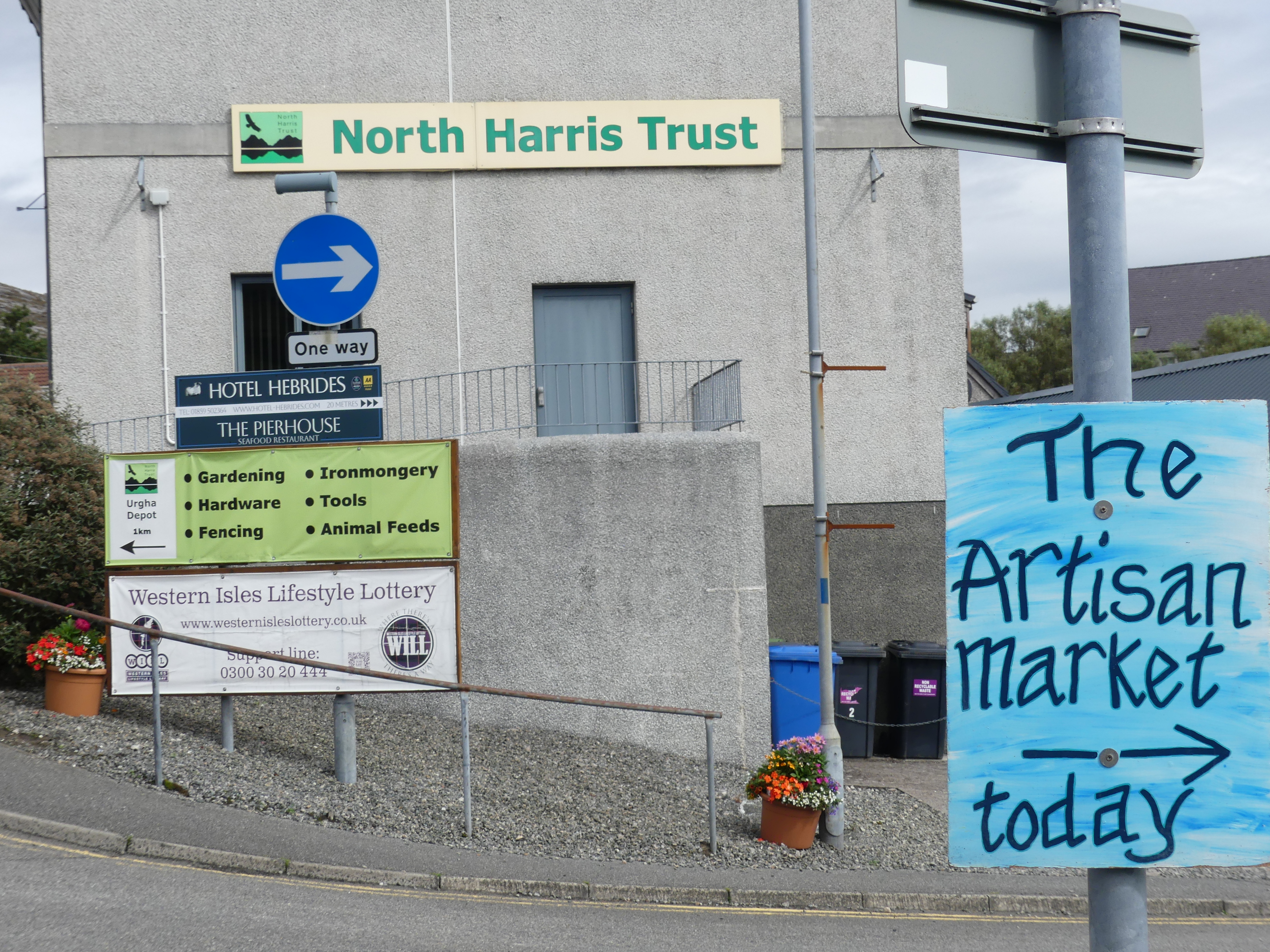
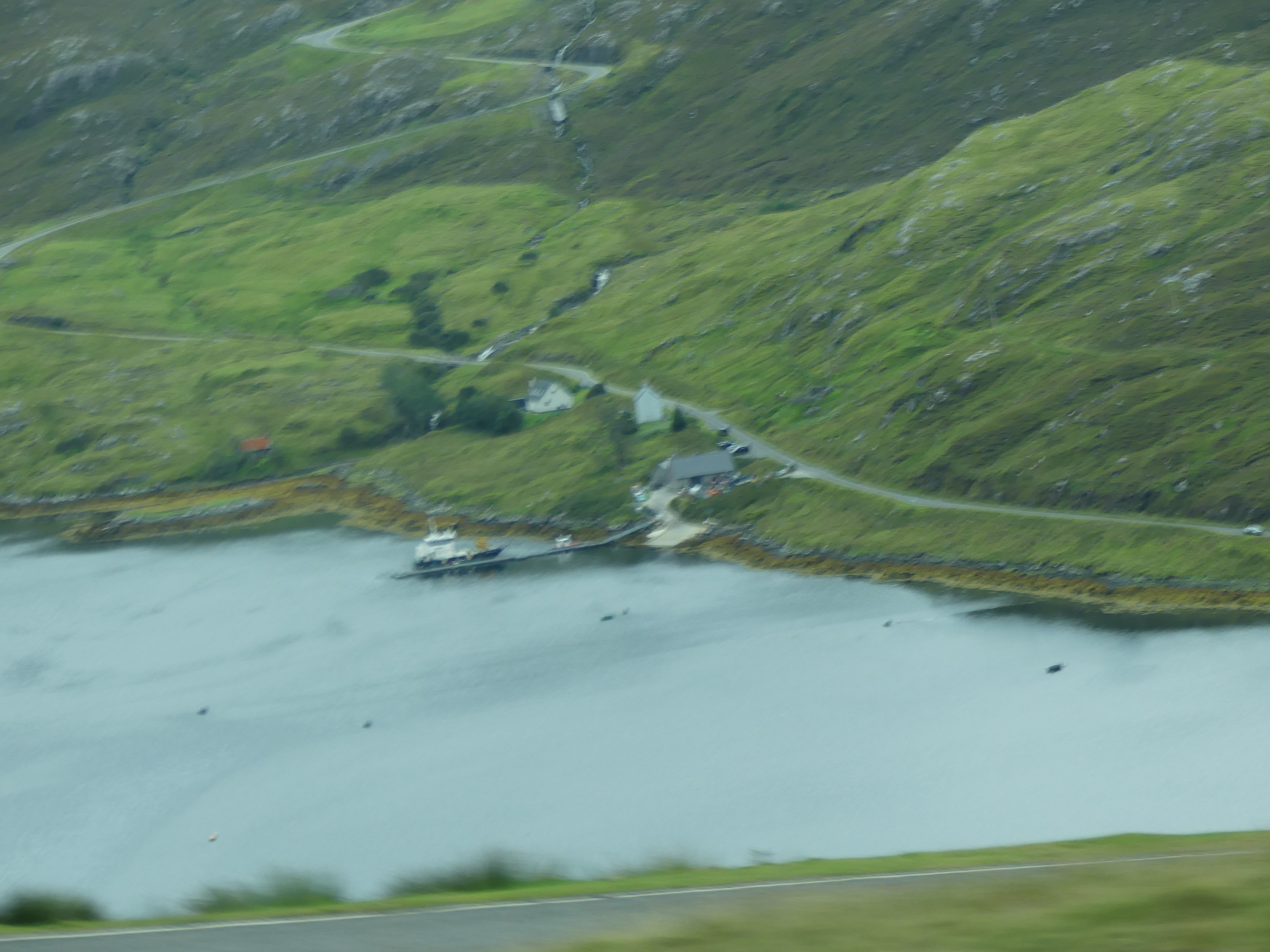
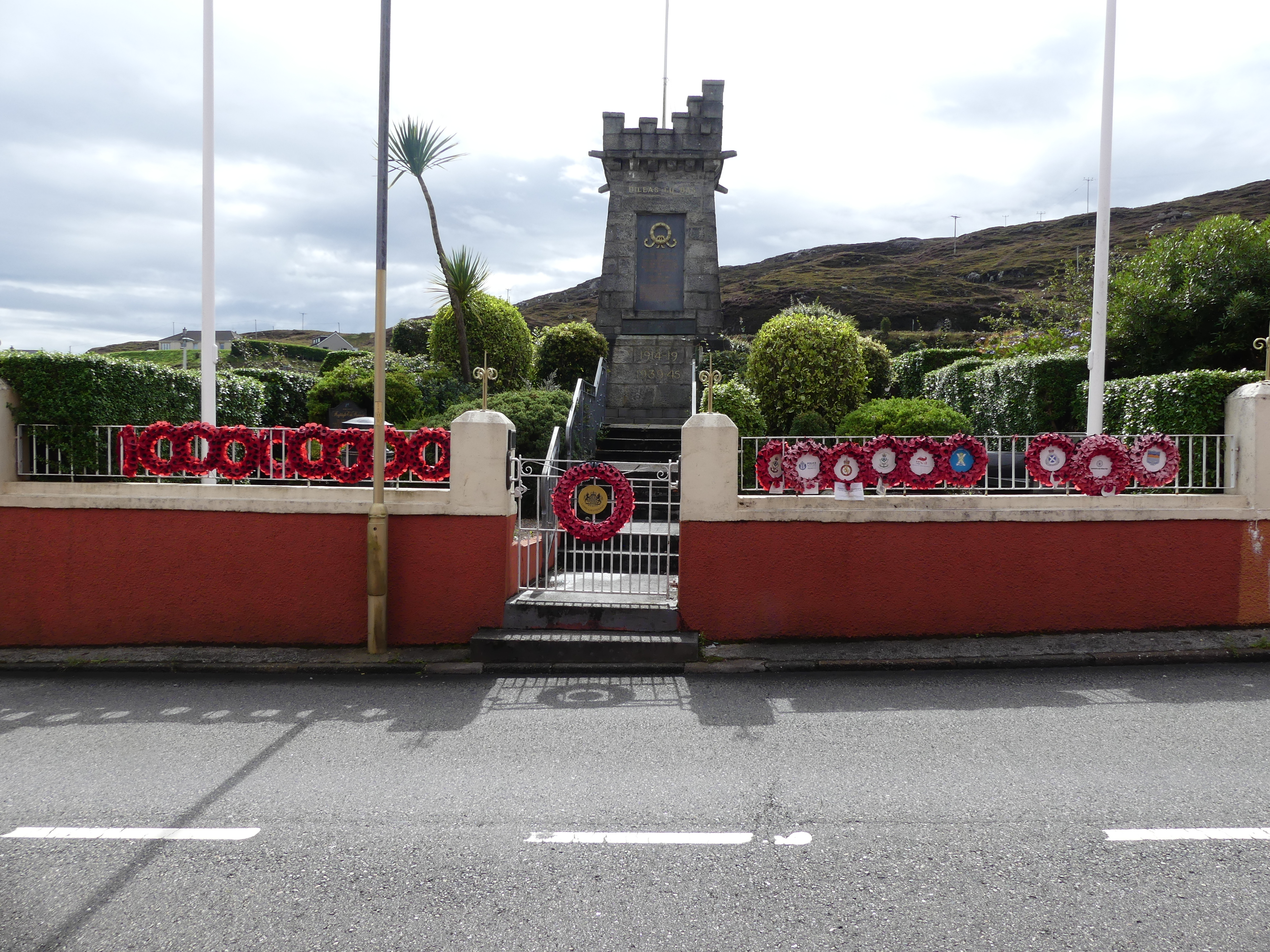
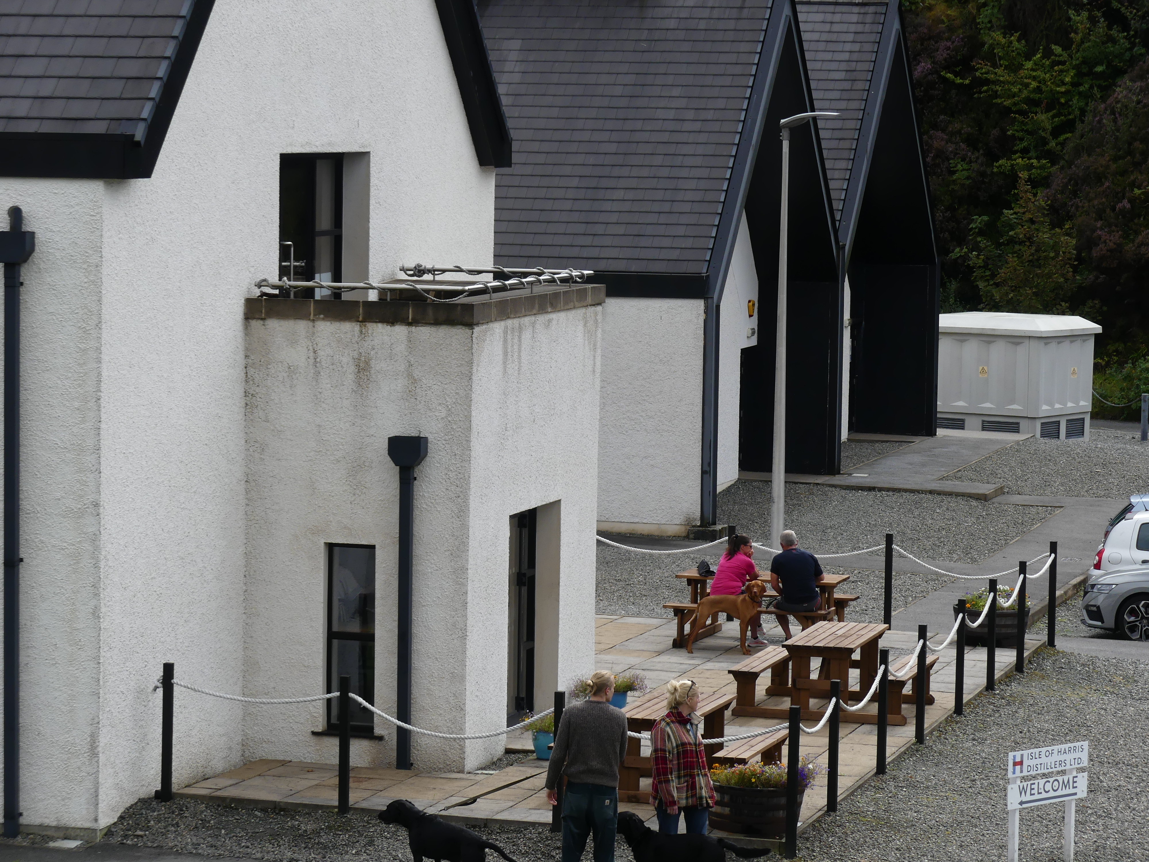
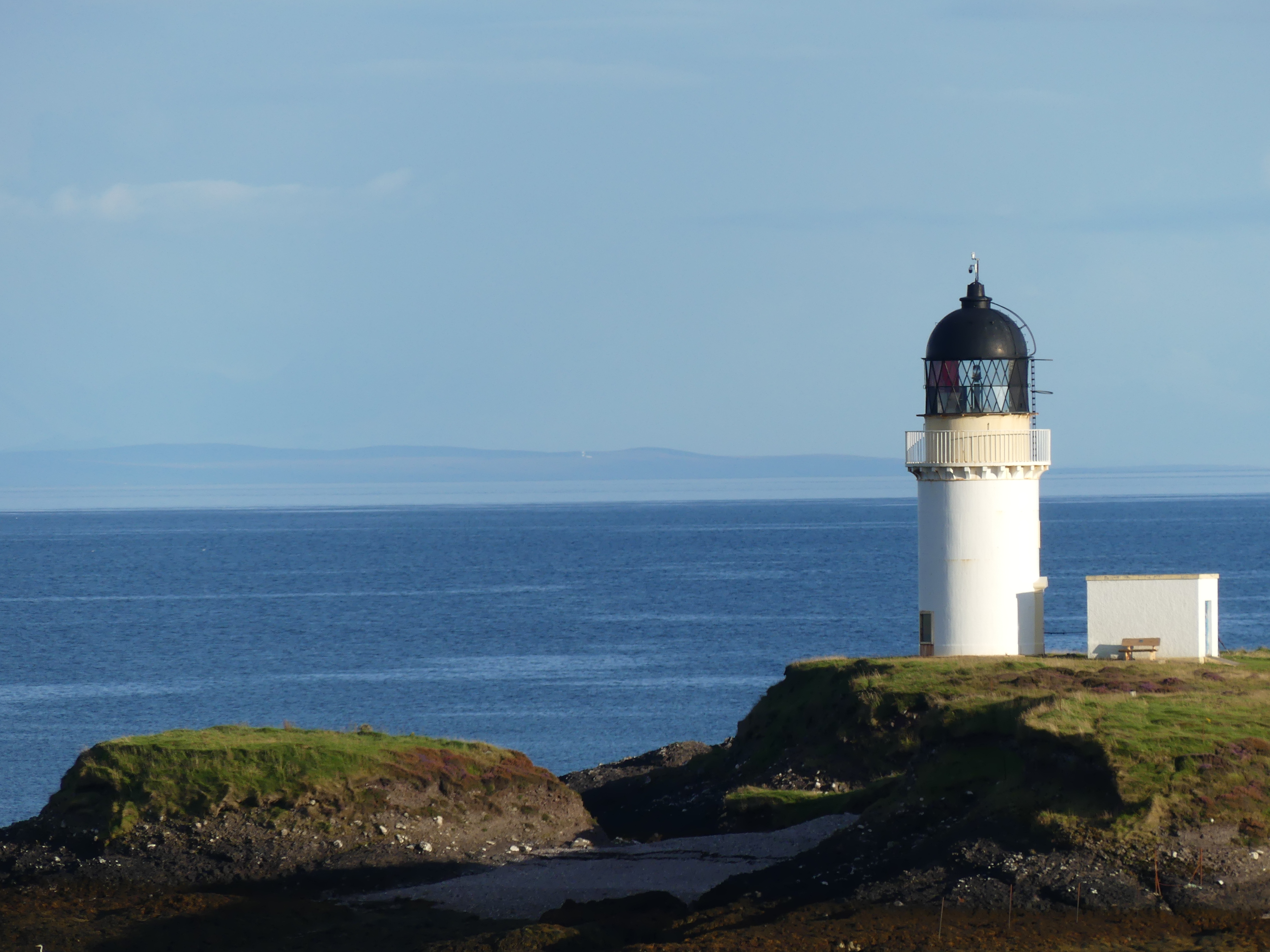
Just as we were beginning to lose hope that we would get to the terminus, it happened – we arrived in North Harris. Perched on the side of a hill over an inlet the village of North Harris was celebrating with an Artisan Market. Set up in the community hall all the hand made crafts to be found on the island were on display. The first stall had wool not pulled into any shape but we had seen the off cuts in the Weavers shed. The stall holder told us she was having trouble obtaining the offcuts due to the decline in small weavers. As it happened I had picked up the business card for A. Harris Tweed Weaver in Stornoway and I passed it onto her. Not only was she grateful but couldn’t believe that a tourist knew more than she did on her subject. Other things of note were the inlet below, the war memorial perched on the very edge of the rock face of the inlet, the distillery and lighthouse below. Not a traffic light to be seen in the village.
Our bus had return to take us back to Stornoway and our ship to continue our adventure. The next port would be Belfast. We had spent sometime in Belfast a few years back when driving around Ireland (North and Eire) so we wondered what we might do. Lean about our decision when reading my next blog “THE RETIREES GO AROUND THE WORLD – DAY 6 SS NIEUW STATENDAM – Outer Hebredies – Belfast Northern Ireland”
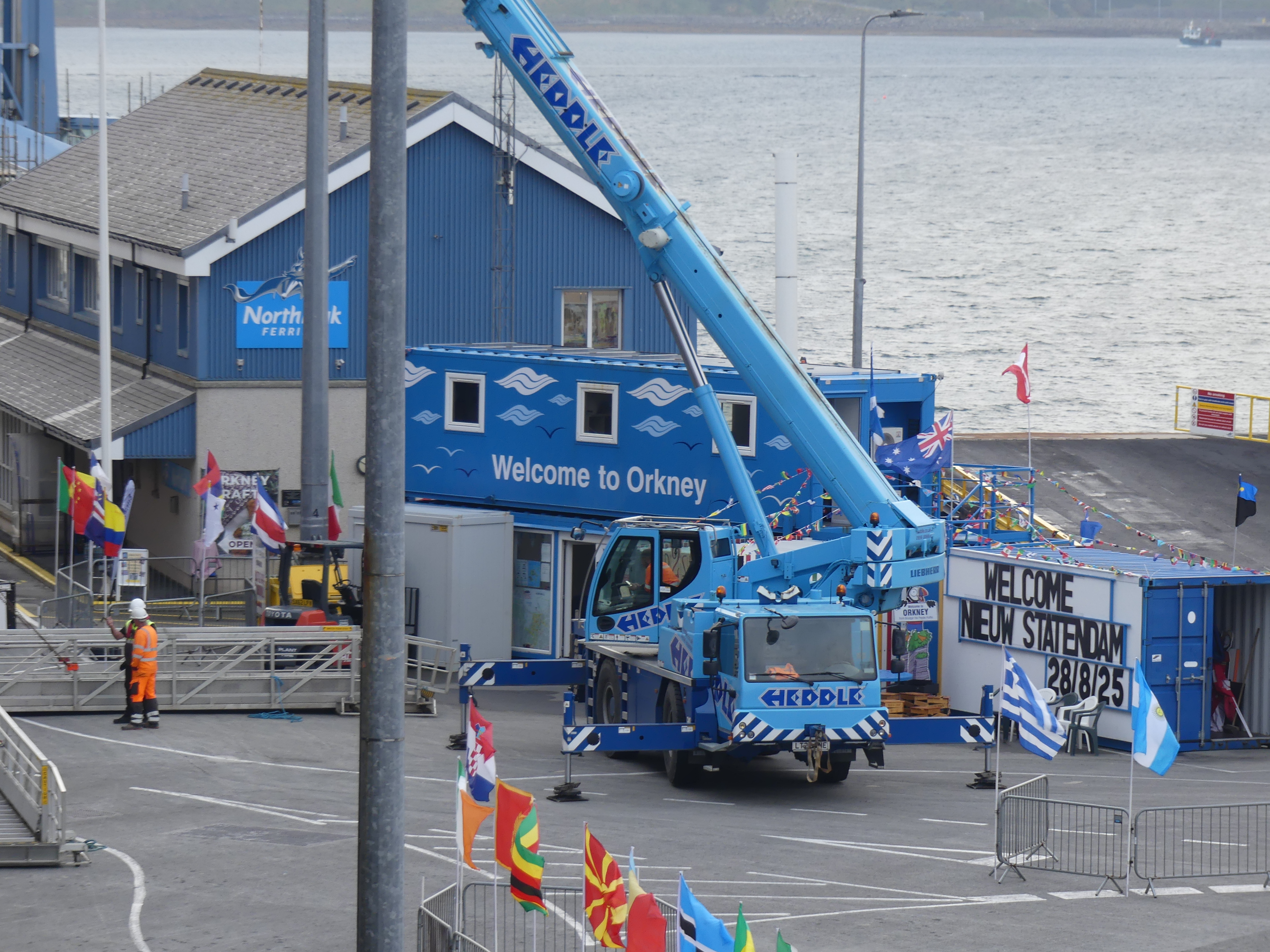
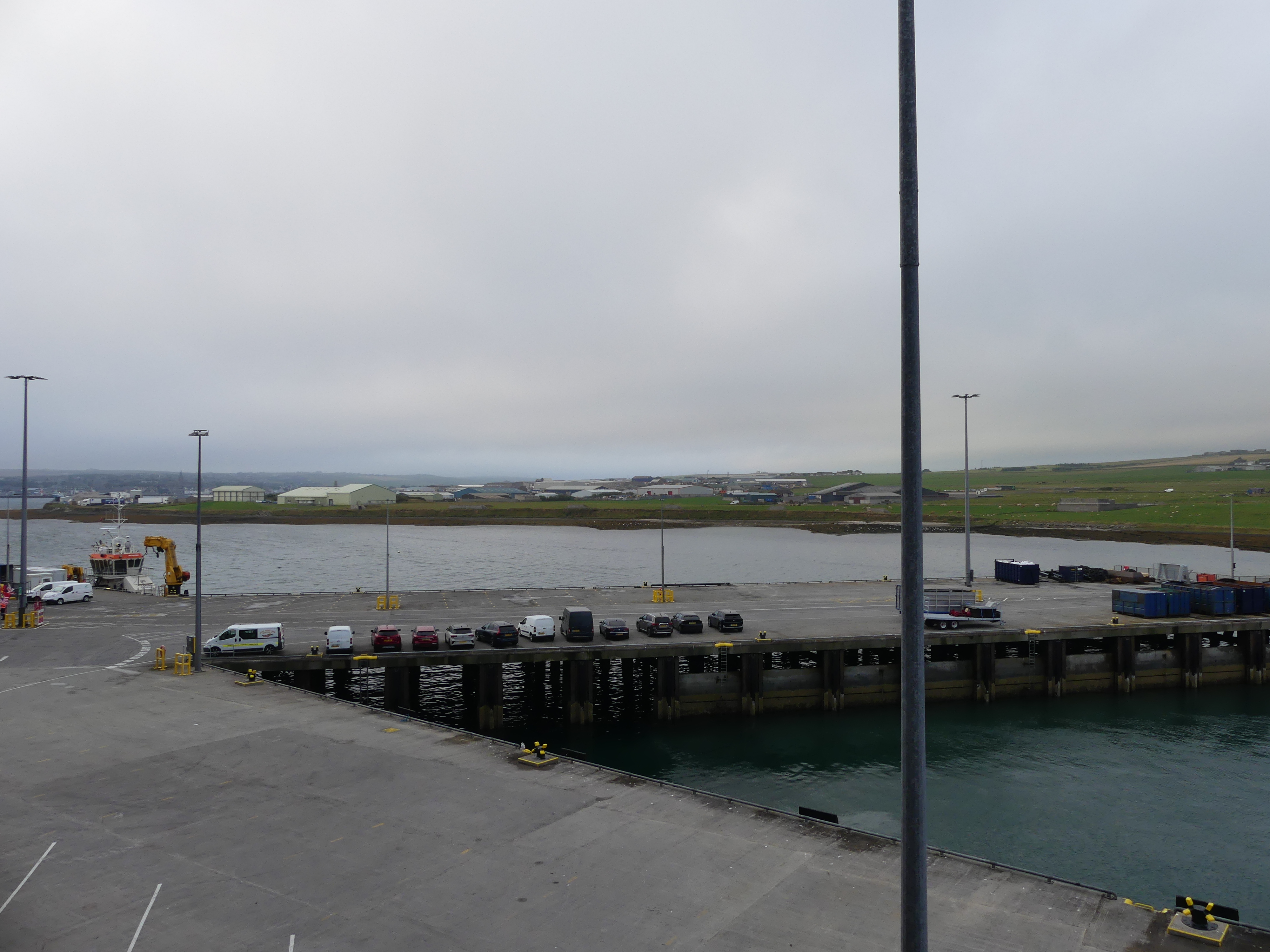
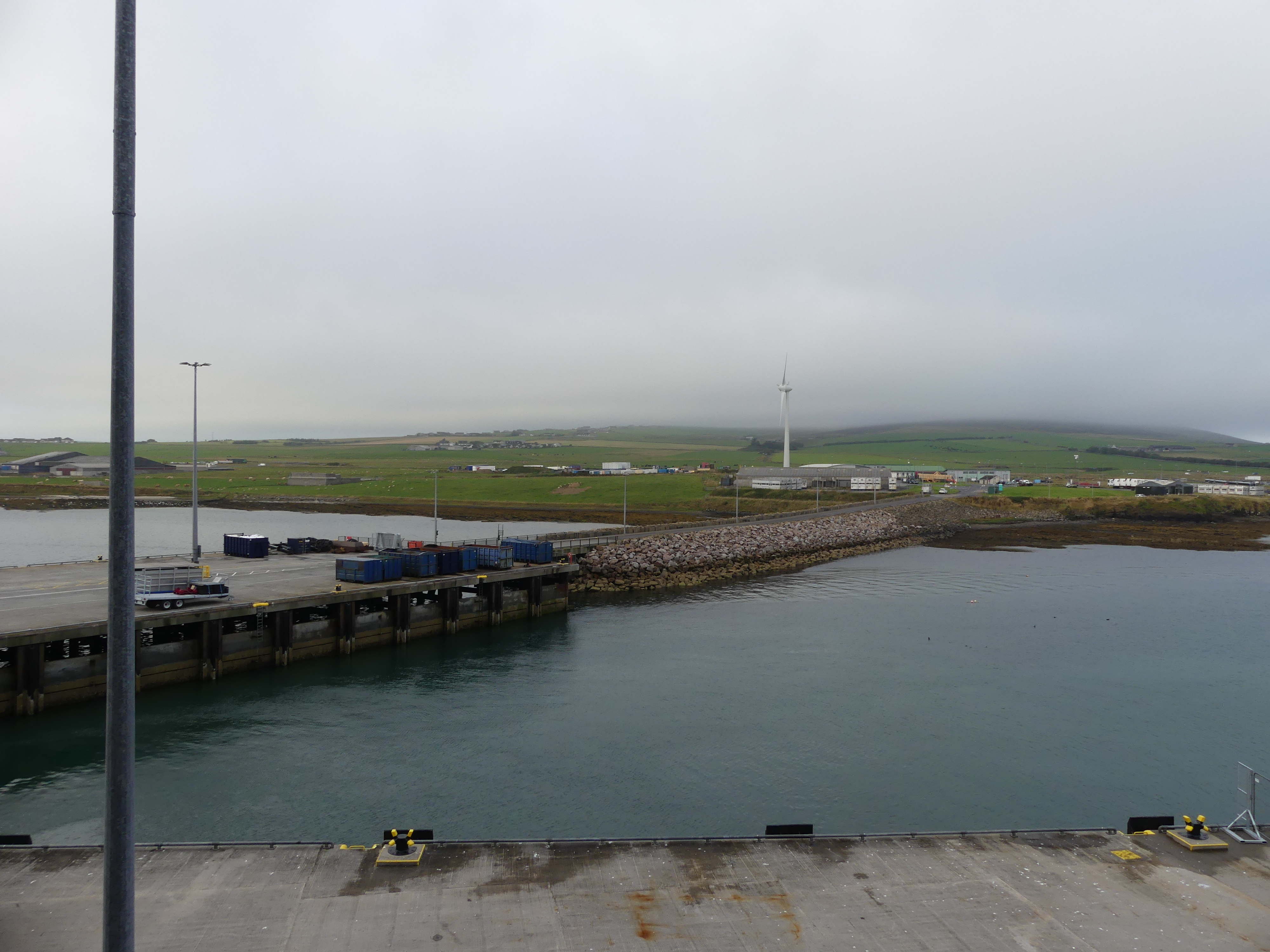
Day 4 of our cruise (I am not counting the days at sea). We have arrive in Kirkwall Orkney Islands and moored at Kirkwall Pier. Something of the history of Kirkwall coming from Wikipedia tells us that “Kirkwall (Scots: Kirkwa, Kirkwaa, or Kirkwal; Norn: Kirkavå; Scottish Gaelic: Bàgh na h-Eaglaise) is the largest town in Orkney, an archipelago to the north of mainland Scotland. First mentioned in the Orkneyinga saga, it is today the location of the headquarters of the Orkney Islands Council and a transport hub with ferries to many locations. It is the centre of the St Magnus International Festival and is also a popular stopping off point for cruise ships. St Magnus Cathedral stands at the heart of the town.”
This did not help us with the deciding what we wanted to do with our limited time in Kirkwall. So we looked at the history of the town and Wikipedia provided the following “The town was first mentioned in the Orkneyinga saga in the year 1046, when it was recorded as the residence of Rögnvald Brusason, the Earl of Orkney …..
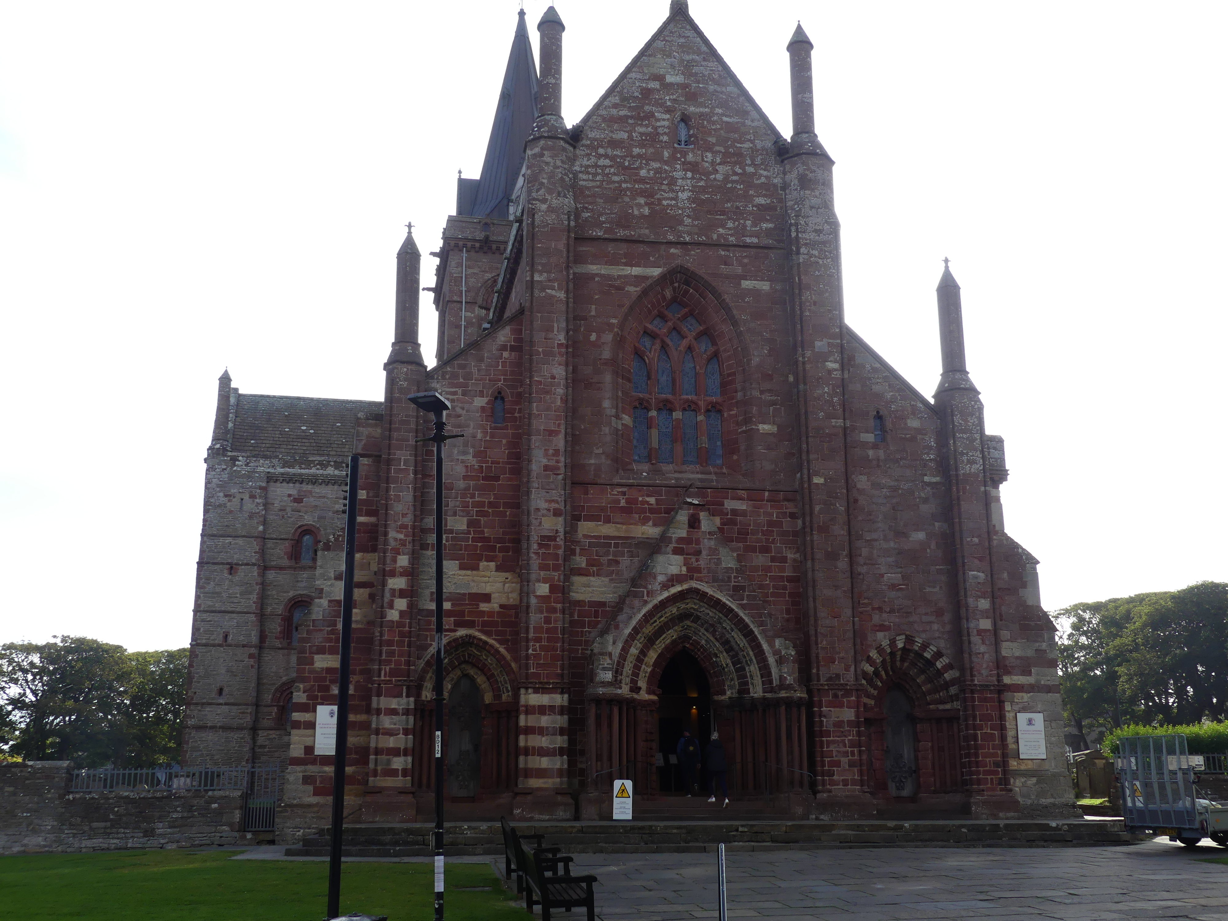
In 1486, King James III of Scotland elevated Kirkwall to the status of a royal burgh, and in time it would return a Burgh commissioner to the Parliament of Scotland. After Union with England it combined with other towns to form the Northern Burghs, sending a single MP to Parliament. In 1918, the Parliamentary Burgh of Kirkwall merged into Orkney and Shetland.” We made our way to the heart of the town and St Magnus Cathedral.
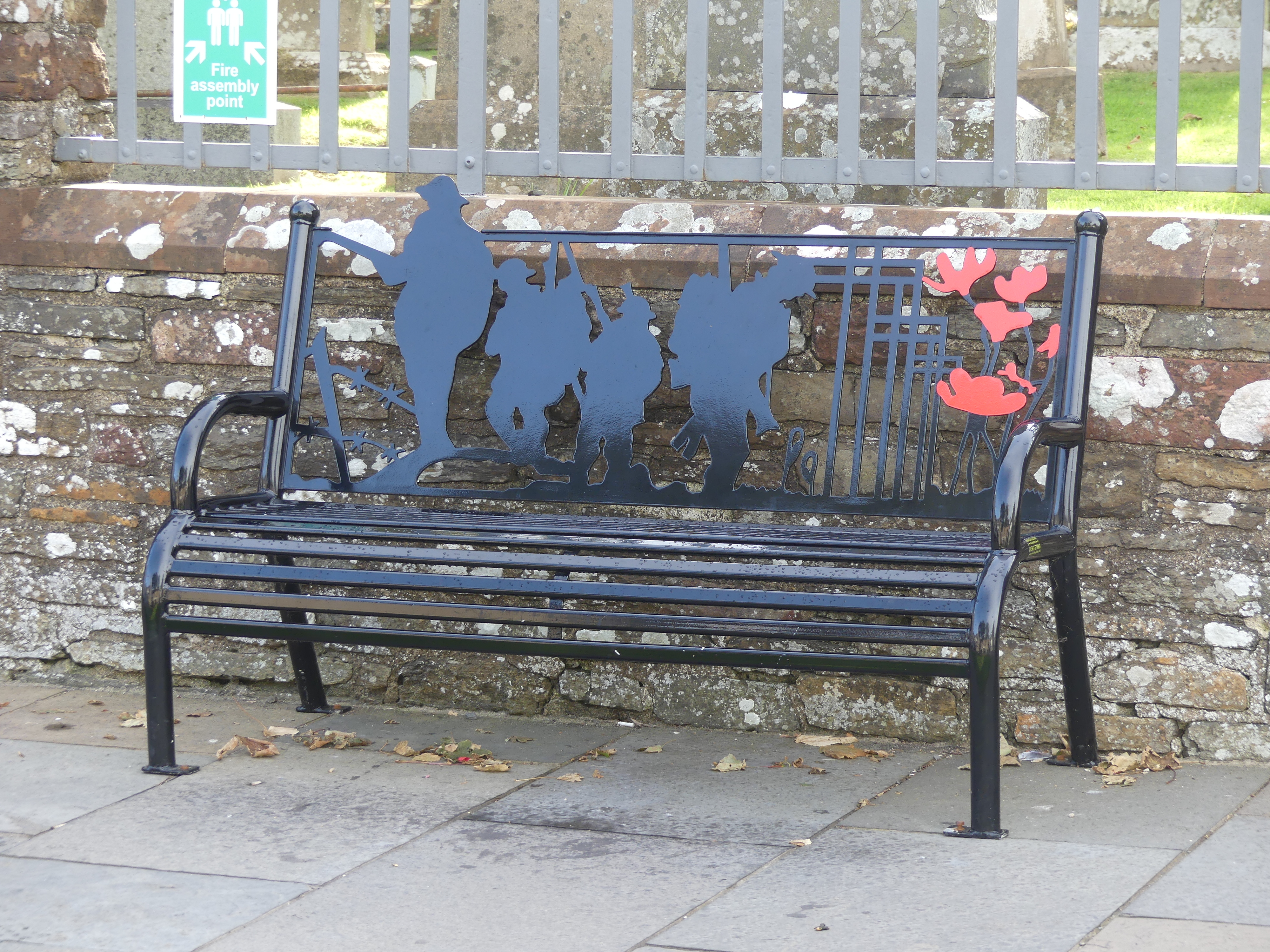
There is something like 9,000 people living in the Orkneys as at its last census. Tourism, particularly cruse ship tourism contributes to its economy and the Orcadians have been loyal Brits over the years. The street furniture portrayed a remembrance to fallen soldiers in a very useful memorial. Then there is St Magnus Cathedral. I have inserted our map that we used to guide our search and you will see that the Cathedral in “the heart of the town”.
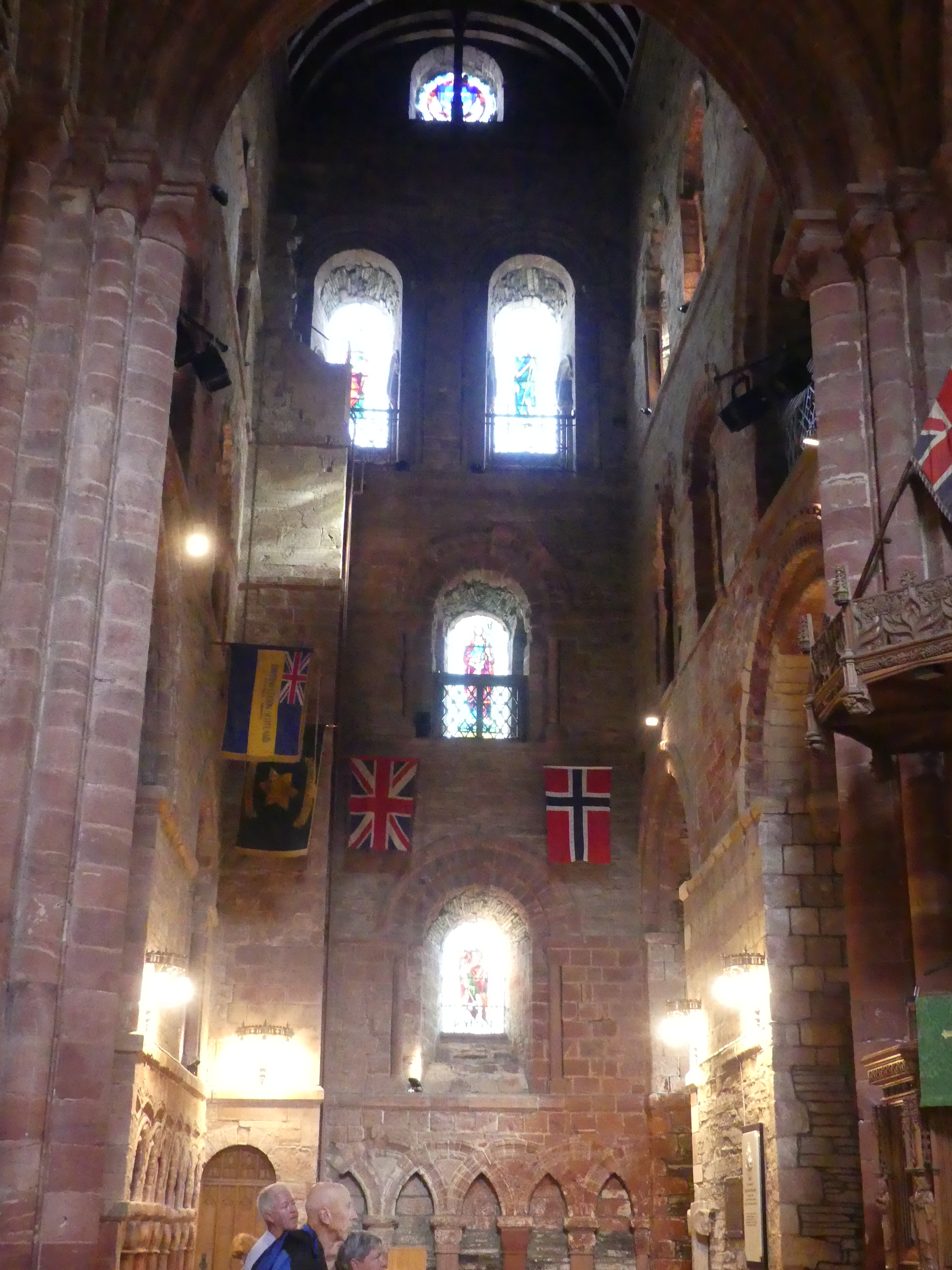
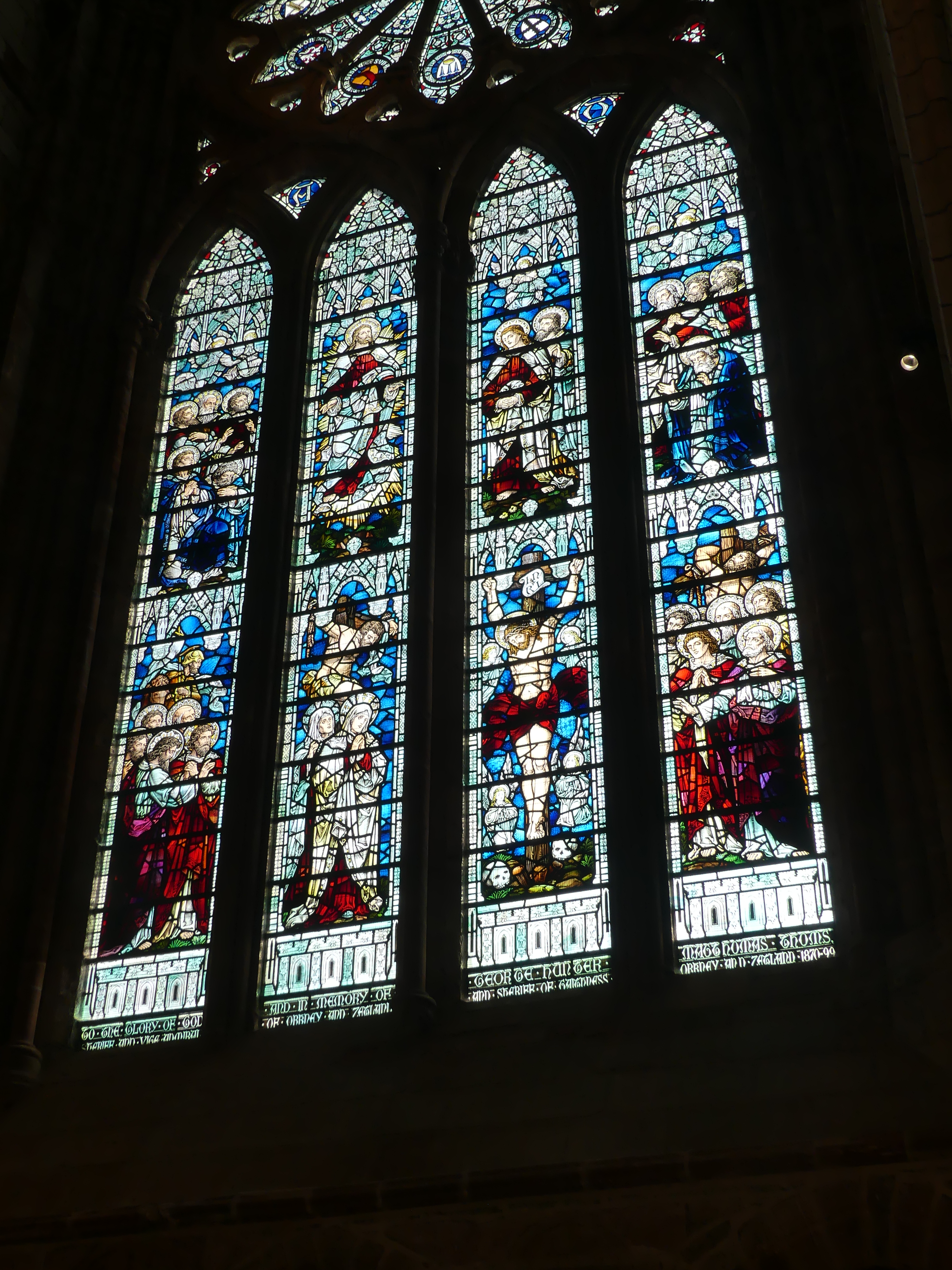
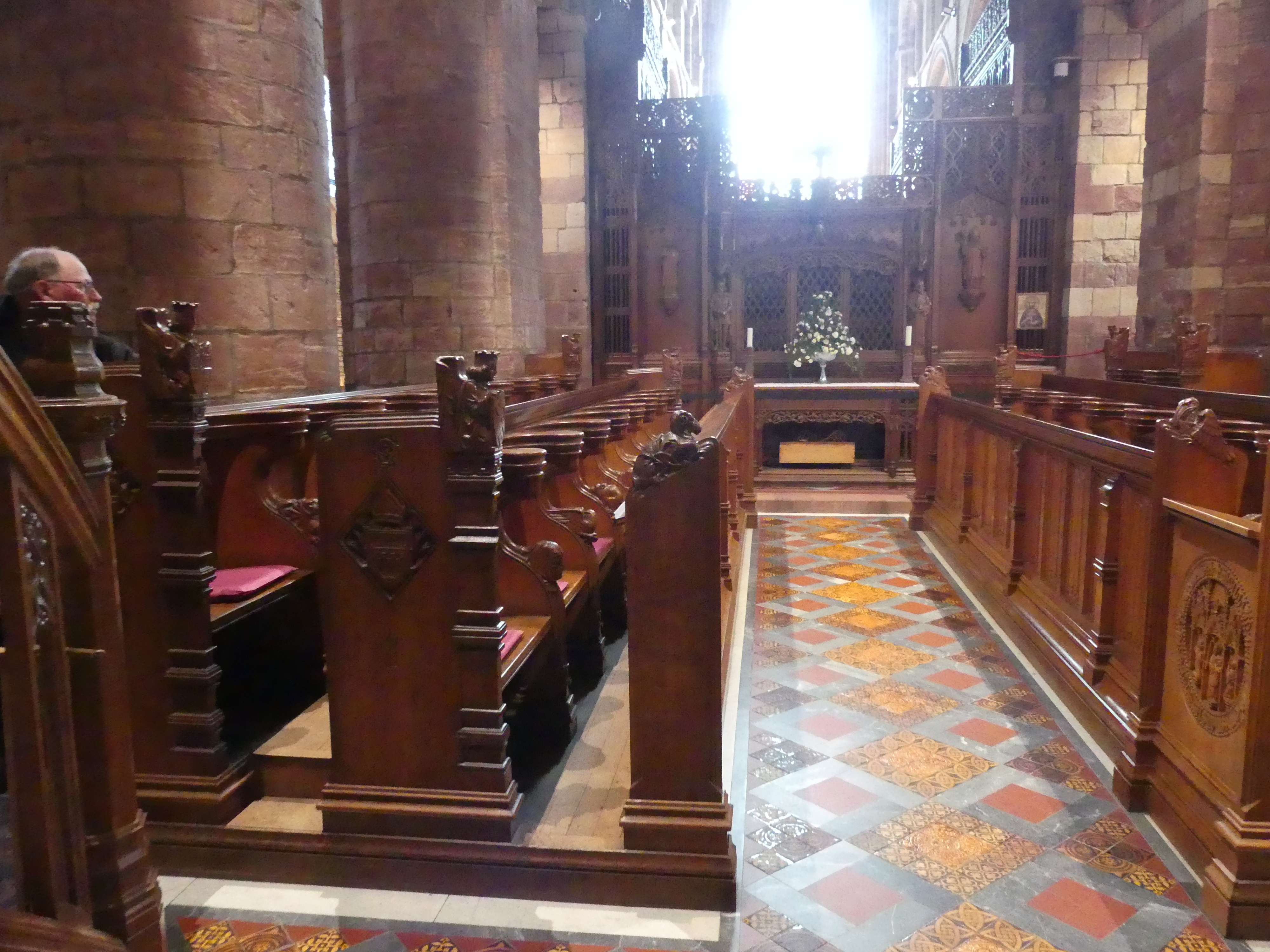
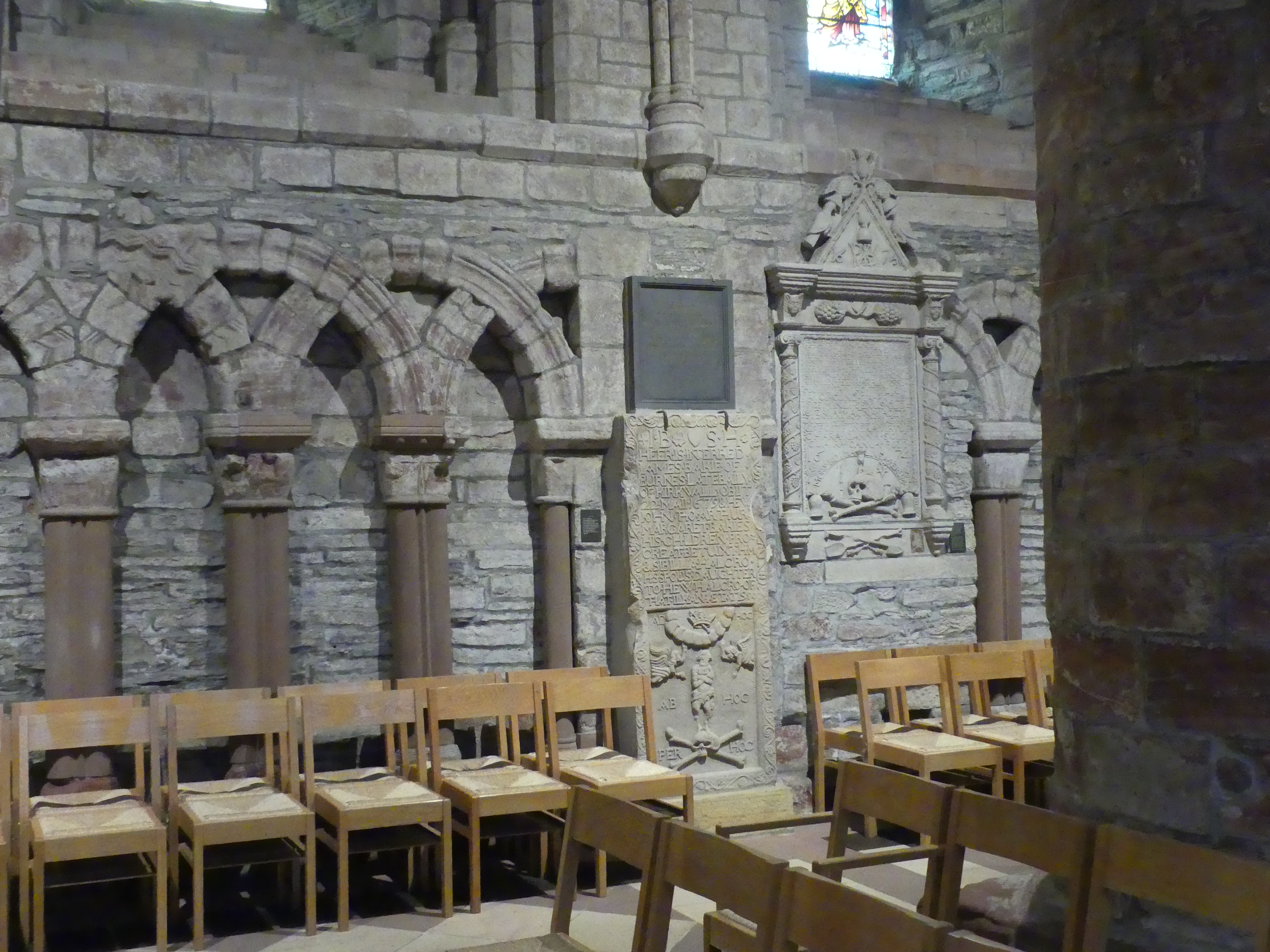
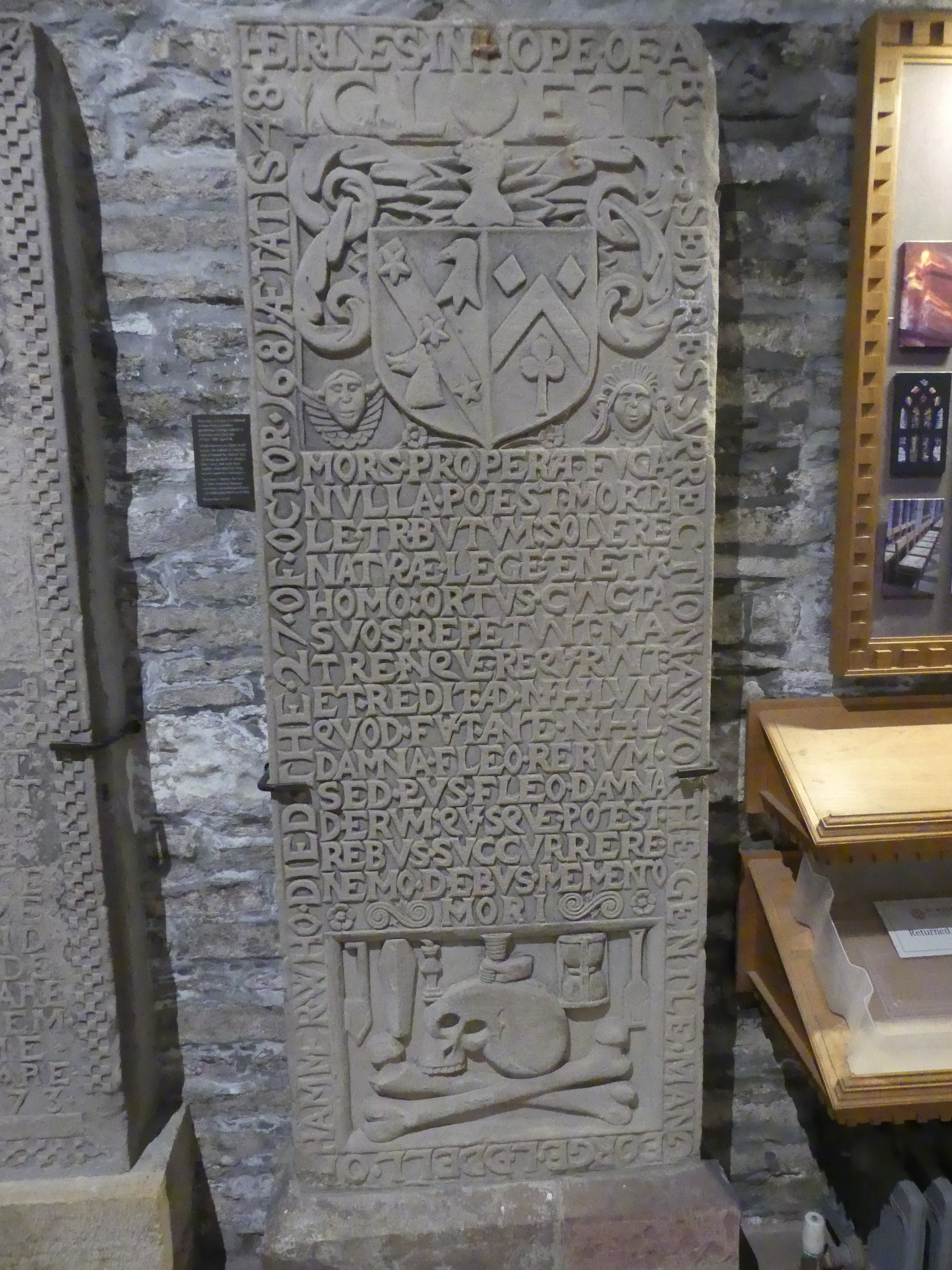
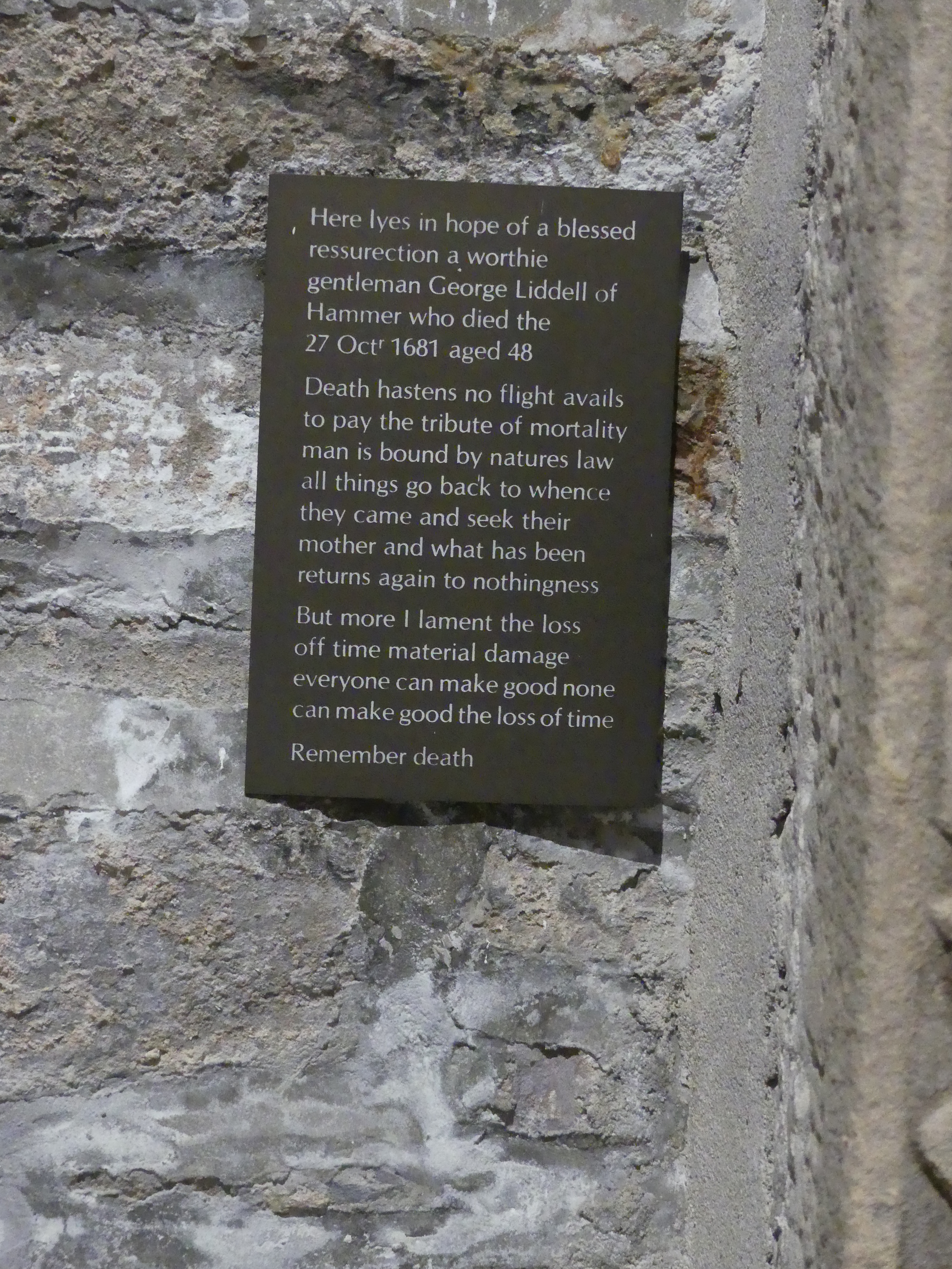
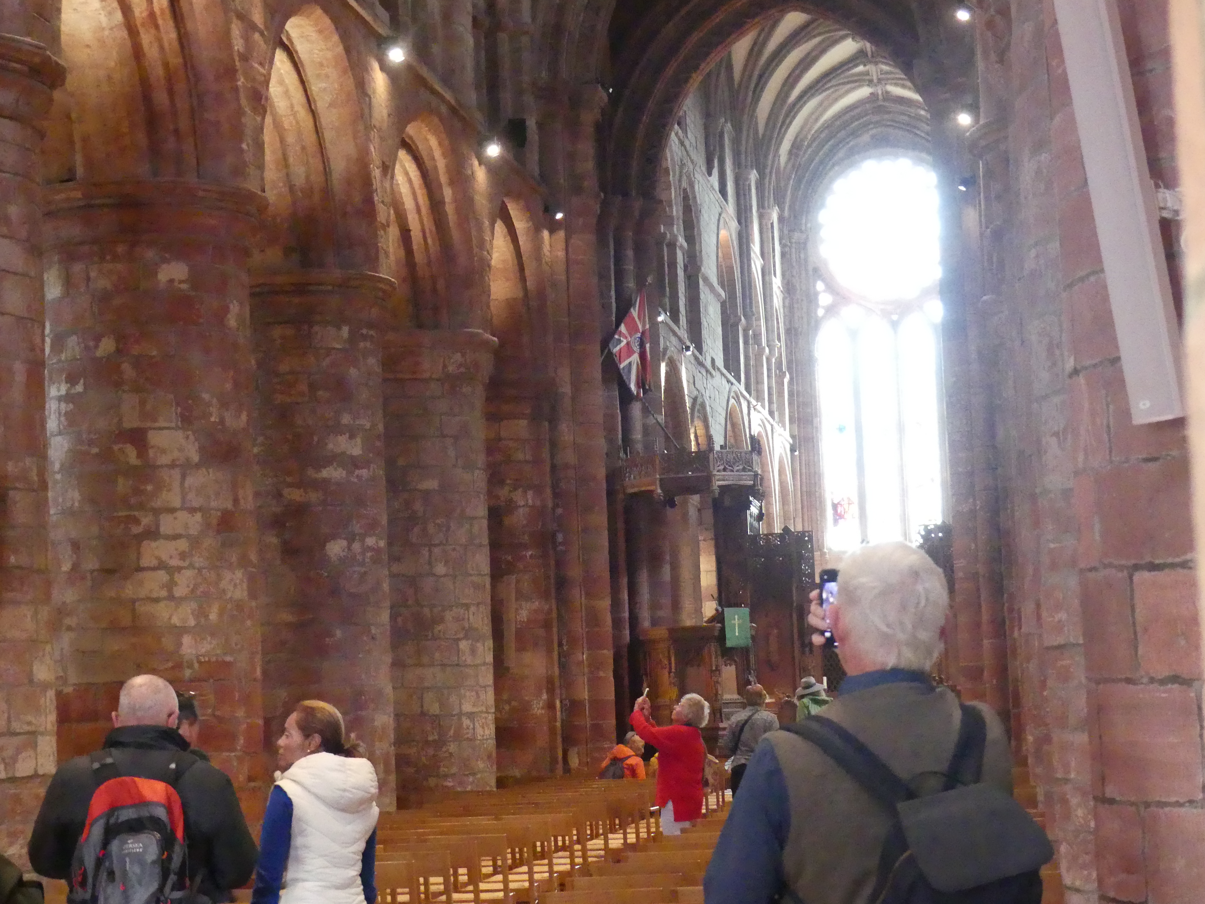
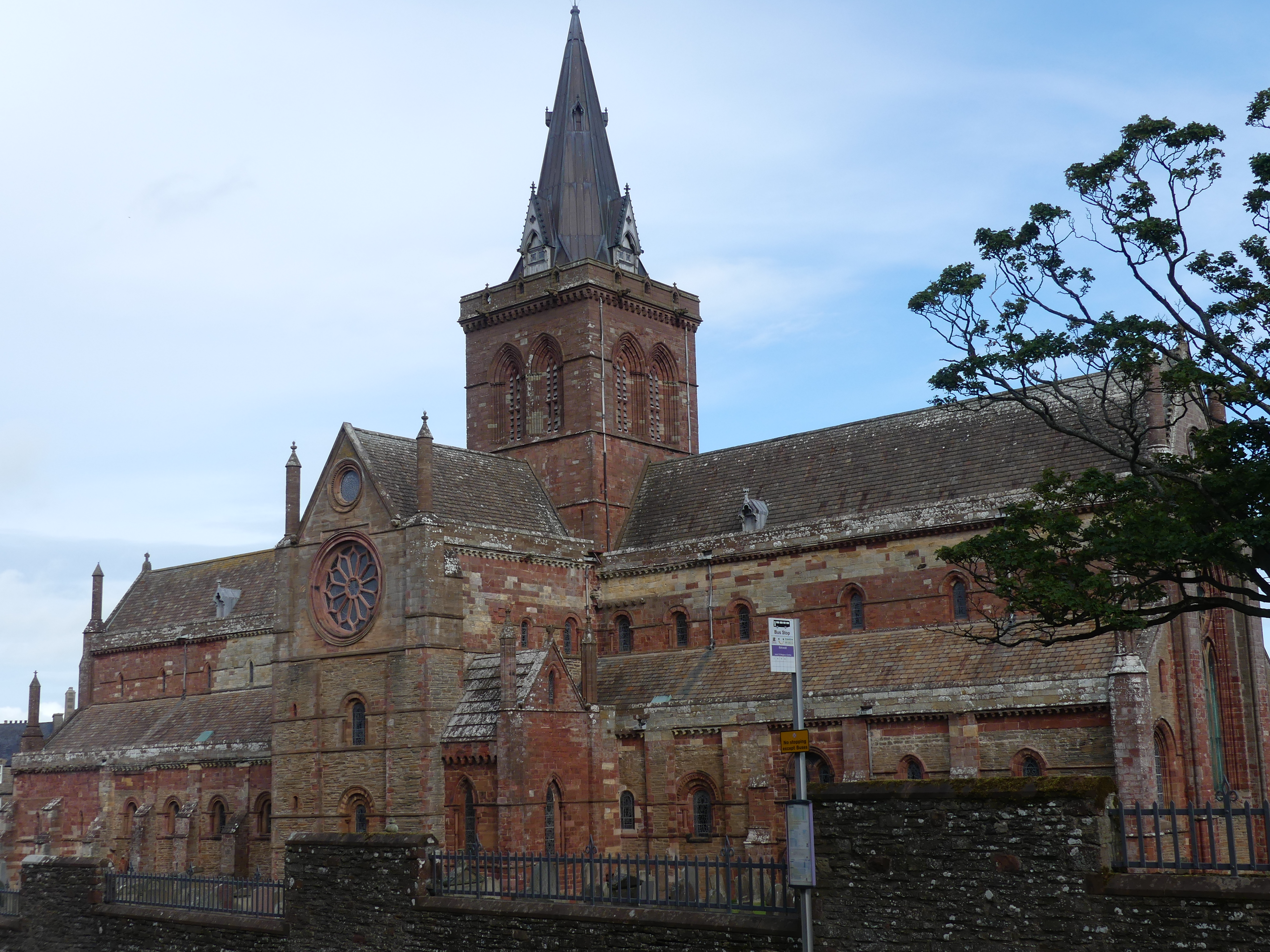
The website for the Cathedral commences with these words “St Magnus Cathedral known as the ‘Light in the North’ was founded in 1137 by the Viking, Earl Rognvald, in honour of his uncle St Magnus who was martyred here in Orkney. The Cathedral belongs to the people of Orkney and its doors are open to all.” The Cathedral has been maintained utilising its interior to give the visitor its history through the headstones of the many people through the centuries brought to rest at the church. My pictures below walk you through the building.
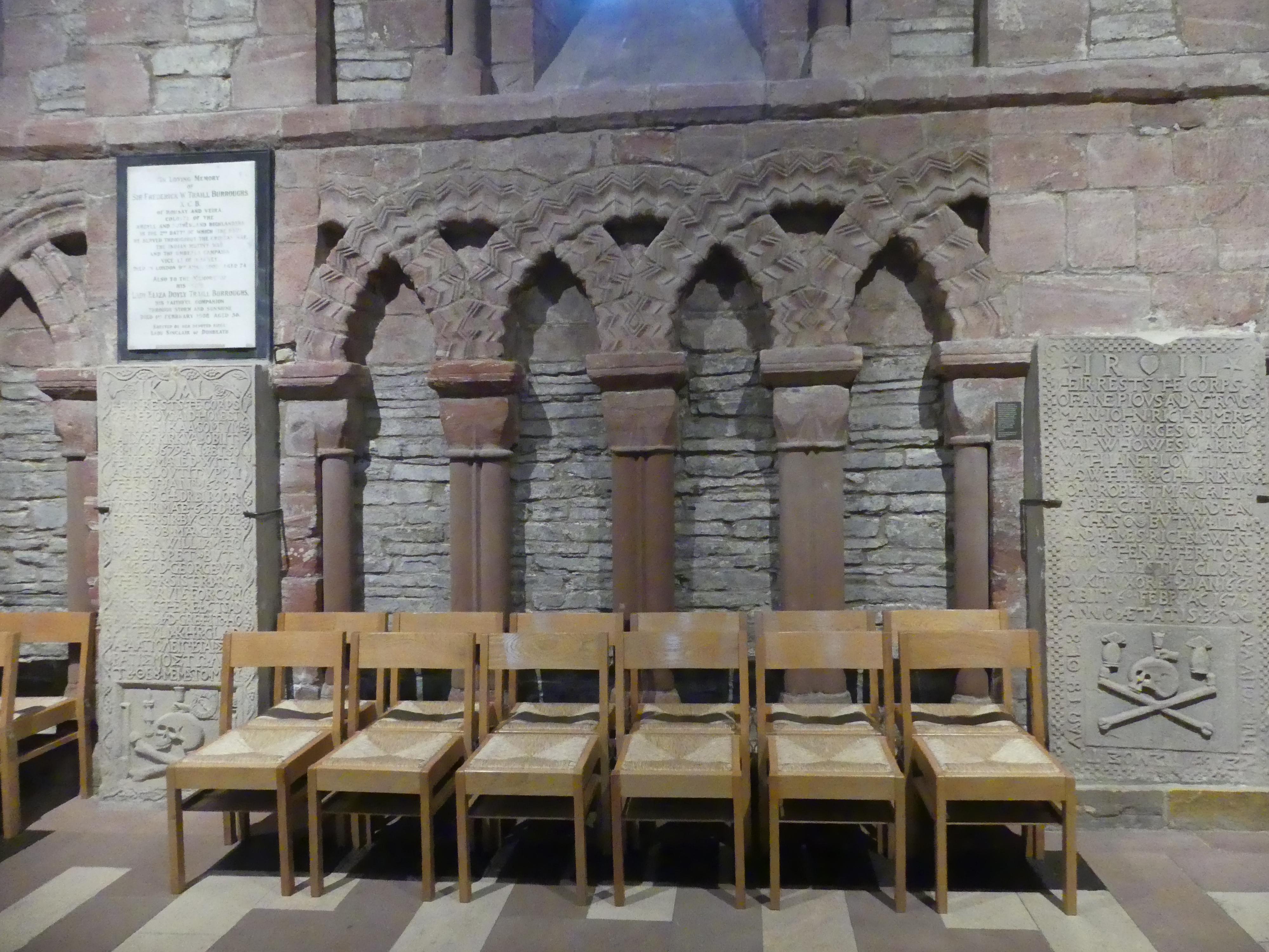
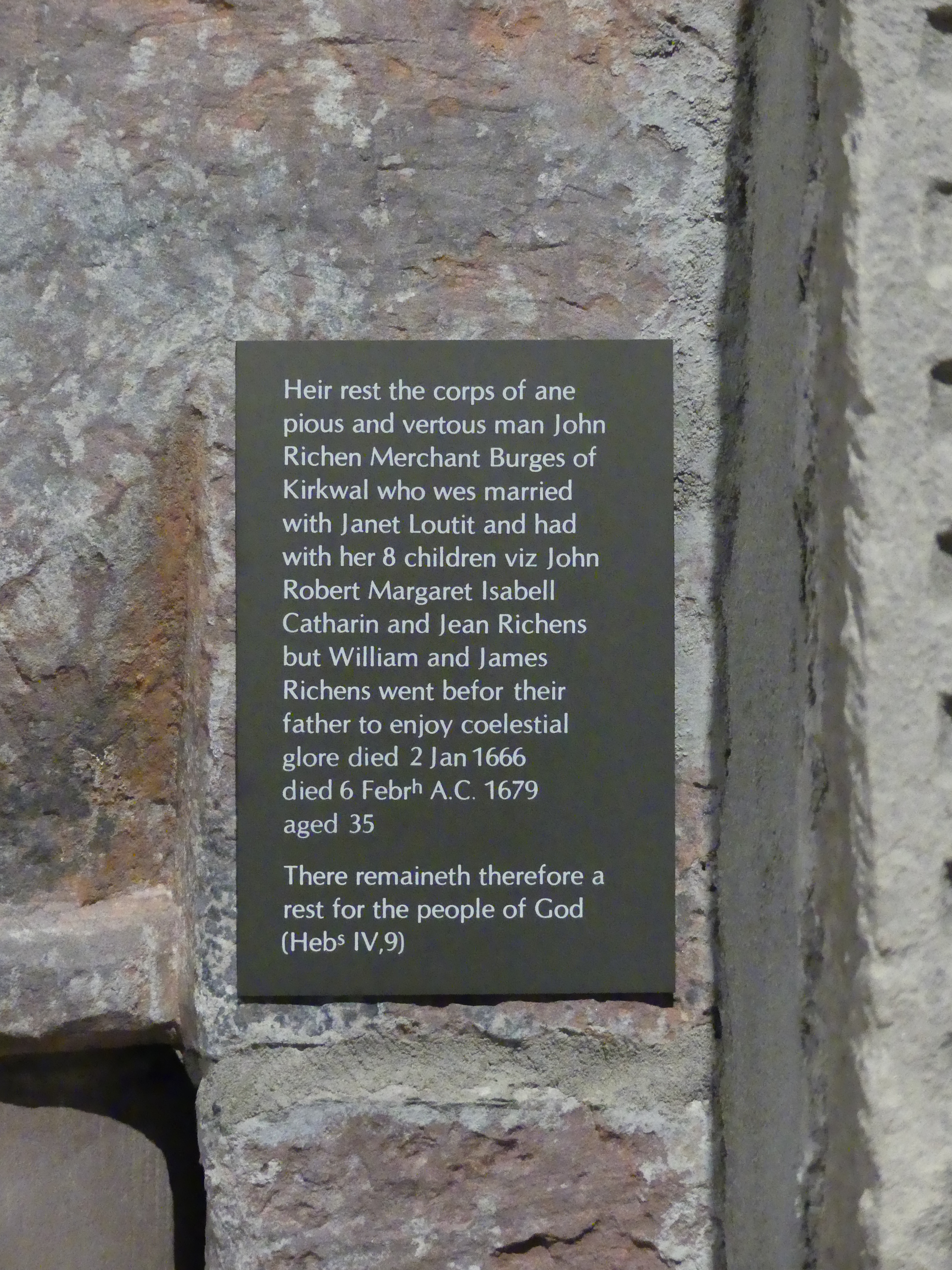
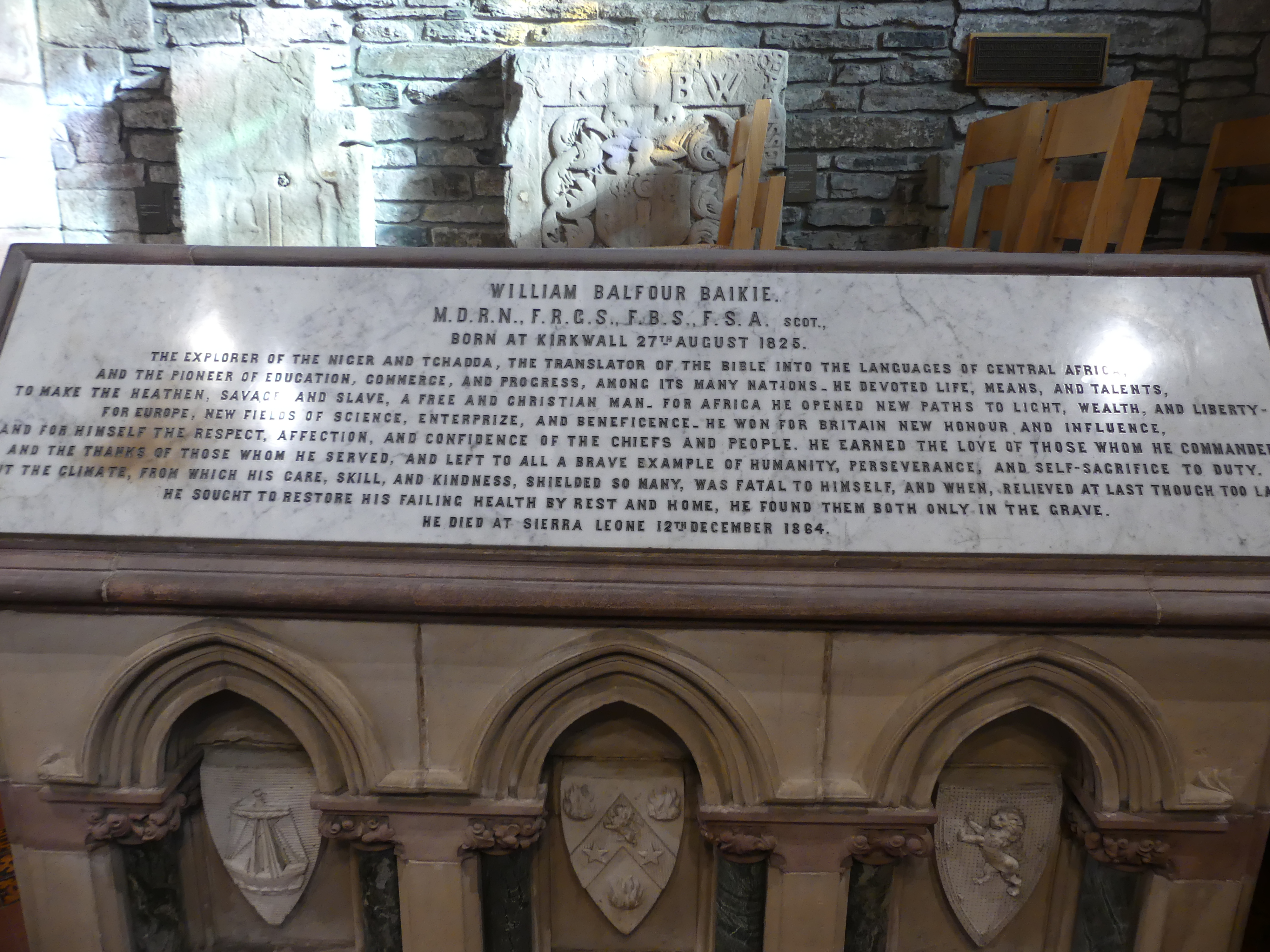
Some of the raw nature of the materials used in building the cathedral portray a genuiness that many of the ostenatious churches we have seen didn’t. This is a church where people worship not a monument to the faith occupying the building. We had purchased a booklet entitled “Reminisciences of the Cahtedral Church of St Magnus since 1846 by an eye witness” the witness was Samuel Baikie. The researcher preparing the booklet was George Burgher and published between 1990 and 2001. In my pictures you will see the tombstone of William Balfour Baikie August 1825 and the booklet records the restorative work undertaken by Samuel. It contains a floor plan of the deceased remains laid to rest in the church as at 1769 and other restorations performed through to the publishing of the booklet.
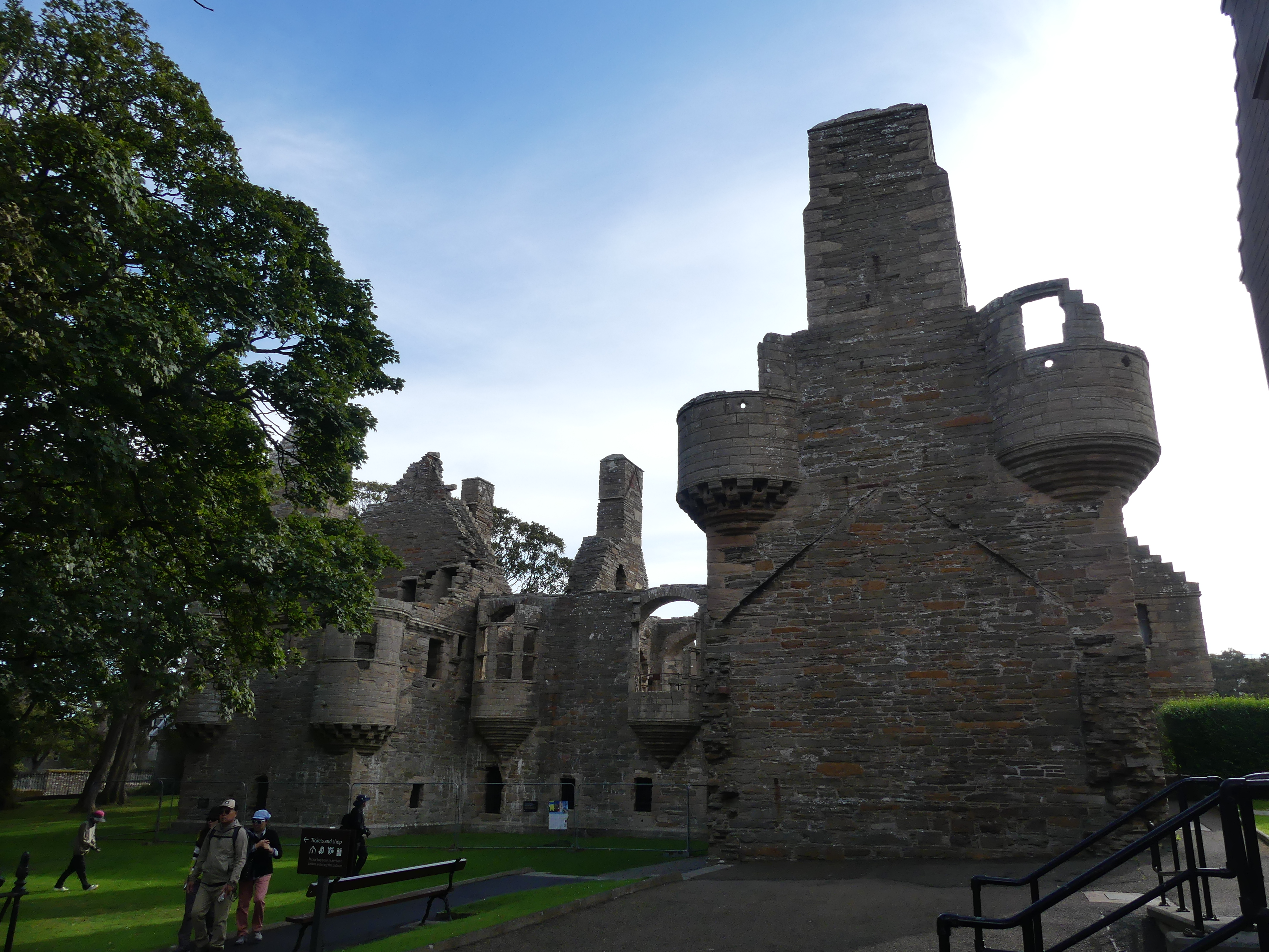
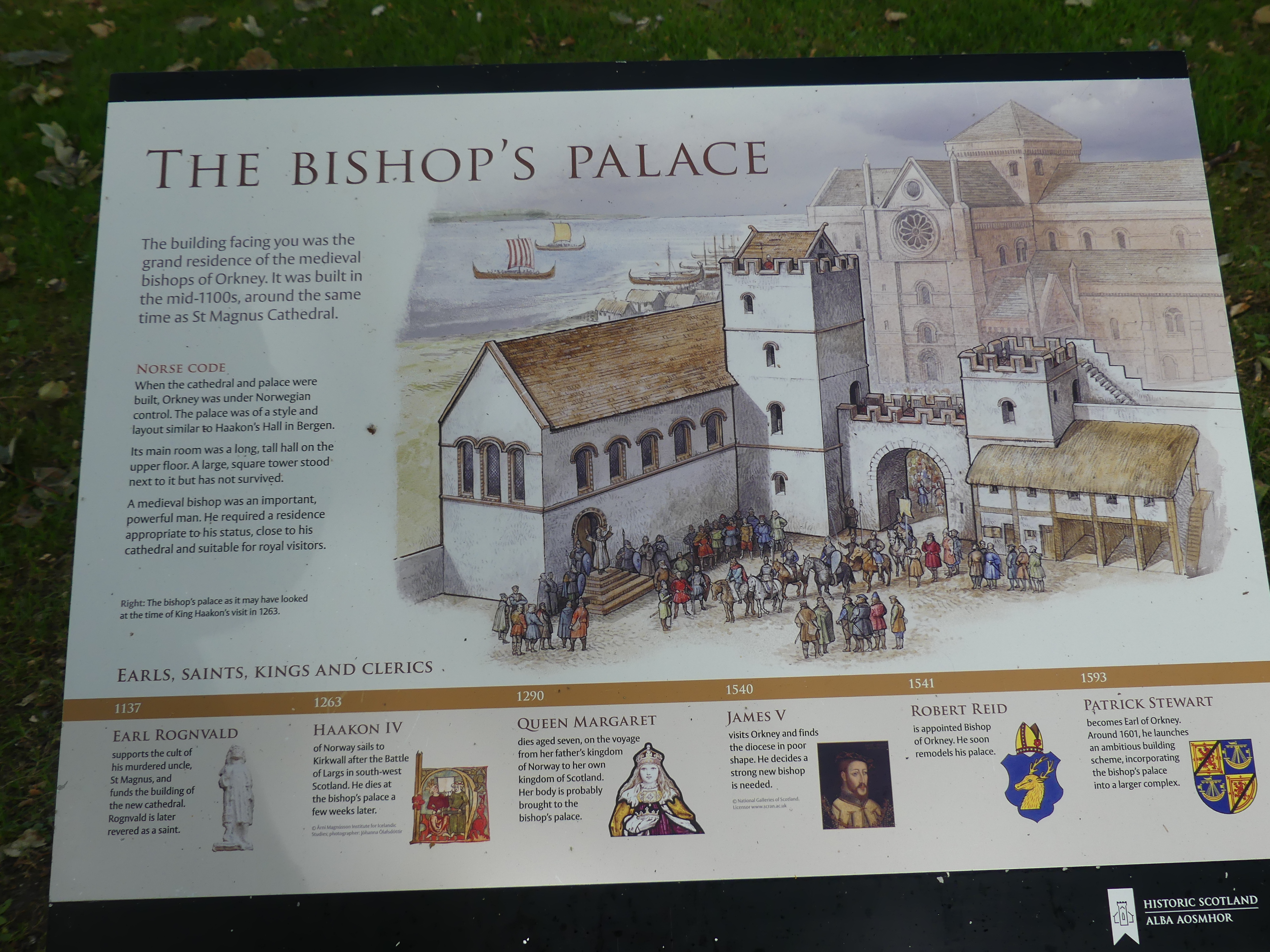
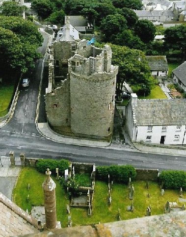
The cathedral is in Broad St at the corner of Palace St. The name of the street suggested we would find more and we did. The Bishops Palace and the Sherriff Court. The Bishop’s Palace, Kirkwall is a 12th-century palace built at the same time as the adjacent St Magnus Cathedral. It housed the cathedral’s first bishop, William the Old of the Norwegian Catholic Church who took his authority from the Archbishop of Nidaros (Trondheim). The ruined structure now looks like a small castle. Originally, it is thought to have been like a typical Royal Norwegian palace, with a large rectangular hall above store rooms and a tower house as the Bishop’s private residence. Wikipedia shows the Bishop’s Palace, seen from St Magnus Cathedral tower and I have copied this photo to the collage of photos below.
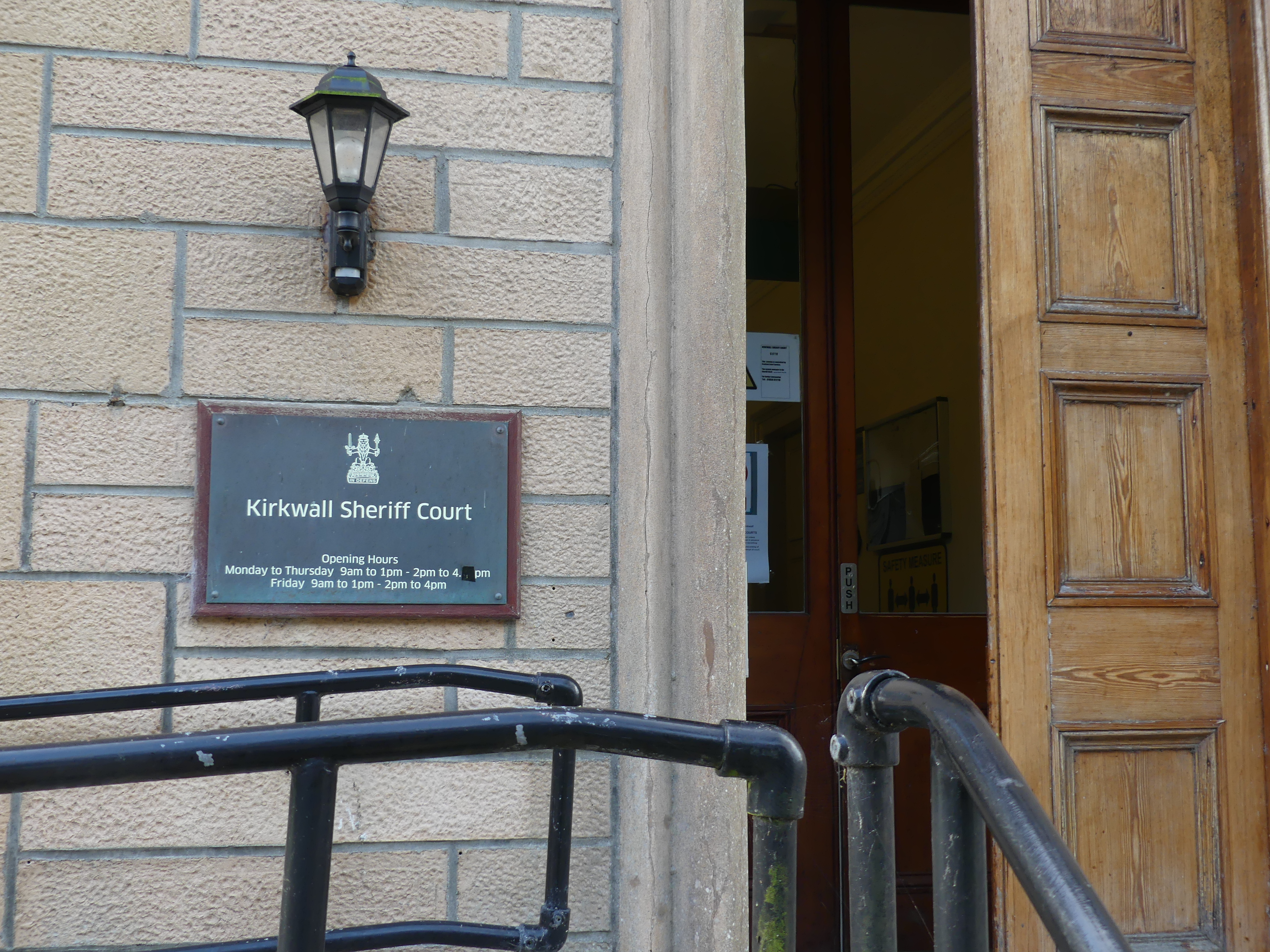
We also encountered the Kirkwall Sheriff Court. The Sheriff Court in Kirkwall continues to serve as the main court for the Orkney Islands, dealing with complex matters that surpass the jurisdiction of the Justice of the Peace Court (for minor offenses) but aren’t severe enough for the High Court (murder, treason). We found the Cathedral coffee shop which included a film on the history of St Magnus, the Cathedral and the Bishops Palace. The coffee shop was a mixture of uses and the parish offices.
Refreshed we made our way to the bus station in Junction Rd intending to travel to a church constructed by WW2 Italian prisioners of war and onto St Margarets Hope on Ronaldsay. This was a local bus which provided transport for the islanders and tourists alike. My pictures below take you on the trip with us. The countryside has a likeness to Shetland – scattered stone farm houses and lots of sea views. By the time we arrived at the stop for the Italian Chapel, I was exhausted and the thought of an 800 metre walk to and from the chapel did not appeal. Preparing for this blog and researching the history of the chapel, I regret not making the time. Next time might be different. The POWs were not assisted in making the chapel but by 1943 the structure pictured below had been constructed.
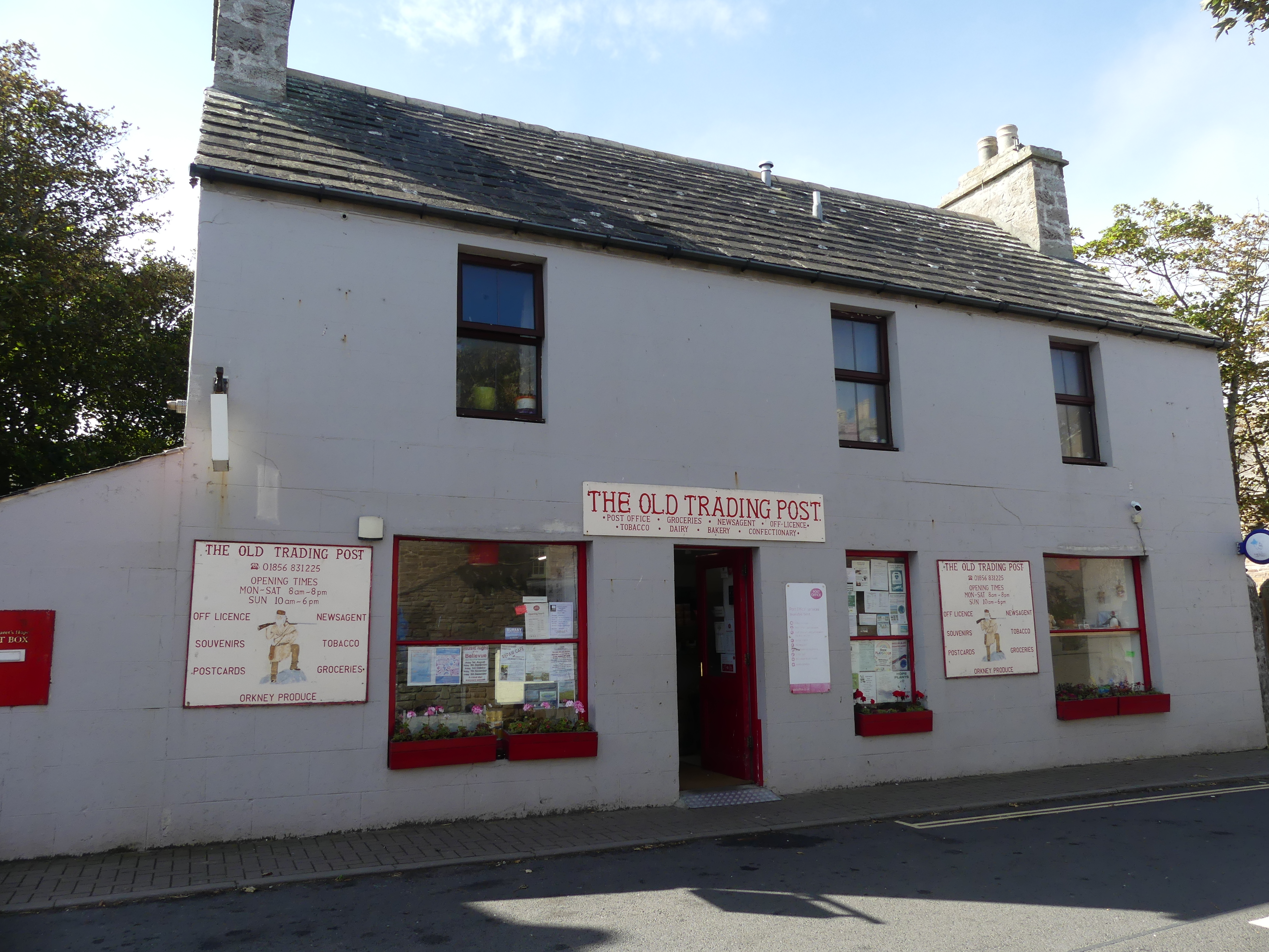
We remained on the bus until it reached its terminus – St Margarets Hope. The village by the sea was a collection of houses plus the post office. My last photo is the Post Office/Convenience store/ Accommodation booking centre – you name it. With such an evocative name I was disappointed. There was some disagreement about the bus journey and whether we should stay aboard to travel on. Unfortunately we didn’t stay on (my fault). It is likely we would have gone onto Burwick on the southern point of Ronaldsay but the information we didn’t have was when would it return to Kirkwall and would it be in time to reboard our ship.
We returned to Kirkwall and then to the ship. I was ready for a nap. Although it felt as though we had done little in Kirkwall, I was very happy to lie down in the cabin and soon was dreaming of the adventure tomorrow. All will be revealed in “THE RETIREES GO AROUND THE WORLD – DAY 5 SS NIEUW STATENDAM – Outer Hebredies – Isle of Lewis and Harris”
“Murders are rare in the Shetland Islands, but high-profile cases have made headlines, notably the 2024 murder of Canadian Claire Leveque by her partner, Aren Pearson, and the 2019 murder of Tracey Walker (also known as Tracy Ann Walker) by Ross MacDougall and Dawn Smith….”
“These events highlight isolated violent crimes in the islands, contrasting with the generally low crime rates often associated with the region.”
“These are noted as extremely rare events, with police describing the 2019 case as only the third murder inquiry in 50 years. Despite the fictionalized murders in the popular “Shetland” books and series, the islands are generally considered a very safe place to live with low crime rates.”
So this sets the scene for our visit to Lerwick capital of the Islands and located on the main island.
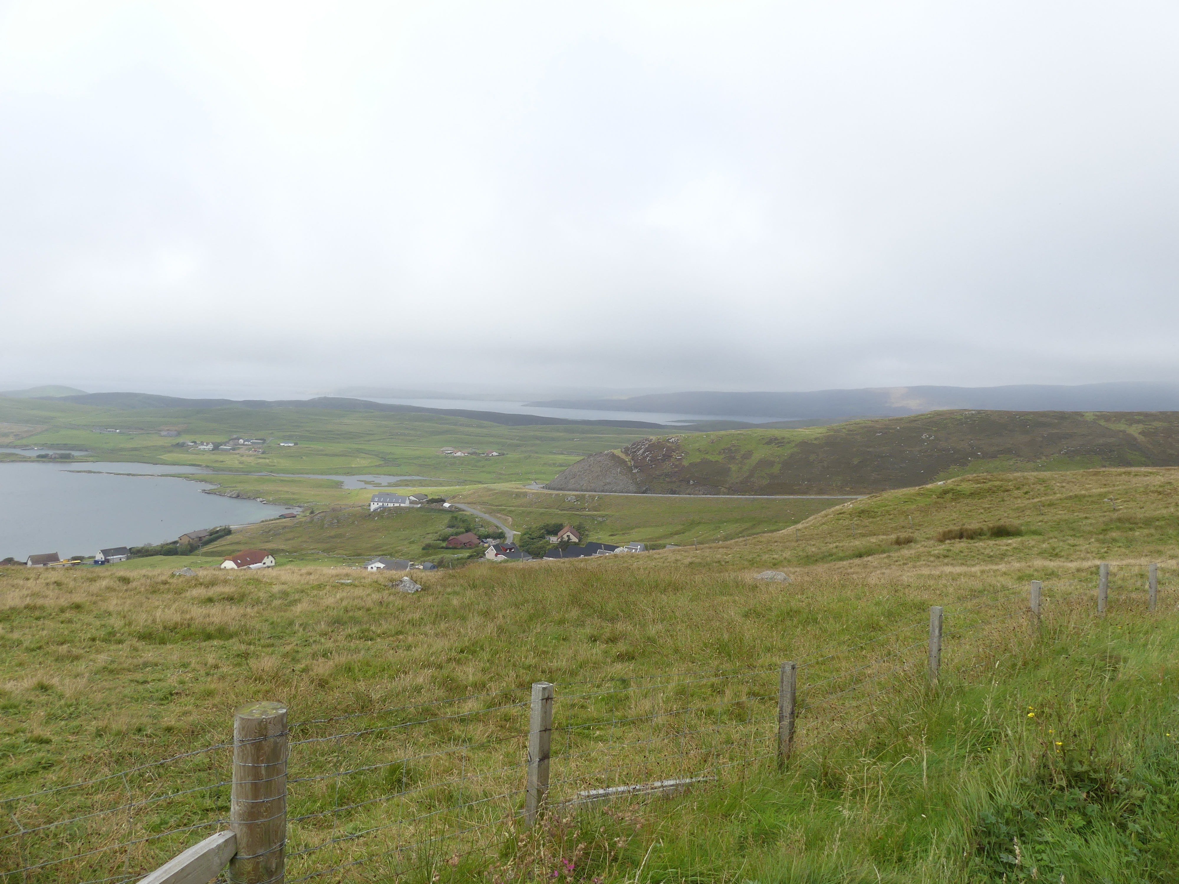
It was a cold and misty day on the east side of Mainland, Shetland and we were calling into Lerwick for the day. Lerwick is the main town and port of the Shetland archipelago, Scotland. Shetland’s only burgh, Lerwick had a population of about 7,000 residents in 2010. It is the northernmost major settlement within the United Kingdom. It is also the background in the BBC series Shetland.
The first settlement to be known as Lerwick was founded in the 17th century as a herring and white fish seaport to trade with the Dutch fishing fleet. Its collection of wooden huts was burned to the ground twice: once in the 17th century by the residents of Scalloway, then the capital of Shetland, who disapproved of the immoral and drunken activities of the assembled fishermen and sailors; again in 1702 by the French fleet. Fort Charlotte was built in the mid 17th century on Lerwick’s waterfront, and permanent stone-built buildings began to be erected around the fort and along the shoreline. Lerwick became capital of the Shetland Islands in 1708, taking over the function from Scalloway.
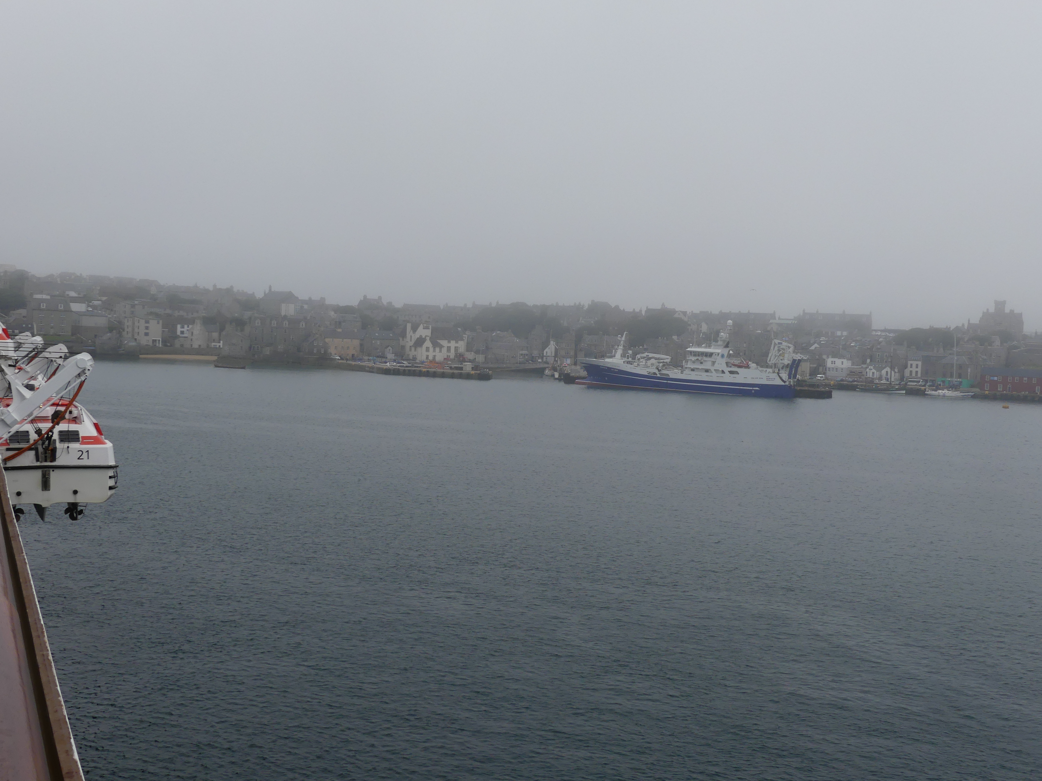
We had decided that we would take a taxi and view the burgh. So after the tenders dropped us off at Victoria Pier, we approached the first cab in the rank and organised a two hour taxi ride with a very amiable cab driver (but not a tour guide) for 120.00 quid.
We were hoping to see the wild Shetland ponies and our driver had a fair idea where to find them.
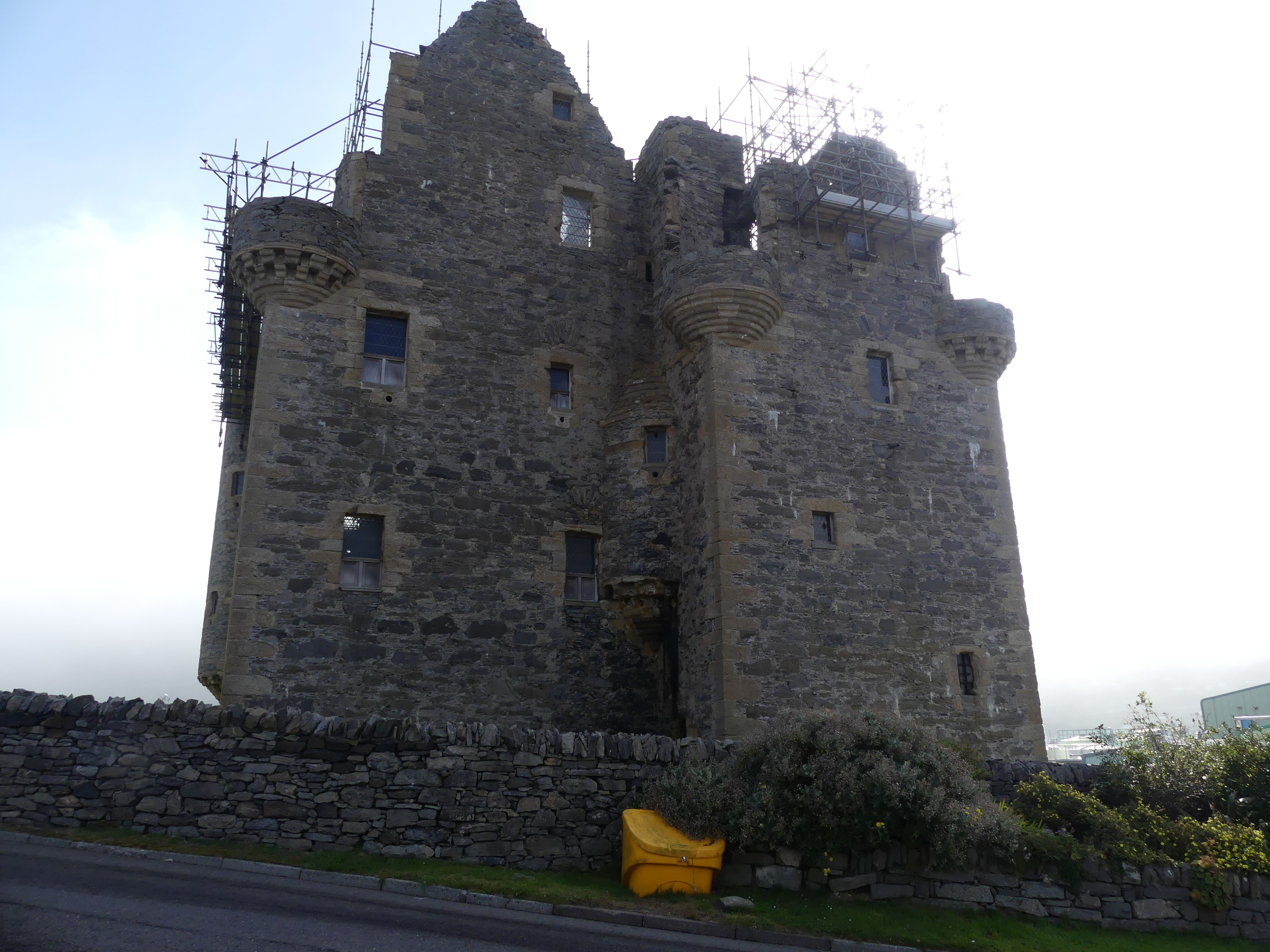
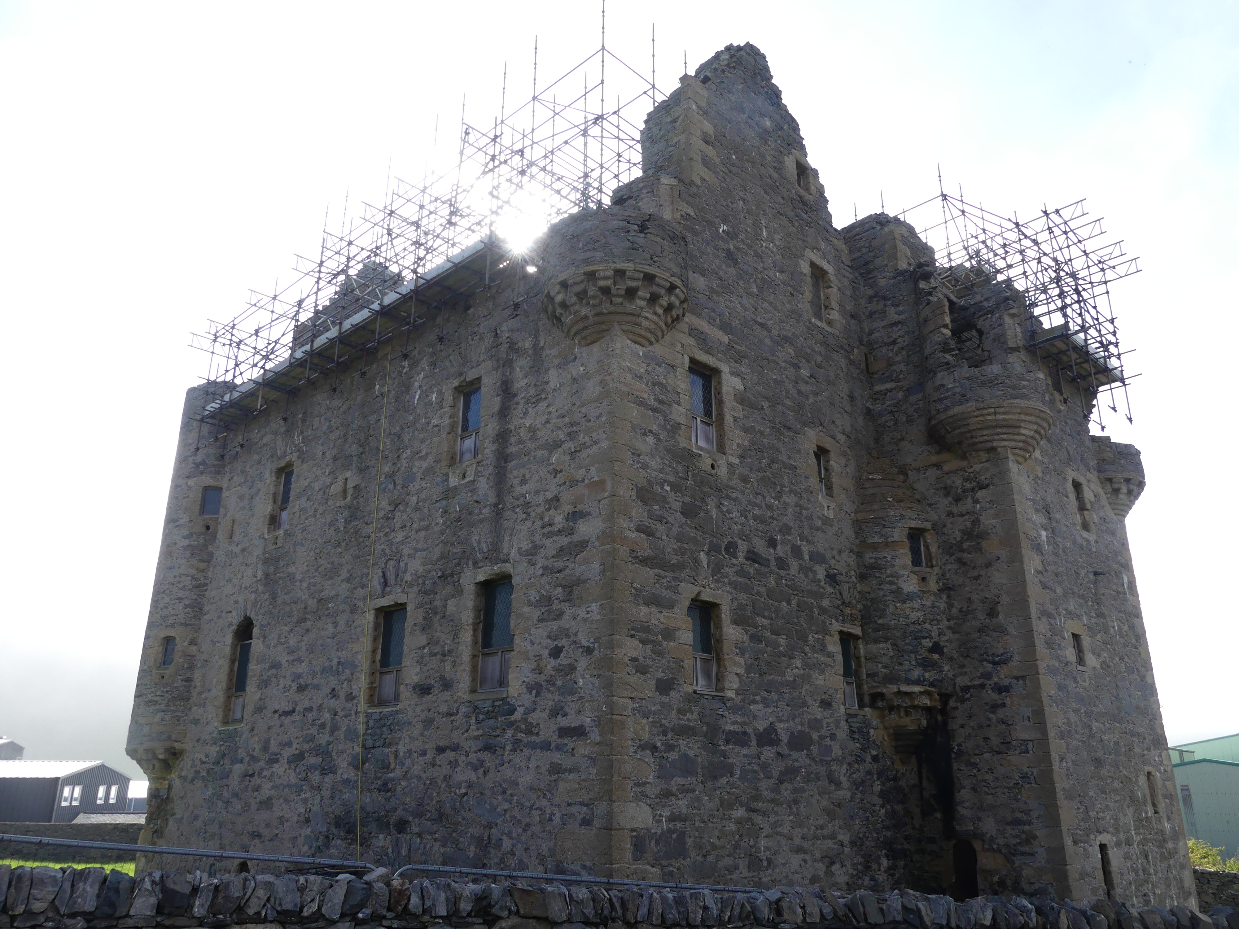
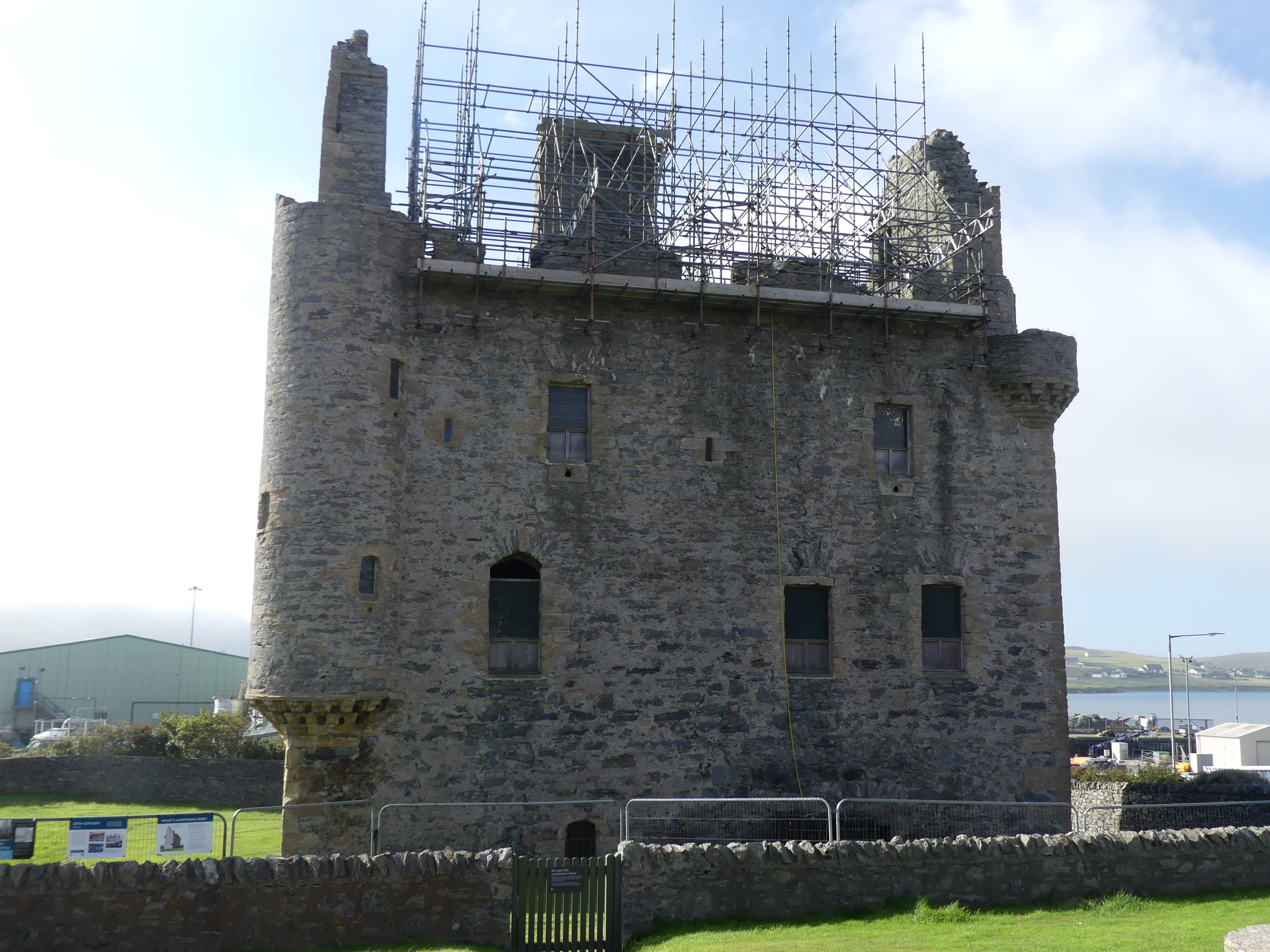
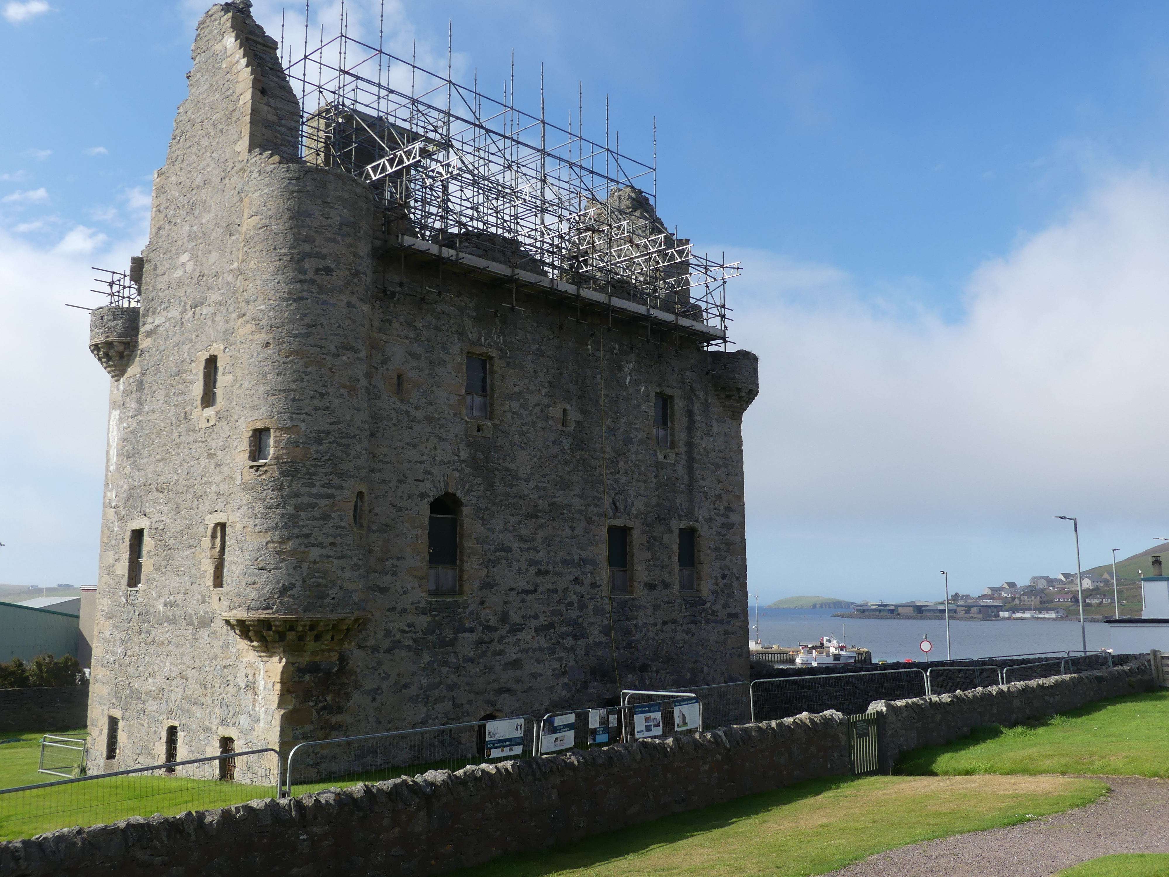
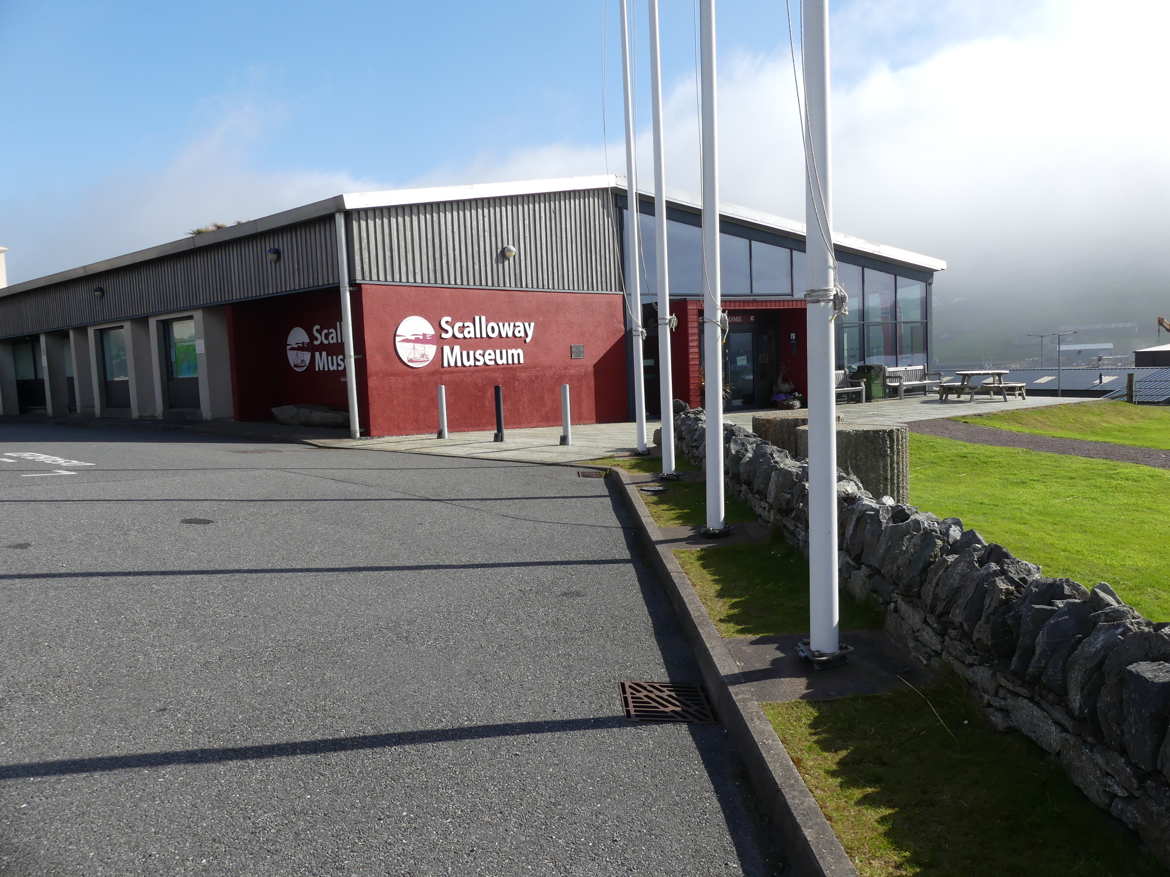
He then proceeded to drive us to Scalloway. Scalloway is the largest settlement on the west coast of the Mainland. The village had a population of roughly 900, at the 2011 census. Now a fishing port, until 1708 it was the capital of the Shetland Islands. Scalloway Castle is a tower house in Scalloway. The tower was built in 1600 by Patrick Stewart, 2nd Earl of Orkney, during his brief period as de facto ruler of Shetland. On arriving it was clear that the castle was no longer open to visitors. Driving into Scalloway we had a great view of the village and its harbour but it remained misty. The castle was bedecked with scaffolding and signs to not enter the premises. My pictures are below. Towards the rear of the castle was a museum but unfortunately not open this day. In the paddock at the rear of the museum a couple of “wild” ponies were grazing.
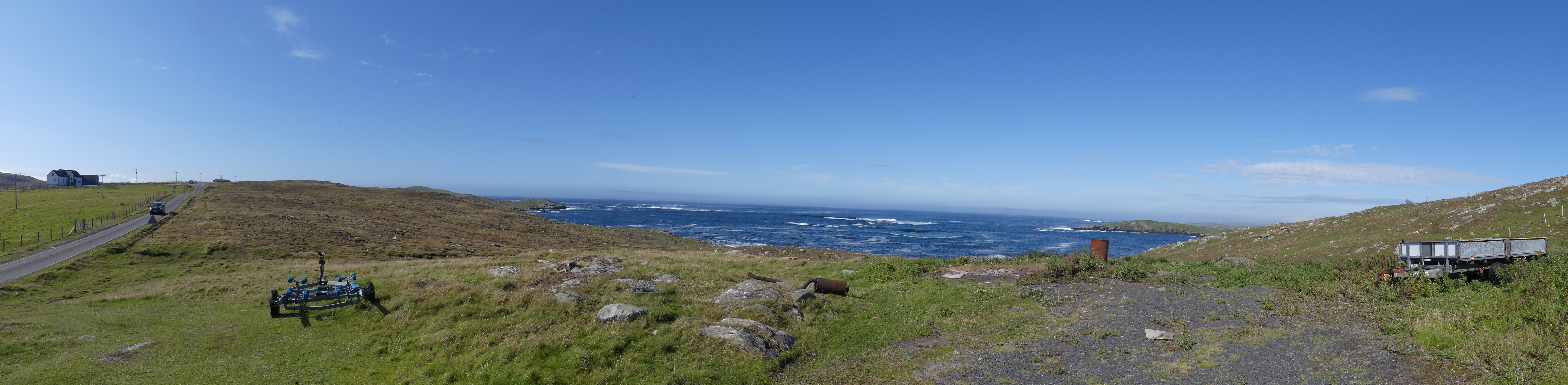
We left Scalloway to see more of the western side of the island. The weather was trying to clear but it was obvious that the eastern side was still overcast from the dense clouds shrouding the central hills. I will tell the story in pictures.
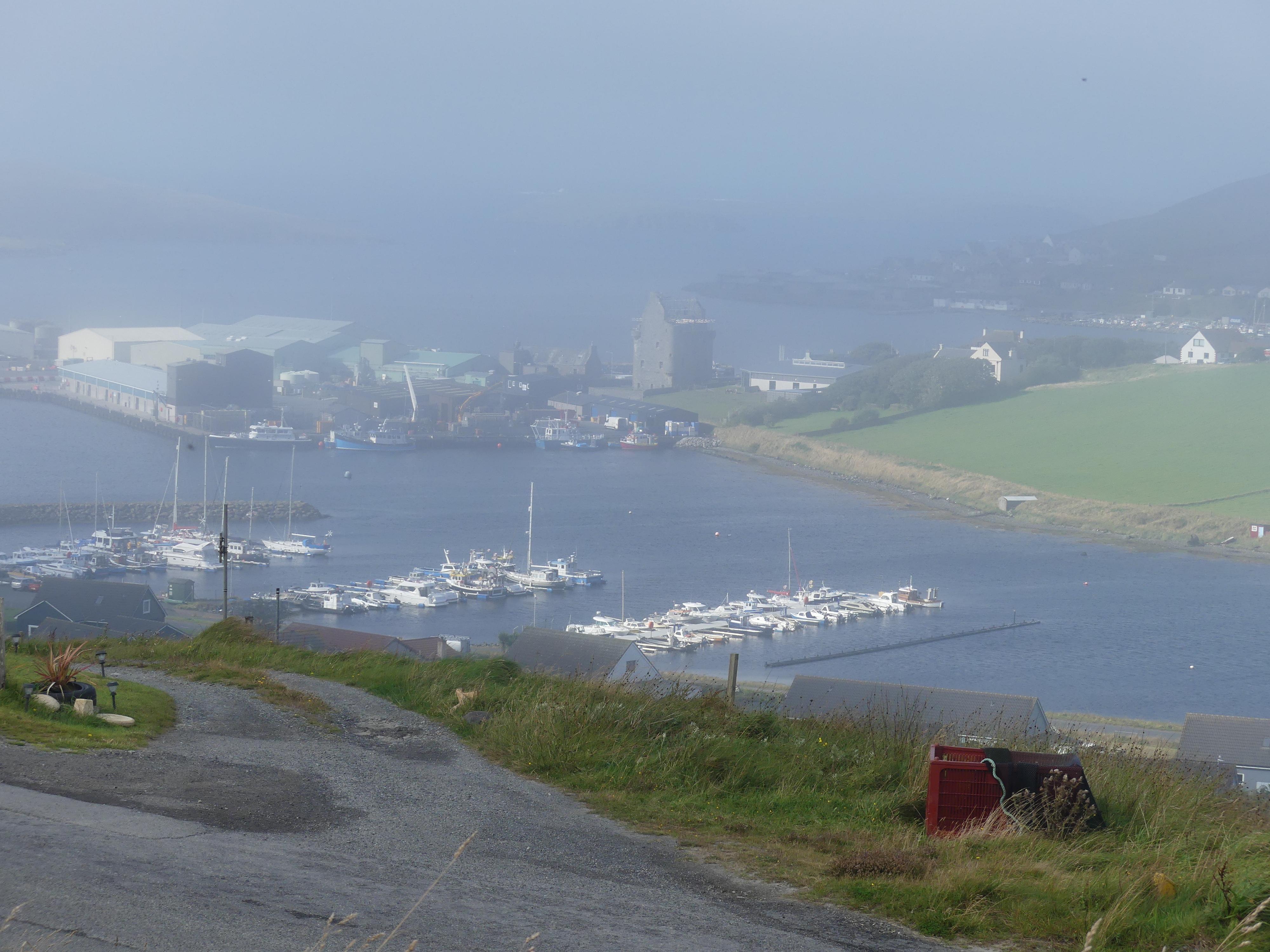
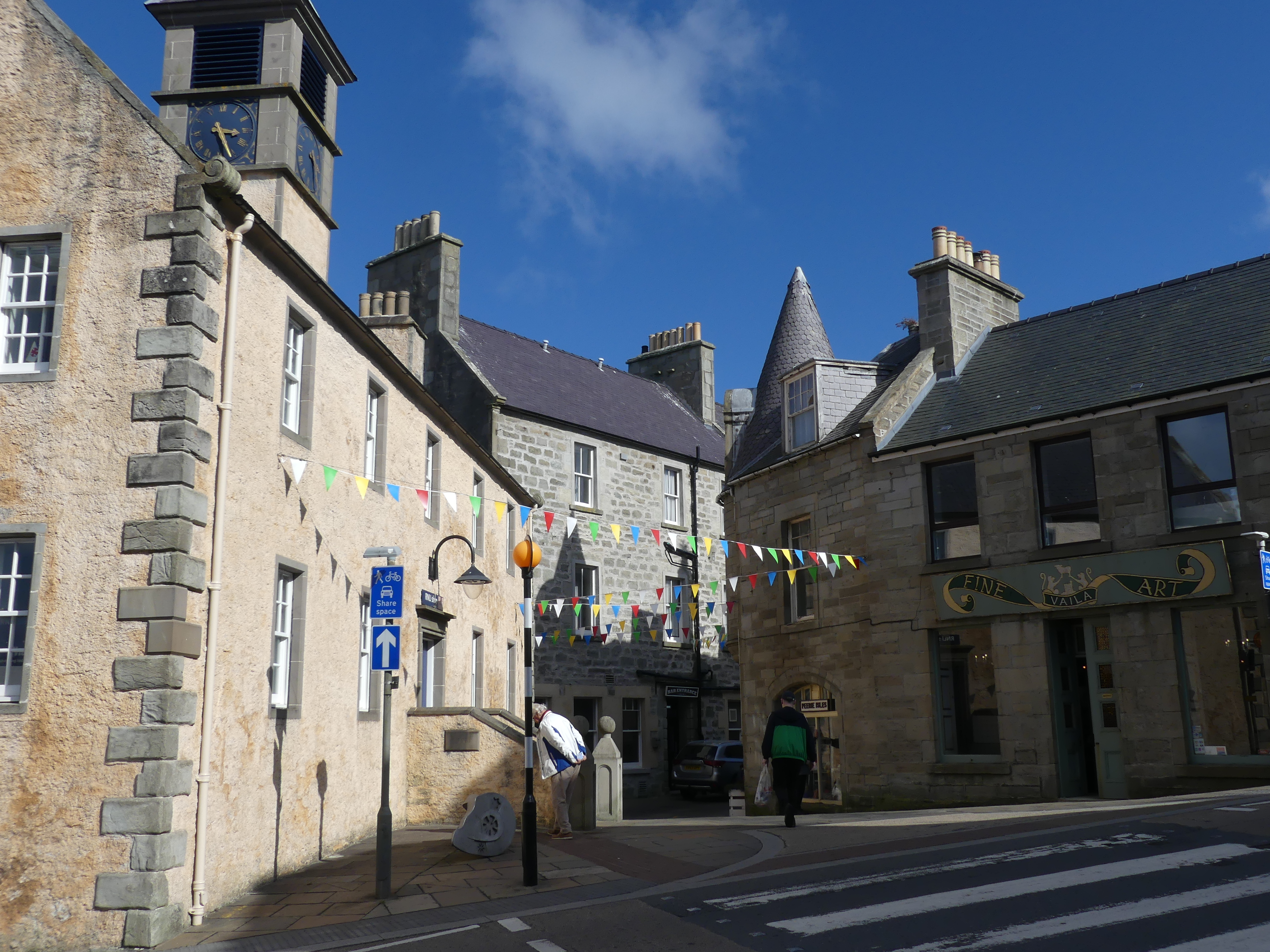
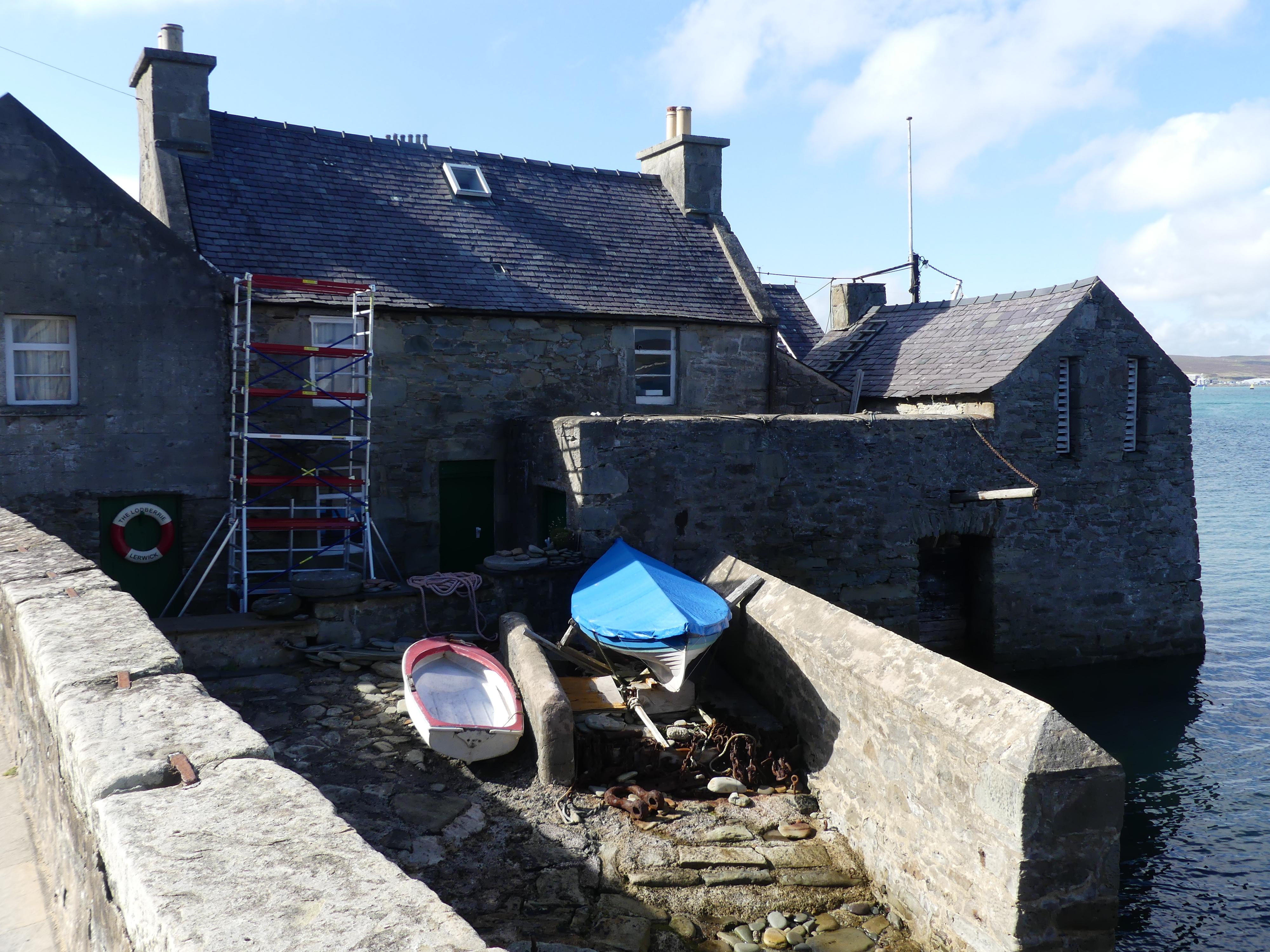
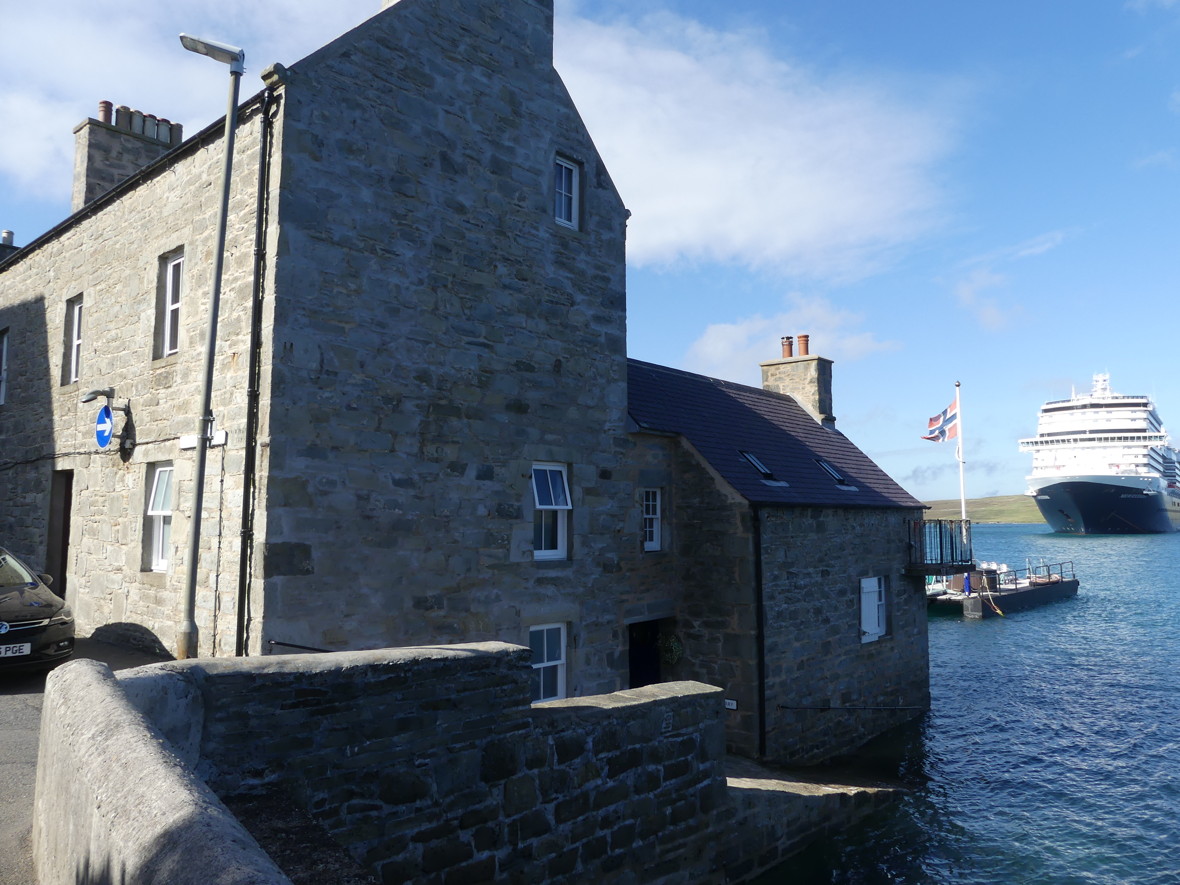
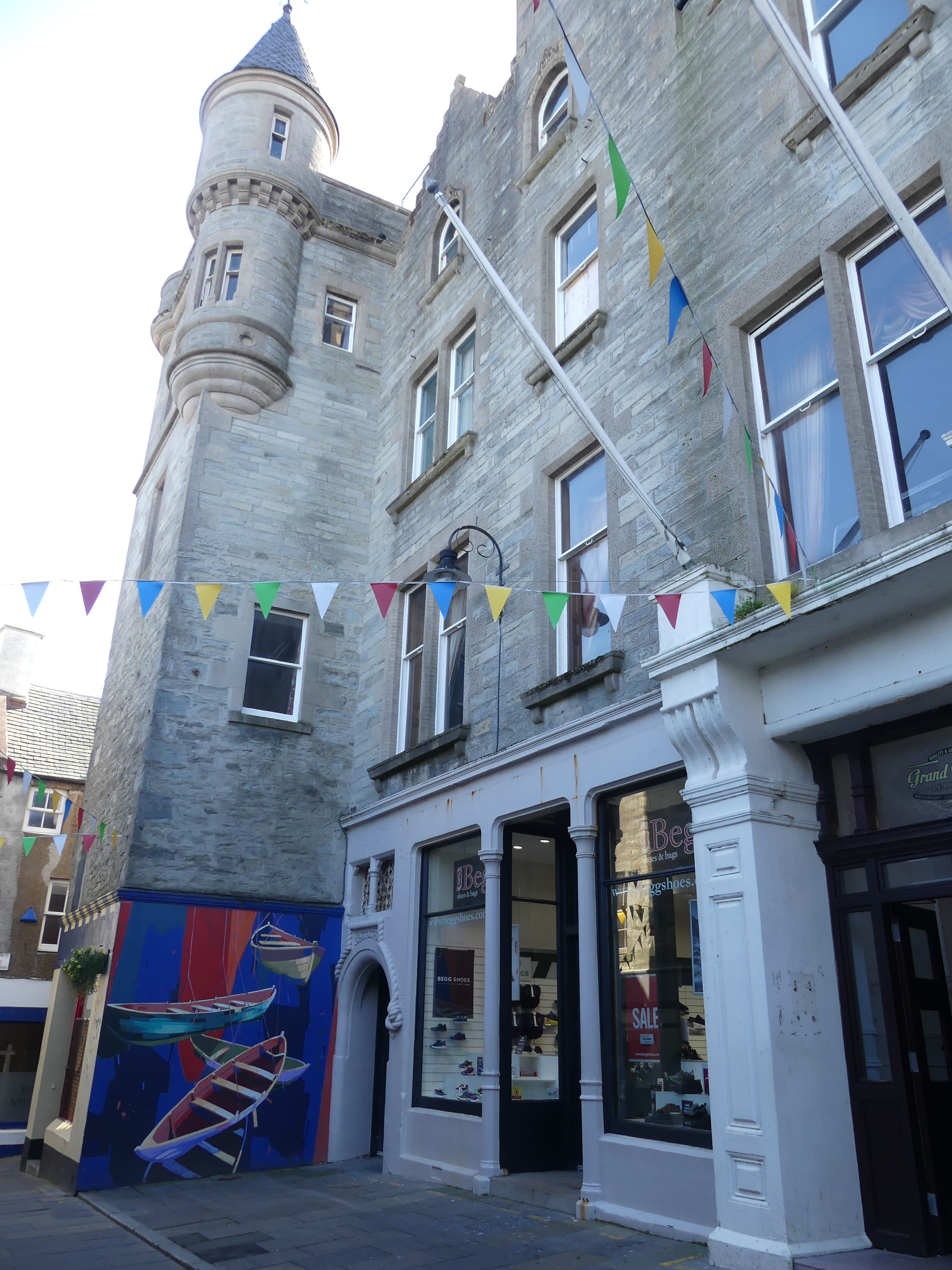
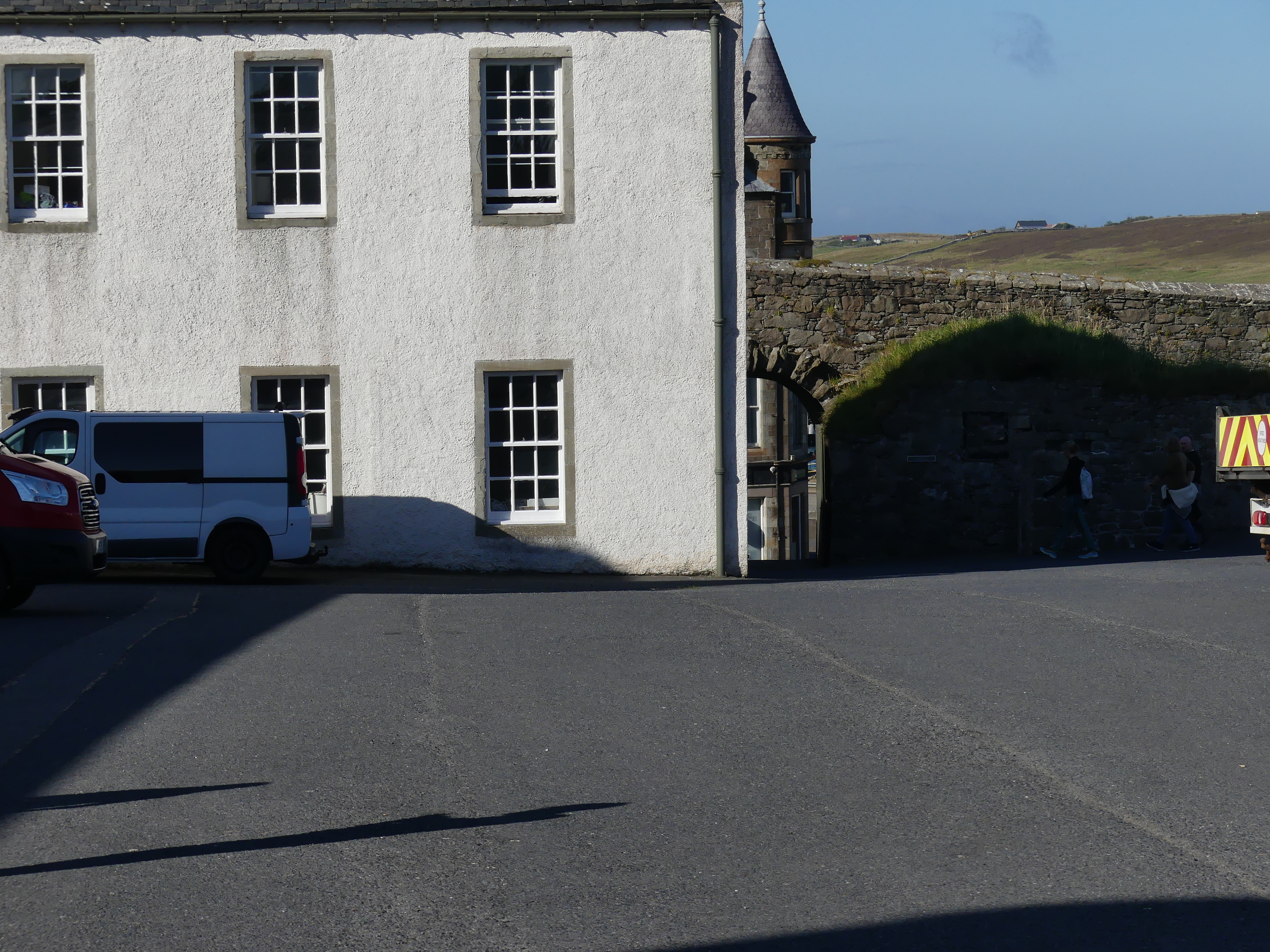
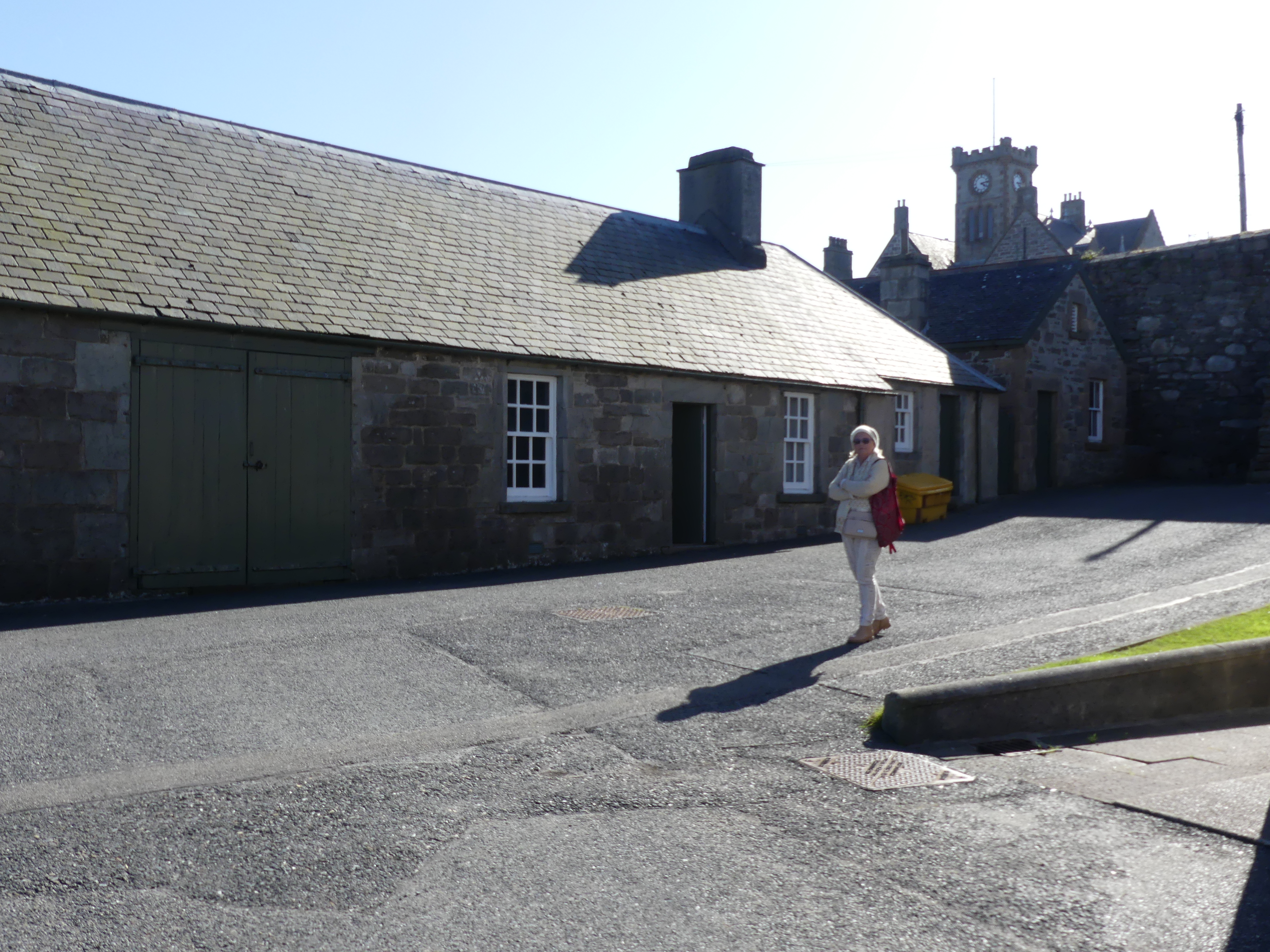
Our cab ride had come to an end with the car re-entering Lerwick and returning to the cab rank. On foot we started to explore the town. The old town was still very much the centre of town with Fort Charlotte at the northern end of the main road. The houses with Lodberries attached we quite evident and Jimmy Perez’s house and Lodberry is picture 4 below with our ship in the background.
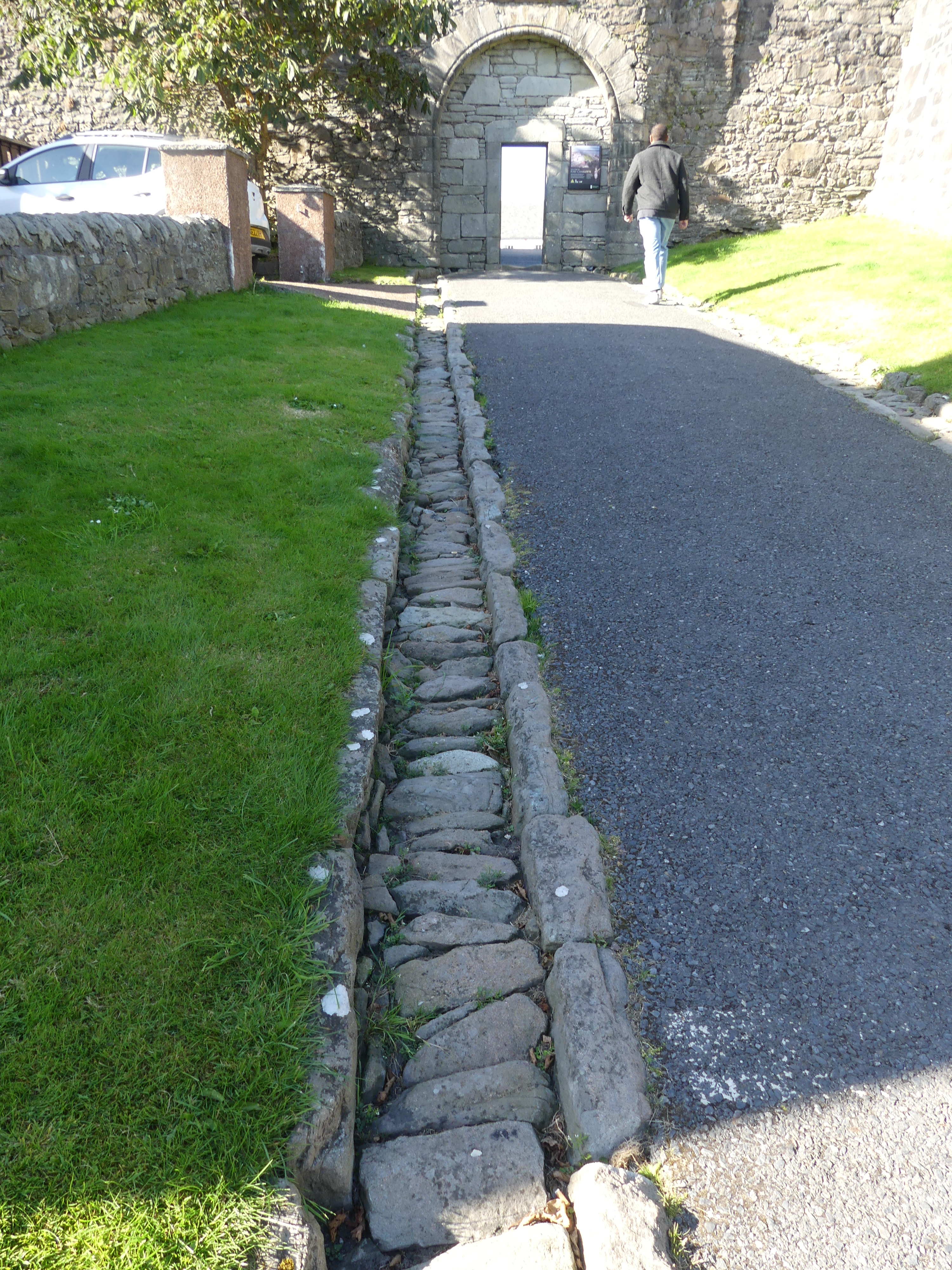
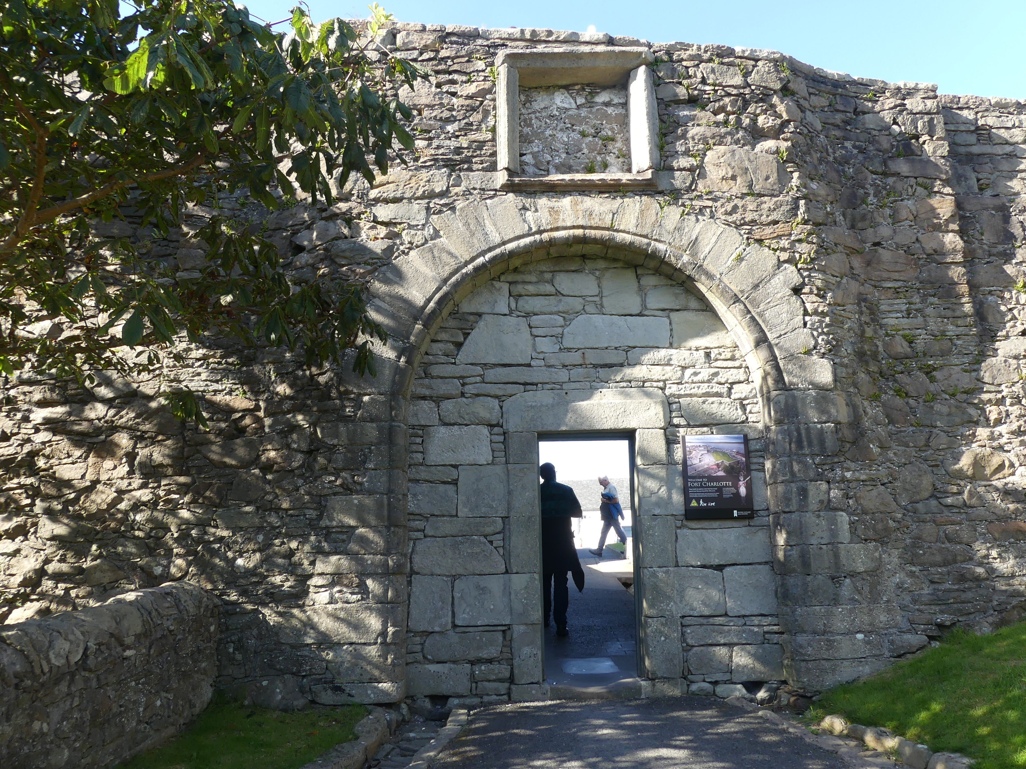
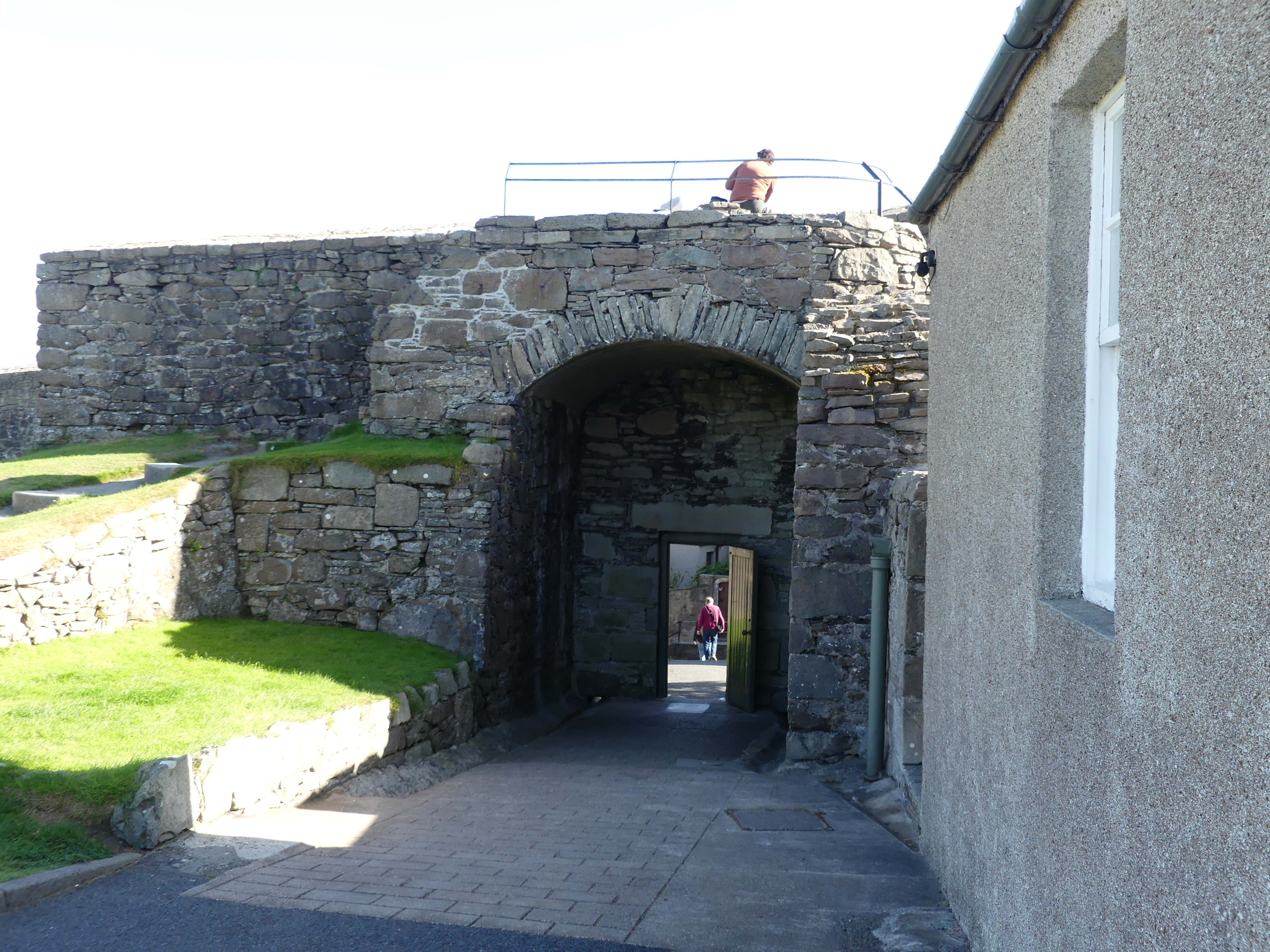
We made our way to Fort Charlotte and learned of its chequered history and current use. Yes that is our ship in the background of picture 7. The first incarnation of the fort was built between 1652 and 1653 during the First Anglo-Dutch War. Little is known of the original structure and no trace of it has been found.
The second structure was built on the same site by Robert Mylne under the orders of Charles II at the start of the Second Anglo-Dutch War in 1665 at a cost of £28,000. It held off a Dutch fleet in 1667 which thought it was far more heavily manned and gunned than it actually was. In fact, the walls were unfinished and there were few guns. At the end of the war it was slighted when the government decided not to station a garrison in Lerwick, and it was unmanned when the Dutch burnt it in 1673 during the Third Anglo-Dutch War.
It was rebuilt in its current form in 1781 and named after Queen Charlotte, but has never seen service during hostilities since then. It housed a garrison during the Napoleonic Wars and was later a base for the Royal Naval Reserve. From 1837 to 1875 it was used as the town jail and courthouse and later a custom house and a coastguard station.
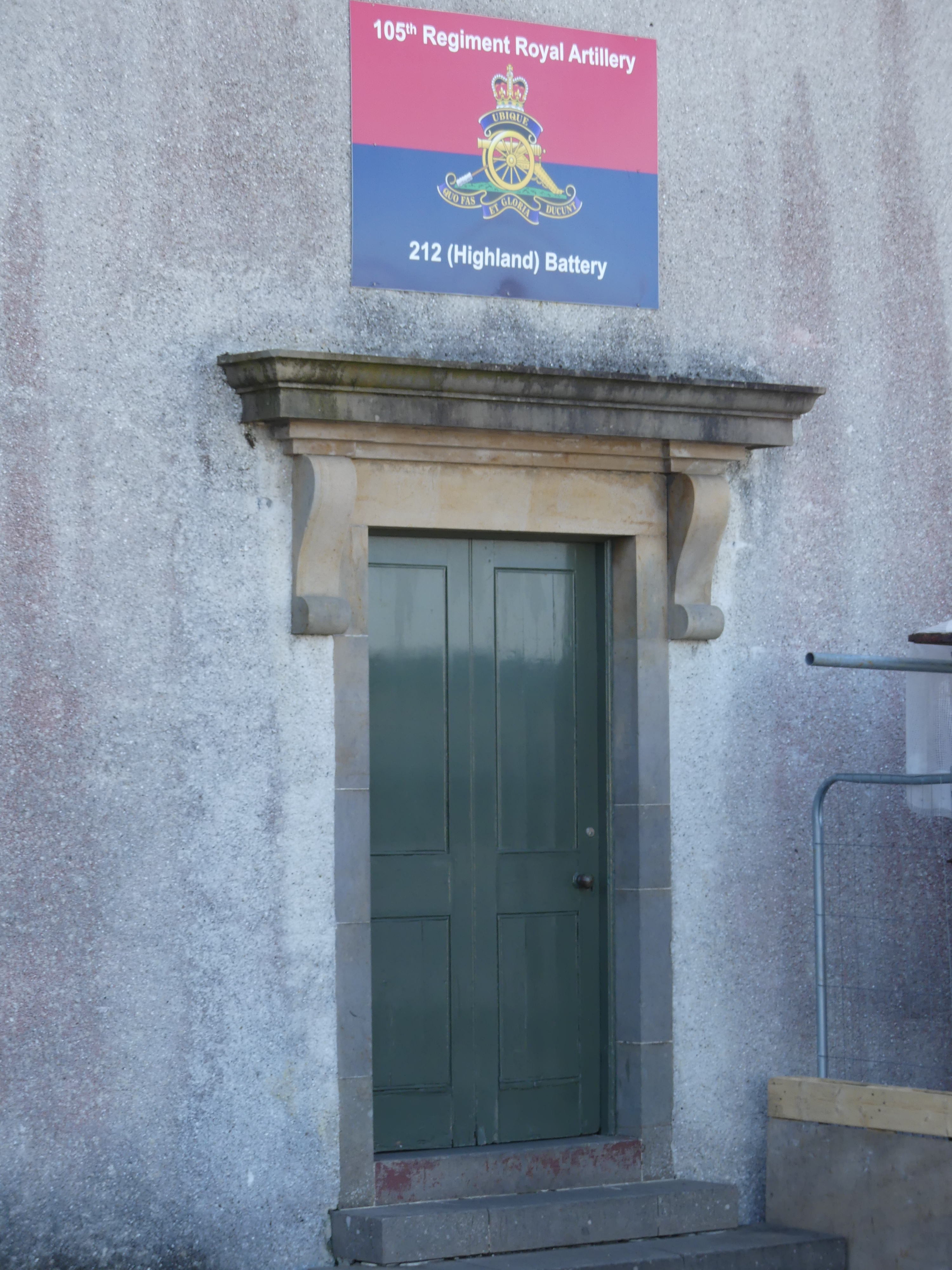
Land reclamation and structures erected in front of the fort mean that it no longer dominates the shoreline and the overall ground plan can only be seen from the air. Fort Charlotte is managed by Historic Environment Scotland, and is the base for 212 Highland Battery, part of Britain’s Army Reserve.
The photos in the last line include the former farm house across the bay, the houses beyond the fort walls and the natural stone wall with the bastion wall built atop of it and the main road below.
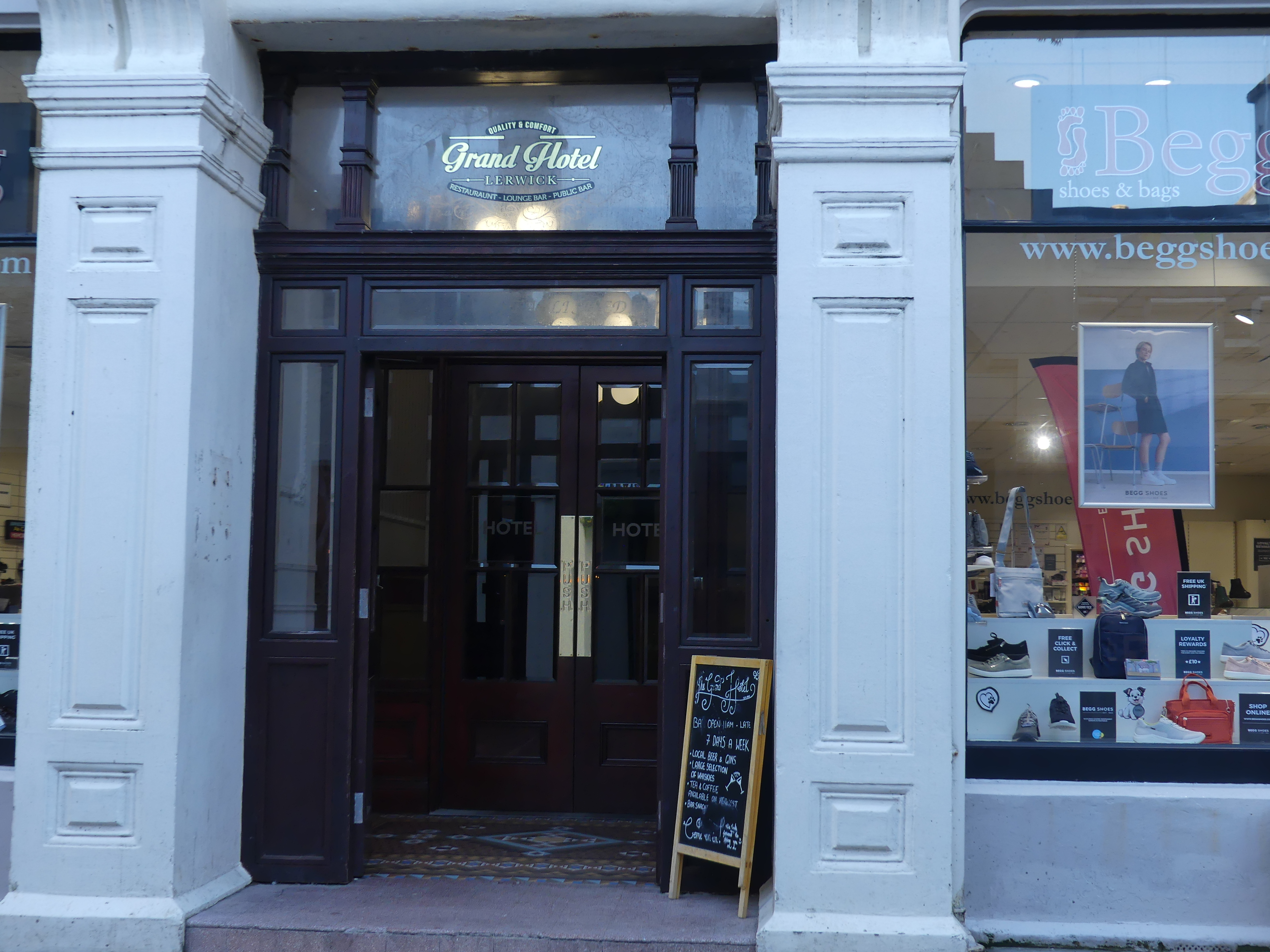
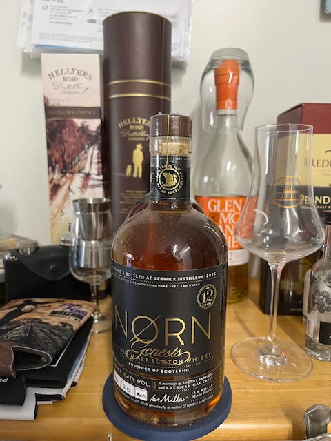
We continued our walk through the town. I had heard there was a distillery opening in the town and here was a chance I might stumble upon it. We walked past the car ferry to Bressay (picture below) and Kerry found the distillery. It was close to closing time and the sales girl explained quickly about their distiller and the fact that the distillery had not produced any scotch for retail sale as yet (the distilled brew must be in the cask for 3 years and a day before it is Scotch) but they could offer a tasting paddle of various other scotchs from around Speyside and the Highlands and a sample that their distiller had been working on at his previous distillery. The bottle label gives away the secret. Beautiful scotch but at 160 quid prohibitively expensive. Below is a picture of my 500 gram 12 year old numbered bottle of “Norn” scotch “a Speyside Single Malt secretively acquired and bottled at 60 degrees North” – Master Distiller Ian Millar.
As we returned to our ship we came upon a shop with a goat at its front door – yes a living breathing live goat. The goat belonged to two Shetlanders running an arts and crafts store and the goat was a pet. They we’re closing for the day so they opened the back door of their van and the goat climbed in and home they went. Its a long time since such a scene occurred in Queens St Brisbane but its an every day event in Commercial St., Lerwick’s main street.
Our day in Shetland had come to an end but I forgot to mention that I purchased a T-shirt emblazoned with Shetland ponies such that I would always remember my visit. At that time I also decided I would collect a T-shirt from each of the islands we visited – Orkneys, Outer Hebrides, and Isle of Mann. No, no photo of my T-shirt. But you may see me wearing in the streets of Brisbane. Til my next blog “THE RETIREES GO AROUND THE WORLD – DAY 4 SS NIEUW STATENDAM – Orkney Isles” – may you keep a fair wind at your back.
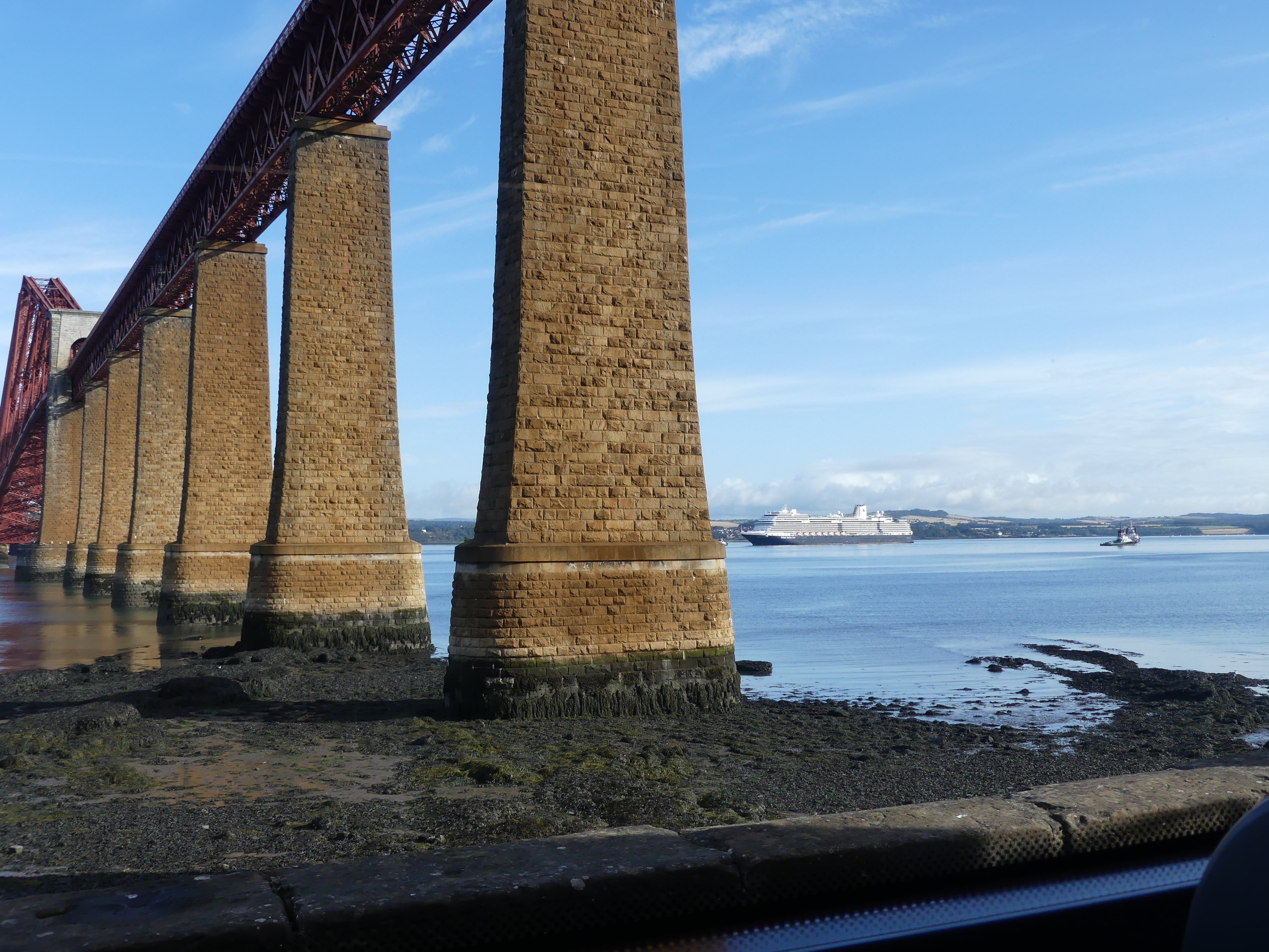
The ship continued to rock and roll gently through the night. Kerry found this disturbing and I slept like a baby – except for the dig in the ribs from Kerry who wanted me to worry about the rolling with her. With the dawn we passed a number of oil platforms until we entered the harbour of Queensport. The ship was too big to dock at Queensport so the ship lowered the tenders and we travelled to the wharf to disembark. The pictures below are of the bridge across the Firth of Forth where the River Forth meets the North Sea, and famous for its three iconic bridges (Rail, Road, Queensferry Crossing) near Queensferry, serving as our entrance to Edinburgh. Some years ago we attended the Edinburgh festival and attended the Tatoo. We stayed at Fife taking the train across one the bridges (there only being two bridges at the time with third under construction) and the reunion with the bridge reminded us of that trip.
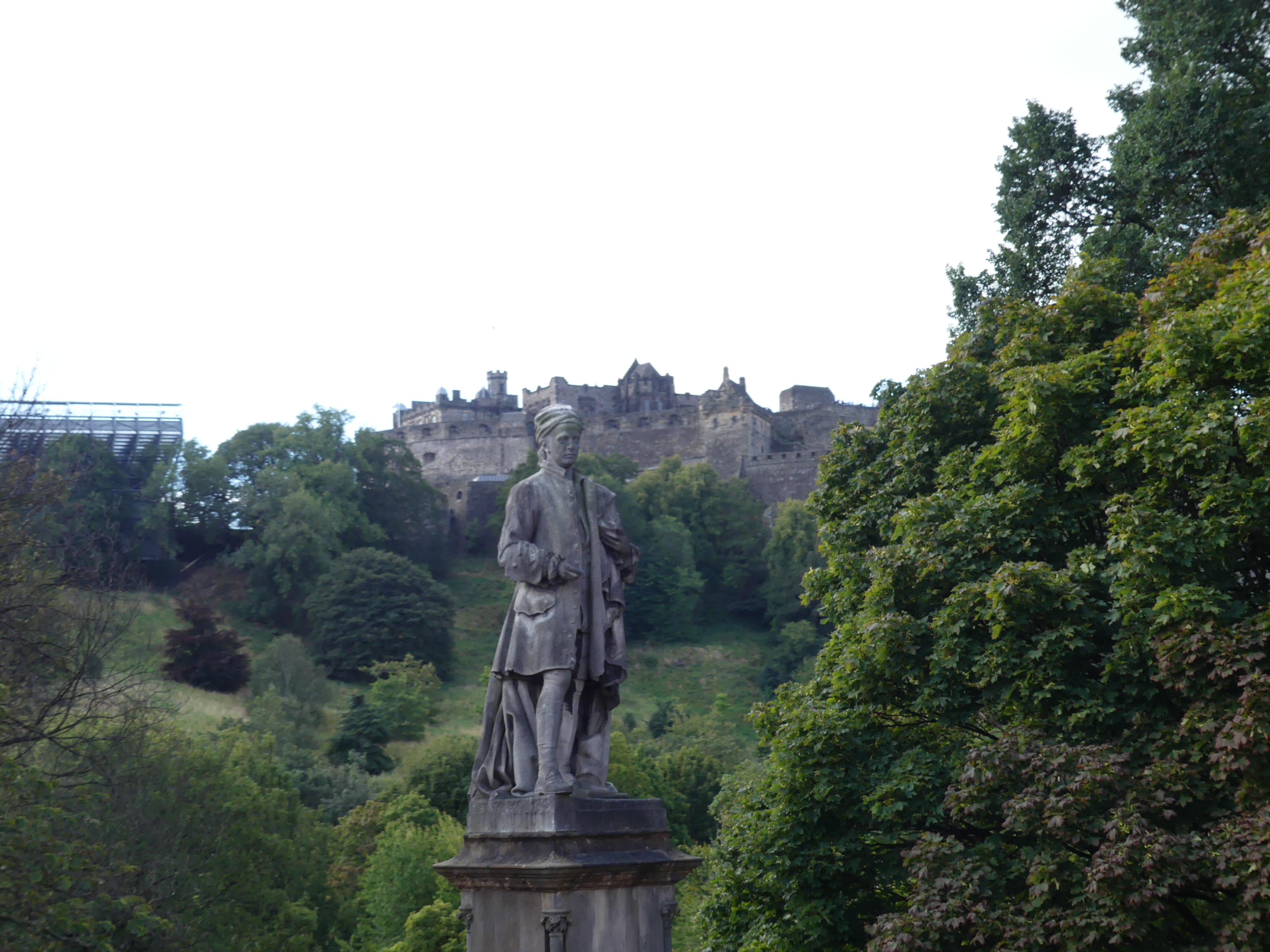
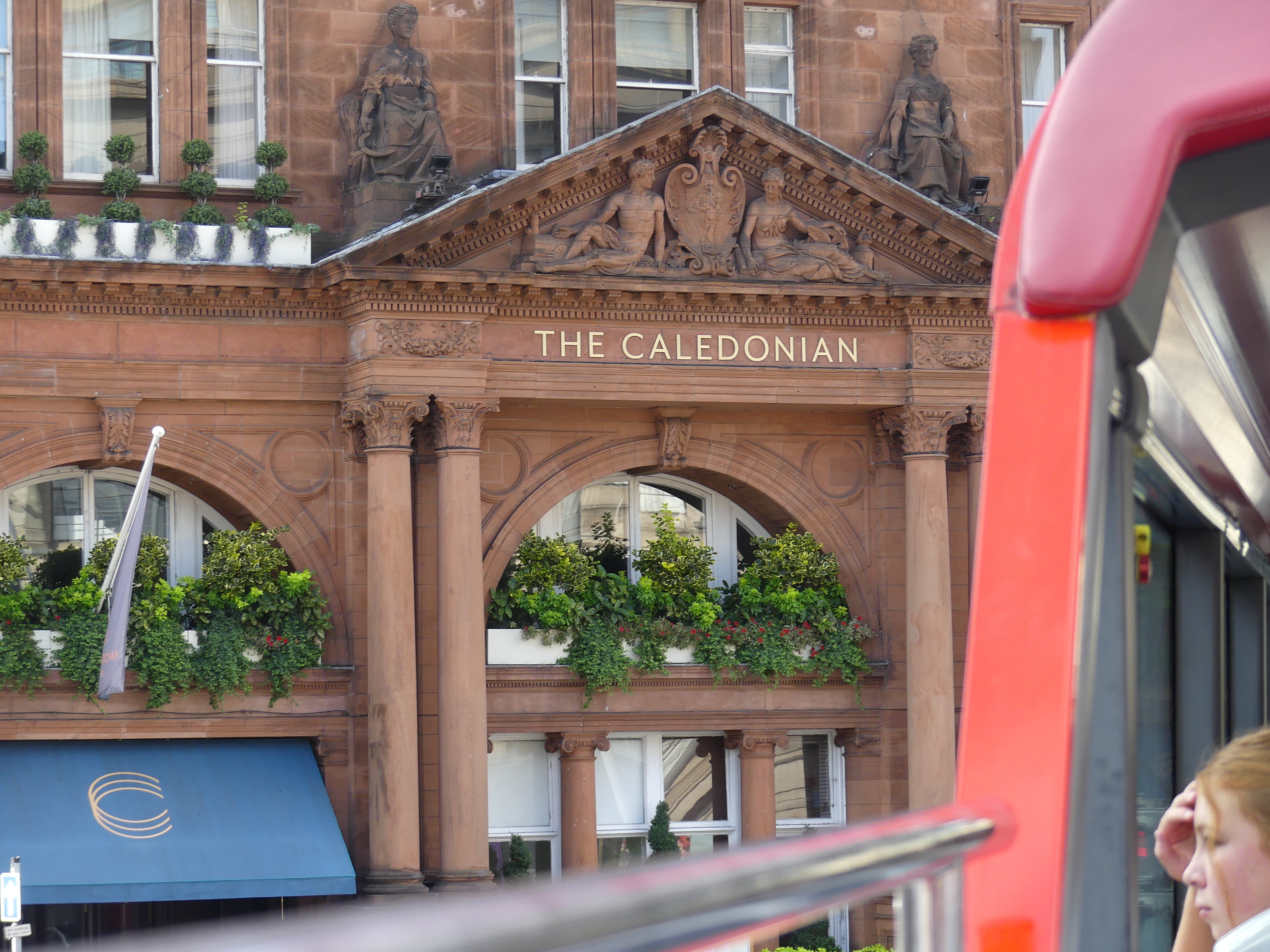
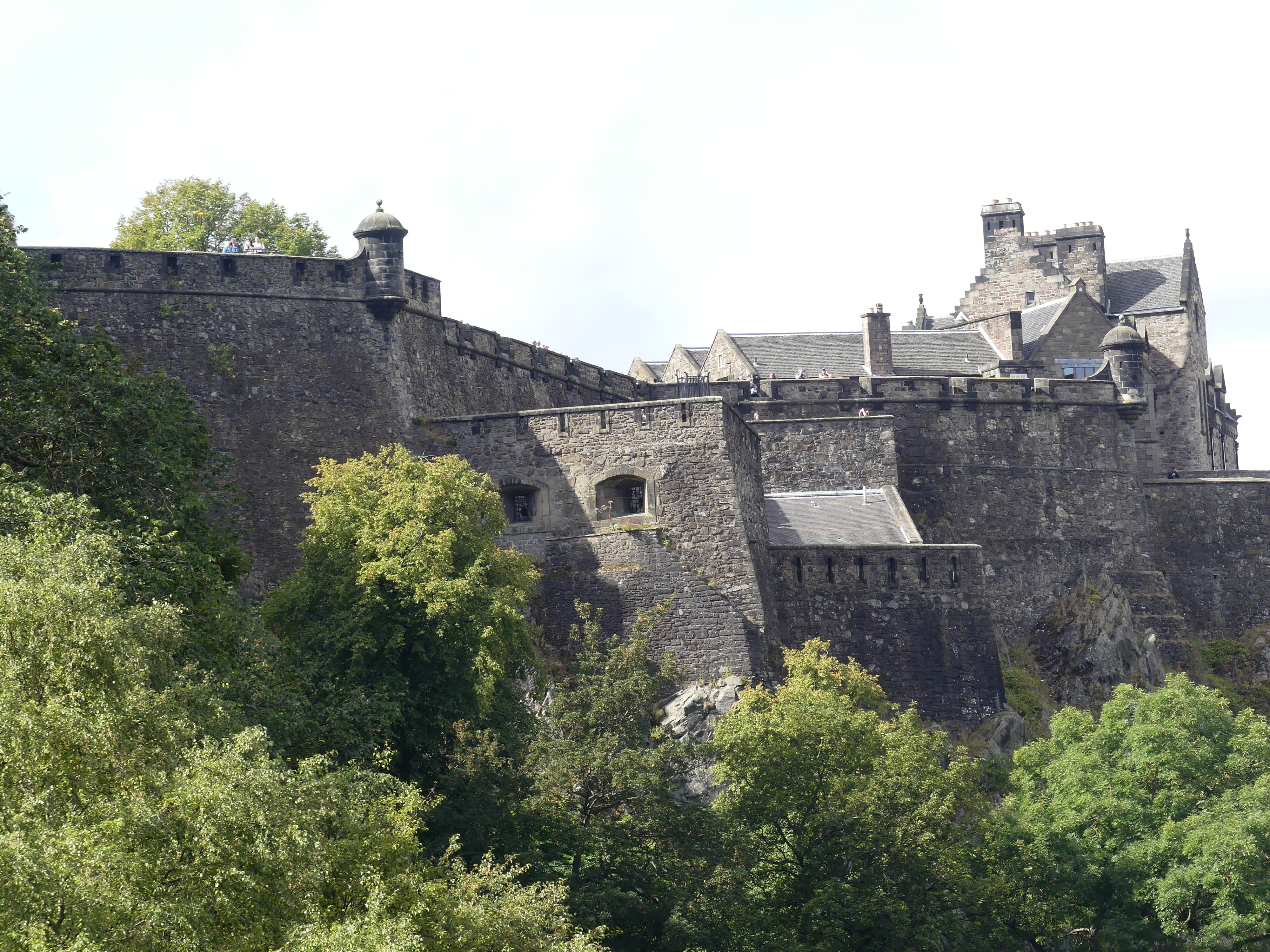
The ship provided a bus shuttle which we caught from the Ferry into Edinburgh. After sought out where we were, we made our way to Waterloo Place outside Princes Street Suites. A man in a uniform brandishing a placard advertising the Hop on Hop off bus stood under Prince Leopold’s Arch selling tickets. The arch built in 1819 to celebrate the visit of Leopold Prince of Saxe Courburg seemed out of place and there was no explanation as to the reason for it. My research shows that the arch marks the entry of Leopold into Edinburgh connecting Waterloo Place over the Old Calton Gorge, with the arch serving as a temporary triumphal gateway for the royal visit. A significant civic event at the time, though this Prince Leopold later became the first King of the Belgians. As we passed the arch we commenced the red line tour passing the Scott Monument. The Scott Monument is a Victorian Gothic monument to Scottish author Sir Walter Scott. It stands in Princes Street Gardens in Edinburgh, near Edinburgh Waverley Railway Station. In the distance you will see Edinburgh Castle.
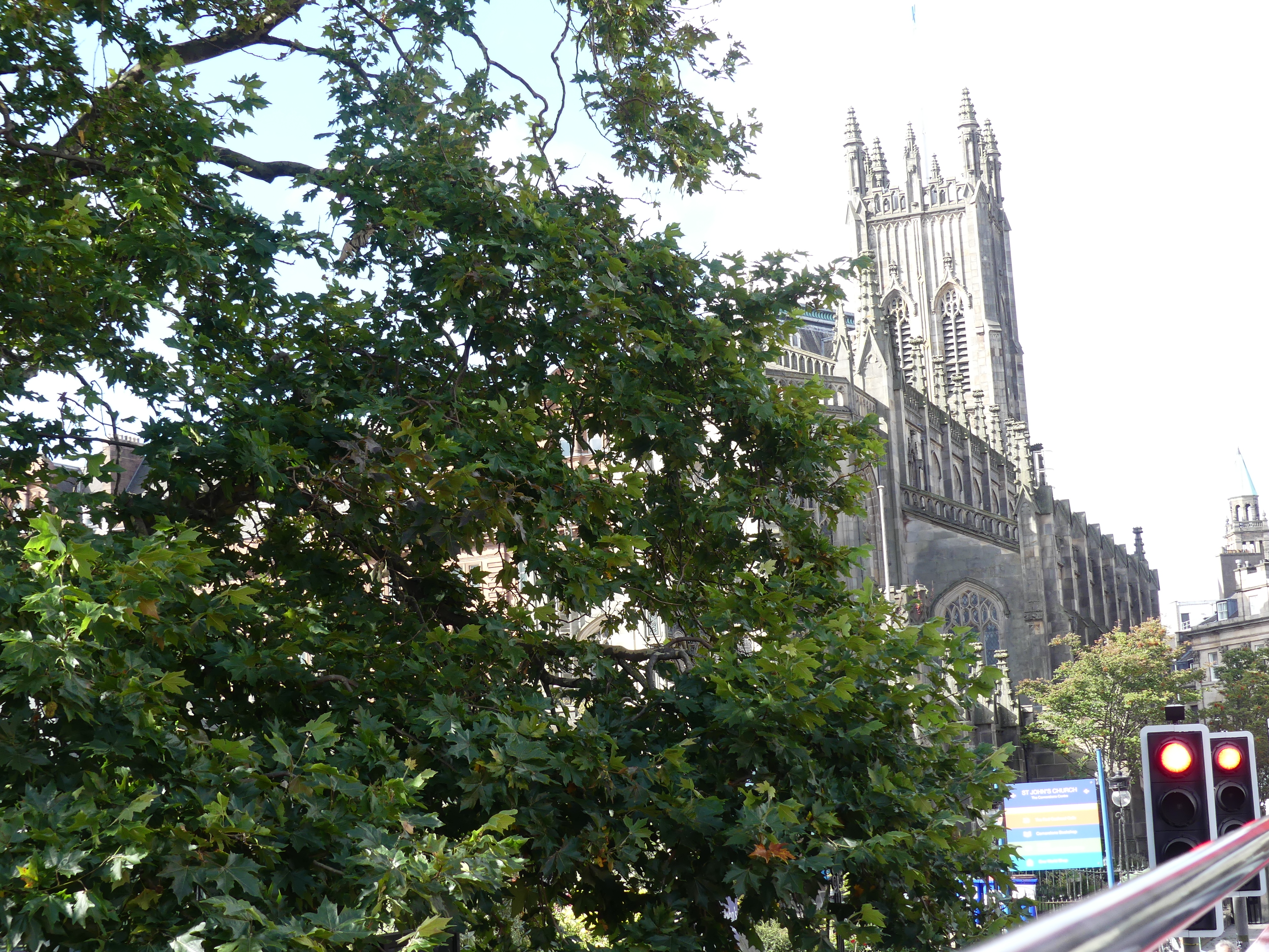
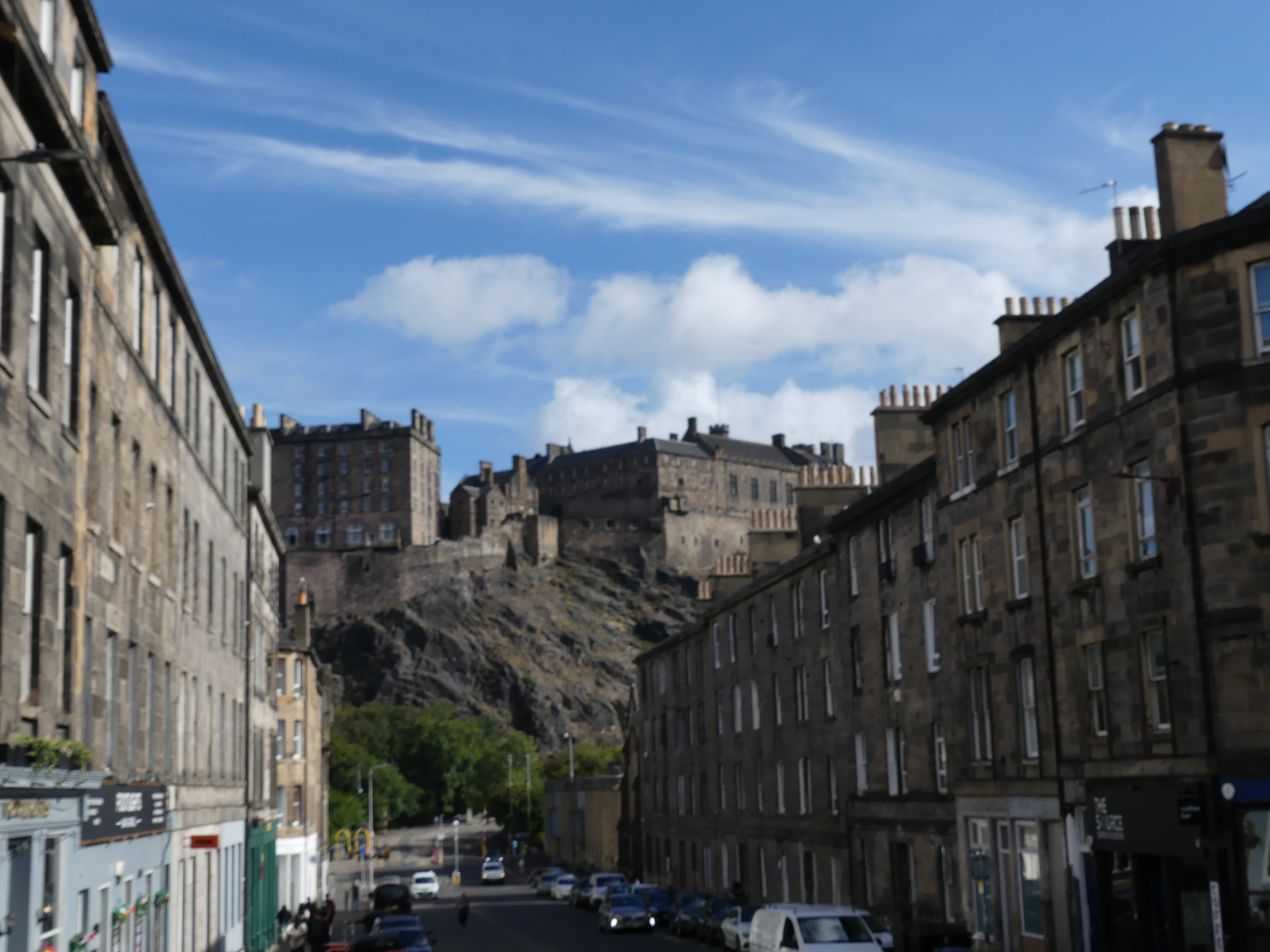
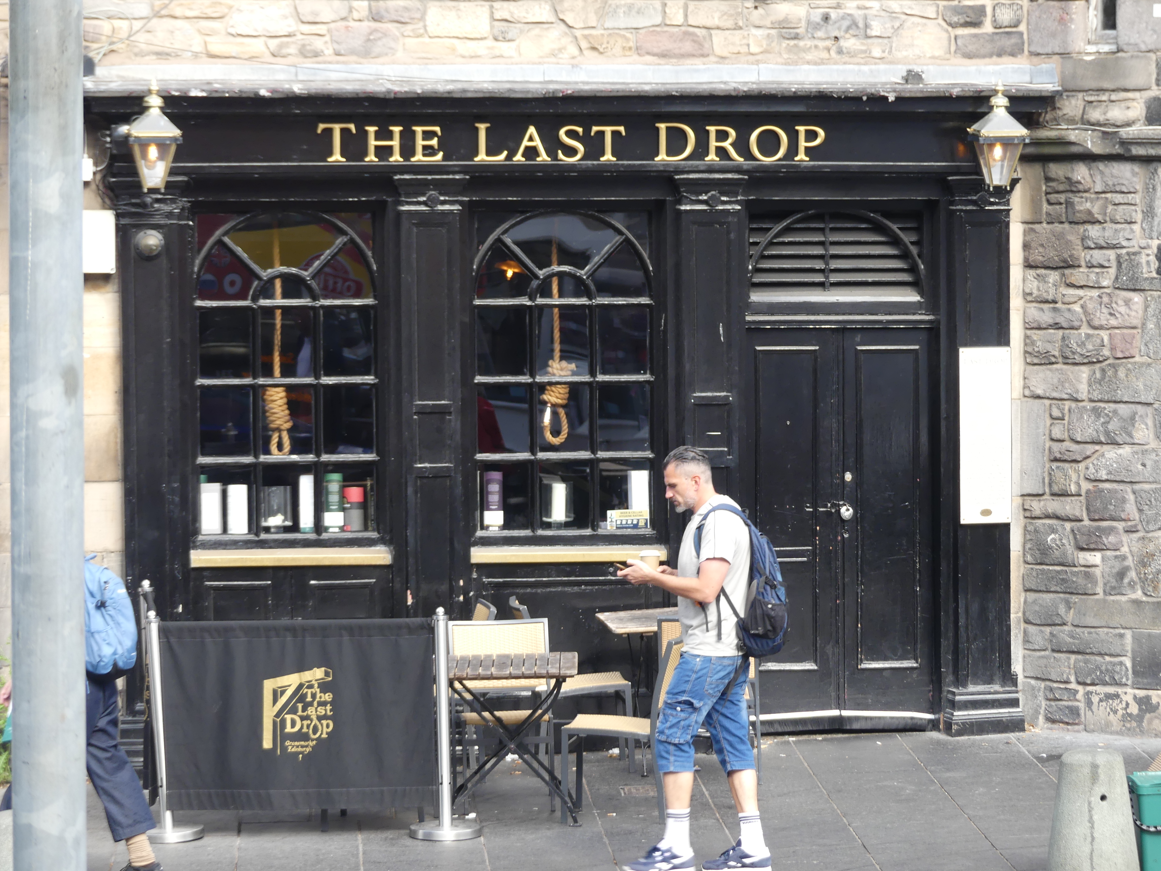
The Bus moves along the Royal Mile through the heart of Edinburgh’s Old Town, connecting the magnificent Edinburgh Castle, perched high on a base of volcanic rock, the Mile is overlooked by impressive, towering tenements, and into the Grassmarket. The Grassmarket is a historic, picturesque, cobbled square beneath Edinburgh Castle, famous for its lively atmosphere, independent shops, quirky pubs (like The Last Drop and Maggie Dickenson), diverse restaurants, and its past as a cattle market and site for public executions.
The Last Drop sits in Edinburgh’s Grassmarket district which was a small open space where local farmers brought their hay and other produce for sale. It was also the location of one of the main gallows in the city and crowds would flock in huge numbers to see the public executions. The Last Drop Tavern is located immediately next to the scene of public hangings which took place there back in the eighteenth century. Tenements once stood on the site, but these were rebuilt into the pub you see today using the old buildings’ original seventeenth century stone.
Maggie Dickensen Pub. Maggie Dickson was a fish hawker from Musselburgh and in 1723 she “fell pregnant” after a secret relationship with an innkeepers son in Kelso. The newborn baby died and Maggie decided it was best to conceal the body so the affair would not be discovered. However, the baby’s body was discovered and Maggie was found guilty of killing a child. She was returned to Edinburgh for execution, which took place in Grassmarket on September 2, 1724. Her friends and relatives took possession of her body, and placed it in a coffin and to be taken to Musselburgh for burial. The party paused en route for a drink and they noticed, the lid of the coffin began to move. Maggie was alive and well enough to walk the rest of the way to Mussleburgh the next day. She survived she was a “good friend” of the ropemaker and the early breaking of the rope allowed her survival. Having already been pronounced legally dead she could not be tried again and she lived another 40 years and known as Half-Hangit Maggie. She opened the pub in Grassmarket, and whenever there was a hanging going on outside, she would bring the accused a pint and say not to worry, she survived her own hanging.
Pictures of both establishments are above. Next stop was Calton Hill.
Calton Hill is a prominent, historic hill in central Edinburgh, famous for its iconic monuments, panoramic city views, and as a UNESCO World Heritage Site location. Key features include the unfinished National Monument (a Parthenon replica) and the City Observatory, offering stunning vistas of Edinburgh Castle, Arthur’s Seat, and the Firth of Forth. Moving on we passed Holyrood House, now overgrown with trees and then the Scottish Parliament Building seen below on the left. As we finished our tour we came across H & T Pawnbrokers. Very elaborate establishment – certainly no Steptoe and Sons there.
We returned to our shuttle bus stop after grabbing a sandwich at the Edinburgh Waverley Railway Station, tired from sitting in the bus – that still happens to me that I need a nap in the afternoon.
Our next adventure is “THE RETIREES GO AROUND THE WORLD – DAY 3 SS NIEUW STATENDAM – Shetland Isles.” We have both enjoyed the BBC drama of “Shetland” and I was anxious to see for my self how this small group of islands could have so many murders occurring on a daily basis.
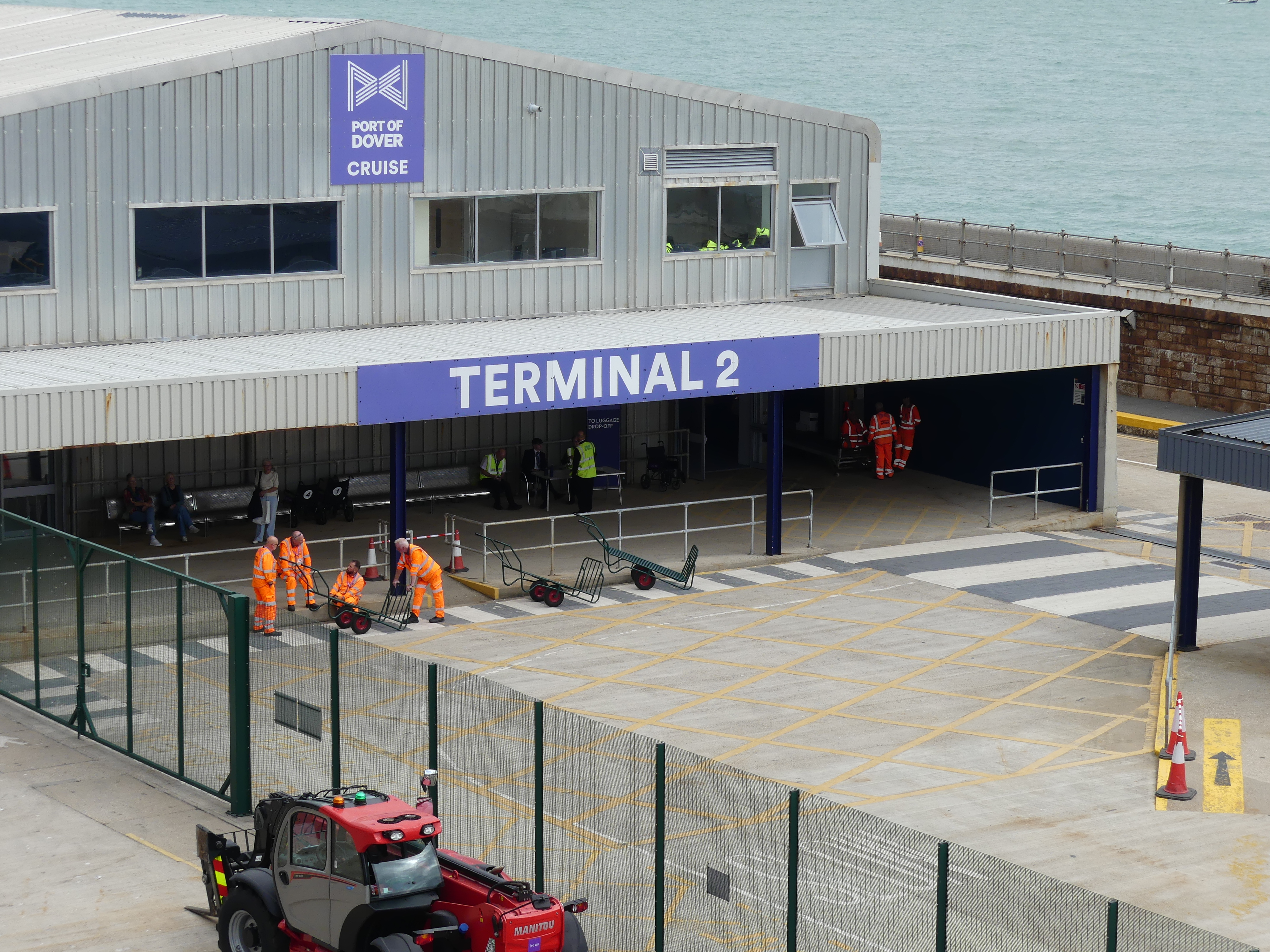
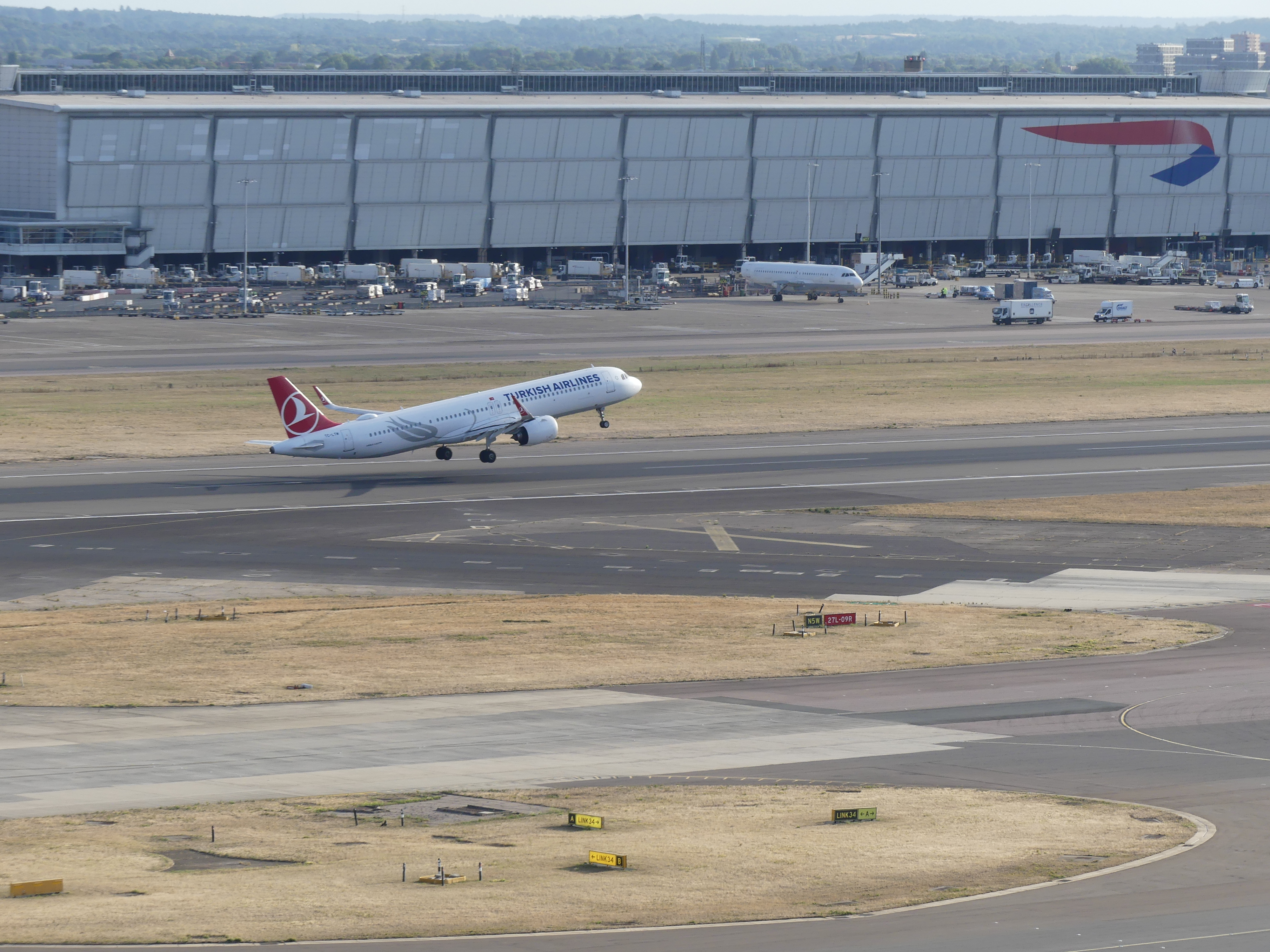
Our plan to travel to Dover was going smoothly until we arrived in Dover and got an understanding of the location of the bus terminus and the Cruise Ship port – they are a long, long, long way apart and there were no taxis due to the backed-up trucks collecting goods from the shipping port. With no other choice and time to spare , we set off on foot dragging our luggage. Fortunately, we met some passengers returning on foot to the same vessel and with their guidance we knew we were pointing in the right direction. Along the way we picked up another couple dragging their suitcases and the six of us were able to help each other to handle this tortuous walk. It seemed such a long trip on foot.
After boarding the SS Nieuw Statendam and accessing our cabin, we were able to look back at the path we had traveled or at least a small part thereof. We were jealous of those arriving by coach and later found out these were returning passengers from cruise excursions. My photos below show the very last part of our walk, the terminal building and the vessel departing from Dover Cruise Terminal.
We spent the rest of our time that afternoon acquainting ourselves with the ship – which was fore and aft, and which was port and starboard and registering that we had found our way to our evacuation station. Where things were located on the ship remained a point of annoyance for the whole trip. Many times, we were confused as to whether we were on the SS Nieuw Statendam or the SS Noordam.
Our voyage was 14 days circumnavigating the United Kingdom – Scotland’s isles, bits of Northern Ireland, the Isle of Mann and Eire returning to Dover. For ease I have broken the cruise into 3 – 4 day blogs. So my next blog will be “THE RETIREES GO AROUND THE WORLD – SS NIEUW STATENDAM – Queensport & Edinburgh then Shetland Isles.”
SS NIEUW STATENDAM
First I will give you a short tour of the ship the SS Nieuw Statendam.
Our cabin was nice and roomy with bathroom and cupboards, bedroom, TV/Lounge room and a deck. We had spent a bit more than usual with our choice of cabin to give ourselves a treat. We were about one third of the way from the fore deck and 9 floors from the water line with floors 10 to 17 above us. Set between two sets of lifts our position was reasonably good. Our cabin steward seemed like a ghost – we would rarely see her and we only knew she was there as things continually moved in the cabin.
The dining was split between 3 decks – decks 11, 7 and 6 with the a la carte restaurants on 6 & 7 and the banquet style on 11 with multiple bars, a disco on deck 17 and one coffee shop. Deck 11 had 2 pools/spas, one for adults only the stern had 3 verandah decks overlooking the adults only pool. More about the ship later.
After a big day we needed to rest but there was no coffee shop with views of the ocean on this ship and we missed Deck 12 of the SS Noordam.
ROTTERDAM
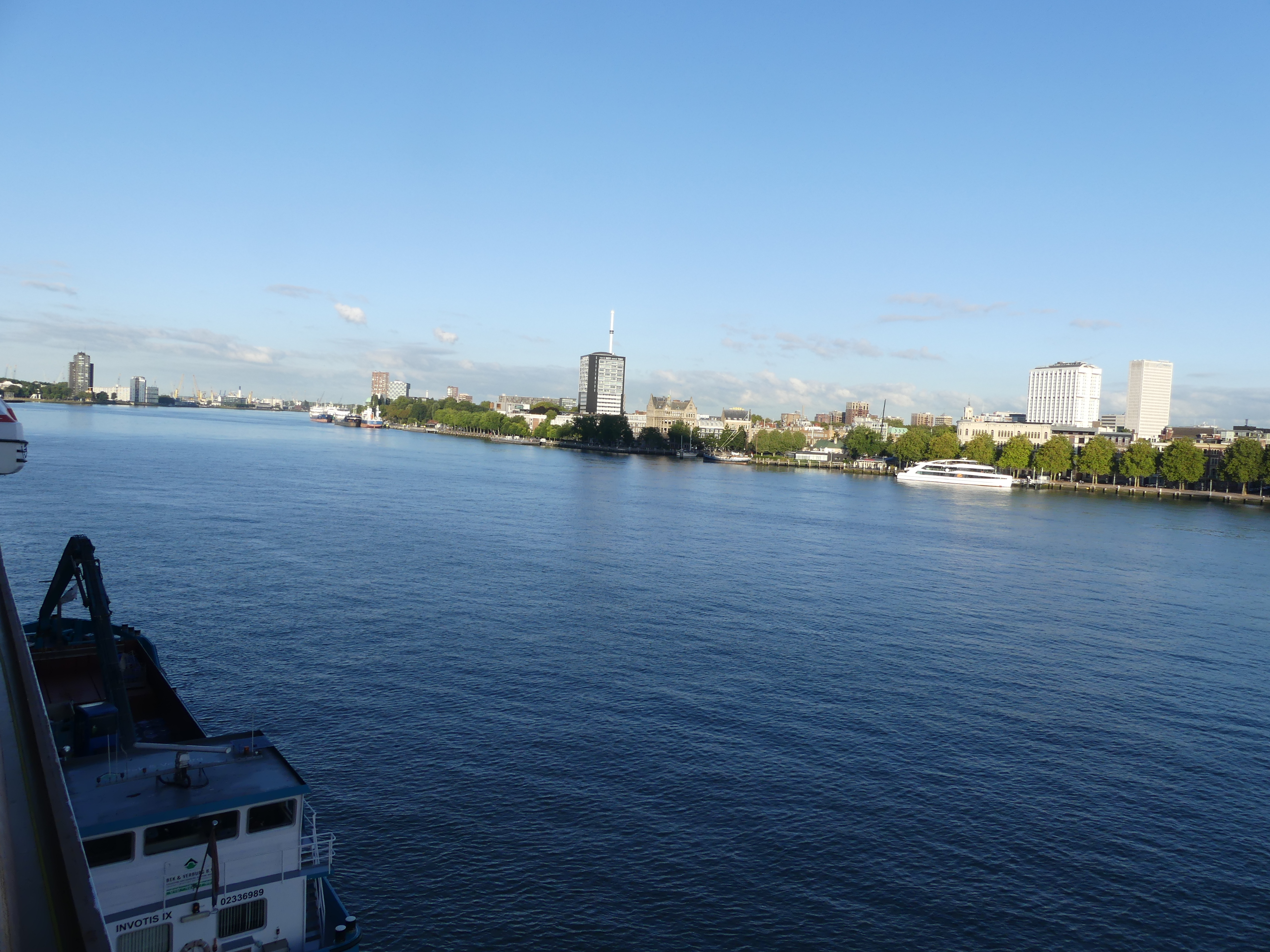
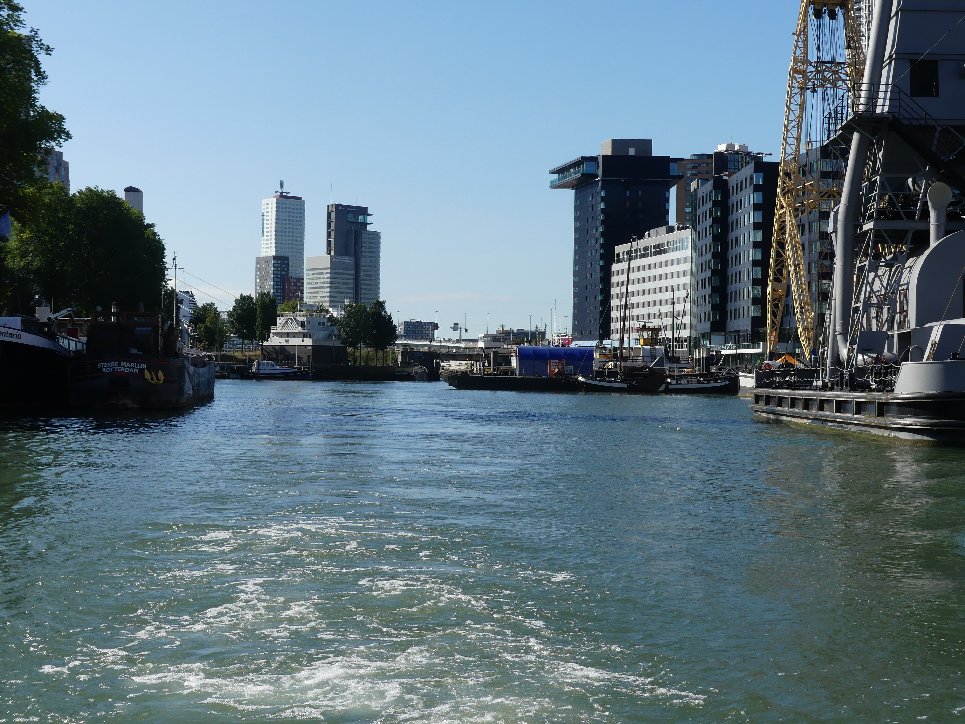
With the morning we found ourselves at sea on our way to Rotterdam; the ship’s home port. We continued to find our way around the ship which rocked a bit too much for some guests. The following morning we arrived in Rotterdam and here are a few snaps I took where the ship tied up. Note there are swans swimming in the river – I have not seen flocks of birds other than gulls this close to the ship.
We did not know much about Rotterdam other than Kerry thought the city had some unusual architecture and I thought of canals and sailing ships from the centuries before. So we were both interested to see the city but not excited about the ship’s excursions. We decided we would explore by canal boat and on foot.
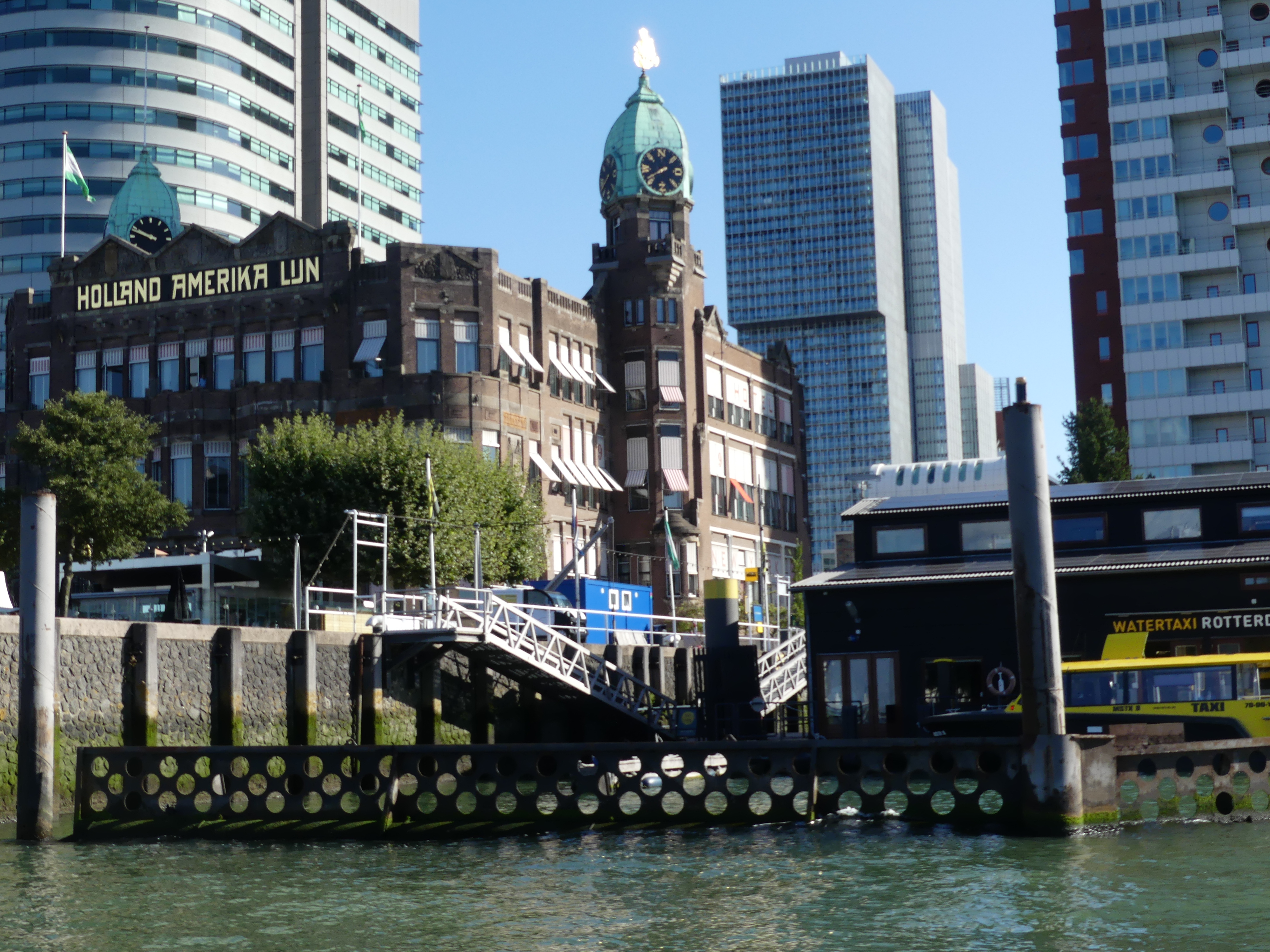
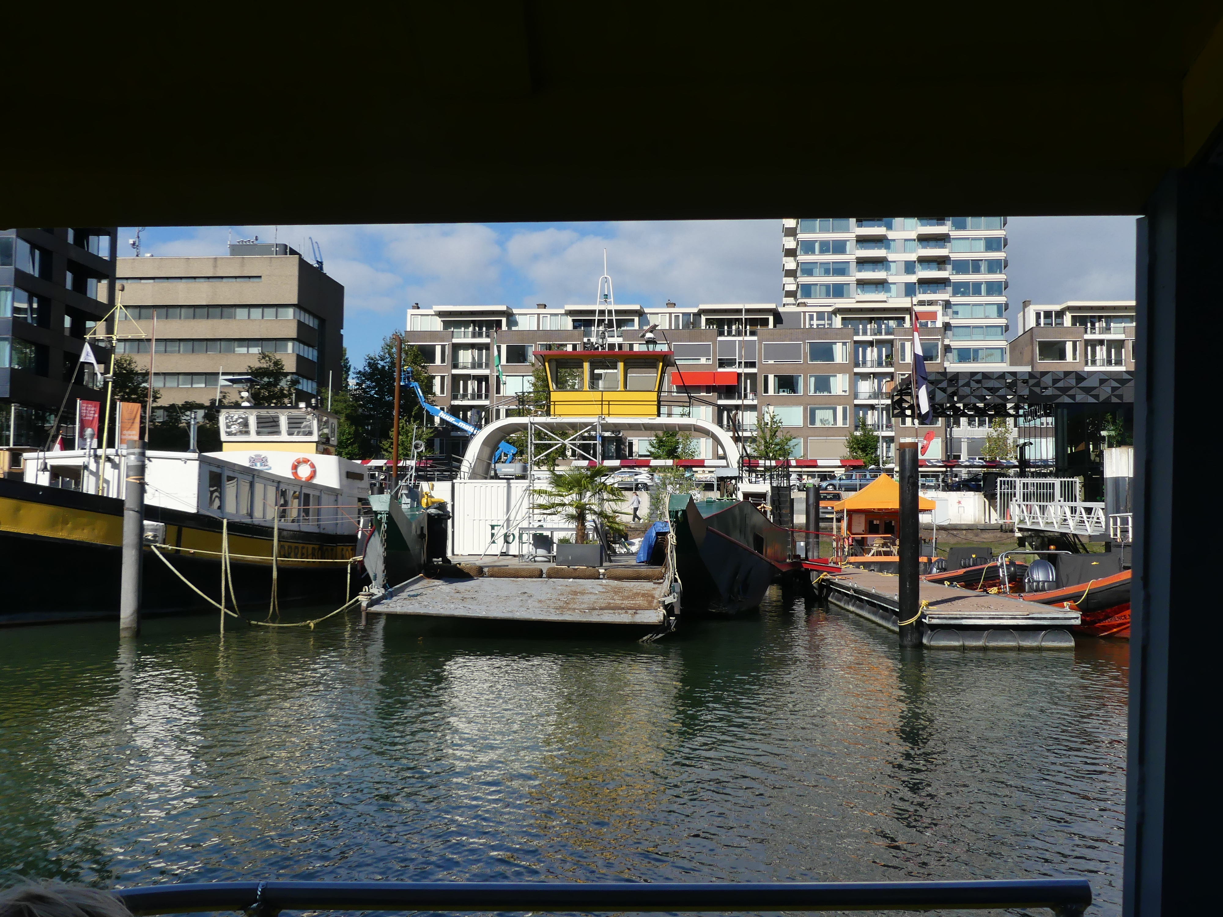
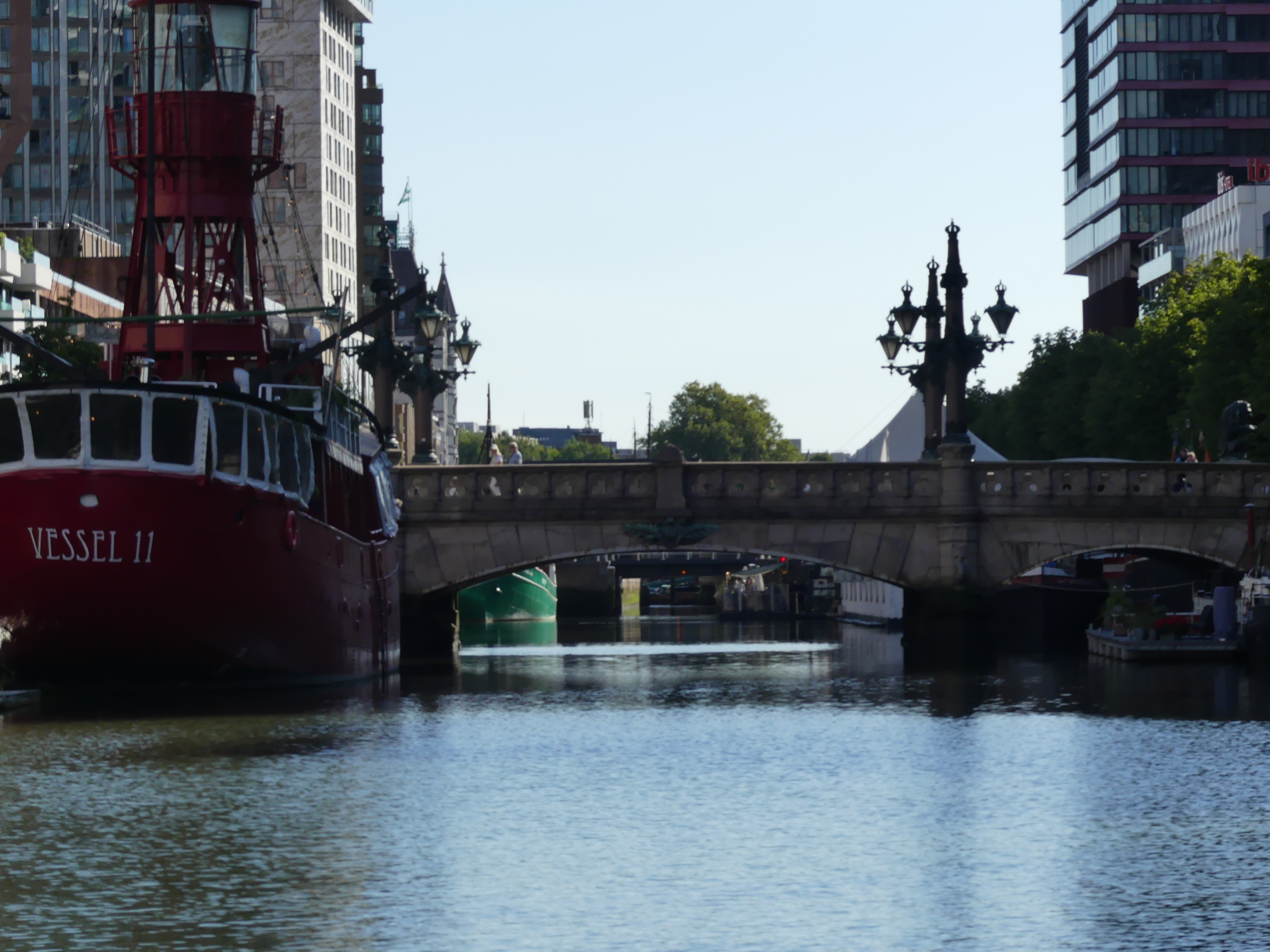
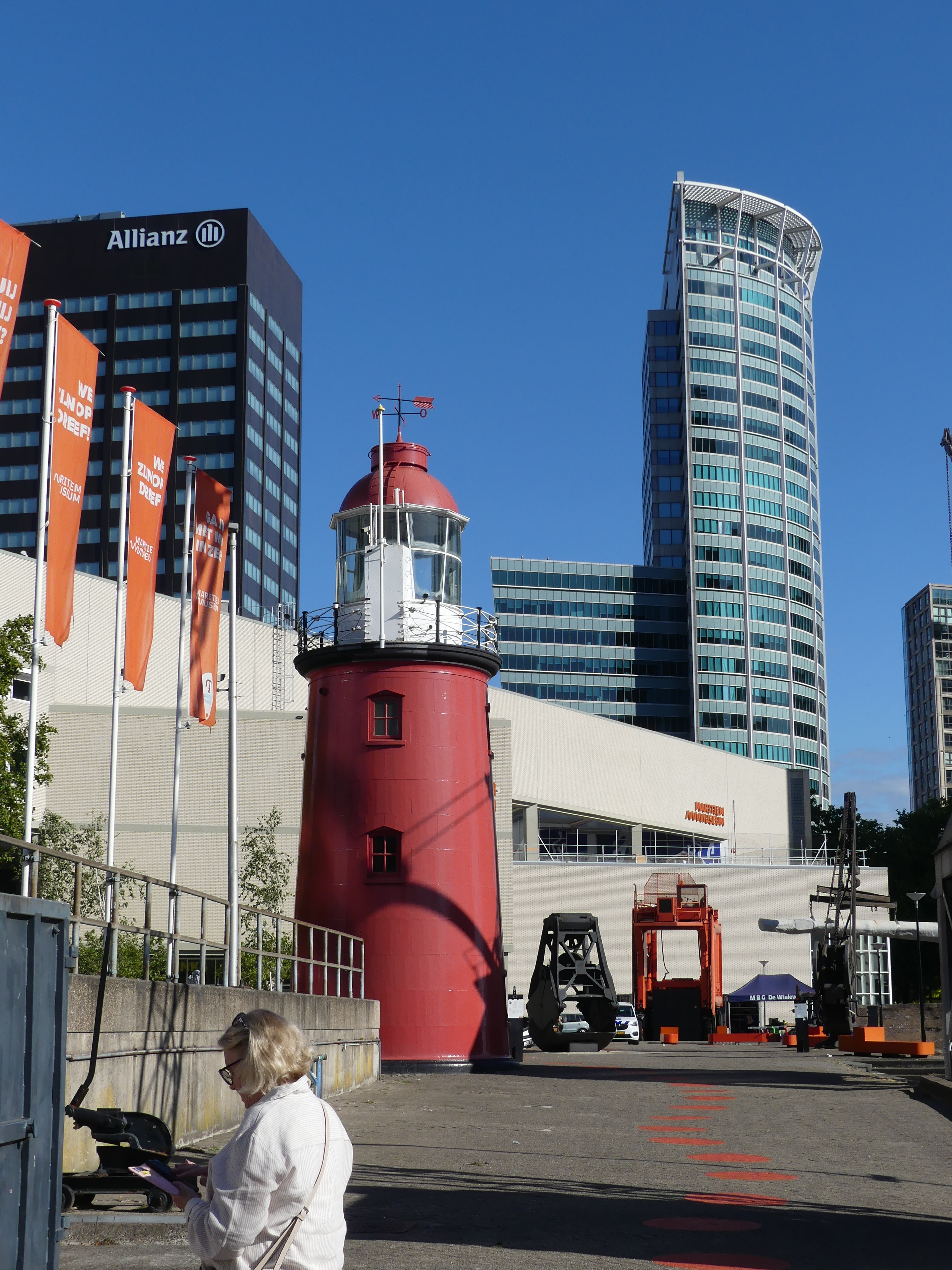
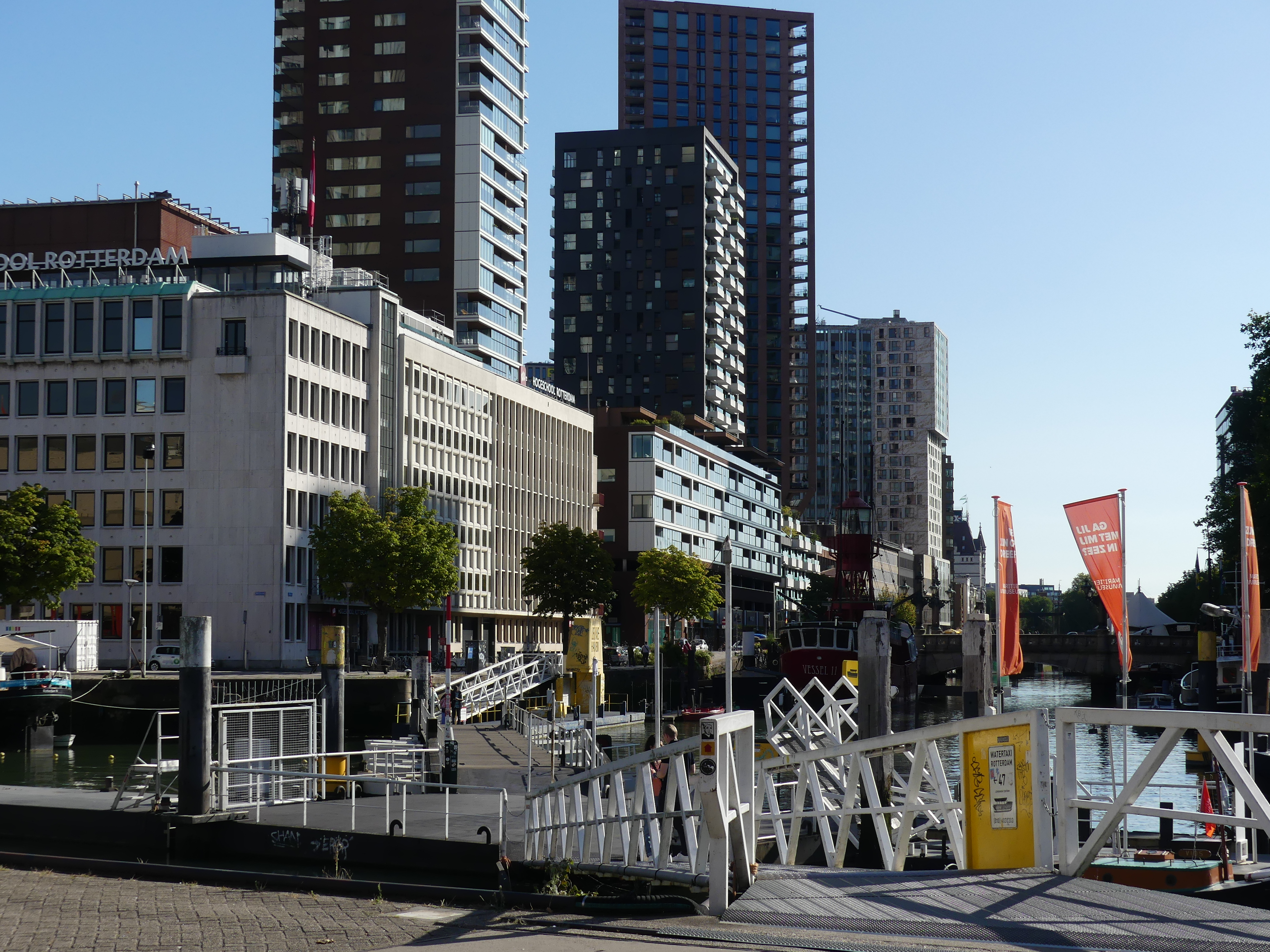
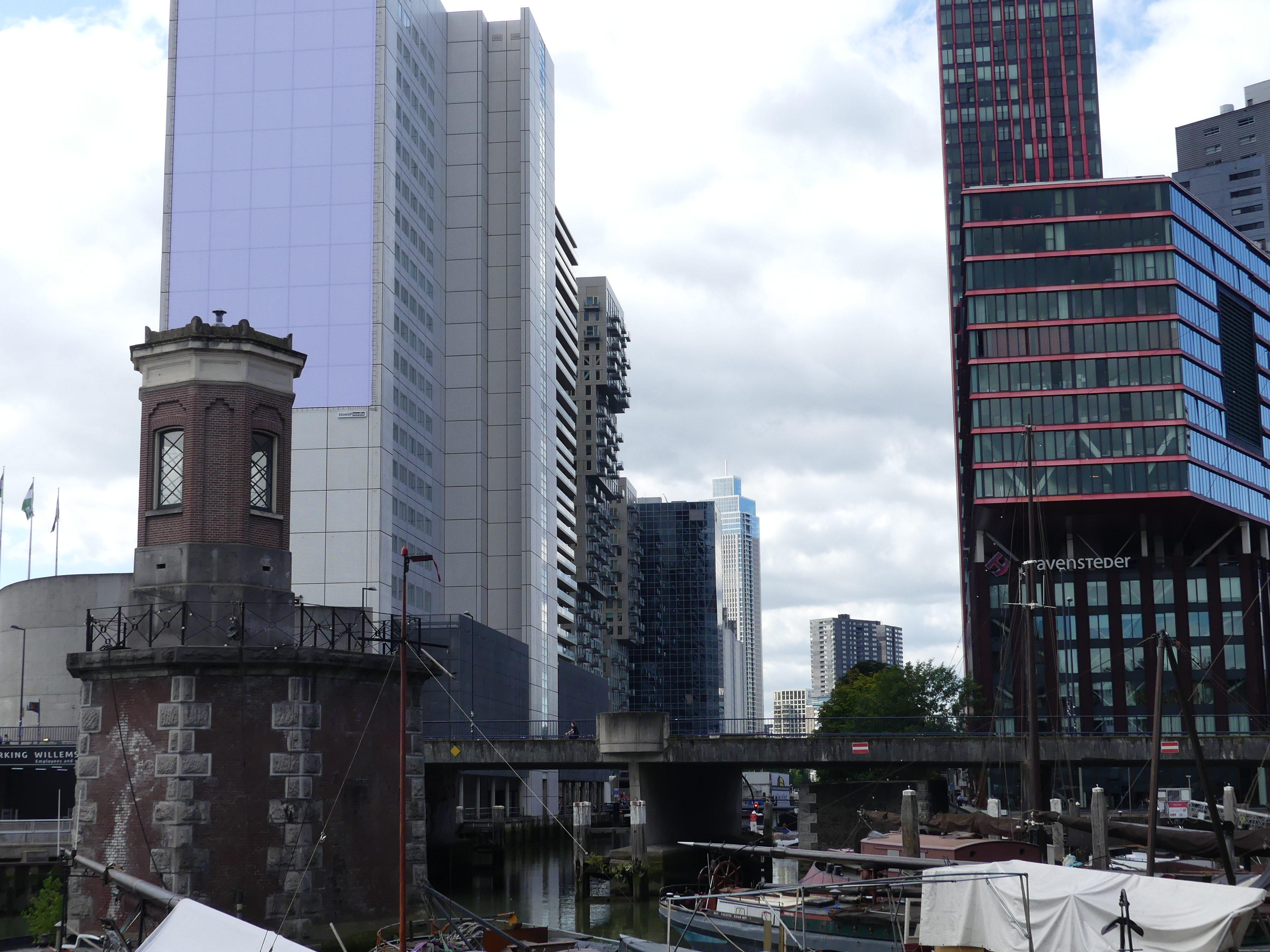
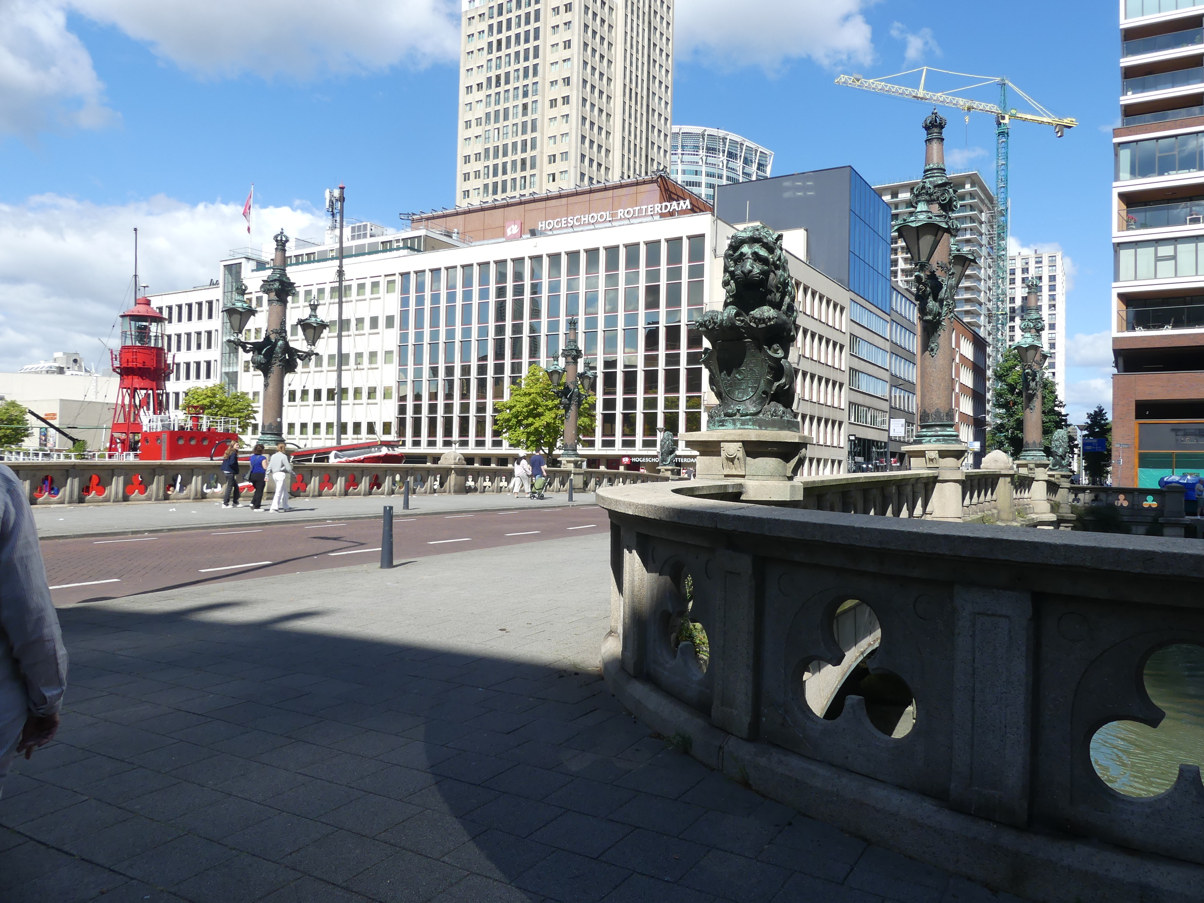
On disembarking from our ship, we made our way on foot to the Holland America building – the design was from centuries past – to the canal ferry station to travel into the CBD of Rotterdam. Our ferry took us past our ship and under the bridge we had observed from our deck and into a different world of architecture and history. One building we passed seemed to have had an extension built on top but they had made it too big. Then we turned into a canal proper (we had been on the river before hand) and passed the canal gate to prevent flooding (the boy with his finger in the dyke inspired this) in the CBD. Boats of all shapes and sizes were tied up in the marina many with murials of the sea adorning their hulls. Our stop and disembarkation point for the ferry was in the midst of the maritime wharf museum. Cranes of many various discription struggled for space amongst all the other parafenalia of sailing the ocean.
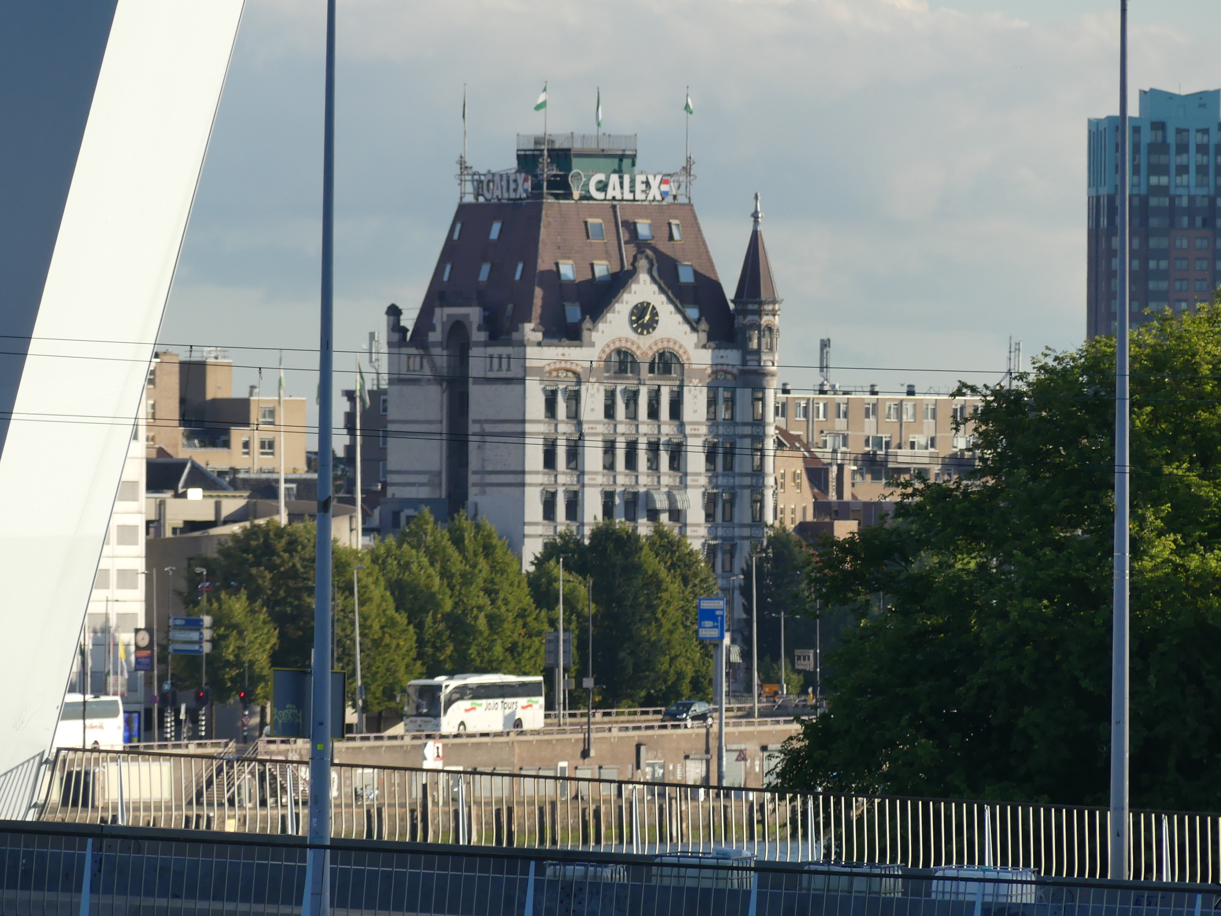
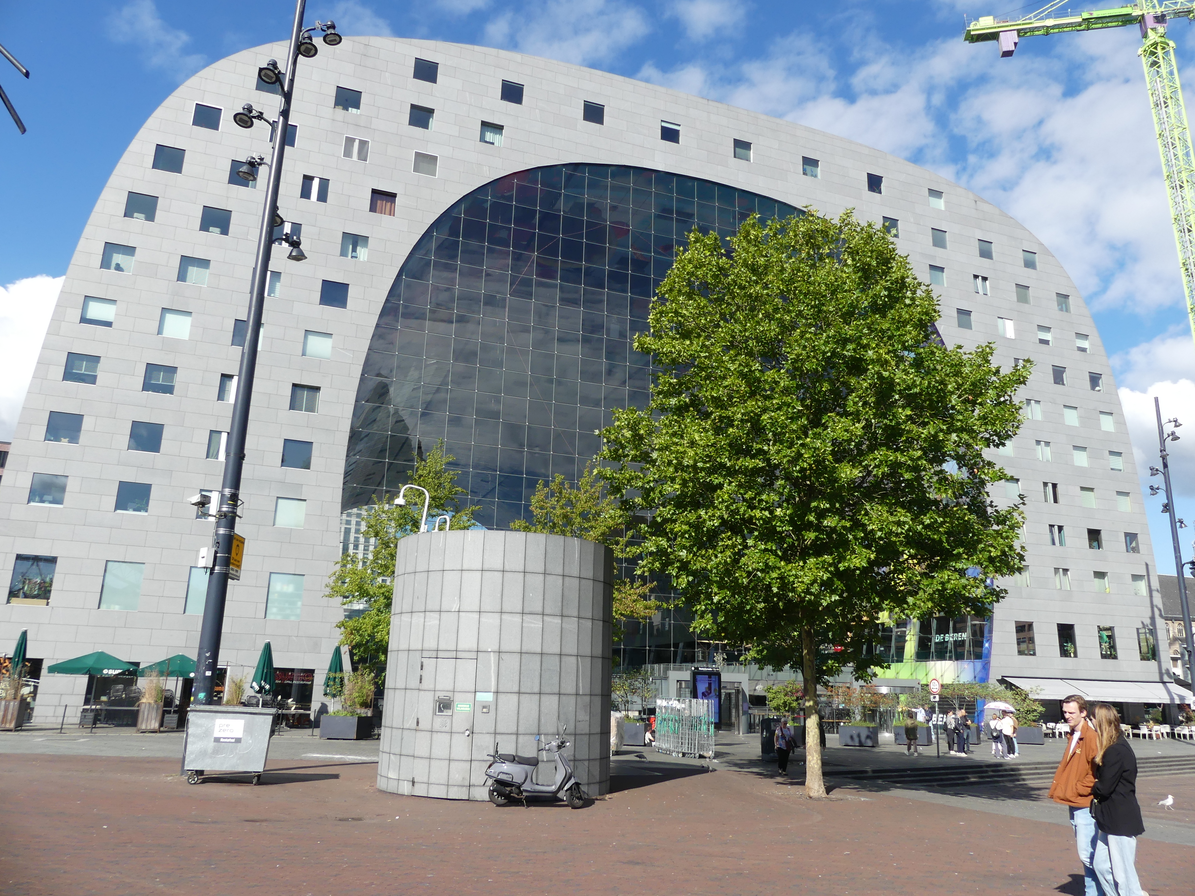
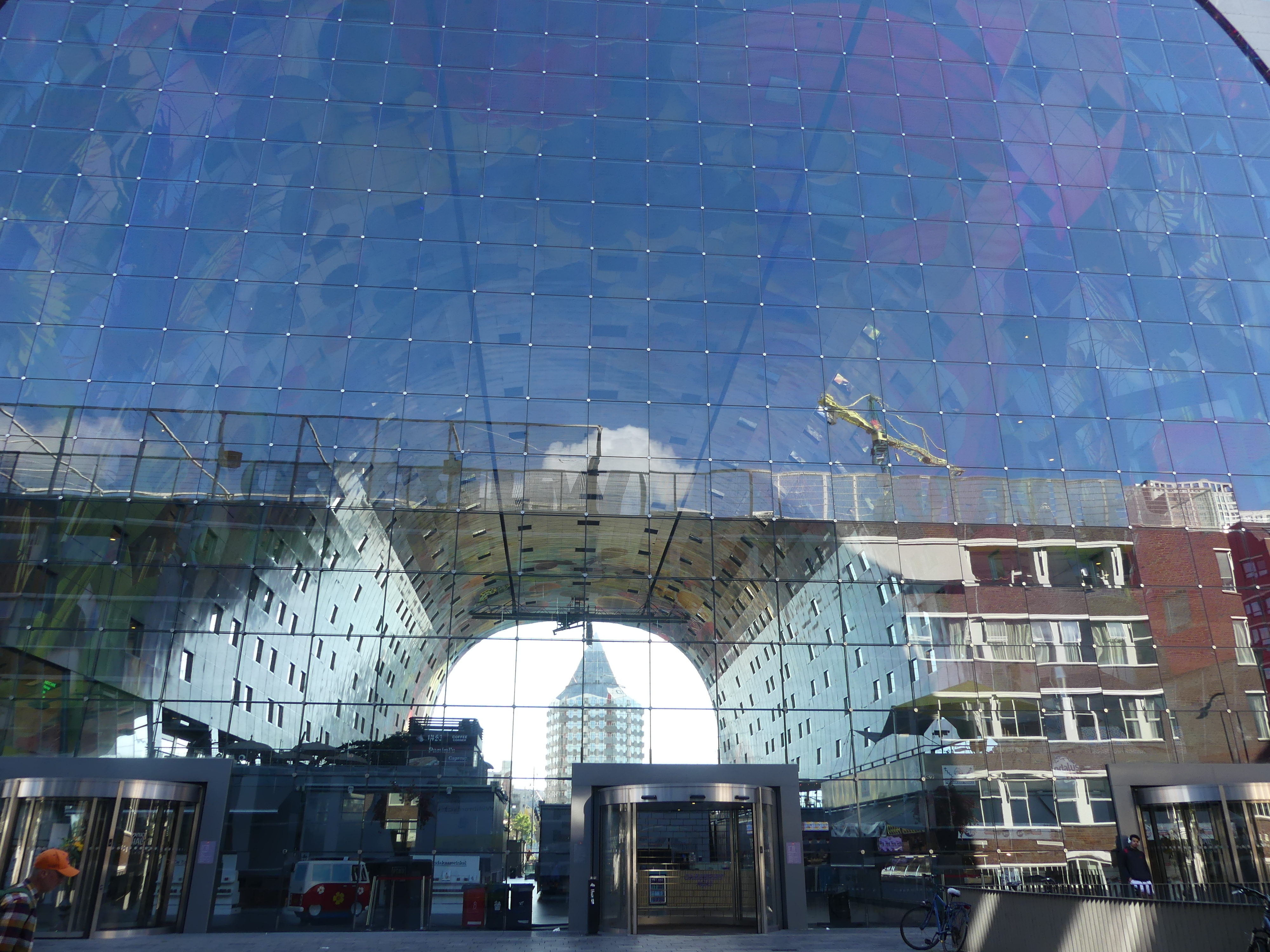
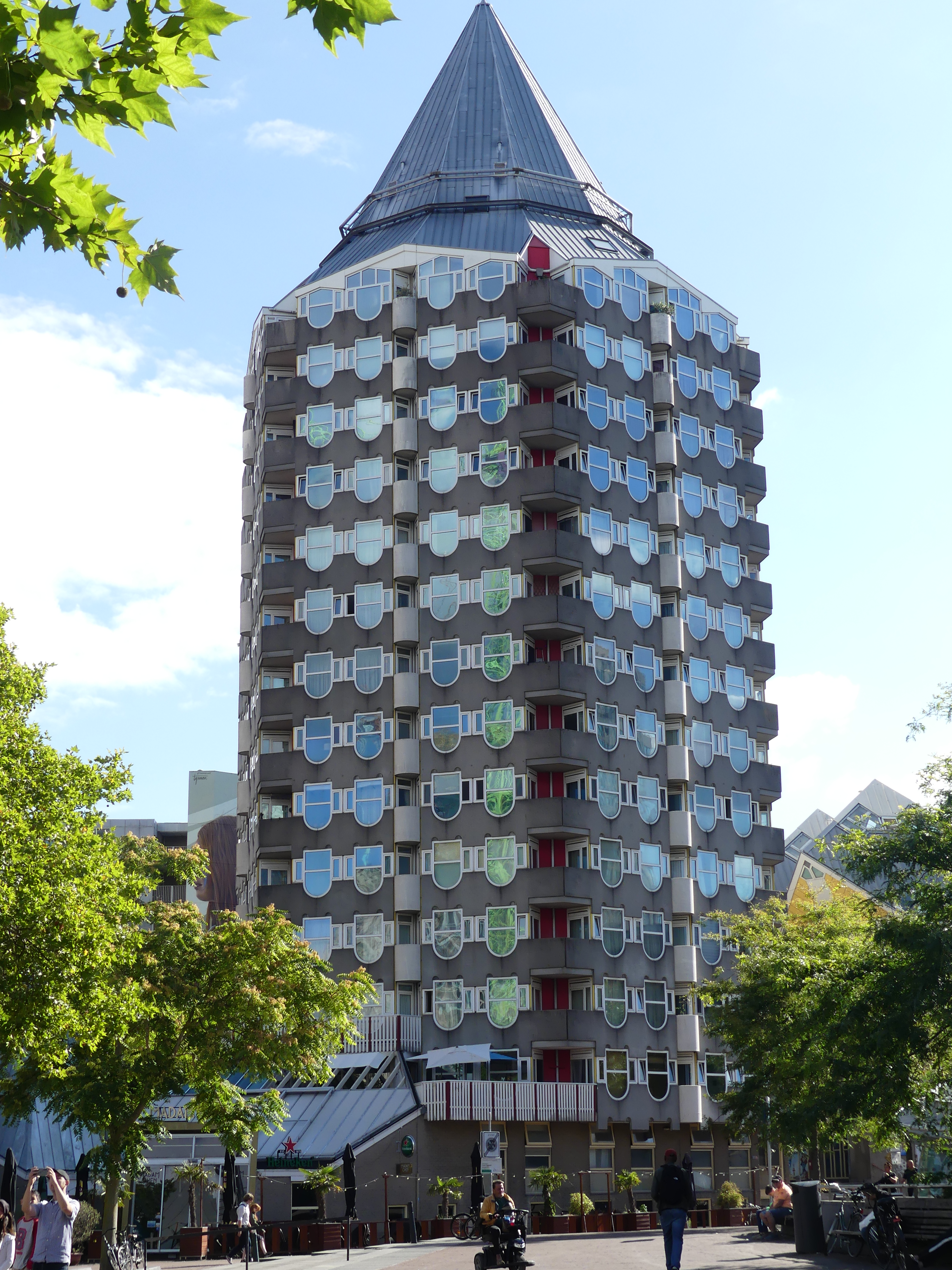
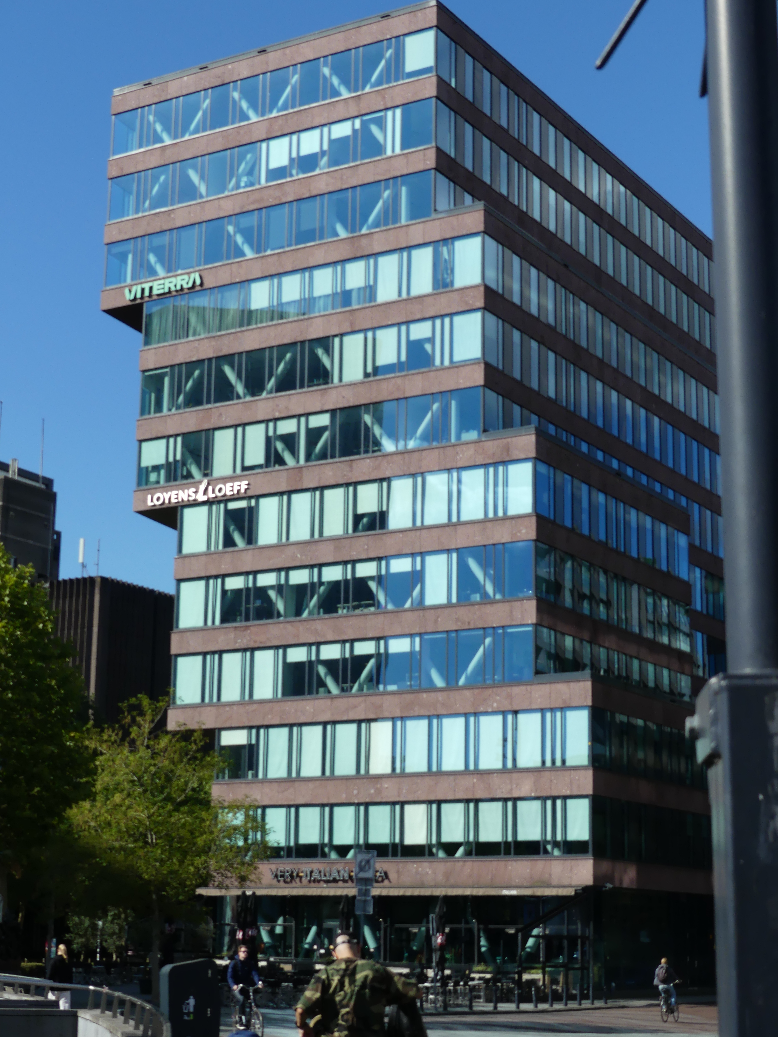
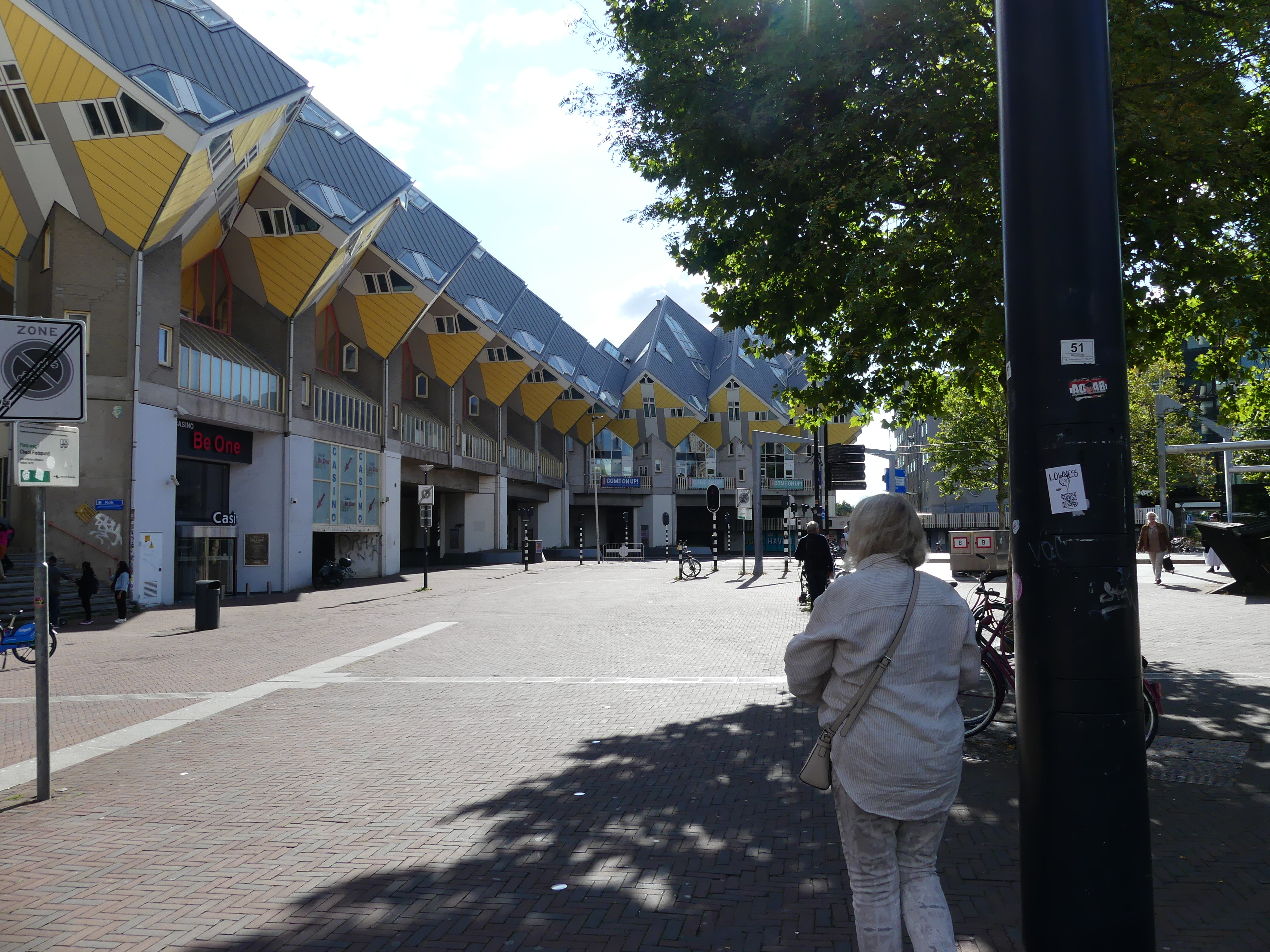
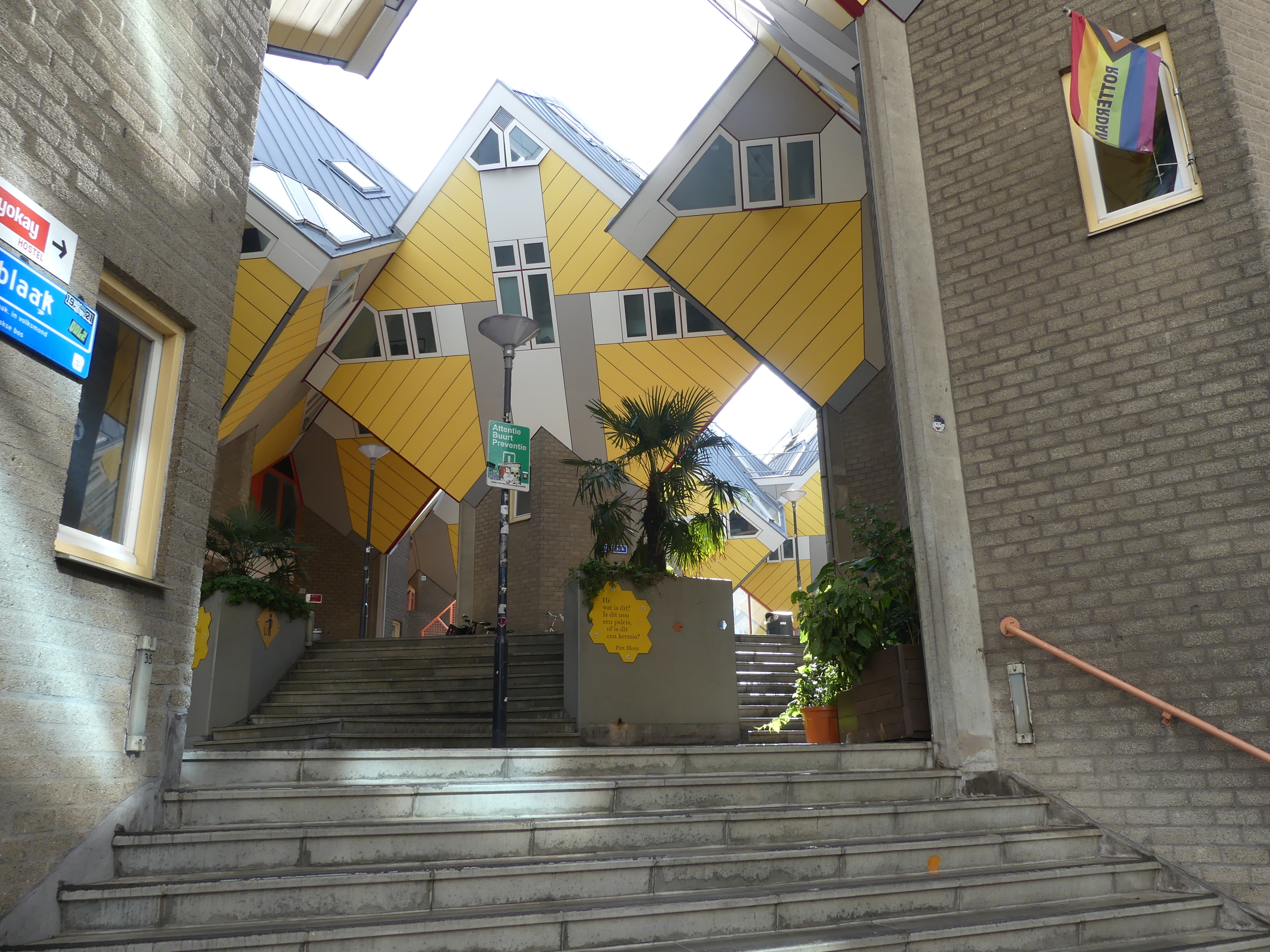
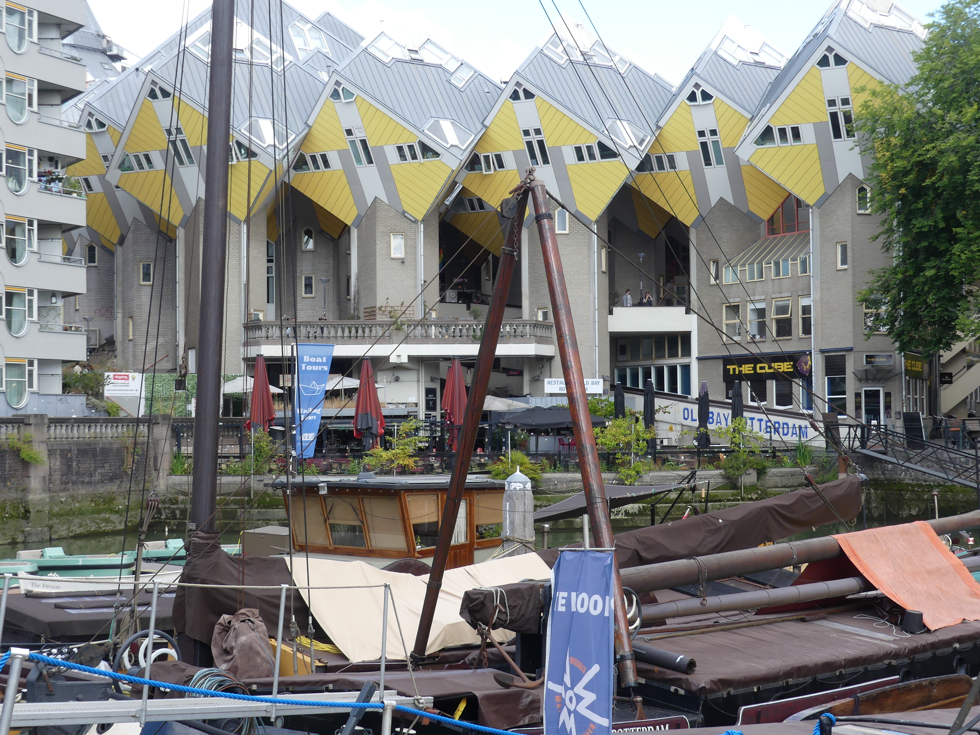
Part of our day at sea prior to arriving in Rotterdam had included a talk by the Tour director about seeing Rotterdam on foot and it had proven very useful. We learnt that in this part of the CBD there we some buildings of the more extreme architectural design so we did have some clues about where we were going. One building we were looking for was the market which had been designed as a large hangar with residential units built into the side walls. Now we were there on Sunday and the markets did not open but we found the building and it is as remarkable as its description. Just nearby is the building that could be mistaken for a pencil or a rocket and another building where it appears to have been built by 3 different builder each with the position of the floors being displaced. Finally the buildings we sought – the cube houses.
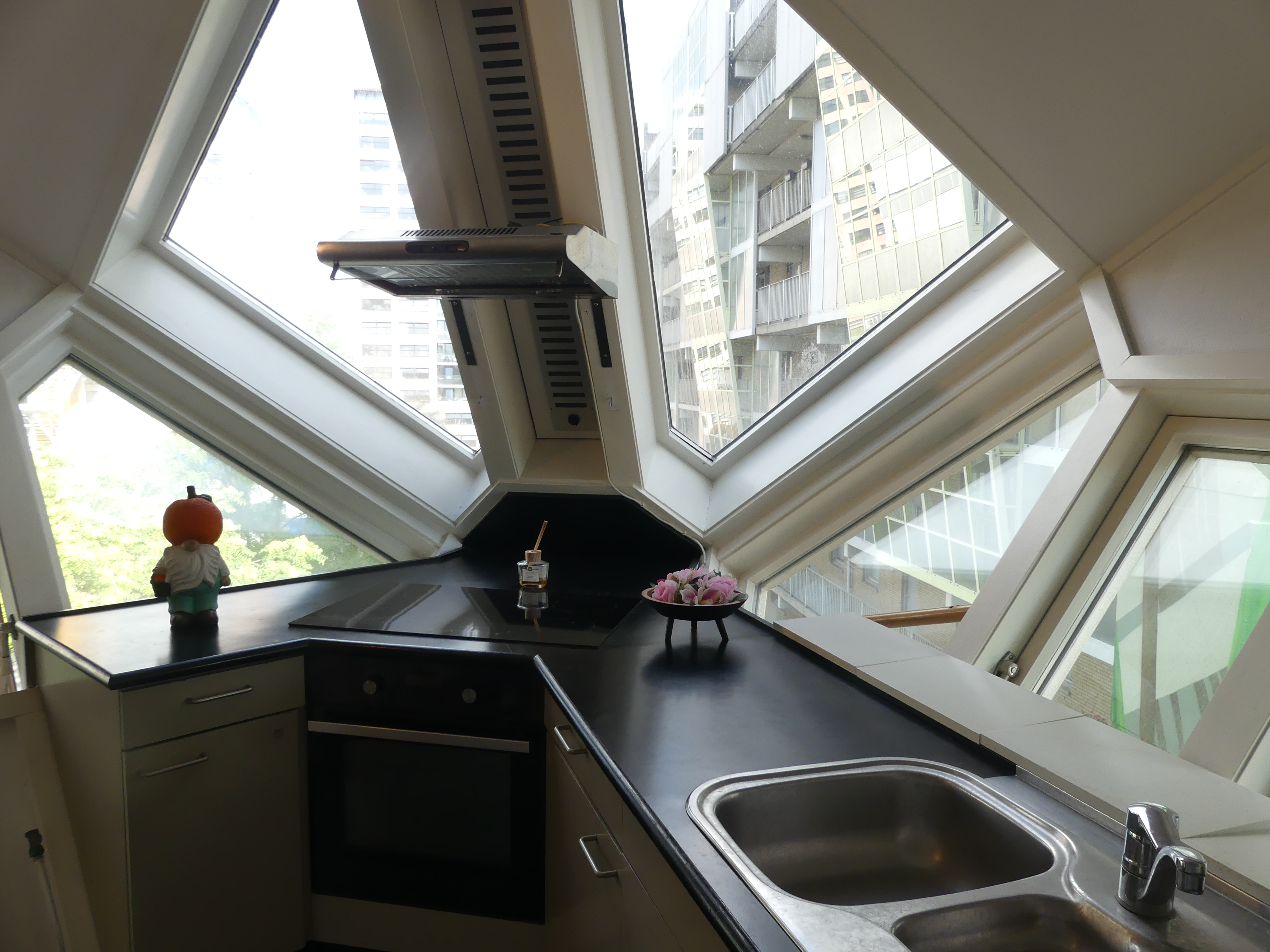
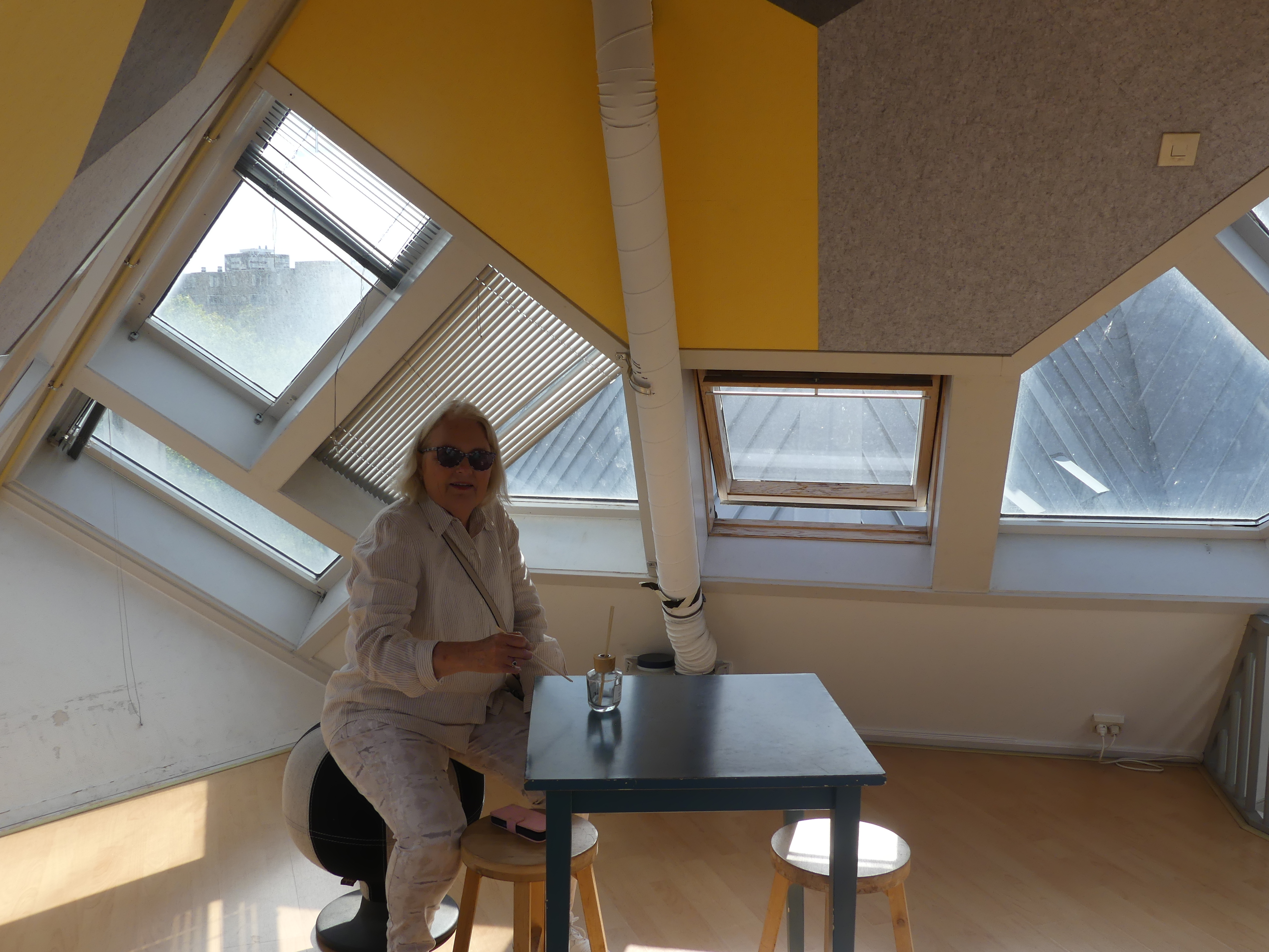
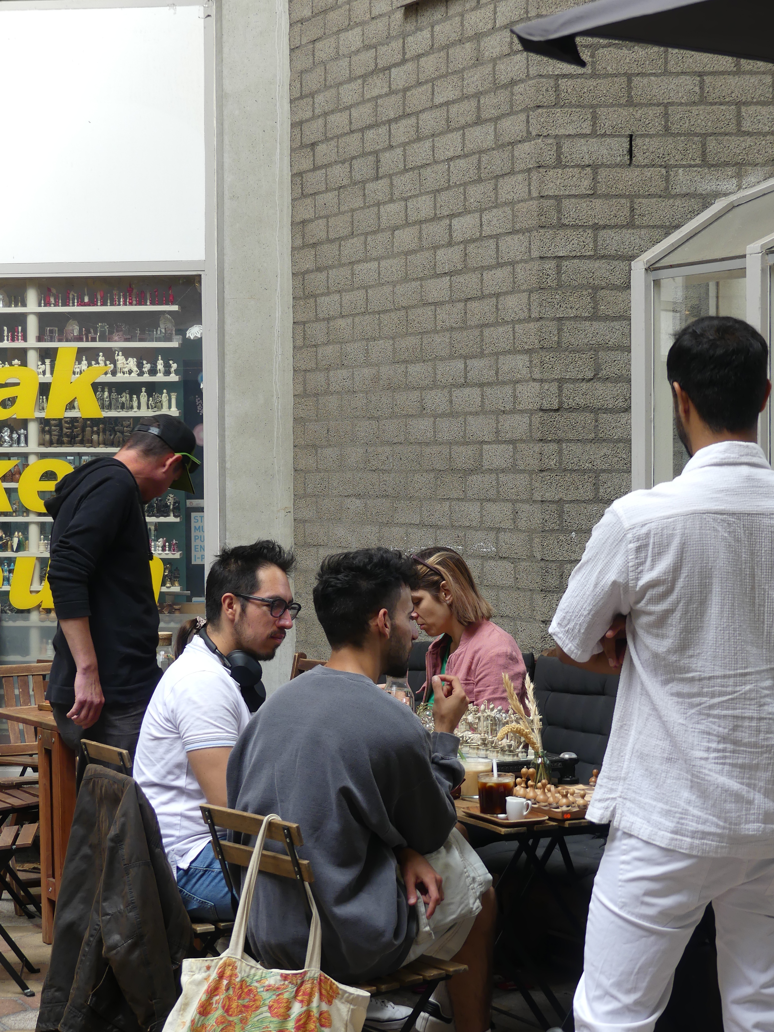
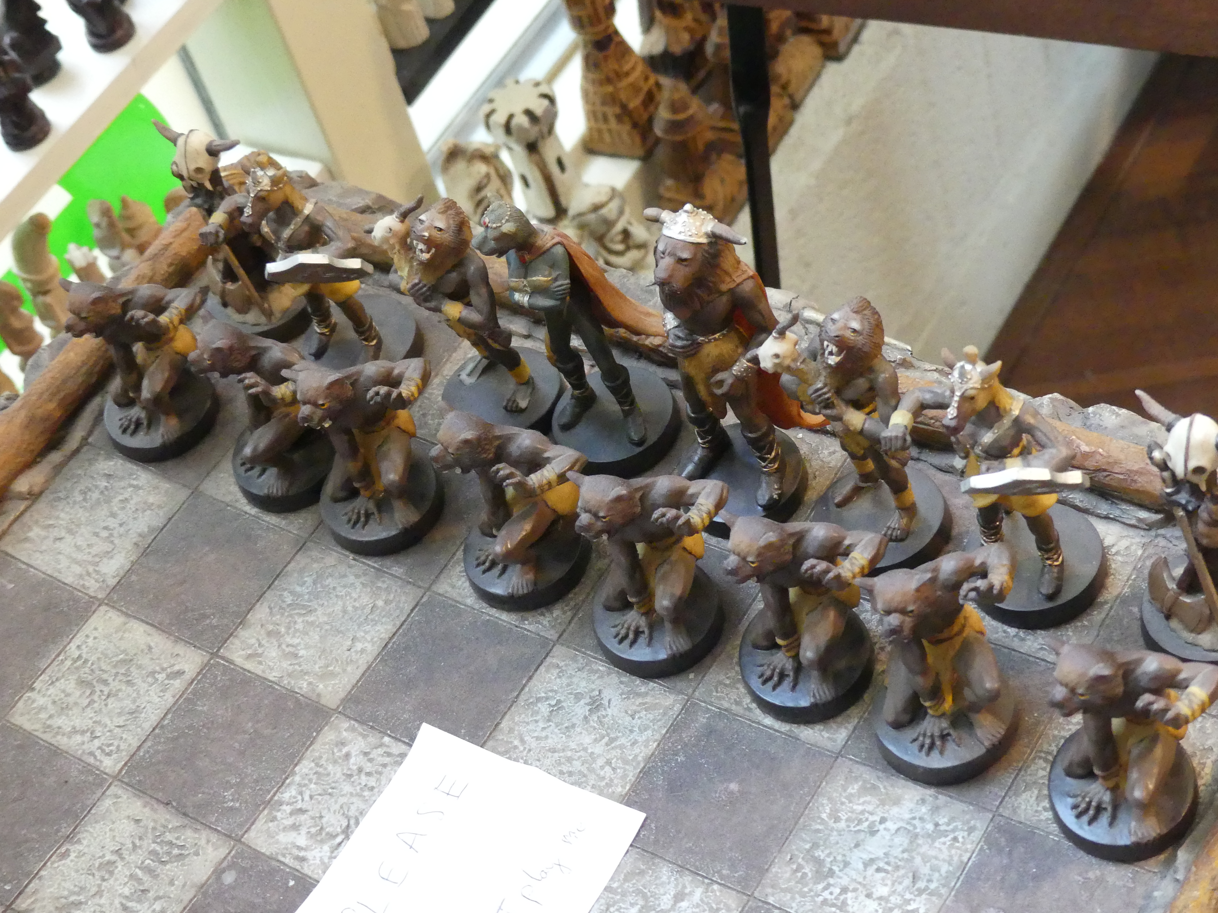
One of the apartments was opened as a gallery and we chose to look inside to see what space the building provided. My pictures below give you the idea of the space and the unusual aspects seen from the windows. As we left the unit we noticed some commercial space and people playing chess outside of a chess piece museum and a coffee shop. I don’t know which came first the chess players or the museum but I was taken back and excited. I have not played chess for years and it was only this year while visiting Son #2 and his family that I had sometime with 2 of our grandchildren and they were playing chess. So bravely I engaged them in competition and realised the enjoyment I used to get from competition. We ordered some coffee and I went to inspect the museum. Had a long chat with the proprietor who said she had over 1,000 chess sets. Something truly unexpected.
We continued to make our way through the cube apartments until we came upon another branch of the marina. We decided we should make our way back to the ferry uncertain how far we had travelled whilst exploring the architecture. The mixture of the styles of architecture kept us enthralled – we had not expected anything like this. As we made our way along the canal bank Kerry saw a local working on his boat and innocently asked him about his boat and she was met with a rude and hostile responce. Not aware that he was telling her to “piss off” Kerry continued her enquiry. Gradually he softened his tone and engaged with Kerry explaining that this was a particular style of sailing ship developed in Rotterdam and he and his father had started work restoring it. His father had died but he had continued with the restoration using the ship as his accomodation. He also explained that he thought tourists were rude asking questions as though he was part of the tour. At one stage I was certain he was going to climb the ships rail and clock her one but in the end they chatted happily ignoring my presence entirely. He had found that Kerry was genuinely interested in the history of the ship and his determination to save the vessel. Ultimately Kerry acknowledged me and he lost interest in Kerry.
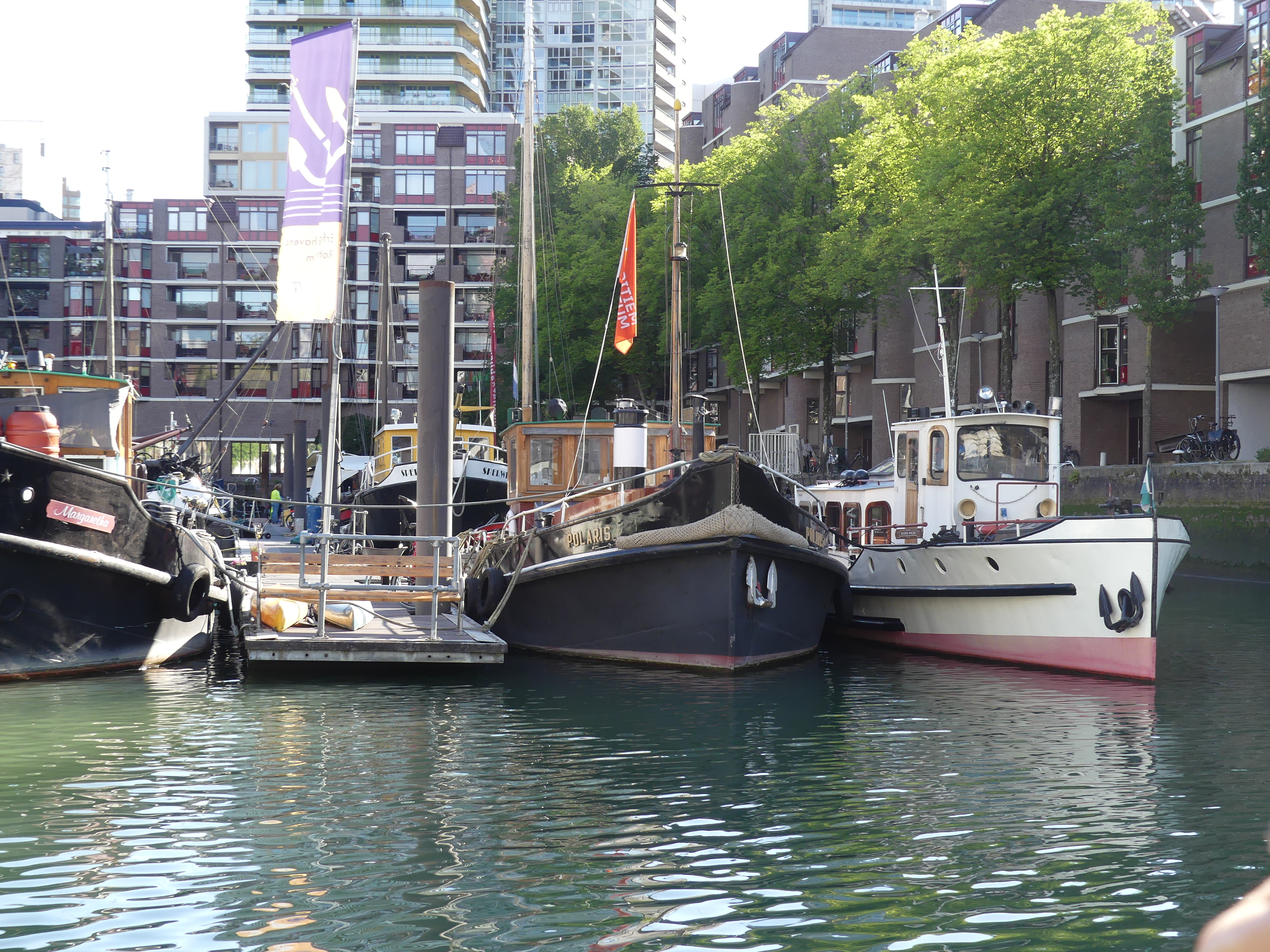
We had seen the unusal architecture but now we were amongst all the house boats, boats making believe they were hotels and boats making believe they are “B&B’s”. Rotterdam has it all. By the time we made our way back to the ferry and then to our ship the sun was going down and I was able to photograph the sunset on a interesting day.
As the sun set in the west we sailed north west to Queensport and Edinburgh. We have been to Edinburgh a few times so we had decided to catch the Hop on Hop off bus rather than take in the main attractions. So be prepared for “THE RETIREES GO AROUND THE WORLD – DAY 2 SS NIEUW STATENDAM – Queensport & Edinburgh then Shetland Isles.”
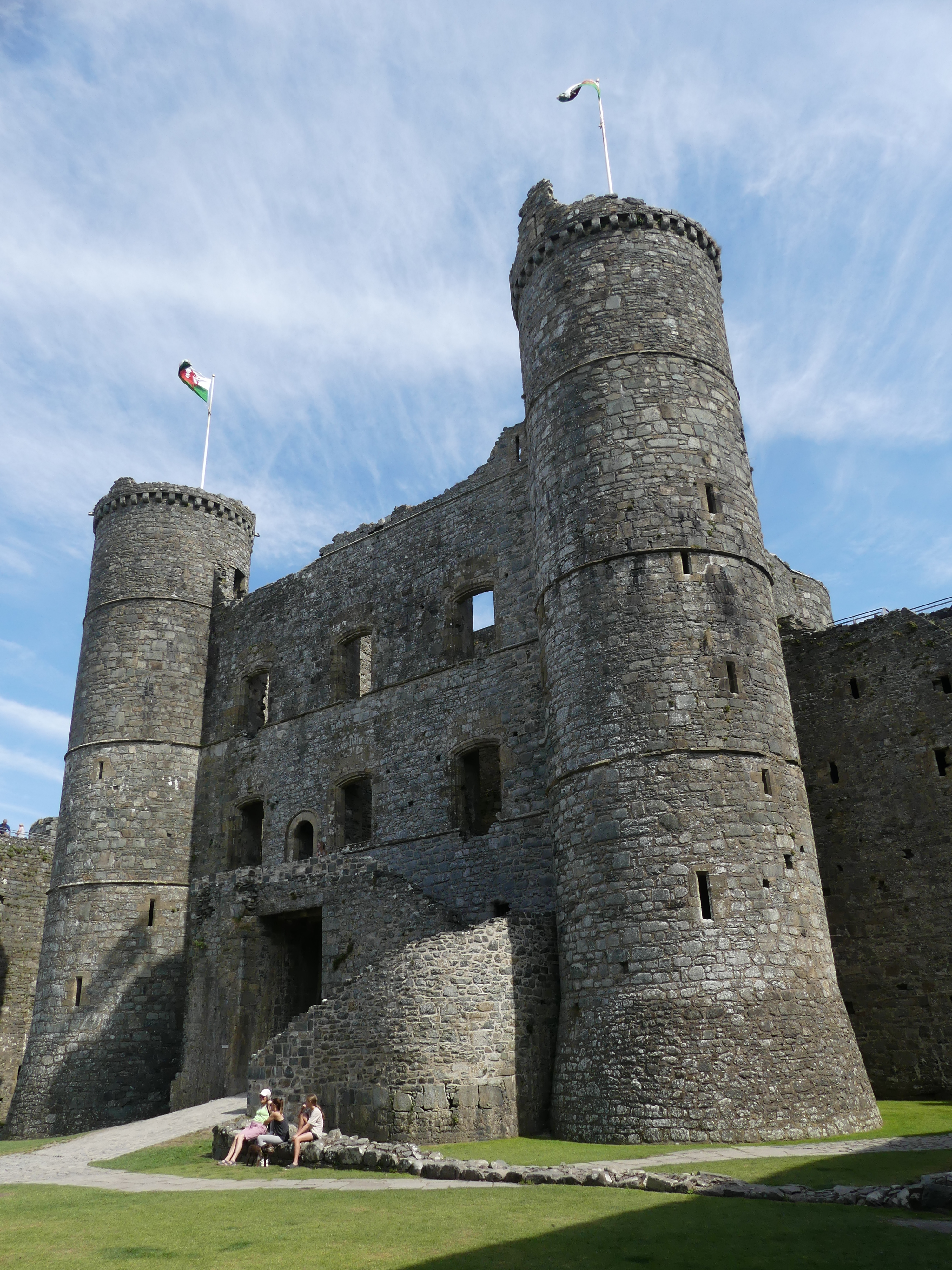
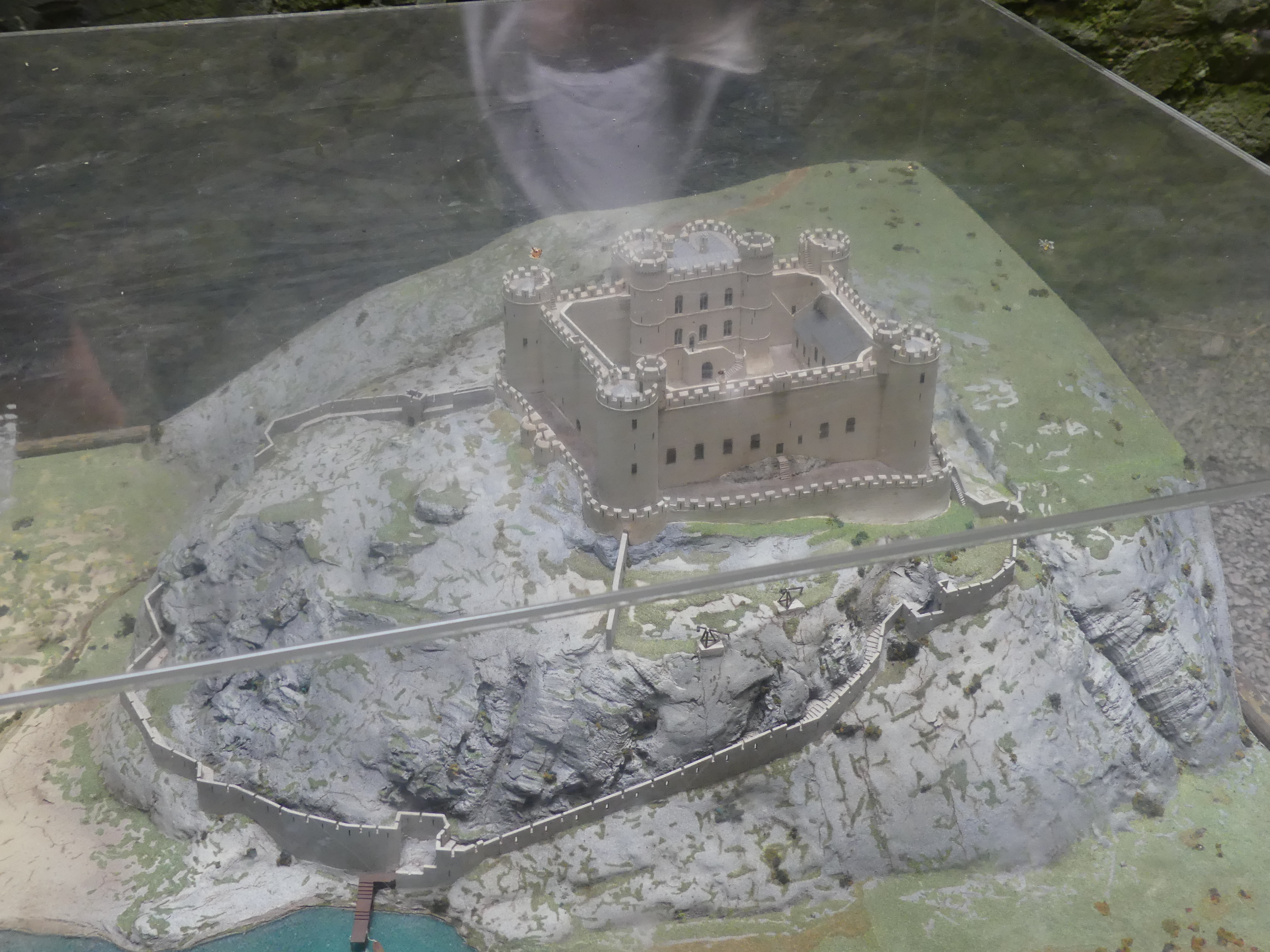
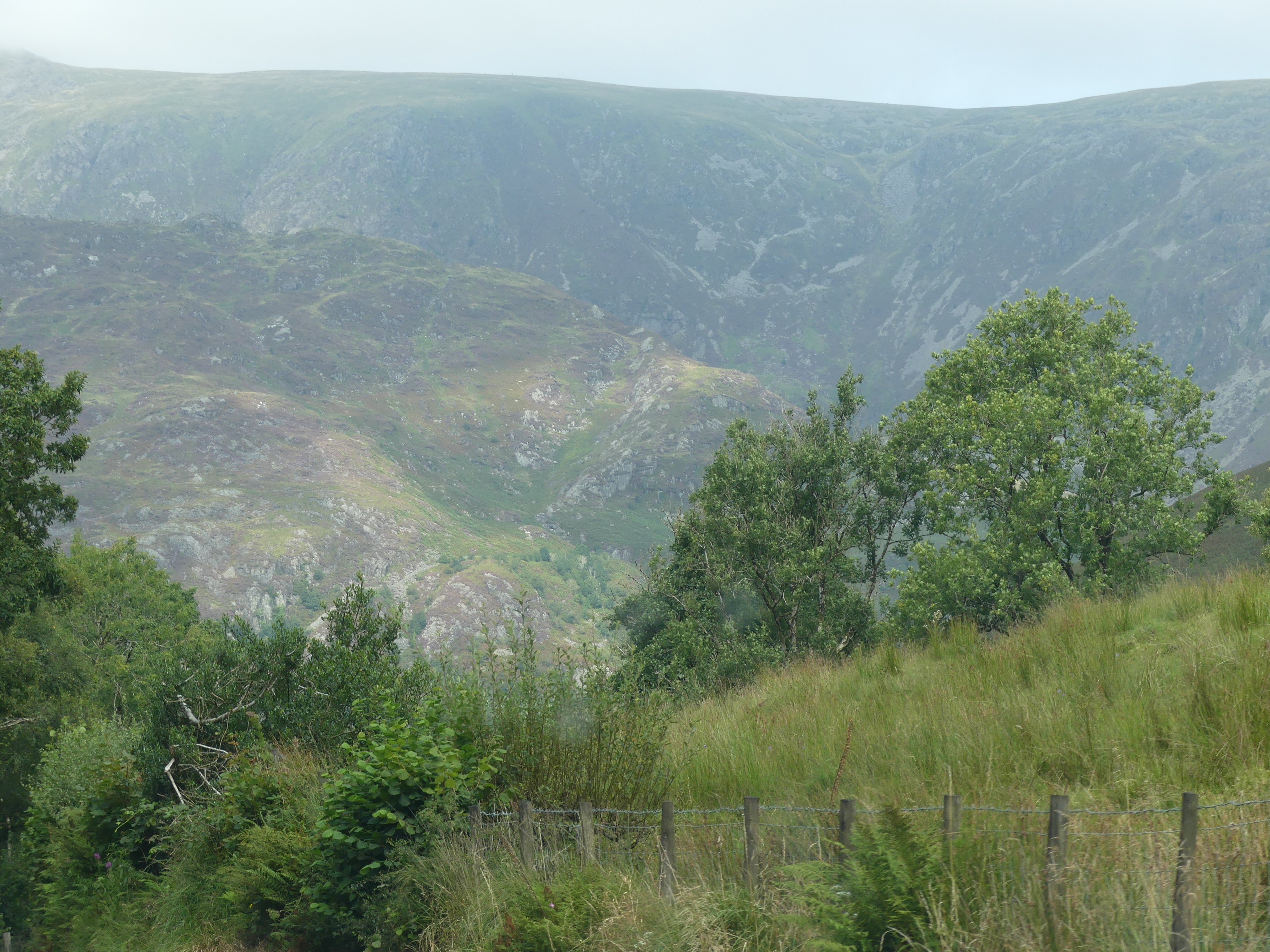
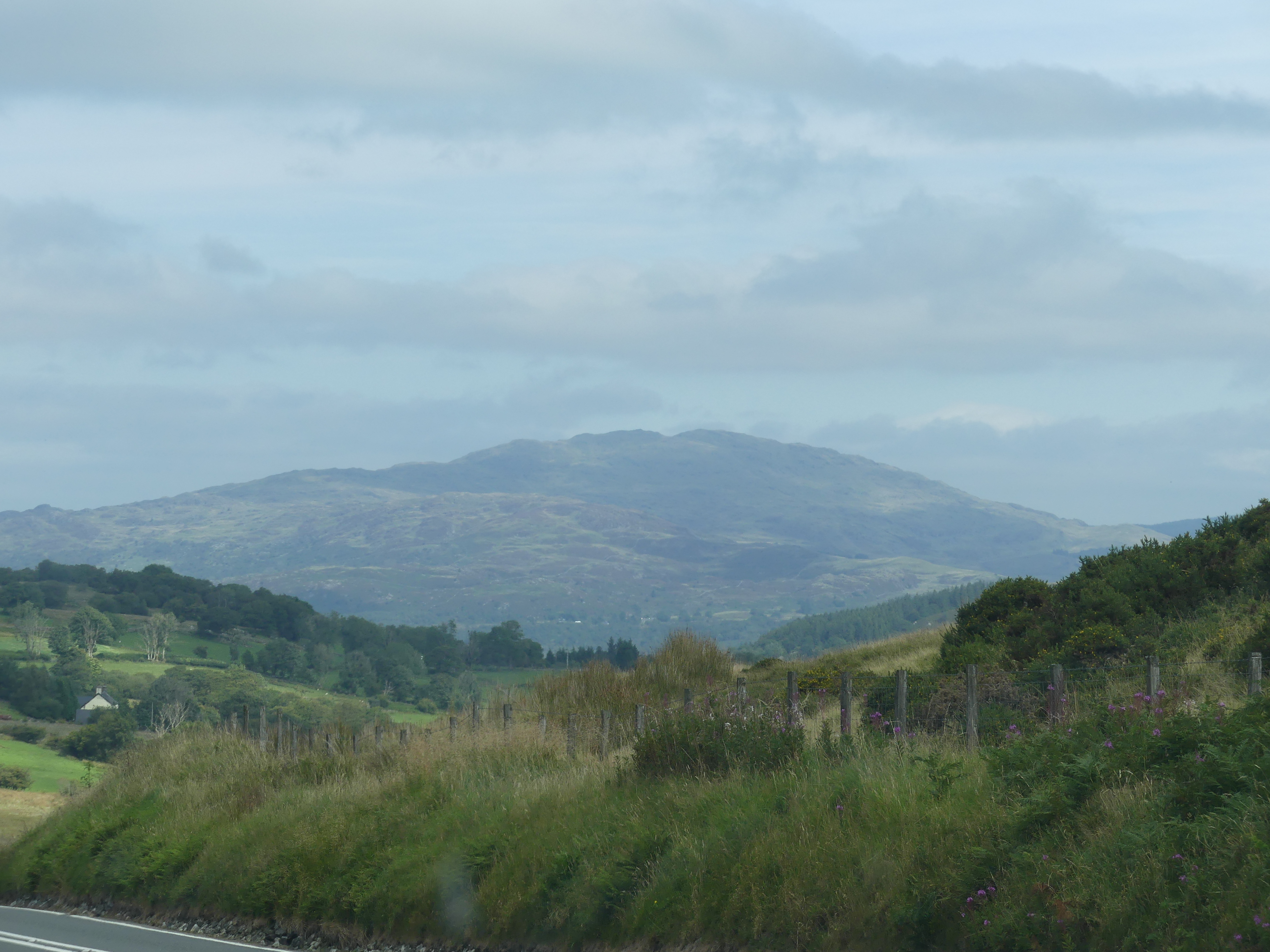
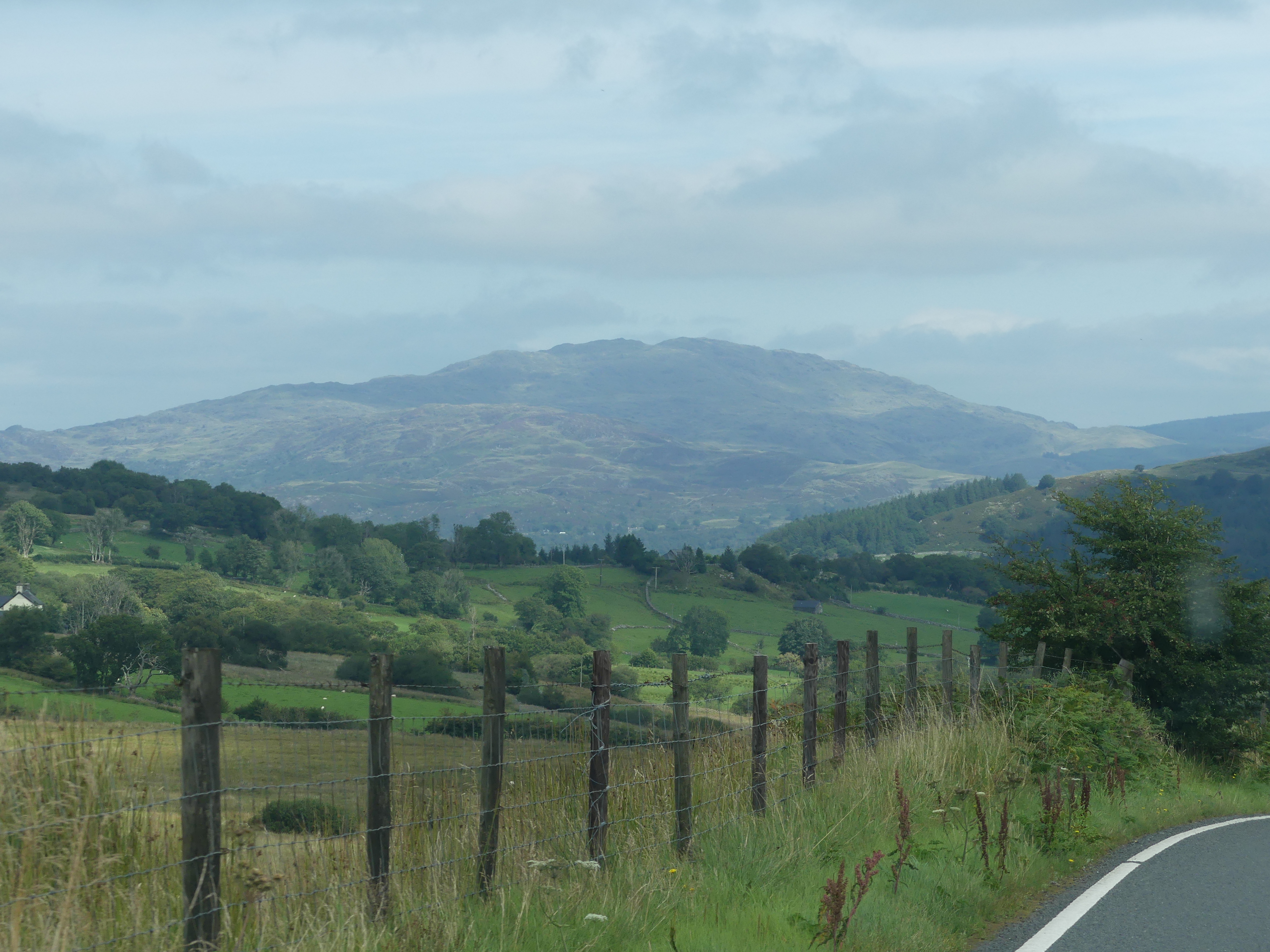
The drive to Chateau Rhianfa on the isle of Anglesey took us past Harlech Castle in Harlech, Gwynedd, Wales, a Grade I listed medieval fortification built onto a rocky knoll which years ago was close to the Irish Sea. A Seagate and stairs to the former landing area remains today but is nowhere near the present coast. It was built by Edward I during his invasion of Wales between 1282 and 1289. Over the next few centuries, the castle played an important part in several wars, withstanding the siege of Madog ap Llywelyn between 1294 and 1295, but falling to Prince Owain Glyndŵr in 1404. It then became Glyndŵr’s residence and military headquarters for the remainder of the uprising until being recaptured by English forces in 1409. During the 15th-century Wars of the Roses, Harlech was held by the Lancastrians for seven years, before Yorkist troops forced its surrender in 1468, a siege memorialised in the song “Men of Harlech”. Following the outbreak of the English Civil War in 1642, the castle was held by forces loyal to Charles I, holding out until 1647 when it became the last fortification to surrender to the Parliamentary armies. In the 21st century the ruined castle is managed by Cadw, the Welsh Government’s historic environment service, as a tourist attraction. As my photos below show the castle is well defended by its environment and provides excellent views of the surrounding village. I have also attached the Cadw brochure.
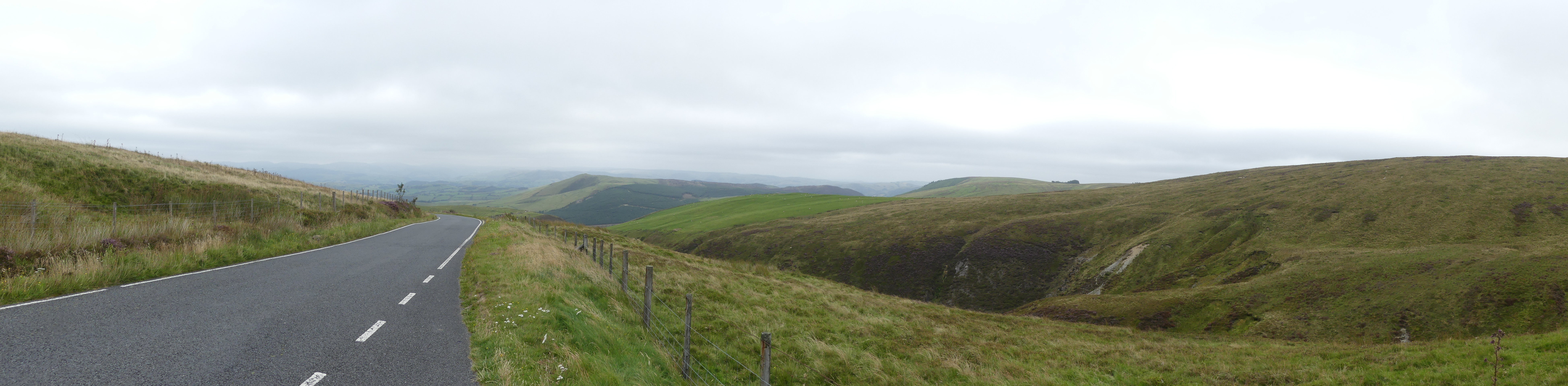
The drive to Harlech was very picturesque and I could not put my camera down.
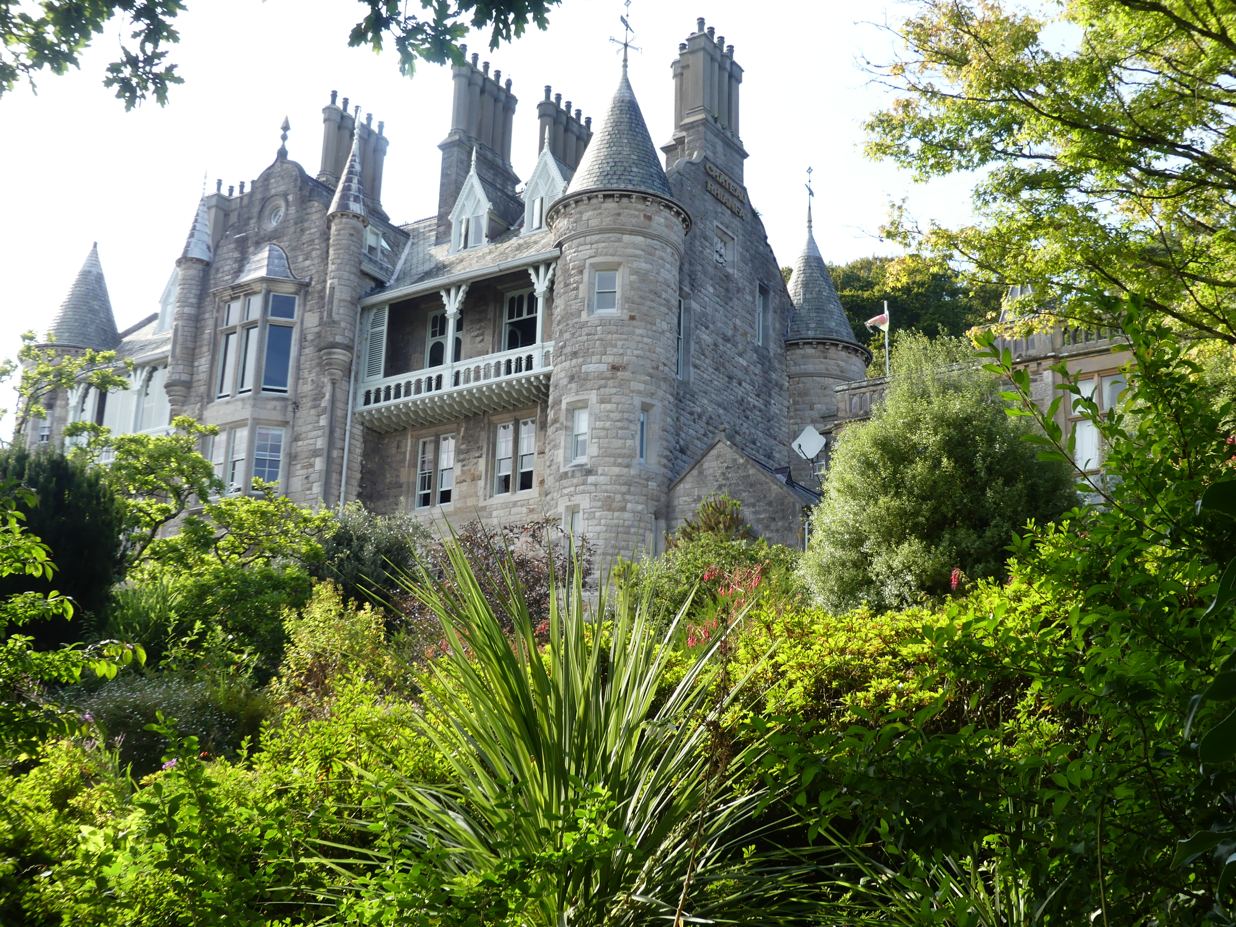
CHATEAU RHIANFA PLAS RHIANFA
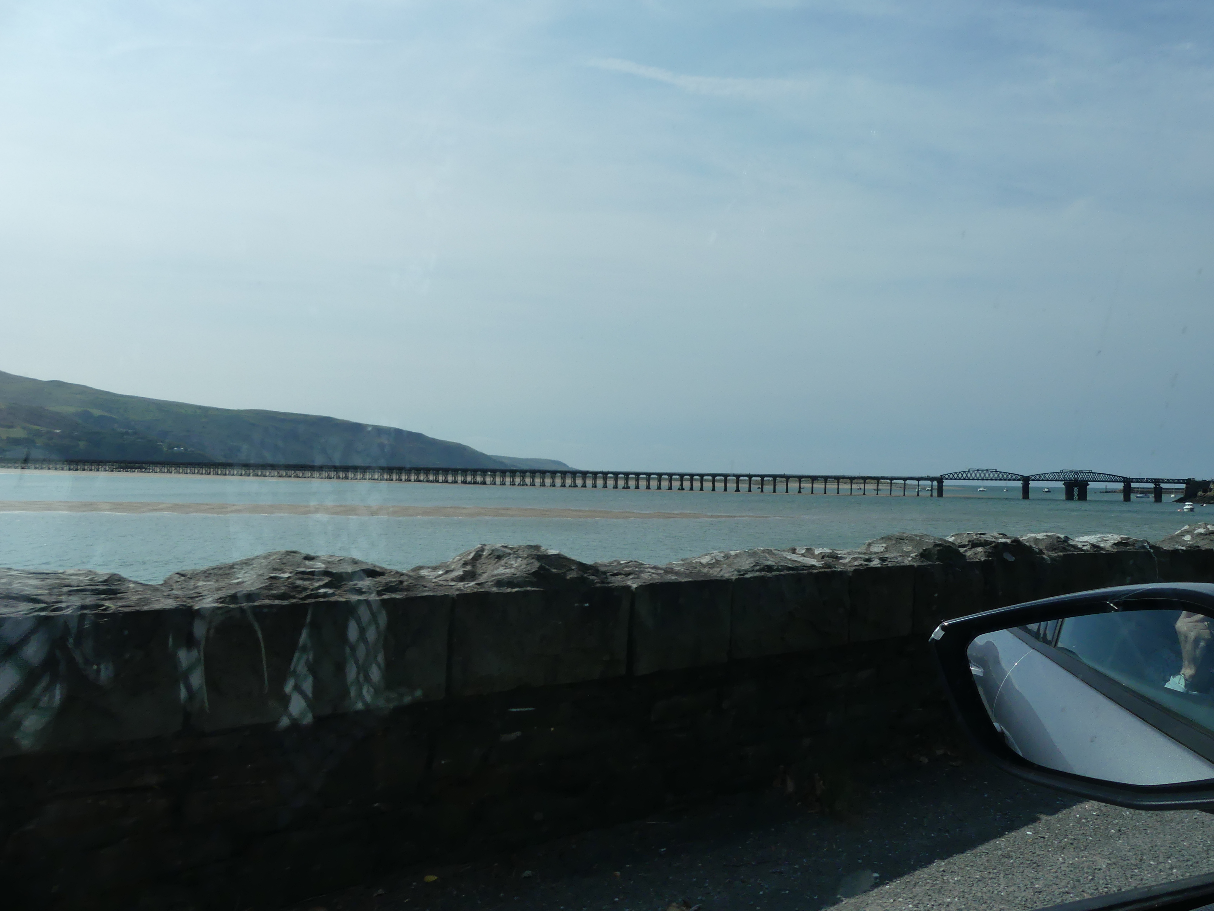
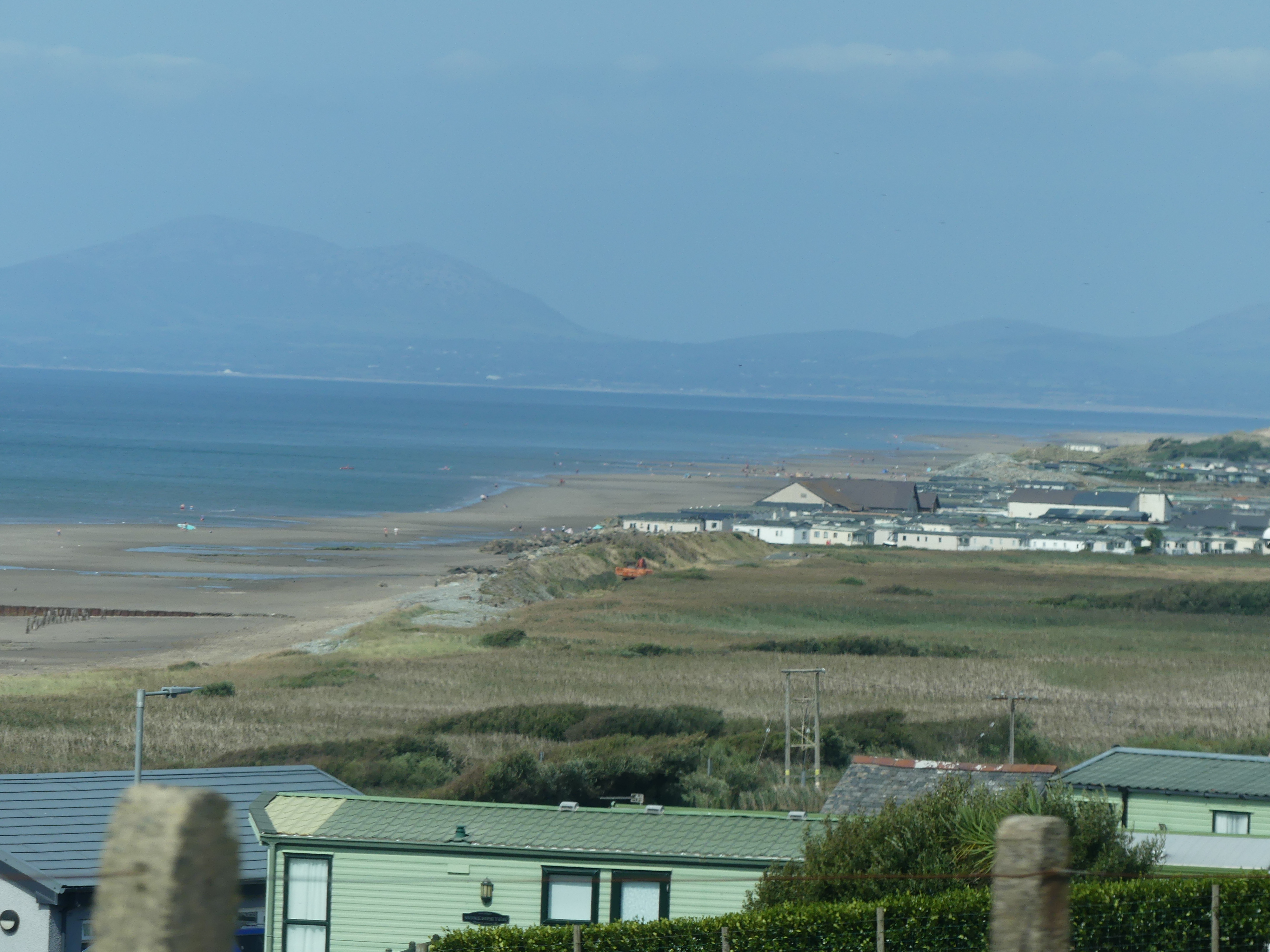
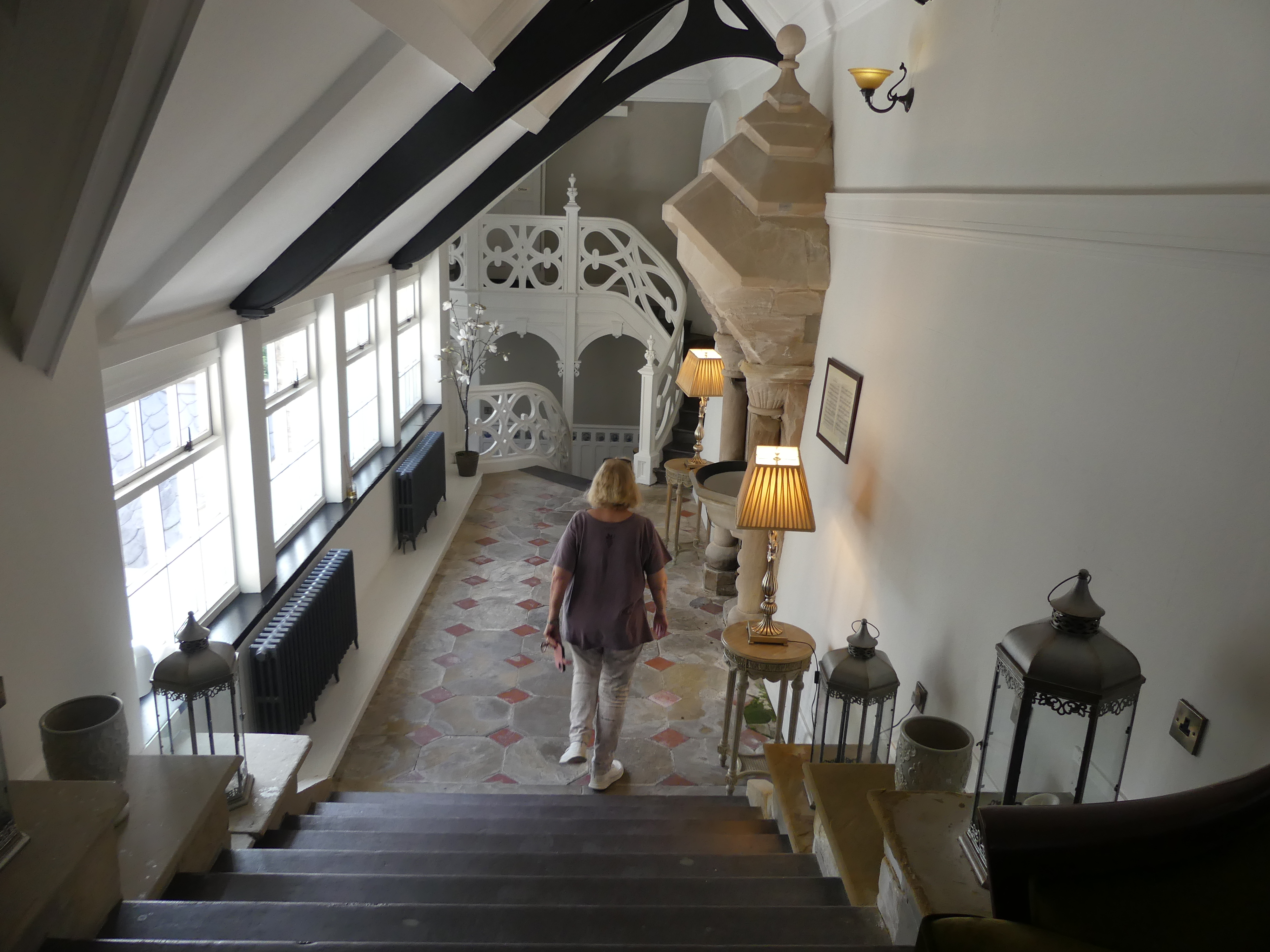
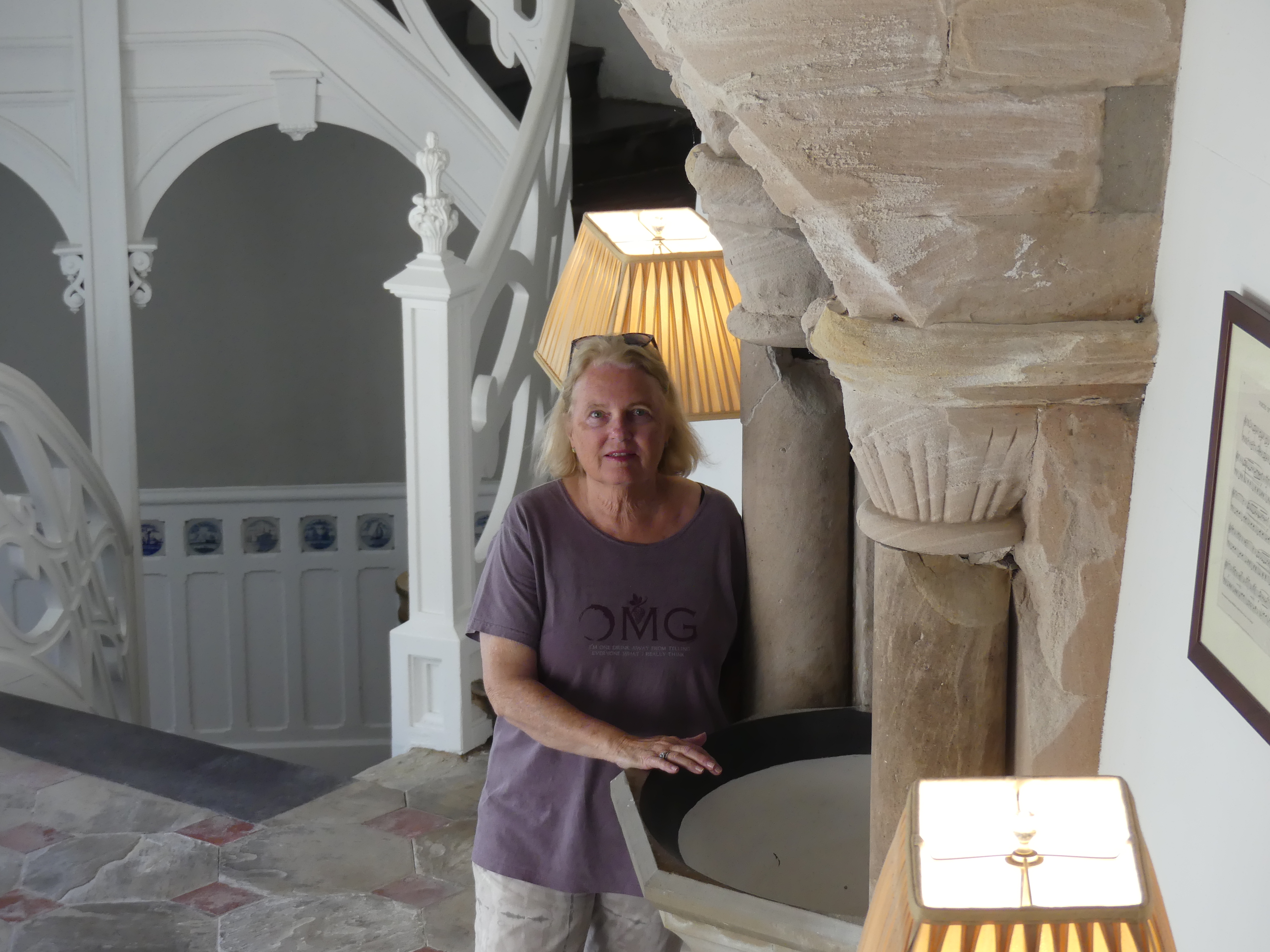
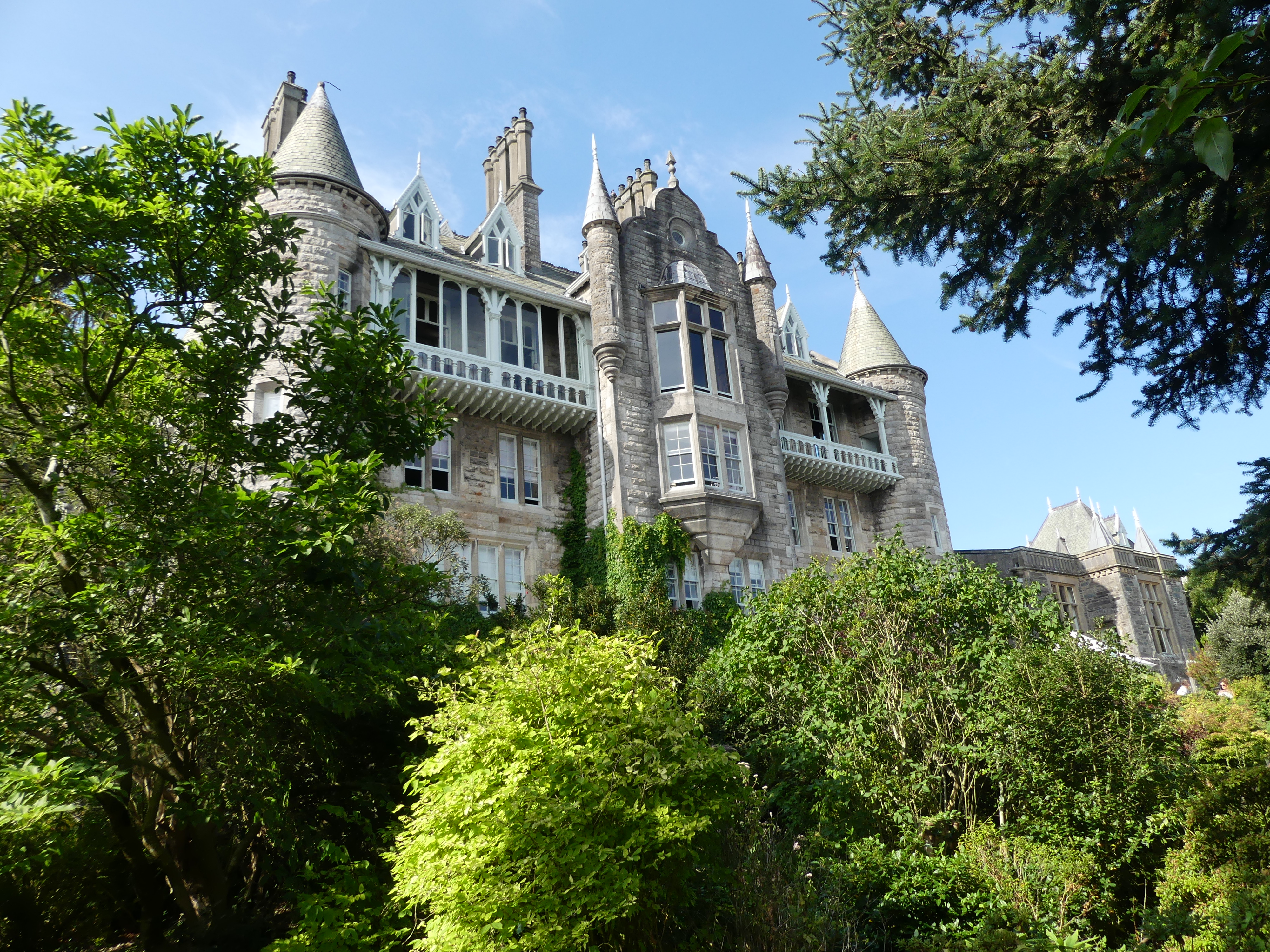
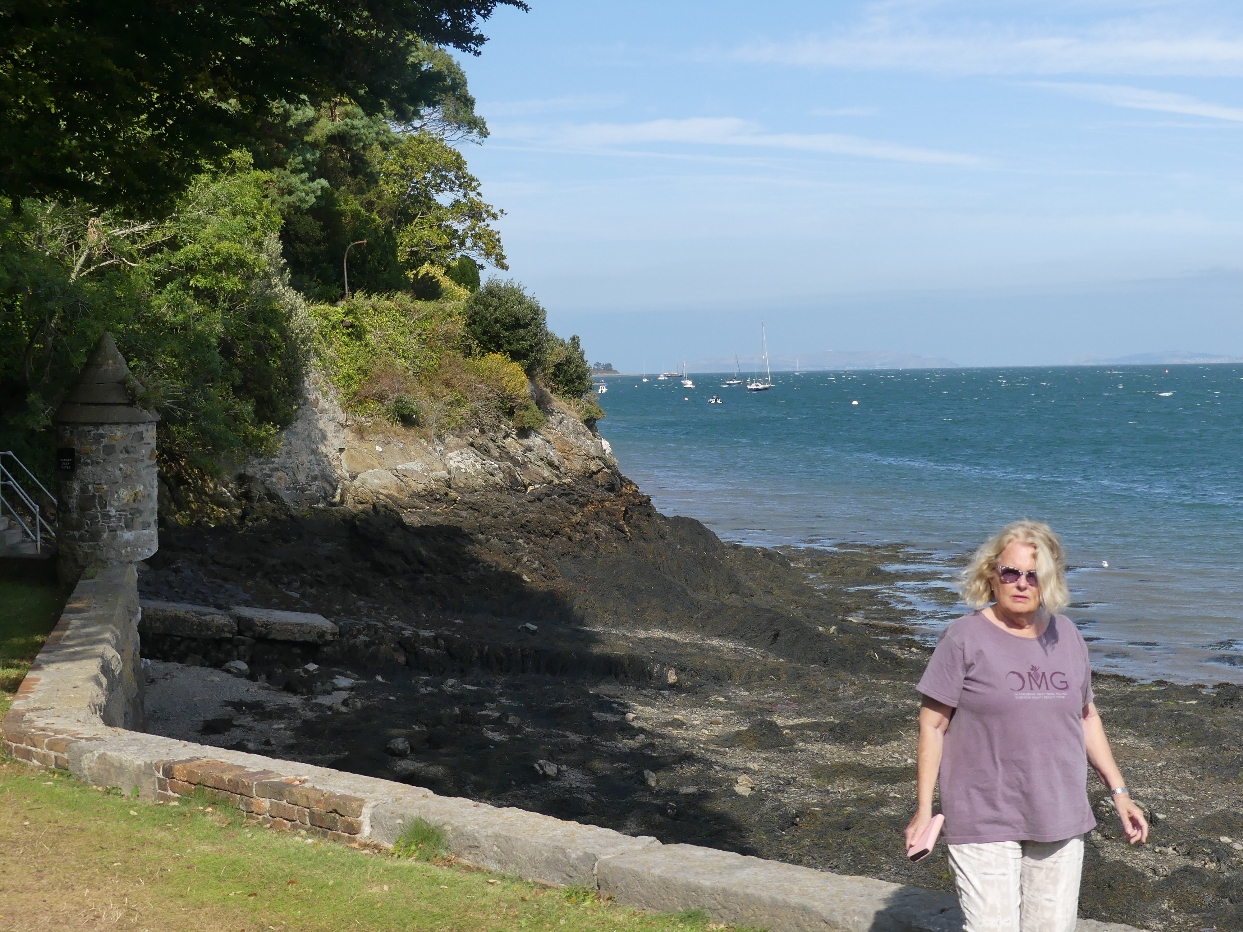
We arrived in Angelsey about mid afternoon and crossed the Menai Bridge. We proceeded along the road following the bay until we noted the entrance – a sharp right-hand turn into a crowded driveway. Chateau Rhianfa, is located on Menai, between Menai Bridge and Beaumaris. The house was built for Sir John Hay-Williams, 2nd Baronet of Bodelwyddan, and his wife Lady Sarah Elizabeth Hay-Williams with construction commencing in 1849 and completed in 1851. The house remained in the possession of the Williams family until 1957 when it was sold and converted into several apartments. Most of the land surrounding the house was also sold, leaving three acres attached to the estate. In 2012 the building reopened as a hotel, with three cottages within the estate converted into guest houses. My photos below show our bedroom – first round bed that I can recall and it was not all that comfortable. It proved to be unusual to sleep in. The bar was quaint but did not seem to be used regularly. Down on the waterfront we looked back to the mainland. The wind was constant and quite cool. The last photo of the exterior of the hotel showing a tower is in fact a view of our bedroom from the outside of the building.
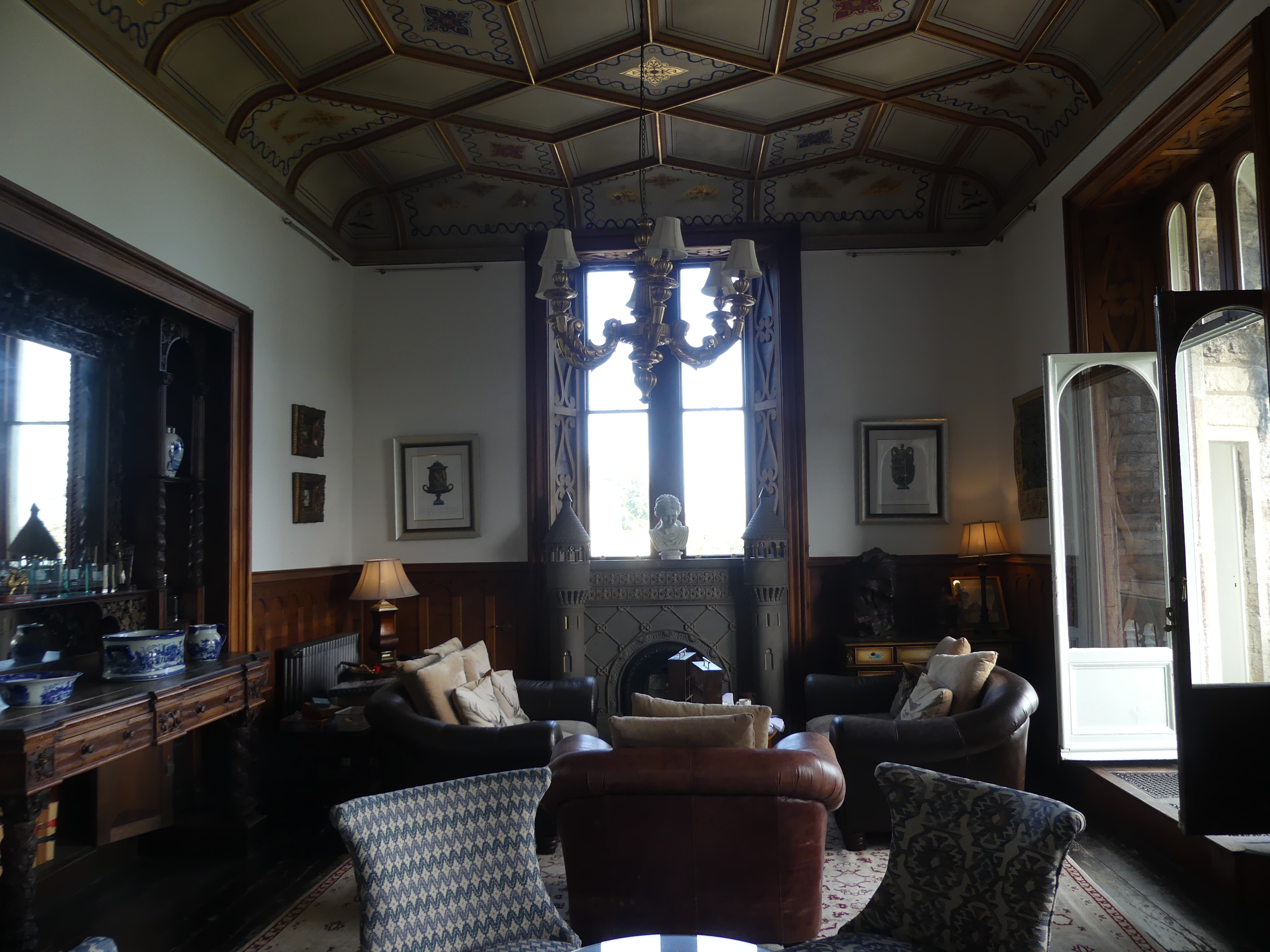
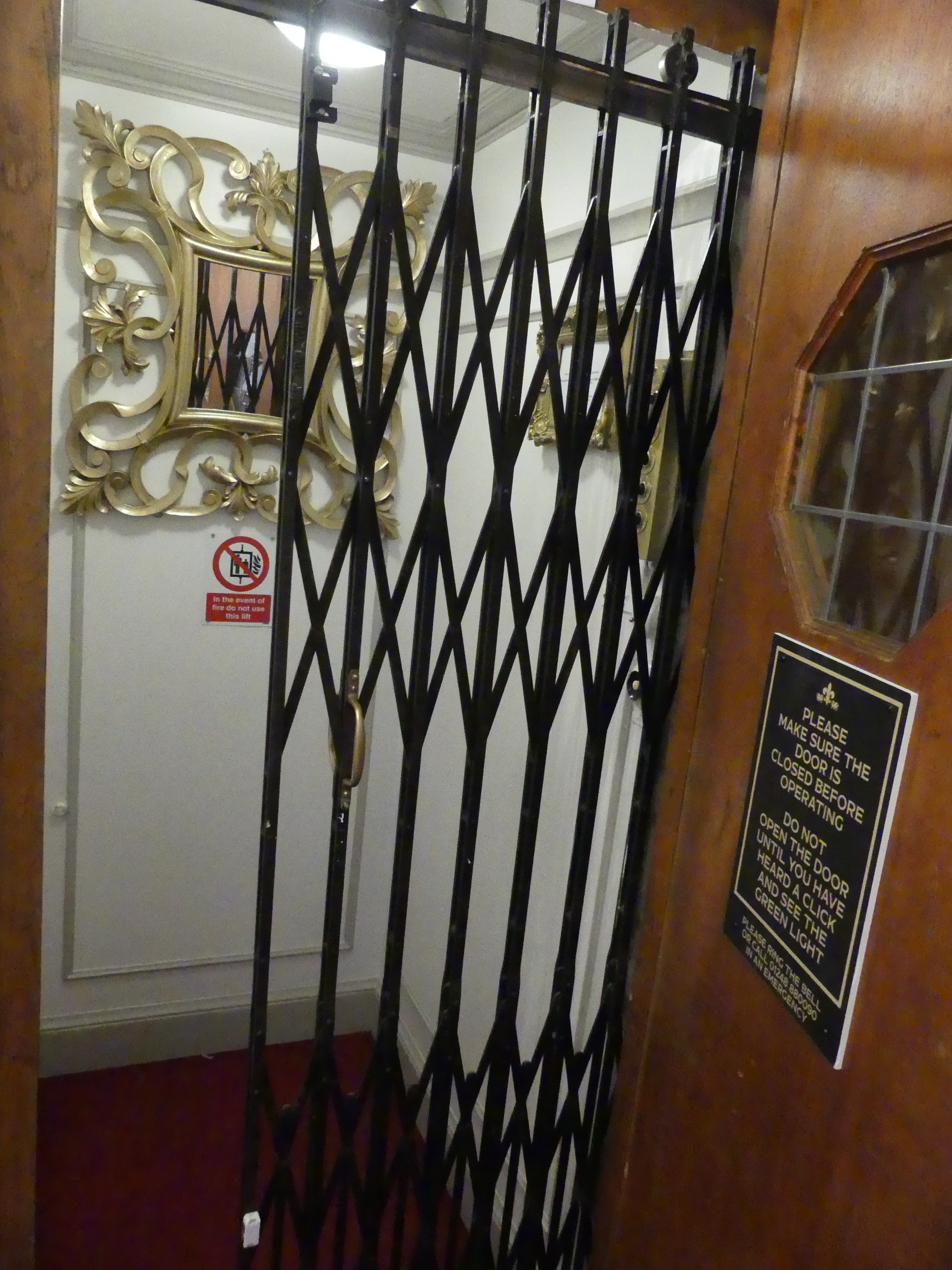
The hotel has been appointed with luxurious furniture and fittings in accord with the style of the building. It is surrounded by gardens and fronts the Menai Strait. The layout of the hotel was quirky but that appeals to us and makes it more interesting. It has an elevator which we gave a lot of use while we were there. Our photos give you a tour of the hotel, Menai Strait on a windy day and the elevator. The following day we had time to move through the many rooms of the hotel starting from the carpark at the entrance then the 3 lounges overlooking the waters of Menai Strait, the corner day bed on the verandah on the first floor, the top of the stairs and the chairs for the elderly to rest after the climb, some wild flowers sprung up in the garden and then the famous lift.
CAERNARFON AND ITS CASTLE
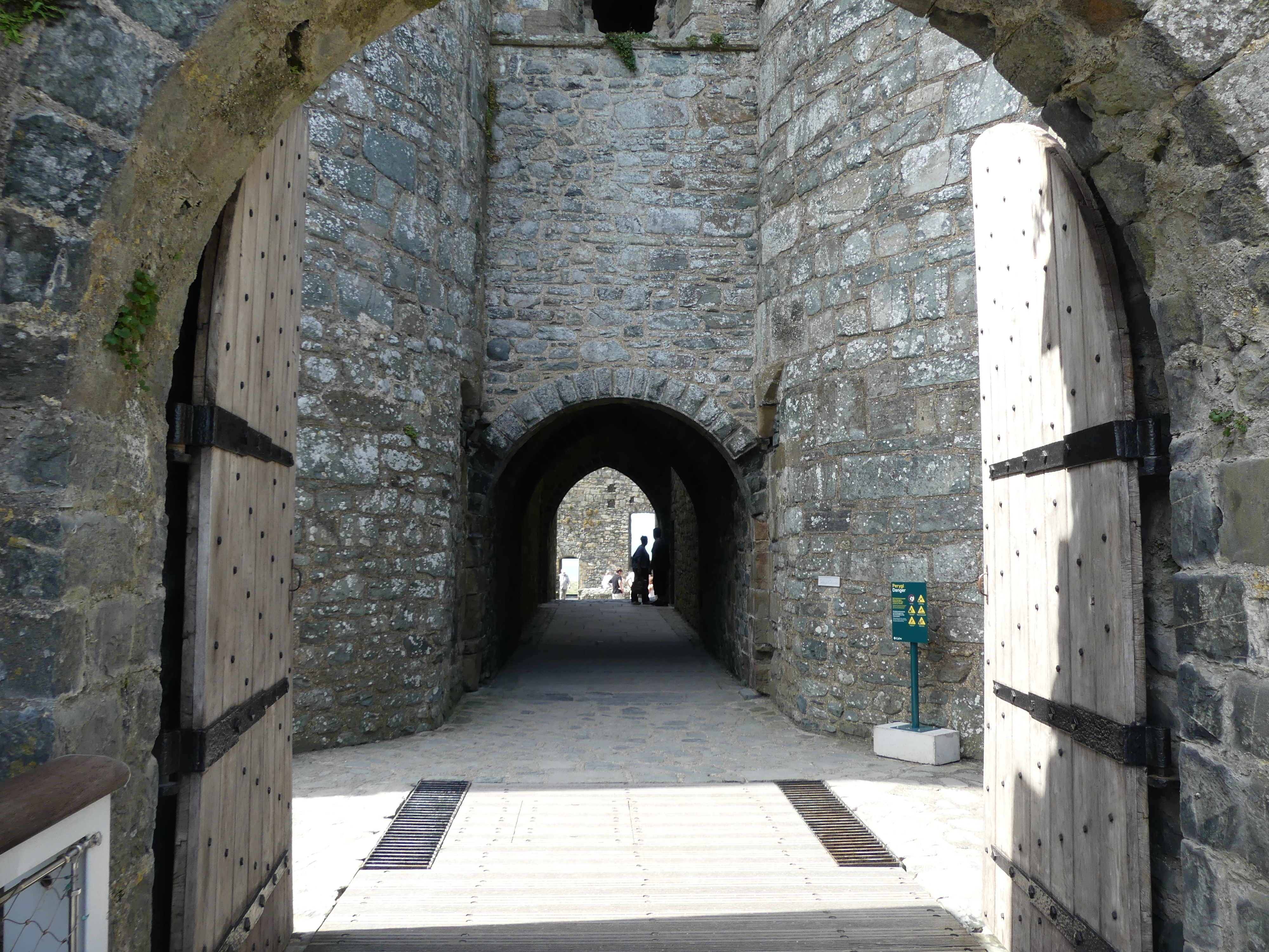
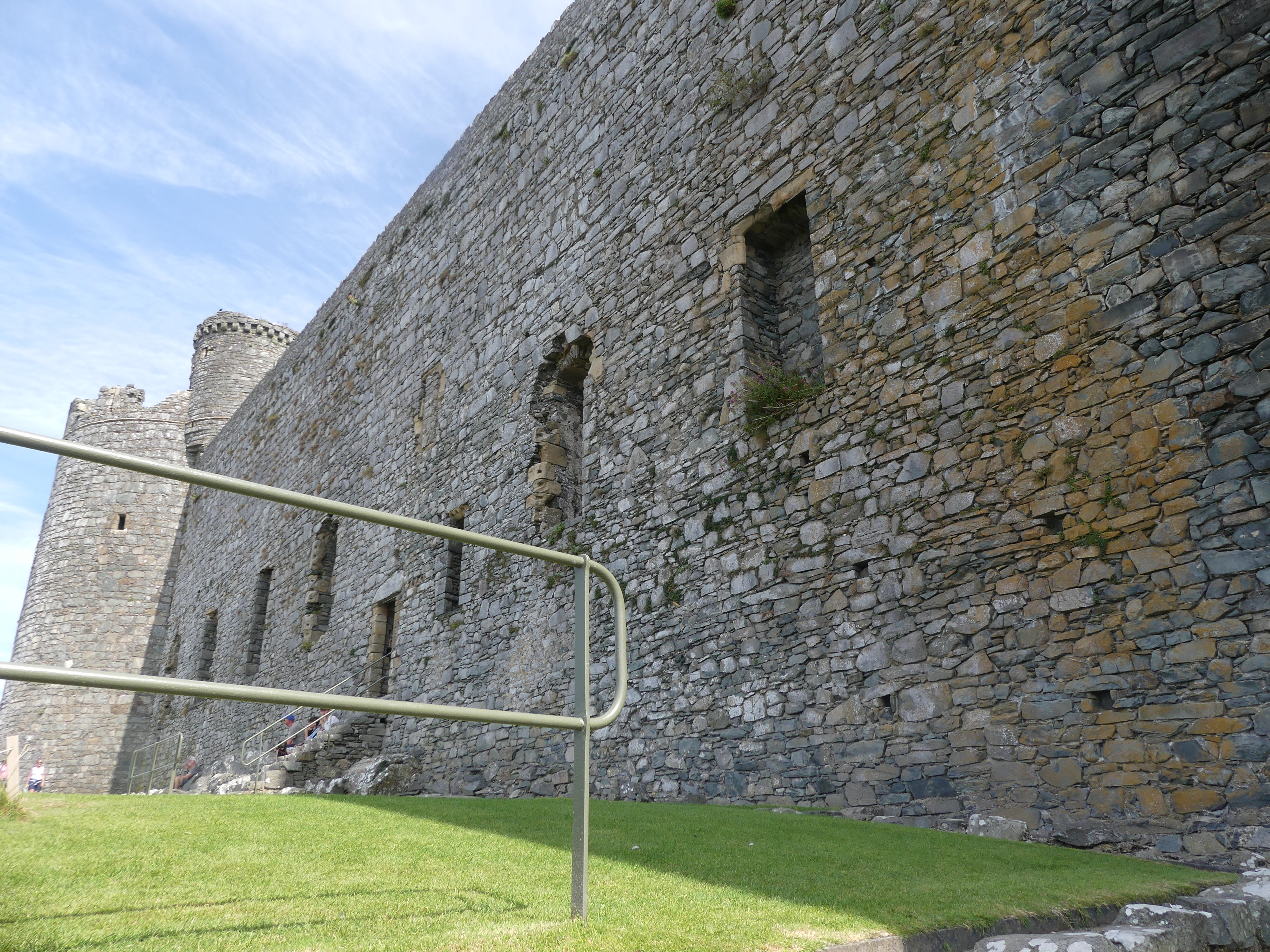
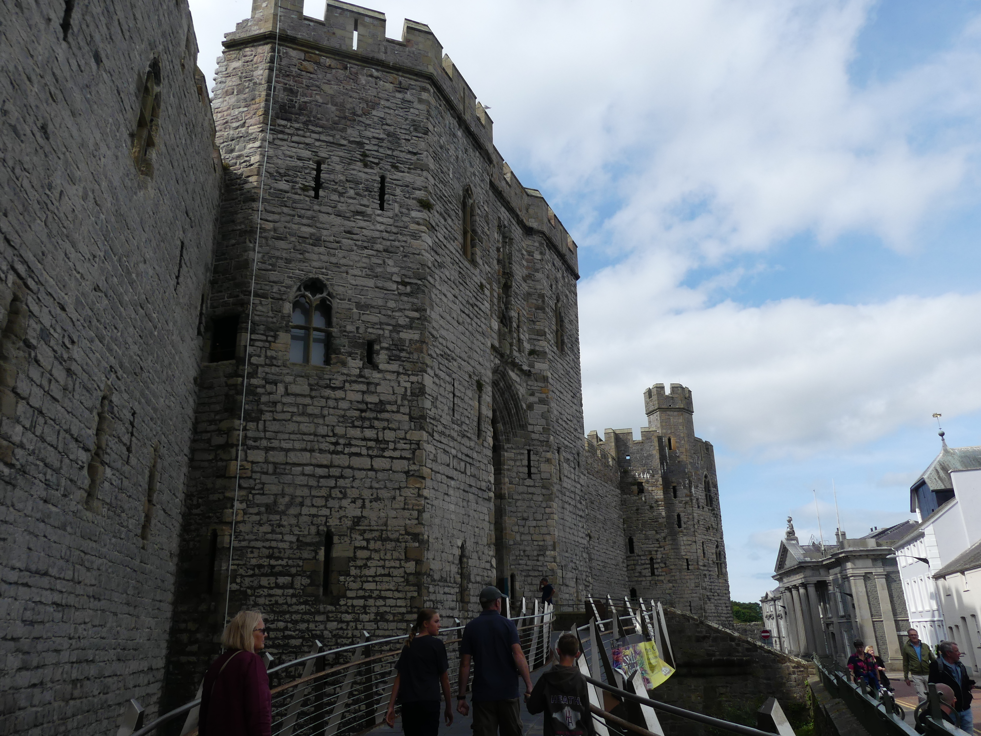
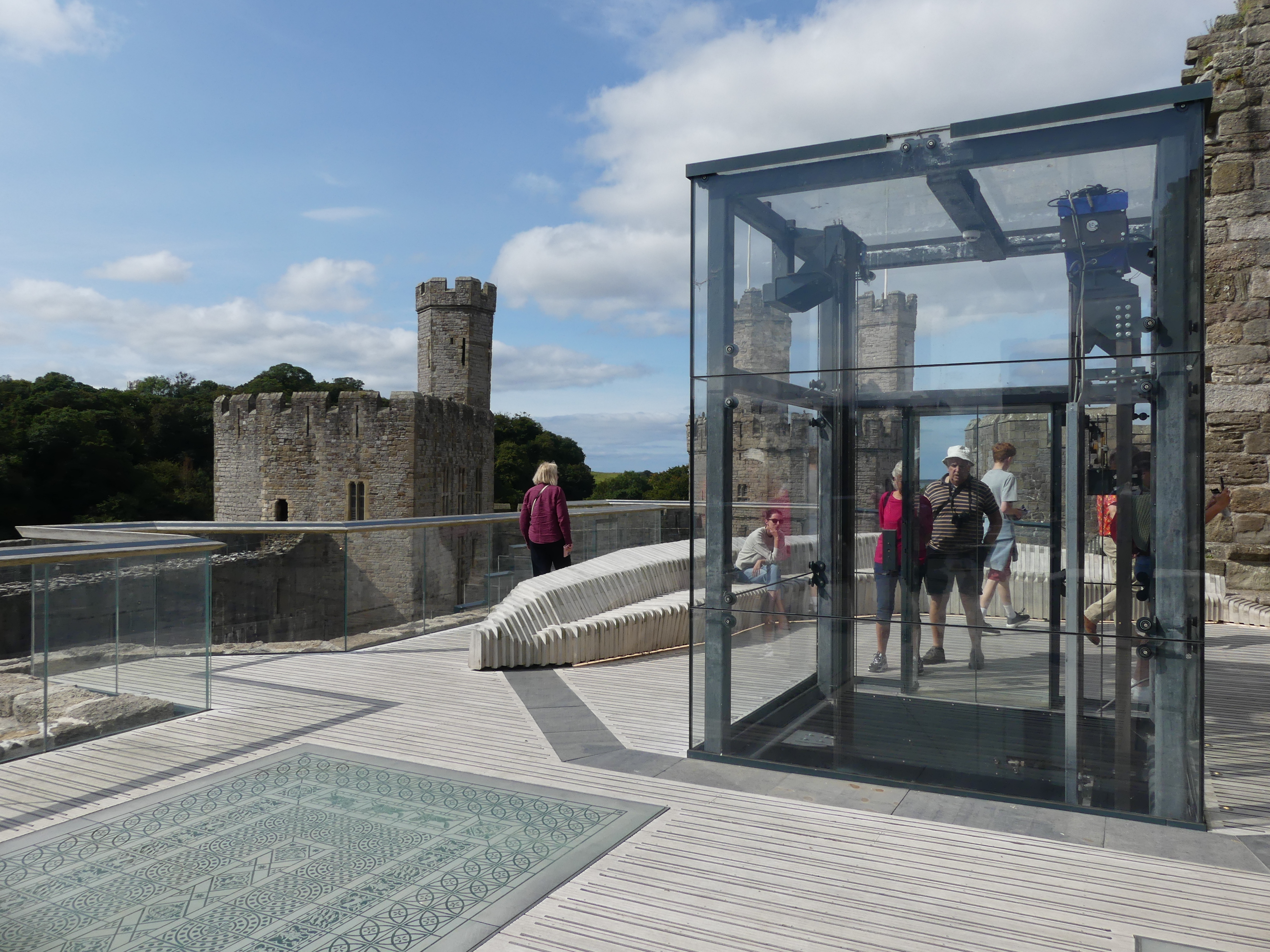
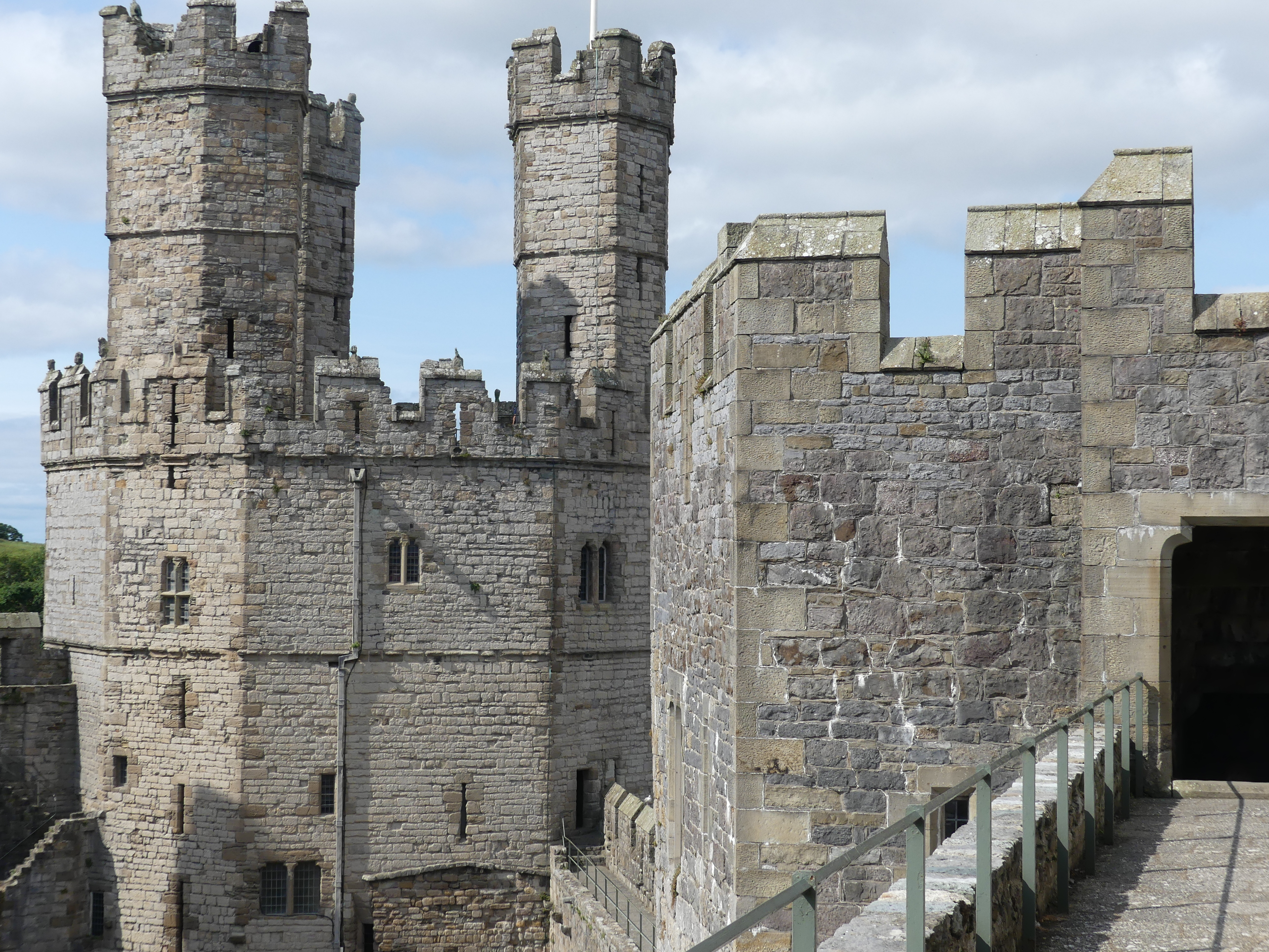
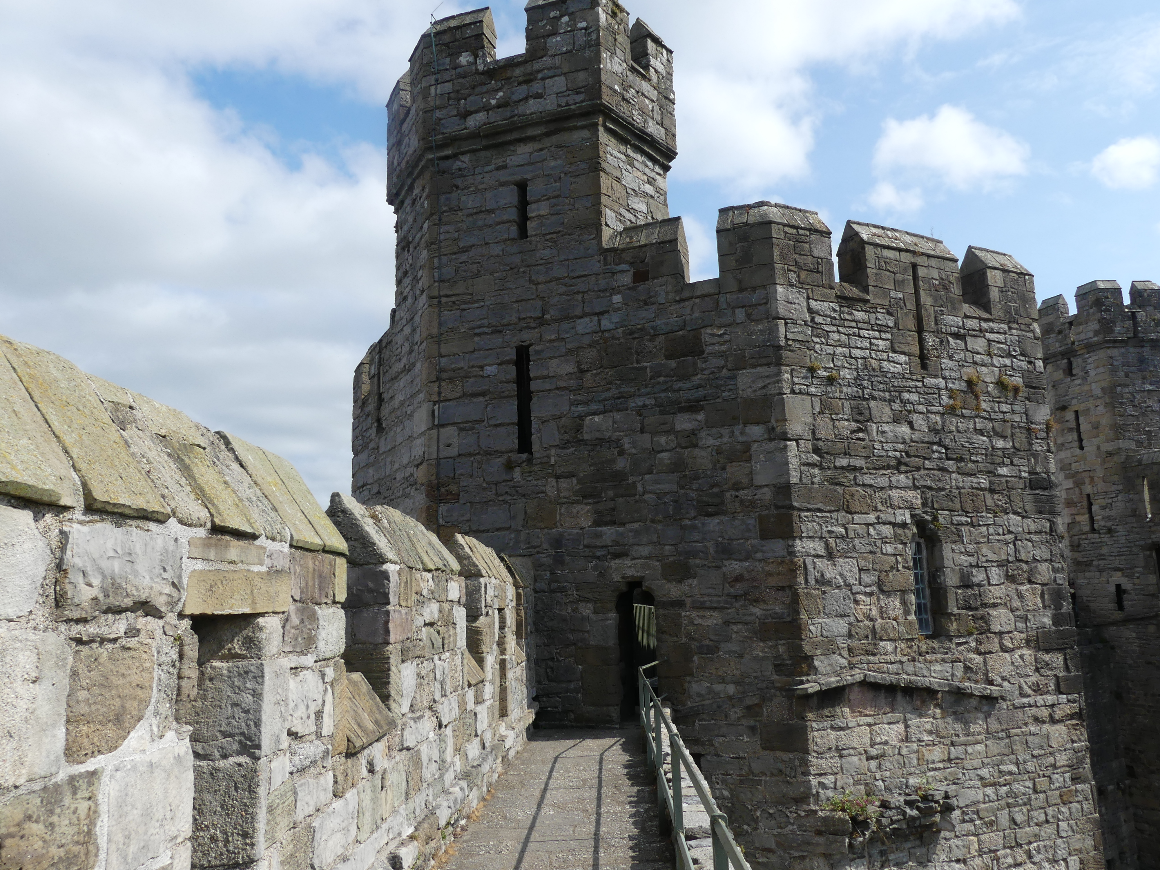
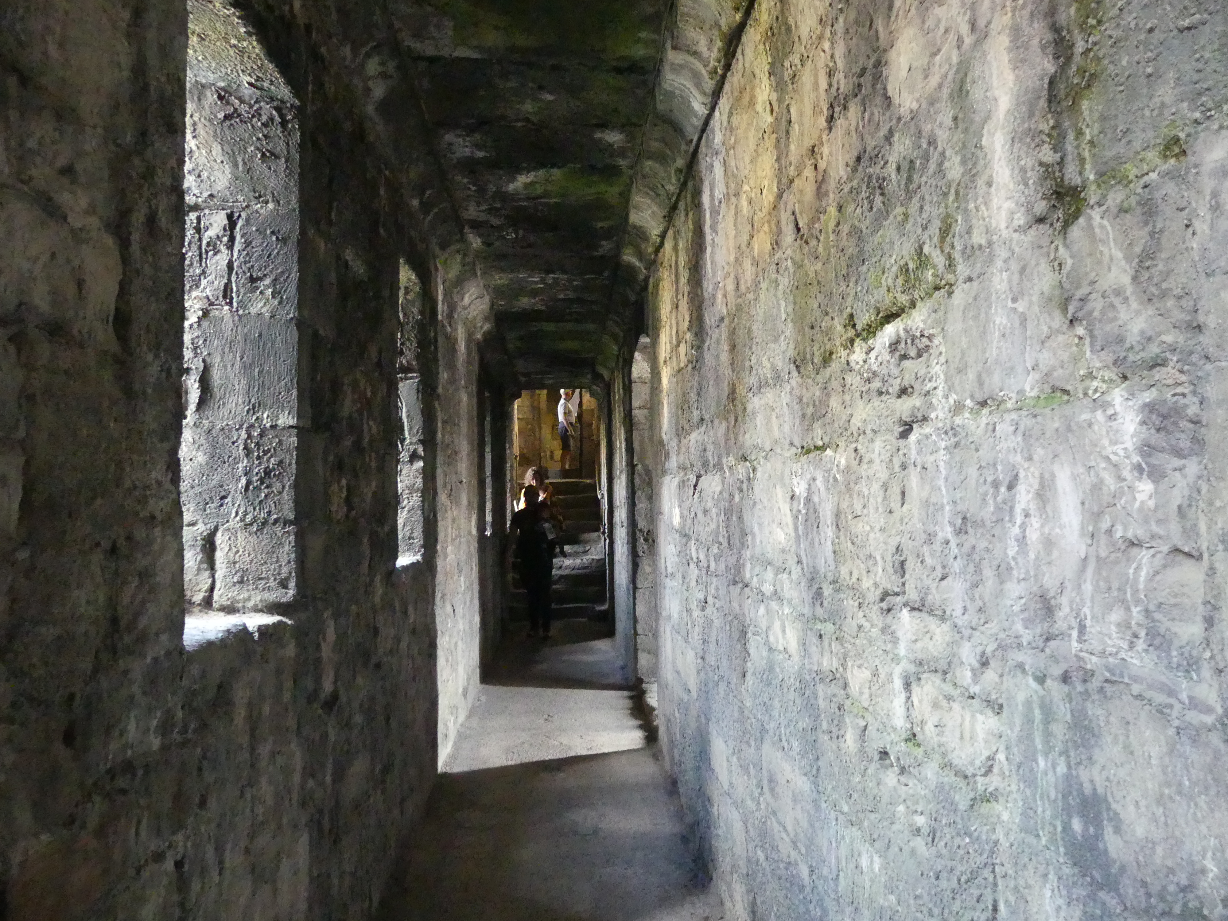
One of the attractions for me in visiting Anglesey was Caernarfon Castle. Although it is located in Caernarfon some 20 minutes drive away, I was keen to visit the castle which has maintained some of its medieval history. One of the best things about travel by road in the UK is their postal system where every residence, business, Government Office and castle has an individual post code and the g.p.s. system on my phone or in the car operated to locate and direct us to where we wanted to be. So locating the castle – no problem. Finding parking – always a bloody headache and this occasion was no exception. When you do find public parking it was different in every village and it took some time to understand what had to be done to avoid a fine – nerve wracking.
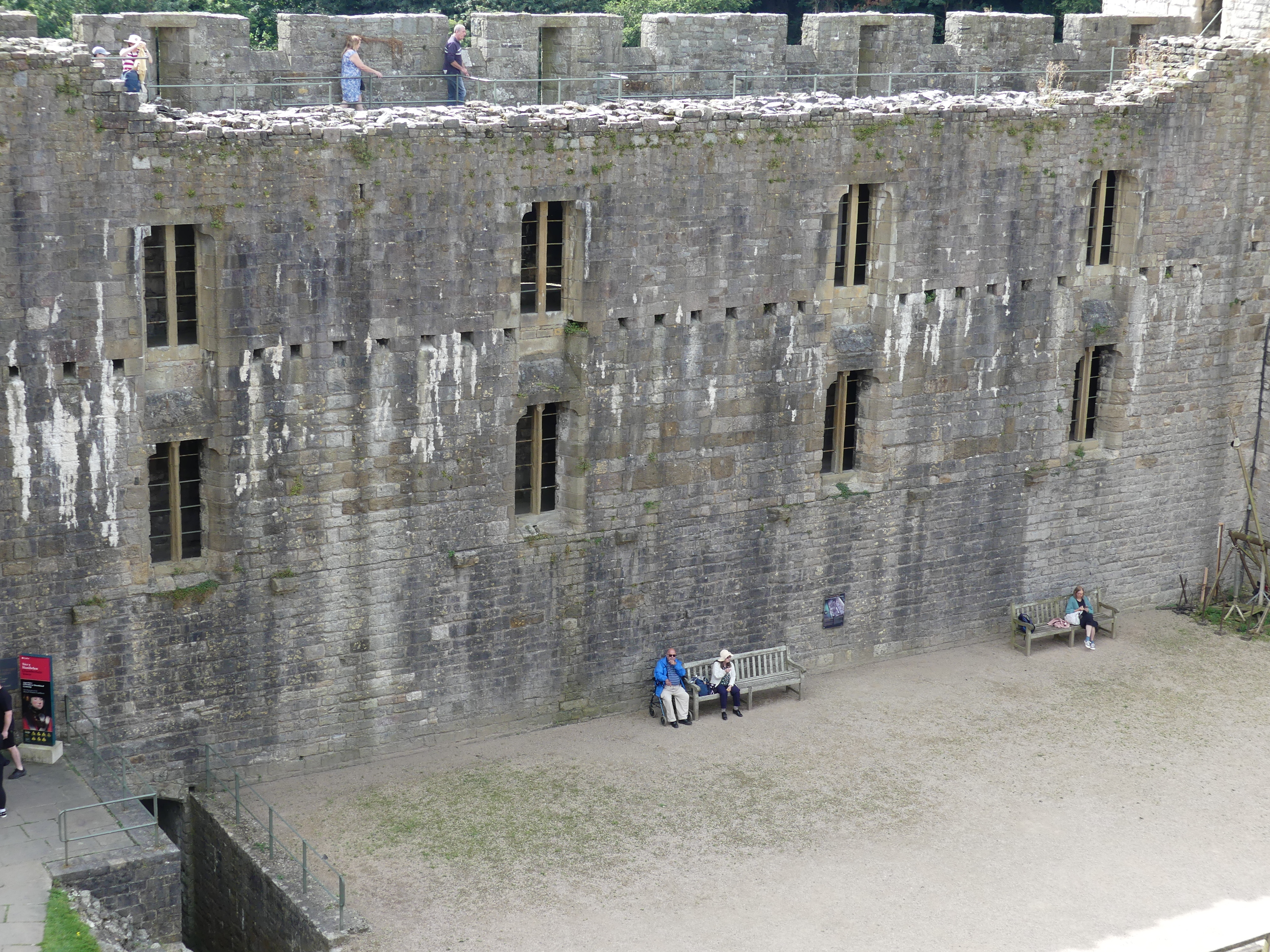
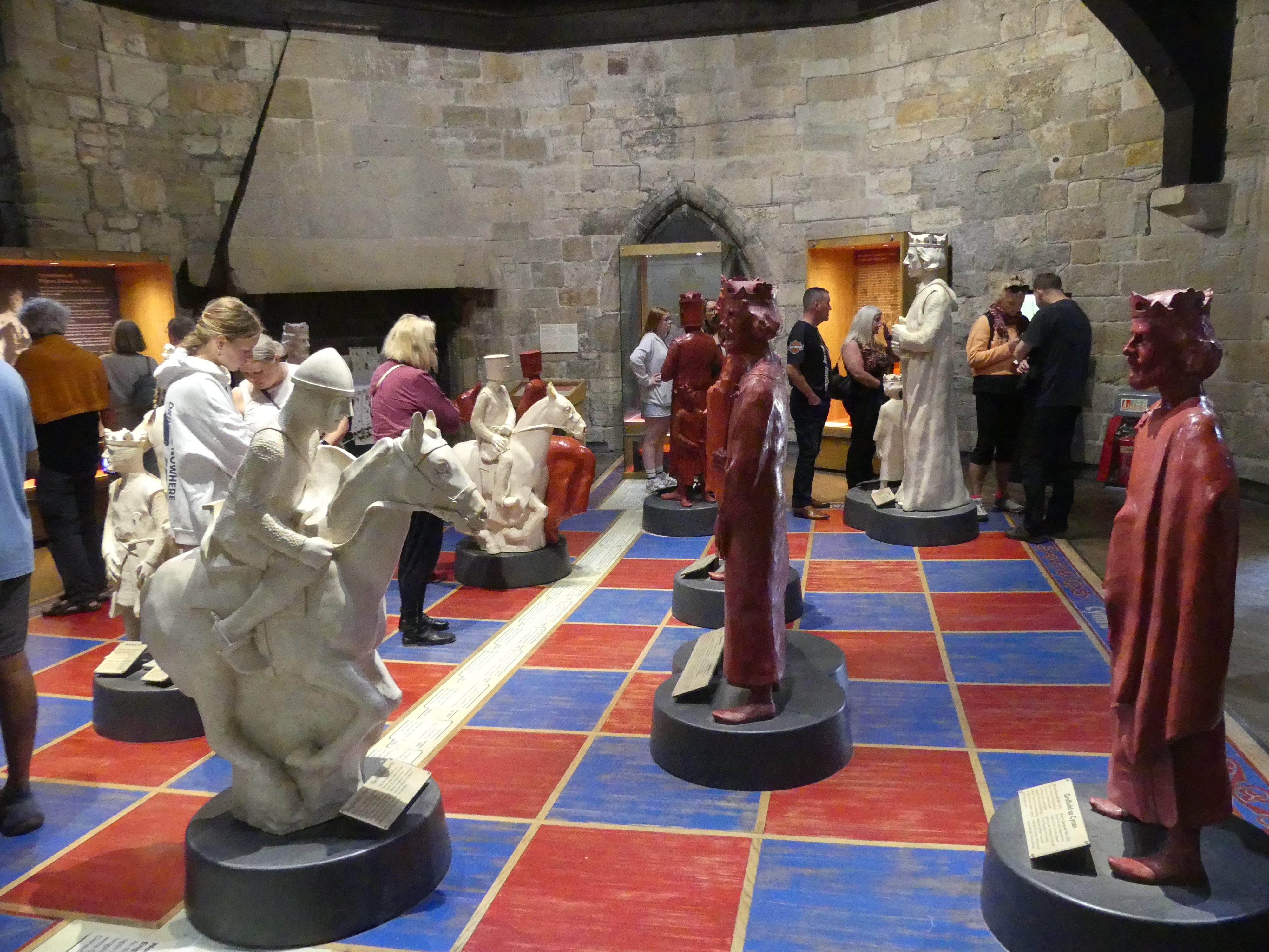
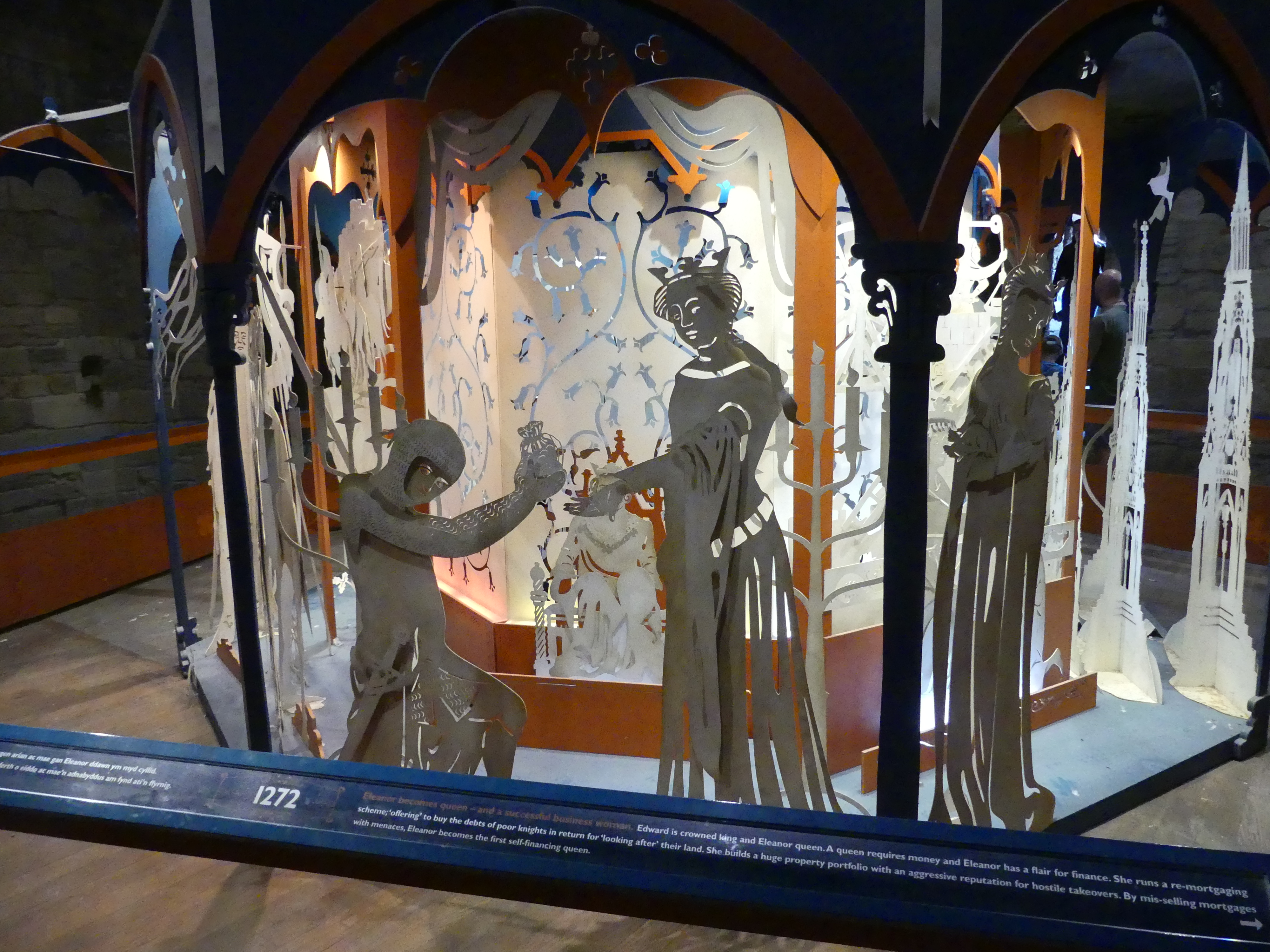
We found the public parking, determined the manner for payment and walked off with fingers crossed. We found one of the gates in the remaining walls of the castle and inside those gates was the streets and businesses given the protection of those walls. Like the “Black Boy Inn” and there did not appear to be any offense taken by the residents. After progressing through to the inner keep, we came to the ticket office and once again our 7 days Cadw pass gained us free entry. That pass saved us a huge sum of entry fees. Inside the inner sanctum of the castle was a mixture of medieval and modern. For the first time the castle had an elevator of modern design and faultless operation. Our photos show that this was a strongly fortified and important place. It was large as castles go and you could well imagine the comfort it afforded the residents living and working in the outer keep. One of the towers had been fitted out to tell some of the stories of the castle – one was a chess set with the key players shown as Kings Queens Knights Bishops and Pawns and the other concerning Edward I and Eleanor of Castile, his queen, particularly how Eleanor retained power after Edwards death.
Her story is told in the collage shown in my pictures above. Eleanor of Castile (1241 – 28 November 1290) was Queen of England as the first wife of Edward I. She also ruled as Countess of Ponthieu in her own right from 1279. Her marriage was to secure and affirm English sovereignty over Gascony. As a 13-year-old, Eleanor was married to Edward on 1 November 1254. She is believed to have birthed a child not long after.
Simon de Montfort’s government imprisoned her in Westminster Palace. Eleanor took an active role in Edward’s reign as he began to take control of Henry III’s post-war government. The marriage was particularly close; Edward and Eleanor traveled together extensively, including the Ninth Crusade. In her lifetime, Eleanor was disliked for her property dealings and the supposed exploitation of Jews, bringing her into conflict with the church. Eleanor died at Harby near Lincoln in late 1290; following her death, Edward built a stone cross at each stopping place on the journey to London, ending at Charing Cross, known as Eleanor crosses.
Notwithstanding the sources of her wealth, Eleanor’s financial independence had a lasting impact on the institutional standing of English queens, establishing their future independence of action. After her death, Eleanor’s reputation was shaped by conflicting fictitious accounts – both positive and negative – portraying her as either the dedicated companion of Edward I or as a scheming Spaniard. These accounts influenced the fate of the Eleanor crosses, for which she is probably best known today.
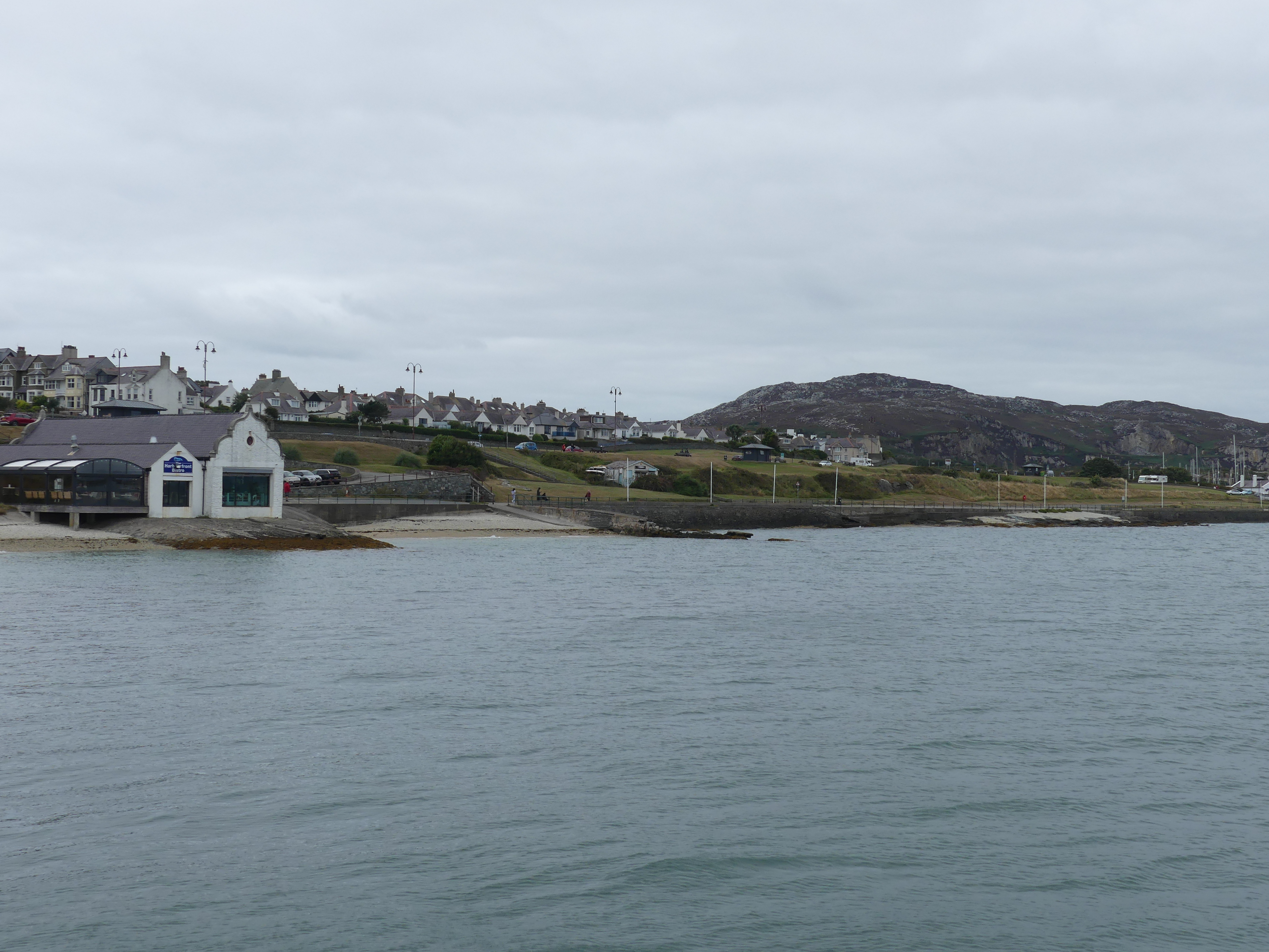
The port of Holyhead is the busiest UK Irish ferry port and is home to the largest seagoing ferry in the world. The origins of Holyhead (Caergybi) date from 450AD, when Celtic King Caswallon defeated Irish invaders on Holy Island. It is a historic port town, and is the largest town and a community in the county of the Isle of Anglesey, Wales. Holyhead is on Holy Island, bounded by the Irish Sea to the north, and is separated from Anglesey island by the narrow Cymyran Strait, having originally been connected to Anglesey via the Four Mile Bridge. For us it was just on the other side of the island.
We had no idea what to expect. The only thing we knew is that you caught the ferry to Ireland from Holyhead. On arrival at the ferry terminal the first thing we noticed is there is dedicated parking and no charge. In the distance we could see what looked like a passenger ship which turned out to be the ferry.
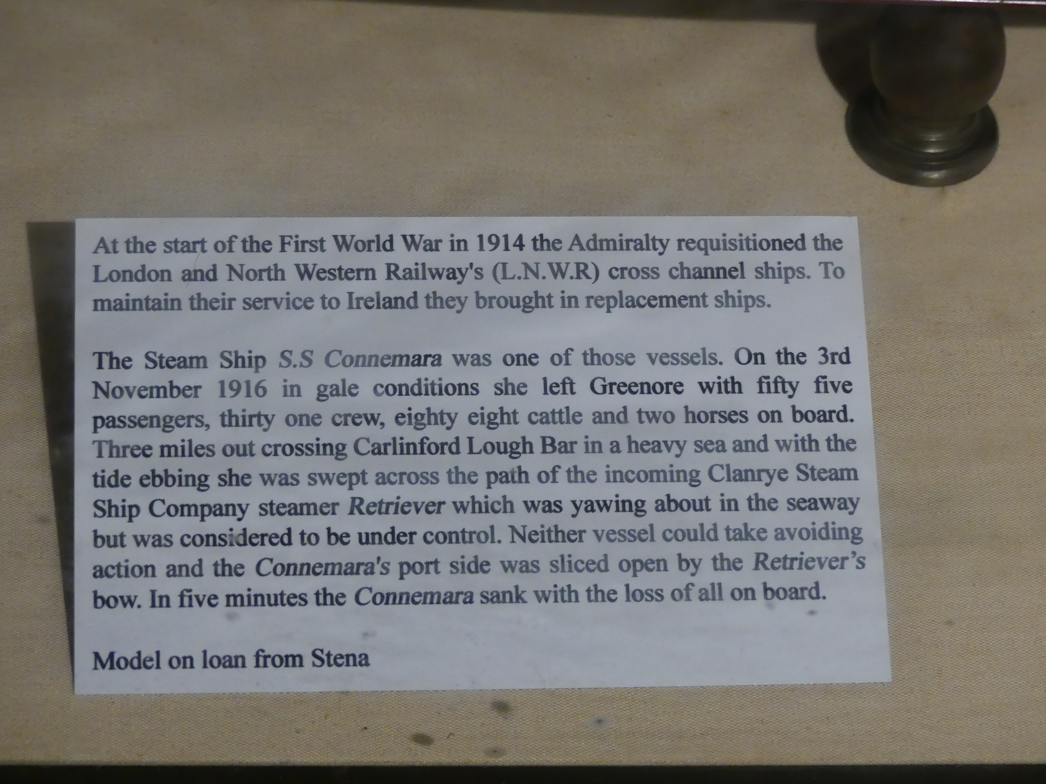
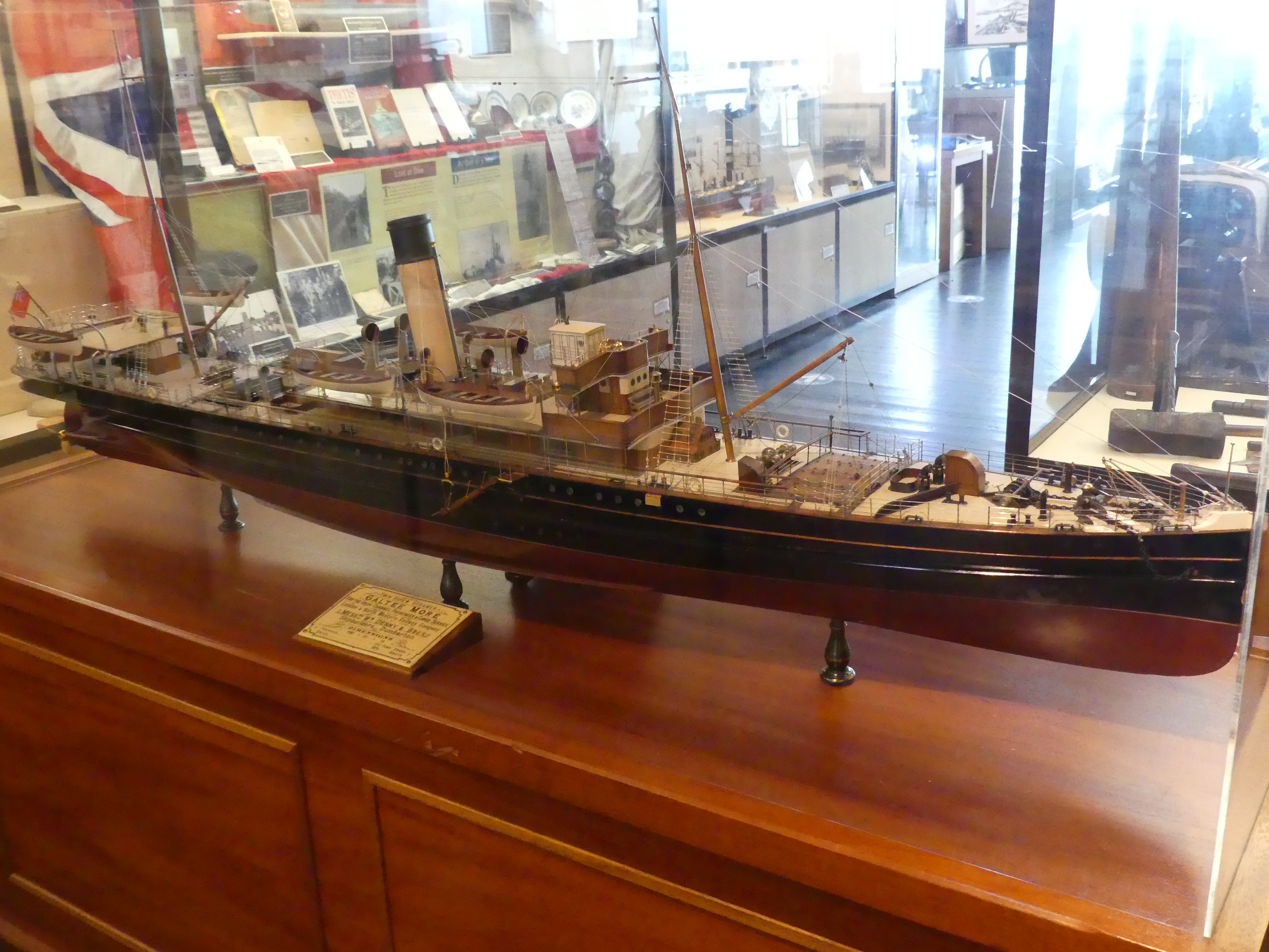
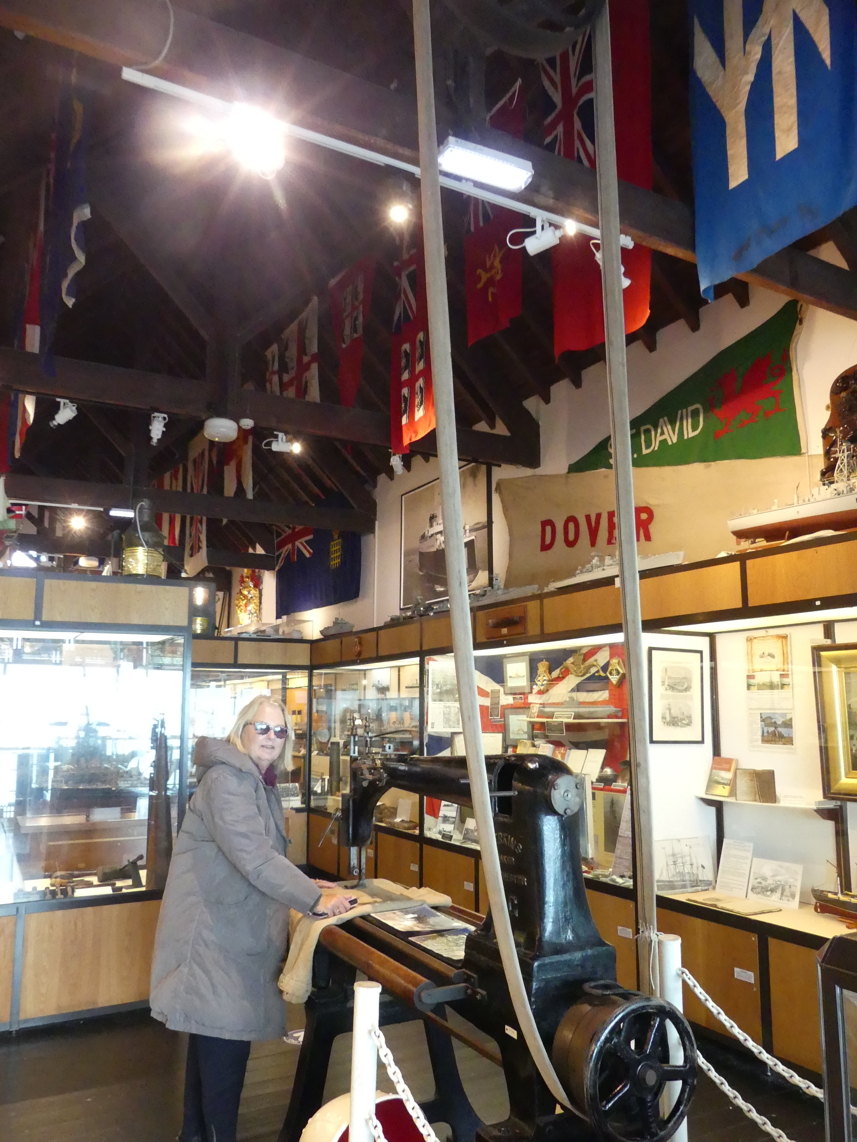
The weather was gray and cold and there was little to see. The thing that caught my eye was a maritime museum sited on the edge of the Bay with a nearby coffee shop and the rails of a former Rescue shed for launching of boats. There was a small entry fee but the volunteers manning the museum were quite prepared to show us around and give us the history of the museum and the displays in the museum. Our photos show the larger building which is the museum with the smaller coffee shop beside it. Kerry found a sewing machine which fascinated her. It was a sail makers machine which once upon a time was driven by steam power and 3 times the size of her industrial machines. Outside of the museum was a brick bomb shelter used during the Wars as Holyhead was a target for enemy planes. It was fitted out as though expecting a raid any moment. After completing our visit we adjourned to the coffee shop and found it was open from lunch only but just for us served us with coffee and cake with the ferry sitting against the wharf.
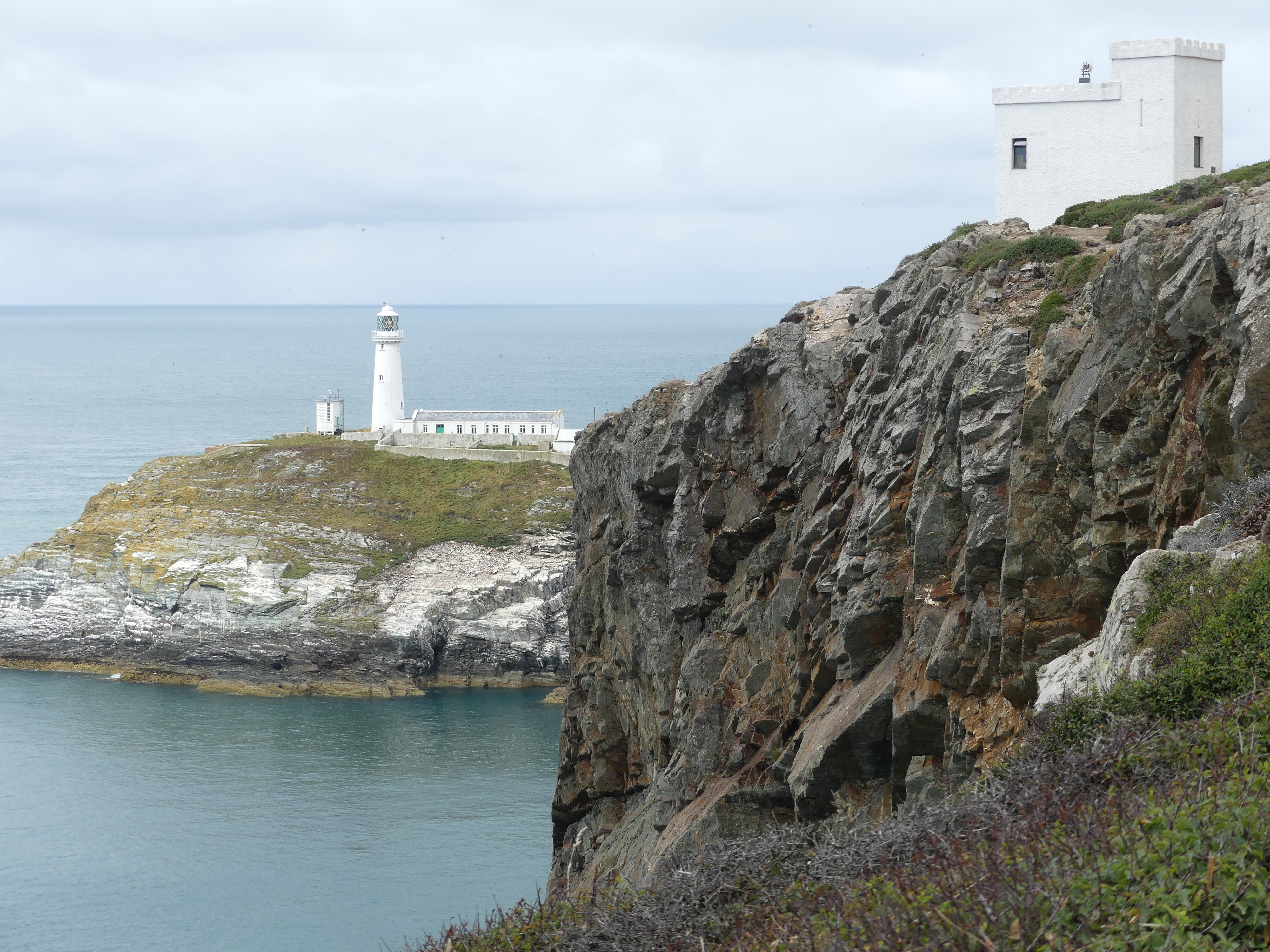
We finished a very welcome coffee and moved on to the South Stack Lighthouse. Searching for the lighthouse was a challenge and we missed the turn ending up in a cliff side park overlooking the lighthouse.The main lighthouse near Holyhead is the South Stack Lighthouse, a historic structure built in 1809 on a small island off the coast of Holy Island. It is famous for its dramatic location, accessed by descending over 400 steps from the mainland cliffs, and is a popular spot for birdwatching, including puffins and other seabirds. The lighthouse is 91 metres tall and the walk to the lighthouse starts on the headland with 400 stairs down then a lengthy walk to the buildings then the climb to the top of the lighthouse turnaround and go back again. That would have taken all day and probably killed one or both of us so we were content to view the building as we encountered an environmental centre built in a miniature castle like building in the reserve with information on the reserve and its flora and fauna. You will see in one picture the RAF planes that regularly flew across.
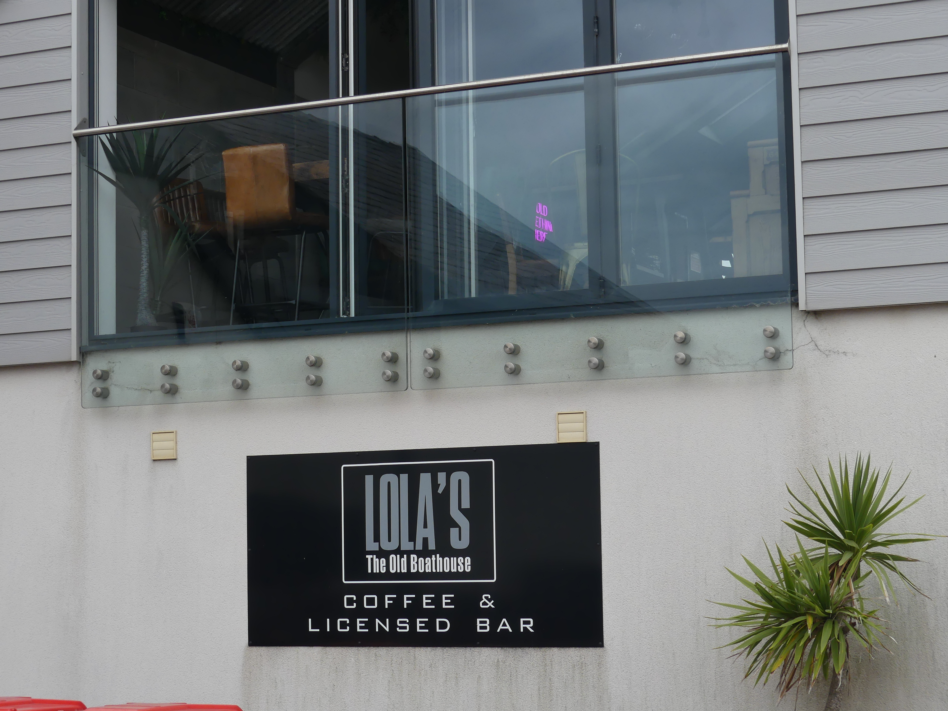
We moved onto the next town and visited the beach and got some lunch. As we departed we came across this restaurant “Lola’s” the old boathouse. Lola is our 2nd grandchild living in Tasmania.
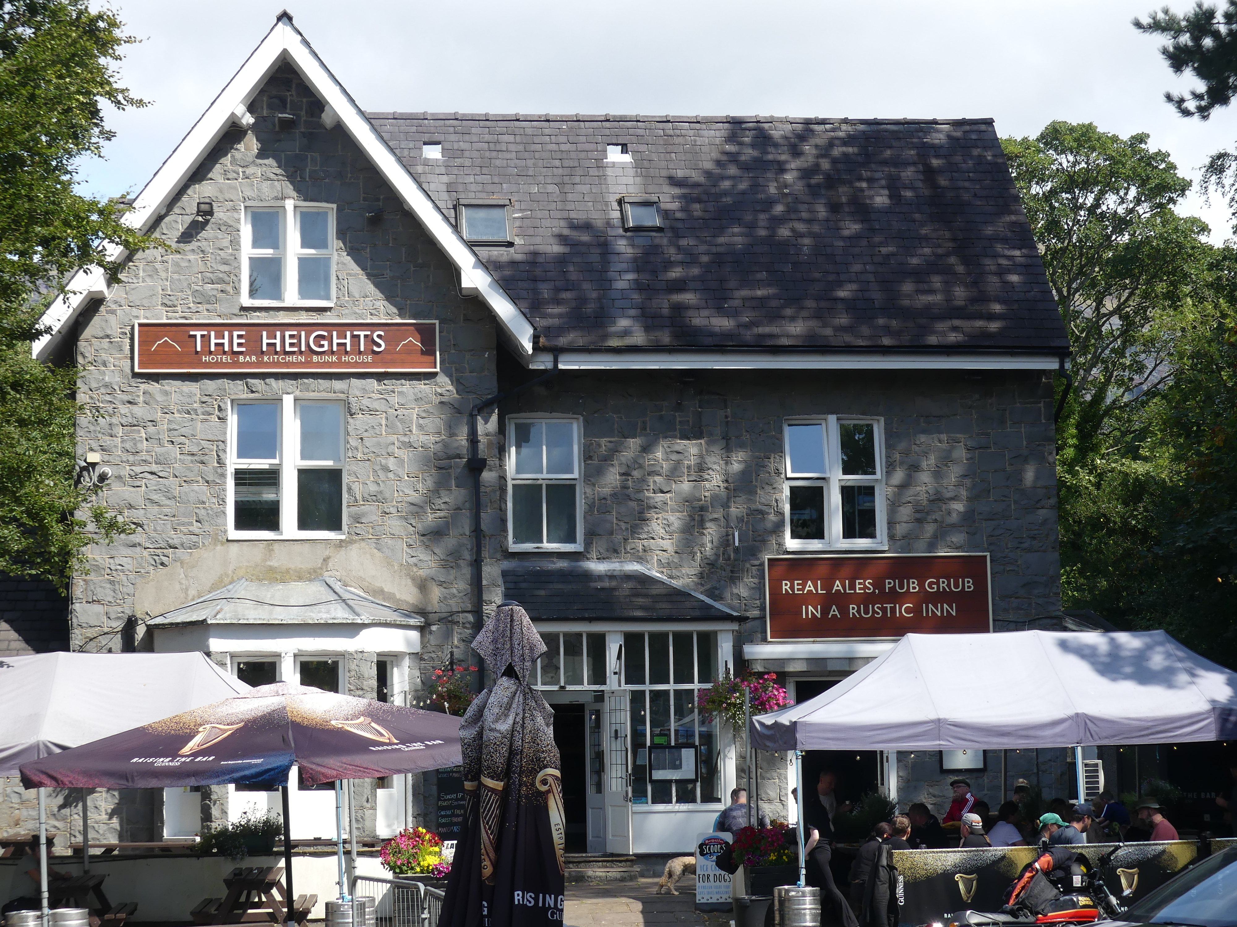
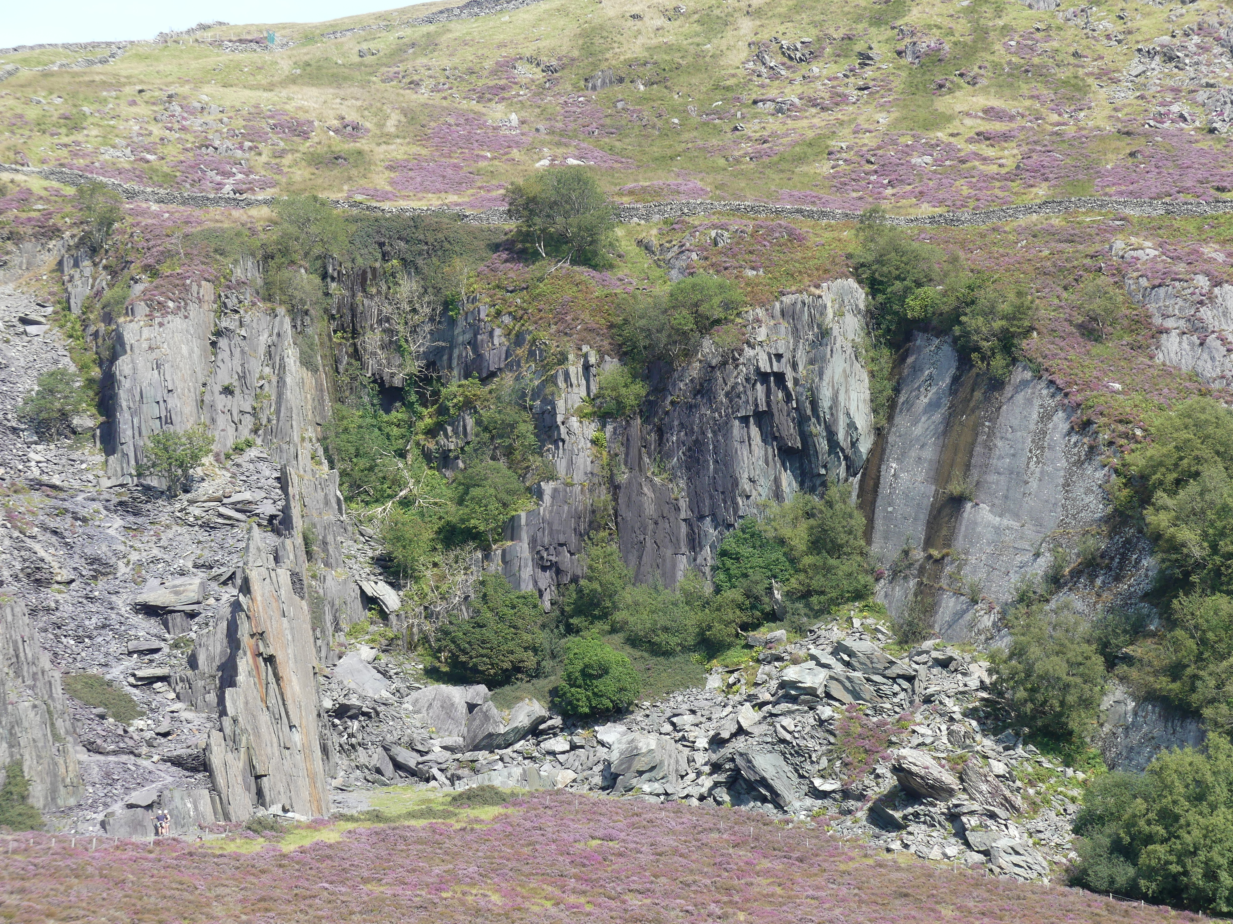
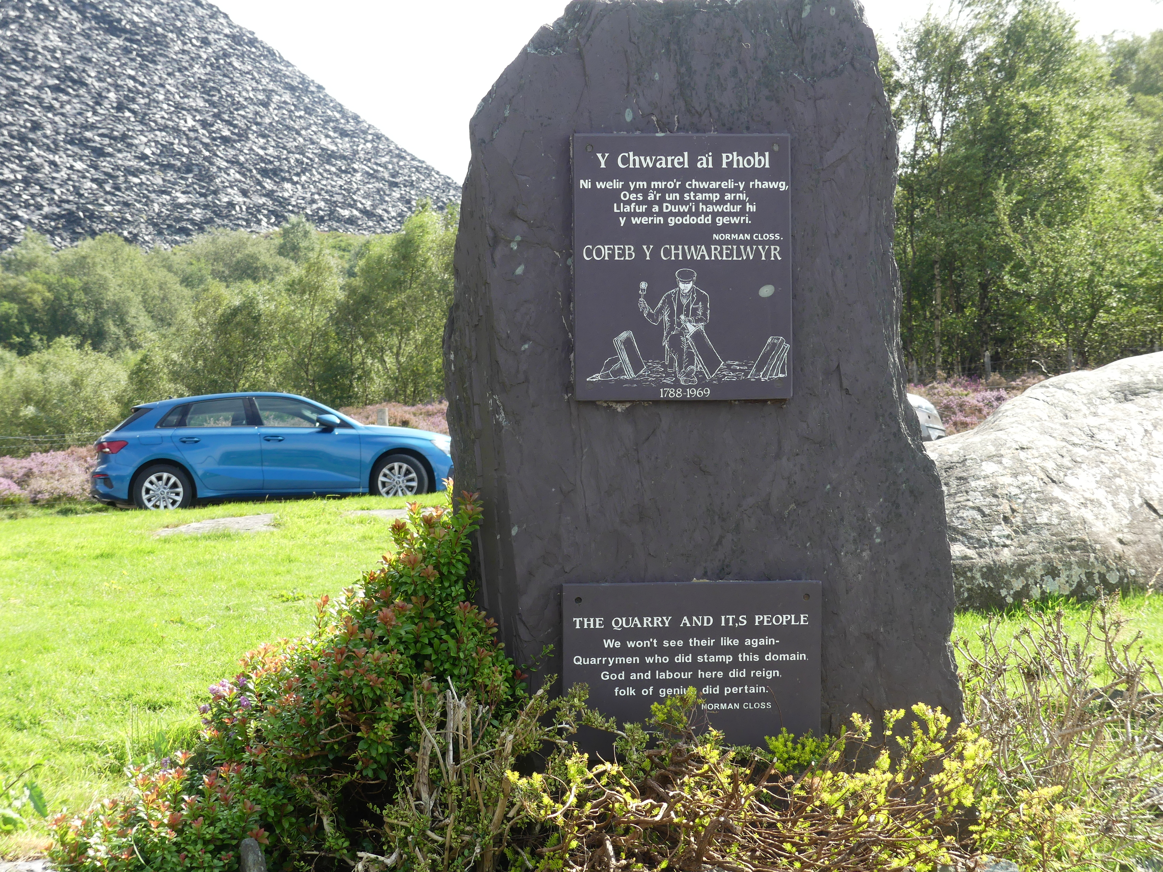
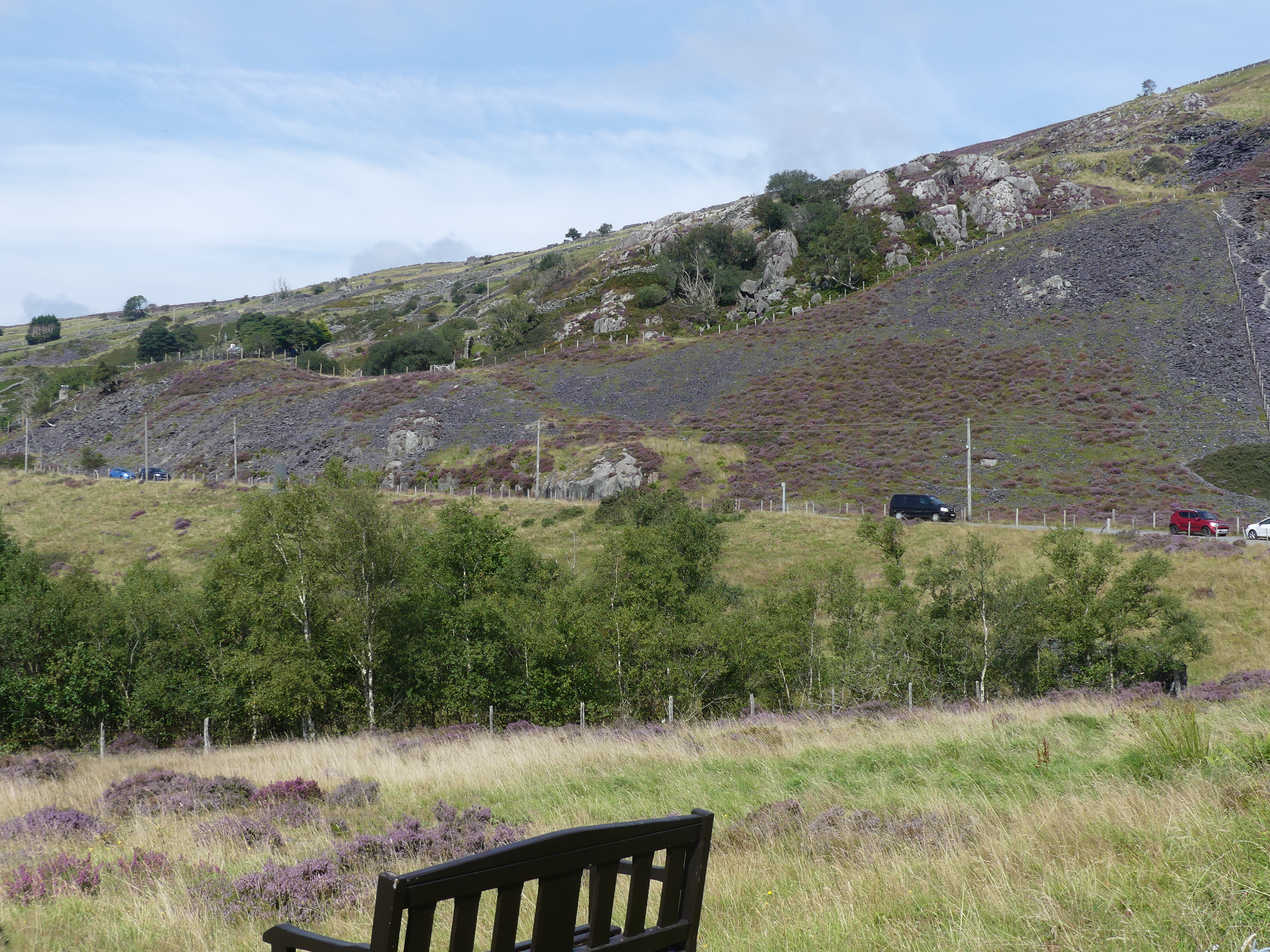
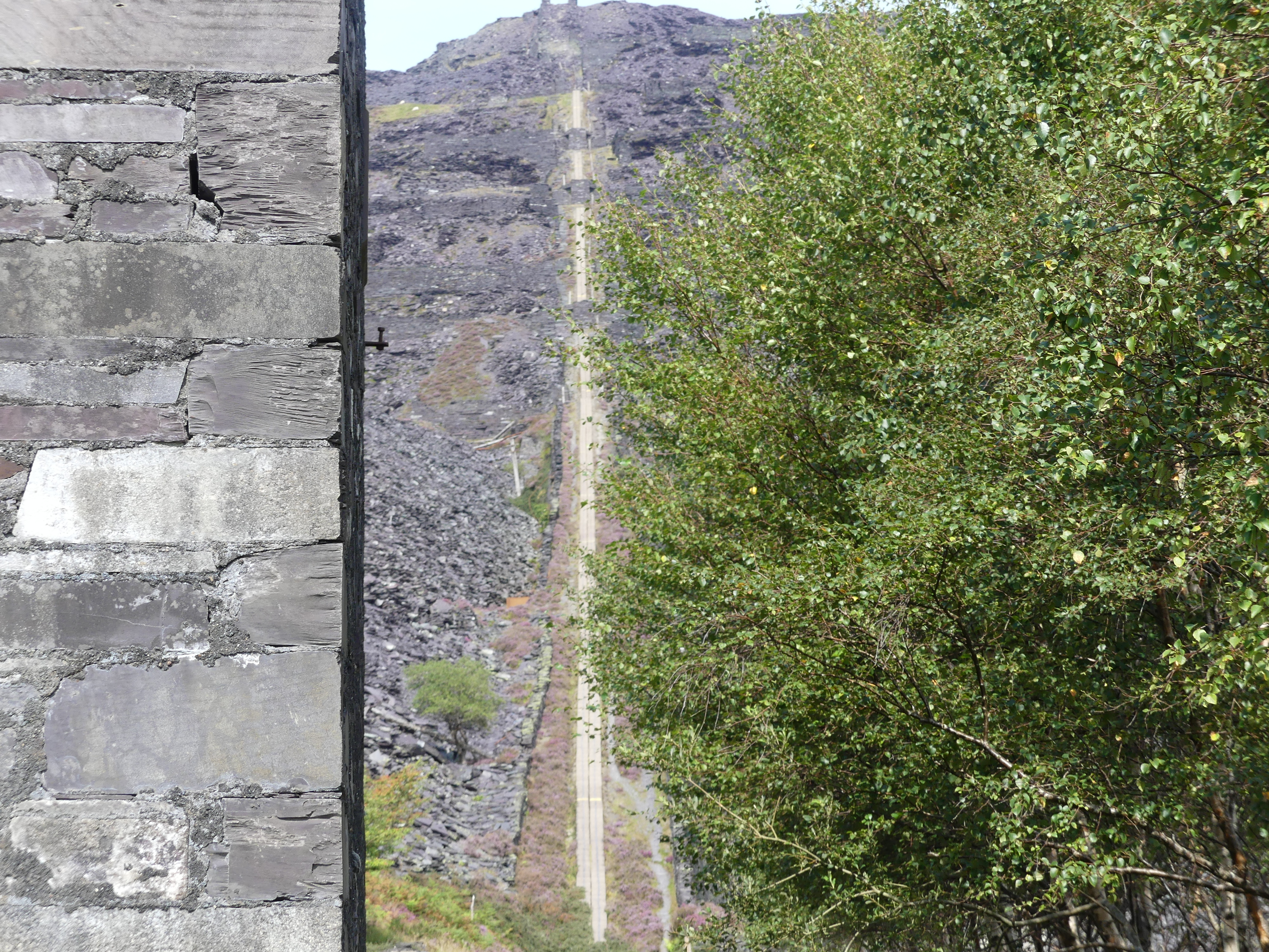
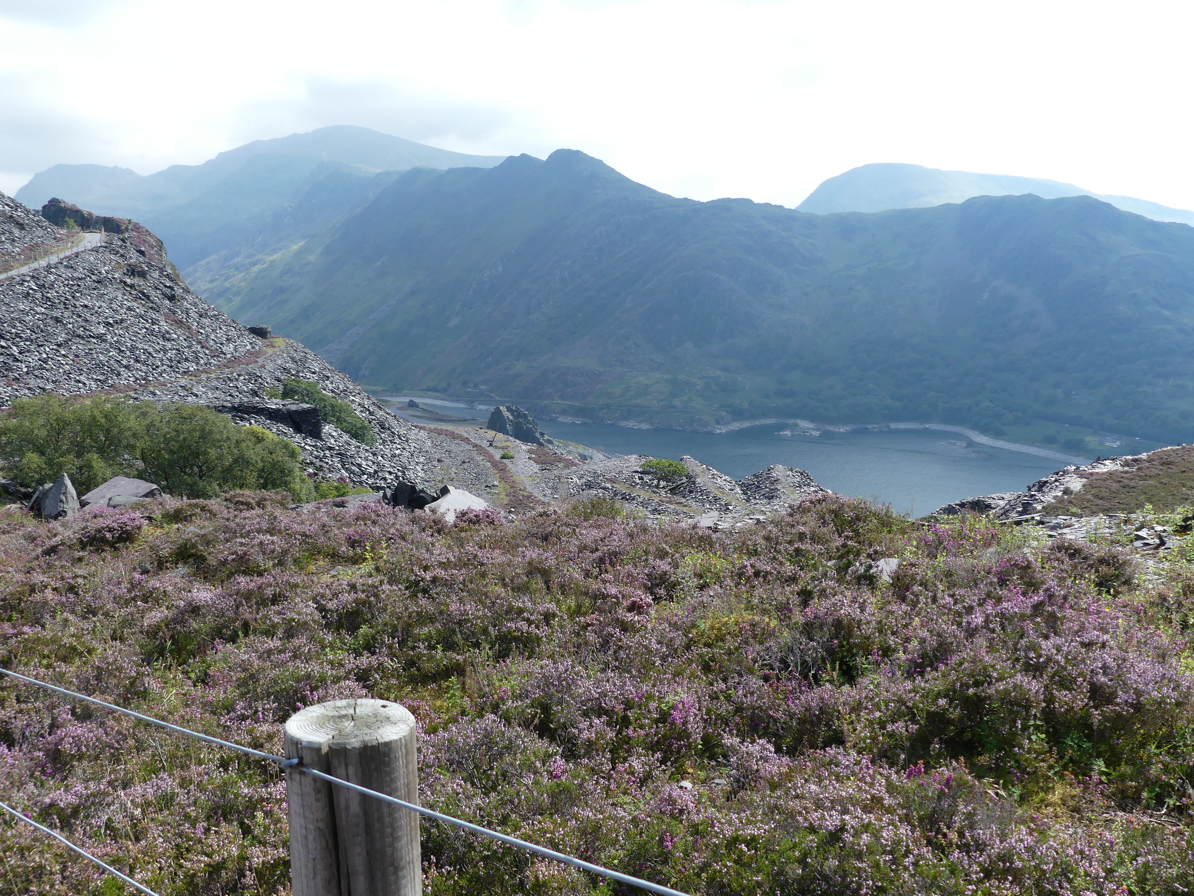
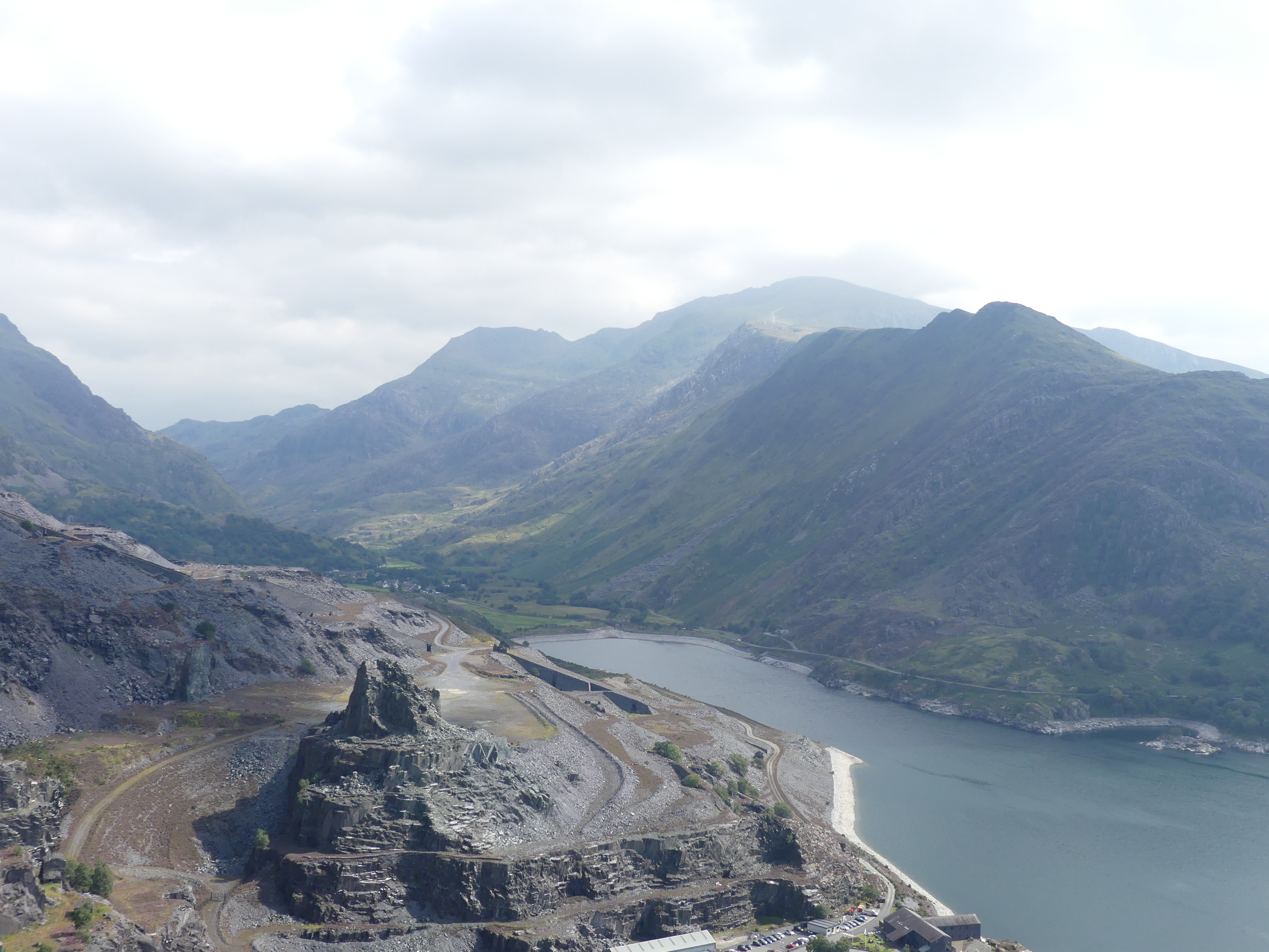
In our travels we were told about an old slate mine that we should visit. To get there we had to travel through a village called The Heights. The Heights rests beside a lake behind which is the mountains in which two of Britain’s largest slate quarries can be found. The main slate mining areas near “The Heights” are in the UNESCO World Heritage site, the Slate Landscape of Northwest Wales, which includes former quarries like Penrhyn Quarry near Bethesda and Dinorwic Quarry near Llanberis. Both were once among the world’s largest slate quarries and now serve as tourist and recreational sites. This abandoned site is just one of those mines.
We parked along the lakeside in The Heights and firstly caught sight of the ruined tower then the Sword in the Stone – not really King Arthur territory which we had visited earlier this year when in Cornwall. We walked through the village finally settling on a pub for a cold beer and lunch. We got some directions to the closest mine and that is the mountain pictured above. Of course narrow country roads once again this time climbing the mountain. As we came to a cul de sac providing visitor parking we were amazed by the slate rubble making up additional height to the mountains. There were a number of ruins in the mine surrounds but slag heap with almost vertical rail lines to remove the stone surrounded us. Below us is the village of the Heights and the ruined castle we had seen across the lake. On a very early trip to North Wales we had visited Baleneau Festinog slate mine and had a very good idea of the labour needed to create the spoil heaps that surrounded us. We really do have many blessings in this life one being I did not have to work in a slate mine.
Our time in Anglesey was up and we now faced the drive to Dover to catch our ship to circumnavigate the British Isles. We drove back to Heathrow Airport and rested up in a hotel then returning the hire car. The hotel had a great roof top lounge where I obtained some good photos before being told to put it away by the Maitre De.
The following day we caught the tube to London and caught the National Express bus to Dover not knowing what awaited us. Read on with our continuing adventure in “THE RETIREES GO AROUND THE WORLD –CHATEAU RHIANFA PLAS RHIANFA, TO DOVER AND SS NEUW STATENDAM.”
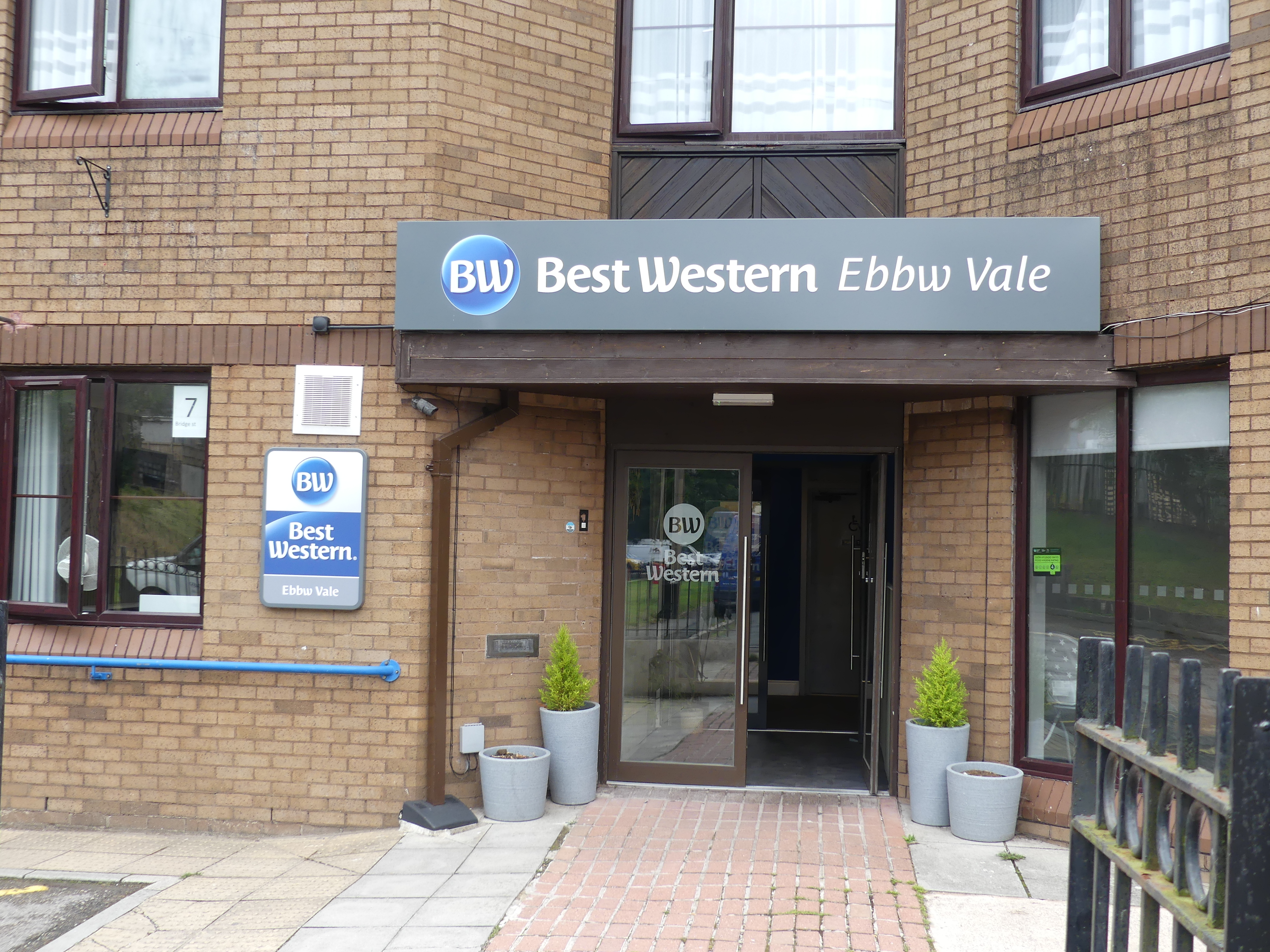
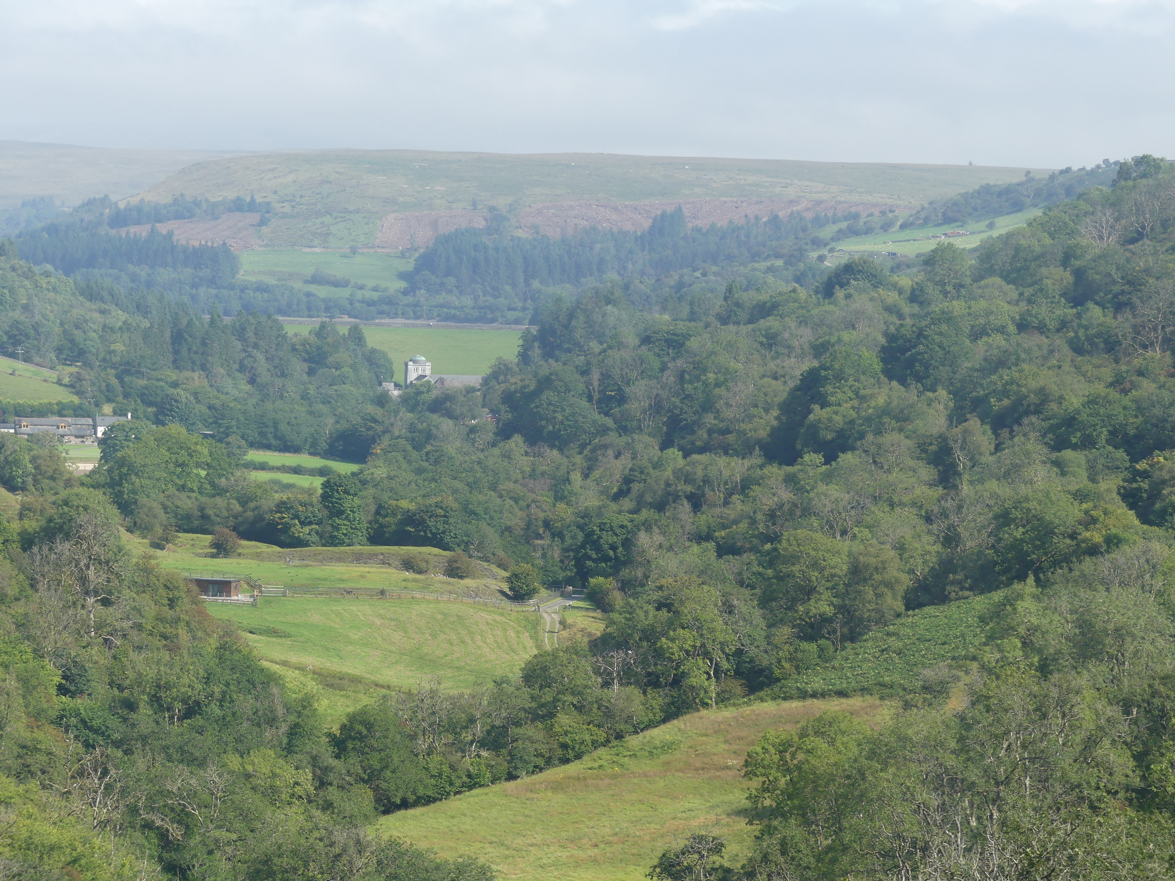
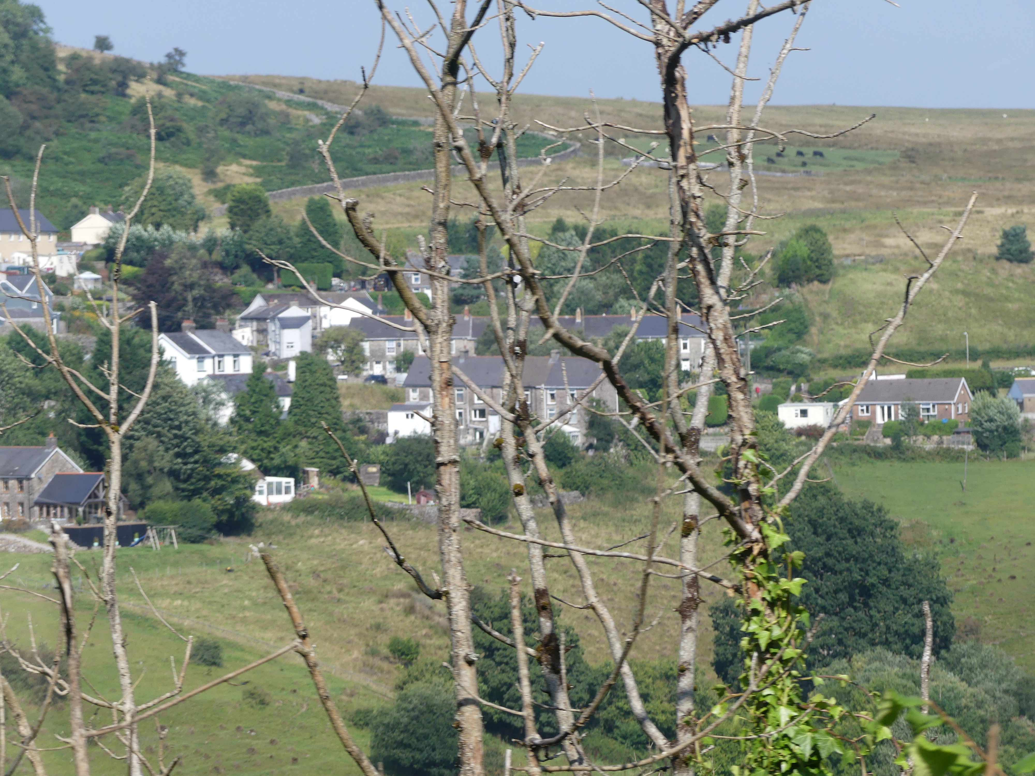
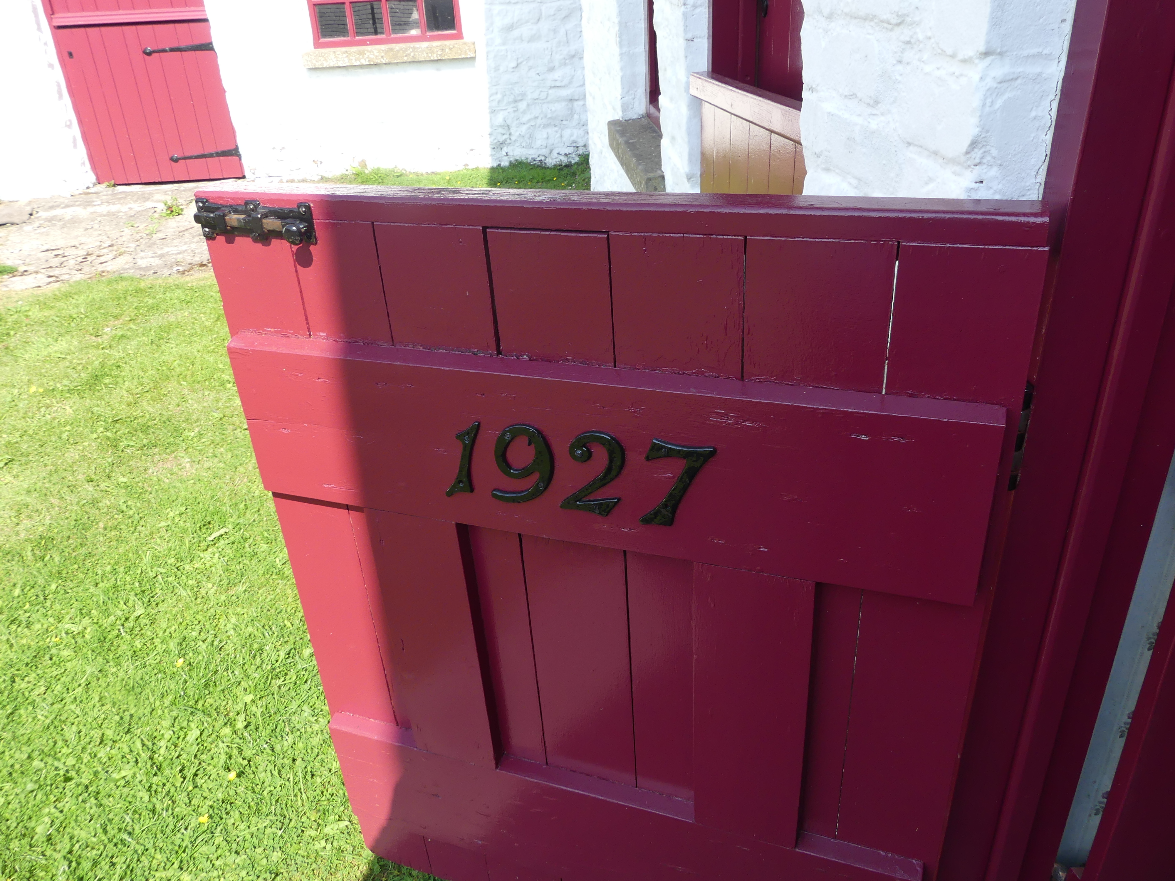
We leave Pembroke to find our way to Best Western Hotel at Ebbw Vale. This proves to be an effort as the hotel is a former Government Health Services building and our GPS cannot find it. With a bit of guess work we strike it lucky and the proof can be seen below. This is a strange configuration, and our room is tiny with a view of the remaining health service building entrance to look at. After moving our bags into the room I find I have a water leak beside my bed but not significant enough to warrant moving rooms even if there were a room available. The good news is we have internet, but the bad news is there is no coffee making facilities or fridge in the room. Good news they don’t mind if we prepare our breakfast in the breakfast room. Management and staff are very easy going but the hotel leaves a lot to be desired. It will do for a few days. The photos below are from Ebbw Vale – not a lot of interesting things. We had chosen the town for accommodation not for sites to see.
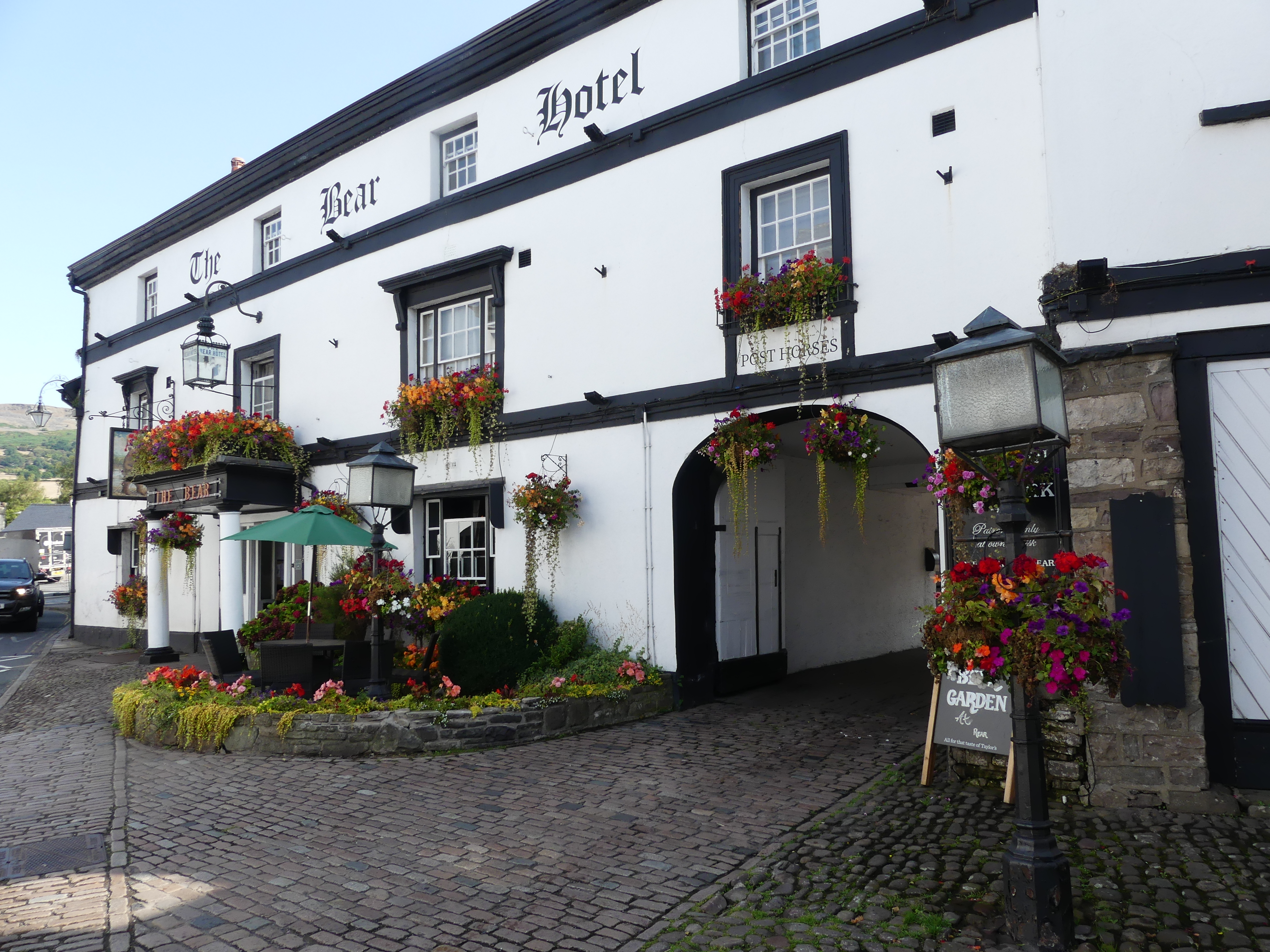
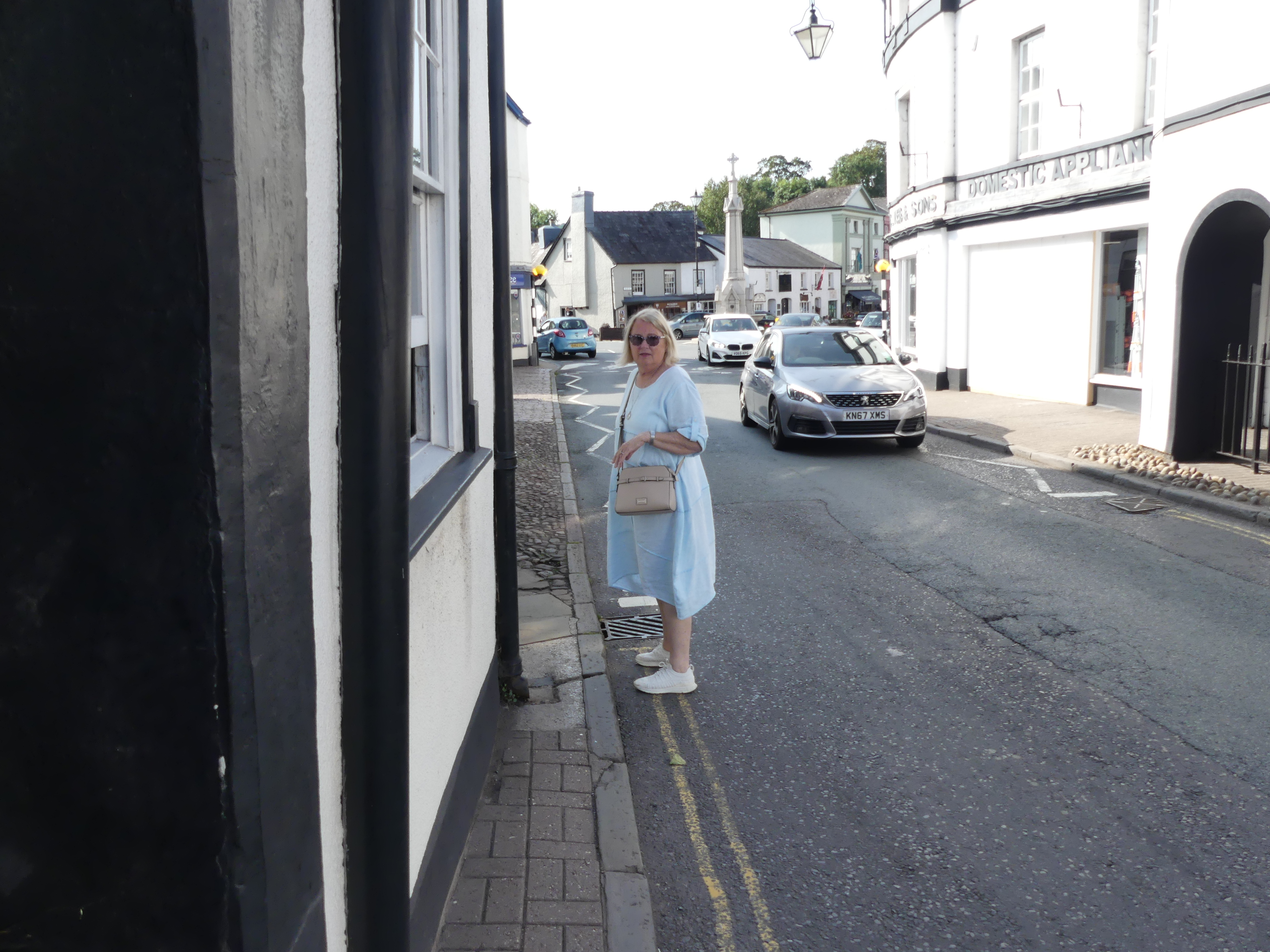
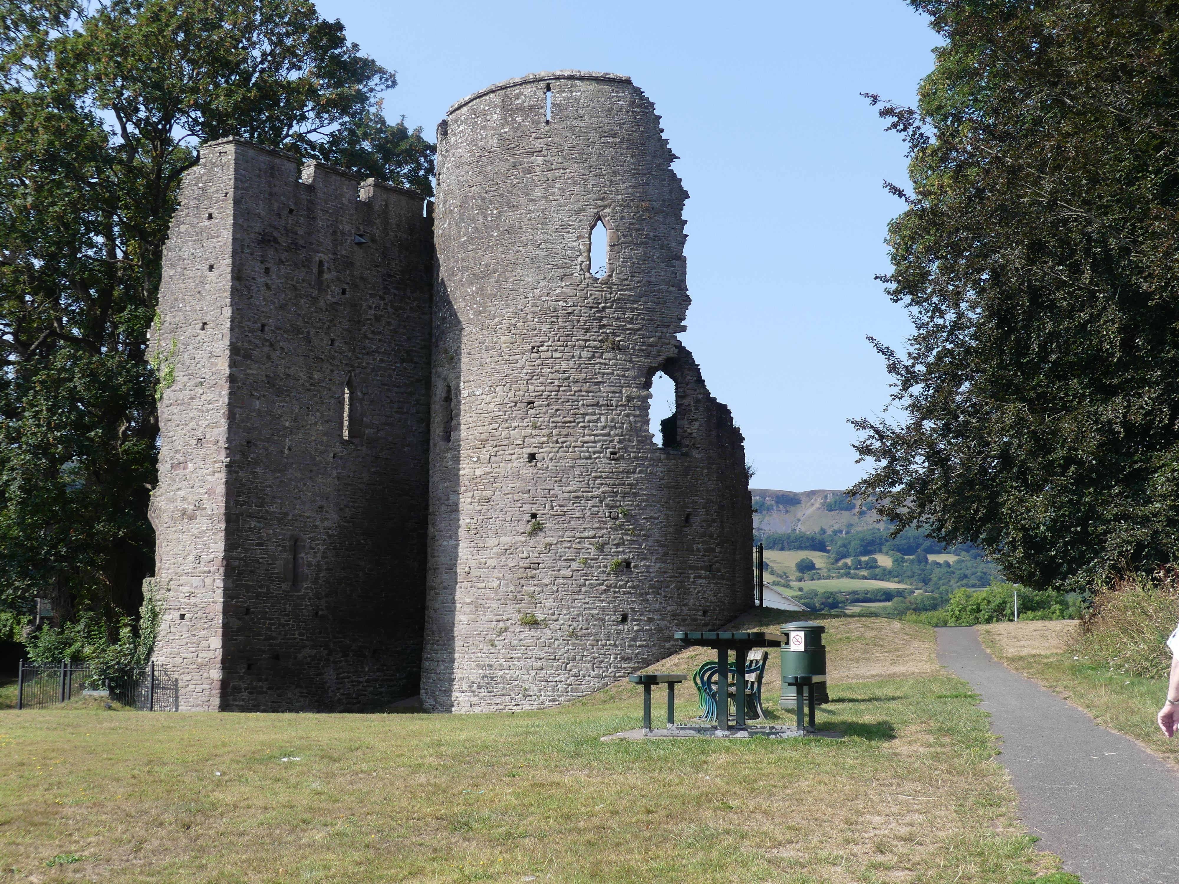
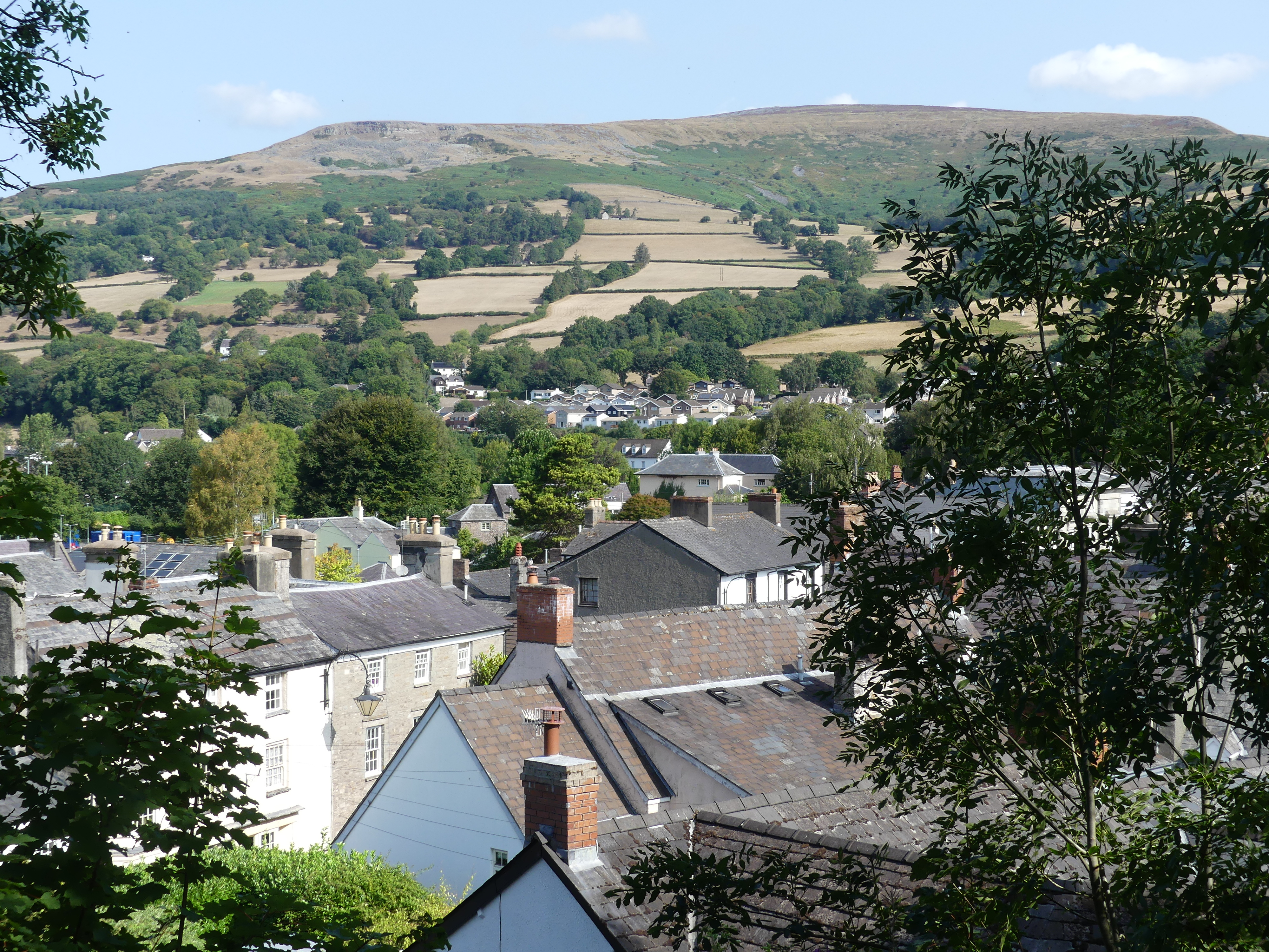
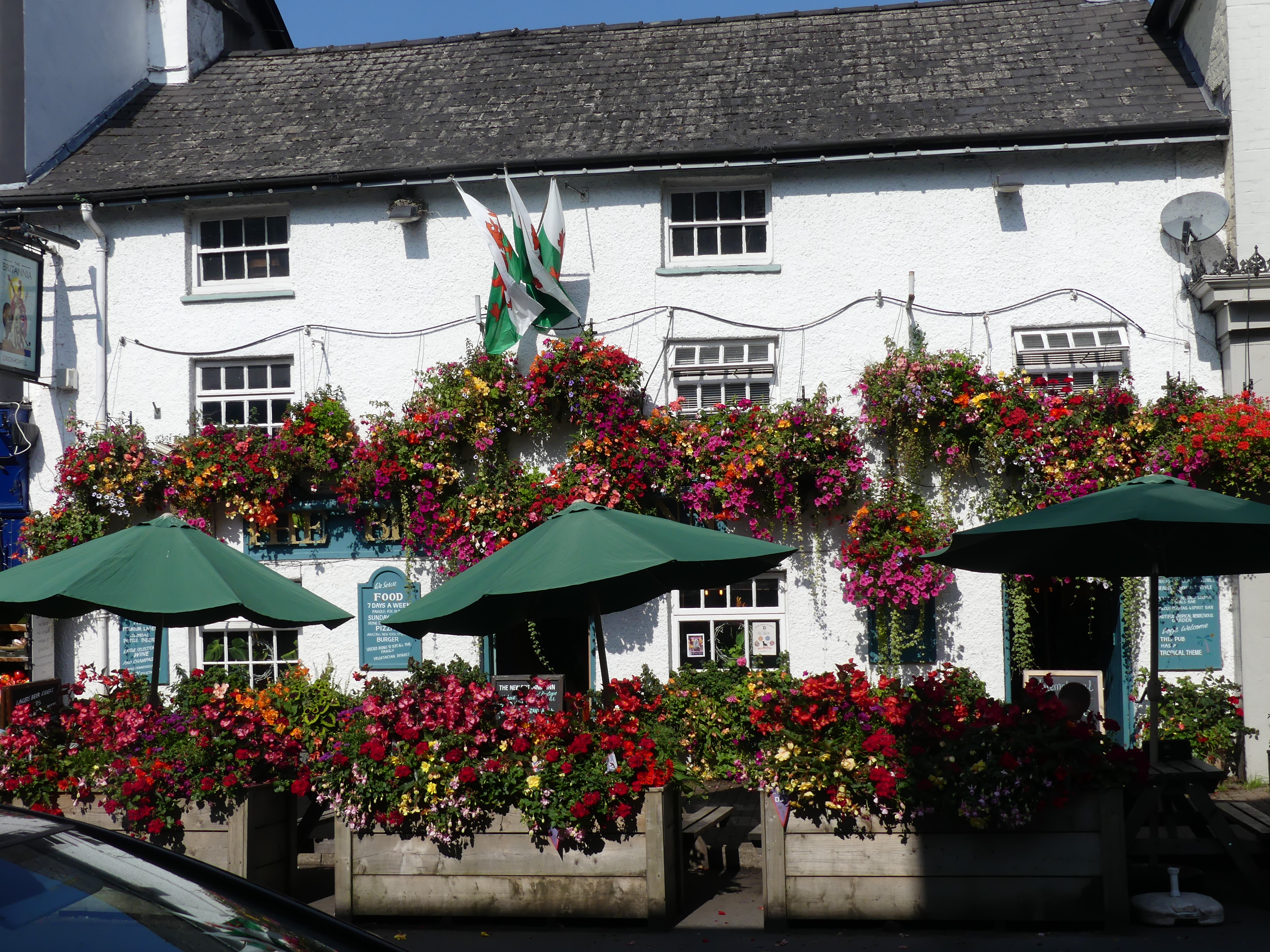
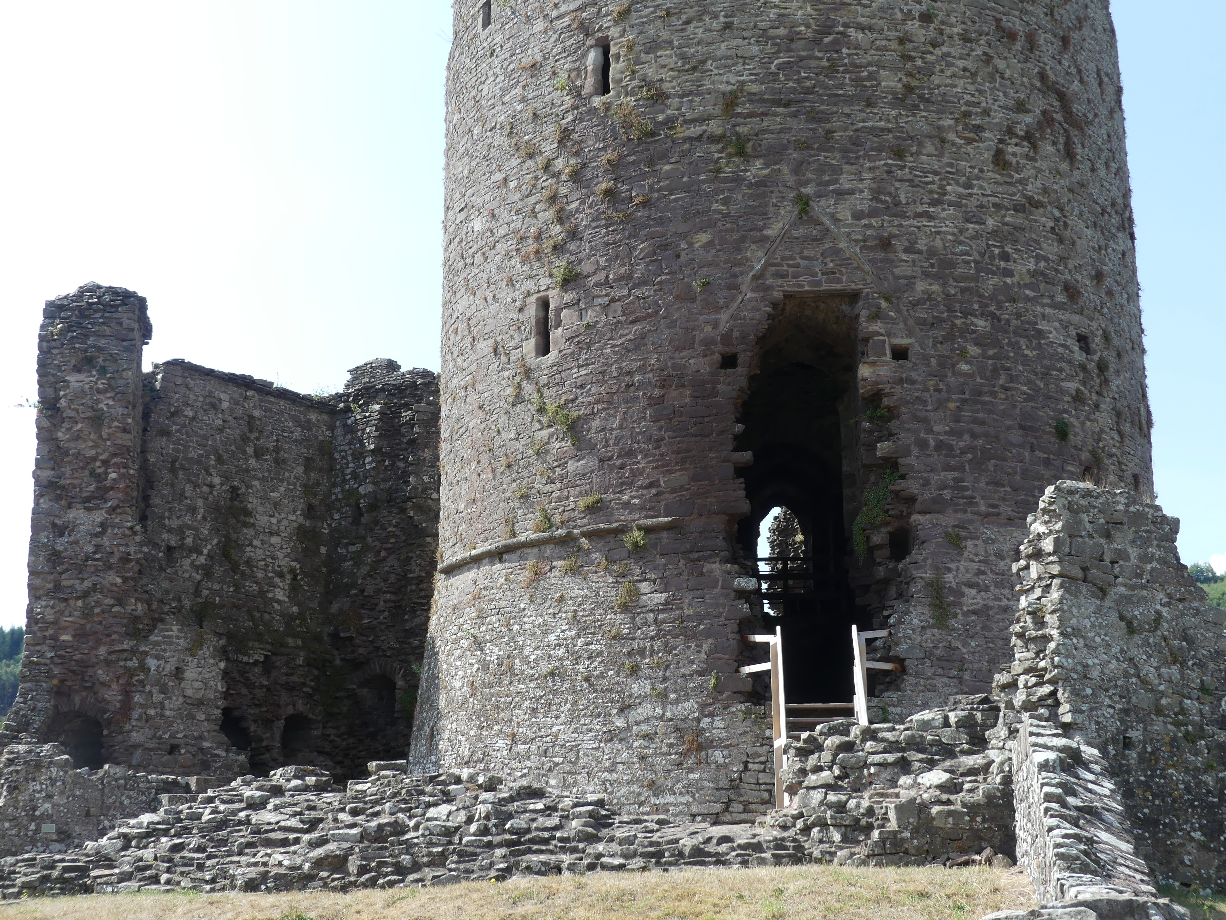
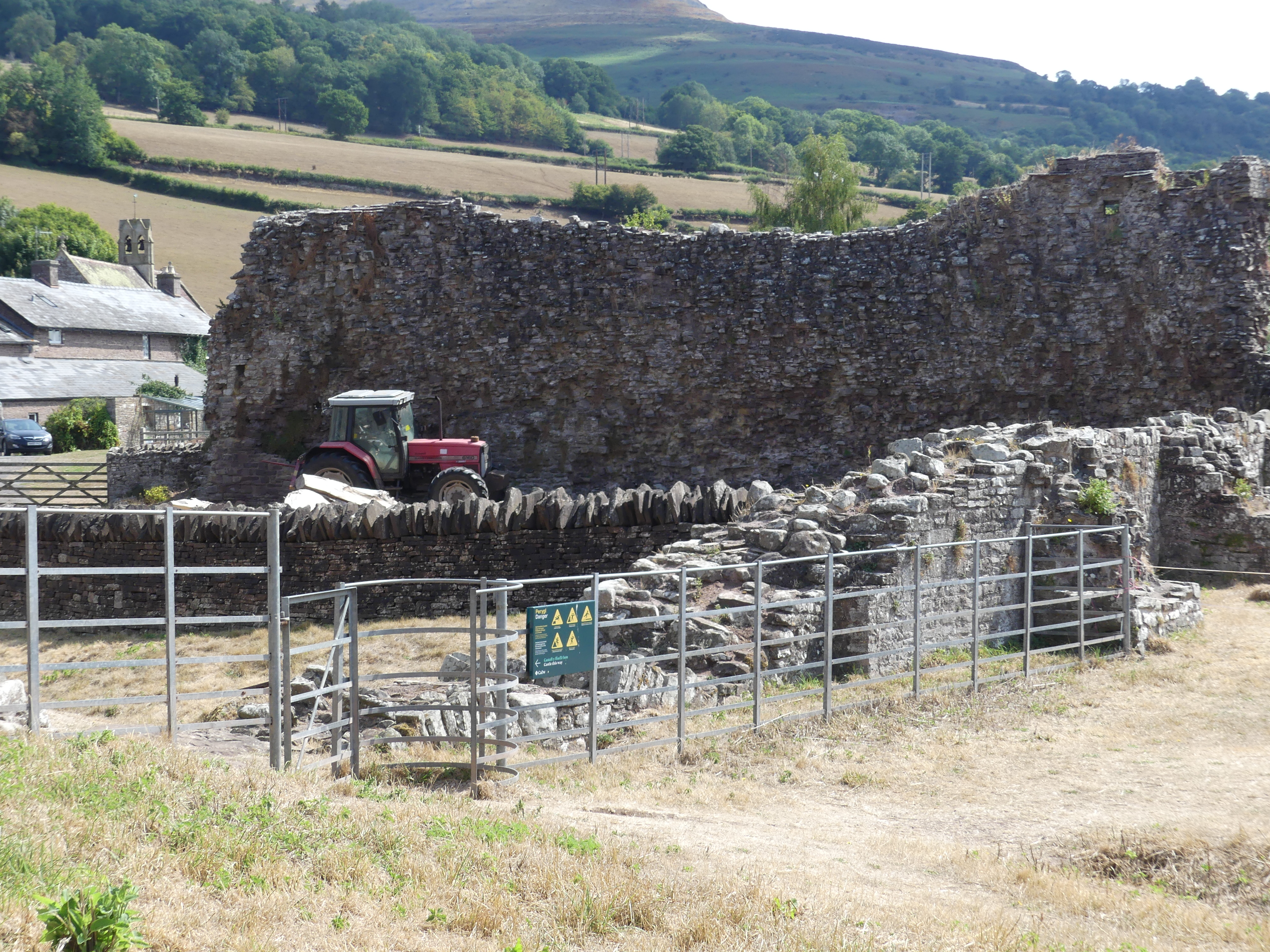
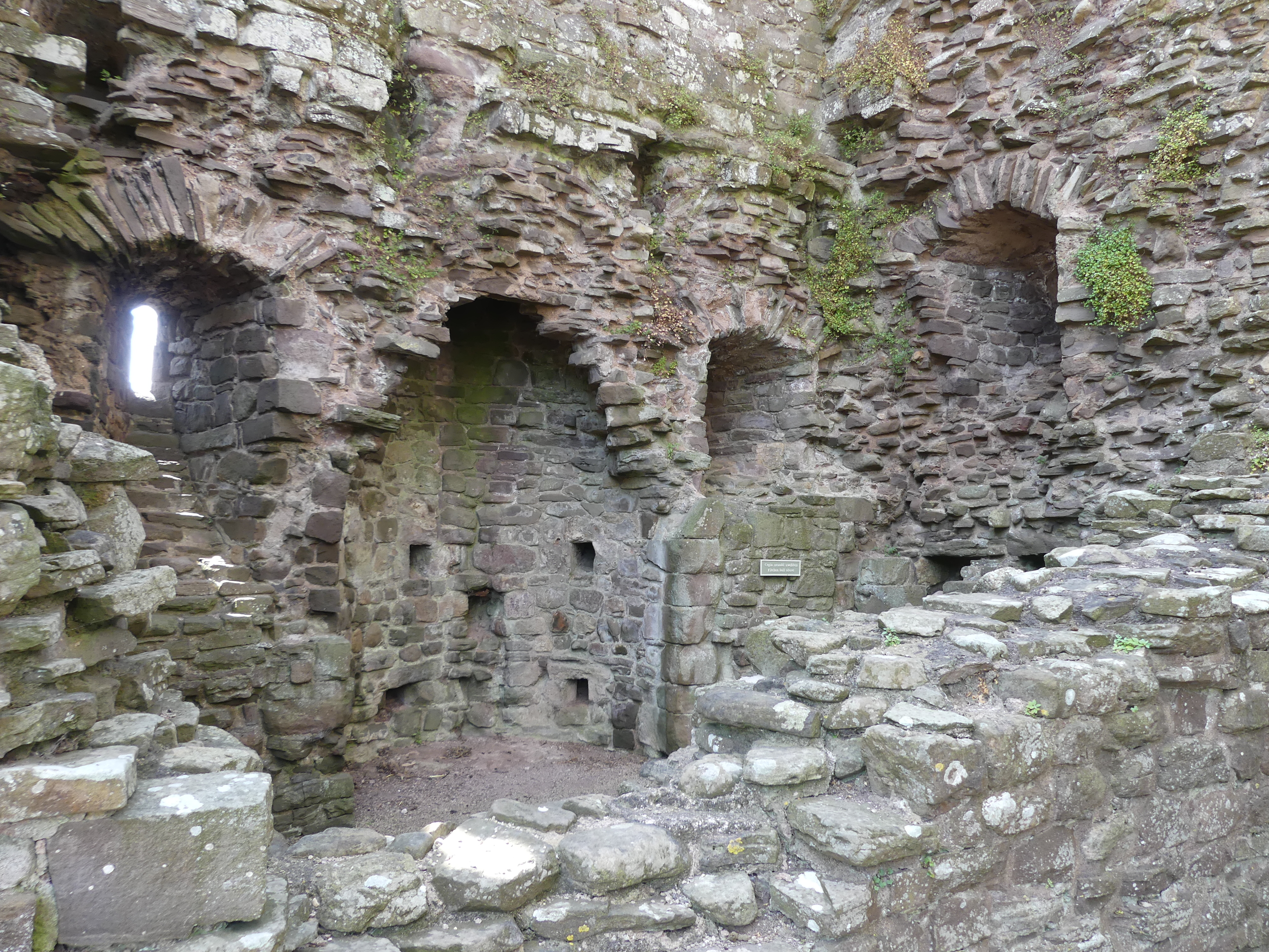
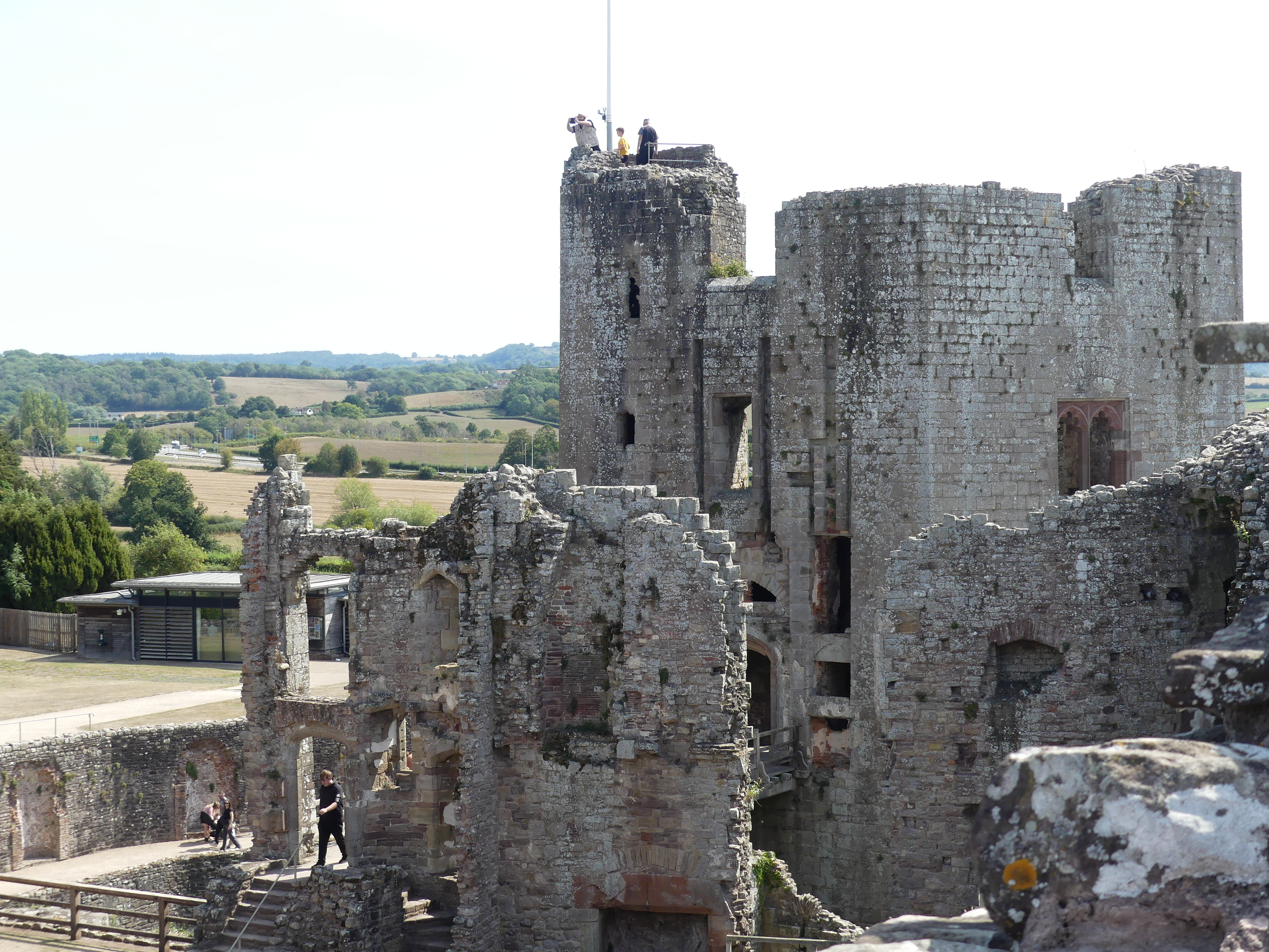
After our hearty breakfast of cereal and coffee/tea we prepared a picnic (we brought our own flask, Vegemite, honey and butter which we keep cold on the window sill whilst putting our milk in the Hotel’s kitchen fridge). We drive to Crickhowell the epicenter of this region. We parked behind the information centre and were confronted by the call to arms for the Rotary Duck Race (note the venue “Bull Pit Meadow” how rural is that) after which we walked the main street of the village – from the Bear Hotel to the castle ruins. The streets are narrow (Kerry has to step onto the road to continue on the footpath) and the castle is a ruin and now the centre piece of the kids playground in the community park. There are bits and pieces of the castle, its keep and defensive wall within the village. The photos show part of a tower, a disconnected part of the wall set 3 m above part of the inner keep and a section of a second tower. From the top of the inner keep we have a view over the whole of the town into the hills.
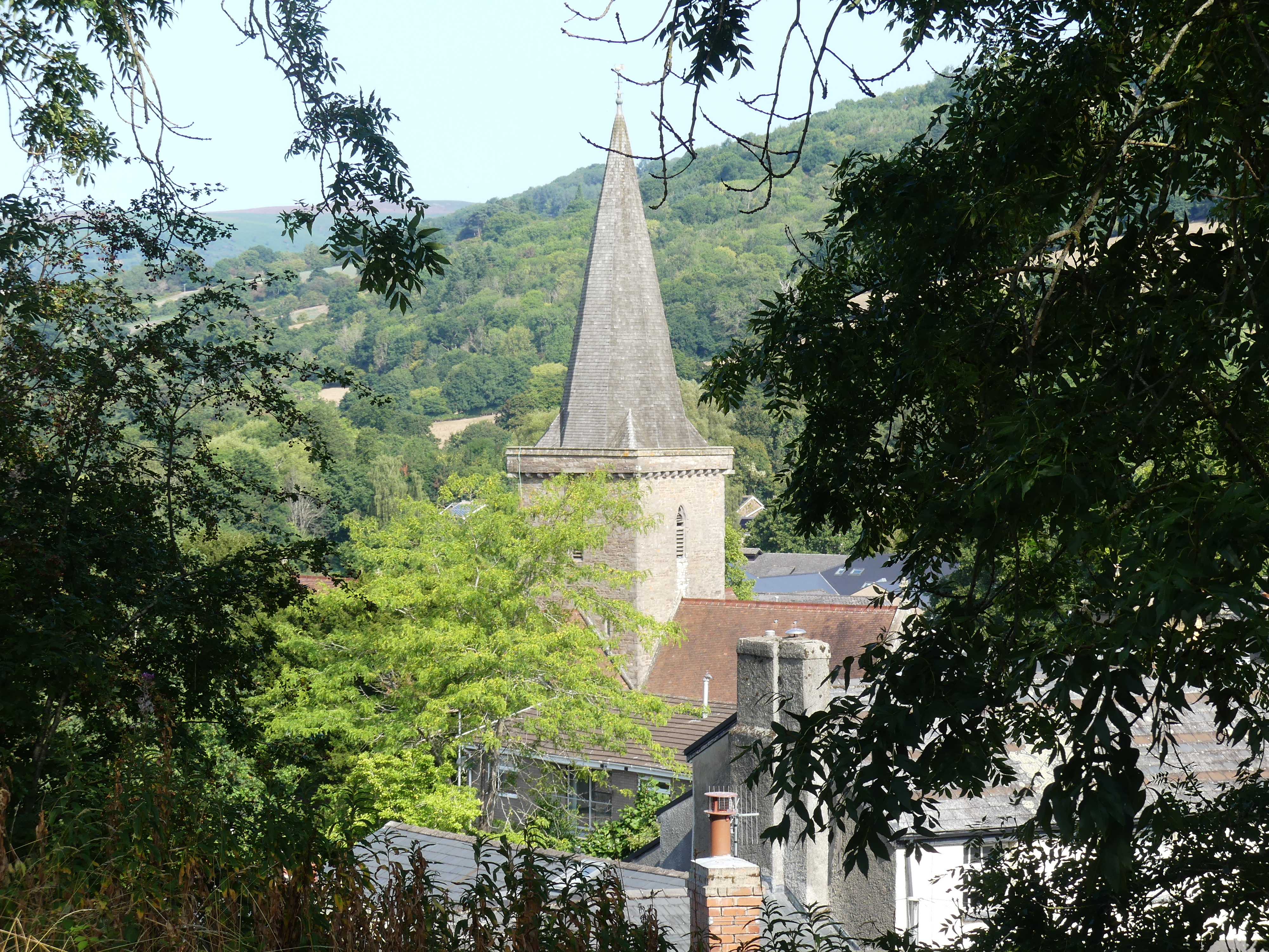
We spy the spire of the local church and return past the old Bear Hotel where we find another part of the defensive walls being used as part of their front fence. Very quaint. We move onto the church we had seen from the ruins which turned out to be St. Edmund’s Church (Eglwys Sant Emyr). Inside the church is a record of the early history of life in Crickhowell – 3 sarcophaguses with death images formed on the top of the container – time had rendered the dates of the internment and identities illegible. The interior of the church was simple and dignified. In the church yard the former members of the community having passed over are recorded and remembered.
The countryside was vibrant and green. I am certain we had a coffee and cake before we returned to the carpark. My photo below is the countryside – don’t go searching for us drinking coffee.
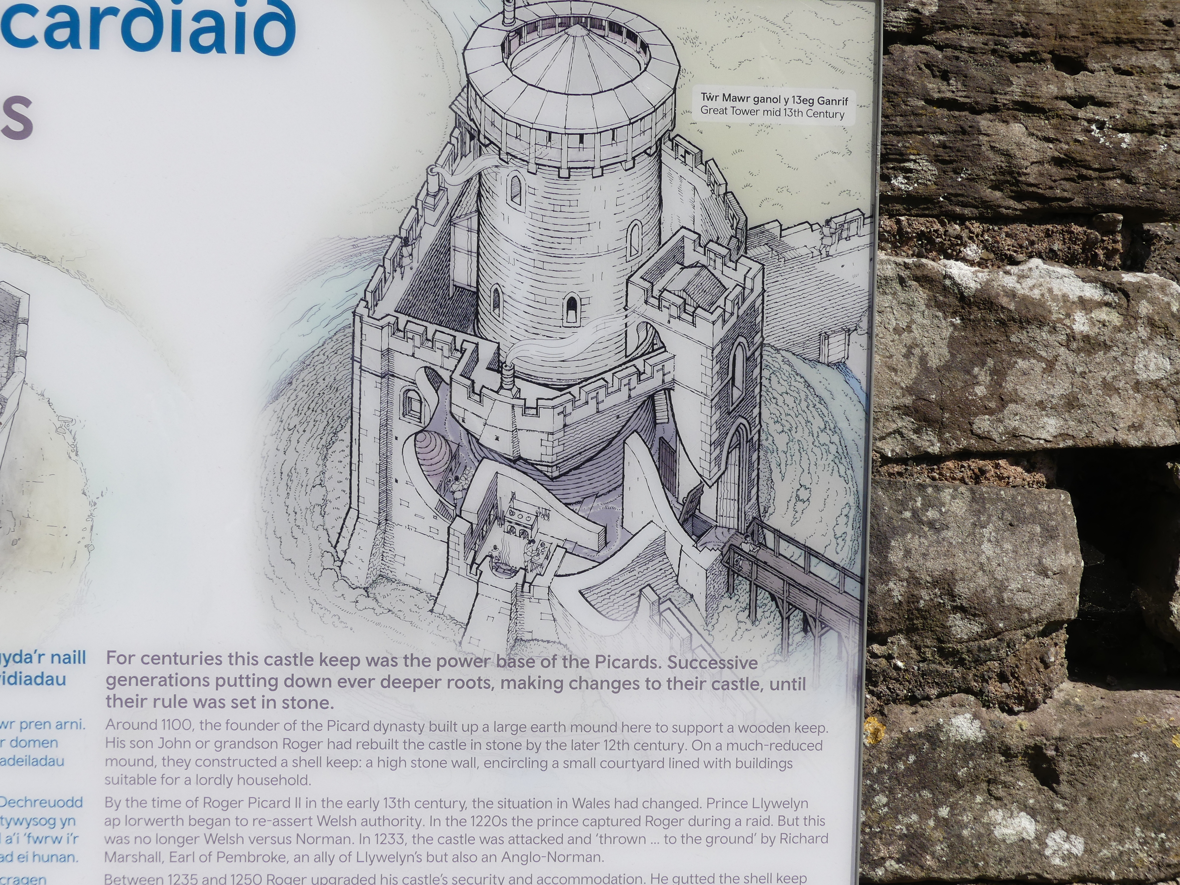
Part of our reason for coming to the Wye River valley is to visit Hay on Wye famous for the bookshops that can be found in the village. However, I was not expecting to accidentally come across another ruin just off the country road. A moat and bailey castle from Norman times – it has likely been slowly demolished by farmers pillaging its stone until the ruin was included in the Cadw Trust. It turns out to be the ruins of Tretower Castle.
The internet tells me that the “Picard dynasty” in Wales refers to the family who held control of Tretower Castle in Powys after the Norman conquest in the late 11th century, founded by a Norman knight named Picard and continued by his descendants, including his son and grandson, who developed the castle into its stone form. After the Picard family, the property passed to other families, including the Vaughans and Bloets.
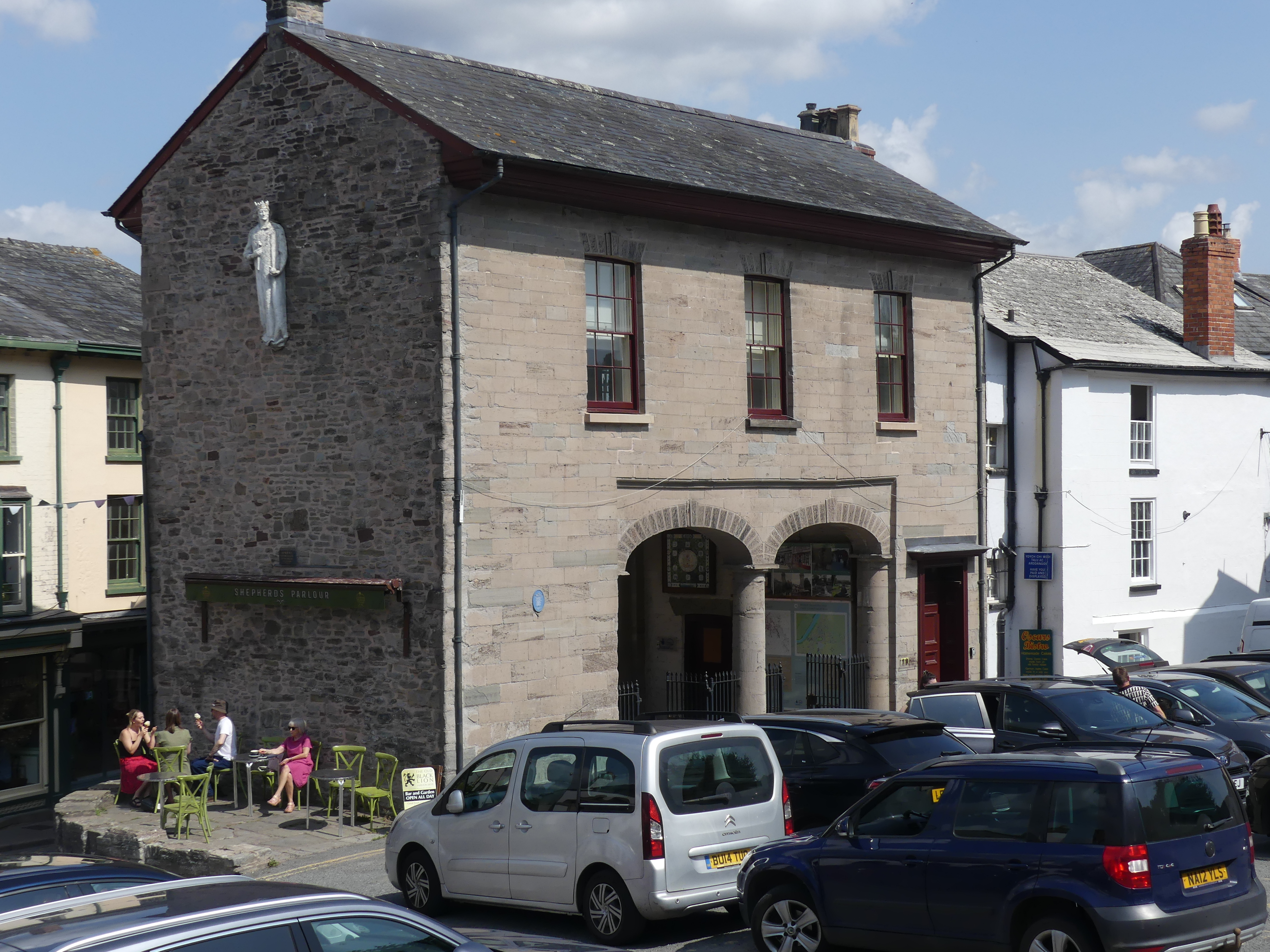
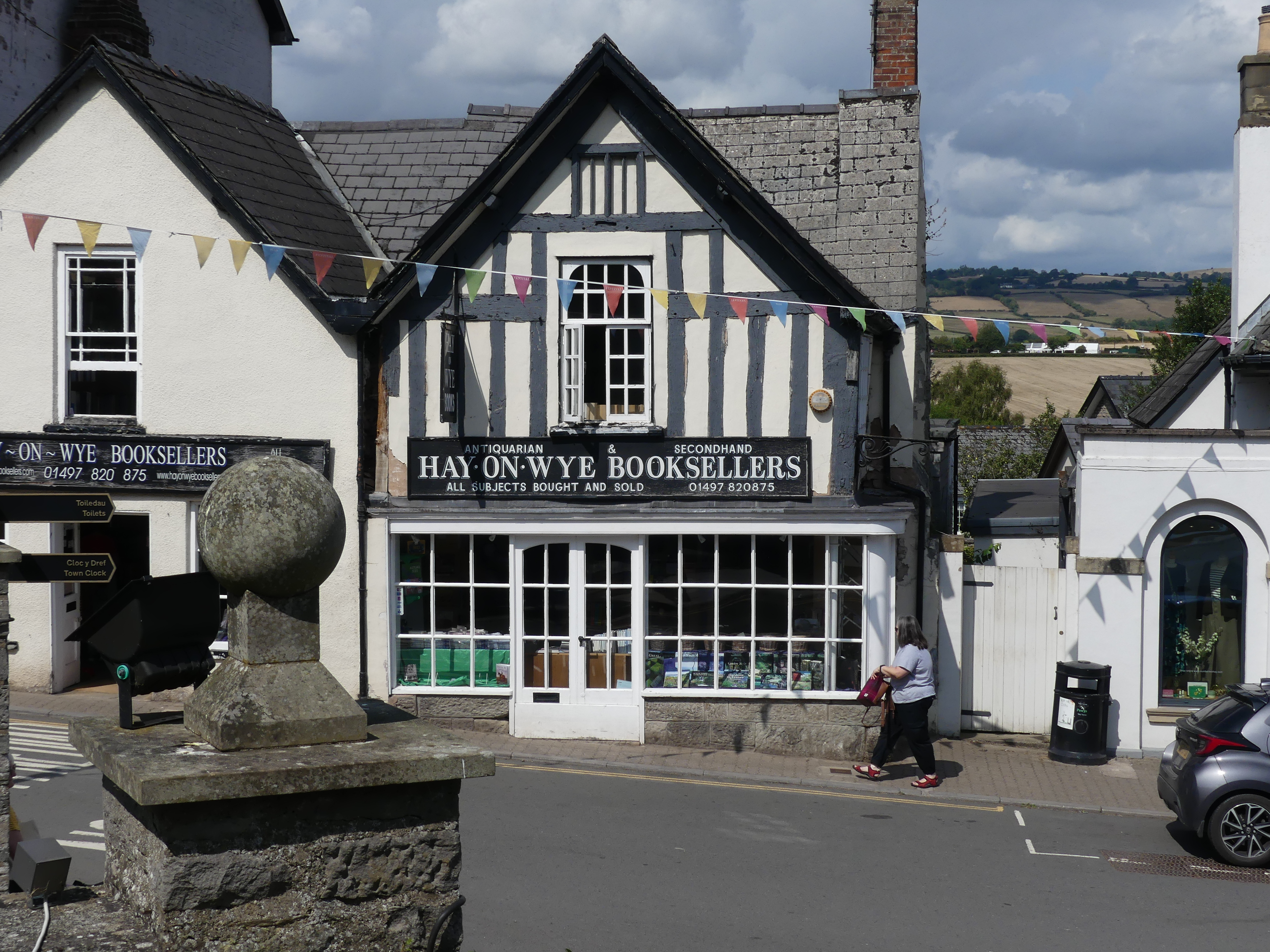
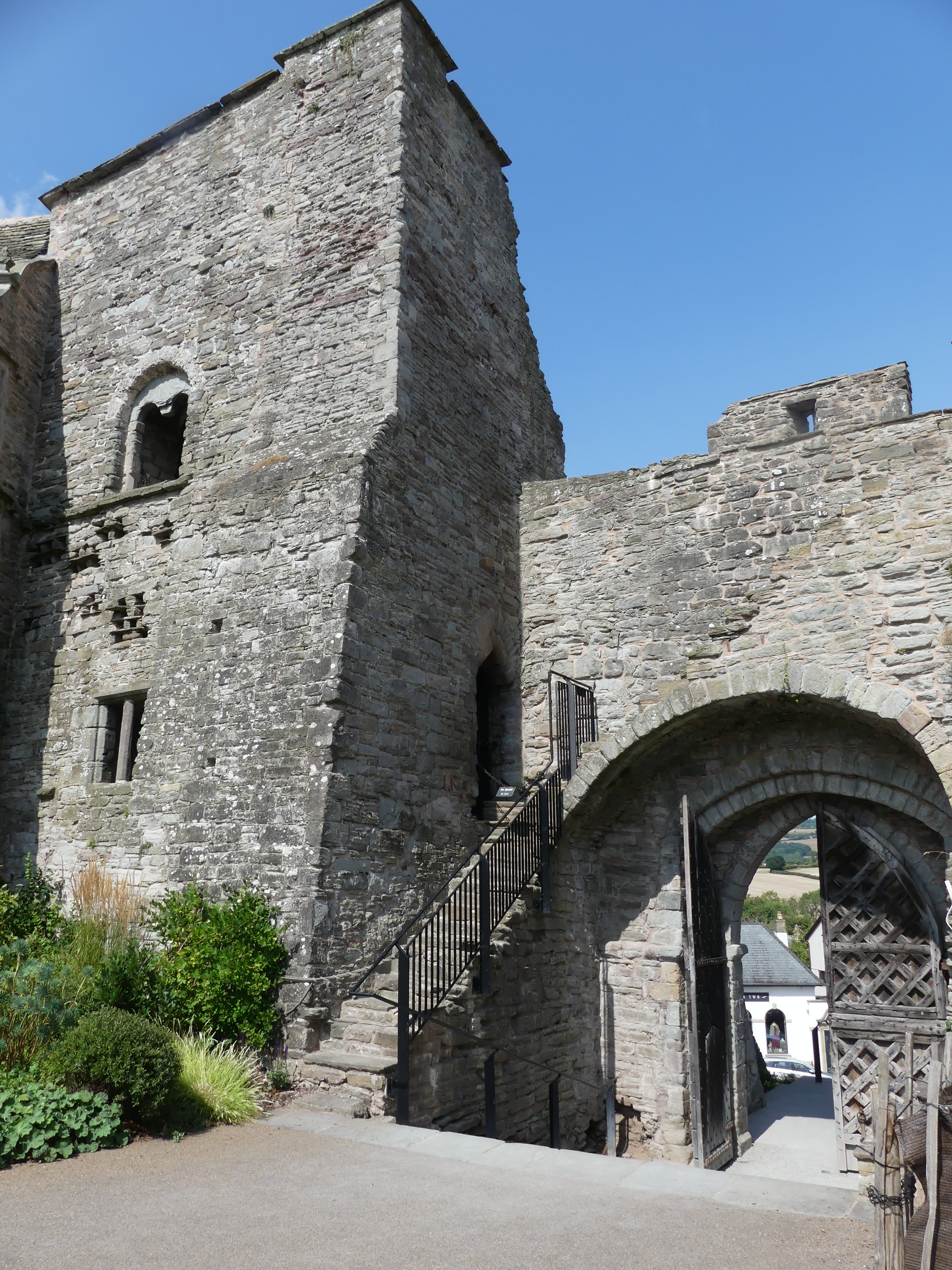
After this interlude we continued onto Hay on Wye. A small village on the banks of the River Wye with touches of its Roman origin still apparent, and like all these villages parking within the village is limited. We parked down near the old, abandoned cattle yards. There is a public book exchange and many different genre of bookshops. The castle that once was home to a minor knight, has been converted to a domestic residence. The market is still used and provides a place in the sun for coffee lovers. My photos include all of these.
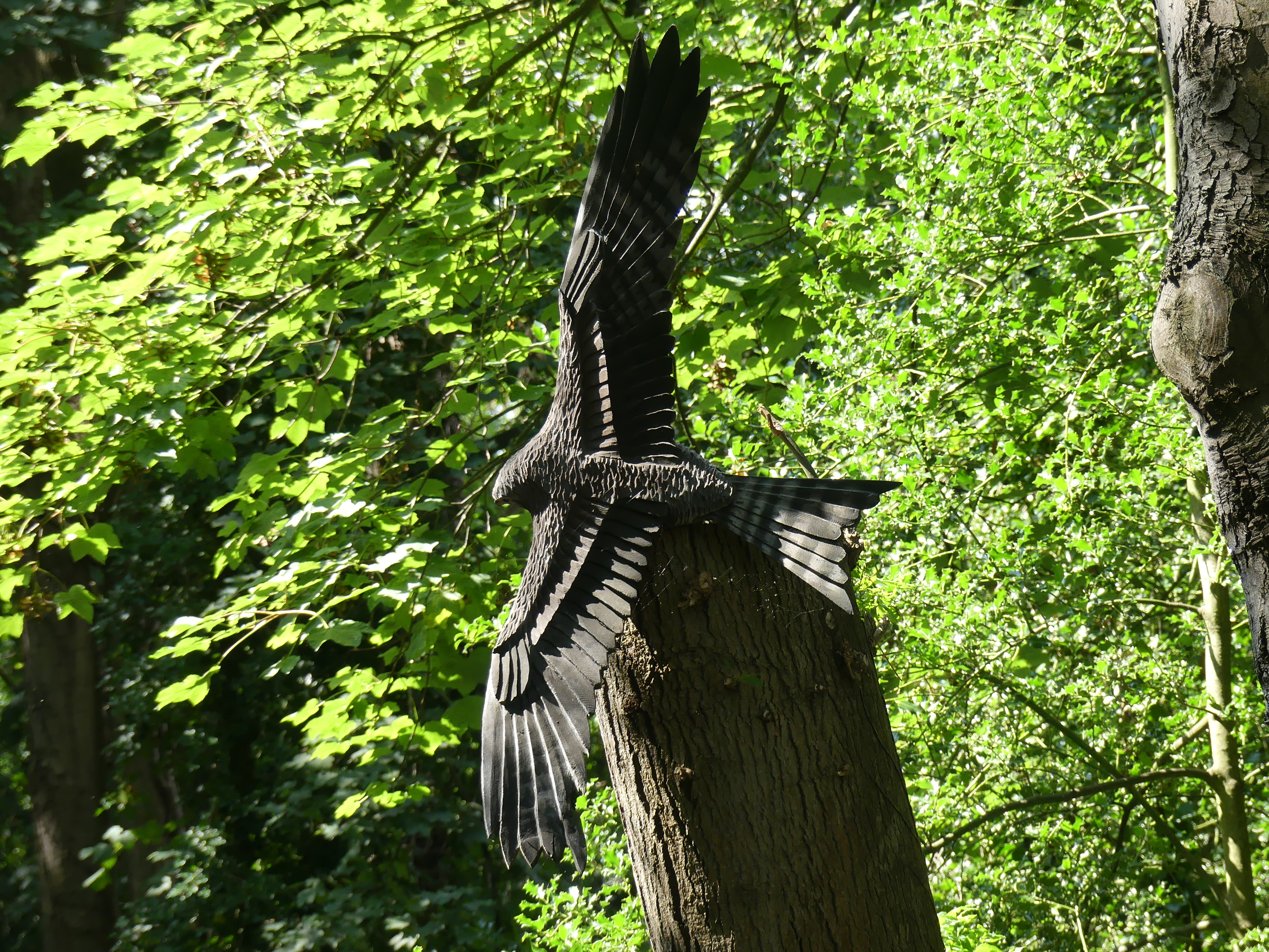
It was very warm, and we decided to have our picnic down on the river. Unfortunately, the flask was not sealing properly and had leaked in the bag. Still we enjoyed our Vegemite sandwiches and coffee. Sitting in the shade of the bushy banks of the river, we cooled off quietly and met some other locals doing the same. One of the surprises was someone had carved in the stumps of dead trees images of local birds of prey. By the way we “forgot” to take the flask when we left the Best Western.
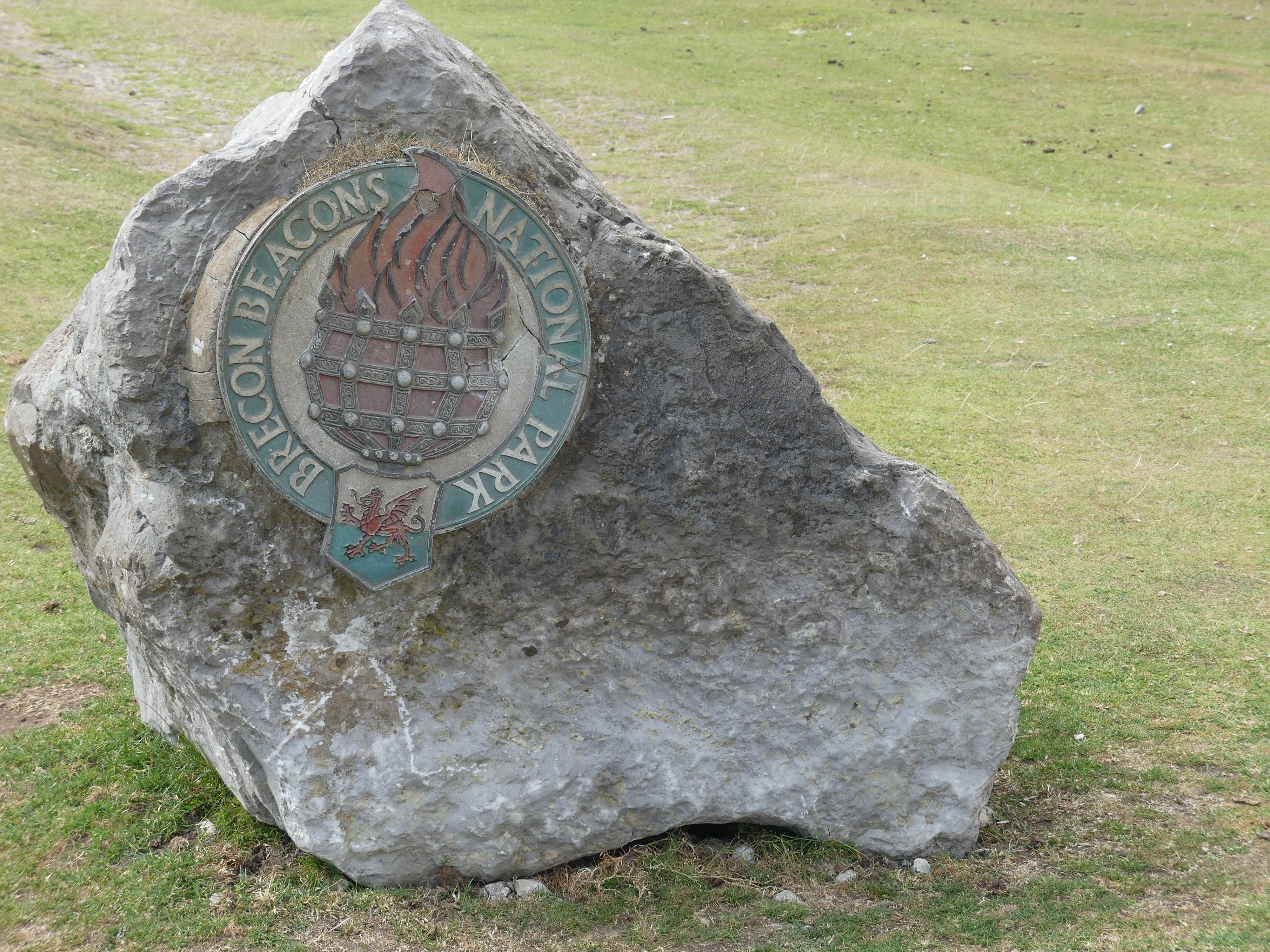
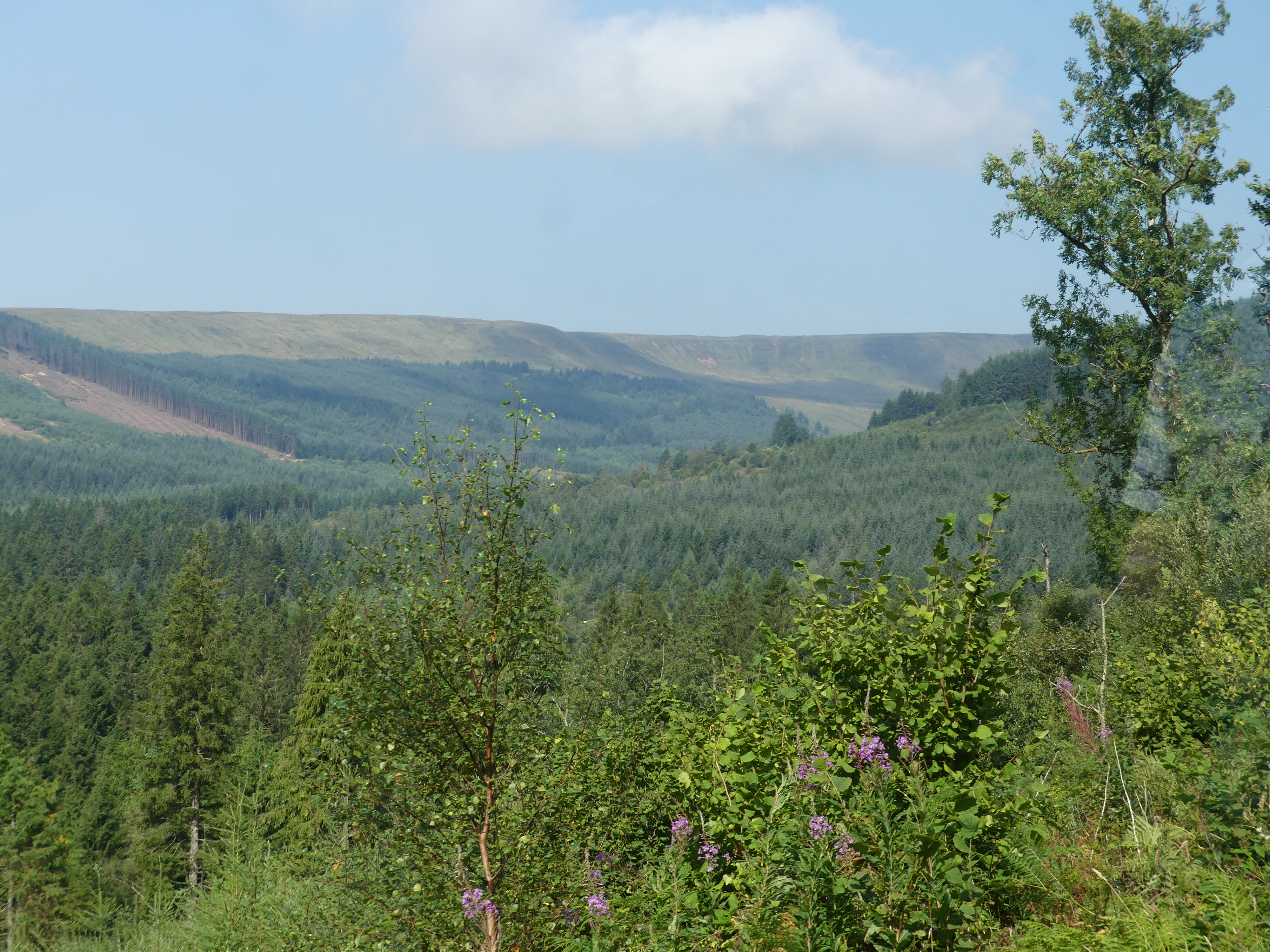
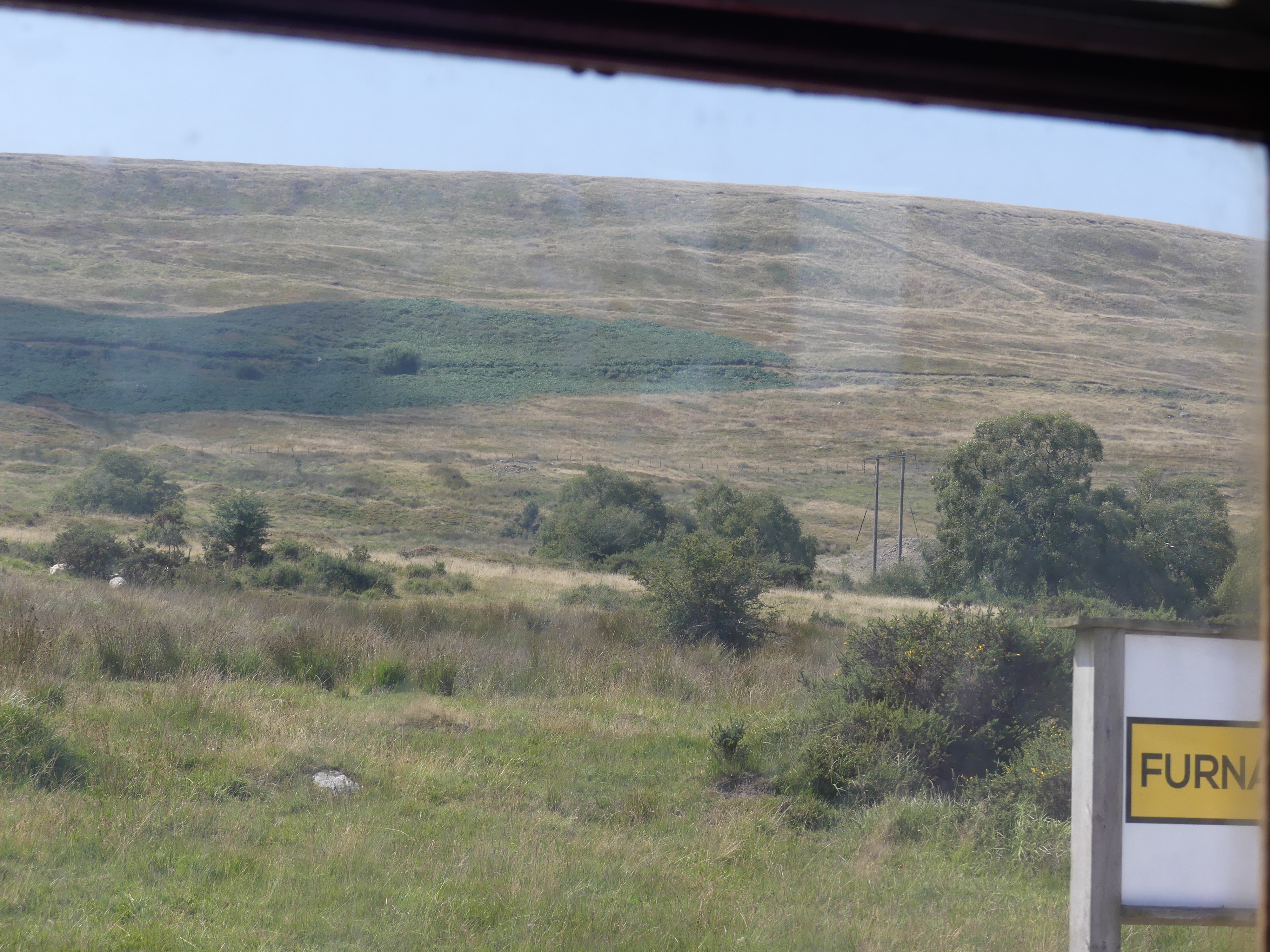
As we returned to our Best Western, we found ourselves crossing Brecons Beacon National Park. It is a national park named after the Brecon Beacons (Welsh: Bannau Brycheiniog), the mountain range at its centre. The national park includes the highest mountain in South Wales, Pen y Fan, which has an elevation of 886 metres (2,907 ft). Stunning picturesque views of rural Wales. We thought we had stumbled across an ice cream van stopped at the top of the peak but were disappointed – he was selling coffee.
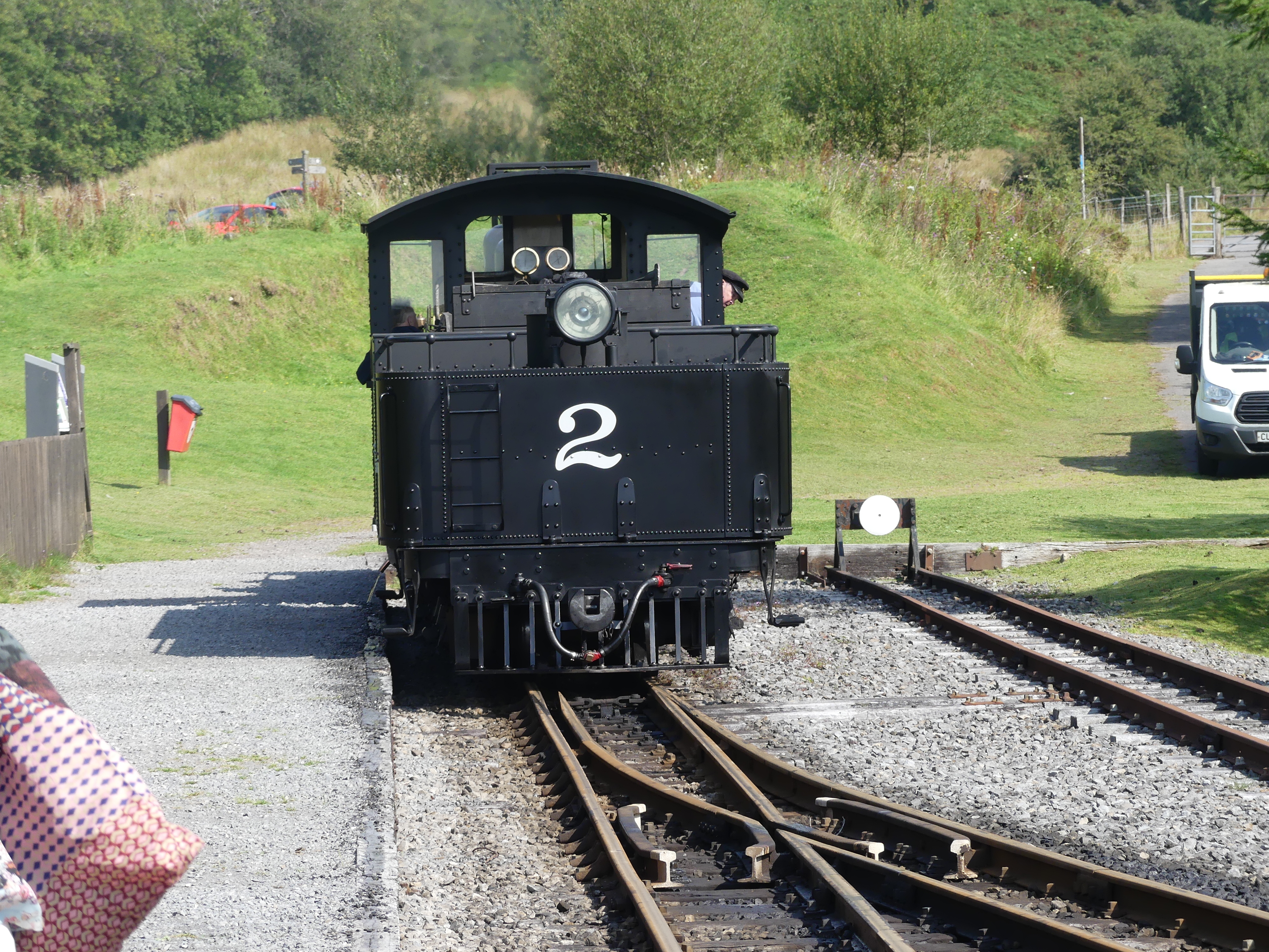
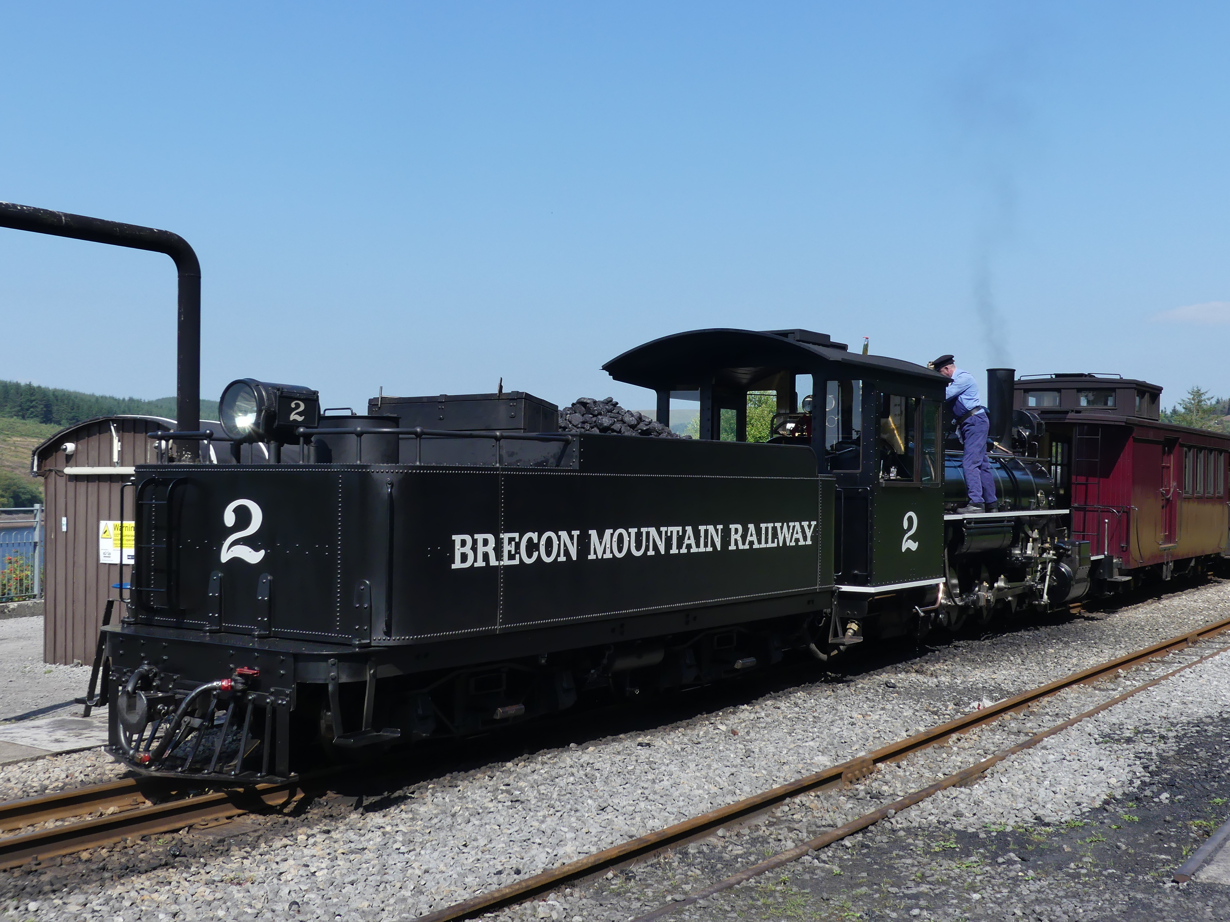
We then traveled on and accidently stumbled across the Brecon Mountain Railway. The Brecon Mountain Railway is a 1 ft 11+3⁄4 in (603 mm) narrow gauge tourist railway on the south side of the Brecon Beacons in Wales. It climbs northwards from Pant along the full length of the Pontsticill Reservoir and continues past the adjoining Pentwyn Reservoir to Torpantau railway station. The railway’s starting point at Pant is located two miles (3 km) north of the town centre of Merthyr Tydfil, Merthyr Tydfil County Borough, South-East Wales. It is very popular so booking in advance is necessary. We booked our tickets for the following day.
We returned to our hotel and as I recall we went for a walk through the town and had dinner at a pub. Nothing flash although the locals thought it a bit of a posh nosh.
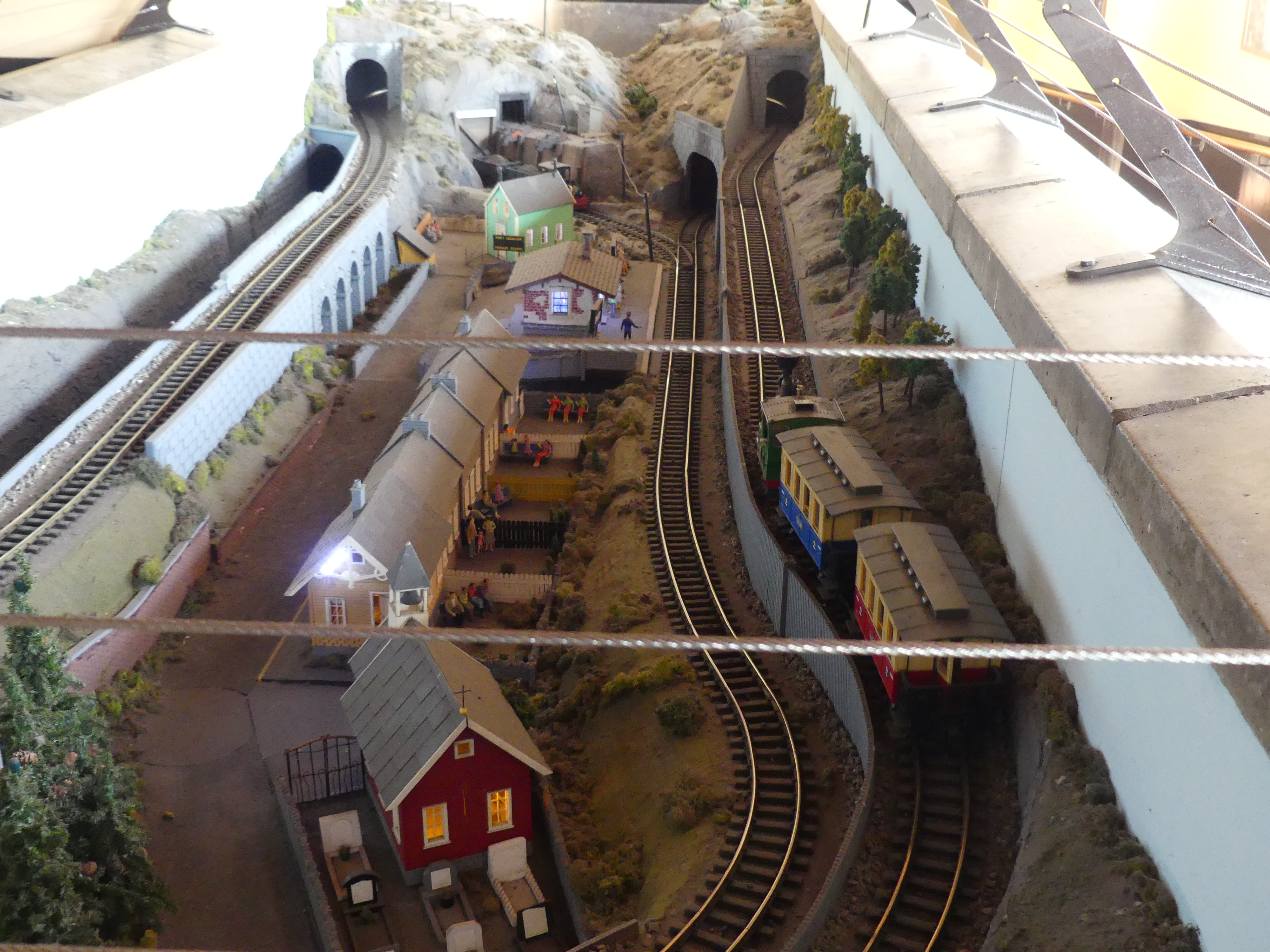
The following morning, we returned to the railway and here are our photos of the ride. Thanks to Wikipedia the history of the Railway follows.
“The Brecon Mountain Railway was founded in the mid-1970s, by Tony Hills (1937–2015). Hills was a long time railway enthusiast who by 1970, had established a base at Gilfach Ddu on the Llanberis Lake Railway where he stored the locomotives he purchased. In 1977, he purchased five miles of trackbed of the abandoned Brecon & Merthyr Railway at Pant and moved his collection there. Construction of the BMR started in 1978, with the grant of a Light Railway Order in 1980. Track was laid between Pant and Pontsticill in 1979–80. At Pontsticill the station house was renovated, the old waiting room was converted into a small workshop and a storage shed was built. Seven bridges were repaired or replaced. The railway opened to passengers in June 1980 using the engine Sybil and one carriage.
Between 1982 and 1996, a large station and workshop were built at Pant. These provide passenger facilities including toilets, cafe, shop and booking office as well as the extensive workshop used to build and maintain the railway locomotives, carriages and wagons.
A 1+1⁄2 miles (2.4 km) extension from Pontsticill to Dol-y-Gaer opened in 1995. The railway was further extended to Torpantau, just short of the southern entrance of the Torpantau Tunnel, with passenger services commencing 1 April 2014.
By 2016, the original waiting room building at Pontsticill, which had served as a workshop for a period, was converted into a steam museum housing various stationary steam engines and three of the smaller locomotives. All of the stationary units were connected up to a steam distribution header and boiler, which in 2017 was still awaiting commissioning.”
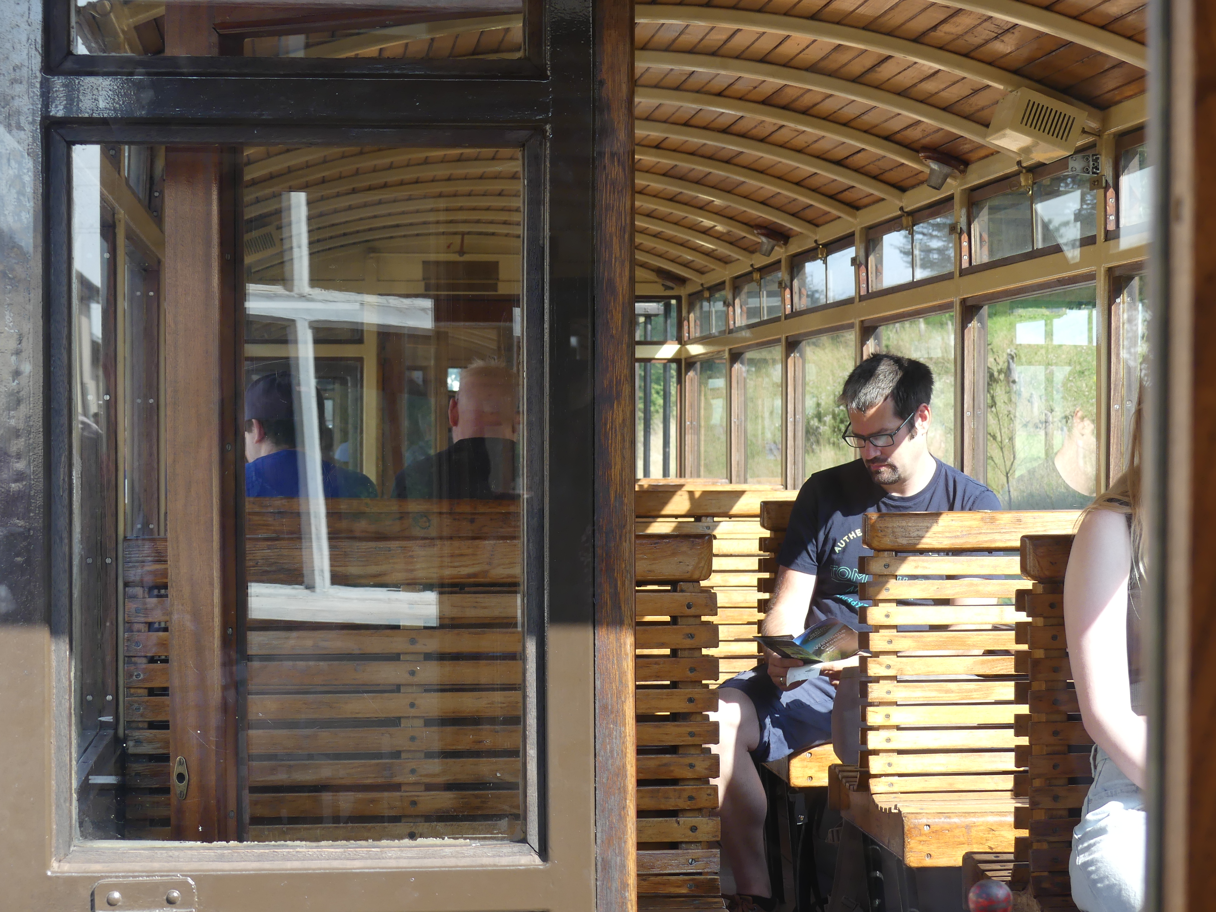
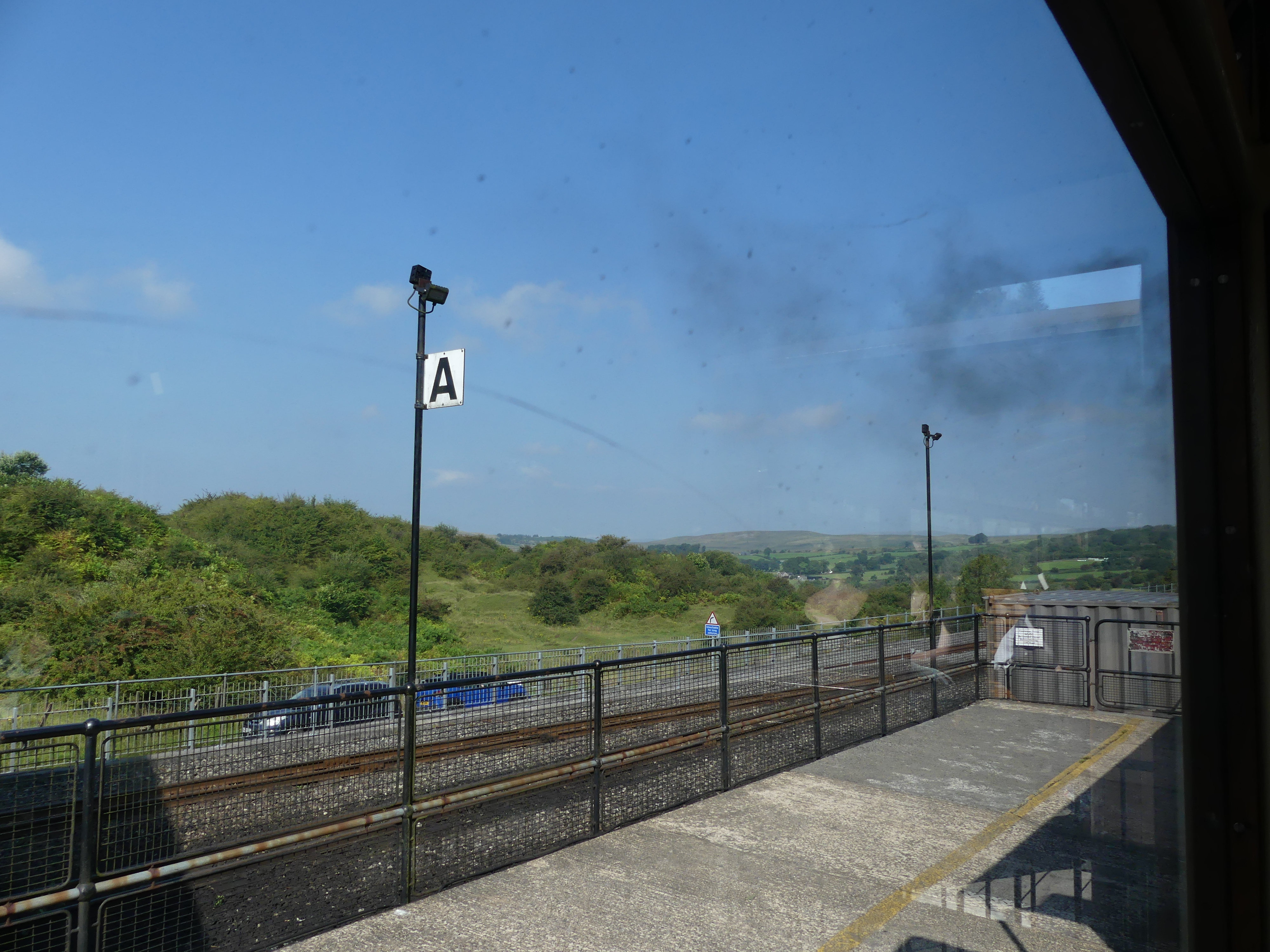
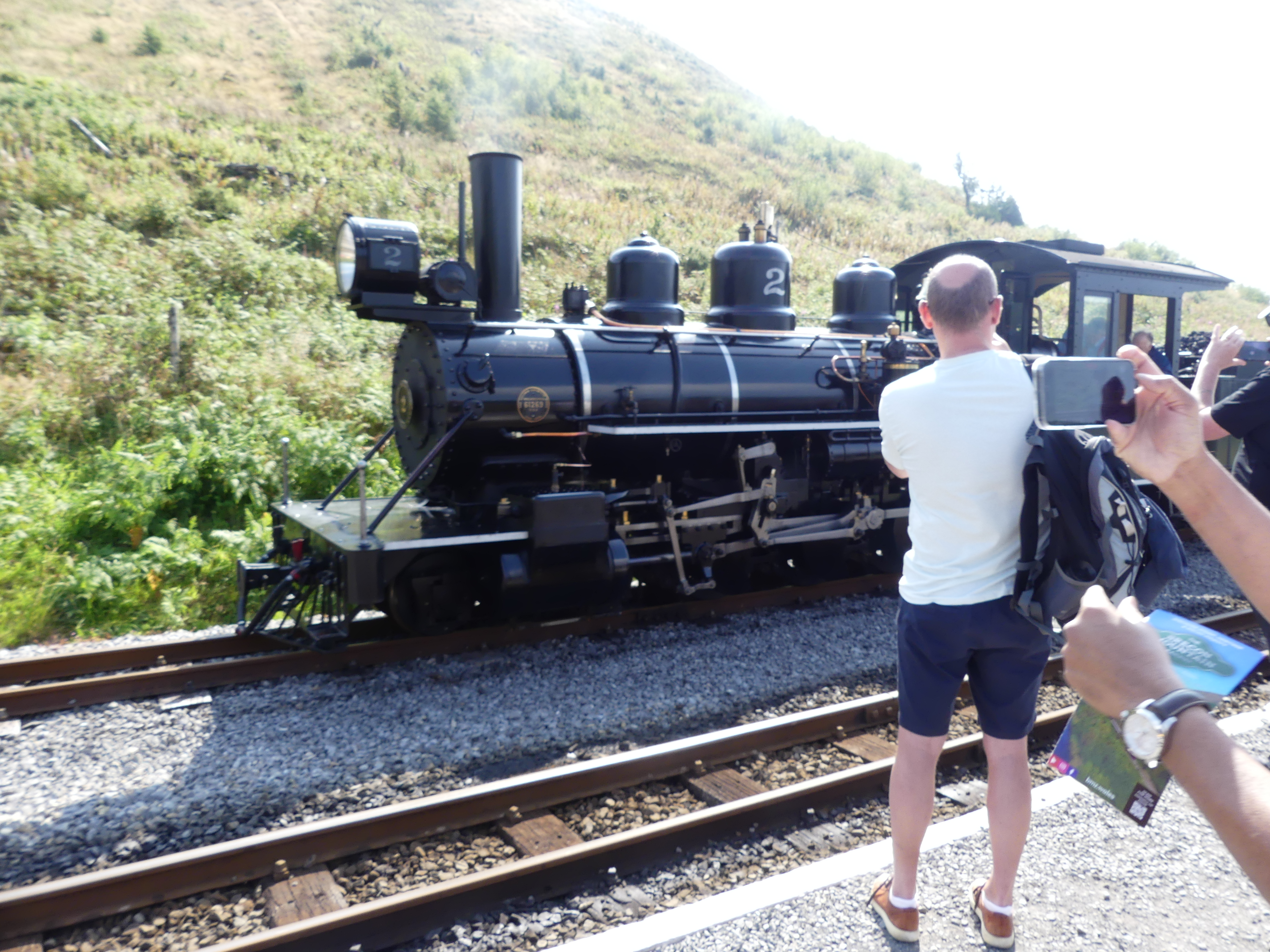
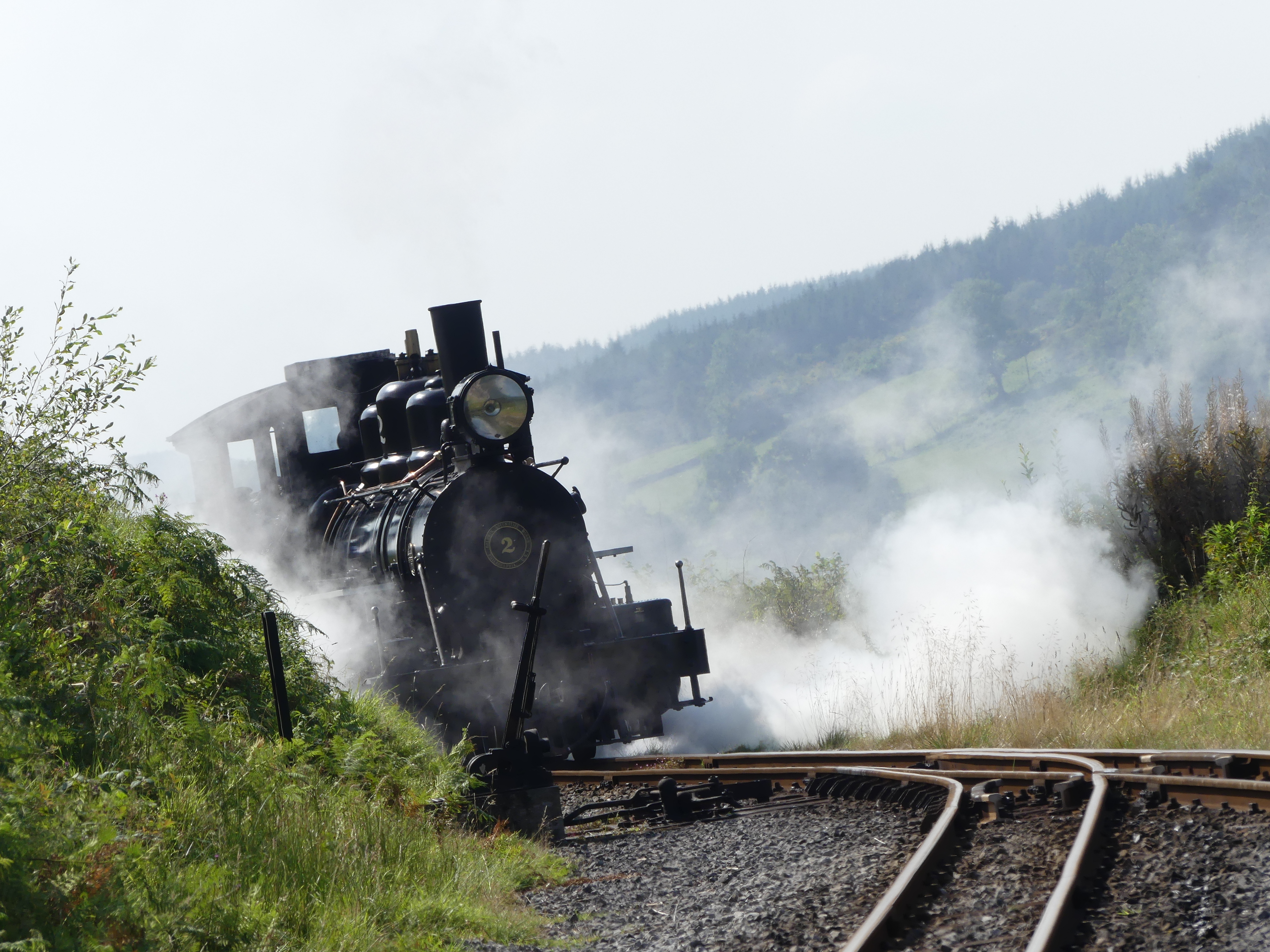
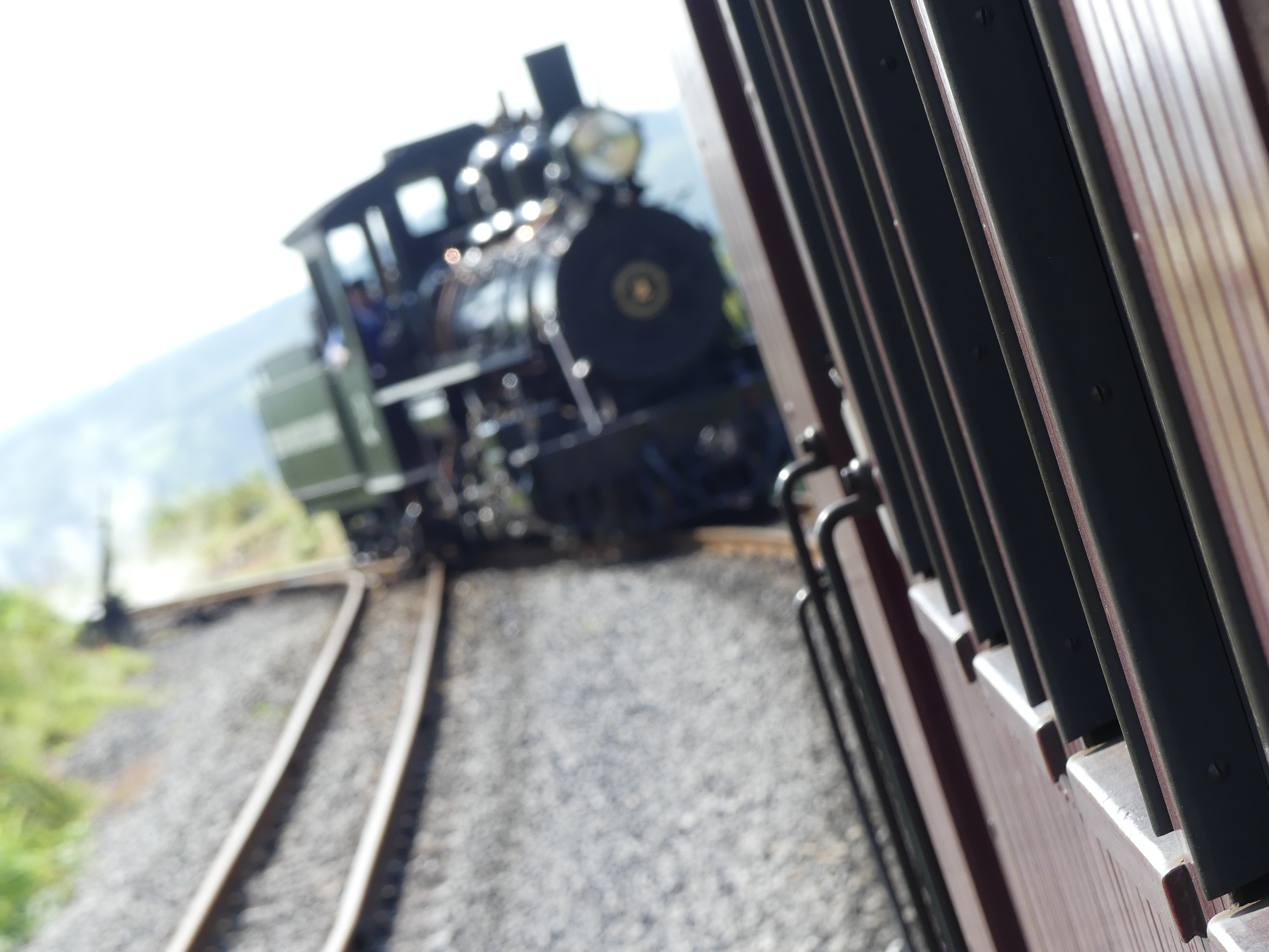
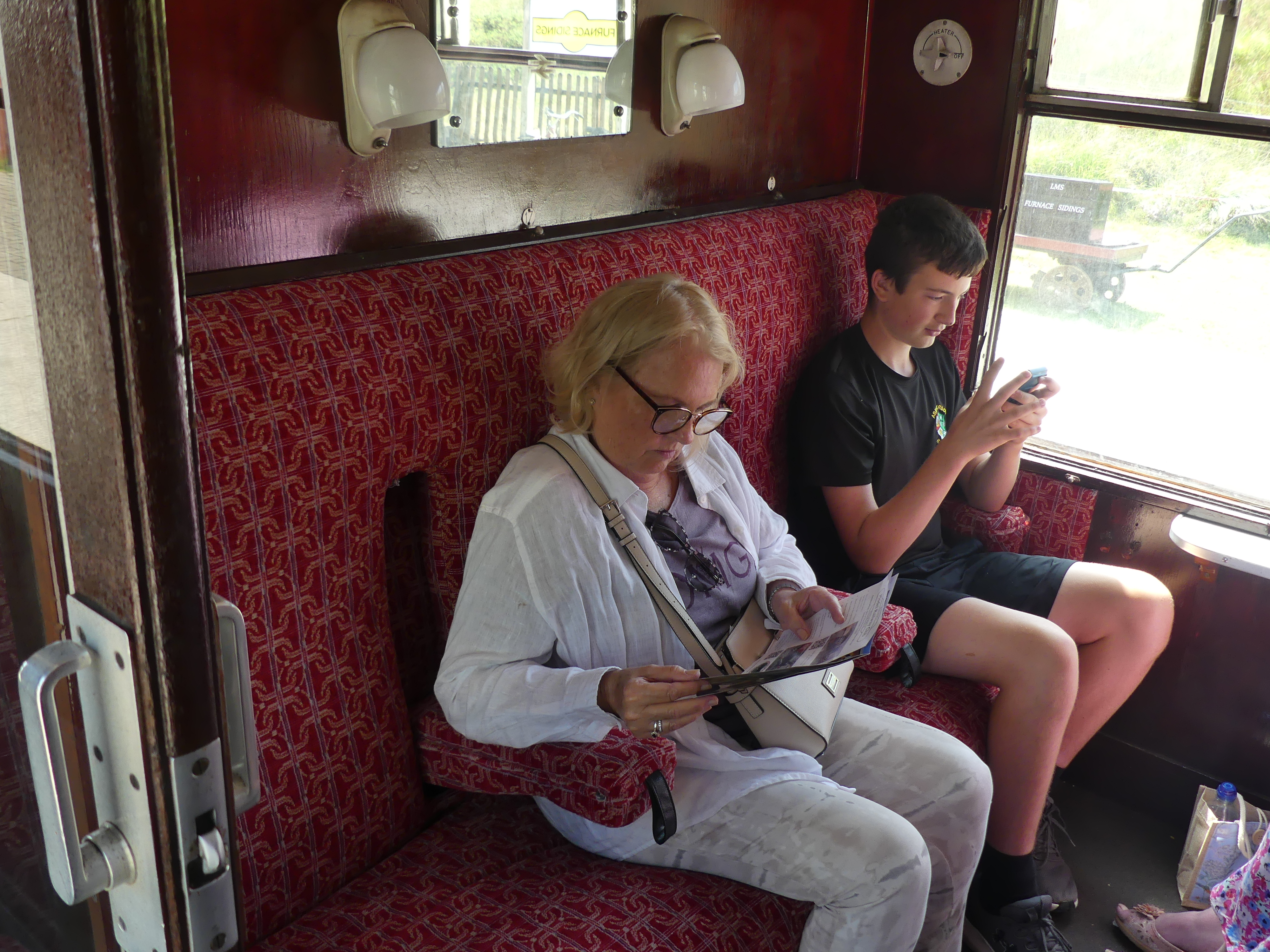
My photos show the station at Pontsticill with the attach museum and workshop, and the trip up to Torpantau. There the train disengages turns around and takes us back to Dol-y-Gaer where converted carriages serve as cafe and refreshment stop. My photo shows Kerry in the queue.
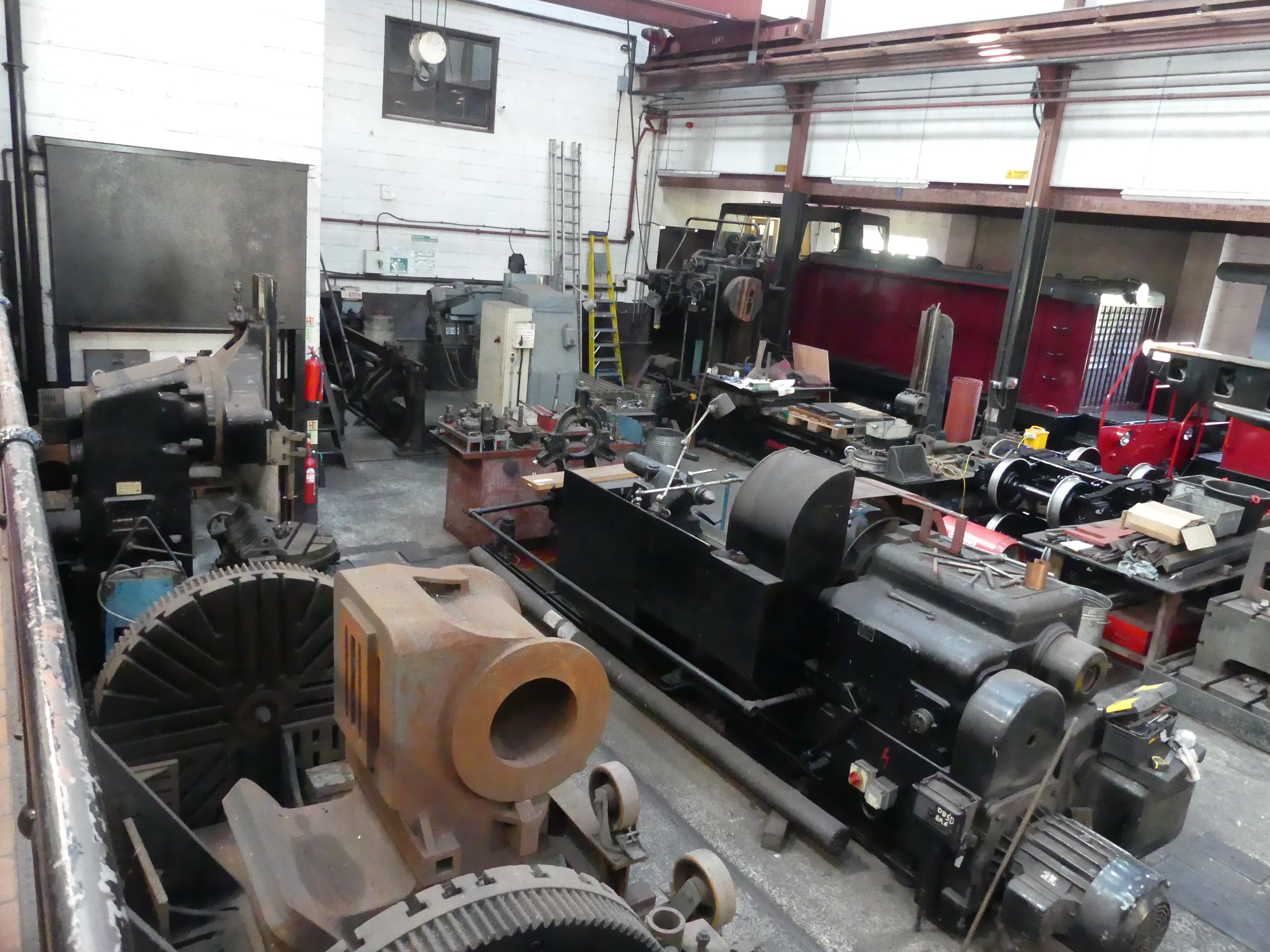
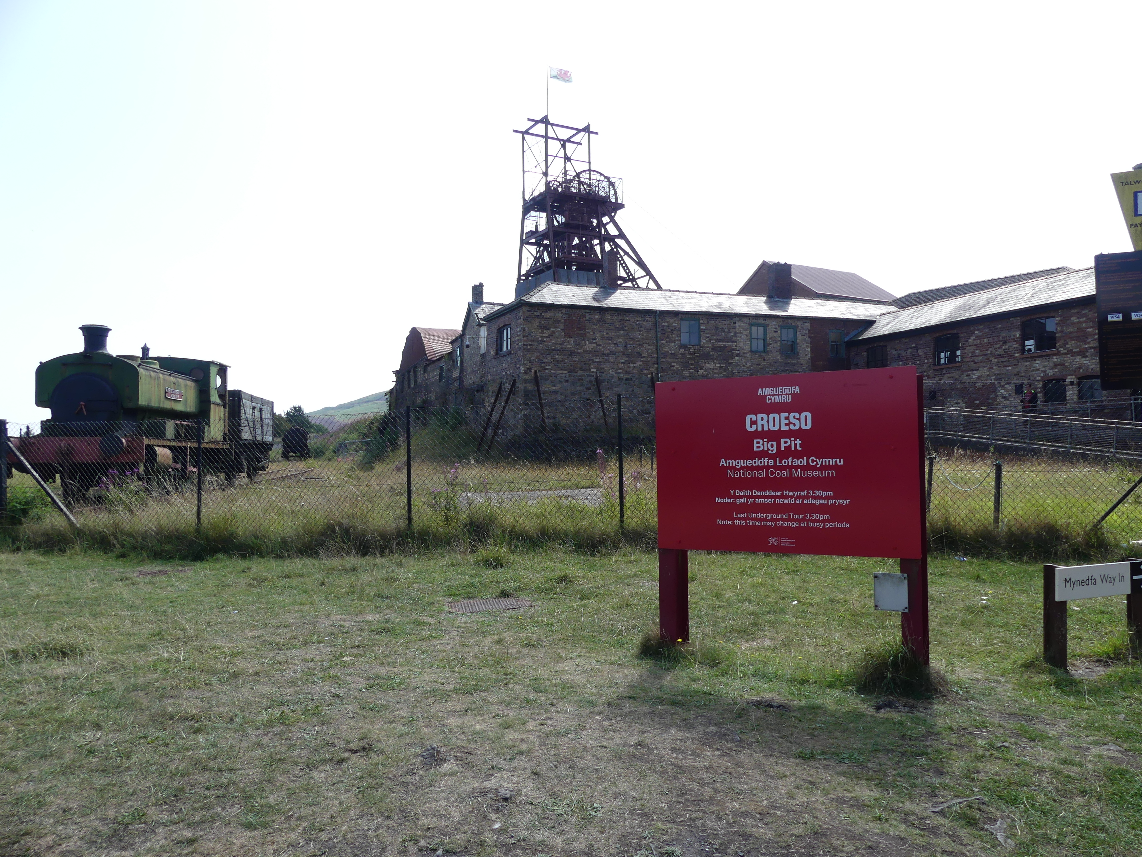
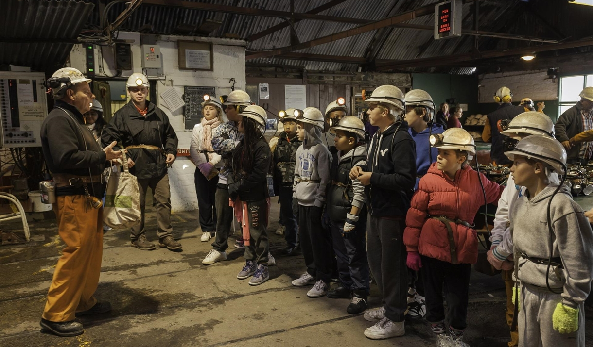
The trip and drive took most of the day. Overnight we investigated visiting the Big Pit and the Blaenavon Heritage Railway the next day. Unlike the Brecon Railway this one is an all-volunteer association keeping the steam train running and it incidentally used to service the Big Pit so whilst the train goes to the Big Pit it’s not synchronized with what is happening with the Big Pit. The railway visits 4 stations in a round trip of about 1 hour. One of the stops is the Big Pit. We knew nothing of these arrangements and learned as we went. The stations are Big Pit Halt along a short branch line then back to Furnace Sidings Halt where we bought our ticket and then two more stations (they call them “Halts”) Whistle Inn Halt and Blaenavon. We caught the train to the Big Pit and on reboarding the train we eventually did the whole of the train ride.
The Big Pit is a short walk from the branch line station and after entering the Big Pit recetion area we were directed to the waiting room. There we awaited our guide who takes a group of about 10 people to a preparation area where we were fitted out with safety gear and handed in our phones and cameras.You won’t see any photos of the mine tunnels as photos underground are prohibited. Then the group enter an elevator to descend 300 feet or 90 m underground to experience “mining”. The trip was very sobering. This was a tough life more than I could understand without experiencing this tour. We learnt about the darkness of the tunnel, the risks of suffocation from dangerous gases, the heat and uncomfortable environment in which to work the long hours of the miners, their children, who often worked with them, and the horses which lived in the mines quite often Shetland ponies. The tour lasted at least an hour and half. This was longer than we had allowed so we were concerned that we did not miss our return train ride back to the station to where we had parked the car. We need not have worried. After a short period standing on the station, we got the train and finished the whole journey and returned to where we had left the car. Below is a picture of the preparation area. I used what was available on the web site – don’t bother looking for us.
We returned to Ebbw Vale and our hotel to prepare for the following day.
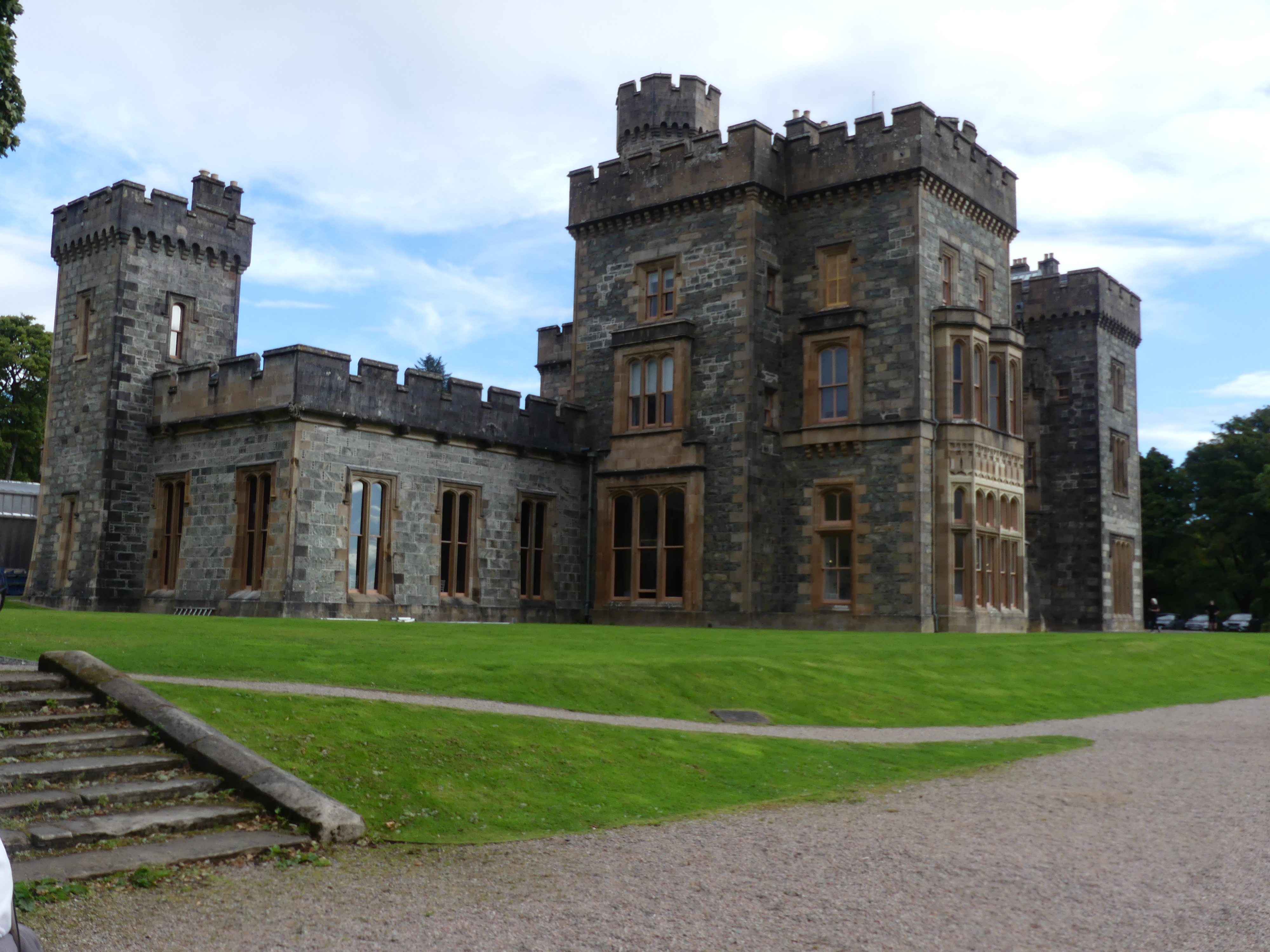
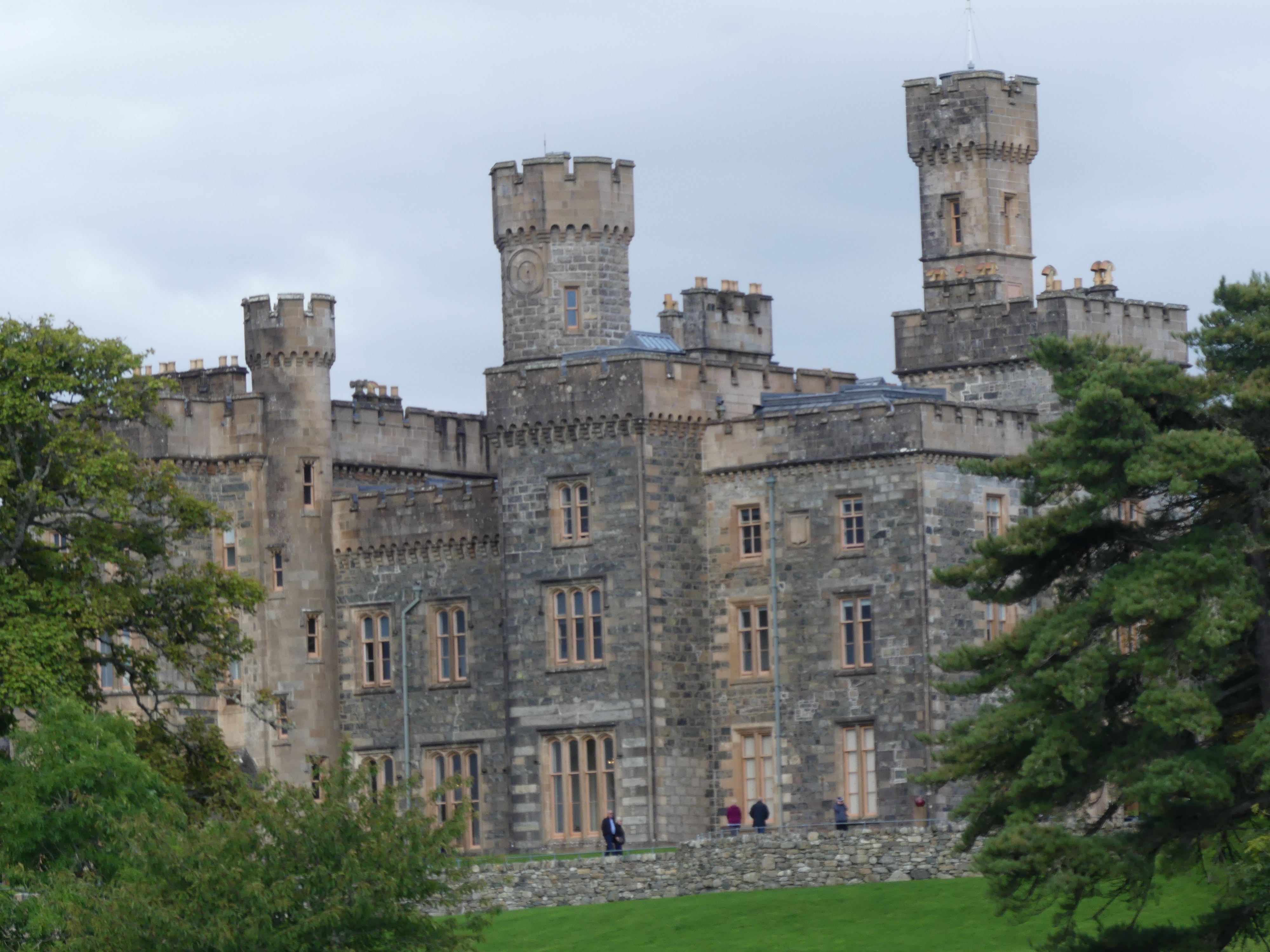
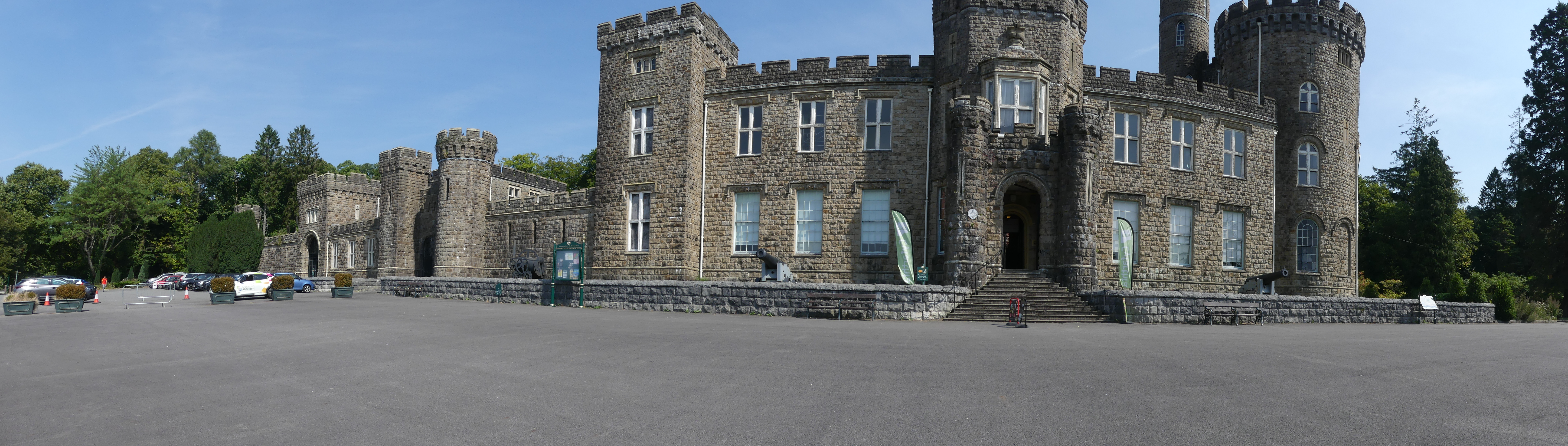
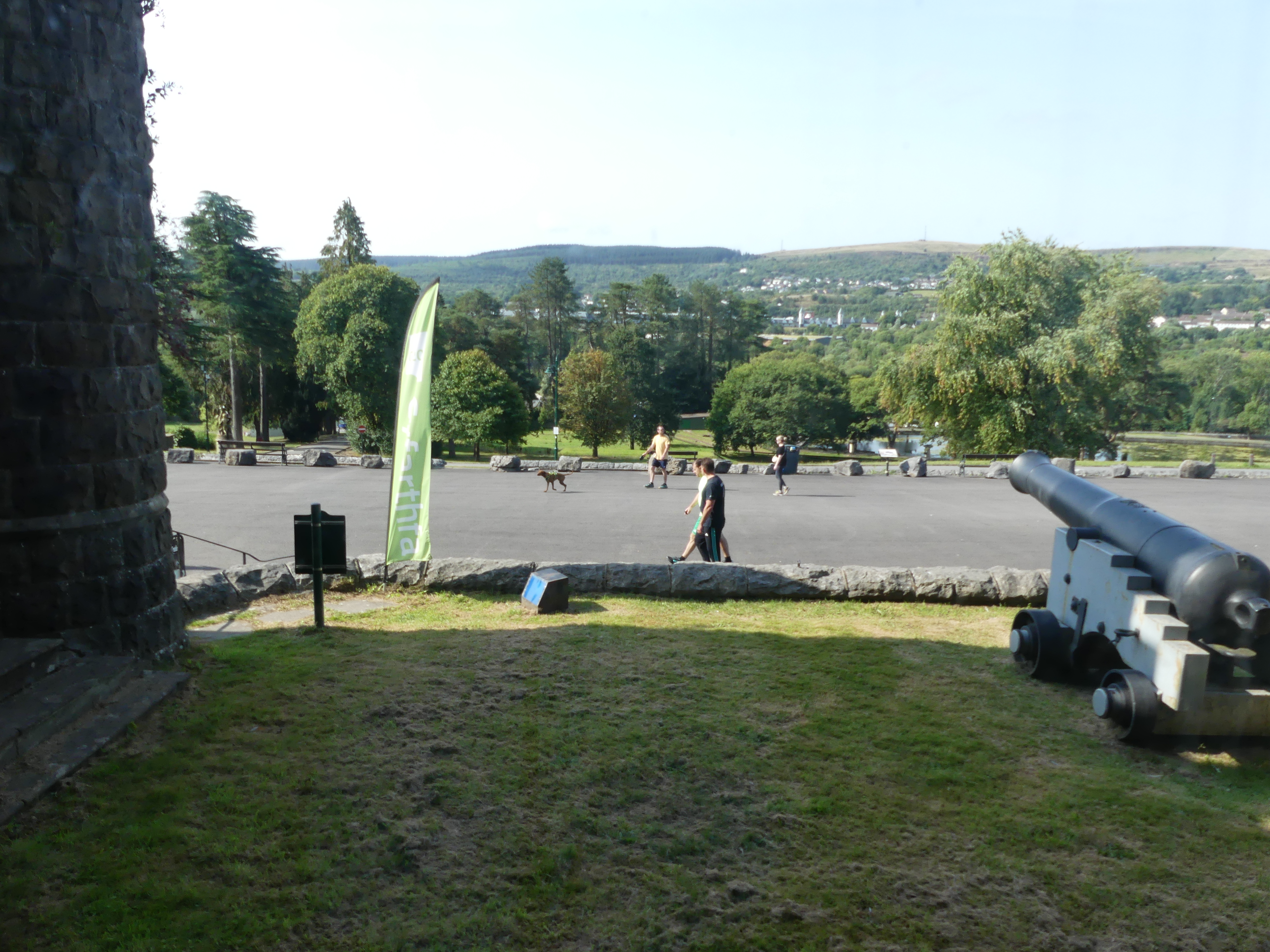
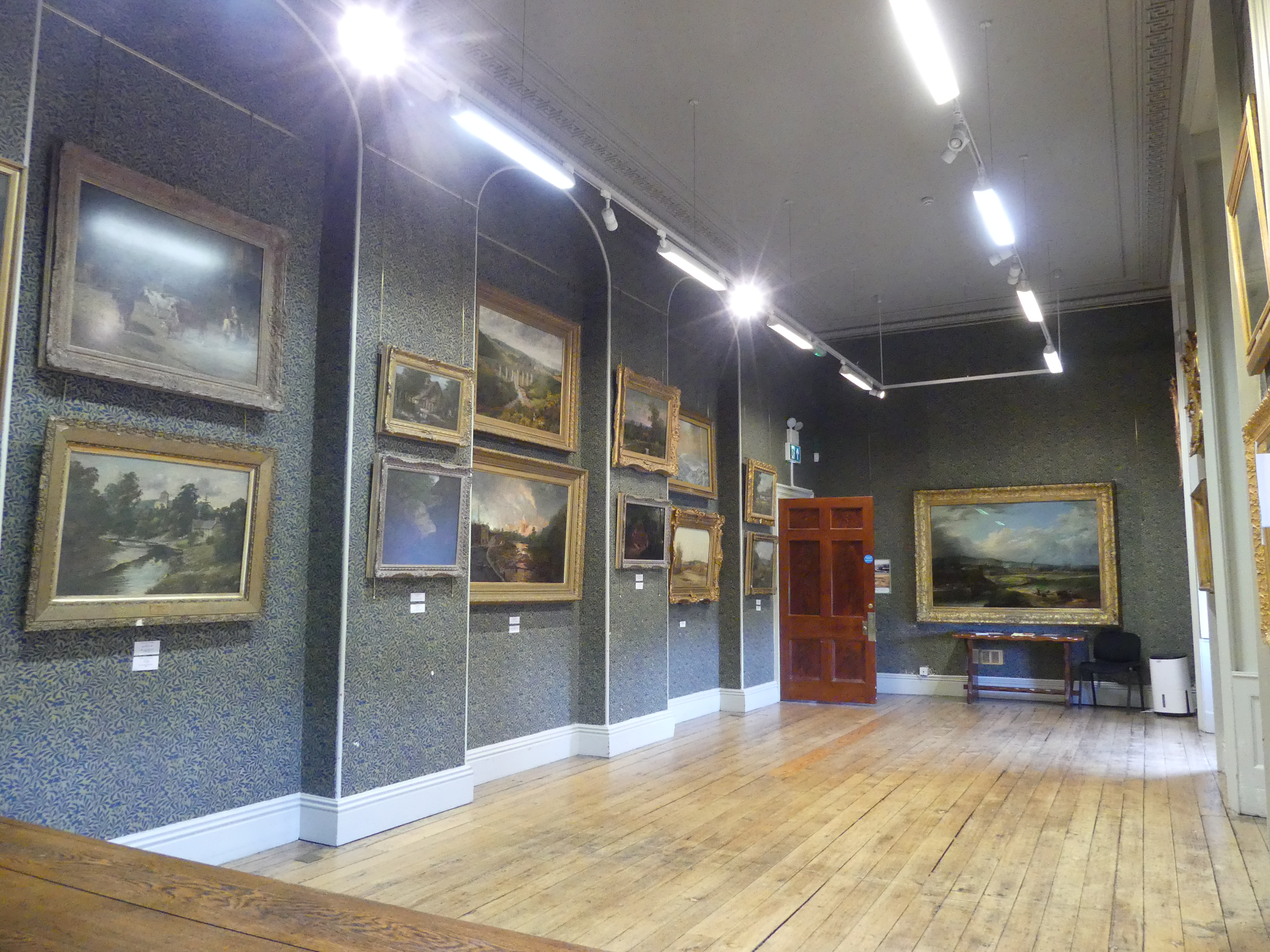
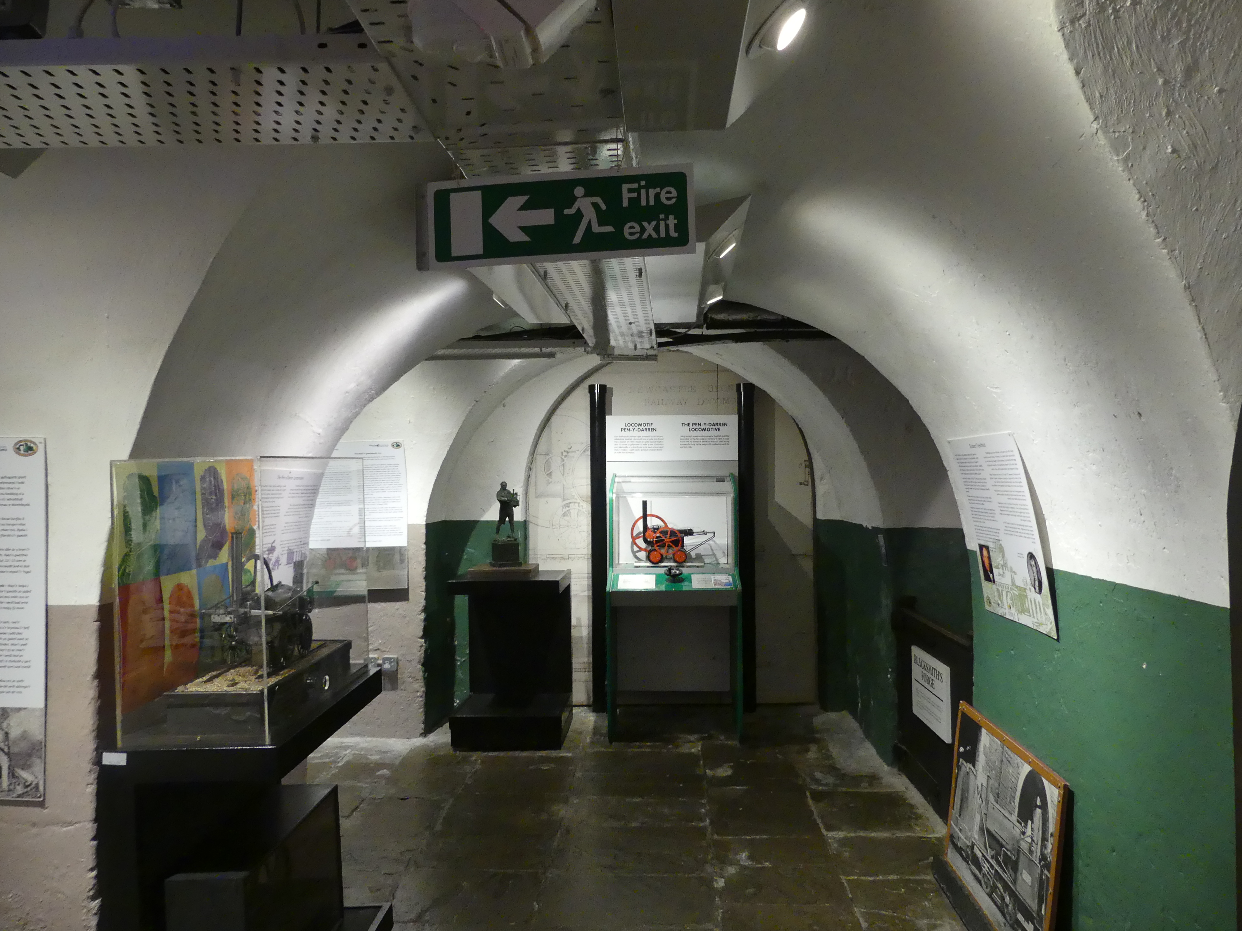
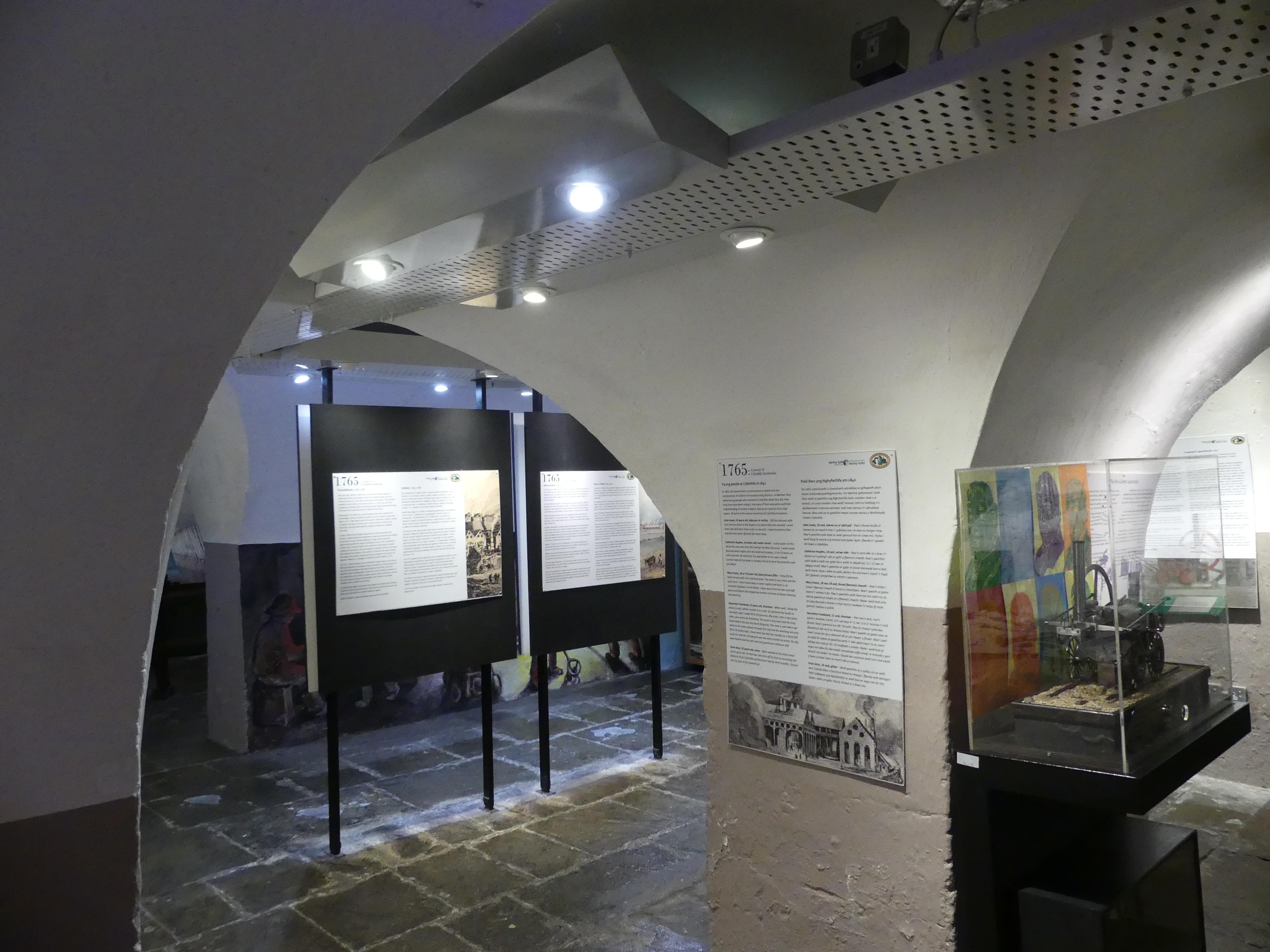
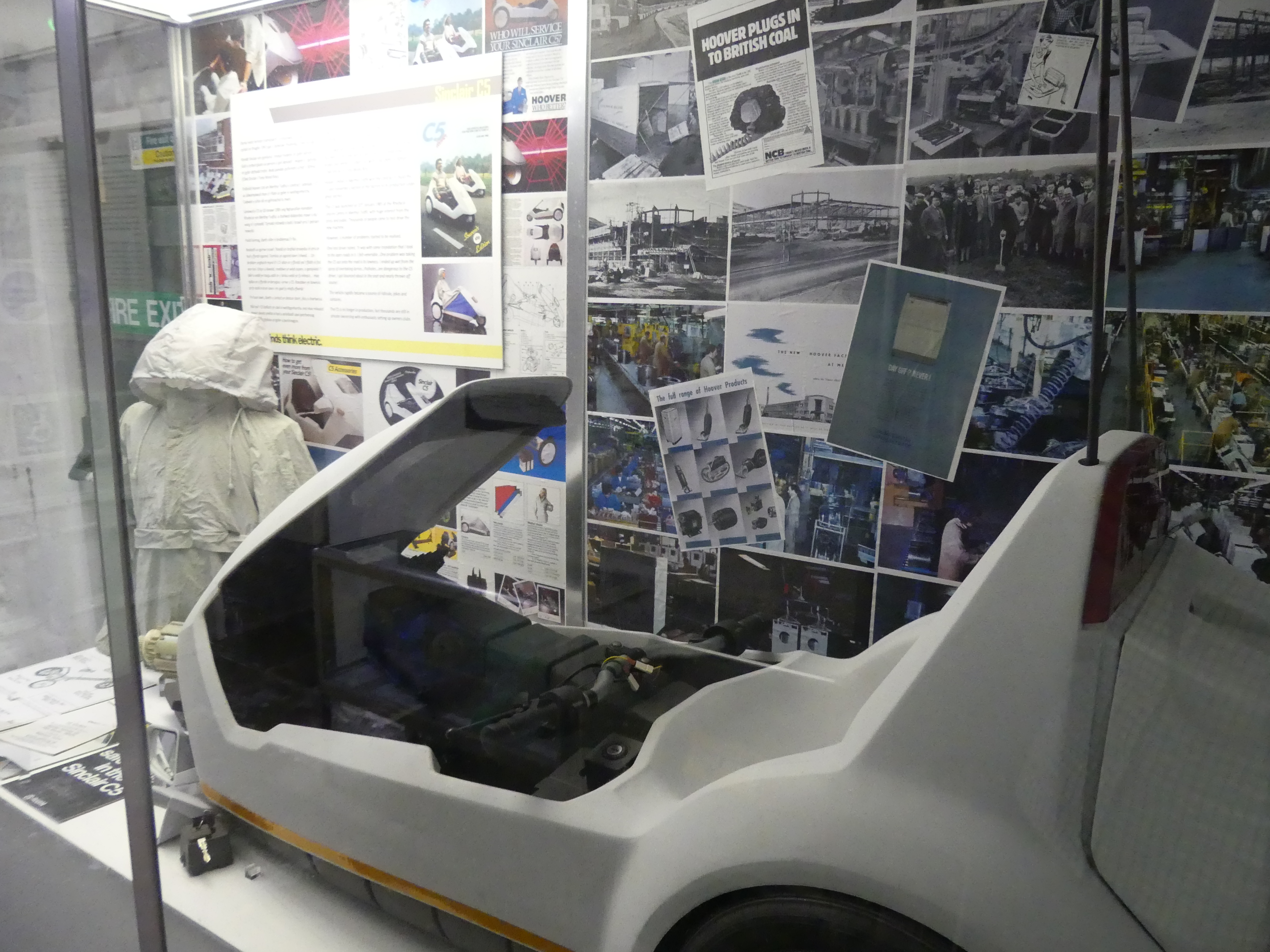
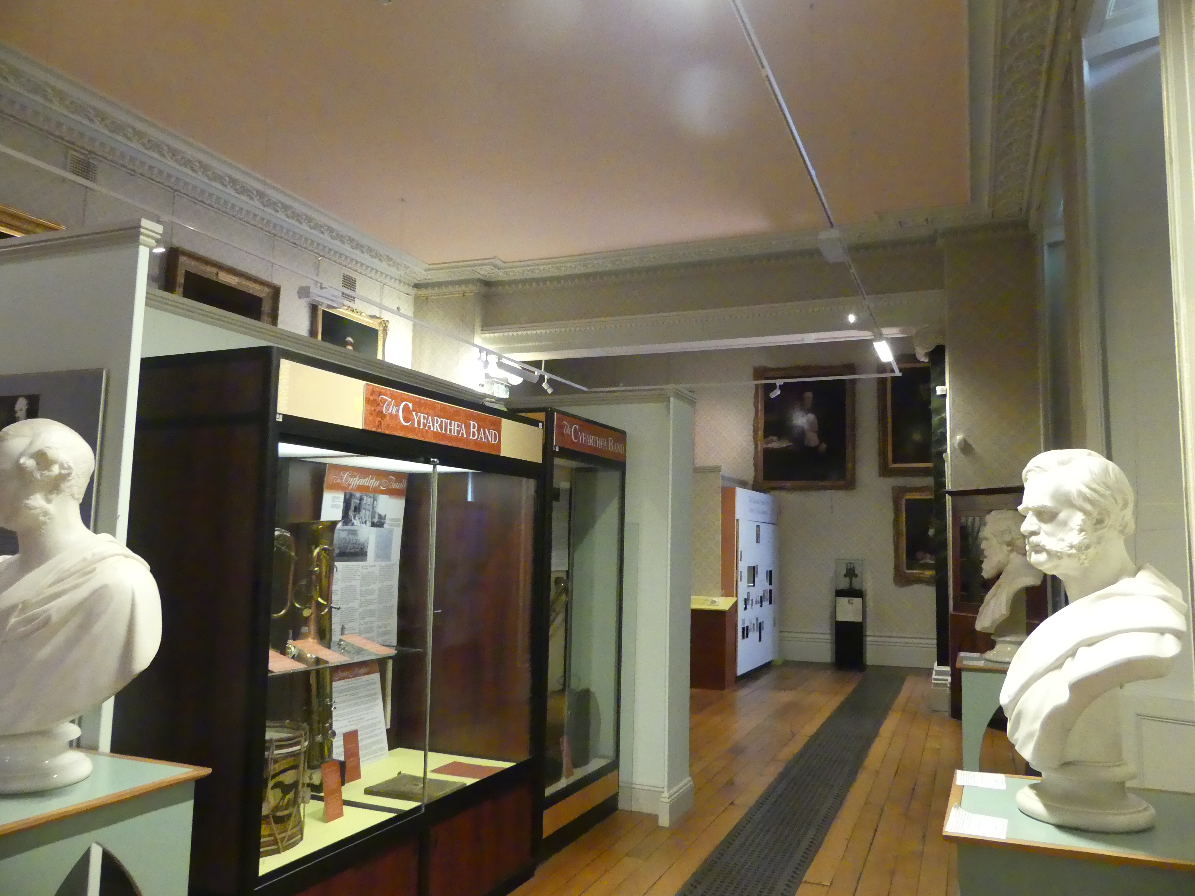
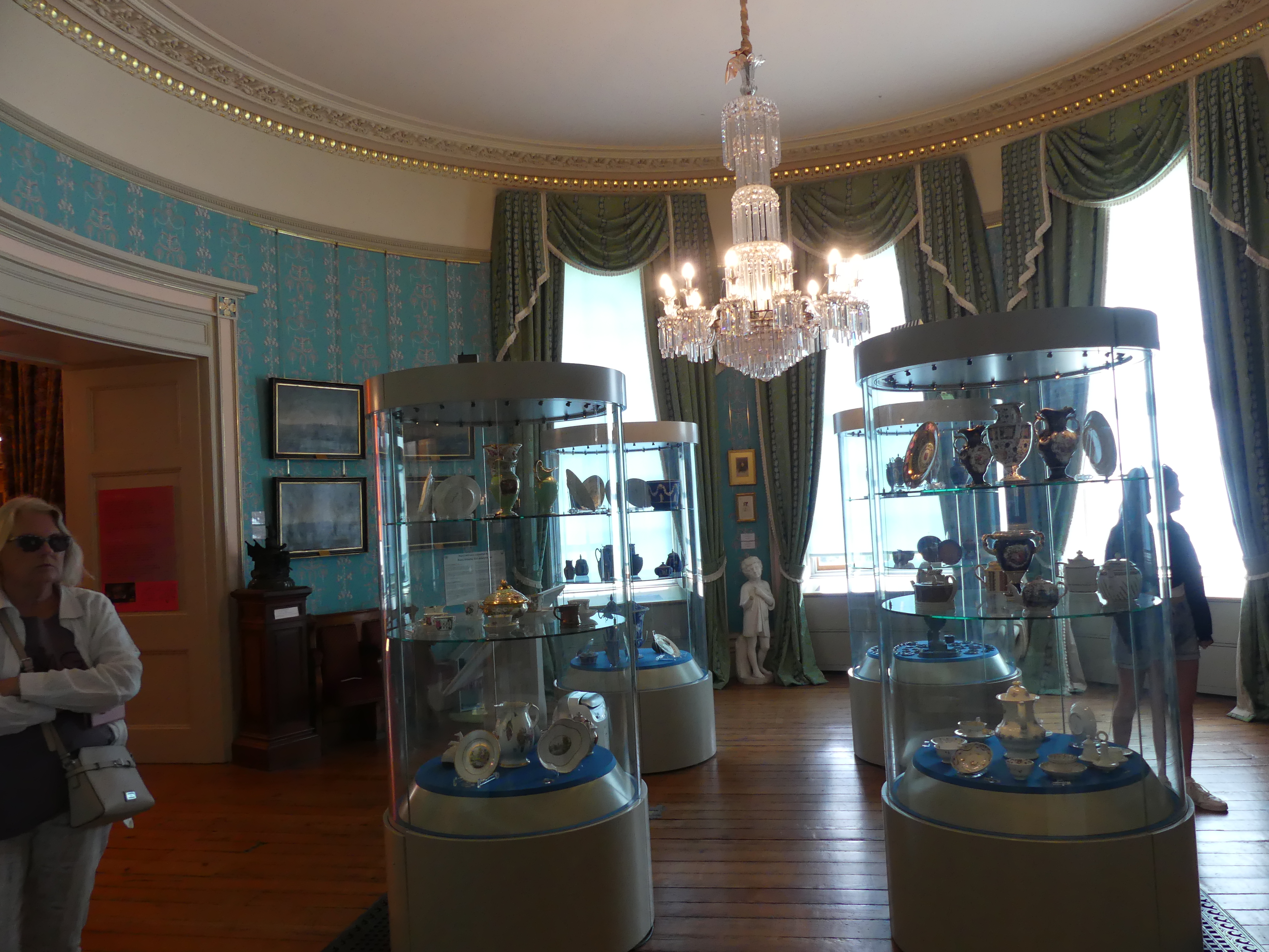
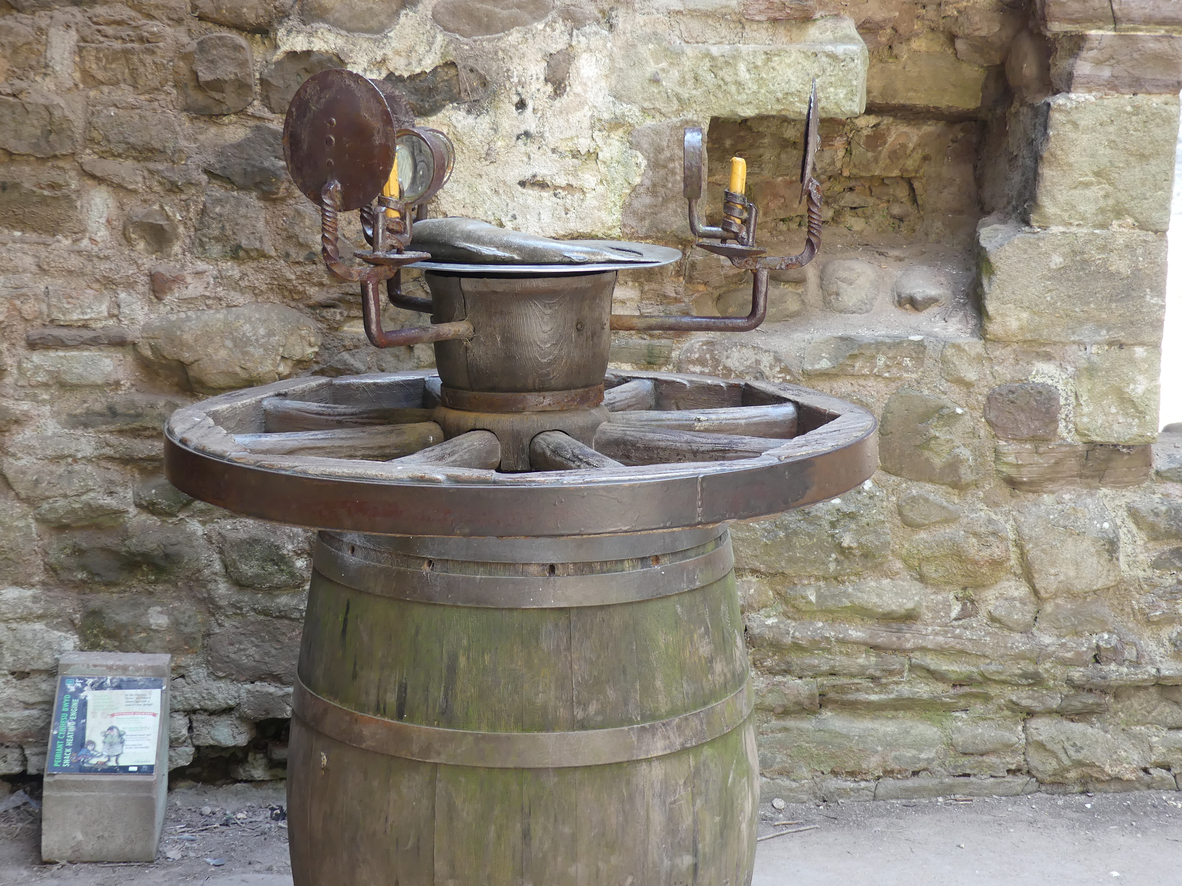
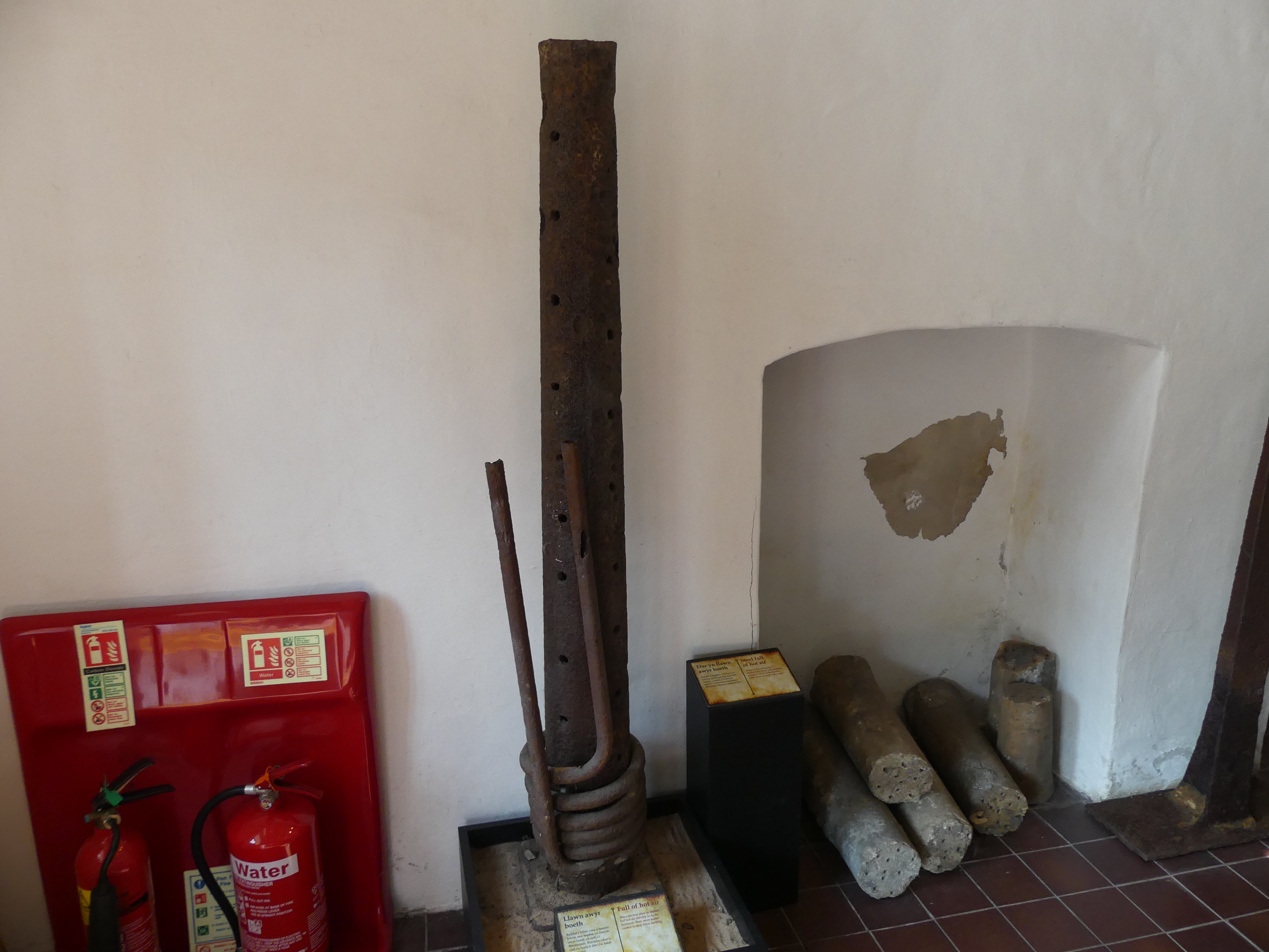
The following day we visited Cyfarthafa Castle and Blaenafon Ironworks ( the featured picture above shows one of the iron presses from Blaenafon Ironworks). Cyfarthfa Castle is a castellated mansion that was the home of the Crawshay family, ironmasters of Cyfarthfa Ironworks in Park, Merthyr Tydfil, Wales. The castle was sold in 1908 to the local council, who decided to use part of the ground floor for a museum, which still operates. The museum includes paintings, including two by James Inskipp. The rest of the building became a secondary school, and it was opened in 1913, operating as separate boys’ and girls’ schools. In 1945, they amalgamated, and in accordance with government policy the school was redesignated as a Grammar school under the name of Cyfarthfa Castle Grammar School. It became a comprehensive school in 1970, under the name Cyfarthfa High School. My photos are below.
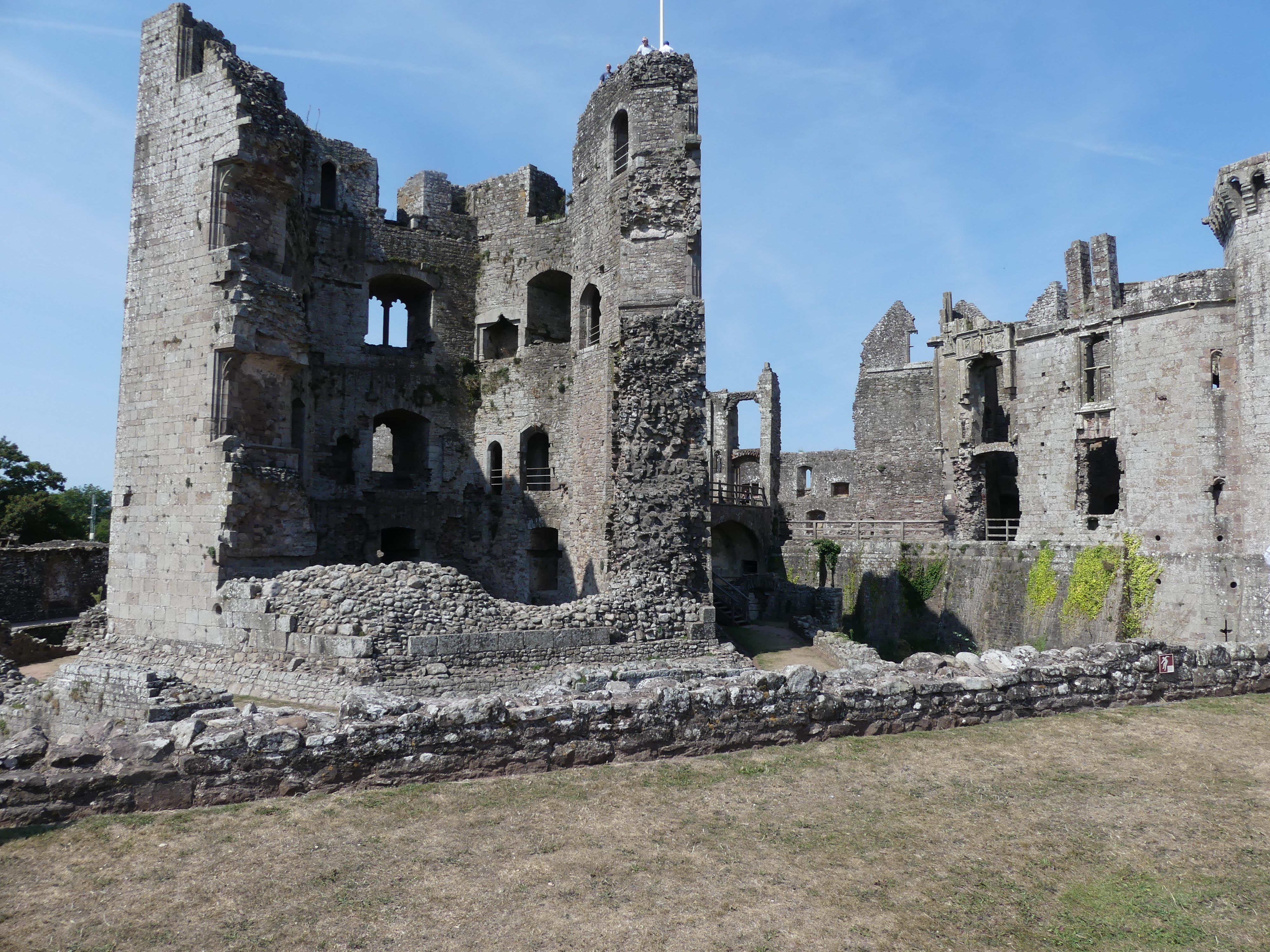
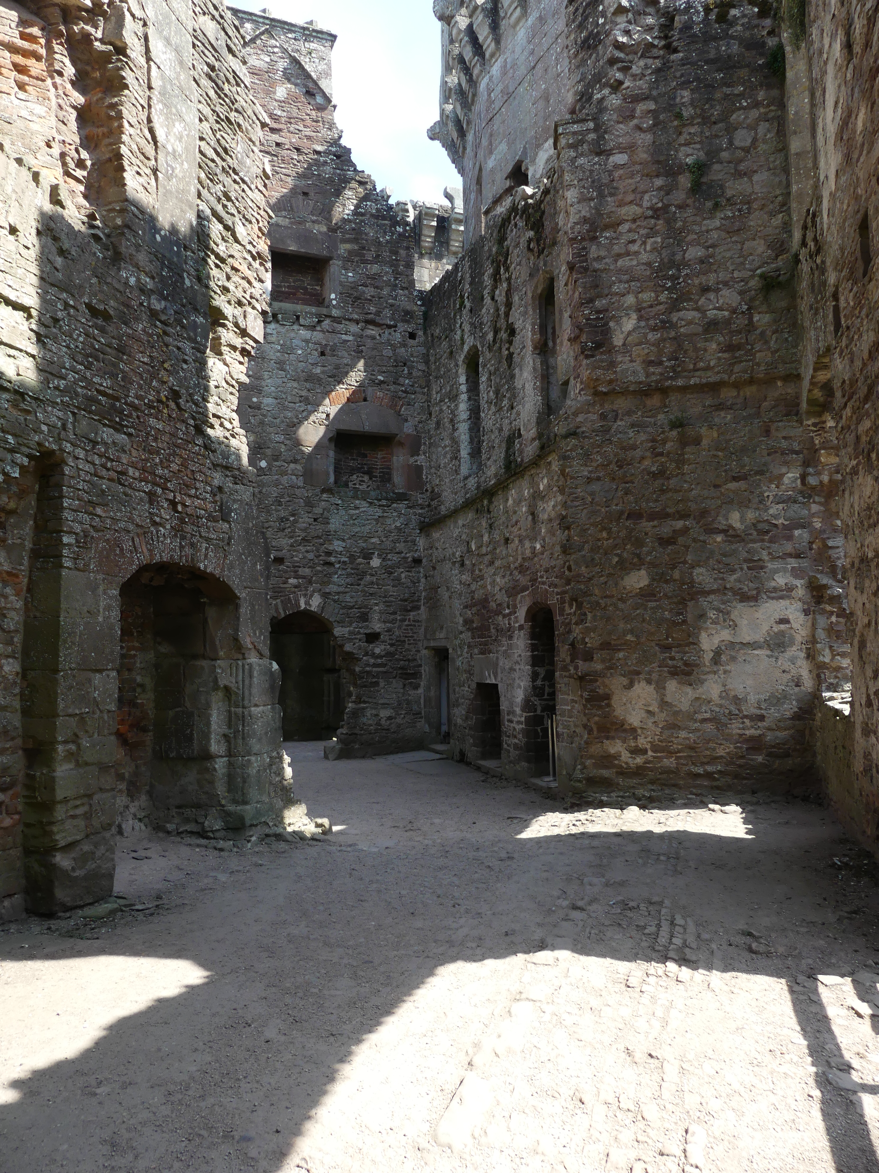
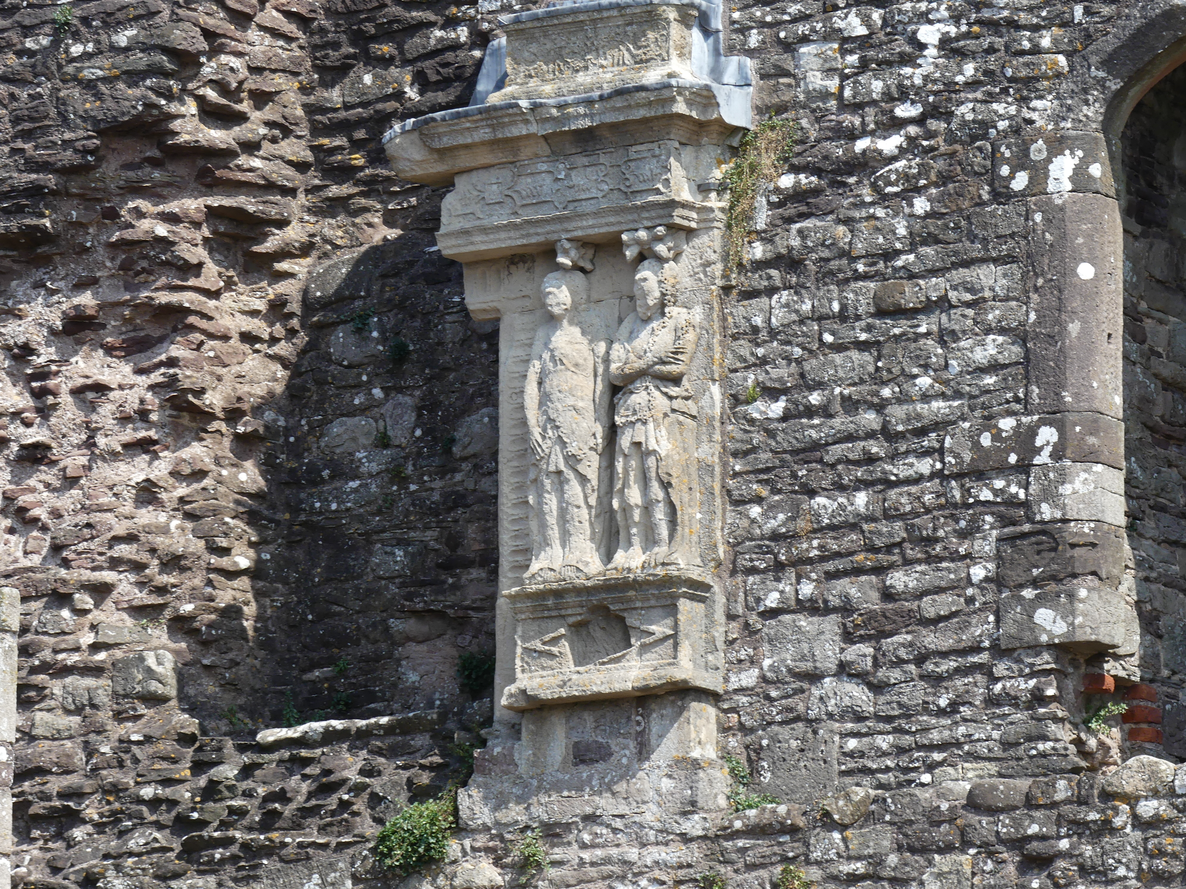
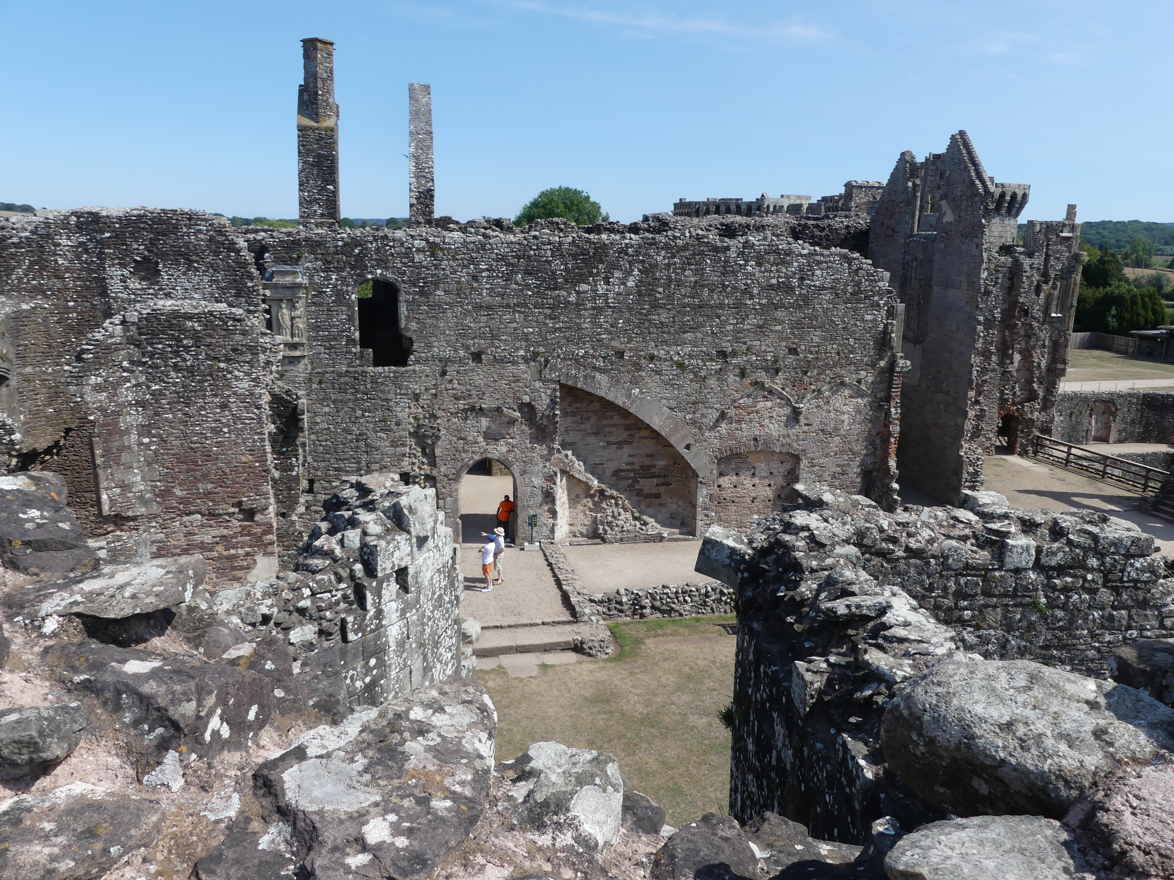
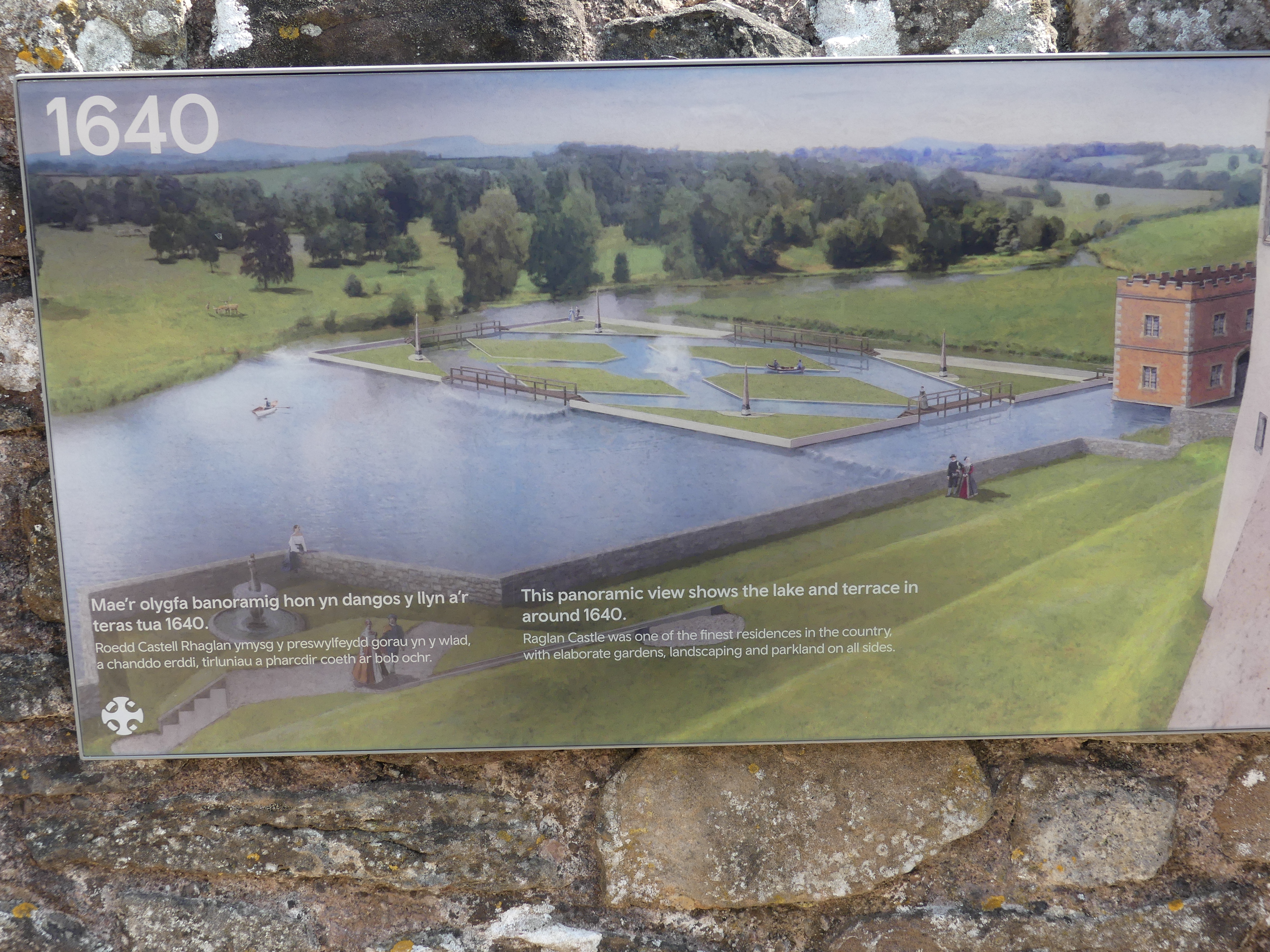
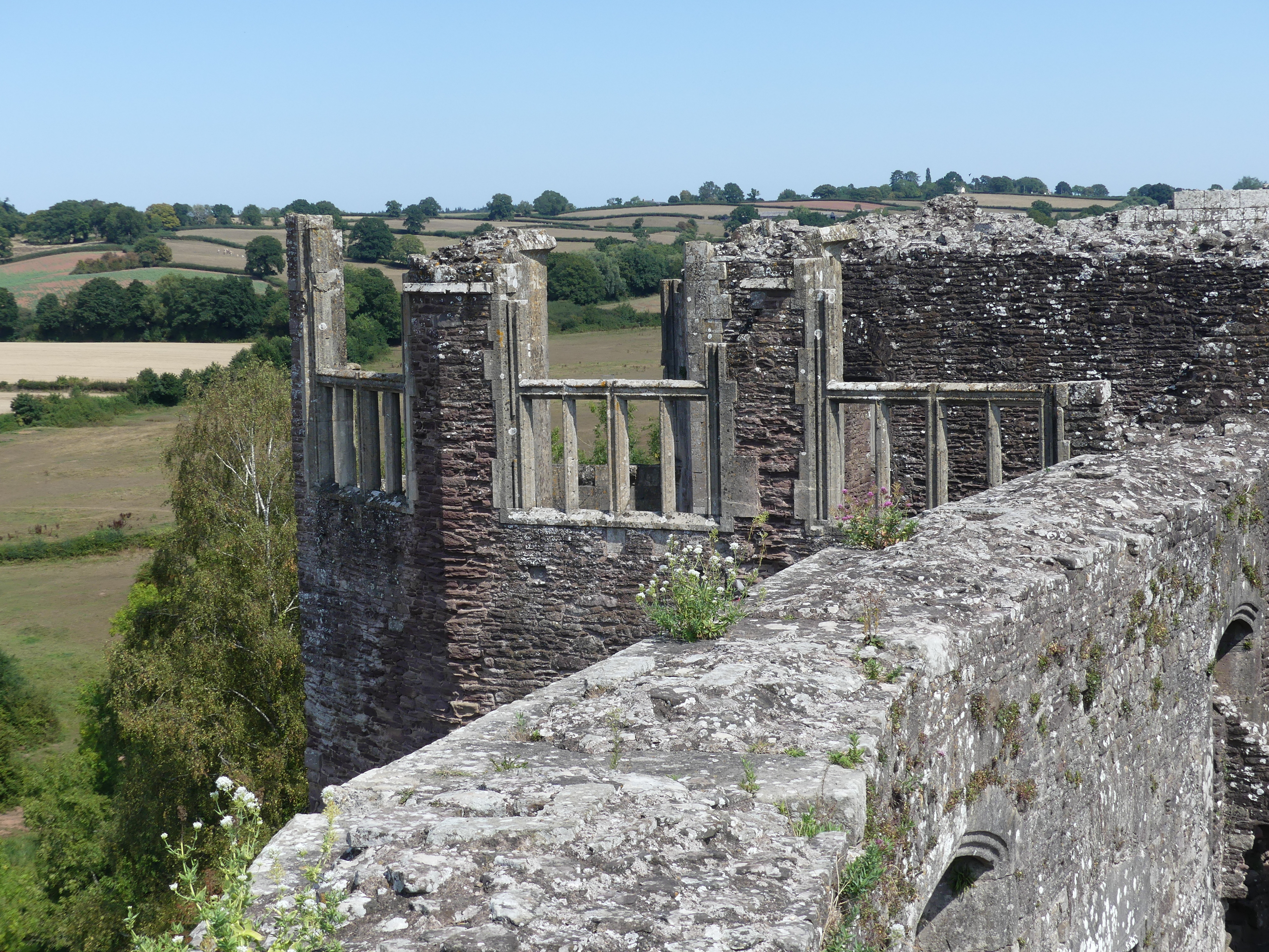
From there we tracked our way to Raglan Castle. Raglan Castle is a late medieval castle located just north of the village of Raglan in the county of Monmouthshire in southeast Wales. The modern castle dates from between the 15th and early 17th centuries, when the successive ruling families of the Herberts and the Somersets created a luxurious, fortified castle, complete with a large hexagonal keep, known as the Great Tower or the Yellow Tower of Gwent. During the First English Civil War, Raglan was occupied by a Royalist garrison on behalf of Charles I but it was taken by Parliamentarian forces in 1646 and its walls slighted or deliberately put beyond military use. After the Stuart Restoration in 1660, the Somersets declined to restore it and it became first a source of local building materials, then a romantic ruin. It is now a tourist attraction. We spent time going through the ruins and sought refreshment, but the café was well hidden. We finally found the cafe – outside of the castle allotment in the courtyard of the neighbouring house. We sat down in the shade and then caused a minor disturbance because the waiter took the order incorrectly but to their credit, they admitted their error and provided us with a refund for the mistake. My photos of the ruins and the café follow including the CADW brochure.
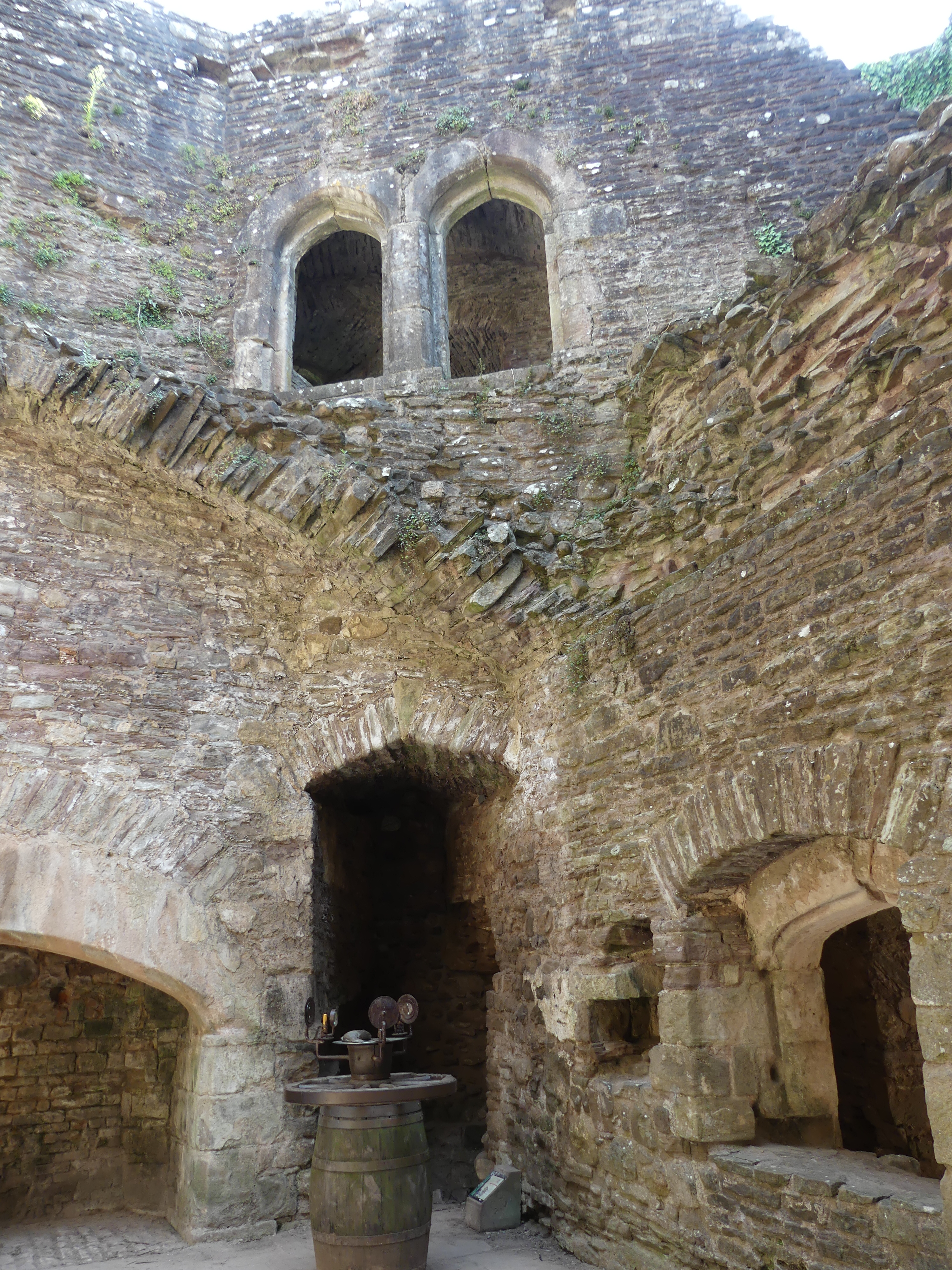
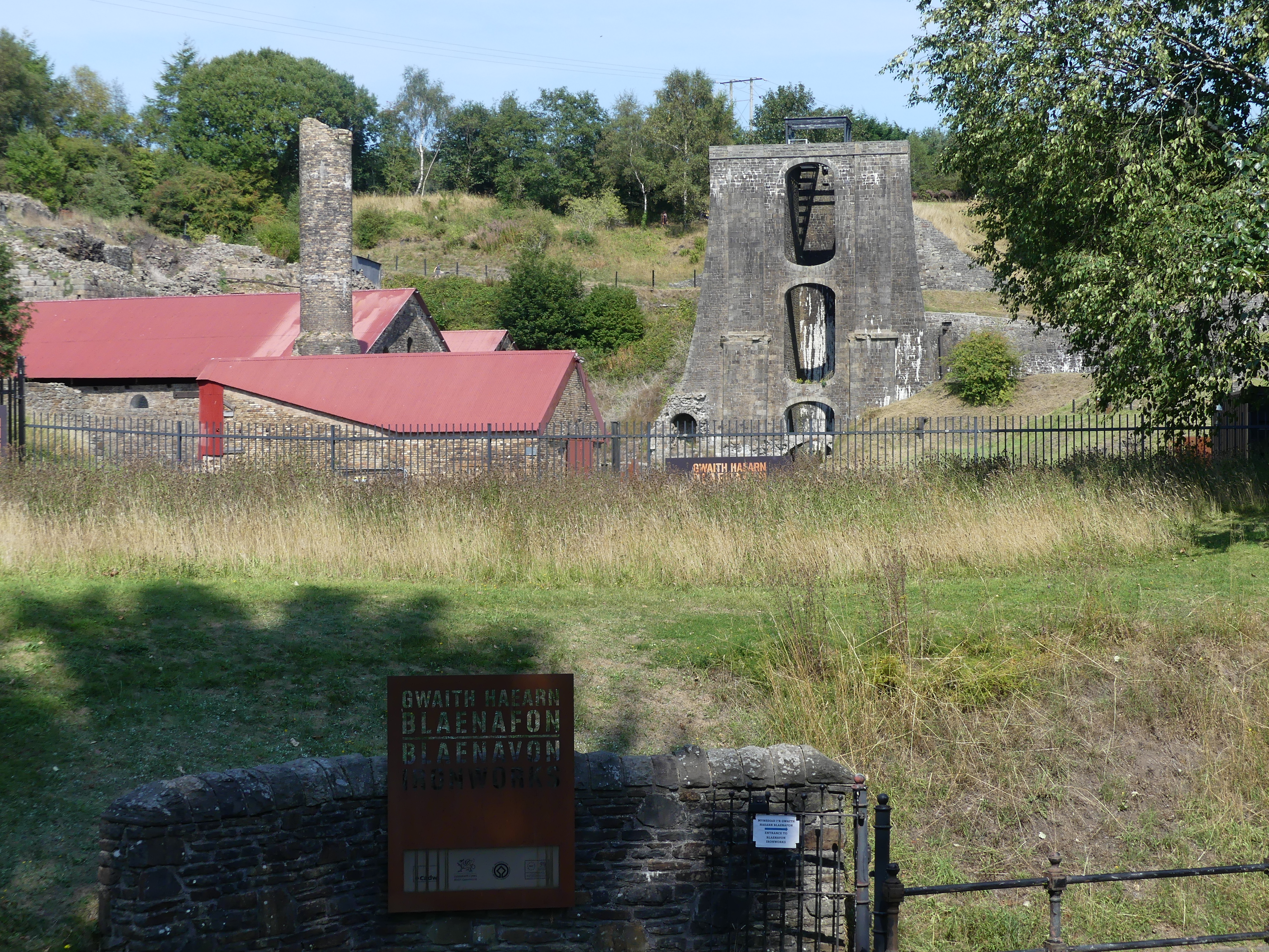
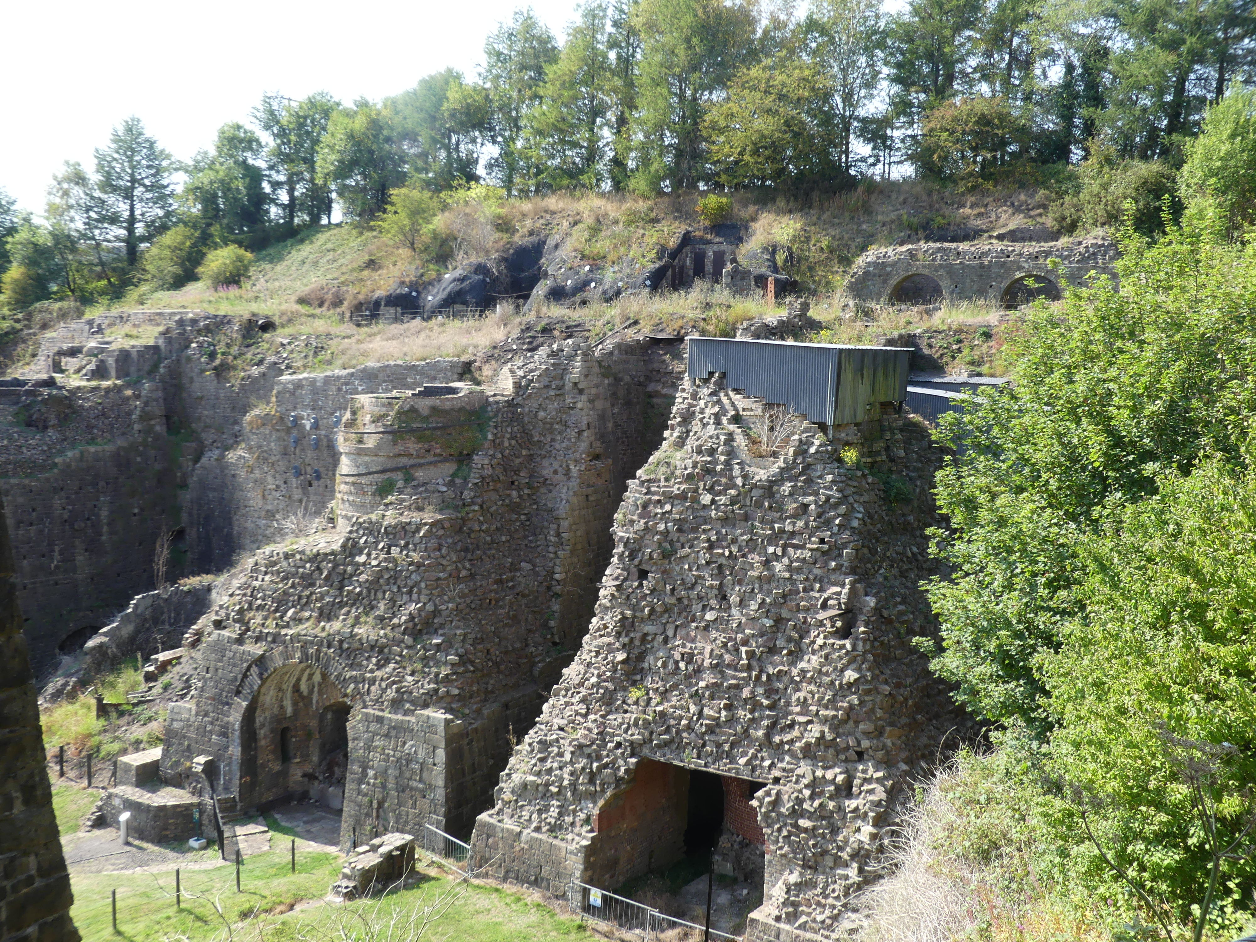
We traveled back through the Brecon Beacons National Park to visit the Ironworks and as it was a different road we encountered a local swimming hole surrounded by people and sheep. The photo is below. It was late afternoon when we arrived at the Ironworks largely hidden by overgrowth of the surrounding trees. This is one of the steel mills ever present through out Wales during its industrial years. The entry was tiny and manned by a husband-and-wife team. She was clearly American, and they recently returned to Wales and took up this position. Seemed an odd fit. However, the recreation of life for the workers in the preserved ironworks was excellent.
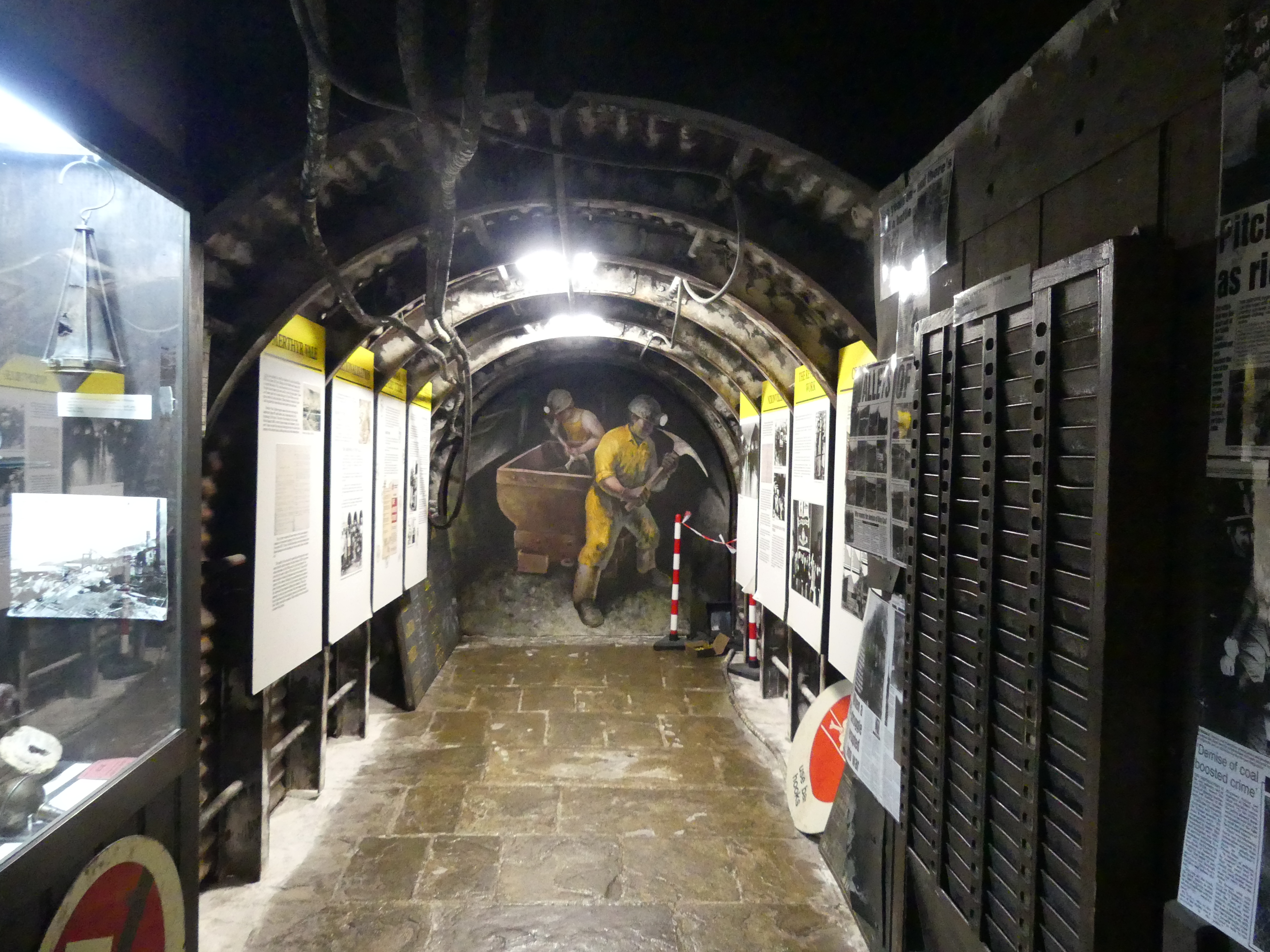
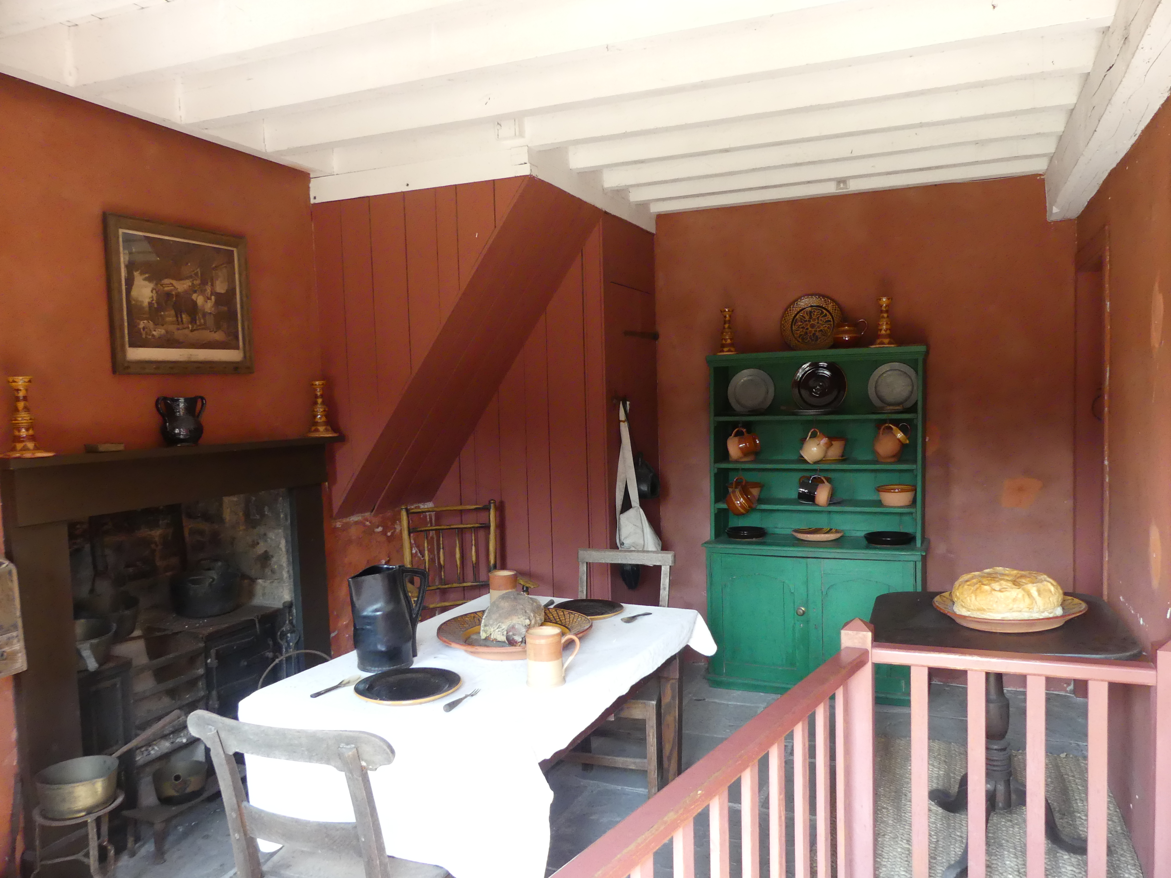
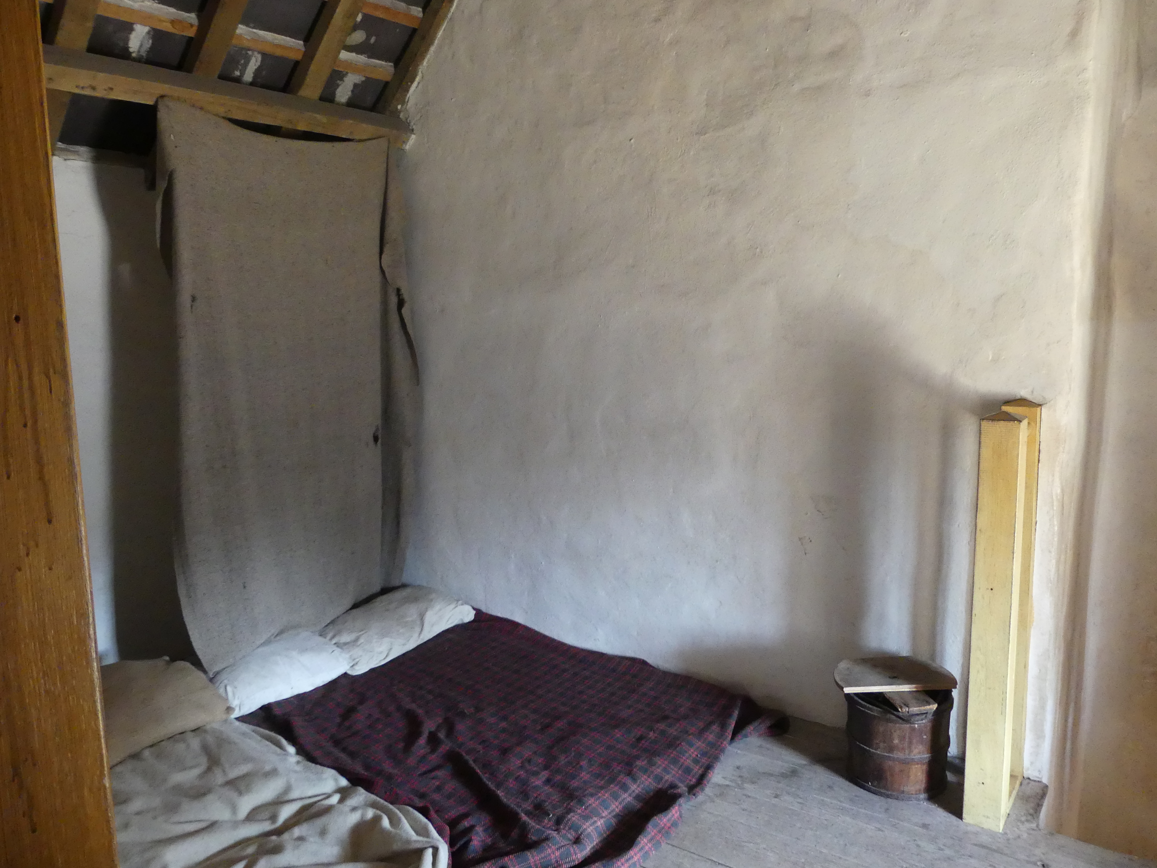
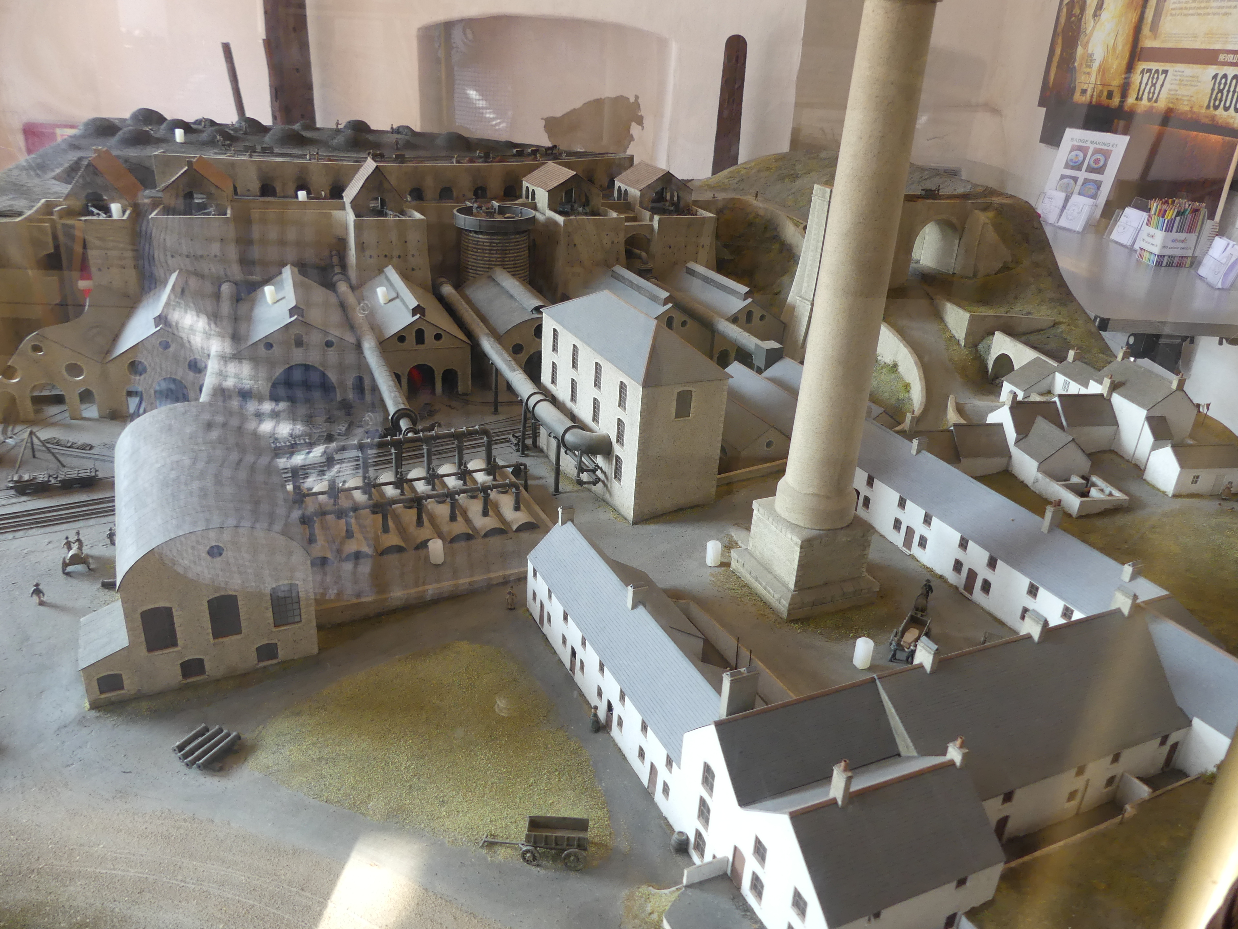
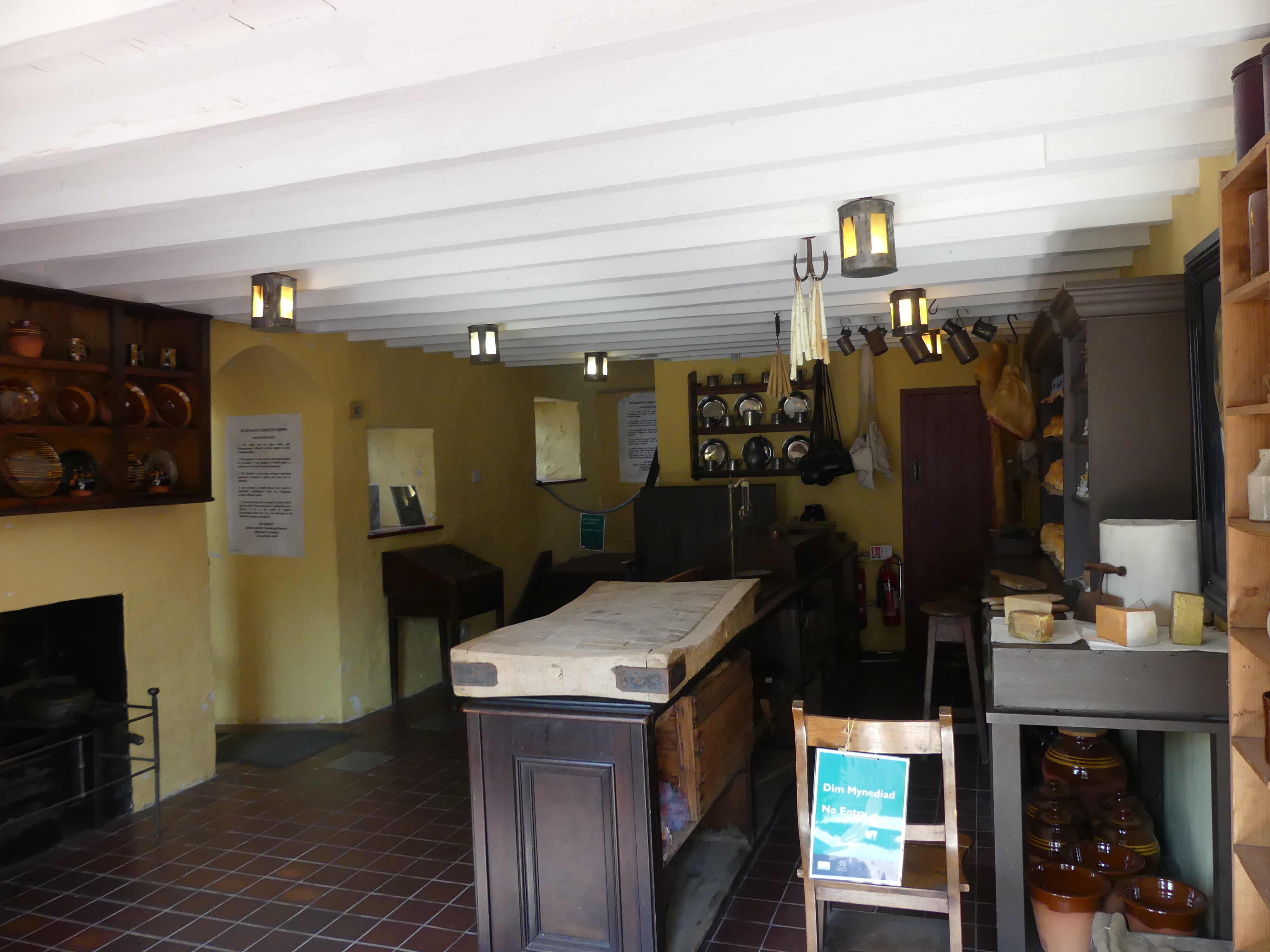
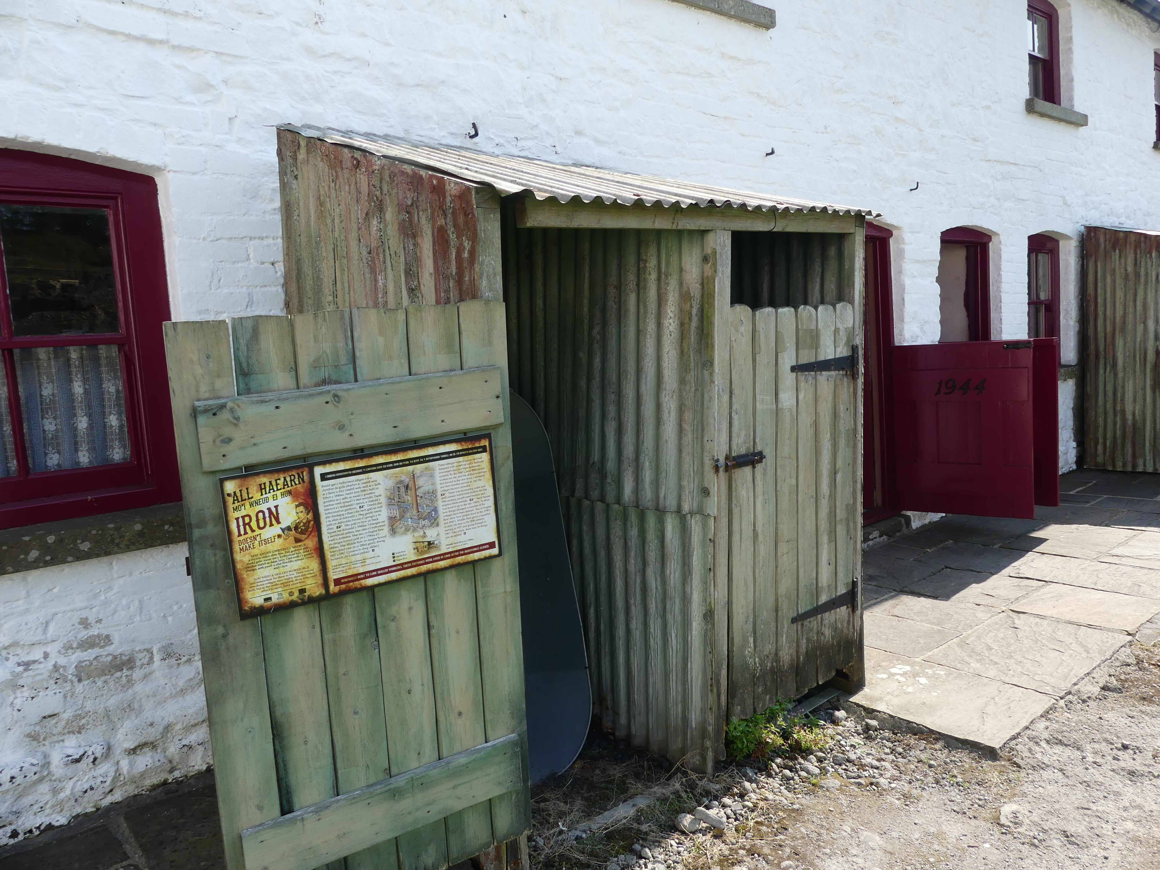
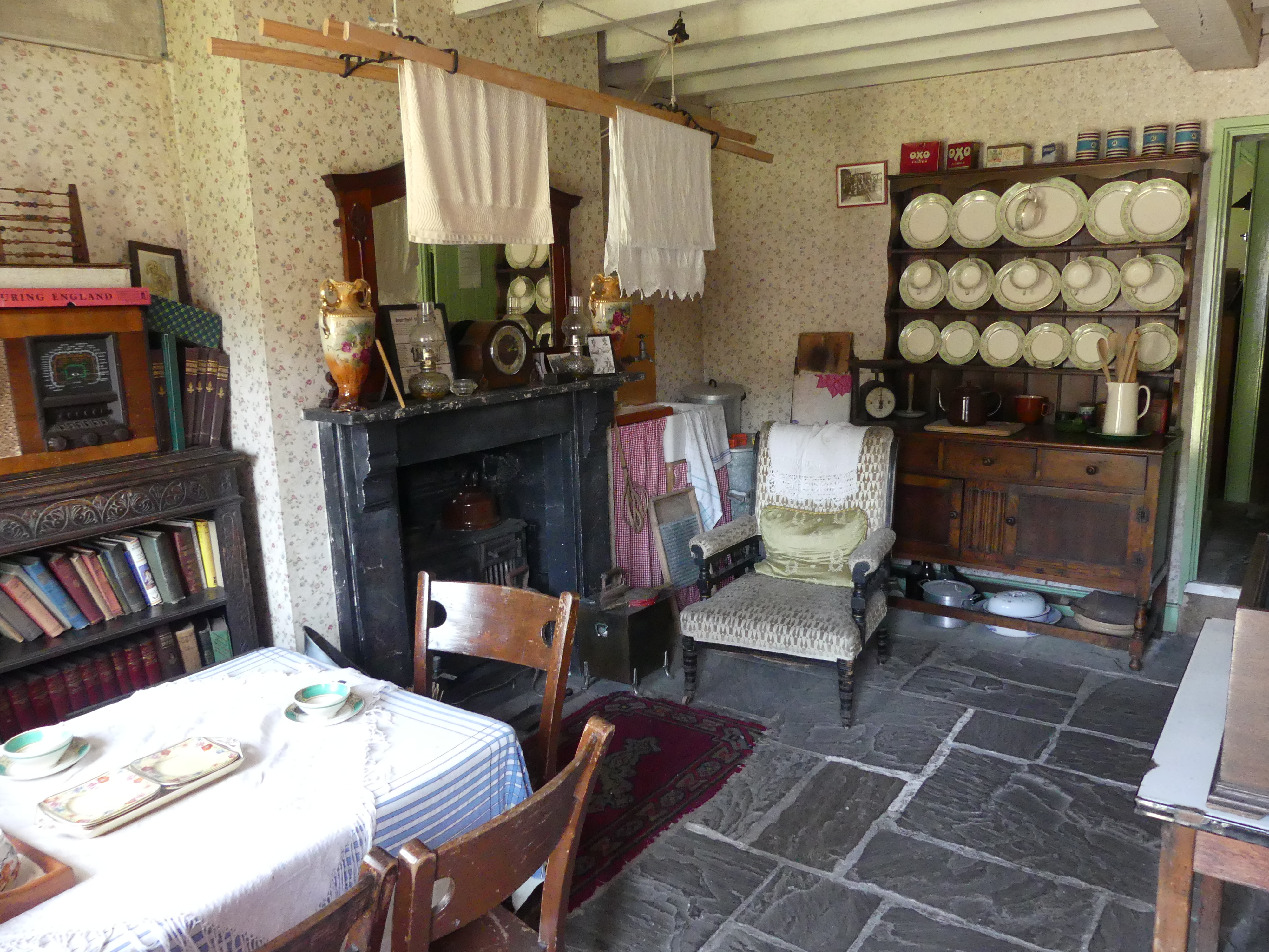
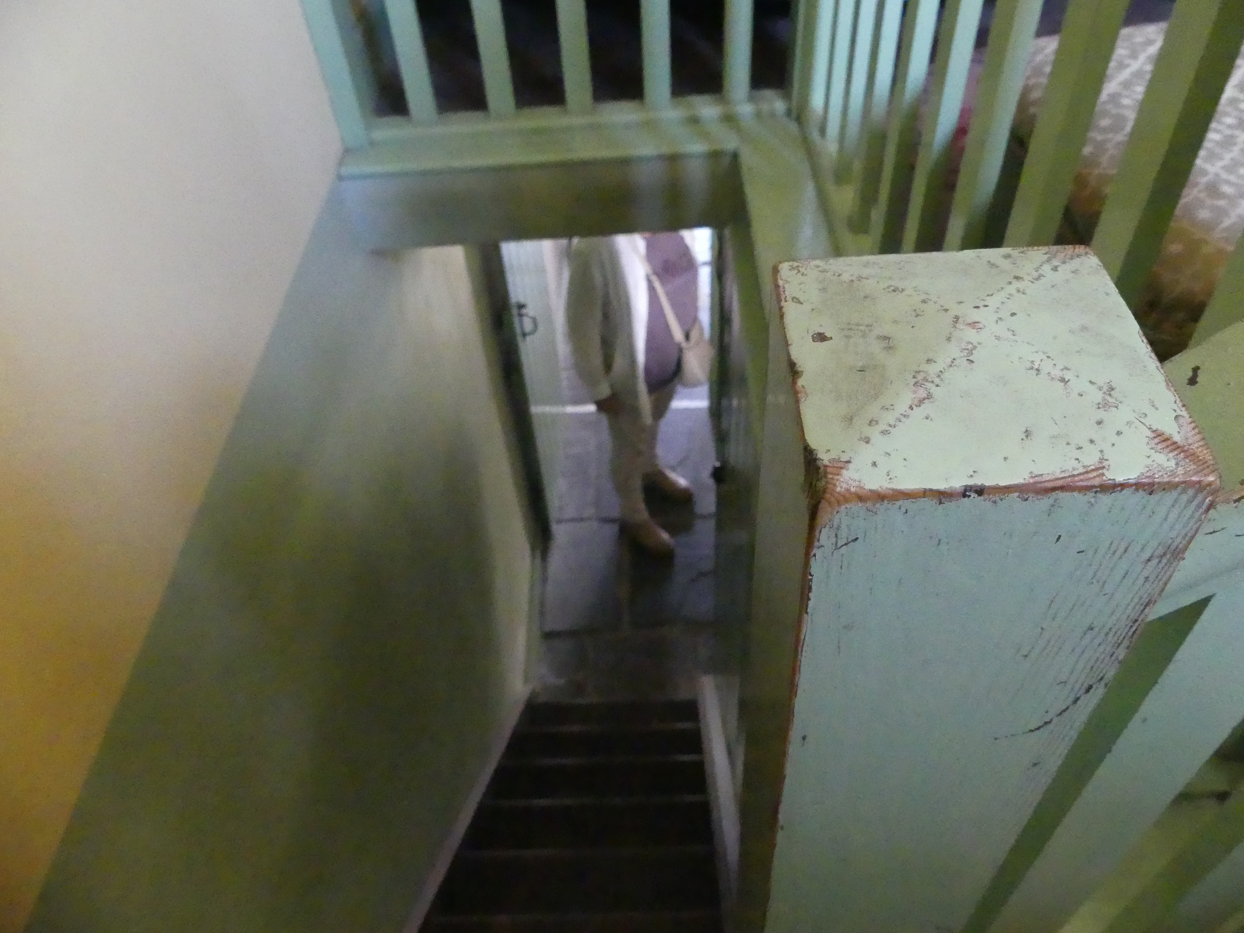
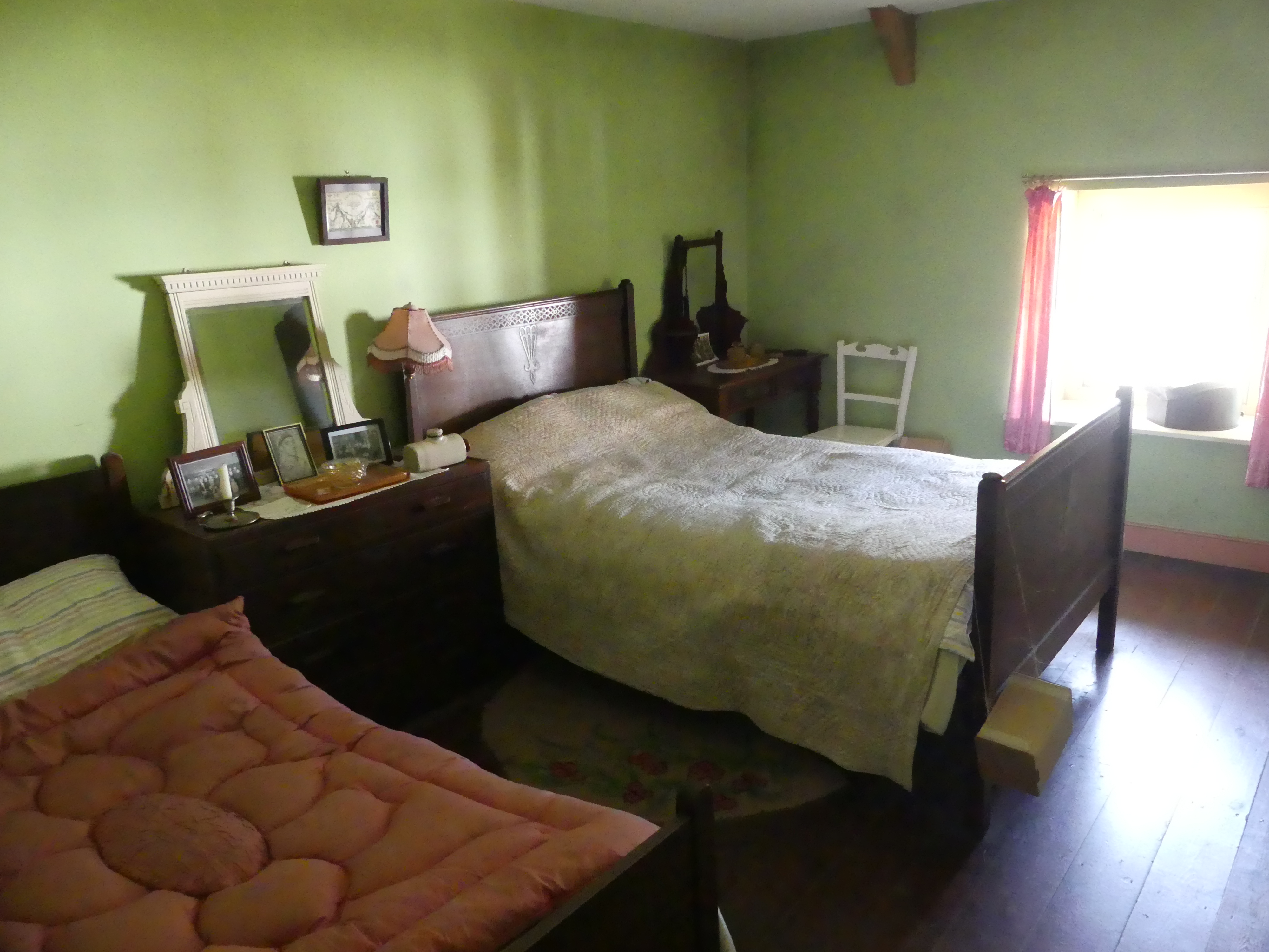
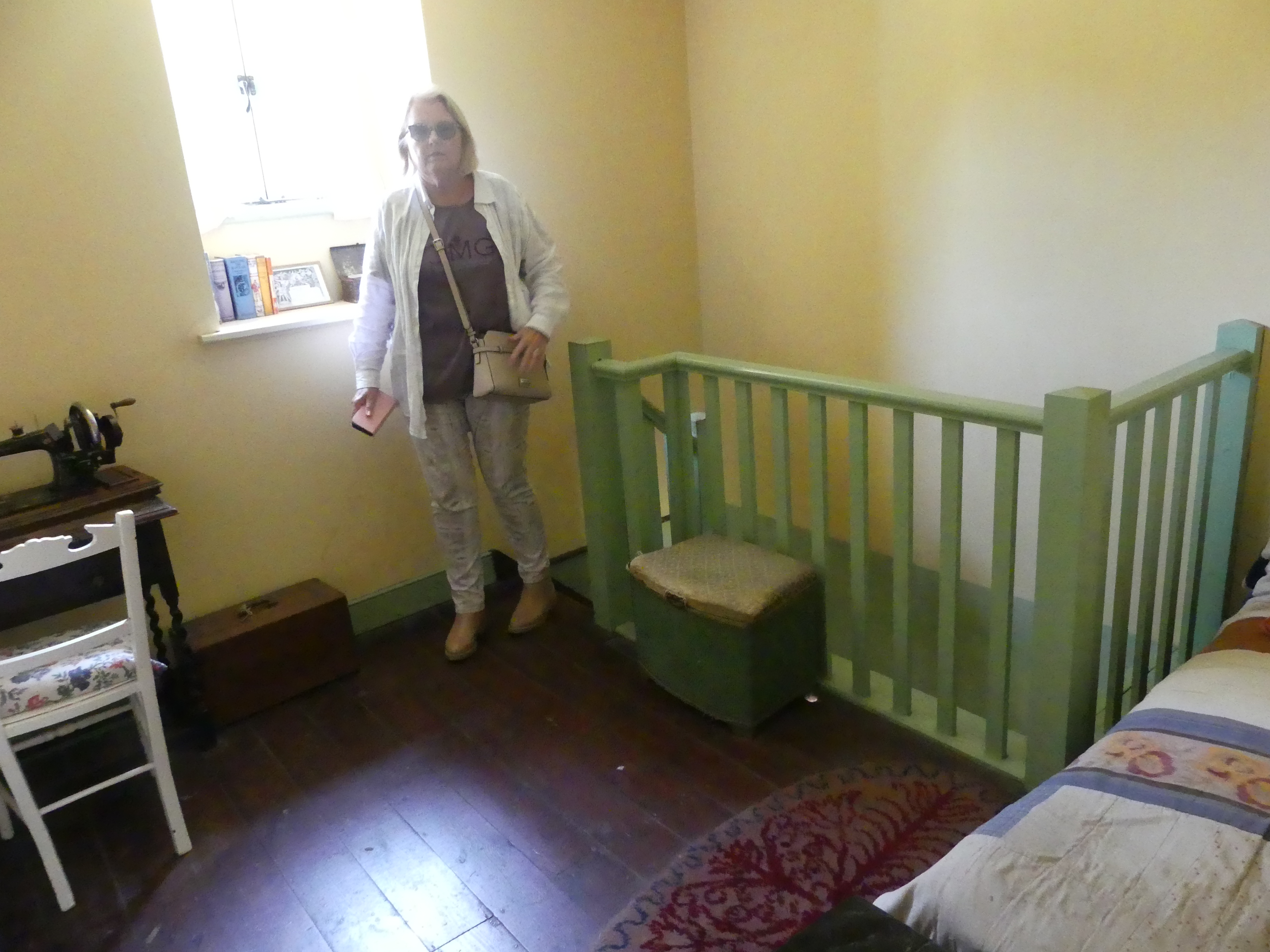
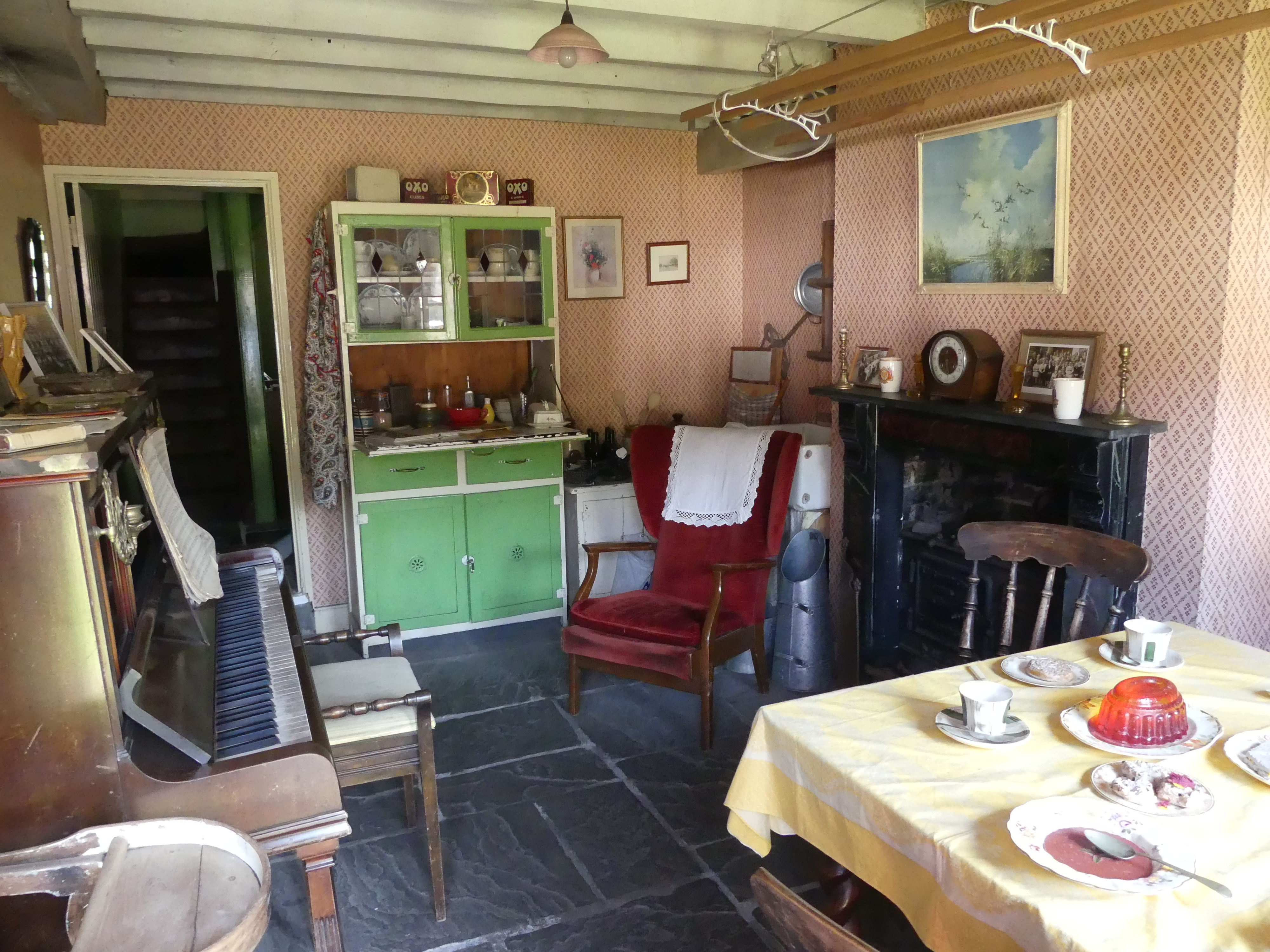
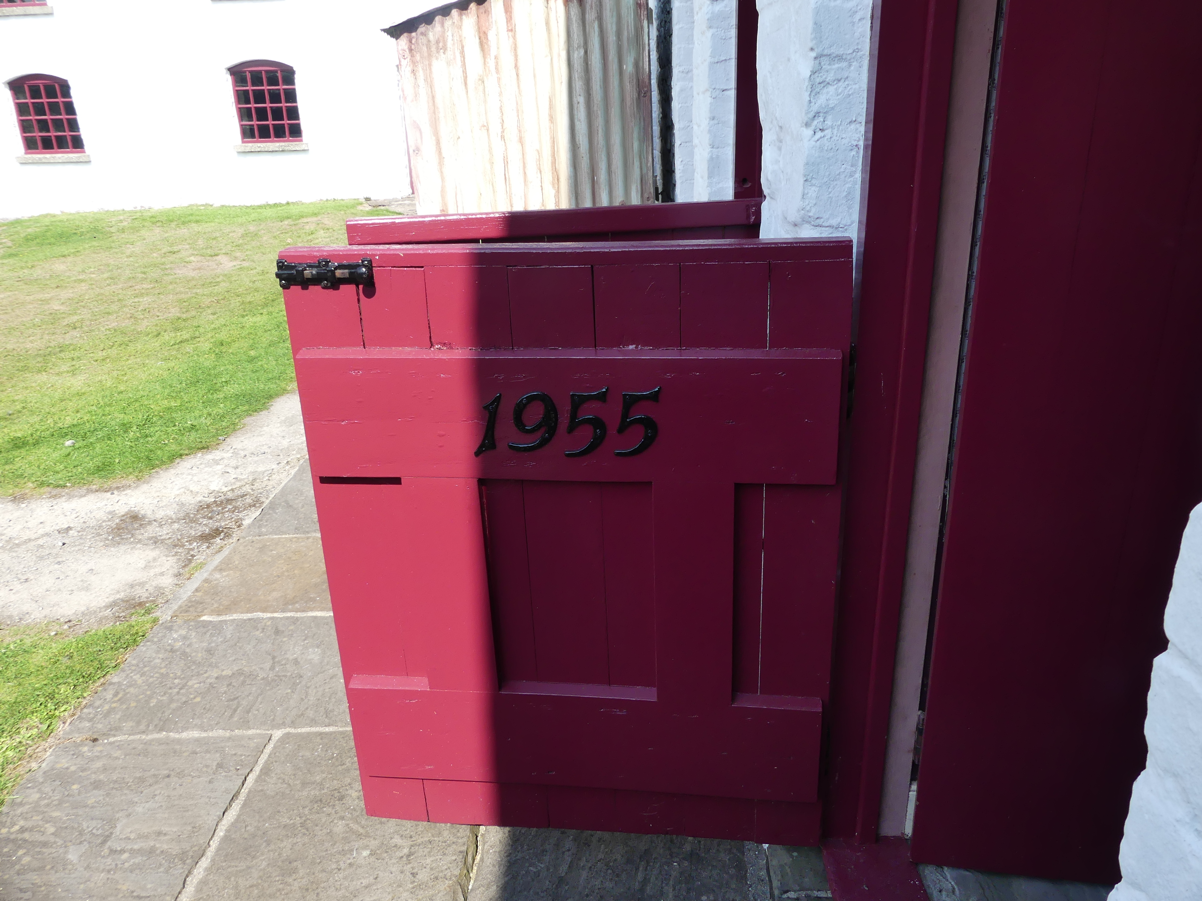
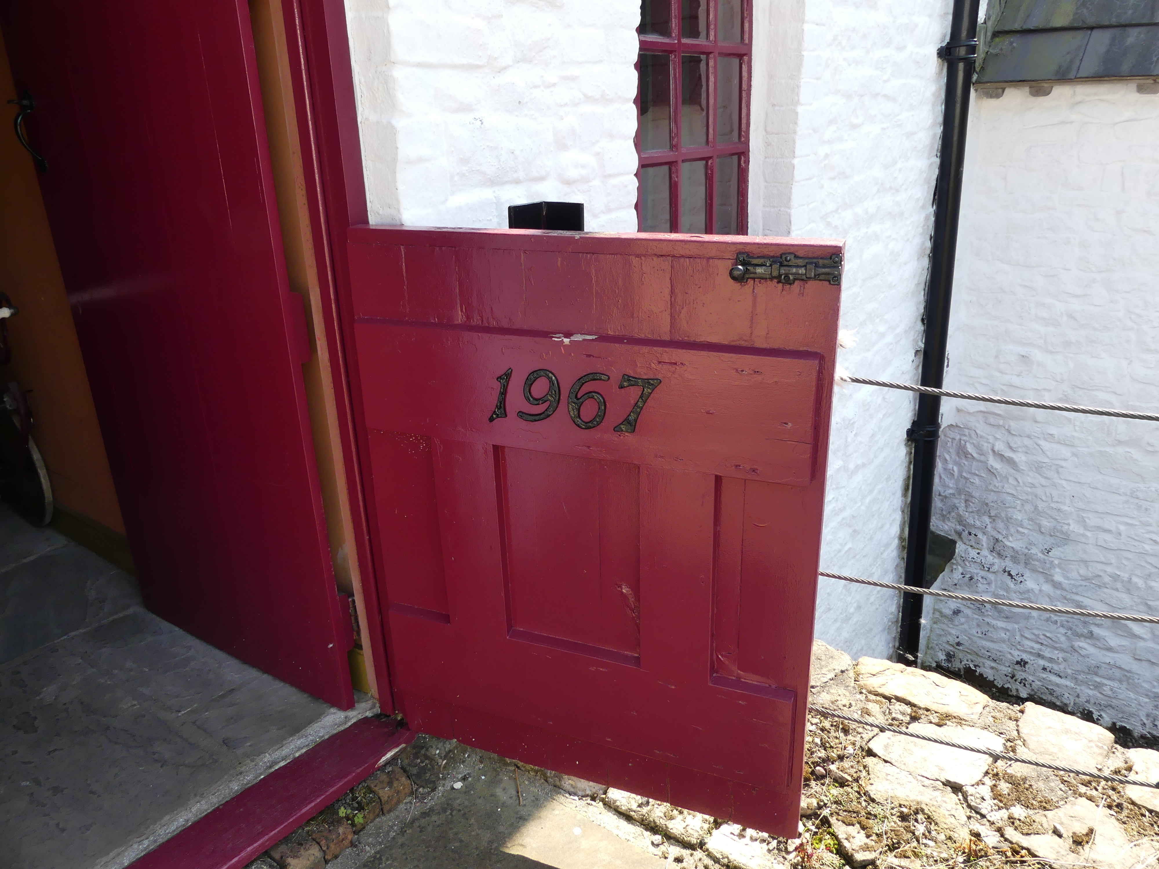
The Ironworks is a former industrial site which is now a museum. It was of crucial importance in the development of the ability to use cheap, low quality, high sulphur iron ores worldwide. It was the site of the experiments by Sidney Gilchrist Thomas and his cousin Percy Gilchrist that led to “the basic steel process” or “Gilchrist–Thomas process”. In 1904 the Ironworks ceased production completely. Work restarted briefly in 1924 but was commercially unviable. The forges at the site were still being used and helped with the production of steel shell during both world wars but was mostly used as a storage yard for the National Coal Board. One of the remarkable things is that some of the workers lodgings have been restored to present certain periods from 18th century through to the 20th century. I thought this might be an uninspiring attraction but quite the contrary it presented considerable history of industrial Wales.
Time to move on from the Best Western as we were due at Chateau Rhianfa Plas Rhianfa, in Anglesey – a far cry from the Best Western. On the way we will look at Harlech Castle before finding our way to Chateau Rhianfa Plas Rhianfa, Glyngarth Menaii Bridge Read on in my next blog “THE RETIREES GO AROUND THE WORLD – CRICKHOWELL (Ebbw Vale)TO CHATEAU RHIANFA PLAS RHIANFA, GLYNGARTH MENAII BRIDGE.”